Hikes in the Santa Monica Mountains
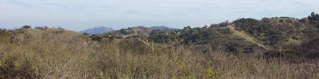
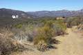
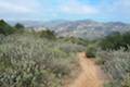
Stretching through Malibu toward downtown Los Angeles, the Santa Monica Mountains are a beautiful coastal range packed with enticing trails. Santa Monica Mountains National Recreation Area spans 40 miles west to east across Los Angeles and Ventura Counties from Point Mugu to Griffith Park. A network of federal, state, and city parks protect over 150,000 acres of the Santa Monica Mountains, offering miles and miles of hiking trails.
Explore over 100 hikes in the Santa Monica Mountains – all listed below!
Highlights of the Santa Monica Mountains


Exploring the Santa Monica Mountains
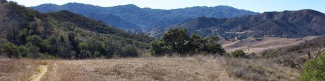
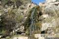
The majority of trails in the Santa Monica Mountains are free to access, including the hike to Sandstone Peak, the highest point in the range at 3,111 feet. The trail to the Santa Monica Mountains’ tallest waterfall, Escondido Falls, is also free.
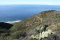
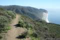
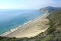
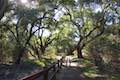
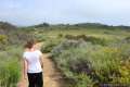
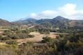
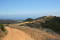
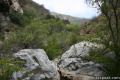
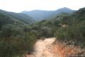
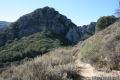
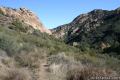
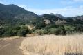
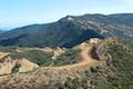
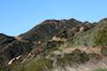
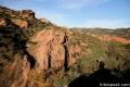
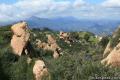
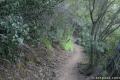
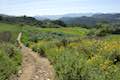
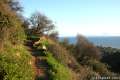
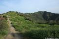
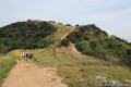
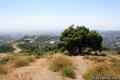
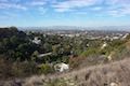
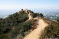
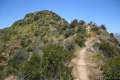
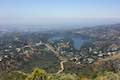
Impressive canyons, vast ocean views, and beautiful spring wildflowers await hikers on trails throughout the range. Topanga State Park and Malibu Creek State Park host many of the mountain range’s trails.
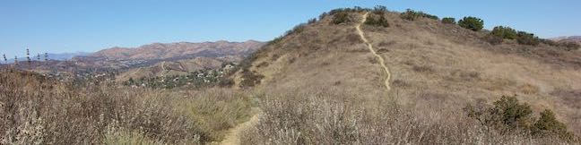
Did you know? One in seventeen Americans lives within a one hour drive of the Santa Monica Mountains. The national recreation area receives over 30 million visitors each year. Despite the beautiful scenery and easy accessibility, most trails never see a crowd.
Santa Monica Mountains Hiking
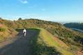
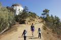
This collection of trails is listed from west to east, but the table may also be sorted alphabetically or by distance to help you pick your next hike. The search feature can quickly isolate the hike you are looking for. Every trail links to its own report complete with photos, GPS maps, elevation profiles, directions, and all the other information needed to locate and enjoy these treks. You can also view hikes around the Santa Monica Mountains on the Hike Finder Map.
| Trail | Description | Distance | Location |
|---|---|---|---|
 075 075 | La Jolla Canyon Loop This hike explores Point Mugu State Park on the west end of the Santa Monica Mountains, offering incredible ocean views. | 11.75 miles 1,225 feet | 34.086097, -119.03688 |
 078 078 | Mugu Peak This out and back hike from La Jolla Canyon to the 1,266-foot summit features superb ocean and canyon views. | 6.5 miles 1,225 feet | 34.092697, -119.055712 |
 081 081 | La Jolla Canyon Falls This out and back hike visits a short seasonal waterfall in Point Mugu State Park. | 1.5 miles 250 feet | 34.093047, -119.043134 |
 085 085 | Scenic and Overlook Trails Loop This loop takes in tremendous ocean views above Big Sycamore Canyon in Point Mugu State Park. | 2.7 - 3.5 miles 425 - 450 feet | 34.071305, -119.012668 |
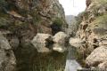
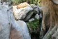
 090 090 | Grotto This out and back hike visits a creek flowing through a talus cave in the Santa Monica Mountains National Recreation Area. | 3.5 miles 500 feet | 34.10995, -118.9373 |
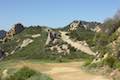
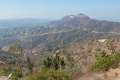
 095 095 | Sandstone Peak This loop summits the tallest peak in the Santa Monica Mountains. | 6.25 miles 1,075 feet | 34.1116, -118.92678 |
 100 100 | Tri Peaks This 1-mile addition to the Sandstone Peak loop adds extra views to the hike. | 7.45 miles 1,075 feet | 34.1116, -118.92678 |
 102 102 | Arroyo Sequit This winding loop explores the upper reaches of a canyon carved by the East Fork of Arroyo Sequit and has grand views of the Santa Monica Mountains. | 2.05 miles 285 feet | 34.08895, -118.8907 |
 103 103 | Nicholas Flat via Malibu Springs Trail This scenic lollipop loop hike ascends an overgrown track to meadows and a pond on Nicholas Flat in Leo Carrillo State Park. | 7 miles 1,425 feet | 34.083743, -118.918329 |
 106 106 | Nicholas Flat via Nicholas Flat Trail This scenic hike ventures from the coast in Leo Carrillo State Park up into the mountains to a grassy flat with a small pond. | 7 - 7.6 miles 1,685 - 1,745 feet | 34.04687, -118.93308 |
 107 107 | Nicholas Flat Trail - Willow Creek Trail Loop This loop in Leo Carrillo State Park wraps around a coastal ridge and tops out at an ocean vista with broad views. | 2.05 miles 620 feet | 34.04687, -118.93308 |
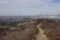
 110 110 | Angel Vista via Rosewood Trail This out and back hike is the most direct route to a panoramic viewpoint overlooking the Conejo Valley. | 4 miles 800 feet | 34.1768, -118.9128 |
 115 115 | Angel Vista via West Los Robles Trail This out and back hike offers a more gradual route to the overlook on the north side of the Santa Monica Mountains. | 7.6 miles 800 feet | 34.1719, -118.881 |
 116 116 | Oak Creek Canyon Trail This loop starts with an all-access nature trail with signs in English and Braille before transitioning to a less developed dirt single track, looping through chaparral and oak woodlands in Los Robles Open Space. | 0.8 miles 200 feet | 34.1753, -118.8856 |
 120 120 | Charmlee Wilderness Park This loop is one of several possible hikes in this bluff-top park with ocean views over Malibu. | 3.25 miles 260 feet | 34.058793, -118.87925 |
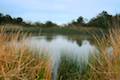
 123 123 | Rocky Oaks Park This short and easy hike visits a pond and a scenic overlook in a small parcel of Santa Monica Mountains National Recreation Area. | 2 miles 175 feet | 34.09732 -118.813637 |
 125 125 | Zuma Canyon Trail This out and back hike leaves a coastal Malibu neighborhood to explore rustic Zuma Canyon. | 2.8 miles 115 feet | 34.0317, -118.8122 |
 129 129 | Zuma Canyon Ocean View - Canyon View Trails This loop demands more effort than the Zuma Canyon Trail and provides great ocean and canyon views. | 3.1 miles 750 feet | 34.0317, -118.8122 |
 132 132 | Zuma Ridge Trail This wide dirt service road weaves northwest up the ridge west of Zuma Canyon, offering access to several nearby trails. | 5.4 - 10.6 miles 1,390 feet | 34.03374, -118.8180 |
 135 135 | Zuma Canyon Narrows This off-trail trek crosses the narrow canyon beyond Zuma Canyon Trail before return along the Zuma Ridge Trail. | 8 miles 1,715 feet | 34.0317, -118.8122 |
 140 140 | Point Dume Natural Preserve This short hike explores overlooks on a scenic headland jutting into the Pacific at the northwest end of Santa Monica Bay in Malibu. | 1 mile 100 feet | 34.004245, -118.80581 |
 145 145 | Castro Crest from Latigo Canyon Road This out and back hike crosses a green canyon and climbs to a scenic saddle below Castro Peak. | 3.8 miles 650 feet | 34.07815, -118.79375 |
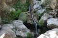
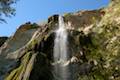 150 150 | Escondido Falls This out and back hike visits a 200-foot waterfall that is split into two tiers. The upper tier is 150 feet tall and stunning after a rainstorm. | 3.5 - 3.8 miles 210 - 400 feet | 34.0261, -118.78 |
 155 155 | Upper Solstice Canyon This out and back hike crosses remote Upper Solstice Canyon from Corral Canyon Road to Castro Crest. | 5.5 - 6.5 miles 540 - 800 feet | 34.08209, -118.75854 |
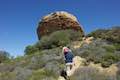
 157 157 | Mesa Peak from Corral Canyon Road This out and back hike travels along a ridge adorned with sandstone outcroppings to approach a peak with ocean views over Malibu. Shorten the outing by stopping at a prominent boulder on a crest above Mesa Peak. | 5.35 - 7 miles 465 feet | 34.079, -118.75556 |
 160 160 | Solstice Canyon Trail This out and back hike is easy and level, and visits the ruins of a burned down ranch and a small waterfall. | 2.6 miles 300 feet | 34.03765, -118.7477 |
 163 163 | Malibu Lagoon State Beach This easy walk below the mountains goes around a bird-filled lagoon and explores a famous surf beach on a sandy stroll to Malibu Pier. | 2 miles 10 feet | 34.03383, -118.68508 |
 165 165 | Corral Canyon This loop offers ocean and canyon views from a unspoiled section of the Santa Monica Mountains in Malibu. | 2.5 miles 525 feet | 34.034336, -118.734362 |
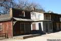 170 170 | Paramount Ranch This segment of the Santa Monica Mountains National Recreation Area includes Western Town, an outdoor set cast as frontier towns in TV and film since the 1950s. | 0.25 - 4 miles 150 feet | 34.115546, -118.755176 |
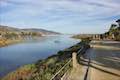
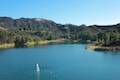
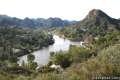 175 175 | Lake Vista Trail This out and back hike crosses the west end of Malibu Creek State Park and climbs to a scenic view over Malibu Lake. | 4.1 miles 350 feet | 34.1052, -118.7318 |
 178 178 | Phantom Trail This hike goes up and over a panoramic ridge on the north side of Malibu Creek State Park. | 4.8 miles 1,175 feet | 34.10625, -118.7323 |
 179 179 | Heartbreak Hill Trail This hike offers a condensed workout, shooting up a ridge to a panoramic crest above Agoura Hills in the Santa Monica Mountains. | 2.1 miles 600 feet | 34.1370, -118.7289 |
 180 180 | Cistern, Lookout, and Cage Creek Trails This team of trails make a scenic descent to Century Lake for a short loop or longer hikes in Malibu Creek State Park. | 2.05 - 3.6 miles 425 feet | 34.1052, -118.7318 |
 185 185 | M*A*S*H Set This hike visits the site where the exteriors of the television show MASH were filmed, a 4.75-mile trek from the park entrance. | 3.6 - 5.7 miles 200 - 425 feet | 34.0964, -118.71673 |
 187 187 | Lost Cabin Trail This 1.5-mile round trip extension to the MASH set hike dead-ends in a mountain canyon at the site of a now nonexistent cabin. | 5.1 - 7.2 miles 190 feet | 34.0964, -118.71673 |
 195 195 | Talepop Loop This lollipop loop crosses a scenic mountain between Liberty Canyon and Las Virgenes Canyon in Malibu Creek State Park. | 4.75 miles 500 feet | 34.10353, -118.7137 |
 199 199 | Grassland Trail to Crags Road and Rock Pool This easy hike enters Malibu Creek State Park on South Grassland Trail, then forms a loop around Crags Road to visit Rock Pool. | 3 miles 125 feet | 34.10345, -118.7140 |
 202 202 | Malibu Creek Traverse This adventure hike explores the C-shaped gorge between Rock Pool and Century Lake in Malibu Creek State Park. | 4 miles 200 feet | 34.097733, -118.72929 |
 204 204 | McAuley Peak This hike up the Backbone Trail leads to to a cool rock formation on a panoramic summit honoring a trailblazing conservationist. | 6.15 miles 1,530 feet | 34.07994, -118.7038 |
 205 205 | Mesa Peak from Malibu Canyon Road (Piuma Trailhead) This out and back hike ascends the Backbone Trail from Malibu Creek State Park to a subtle summit with substantial ocean views. | 6.5 miles 1,375 feet | 34.07994, -118.7038 |
 206 206 | Las Virgenes View Trail This hike patiently weaves its way across hills along Las Virgenes Road and rises up a canyon to ridgetop views over Malibu Creek State Park and mountains in Calabasas. | 4.95 miles 520 feet | 34.1042, -118.7111 |
 207 207 | Anza Loop Trail This hike follows a historic route through rolling hills in Calabasas south of the 101 Freeway. | 3.8 - 4.5 miles 510 - 535 feet | 34.14655, -118.6963 |
 208 208 | Calabasas Stairs This hike leads to a long flight of stairs off Anza Loop Trail (add 0.2 miles for each extra trip up and down the steps). | 1.4 miles 330 feet | 34.1499, -118.6769 |
 210 210 | Calabasas Peak via Calabasas - Cold Creek Trail This out and back hike starts up a scenic single track formerly know as the Secret Trail to reach the summit. | 4.5 miles 750 feet | 34.12637, -118.657407 |
 211 211 | Summit to Summit Motorway This mostly unpaved road crosses a scenic ridge between the high points of Old Topanga Canyon Road and Topanga Canyon Boulevard. | 6 - 6.6 miles 245 feet | 34.12509, -118.63485 |
 212 212 | Calabasas Peak from Old Topanga Canyon Road This out and back hike on Calabasas Peak Motorway approaches Calabasas Peak from the northeast, providing big views over Topanga and other parts of the Santa Monica Mountains. | 4.2 miles 635 feet | 34.124945, -118.63486 |
 214 214 | Calabasas Peak from Stunt Road This out and back hike on Calabasas Peak Motorway approaches Calabasas Peak from the south, ascending through sandstone formations to panoramic views of the Santa Monica Mountains and San Fernando Valley. | 3.6 miles 900 feet | 34.09528, -118.6495 |
 218 218 | Red Rock Canyon Park This park is filled with interesting sandstone formations and trails to a scenic overlook and nearby Calabasas Peak. | 2.5 - 5.2 miles 325 - 1,000 feet | 34.1061, -118.6372 |
 222 222 | Stunt High Trail to Saddle Peak This out and back hike combines Stunt High Trail and a section of the Backbone Trail to visit the 6th tallest summit in the Santa Monica Mountains. | 7.5 miles 1,675 feet | 34.09505, -118.64855 |
 225 225 | Backbone Trail to Saddle Peak This shorter hike approaches the summit from the east. | 2 miles 450 feet | 34.080806, -118.64711 |
 230 230 | Topanga Lookout This out and back hike visits the site of an old fire tower that still offers great views of the surrounding mountains. | 2 miles 160 feet | 34.08125, -118.6451 |
 235 235 | Tuna Canyon Park This ocean-view packed hike explores a less-visited park between Topanga and Malibu. | 1.6 - 5.1 miles 275 - 900 feet | 34.059538, -118.616345 |
 240 240 | Hondo Canyon This out and back hike up a section of the Backbone Trail crosses grassy fields and climbs a wooded canyon to ocean views and a trail to Topanga Lookout. | 7.6 - 10.6 miles 1,550 feet | 34.09295, -118.60915 |
 242 242 | Summit Valley Edmund D. Edelman Park This park offers a pair of loops with views over a grassy valley in Upper Topanga Canyon. | 1.65 - 2 miles 190 - 410 feet | 34.12738, -118.59877 |
 243 243 | Viewridge Trail This lollipop loop in Summit Valley Edmund D. Edelman Park travels down a canyon to Summer Hill Ranch Road where Canyon Overlook offers sweeping views over Topanga. | 3 miles 225 feet | 34.133, -118.59172 |
 245 245 | Eagle Rock from Trippet Ranch This loop takes Musch Trail and Eagle Springs Fire Road to visit an exceptional sandstone summit in Topanga State Park. | 4.5 miles 800 feet | 34.0933, -118.5874 |
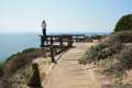
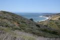
 250 250 | Parker Mesa Overlook from Trippet Ranch This out and back hike from Topanga State Park's main trailhead leads to a bluff with immense ocean views. | 6.7 miles 375 feet | 34.0933, -118.5874 |
 255 255 | Parker Mesa Overlook from Paseo Miramar This steep out and back hike rewards the effort with Pacific Ocean views en route to an overlook perched above Santa Monica Bay. | 5.7 - 7.8 miles 900 - 1,250 feet | 34.0508, -118.5571 |
 260 260 | Los Liones Trail This out and back hike visits a lust canyon with ocean views and can be used to reach Parker Mesa Overlook. | 2.6 miles 550 feet | 34.04727, -118.56007 |
 265 265 | Eagle Rock from Santa Ynez Canyon This out and back hike crosses a shaded canyon, climbing a ridge to summit a sandstone prominence in Topanga State Park. | 7.4 miles 1,400 feet | 34.0782, -118.56745 |
 270 270 | Santa Ynez Falls This out and back hike follows a shaded creek to a gorge containing a short waterfall. | 2.5 miles 250 feet | 34.0782, -118.56745 |
 272 272 | Winnetka Ridge Trail This ridge top hike ventures into the Santa Monica Mountains from the end of Winnetka Avenue in Woodland Hills. | 1.5 miles 200 feet | 34.14985, -118.57168 |
 273 273 | Corbin Canyon This partial loop offers an easy stroll along the bottom of a canyon on the north side of the Santa Monica Mountains near Tarzana and Woodland Hills. | 2.05 miles 150 feet | 34.1567, -118.56495 |
 275 275 | Vanalden Cave This short out and back hike explores a unique sandstone cave that you can stand inside and above, and the hike can be extended by visiting a nearby vista point with a panoramic perspective of the Santa Monica Mountains. | 0.6 - 1.55 miles 100 - 350 feet | 34.134666, -118.563017 |
 285 285 | Temescal Peak This pair of out and back hikes ascend Temescal Ridge to a summit with sweeping views over Topanga State Park. | 5.8 - 7.6 miles 575 - 1,200 feet | 34.07863, -118.55997 |
 290 290 | Skull Rock This out and back hike descends Temescal Ridge to a head-shaped formation with great views over Santa Monica Bay. | 1.5 miles 275 feet | 34.07631, -118.5462 |
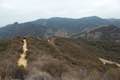
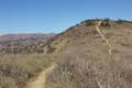
 293 293 | Hub Junction from Reseda Boulevard This hike from the edge of the San Fernando Valley goes through Topanga State Park to a scenic junction at the crossroads of the Eastern Santa Monica Mountains. Extend the trek to 6.85 miles round trip by summiting Temescal Peak or to 7.95 miles round trip by taking a loop to Eagle Rock. | 5.3 - 5.45 miles 400 - 460 feet | 34.13133, -118.55313 |
 295 295 | Caballero Canyon Trail This out and back hike ascends a canyon to views over the San Fernando Valley. | 3.4 miles 625 feet | 34.14273, -118.54088 |
 300 300 | Temescal Canyon This loop offers a variety of scenery and decent exercise, despite its relative brevity. | 2.6 - 5.25 miles 860 feet - 1,075 feet | 34.0502, -118.5291 |
 305 305 | Rivas Canyon This single-track trail crosses a lush secluded canyon connecting Temescal Gateway Park to Will Rogers State Park. | 2.1 - 4.2 miles 480 feet | 34.055895, -118.528326 |
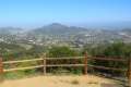
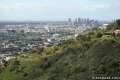
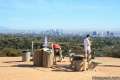 310 310 | Inspiration Point This easy loop in Will Rogers State Historic Park leads to an overlook with views from Santa Monica Bay to downtown LA. | 2.25 miles 325 feet | 34.054252, -118.51335 |
 315 315 | Rustic Canyon's Murphy Ranch from Will Rogers State Historic Park This adventure visits the former ruins of a commune built by Nazi sympathizers in a canyon east of the park. | 4 - 5 miles 225 - 950 feet | 34.0546, -118.5109 |
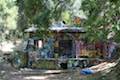 320 320 | Rustic Canyon's Murphy Ranch from Sullivan Ridge This loop drops into Rustic Canyon where hikers could visit abandoned buildings once occupied by Nazi sympathizers. | 3.85 miles 325 feet | 34.061, -118.5037 |
 325 325 | Sullivan Ridge This out and back hike follows a scenic 6.3-mile long ridge through the Big Wild east of Will Rogers State Park. | 7.5 - 14.3 miles 1,200 - 1,350 feet | 34.061, -118.5037 |
 330 330 | Sullivan Canyon This out and back hike follows a wide trail up the center of a sycamore-filled canyon. | 8.5 miles 950 feet | 34.07377, -118.50686 |
 335 335 | Westridge Trail to San Vicente Mountain This out and back hike travels a scenic ridge between a Brentwood neighborhood and a 1,960-foot summit that was once used as a Nike Missile site. | 7.4 miles 730 feet | 34.08542, -118.50894 |
 340 340 | Mandeville Canyon to San Vicente Mountain This loop incorporating a few trails, taking a DWP road up to Westridge to visit San Vicente Mountain, before crossing Mulholland Drive and Canyonback Ridge to return to Mandeville Canyon via Hollyhock Fire Road. | 5 miles 770 feet | 34.121207, -118.50665 |
 345 345 | Mulholland Drive to San Vicente Mountain This out and back hike approaches the peak from the east and offers views to the north and south en route to the old Nike Missile site. | 2 miles 360 feet | 34.12815, -118.50275 |
 350 350 | Upper Canyonback Trail This out and back hike descends Canyonback Ridge from Mulholland Drive to the Mountain Gate Country Club Estates. | 3 - 8 miles 200 feet | 34.128214, -118.50272 |
 355 355 | Lower Canyonback Trail This out and back hike ascends Canyonback Ridge from Kenter Ave. in Brentwood to the Mountain Gate Country Club Estates. | 3.6 - 8 miles 500 feet | 34.0818, -118.49459 |
 360 360 | Getty View Park This out and back hike crosses East Sepulveda Fire Road (Casiano Fire Road) on a ridge east of the 405 Freeway that offers light traffic and plentiful views of the Getty Museum and Santa Monica Bay. | 3 miles 375 feet | 34.088875, -118.472562 |
 370 370 | Dixie Canyon Park This hike forms a partial loop in a small wooded canyon on the Sherman Oaks side of the Santa Monica Mountains. | 0.55 miles 175 feet | 34.13388, -118.42345 |
 372 372 | Longridge Park This short hike on an undeveloped ridge in the Santa Monica Mountains has sweeping views over the San Fernando Valley. | 0.4 miles 75 feet | 34.13677, -118.42087 |
 395 395 | Franklin Canyon Lake Loop & Chaparral Trail This loop around Franklin Canyon Lake can be extended to ascend Chaparral Trail for an overview of Franklin Canyon. | 1.5 - 2.5 miles 100 - 325 feet | 34.115753, -118.413778 |
 400 400 | Hastain Trail This pair of short loops explore Franklin Canyon Park in the Santa Monica Mountains above Beverly Hills. | 1.8 - 2.2 miles 350 - 550 feet | 34.111344, -118.415152 |
 410 410 | Fryman Canyon Loop This loop in the Hollywood Hills follows Betty B. Dearing Trail through Wilacre Park and Coldwater Canyon Park. | 3 miles 450 feet | 34.13325, -118.39175 |
 440 440 | Trebek Open Space This out and back hike incorporated Bantam Trail and Castair Trail in a park adjacent to Runyon Canyon. | 1 - 2.5 miles 125 - 375 feet | 34.11354, -118.3594 |
 445 445 | Runyon Canyon This set of loops tour the most popular dog park in Los Angeles, offerings good exercise and views over Hollywood. | 0.85, 1.9, 2.65, or 3.3 miles 200 - 800 feet | 34.10526, -118.348933 |
 446 446 | Burbank Peak This out and back hike climbs to the Wisdom Tree perched at the west end of Griffith Park. | 1.6 miles 740 feet | 34.1331, -118.3364 |
 447 447 | Cahuenga Peak from Burbank Peak Trail This out and back hike ascends a dirt single track to Cahuenga Peak and the adjacent Mount Lee, home of the Hollywood Sign. | 3 miles 875 feet | 34.1331, -118.3364 |
 450 450 | Mount Lee and the Hollywood Sign via Innsdale Drive & Mulholland Highway This out and back hike combines trails and streets to deliver some of the very best views of the Hollywood Sign on the way to the summit of Mount Lee above the sign. | 4.6 miles 750 feet | 34.130, -118.327 |
 451 451 | Hollywood Sign - Hollywood Reservoir Loop This hike combines trails and streets to visit the Hollywood Sign on Mount Lee, neighboring Cahuenga Peak and Burbank Peak, and Lake Hollywood Reservoir. | 5.4 - 7.4 miles 1,070 feet | 34.12805, -118.3273 |
 452 452 | Lake Hollywood Reservoir Walking Trail This easy loop circles a peaceful fence-enclosed reservoir in the hills below the Hollywood Sign. | 3.5 miles 50 feet | 34.1288, -118.3363 |
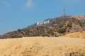 455 455 | Mount Lee and the Hollywood Sign via Hollyridge Trail This hike ascends from Beachwood Canyon to the summit of Mount Lee behind the Hollywood Sign. | 3.5 miles 750 feet | 34.12935, -118.31474 |
 460 460 | Mount Chapel, Mount Bell, and Mount Hollywood This undulating loop tops three prominent summits on a panoramic tour of Griffith Park. | 5.7 miles 675 feet | 34.12935, -118.31474 |
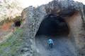
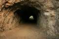 470 470 | Bronson Cave This short easy hike visits a man-made cave recognizable as the Batcave from the Batman TV series and hundreds of other locations on TV and film. | 0.66 miles 50 feet | 34.12446, -118.31425 |
 471 471 | Mount Hollywood This 1,625-foot peak is a star of Griffith Park with panoramic views that can be reached from Griffith Observatory on a steep 1.4-mile hike or a scenic 2.65-mile trek and from lower in the park in Western Canyon for a hike of around 4.2 miles. | 1.4 - 4.8 miles 500 - 925 feet | 34.12093, -118.30042 |
 472 472 | Griffith Observatory to the Hollywood Sign This hike travels from one Griffith Park landmark to another, taking a lengthy route across Mount Hollywood. | 8.8 miles 575 feet | 34.12093, -118.30042 |
 473 473 | Ferndell Trail This relaxing hike goes through a tropical garden in the lushest little canyon in Griffith Park and can be extended to explore more of Western Canyon. | 0.5 - 1.75 miles 65 - 260 feet | 34.10935, -118.3076 |
 474 474 | Griffith Observatory via West Observatory Trail This partial loop goes from Western Canyon up ridges to Griffith Observatory, getting sweeping views over Los Angeles and Griffith Park along the way. | 2.1 miles 540 feet | 34.11325 -118.3075 |
 475 475 | Griffith Observatory via East Observatory Trail This hike from Vermont Canyon Avenue up to Griffith Park's great observatory delivers excellent views over Los Angeles along the way. | 1.5 miles 380 feet | 34.11835, -118.295 |
 477 477 | Glendale Peak - Mount Hollywood Loop This hike tops two summits in Griffith Park that both have awesome views. | 4.15 miles 765 feet | 34.12184, -118.29679 |
 478 478 | Glendale Peak This hike visits a less known summit on the southeast side of Griffith Park with views that deserve more attention. | 2.55 - 3.3 miles 330 - 405 feet | 34.1208, -118.2934 |
 479 479 | Cedar Grove & Vista View Point Loop This hike on the southeast side of Griffith Park follows paved and unpaved trails to two park attractions, a quiet grove with a picnic area and a helipad with panoramic views. | 2.3 miles 400 feet | 34.11865, -118.28615 |
 480 480 | Amir's Garden This hike reaches a relaxing garden on the east side of Griffith Park that is a pleasant retreat for hikers. | 1 miles 275 feet | 34.145, -118.29385 |
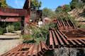
 490 490 | Old Zoo Picnic Area This short hike explores the abandoned exhibits and animal cages in the ruins of the old LA Zoo in Griffith Park. | 0.5 miles 50 feet | 34.135, -118.2867 |
 492 492 | Bee Rock This hive-shaped point on the east side of Griffith Park can be reached via a pair of loop hikes. | 1.7 - 4 miles 600 feet | 34.131, -118.284 |
 465 465 | Mount Lee and the Hollywood Sign via Brush Canyon Trail This out and back hike crosses Griffith Park from Canyon Drive to the top of Mount Lee, directly behind the landmark Hollywood Sign. | 6.4 - 7.1 miles 1,050 feet | 34.12485, -118.3136 |
 495 495 | Beacon Hill This out and back or loop hike in Griffith Park climbs to the easternmost summit in the Santa Monica Mountains. | 2.75 - 3.9 miles 500 feet | 34.131, -118.284 |
Or explore hikes around the Santa Monica Mountains on the Hike Finder Map