Topanga Lookout
in the Santa Monica Mountains
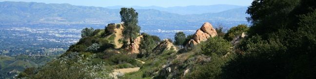
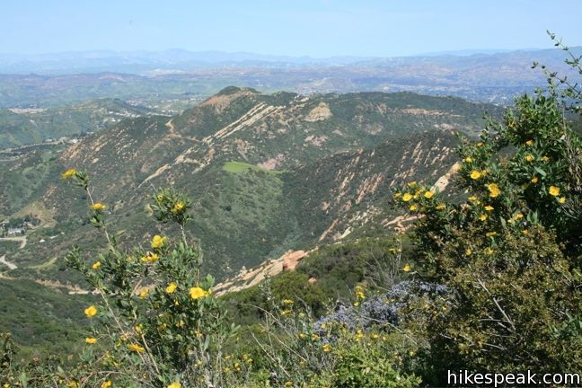
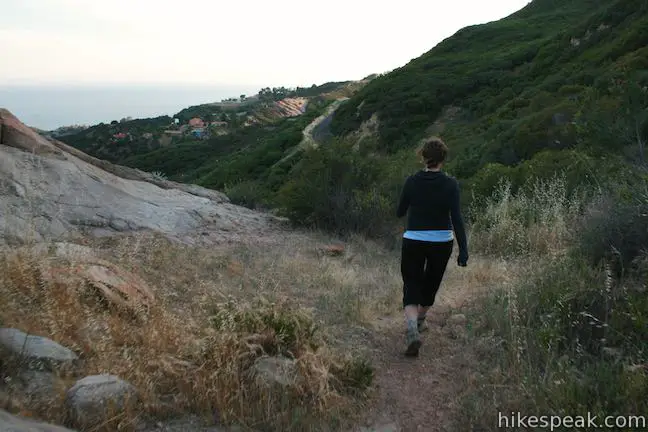
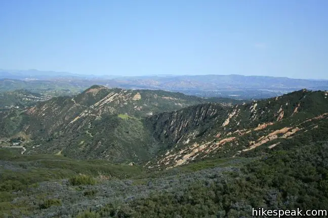
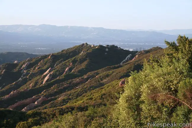
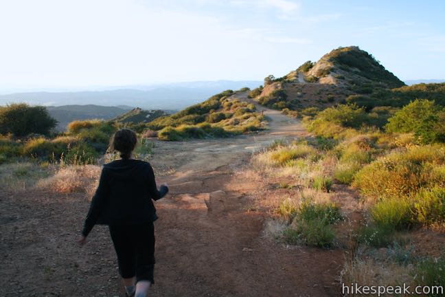
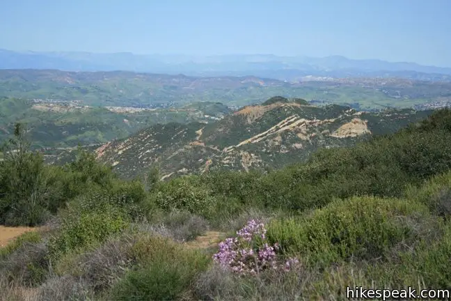
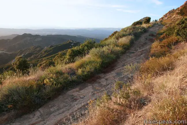
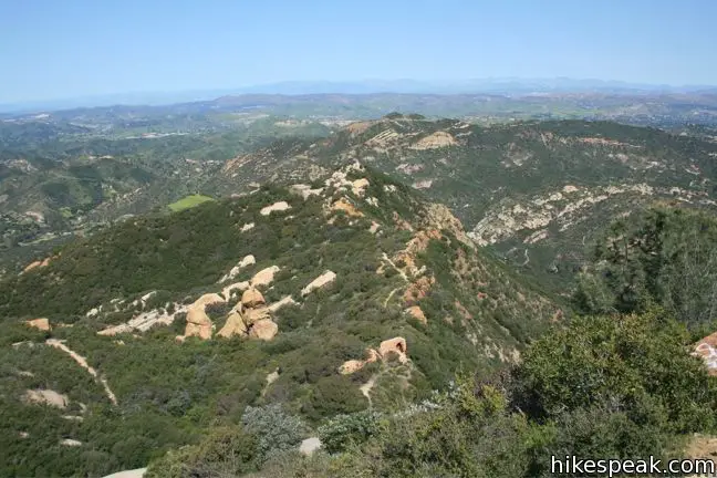
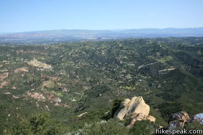
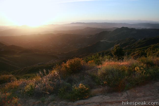
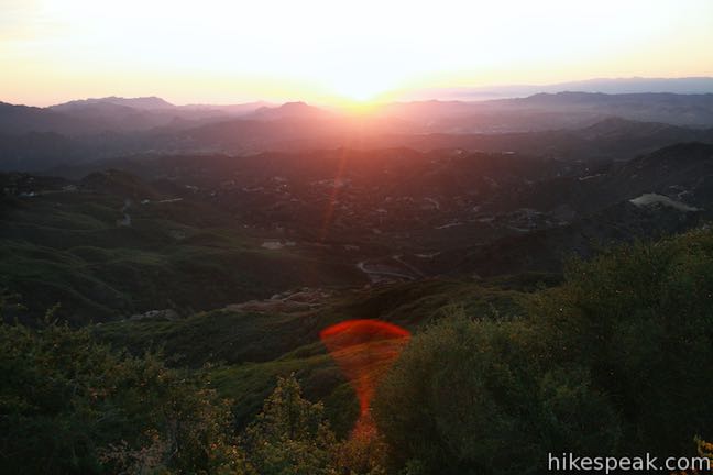
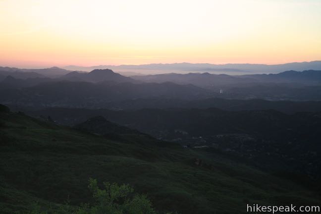
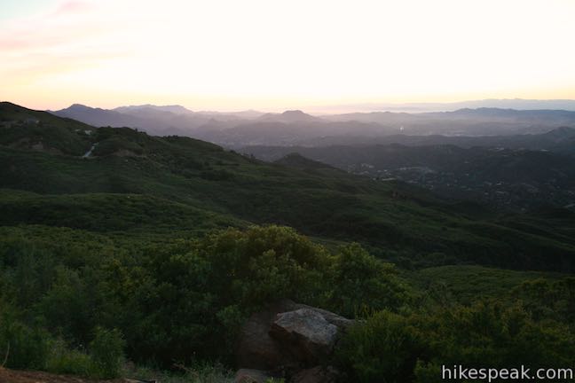
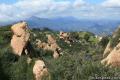
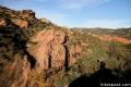
At a saddle in the Santa Monica Mountains 2,375 feet above the Pacific Ocean and 3 miles from the coast, the Backbone Trail crosses Stunt Road, creating a high trailhead for nearby destinations. Topanga Lookout, the former site of a fire tower, stands above Red Rock Canyon Park and continues to offer fine views of the Santa Monica Mountains, Calabasas, and the Santa Susana Mountains. This hike to Topanga Lookout is 2 miles round trip with just 160 feet of elevation gain.
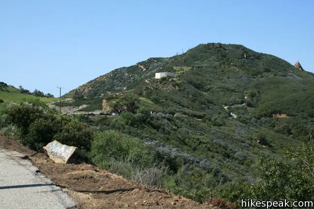
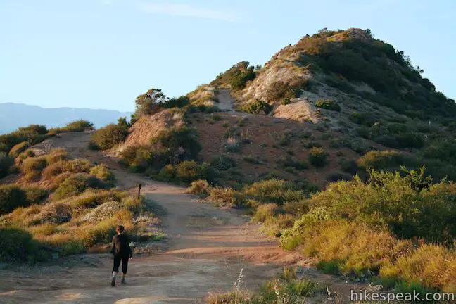
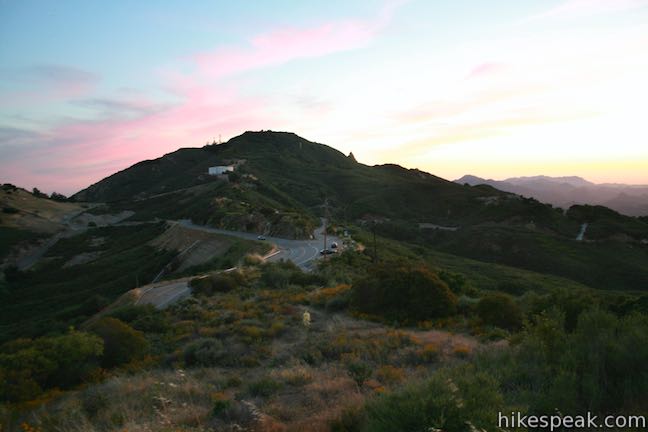
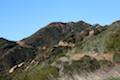
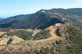
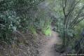
Just beyond the gated trailhead, the paved Topanga Tower Motorway crosses a junction with Fossil Ridge Trail, a 0.6-mile section of the Backbone Trail that connects to the top of Hondo Canyon Trail. Photos of Fossil Ridge Trail are shown below. Continue past this junction up the paved road toward the radio towers atop the summit. When a wide dirt trail breaks off to the left, follow this track along the ridge uphill and down to the lookout.
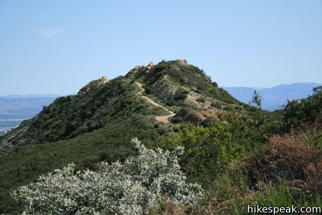
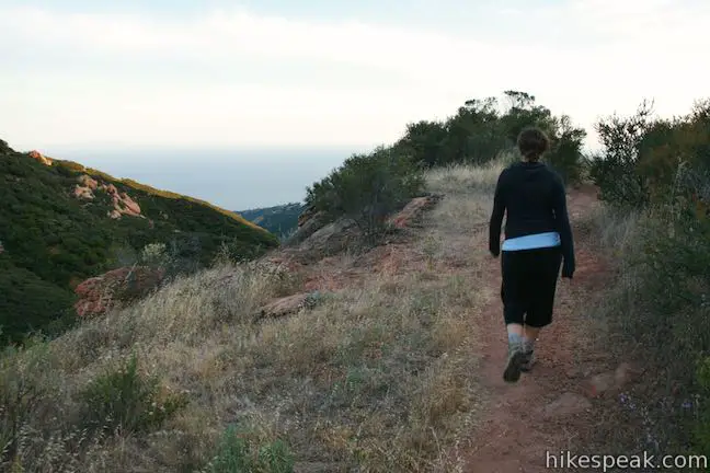
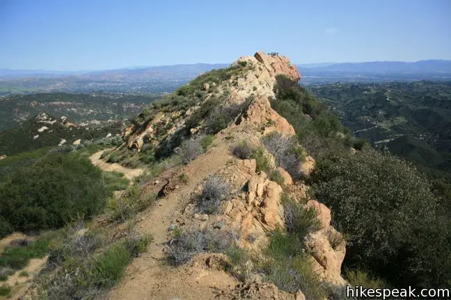
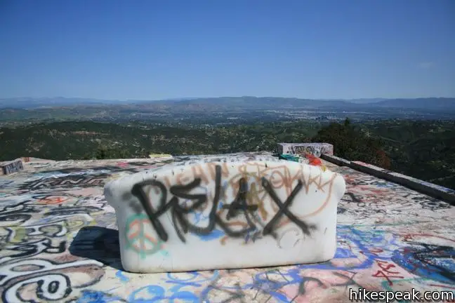
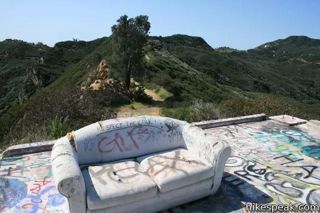
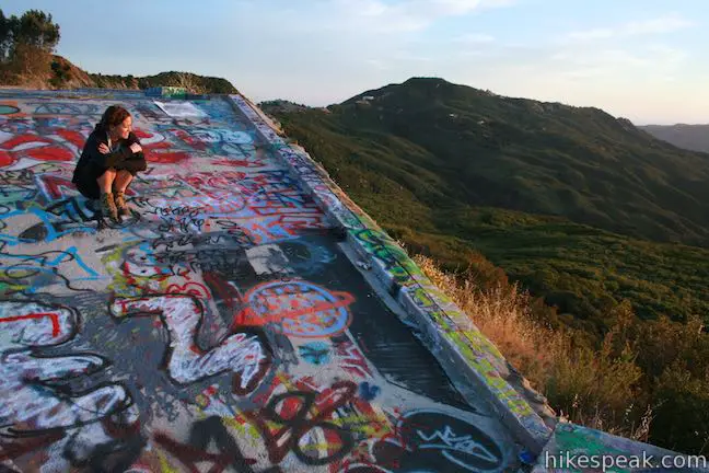
Step out on to the large graffiti-covered concrete foundation at the site of the old fire tower. The views are wide and far. It is clear why this site was chosen to look over the mountains. Take in the views of Calabasas Peak and the surroundings before returning the way you came. Across the road, the Backbone Trail finds its way up to Saddle Peak. This neighboring 2-mile hike offers exceptional ocean views. No fee or permit is required to hike to Topanga Lookout, so get out and enjoy.
An alternative route up to Topanga Lookout can be found at the junction of Calabasas Peak Motorway and Red Rock Canyon Motorway, along the trail to Calabasas Peak. This unmarked trail starts in between the two fire roads and climbs the ridge to the overlook.
Directions to the Trailhead
- From PCH, turn inland on Las Flores Road (across from Duke's Restaurant).
- Drive 3.4 miles up this narrow twisting canyon and turn right onto Rambla Pacifico Street.
- After 0.6 miles, make a sharp right onto Schueren Road, and take that for 1.8 miles to the intersection with Stunt Road and Saddle Peak Road.
- The trailhead is on the left just past the intersection.
- From the 101 Freeway, exit Las Virgenes Road and head south toward Malibu.
- After 2.8 miles turn left (east) on Mulholland Highway.
- Turn right on Stunt Road after 4 miles and drive another 4 miles to the top of the road at the intersection with Schueren Road and Saddle Peak Road.
Trailhead Location
Trailhead address: 23300 Saddle Peak Road, Topanga Canyon, CA 90290
Trailhead coordinates: 34.08125, -118.6451 (34° 04′ 52.5″N 118° 38′ 42.4″W)
View Santa Monica Mountains in a larger map
Or view a regional map of surrounding Los Angeles trails and campgrounds.


 | Backbone Trail to Saddle Peak This 2-mile hike approaches Saddle Peak from the east. |
 | Stunt High Trail to Saddle Peak This 7.5-mile hike combines Stunt High Trail and a section of the Backbone Trail to visit the 6th tallest summit in the Santa Monica Mountains. |
 | Calabasas Peak from Stunt Road This 3.6-mile hike on Calabasas Peak Motorway approaches Calabasas Peak from the south, ascending through sandstone formations to panoramic views of the Santa Monica Mountains and San Fernando Valley. |
 | Calabasas Peak from Old Topanga Canyon Road This 4.2-mile hike on Calabasas Peak Motorway approaches Calabasas Peak from the northeast, providing big views over Topanga and other parts of the Santa Monica Mountains. |
 | Calabasas Peak via Calabasas - Cold Creek Trail This 4.5-mile round trip hike starts up a scenic single track formerly know as the Secret Trail and ascends 750 feet to the summit of Calabasas Peak. |
 | Red Rock Canyon Park The trails in the beautifully sculpted Red Rock Canyon are 2.5 and 5.2 miles in length. |
 | Hondo Canyon This section of the Backbone Trail crosses fields of grains and forests of bays, climbing 1,550 feet over 3.8 miles to a small ocean view (and an extension to Topanga Lookout). |
 | Tuna Canyon Park This 1.6 to 5.1-mile hike offers spectacular ocean views from a less-visited park between Topanga and Malibu. |
 | More trails in the Santa Monica Mountains Explore other destinations in the range. |
 | Temescal Canyon This 2.6-mile loop offers a variety of scenery and decent exercise, despite its relative brevity. |
 | Ocean View Trail - Canyon View Trail Loop This 3.1-mile loop demands more effort than Zuma Canyon Trail and provides great ocean and canyon views. |
 | The Grotto This 3-mile out and back hike visits a remote grotto in the Santa Monica Mountains National Recreation Area. |
 | Westridge Trail to San Vicente Mountain This 7.4-mile hike travels a scenic ridge between a Brentwood neighborhood and a summit that was once used as a Nike Missile site. |
 | Needles Lookout in Giant Sequoia National Monument This 5-mile hike visits a fire tower with unbeatable views of the region. |
Common Questions about Topanga Lookout in the Santa Monica Mountains
- Is the trail open?
- Yes. You should expect to find that Topanga Tower Motorway is open. There are no recent reports of trail closures. If you discover that the trail is closed, please help your fellow hikers by reporting a closure.
- Is this trail free to access?
- Yes, Topanga Tower Motorway is free to access. No entrance fee, pass, or permit is required. If you discover that access rules have changed, please provide feedback on your experience.
- How much time does this hike take?
- It takes approximately 1 hour to hike Topanga Tower Motorway. Individual hiking times vary. Add extra time for breaks and taking in the views.
- How long is this hike?
- The hike to Topanga Tower Motorway is a 2 mile out and back with 160 feet of elevation change.
- Are dogs allowed on this trail?
- Yes, dogs are allowed on Topanga Tower Motorway. The trail is open to hikers, dogs.
- Is Topanga Tower Motorway good for kids?
- Yes, this hike is likely suitable for children. It is relatively short (2 miles) with manageable elevation gain.
- What mountain range is this trail in?
- Topanga Tower Motorway is located in the Santa Monica Mountains.
- Where is the trailhead located?
- The trailhead for Topanga Tower Motorway is located in Topanga Canyon, CA.
Trailhead Address:
23300 Saddle Peak Road
Topanga Canyon, CA 90290
Trailhead Coordinates:
34.08125, -118.6451 - What are the driving directions to the start of the hike?
To get to the trailhead: From PCH, turn inland on Las Flores Road (across from Duke's Restaurant). Drive 3.4 miles up this narrow twisting canyon and turn right onto Rambla Pacifico Street. After 0.6 miles, make a sharp right onto Schueren Road, and take that for 1.8 miles to the intersection with Stunt Road and Saddle Peak Road. The trailhead is on the left just past the intersection.
From the 101 Freeway, exit Las Virgenes Road and head south toward Malibu. After 2.8 miles turn left (east) on Mulholland Highway. Turn right on Stunt Road after 4 miles and drive another 4 miles to the top of the road at the intersection with Schueren Road and Saddle Peak Road.
View custom Google Maps directions from your current location.
- Are there other trails near Topanga Tower Motorway?
- Yes, you can find other nearby hikes using the Hikespeak Hike Finder Map.

13 Comments on Topanga Lookout in the Santa Monica Mountains
What hikers are saying:
✨ Generated summary of user commentsHikers enjoy exploring this route, including seeing the prominent fenced-in tower. Jeff warns that this specific tower is private property and currently being remodeled into a residence, requiring visitors to stay within public areas. Access is straightforward with parking located at the intersection of Schueren Road, Stunt Road, and Saddle Peak Road.
The tower in this article is not a fire lookout tower; it was built as part of the Nike missile defensive system that controlled the launch base located at the current site of Los Angeles County Fire Department Camp 8, located down the hill towards the ocean. The blast resistant building located next to the tower housed equipment related to the Nike system.
Interesting! In several guides this is described as the location of the old Topanga Fire Lookout and there appear to be archival photos of a fire tower built on the spot. The current fire station is listed as the location of Nike Site LA-78 by the Fort MacArthur Museum, but they have a different address for the L&A location. I’m curious to find out more. Perhaps the fenced-in structures on the summit above Topanga Tower Motorway were part of the Nike missile defense system?
San Vicente Mountain and White Point provide great information about the Nike Sites for those who are interested.
Both a look out tower and the Nike tower are there. The Nike tower is fenced in and very noticable. The only thing left of the fire tower is a square cement block one mile down the trail.
What you are calling a Nike tower is an unused AT&T microwave radio site tower. It has been out of service for about 20 years and is now privately owned and being remodeled as a future residence. It is private property.
[…] For more on this hike and other great hikes check out – https://www.hikespeak.com/trails/topanga-lookout/ […]
[…] sight for yourself, it won’t cost you much: no fee or permit is required to make the hike, according to Hikespeak.[…]
[…] sight for yourself, it won’t cost you much: no fee or permit is required to make the hike, according to Hikespeak. […]
Where to park is the Question coming from PCH area
Parking is available at the intersection of Schueren Road, Stunt Road, and Saddle Peak Road, where the hike begins.
My grandson went missing on 8/11/18 if you have any information on him please contact the LAPD
https://www.simivalleyacorn.com/articles/young-man-vanishes/
Does anybody know if it is allowed to fly drones on this trail or who I can contact to get this answer?
[…] and Stunt Road crossroads. However, there are a number of ways tot get there (which you can find here) offering different sites and terrain to traverse. Whichever route you take will cost you […]
[…] Topanga Lookout Trail: There’s a great hike off Stunt Road off of Topanga, on the valley side. It’s one of those little places that a friend of mine showed me. You want to get on the top of the mountain and see ocean and valley, and there are a lot of ways to do it, but this one is great. A lot of people bring dogs up there […]