The Grotto
in the Santa Monica Mountains
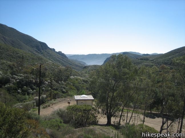
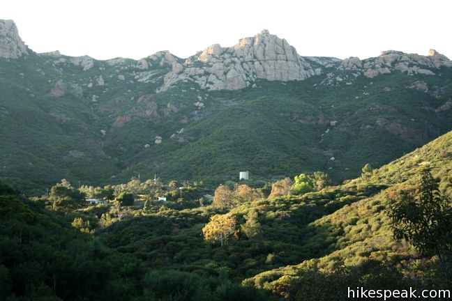
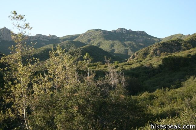
Simply named The Grotto, this narrow bolder-filled canyon with small talus caves covering a creek in the mountains makes a fun destination for a short hike. From the Circle X Ranch Visitor Center in the Santa Monica Mountains National Recreation Area on the west side of Malibu, it is 3-mile round trip to the Grotto with 475 feet of elevation loss.
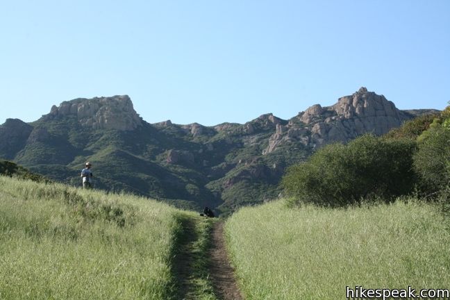
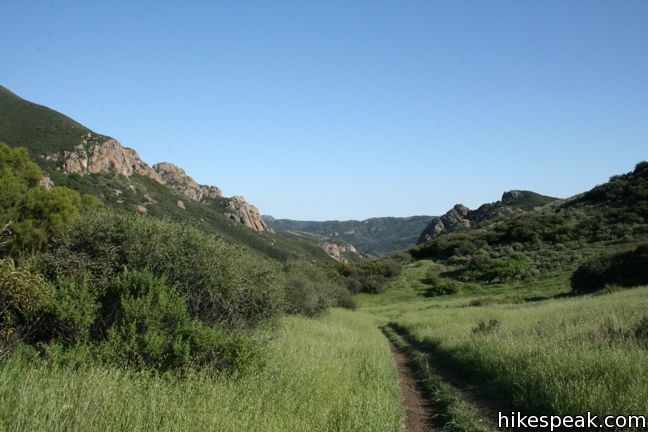
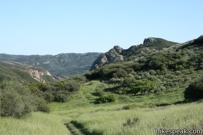
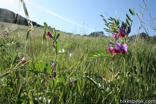
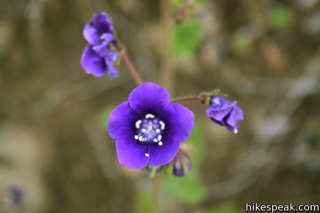
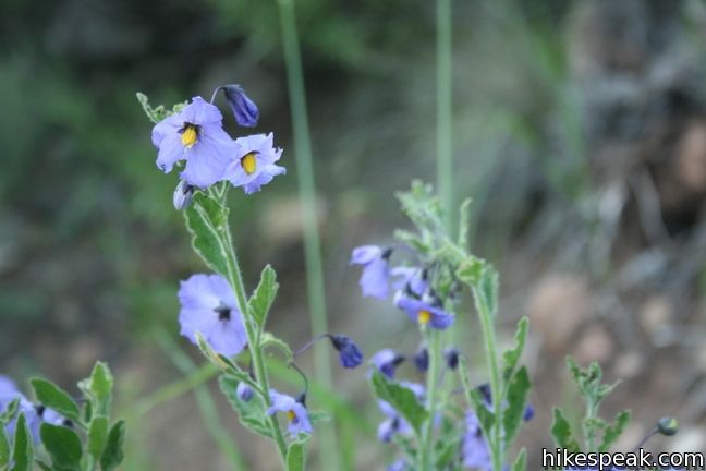
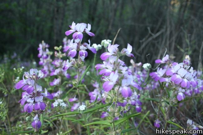
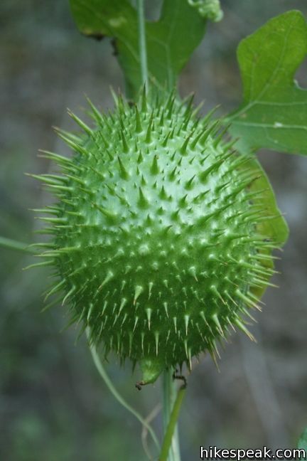
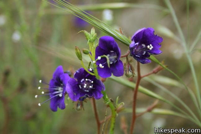
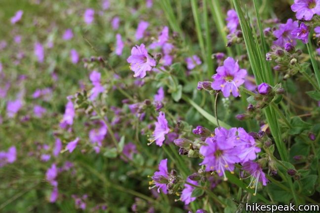
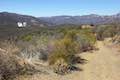
From the main parking area for Circle X Ranch, walk down the access road to a small group campsite and pick up the single track trail to the Grotto, which descends into a verdant canyon. Along the way, the trail passes in and out of shade as it follows a small creek down the mountain. Wildflowers are plentiful in the spring.
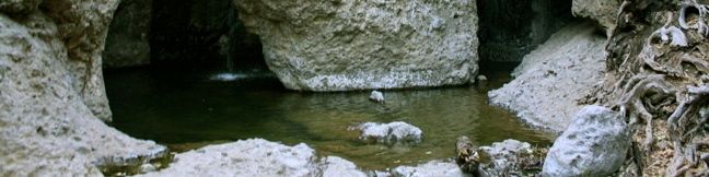
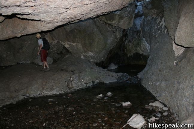
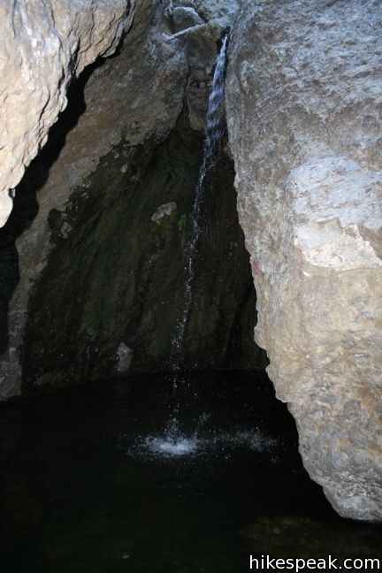
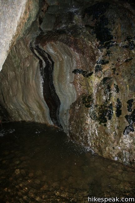
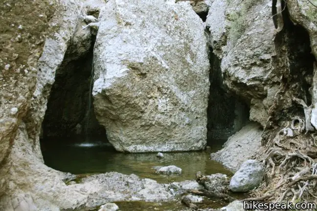
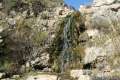
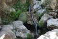
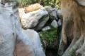
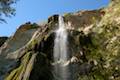
The trail comes to a sudden end as the creek, the West Fork of the Arroyo Sequit, passes through and beneath large rocks. Continue downstream, passing over the rocks. The water can be seen between the boulders some ten feet below. A couple openings offer passages down between the rocks to explore the hidden parts of the Grotto. Continuing over the rocks, to the point where the creek exits the narrow part of the canyon. The hike ends here. A short waterfall at the base of the grotto has water tumbling off a rock like a showerhead, dropping twelve feet into an enclosed pool. Here a ring of shallow water around a tall boulder creates a tube-like semi-circular cave.
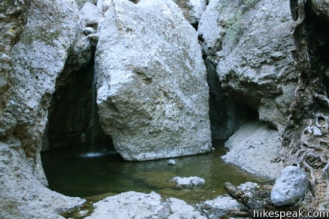
The grotto is a great spot for young and old to explore. The back of the grotto is dark and a bit mysterious. Gollum could easily reside here.
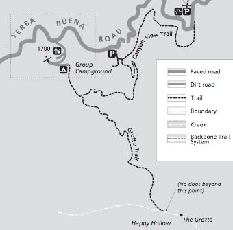
After enjoying the grotto, hike back up the same trail. This is one of those backwards hikes where you do the uphill hiking on the way out, so you will now be gaining 475 feet of elevation to return to the trailhead. Dogs are permitted along the trail, but not allowed over the last 1/8 mile through the grotto itself. No fee or permit is required, so get out and enjoy!
Directions to the Trailhead
- Take PCH to the far west end of Malibu.
- Turn north up Yerba Buena Road (alongside Neptune's Net Restaurant) and drive up Yerba Buena Road for 5.5 miles until you arrive at the Circle X Ranch Ranger Station (on the right).
- Park here and follow the signs to the trailhead.
Trailhead Location
Trailhead address: 12896 Yerba Buena Road, Malibu, CA 90265
Trailhead coordinates: 34.10995, -118.9373 (34° 06′ 35.8″N 118° 56′ 14.3″W)
View Santa Monica Mountains in a larger map
Or view a regional map of surrounding Los Angeles trails and campgrounds.
 | Sandstone Peak This 6.25-mile loop summits the tallest peak in the Santa Monica Mountains. |
 | Tri Peaks This 1.2-mile addition to the Sandstone Peak loop adds extra views to the hike (and some great views). |
 | Arroyo Sequit This 2.05-mile loop winds around the upper reaches of a canyon carved by the East Fork of Arroyo Sequit and has grand views of the Santa Monica Mountains. |
 | Nicholas Flat via Malibu Springs Trail This scenic 7-mile round trip hike ascends 1,425 feet to meadows and a pond on Nicholas Flat in Leo Carrillo State Park. |
 | Nicholas Flat Trail - Willow Creek Trail Loop This 2.05-mile loop in Leo Carrillo State Park wraps around a coastal ridge and tops out at an ocean vista with broad views. |
 | Nicholas Flat via Nicholas Flat Trail This scenic 7 to 7.6-mile hike ventures from the coast in Leo Carrillo State Park up into the mountains to a grassy flat with a small pond. |
 | La Jolla Canyon Loop This 11.75-mile hike explores Point Mugu State Park on the west end of the Santa Monica Mountains, offering extraordinary ocean views. |
 | La Jolla Canyon Falls This 1.5-mile hike visits a short seasonal waterfall in Point Mugu State Park (that is also a stop on the larger loop). |
 | More trails in the Santa Monica Mountains Explore beyond Circle X Ranch to other destinations in the range. |
 | Solstice Canyon This easy and level 2.6-mile out and back hike visits the ruins of a burned down ranch and a small waterfall. |
 | Santa Ynez Falls This 2.5-mile follows a shaded creek to a gorge containing a short waterfall. |
 | Escondido Falls This 3.8-mile out and back hike visits a 200-foot waterfall that is split into two tiers. The upper tier is 150 feet tall and stunning after a rainstorm. |
- The Circle X Ranch park guide (opens in a new tab)
- The National Park Service webpage for Circle X Ranch (opens in a new tab)
- The Grotto Trail on modernhiker.com (opens in a new tab)
- Grotto Falls on world-of-waterfalls.com (opens in a new tab)
- The Grotto Falls on californiathroughmylens.com (opens in a new tab)
Common Questions about The Grotto in the Santa Monica Mountains
- Is the trail open?
- Yes. You should expect to find that Grotto Trail is open. There are no recent reports of trail closures. If you discover that the trail is closed, please help your fellow hikers by reporting a closure.
- Is this trail free to access?
- Yes, Grotto Trail is free to access. No entrance fee, pass, or permit is required. If you discover that access rules have changed, please provide feedback on your experience.
- How much time does this hike take?
- It takes approximately 1 hour 30 minutes to hike Grotto Trail. Individual hiking times vary. Add extra time for breaks and taking in the views.
- How long is this hike?
- The hike to Grotto Trail is a 3 mile out and back with 475 feet of elevation change.
- Are dogs allowed on this trail?
- Yes, dogs are allowed on Grotto Trail. The trail is open to hikers, dogs (allowed on the trail but prohibited on the boulders to the grotto itself).
- Is this a good hike for wildflowers?
- Yes, Grotto Trail is known for its seasonal wildflower displays.
- What mountain range is this trail in?
- Grotto Trail is located in the Santa Monica Mountains.
- Where is the trailhead located?
- The trailhead for Grotto Trail is located in Malibu, CA.
Trailhead Address:
12896 Yerba Buena Road
Malibu, CA 90265
Trailhead Coordinates:
34.10995, -118.9373 - What are the driving directions to the start of the hike?
To get to the trailhead: Take PCH to the far west end of Malibu. Turn north up Yerba Buena Road (alongside Neptune's Net Restaurant) and drive up Yerba Buena Road for 5.5 miles until you arrive at the Circle X Ranch Ranger Station (on the right). Park here and follow the signs to the trailhead.
View custom Google Maps directions from your current location.
- Are there other trails near Grotto Trail?
- Yes, you can find other nearby hikes using the Hikespeak Hike Finder Map.

21 Comments on The Grotto in the Santa Monica Mountains
What hikers are saying:
✨ Generated summary of user commentsHikers enjoy the vibrant wildflowers and the peaceful solitude found during early morning visits. The path leads to a boulder-filled grotto that requires some light climbing, though a steep drop near the end makes the final section impassable for dogs. To avoid car sickness on the winding mountain roads, Gianni suggests taking Kanan and Encinal Canyon instead of Decker Road.
“The hike was mild but had enough on the way back to get a heart rate going.” Jump to comment ↓
Props for listing this hike. We took our 3 year olds, which was a bit of a stretch, but they loved the grotto (just not the climb back up). Fun day and sore feet tonight!
[…] https://www.hikespeak.com/trails/grotto-hike-malibu/ […]
Lets hike….
Can you start the hike at Circle X take the Grotto trail and continue to hike to PCH.
I believe the trail ends at the Grotto.
Beautiful trail. Can’t understand why people leave cigarette butts, cans and plastic bottles along the side of the path.
Is the Grotto hike well marked?
[…] For more on this hike and other great hikes check out […]
To get to the circle X ranch do we drive and or go thru mountain roads? Are there many curves on this road and or drive to the ranch?
John
The roads are all paved, but the are lots of curves, especially if you take the road up from PCH.
This was a great hike! When I went there on a Tuesday morning fairly early (8-9AM) there was not one single soul around. It was amazing. The hike was mild but had enough on the way back to get a heart rate going. Beautiful views and especially lovely being the only one there! Would definitely go back.
Hi Molly,
Is the water deep enough to sit in the grotto, like a bath?
[…] things often come to mind when someone hears “The Grotto”: the Little Mermaid’s hiding place for all her found human treasures, or the Playboy mansion. […]
i would take Kanan and Encinal canyon because Decker is very windy. If you take Encinal, you wont get carsick
Can you go in the water at the Grotto? Is it safe?
Is this a moderate hike or strenuous?
[…] Red Tape/Notes: No fee or permit required; for more information on the trail, hikespeak […]
Is the Grotton considered an easy hike? I have no hiking experience.
The Santa Monica Mountain do have easier hikes than this. You might want to try something like Solstice Canyon Trail before visiting The Grotto.
This is not a 3-mile round trip hike like the description says. According to the site signs, It’s 2.3 to 2.6 miles out to the beginning of the Grotto trail. The Grotto trail is about 0.8 mile with a ton of boulders and some easy climbing.
Please update the information. You are misguiding people. This trail takes about 1.5 to 2 hours for experienced hikers and can take closer to 4 for beginners.
2022/04/12 Hiked the trail today. Beautiful wildflowers: Sticky yellow monkey flowers, mustard, calif. sun flowers, deer weed, and more. About 0.3 miles from the end, there is a 8 to 10 foot drop over boulders and a small waterfall; No obvious good routes around. My 14 and 9 year-olds were able to get down with some jumps. No way for a dog to get past this point.