Willamette Valley
Extending south from the Greater Portland Metropolitan Area, Willamette Valley consists of fertile lands bordering the Willamette River. This wine-producing region is well know for its pinot noir, but the hiking deserves acclaim too! Salem and Eugene are the region’s largest cities.
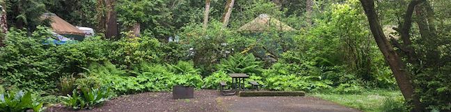
The Willamette Valley Region includes three counties, Marion County, Linn County, and Lane County, each of which extend west of the valley into the east side of the Cascade Range. Marion County’s Silver Falls State Park is packed with waterfalls and is one of Oregon’s most beautiful and thrilling places to hike.
Willamette Valley Hiking
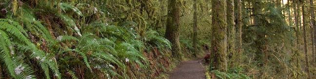
This collection of trails lists hikes roughly from west to east and north to south, but the table may also be sorted alphabetically or by distance to help you pick your next hike. Click on any trail to see a full write-up complete with photos, GPS maps, directions, and all the other information needed to locate and enjoy these hikes. You can also view hikes around the Willamette Valley on the Hike Finder Map.
| Trail | Description | Distance | Location |
|---|---|---|---|
 560 560 | Trail of Ten Falls This loop passes ten acclaimed waterfalls in Silver Falls State Park on a picturesque and exciting hike that actually goes behind four of the waterfalls. | 7.9 miles 600 feet | 44.8776, -122.6556 |
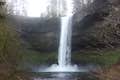
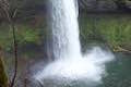 570 570 | South Falls This lollipop loop hike goes up to and behind a 177-foot waterfall that is the jewel of Silver Falls State Park. | 1.1 miles 200 feet | 44.8776, -122.6556 |
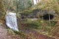 572 572 | Maple Ridge Loop This hike in Silver Falls State Park ventures behind both South Falls and Lower South Falls and also explores a ridge-top forest. | 2.8 miles 375 feet | 44.8776, -122.6556 |
 605 605 | Clear Lake Loop This charming curcuit crosses lava fields and old-growth forests along the shore of a strikingly clear Cascadian lake. | 5 miles 75 feet | 44.3735, -121.9985 |
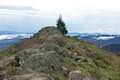 615 615 | Spencer Butte This out and back hike crosses a fern-covered forest and goes up to the crown of a butte with 360-degree views. | 5.2 miles 1,100 feet | 43.99593, -123.0997 |
 620 620 | Terwilliger Hot Springs Venture into Willamette National Forest to a natural hot springs where bathers can soak in a series of terraced pools. | 0.9 miles 85 feet | 44.082, -122.2319 |