Victoria
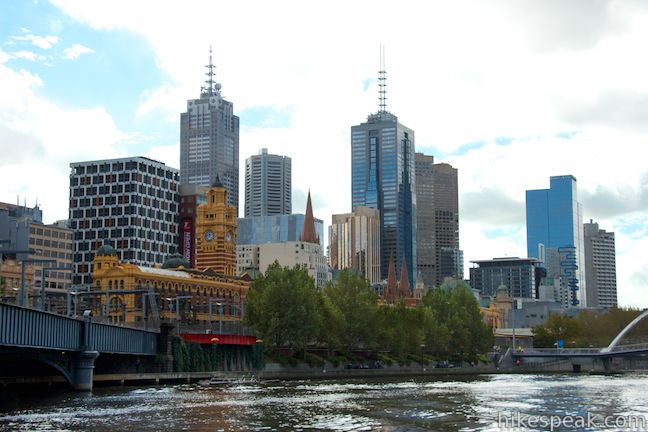
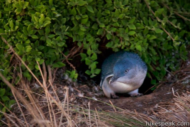
Victoria is Australia’s second most populous state with the nation’s second biggest city, Melbourne (and a fantastic city it is). Behind this metropolis, there’s a backyard of nature to explore. Get out of the city to one of Victoria’s 36 national parks, or one of the state’s other parks or reserves. Use hikespeak.com to find information on hiking and camping in Wilsons Promontory National Park, the southernmost point on Mainland Australia or visit Phillip Island, the well-preserved home of adorable little blue penguins and many coastal walks.
Hikes in Victoria, Australia
This collection of hiking trails in Victoria lists the hikes roughly from west to east and north to south. The table may also be sorted alphabetically or by distance to help you pick your next hike in Victoria. Each trail links to its own report complete with photos, GPS maps, elevation profiles, directions, and all the other information needed to locate and enjoy these hikes. Below the table is an interactive map showing the location of each hike.
| Trail | Description | Distance | Location |
|---|---|---|---|
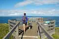
 750 750 | Nobbies Boardwalk This short out and back walk on Point Grant at the west end of Phillip Island provides excellent coastal views highlighted by Seal Rocks, Nobbies, and the Nobbies Blowhole. | 1 km 15 meters | -38.517163, 145.117576 |
 760 760 | Penguin Parade to the Nobbies This 4-kilometer one-way road can be walked, driven, or biked between the Penguin Parade Visitor Center and the Nobbies Centre, exploring beautiful coastline along the way. | 8 km 25 meters | -38.508812, 145.147153 |
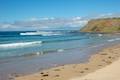 770 770 | Summerlands Beach This short out and back return hike brings you to a picturesque surf beach that is taken over by little penguins in the evening. | 1 km 10 meters | -38.508812, 145.147153 |
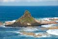 780 780 | Pyramid Rock This short out and back walk takes hikers out onto a grassy point to two overlooks of Pyramid Rock, a triangle-shaped rock island just off the southern coast of Phillip Island. | 0.8 km 10 meters | -38.525928, 145.221826 |
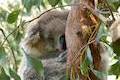 790 790 | Koala Conservation Centre This loop explores the fantastic boardwalks in Phillip Island's Koala Conservation Centre as well as a longer trail through eucalyptus woodlands. | 1.2 km 15 meters | -38.485668, 145.262828 |
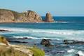 800 800 | Cape Woolamai This loop along beaches and bluffs is packed with Cape Woolamai highlights, including Woolamai Surf Beach, the Pinnacles, Cape Woolamai Beacon, Old Granite Quarry, and Cleeland Bight. | 8.5 km 112 meters | -38.543936, 145.339985 |
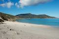 850 850 | South Norman Bay, Norman Point, and Little Oberon Bay This out and back hike in Wilsons Promontory National Park is packed with coastal views, traveling from Tidal River Campground to Norman Bay and across Norman Point to Little Oberon Bay, a pristine beach with pale sand and clear turquoise water. | 9.5 km 70 meters | -39.030653, 146.321366 |
Camping and Lodging in Victoria, Australia
 | Big 4 Caravan Park on Phillip Island This holiday park offers convenient cabin and camping accommodations on the east end of Phillip Island. |
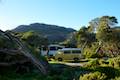 | Tidal River Campground This 484-site campground is the major camping facility within Wilsons Promontory National Park, the coastal paradise at the southernmost point of Mainland Australia. |
Transportation in Victoria, Australia
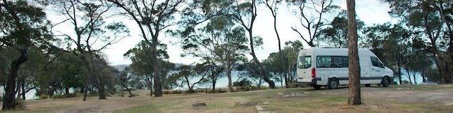
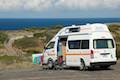 | Voyager Campervan Find out more about the Voyager, a four-person campervan that can be rented from Britz. |
Or explore hikes in Australia on the Oceania Hike Finder Map