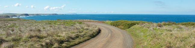
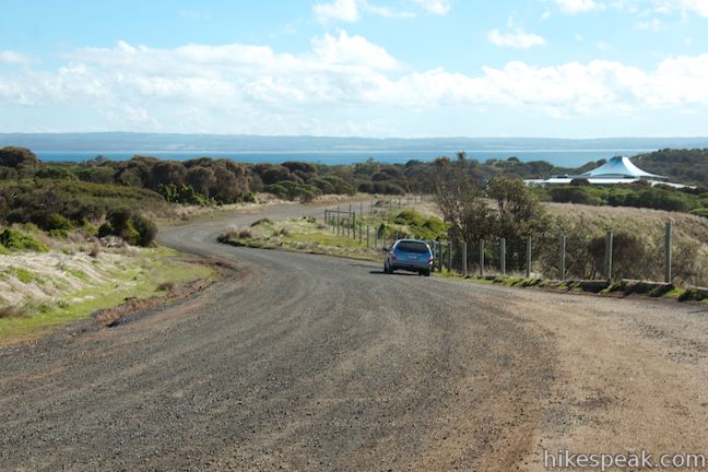
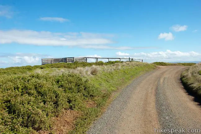
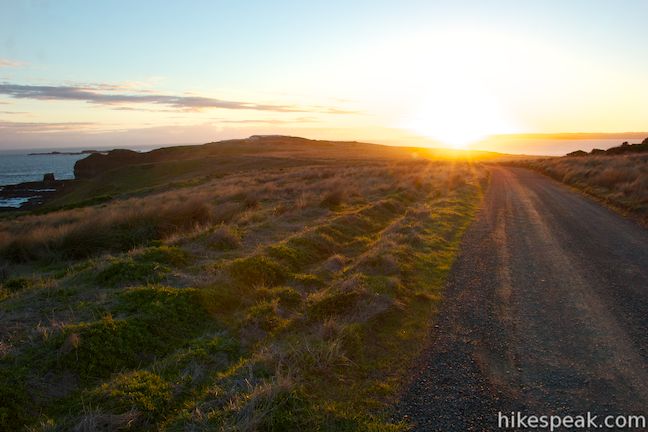
The western end of Phillip Island holds two of the island’s top attractions, the Nobbies and the Penguin Parade, which can be connected by an oceanfront stroll through a scenic reserve on the southern coast of Phillip Island. This walk is not actually along a trail, but on a gravel road that can be used by hikers, bikers, and drivers. Why go for a hike on a road you could drive on? The road gets minimal traffic, so you won’t have to share the road with too many vehicles. Plus, there are three scenic vista points to check out, with wooden platforms boasting panoramic views that can’t be seen from inside a car. The route between the Nobbies Centre and the Penguin Parade Visitor Centre is known as the Boulevard and is 4 kilometers one-way, allowing for an 8-kilometer (5-mile) out and back return walk. Bikers can combine this route with Ventner Road, the main road to the Nobbies Centre, for a 7-kilometer loop. Drivers coming back from the Nobbies Boardwalk can choose to pass this way as well, all though it’s bound to be more rewarding on foot.
Unlike cars, which can only drive on the Boulevard in one direction (from the Nobbies to the Penguin Parade), hikers can walk either direction on the road. Go for a one-way hike with vehicle assistance, or do an out-and-back return on the Boulevard to enjoy a satisfying second helping of ocean views. The directions below start from the Penguin Parade Visitor Centre, but this coastal route is straightforward and easy to follow (once you’ve found it) no matter which end you set out from. The Boulevard is only open from sunrise to sunset to protect the area’s little penguin colony, so plan your visit accordingly.
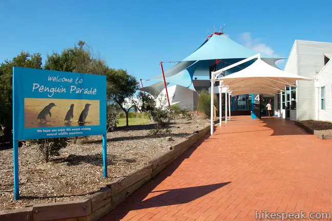
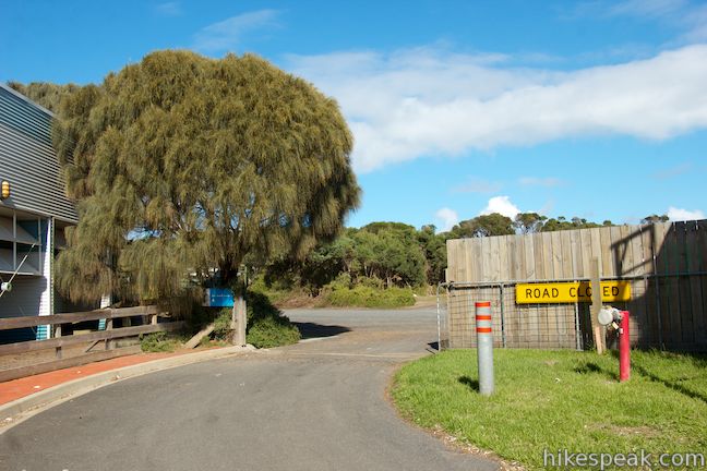
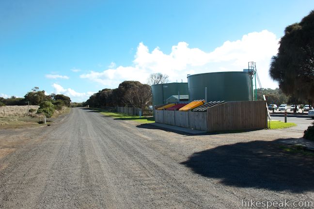
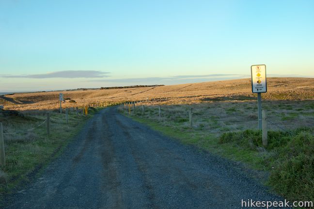
The toughest part about this walk may be finding where it begins. There are no signs directing visitors to the walk from the Penguin Parade to the Nobbies Centre, so you will need to find the road yourself. From Car Park One, walk toward the bus shelter on the roundabout outside the visitor center. Pass below the overhang and keep the Penguin Parade building to your left as you look for a walkway between the building and a pair of green holding tanks. You will see a gate slid back against a fence that reads “road closed” (the gate is used at night when the area is closed for the penguins). Walk through the open passage to the left of the gate and you will immediately meet a gravel road. This is your road to the Nobbies!
To the right, the road (Saint Helens Road) heads inland for about 300 meters to an intersection with Ventnor Road. This piece of the road can be used by vehicles at the end of the drive from the Nobbies and by bikers looping back to the Nobbies Centre via Ventnor Road. To the left, the gravel road passes along the side of the Penguin Parade Visitor Centre and heads toward the coast. Turn left to hike to the Nobbies.
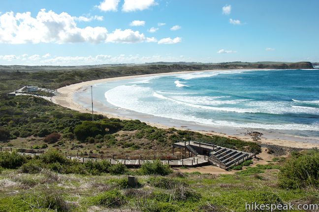
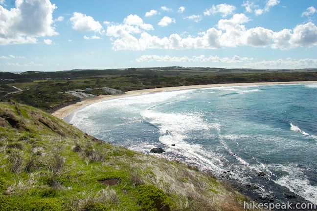
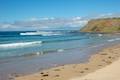
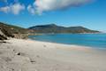
After 100 meters, you will come to a signed junction with a paved walkway on the left that leads down to Summerlands Beach, the very beach that the penguins parade up in the evening. The beach is open to the public daily in the morning and early afternoon. Take this side trail to add 0.8 kilometers (or more with beach strolling) to your hike. You will notice that penguins have used this road as well, as there are white streaks and webbed-footprints on the ground where the little creatures have pooped and walked.
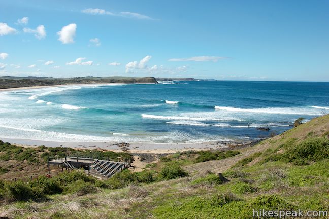
Stay to the right up the gravel road to continue toward the Nobbies. Over the next half a kilometer, the road climbs gradually up to a coastal bluff. On the way up, there are views over Summerlands Beach where a sandy cove has been built up with stadium lights and seating for spectators to the nightly penguin parade when thousands of the world’s smallest penguins return to burrows in this area of Phillip Island.
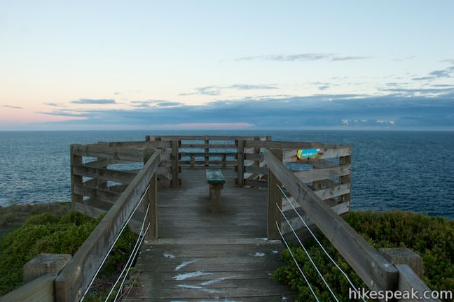
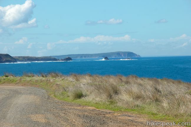
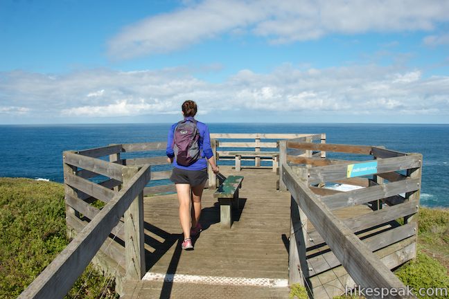
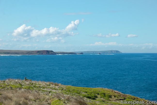
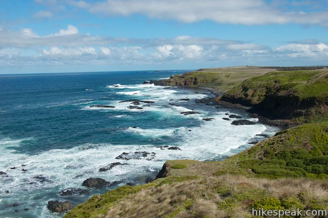
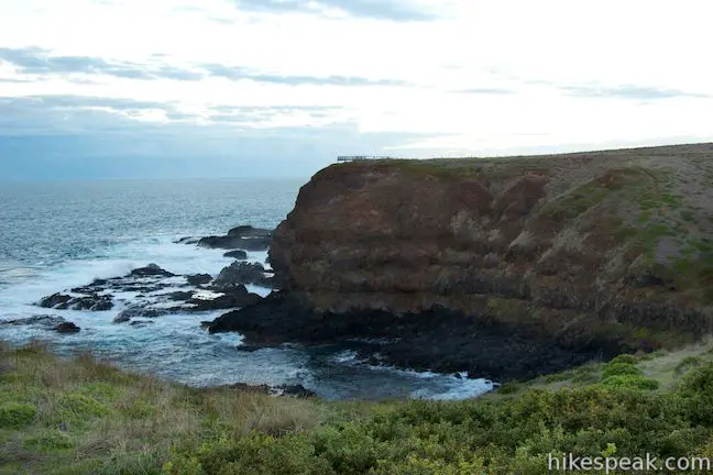
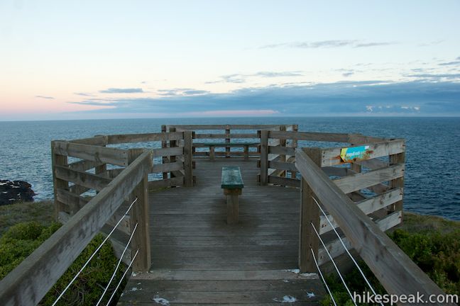
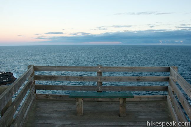
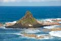
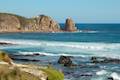
As the road curves to the right to head west along the south coast of Phillip Island, you will come to the first vista point along the trail, Scotchmans Lookout. Step out on the wooden viewing platform and enjoy easterly views across Summerlands Bay toward Kennon Head, Pyramid Rock, and Cape Woolamai. The cape is the easternmost point on Phillip Island and Pyramid Rock is an easy-to-identify sea stack along the coast.
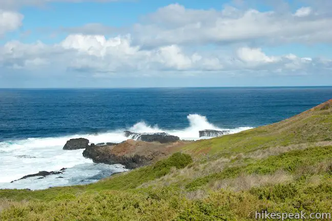
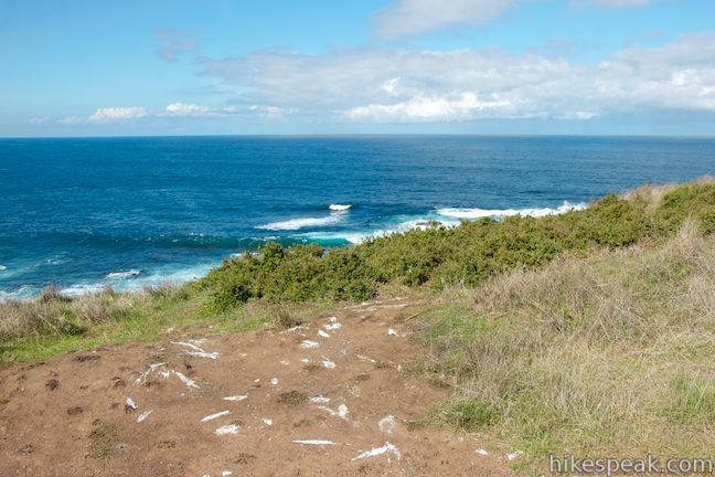
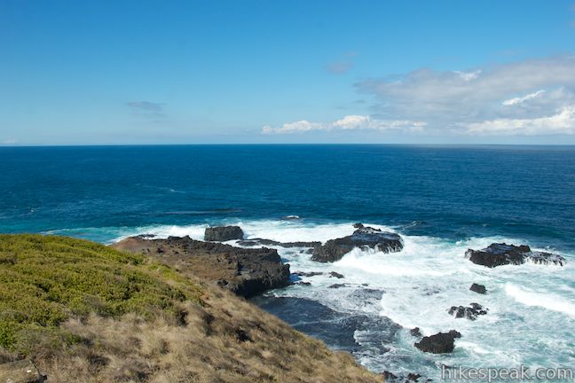
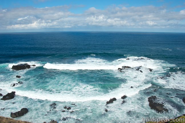
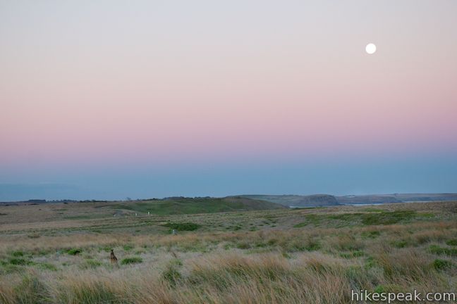
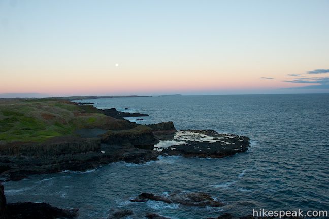
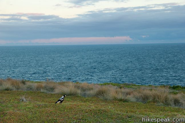
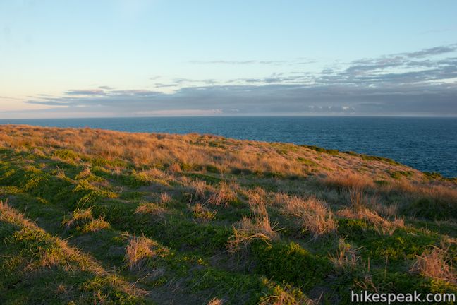
The Boulevard becomes even more gradual beyond Scotchmans Lookout, crossing gently rolling oceanfront bluffs. Windswept green grasses and brush along the trail allow for broad panoramic views. As you walk, there are numerous places to look down on the coast below, where waves collide with small rocky islands and points.
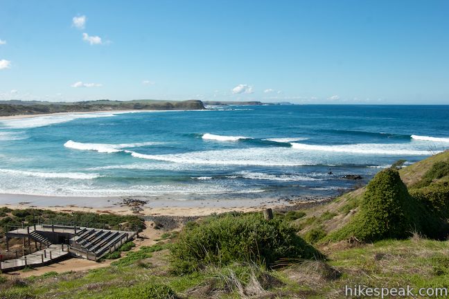
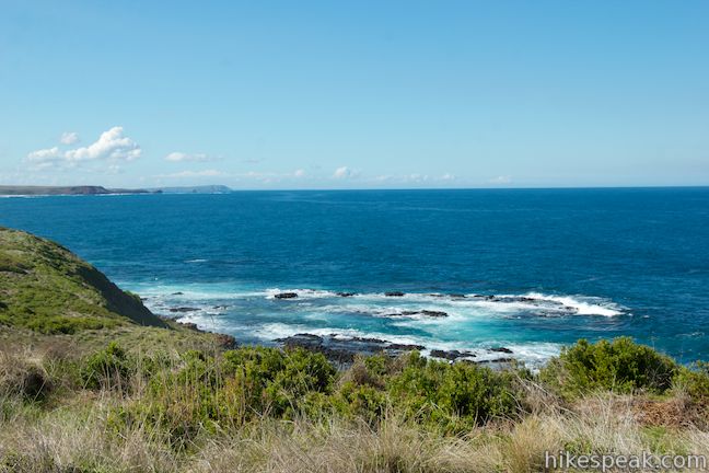
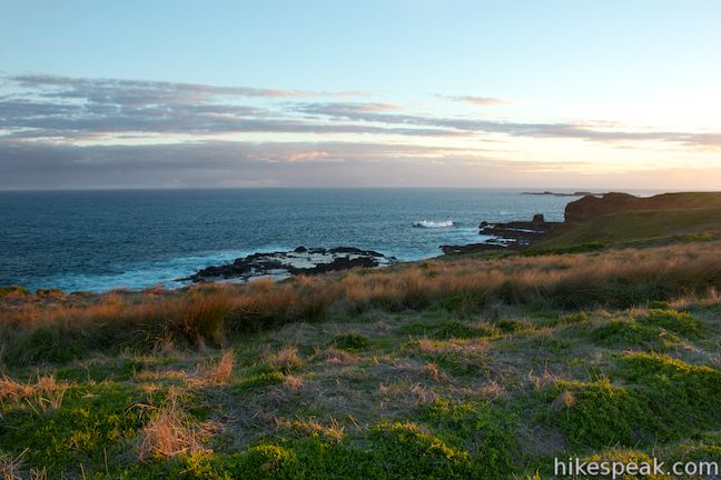
After walking 0.6 kilometers past the first overlook (1.2 kilometers from the start), you will come to South Coast Lookout with views up the coast in both directions. The overlook sits atop sheer cliffs, allowing you to look down on waves battering the rocks that divide the island from the deep blue waters of the Bass Straight. The coastline to the east is particularly picturesque, with rocky coves and a procession of grassy bluffs. It is a longer walk to the next overlook, so those looking for a shorter hike could turn around at South Coast Lookout for a satisfying 2.4-kilometer round trip return walk from the Penguin Parade Visitor Centre.

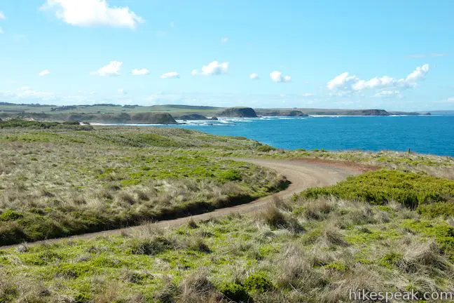
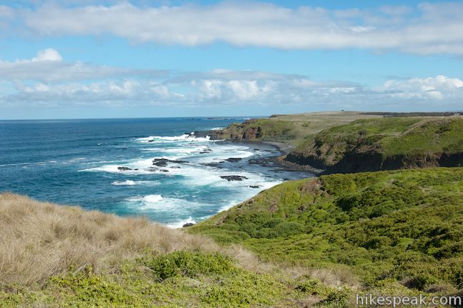
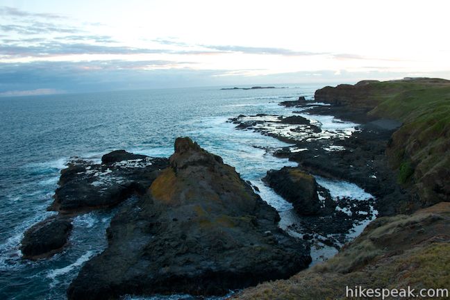
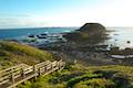
Past South Coast Lookout, there are numerous overlook-worthy views along the road as it winds around curves in the coastal bluffs that offer windows onto the shore below. The hiking remains easy-going over the next two kilometers leading to Seagull Rock Lookout, the third and final overlook along the road (3.2 kilometers from the start). Step out onto this overlook on the bluff’s edge and look down on a large dark rock on the coast called Seagull Rock. The popular seabird spot is surrounded by more beautiful rugged coastline. Have a seat on the bench and enjoy the ocean view panorama before continuing up the road.
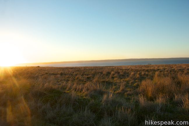
The final 0.8 kilometers from Seagull Rock Lookout to the Nobbies Centre heads gradually downhill and then uphill, sticking with the south coast of the peninsula. You’ll soon spot the Nobbies Centre built on Point Grant. The ocean continues to batter the southern coast of the island and there are also views of blue waters to the north, in Westport, on the other side of Phillip Island.
The west end of the Boulevard is also lacking obvious signage (which probably contributes to the small number of vehicles and hikers that put it to use). The gravel road meets the southeast side of the loop in the road outside the visitor center. If you walk around to the northeast side of the loop, you’ll find a large parking area and the start of the Nobbies Boardwalk, which allows visitors to hike a kilometer of scenic boardwalks on the western end of Phillip Island. If you are returning to the Penguin Parade Visitor Centre, turn around and hike 4 kilometers back to the start for an 8-kilometer return hike (9 kilometers if you add the Nobbies Boardwalk).
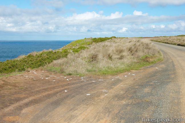
As you walk along the Boulevard, you will notice a few intersections with gravel roads that venture inland. Simply stick with the coastal road and you’ll have no problem getting between the two visitor centers. These side roads are remnants of the Summerland Estate, a housing development that stood on this end of Phillip Island. The empty roads are a reminder of the aggressive conservation effort that helped save the penguin colony. Construction began on the housing development in the 1920s and the Summerland Estate had close to two hundred homes at its peak. These houses were built in and alongside the small area where the little penguins live. The penguin population shrank dramatically after the houses went in. The response on behalf of the penguins is impressive, as a panel at the Penguin Parade explains:
In 1985, the state government began buying back houses located in the penguin colony. All houses were removed from Summerland Estate by 2010. Little penguin numbers have doubled in the last 30 years thanks to extensive protection and habitat restoration by Phillip Island Nature Parks.
Today, you won’t see any houses between the Penguin Parade Visitor Centre and the Nobbies Centre, but over 30,000 little penguins call this area home.
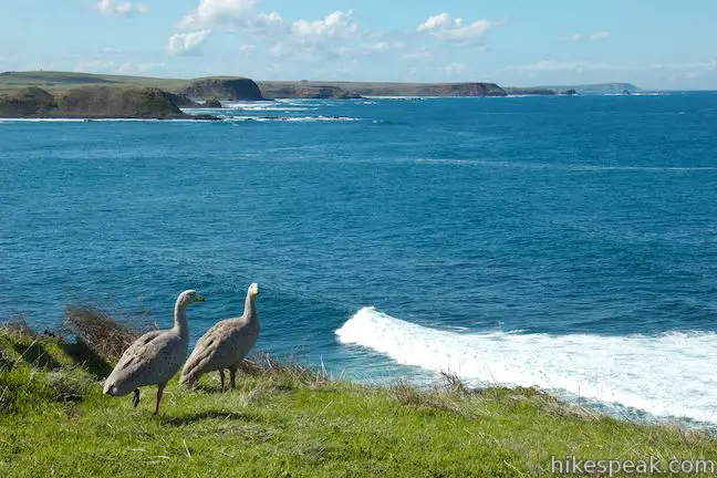
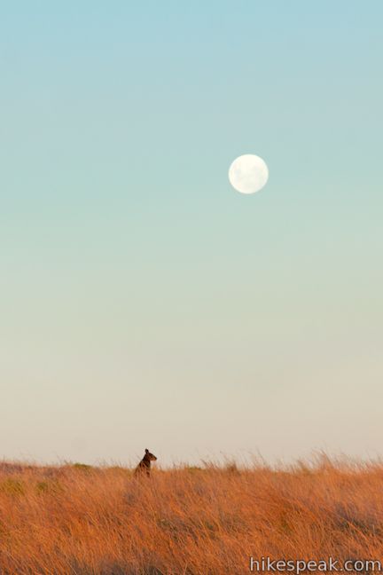
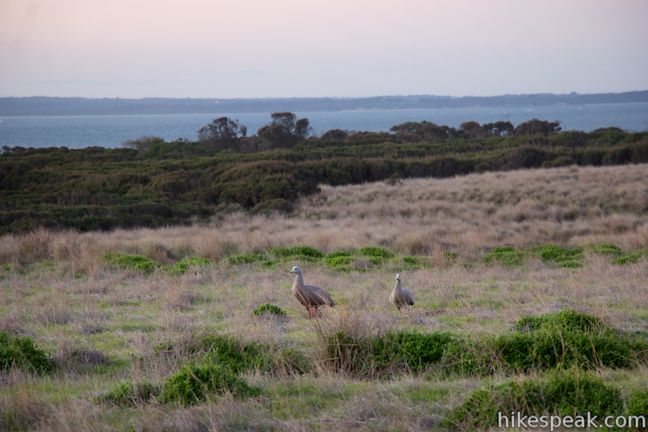
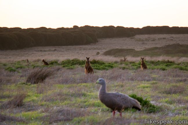
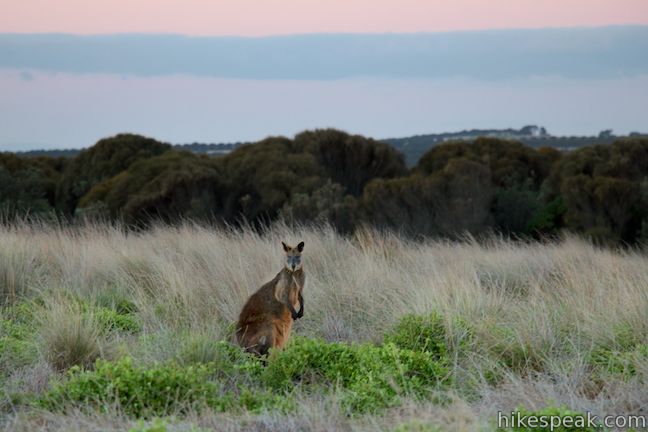
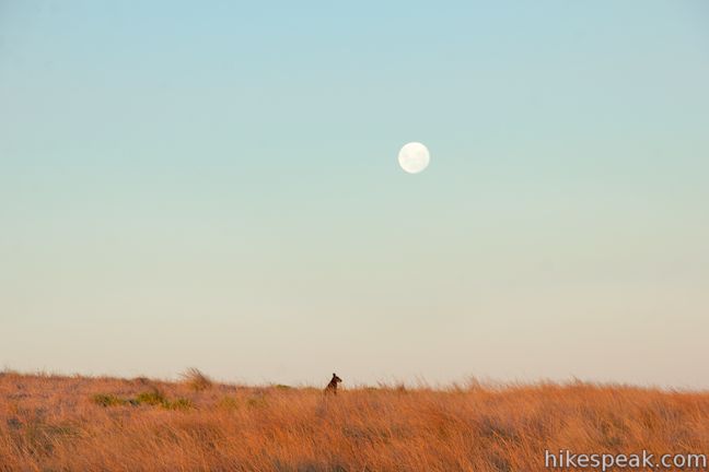
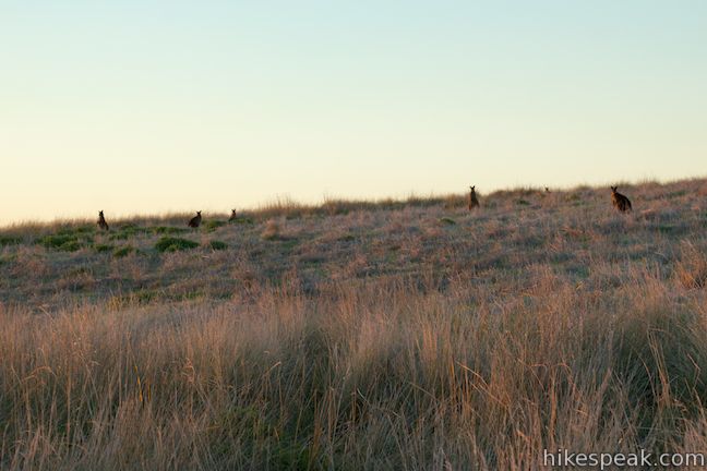
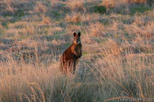
To further protect this area, all roads west of the Penguin Parade are closed between sunset and sunrise. This closure includes the Boulevard and applies to everyone, whether you are in a car or on foot. Give yourself plenty of time to finish this hike before sunset when a ranger will come through to close the road for the night. The hours around sunset and sunrise are great times to spot black wallabies along the road, but you will likely not see any of these marsupials at midday. Dogs are not permitted on the Boulevard, but bikes are. No fee or permit is required to walk between the Penguin Parade and the Nobbies on Phillip Island, so get out and enjoy!
Directions to the Trailhead
- From Melbourne, take M1 east for approximately 30 kilometers to the exit for South Gippsland Freeway (M420) and drive south for 97 kilometers on M420 following signs for Phillip Island.
- Bear right onto Phillip Island Road (B420) to cross the bridge onto Phillip Island.
- Now continue another 8.5 kilometers and bear left at a major split onto Back Beach Road (toward the Penguin Parade).
- Drive 10 kilometers to the end of the road and turn left onto Ventnor Road.
- Drive another 1.5 kilometers and turn left into the large parking area for the Penguin Parade.
- During the day, you should be able to find a space all the way up front in Car Park One.
Trailhead Location
Trailhead address: 1019 Ventnor Road, Summerlands, VIC 3922, Australia
Trailhead coordinates: -38.508812, 145.147153 (38° 30′ 31.72″S 145° 08′ 49.75″E)
View Phillip Island in a larger map
Or view a regional map of surrounding Australian trails, campgrounds, and lodging.


 | Summerlands Beach This 1-kilometer out and back return hike brings you to a picturesque surf beach that is taken over by little penguins in the evening. |
 | Nobbies Boardwalk This 1-kilometer walk on Point Grant at the west end of Phillip Island provides excellent coastal views highlighted by Seal Rocks, Nobbies, and the Nobbies Blowhole. |
 | Pyramid Rock This 0.8-kilometer walk (400 meters one way) takes hikers out onto a grassy point to two overlooks of Pyramid Rock, a triangle-shaped rock island just off the southern coast of Phillip Island. |
 | Koala Conservation Centre This 1.2-kilometer loop explores the fantastic boardwalks in Phillip Island's Koala Conservation Centre as well as a longer trail through eucalyptus woodlands. |
 | Cape Woolamai This 8.5-kilometer loop along beaches and bluffs is packed with Cape Woolamai highlights, including Woolamai Surf Beach, the Pinnacles, Cape Woolamai Beacon, Old Granite Quarry, and Cleeland Bight. |
 | More trails in Australia Explore other destinations in Victoria and Tasmania, Australia. |
 | Big 4 Caravan Park on Phillip Island This holiday park offers convenient cabin and camping accommodations on the east end of Phillip Island. |
- Penguin Parade to the Nobbbies on visitvictoria.com (opens in a new tab)
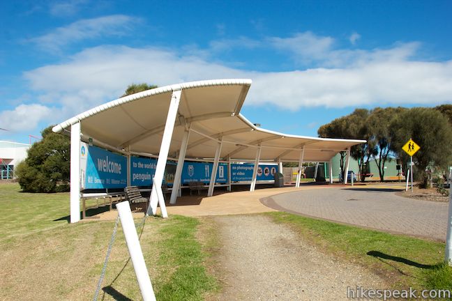
- The official website for the Penguin Parade (opens in a new tab)
- The Penguin Parade on visitphillipisland.com (opens in a new tab)
- A walk and bike tracks brochure for Phillip Island from visitbasscoast.com (opens in a new tab)
- Phillip Island walks and cycling tracks guide on visitphillipisland.com (opens in a new tab)
Common Questions about Penguin Parade to the Nobbies on Phillip Island
- Is the trail open?
- Yes. You should expect to find that Penguin Parade to The Nobbies is open. There are no recent reports of trail closures. If you discover that the trail is closed, please help your fellow hikers by reporting a closure.
- Is this trail free to access?
- Yes, Penguin Parade to The Nobbies is free to access. No entrance fee, pass, or permit is required. If you discover that access rules have changed, please provide feedback on your experience.
- How much time does this hike take?
- It takes approximately 2 hours 15 minutes to hike Penguin Parade to The Nobbies. Individual hiking times vary. Add extra time for breaks and taking in the views.
- How long is this hike?
- The hike to Penguin Parade to The Nobbies is a 8 km / 5 mile out and back return with 25 meters / 80 feet of elevation change.
- Are dogs allowed on this trail?
- No, dogs are likely not allowed on Penguin Parade to The Nobbies. The trail is primarily open to hikers, bikes.
- Are there ocean views on this hike?
- Yes, Penguin Parade to The Nobbies offers views of the ocean.
- Where is the trailhead located?
- The trailhead for Penguin Parade to The Nobbies is located in Summerlands, Victoria.
Trailhead Address:
1019 Ventnor Road
Summerlands, Victoria 3922
Trailhead Coordinates:
-38.508812, 145.147153 - What are the driving directions to the start of the hike?
To get to the trailhead: From Melbourne, take M1 east for approximately 30 kilometers to the exit for South Gippsland Freeway (M420) and drive south for 97 kilometers on M420 following signs for Phillip Island. Bear right onto Phillip Island Road (B420) to cross the bridge onto Phillip Island. Now continue another 8.5 kilometers and bear left at a major split onto Back Beach Road (toward the Penguin Parade). Drive 10 kilometers to the end of the road and turn left onto Ventnor Road. Drive another 1.5 kilometers and turn left into the large parking area for the Penguin Parade. During the day, you should be able to find a space all the way up front in Car Park One.
View custom Google Maps directions from your current location.
- Are there other trails near Penguin Parade to The Nobbies?
- Yes, you can find other nearby hikes using the Hikespeak Hike Finder Map.

Go the extra miles...
Submit a rating of this hike to go with your comment. Contribute to the average trail rating.