Cape Woolamai is a 308-hectar (760-acre) reserve established in 1968. The preserve protects the southeast end of Phillip Island and also the highest point on the island, a 112-meters-above-sea-level crest on the bluffs at the top of Cape Woolamai. The summit isn’t much of a climb, so sandy beaches and stunning granite cliffs are the real draw for hikers.
Thanks to a small network of trails, there are a number of hiking options on Cape Woolamai, ranging from 1.6 kilometers (1 mile) to 8.5 kilometers (5.3 miles). This page will highlight some of the cape’s shorter hiking options while describing a long but easy 8.5-kilometer loop that hits Cape Woolamai’s main attractions. The comprehensive 8.5-kilometer hike begins on Woolamai Surf Beach, follows coastal bluffs to views of the Pinnacles, reaches broad views at the Cape Woolamai Beacon, turns inland and ventures to the Old Granite Quarry, before finishing with a long beach stroll along Cleeland Bight to return to the trailhead.
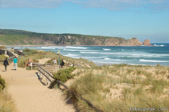
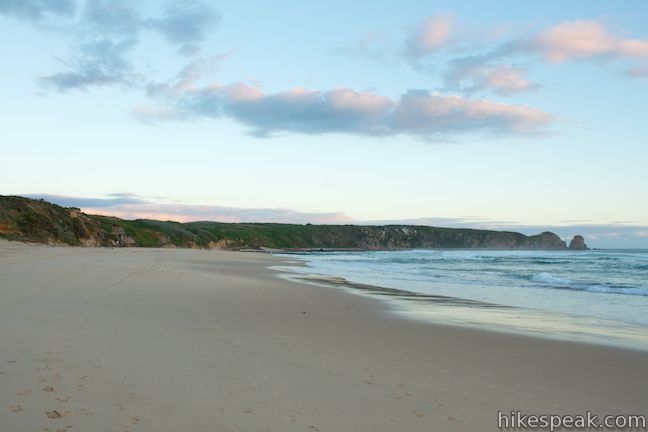
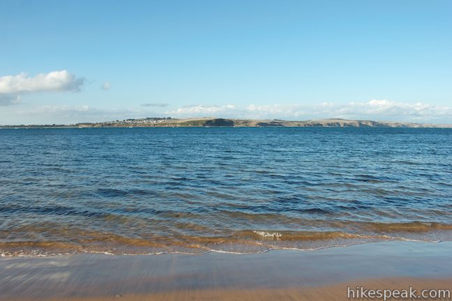
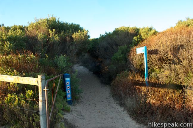
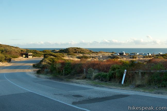
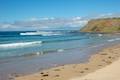
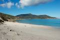
A few guides for Cape Woolamai state that the hiking trails begins next to the wooden shelter at the end of Woolamai Beach Road. The trail closest to the shelter is actually a sandy road for maintenance vehicles. A bit farther back up Woolamai Beach Road there is a trail to Cleeland Bight, the beach along the east side of the cape. This trail will be the last leg of the counter-clockwise loop described here. From the car park at the end of Woolamai Beach Road, you’ll probably be drawn to Woolamai Surf Beach, a long sandy beach along the west coast of Cape Woolamai. Don’t resist the allure of the beach, because this hike actually begins with a 700-meter stroll down Woolamai Surf Beach.
Take the wooden ramp down to the beach and walking southeast along a wide strip of sand toward a rocky point that juts out from Cape Woolamai. later in this hike, when you reach the other side of this rocky point, you’ll see the impressive formation called the Pinnacles.
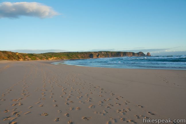
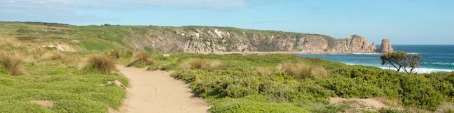
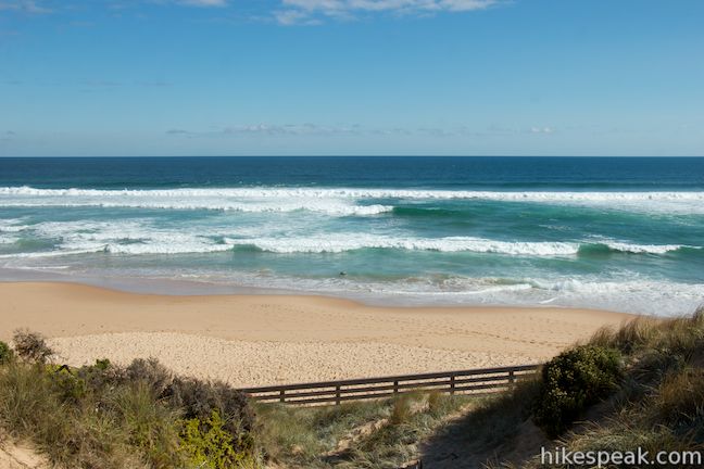
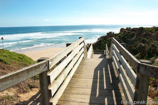
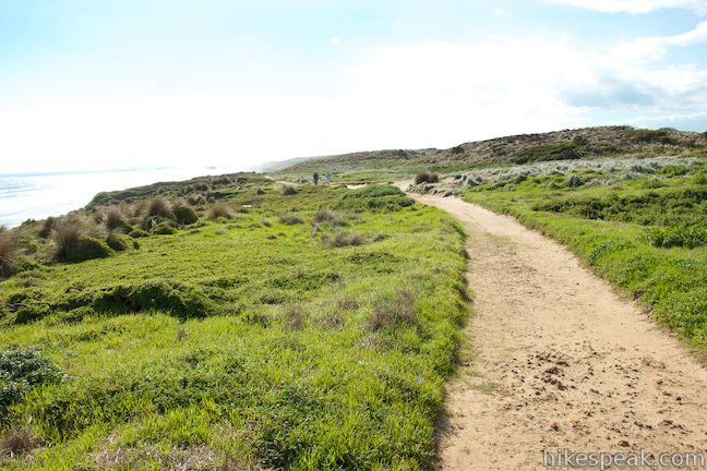
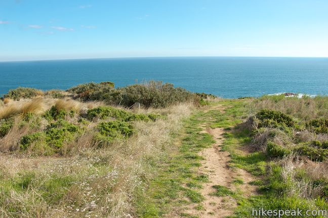
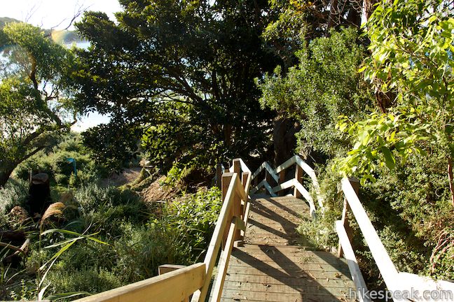
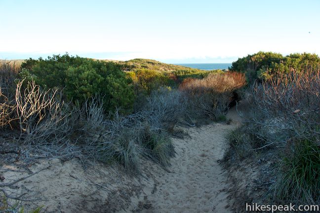
Enjoy an easy stroll across Woolamai Beach, watching surfers complete entertaining tricks on the beautiful waves at this world-renowned surf beach. For a quick 1.6-kilometer walk, you could simply stroll to the end of Woolamai Beach and back. After 700 meters, and before reaching the end of the beach, you will spot a wooden staircase on the left. Take it up onto the sandy grass-covered bluffs that connect the rocky end of Cape Woolamai with the rest of Phillip Island. In centuries past, Cape Woolamai was its own island, becoming linked to Phillip Island by a straight of sand called a “sandy tie bar.” The dunes on this sand bridge succeeded over time to brush and grasses that now provide low vegetation over the narrow northern end of Cape Woolamai where the opposing beaches are just a few hundred meters apart.
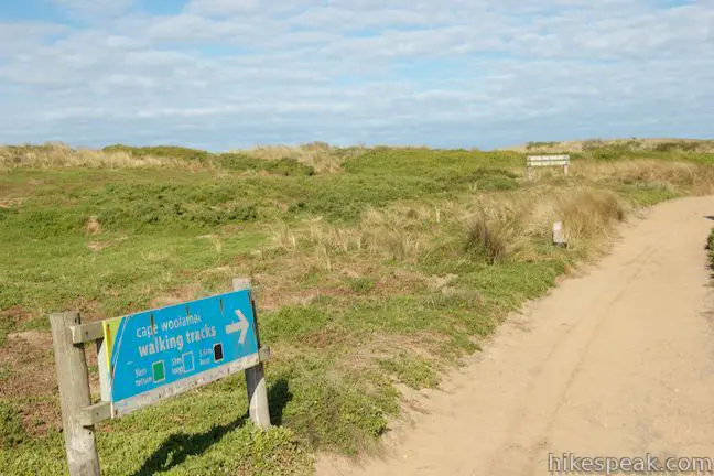
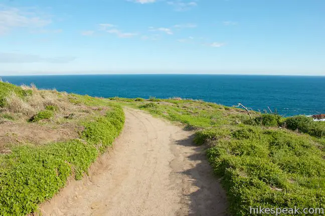
At the top of the steps, there is a sign for the Cape Woolamai Walking Trails directing you to turn right (the service road to the left heads back to the parking area). The trail sign highlights three of the hiking possibilities on Cape Woolamai, each with an identifying color that is used on markers along the trail.
- Pinnacles Walk – The green route is 4.4 kilometers long, an out and back walk that ventures 1.4 kilometers farther down the bluff to an overlook above the Pinnacles and turns around there.
- Cape Woolamai Beacon Walk – The black route is 7.4 kilometers long and continues past the Pinnacles to the light beacon at the high point of Cape Woolamai before circling back around the end of the cape.
- Old Granite Quarry Walk – The blue route is 5.6 kilometers long and crosses over to the east side of the cape to the site of an old rock quarry. Return via the same route or make it a 5-kilometer loop and walk back along the beach.
The hike described here actually borrows a bit from all three. You can call it the black and blue route if you like (no bruises, please). After following the black arrows to the Pinnacles and Cape Woolamai Beacon, this hike follows a blue arrow to the rock quarry, and then takes an uncolored route to end the hike with another beach stroll.
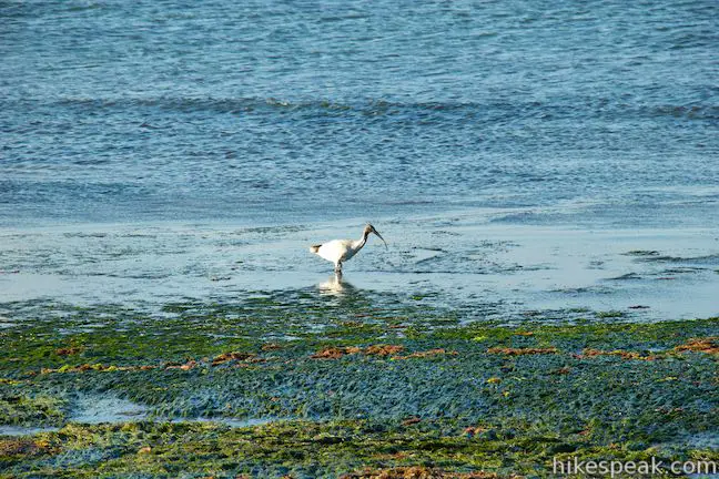
Get underway by heading south down the wide dirt trail. There will be views over Woolamai Beach to your right as you get closer to the long rock wall that runs into the ocean at the end of the beach. To your left, you will see burrows in the ground, evidence of the muttonbird rookeries on Cape Woolamai. Muttonbird, or short-tailed shearwater, are a variety of puffins that breed and nest in islands along the Bass Straight. A sign along the trail explains that short-tailed shearwater:
Undertake an amazing migration from the waters around the Aleutian Island near Alaska to breed on Phillip Island. Over one million birds land on our shores around September 24th each year. They live in burrows and lay one egg per pair. Adults leave Phillip Island in April and the chicks follow in late April to early May.
Before Phillip Island was synonymous with the Penguin Parade, the annual return of the muttonbirds was a top wildlife attraction on the island.
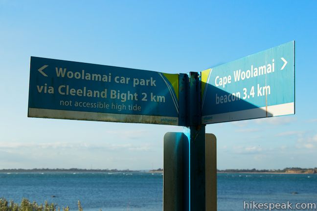
At just 350 meters from the top of the steps, you will come to a junction. Those following the blue arrows would turn left here to cross over to the east side of the cape toward the Old Granite Quarry. The trail to the left is also used as a return route back to this point by the blue and black routes. Stay to the right for now, following black and green arrows toward the Pinnacles.
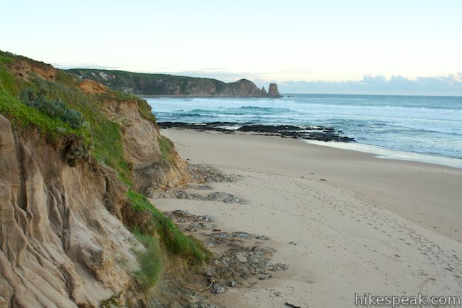
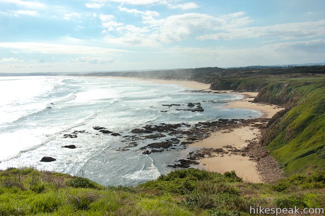
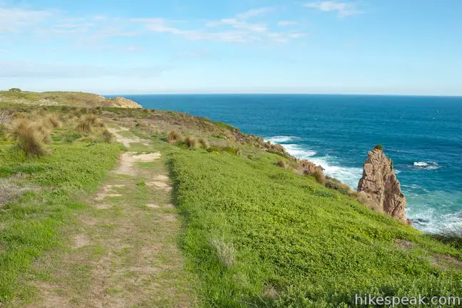
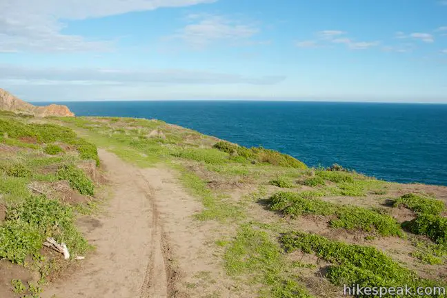
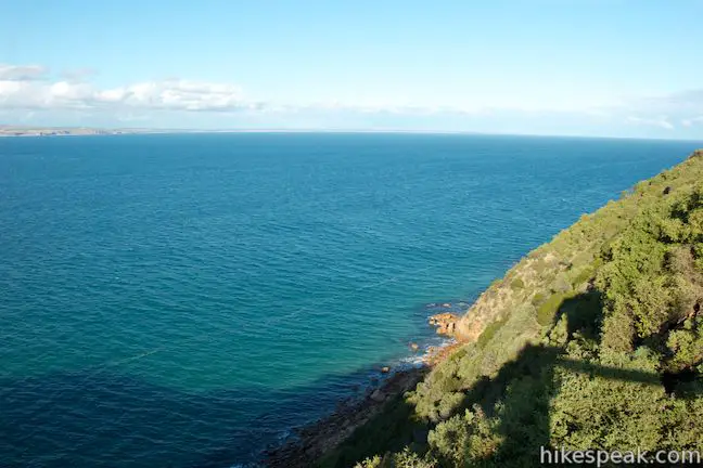
As you hike down the lovely west coast of the cape, be sure to look over your right shoulder for views of Woolamai Surf Beach and the south coast of Phillip Island. In another 550 meters, there will be a short spur path on the right that presents nice views over the end of Woolamai Beach.
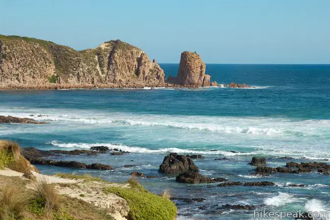
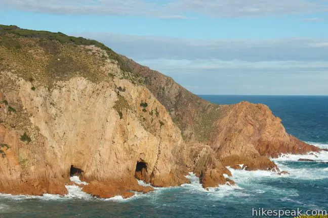
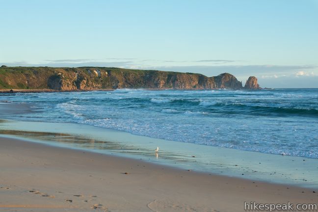
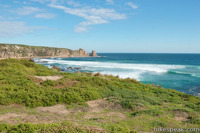
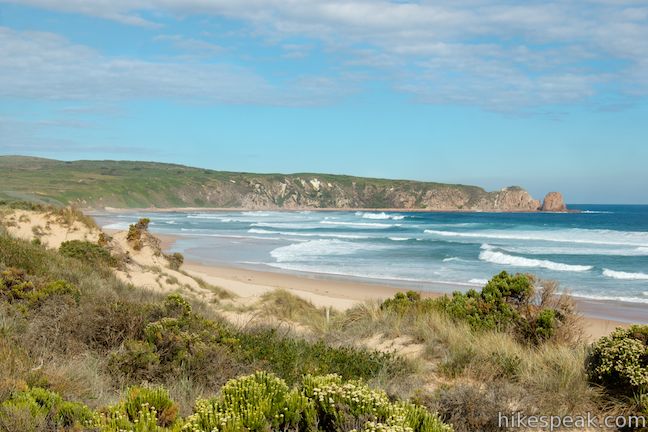
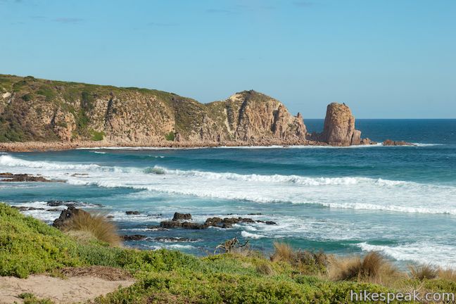
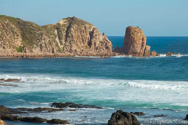
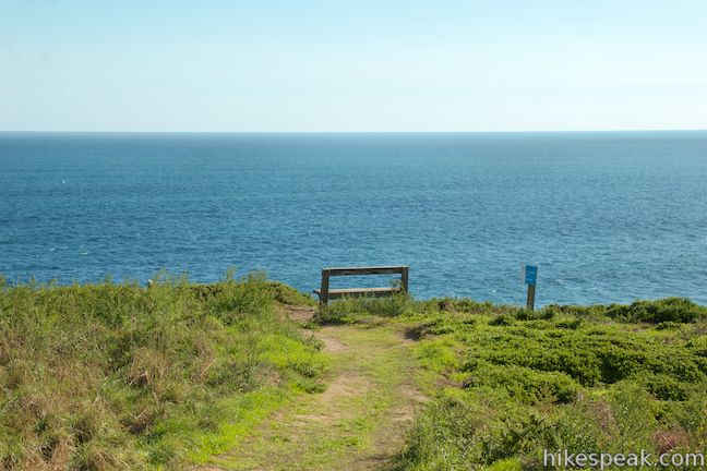
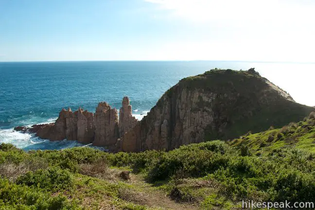
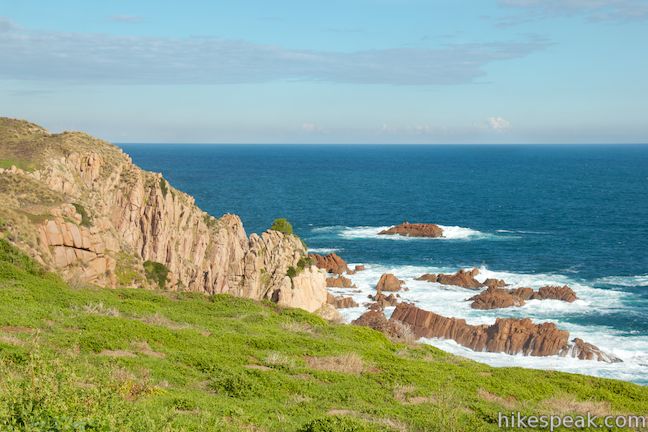
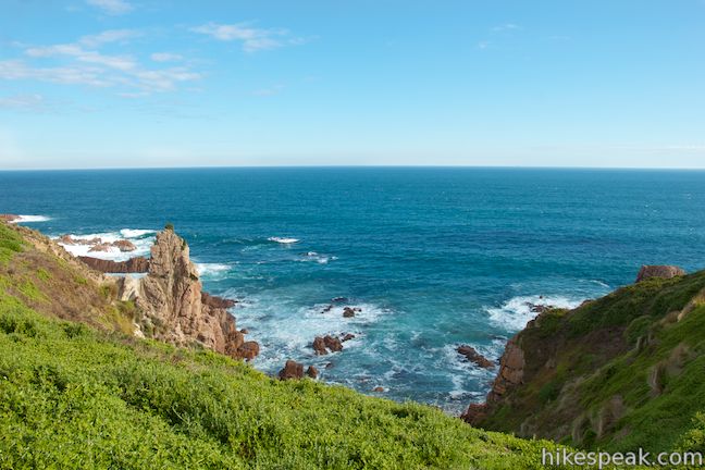
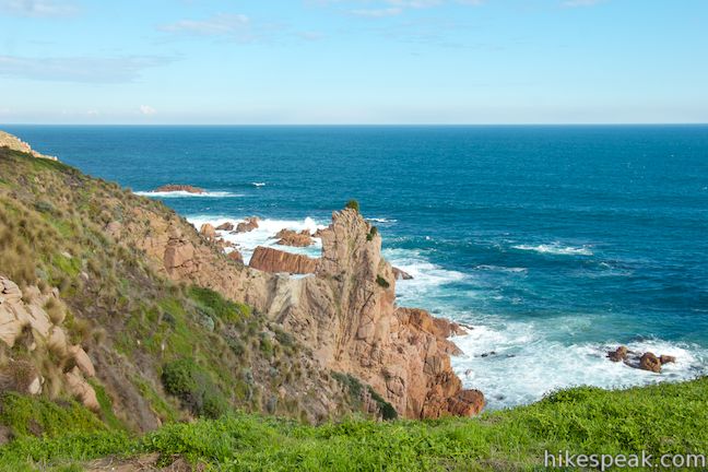
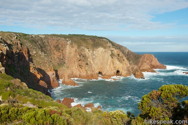
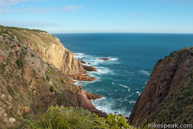
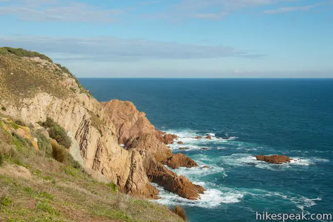
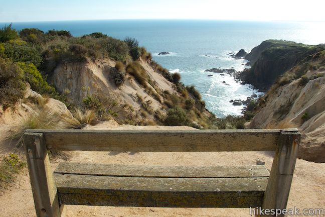
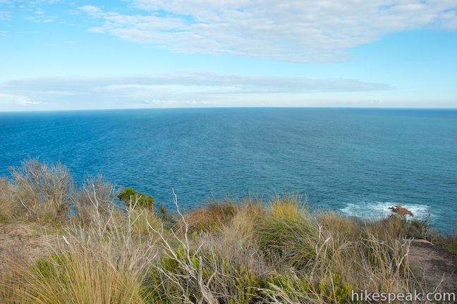
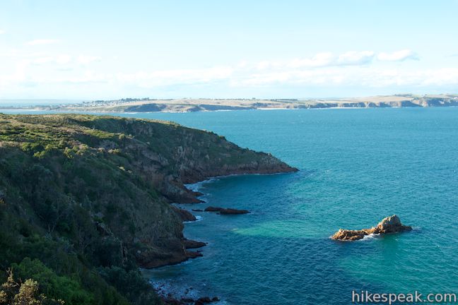
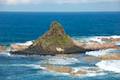
At 1.05 kilometers from the junction and 2.2 kilometers from the car park, a bench will appear at the edge of the grassy bluff. If breathtaking views actually take your breath away, you may want to sit down before you look out from here. Below the bluff, the coast is made up of impressive rock formations. The Pinnacles, sea stacks resembling connected granite columns, rise out of the surf near the end of the point directly offshore. Waves crash into orange granite, which grows redder in the late day sun, adding a splash of excitement. Look down on the narrow but imposing Pinnacles and imagine how impressive they must look from sea level.
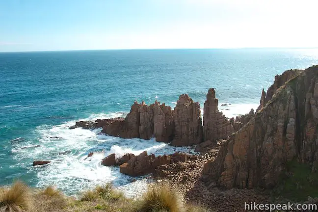
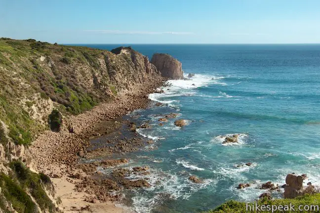
This is where those following the green arrows are directed to turn around. However, you only need to hike a bit farther to seem ore excellent rock formations on the cliffs below, where bare orange granite plunges from the bluff to the sea. Follow black arrows from the bench at the Pinnacles for another 2.05 kilometers on a gentle ascent to the summit at the tip of Cape Woolamai. As you continue up the trail, you will be bombarded with beautiful views of the coastal bluffs and the ocean beyond. Before reaching the light beacon, you will gain a striking view of orange cliffs below the headland at the south end of the cape. Where the rocks meet the surf, there is a pair of sea caves that resemble subway tunnels. Stand and watch waves rushing in and out of the caves, splashing up the side of the rocks. These dramatic cliffs are probably the most dynamic of the hike.
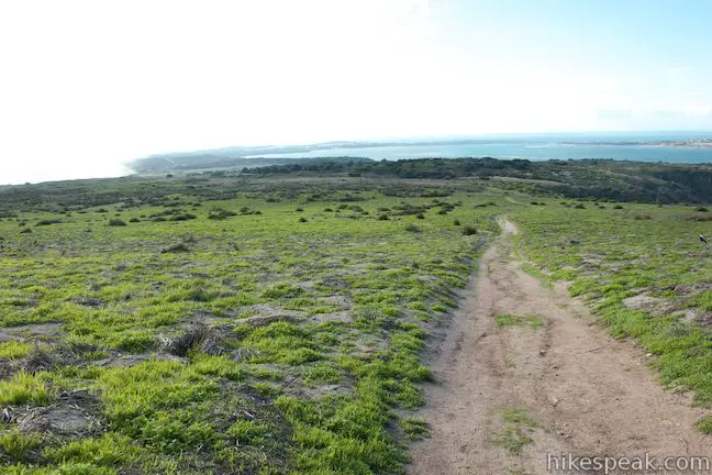
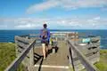
Continue hiking out to the southeast end of the cape, gradually coming up a crest in the terrain where you’ll find the Cape Woolamai Beacon. This light beacon keeps ocean vessels from running into Phillip Island. To the south, beyond the tip of Cape Woolamai lies the Bass Straight, a long carpet of blue water separating Victoria from the island of Tasmania. A bench below the beacon faces inland to present views down the cape’s beaches and grassy dunes and across Phillip Island. You can look east across the bay at the Eastern Entrance of Western Port toward the town of San Remo on the Australian mainland. At an elevation of 112 meters, the Cape Woolamai Beacon sits at the highest point on Cape Woolamai and all of Phillip Island.
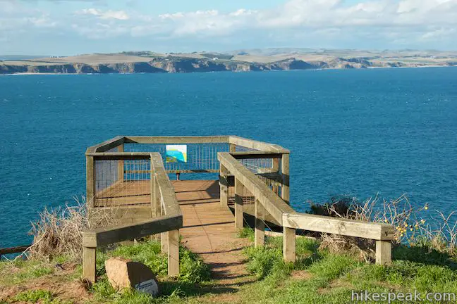
After 4.25 kilometers of hiking, it is time to start heading back up Cape Woolamai. Proceed down the other end of the loop trail, heading inland along the cape’s east coast. Hiking down a gradual slope, you will come to a short spur trail on the right out to a wooden overlook with east-facing views. The platform is perched at the edge of a steep bluff to present panoramic ocean views.
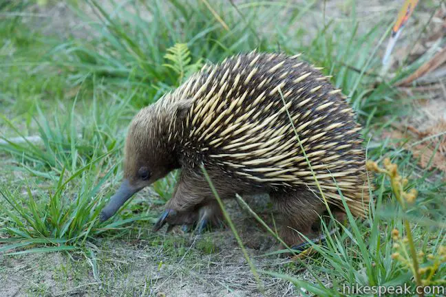
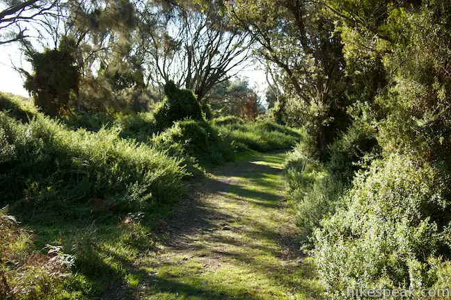
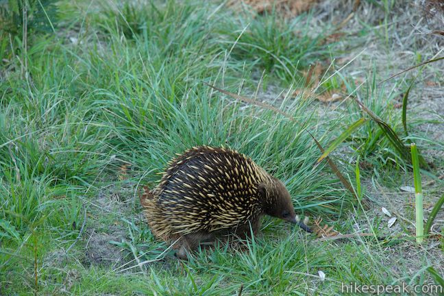
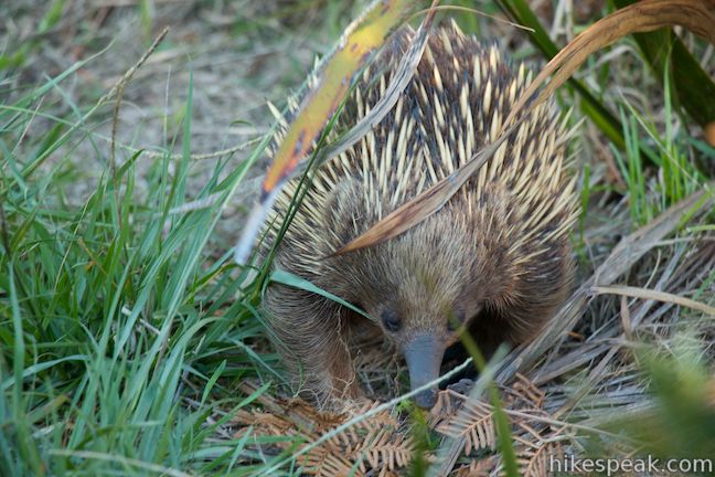
Take the wide trail through low grasses toward a small cluster of trees. Around dawn and dusk, this is an excellent area to spot native wildlife like wallabies and echidnas and pests like rabbits and foxes. The trail enters a forest with some of the loop’s only shade. There is a bench placed here so that you can relax and take a break from the sun.
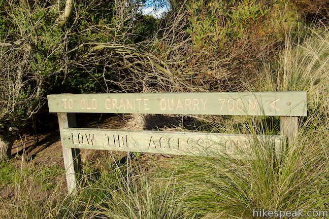
Before you leave the forest, you will come to a junction with a trail to the Old Granite Quarry. The main trail continues to the left toward the junction in the muttonbird rookeries. Head this way to stick with the black route for a 7.4-kilometer hike, or turn right to venture 700 meters out to the old quarry. From the quarry, you can walk back along the beach on the east side of the cape.
Turning right toward the quarry, a wide grassy trail takes hikers downhill in and out of trees. Look for echidnas as you walk across grassy fields. You might see one on the trail!
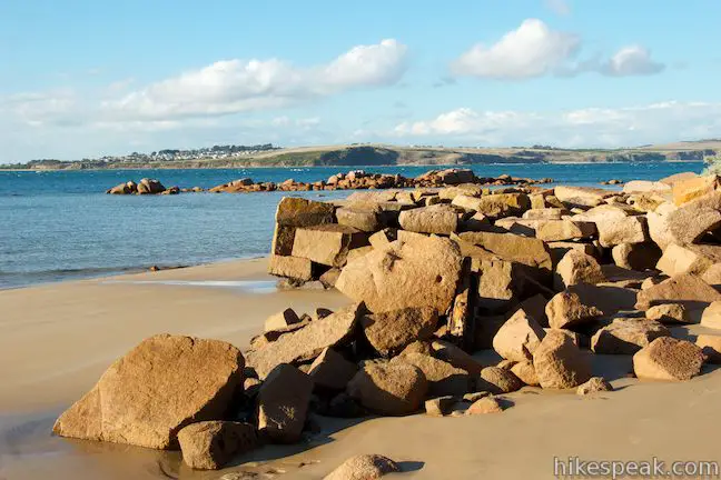
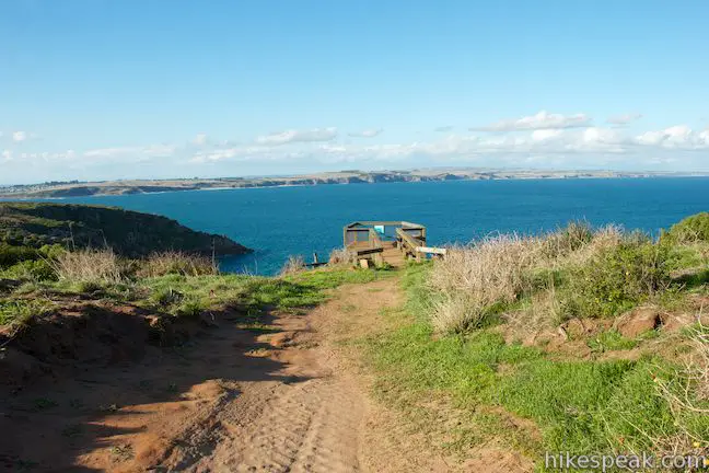
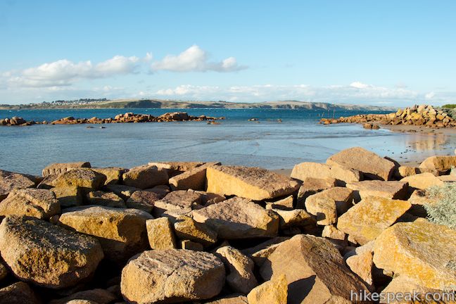
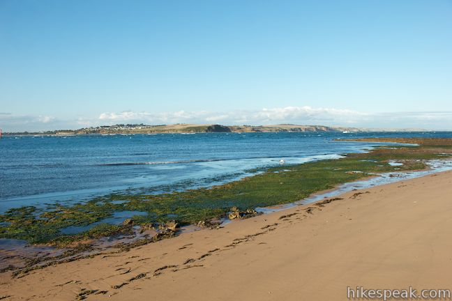
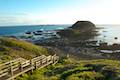
Eventually you will reach a sign in the trees just above the coast that marks the old quarry area. Go down a flight of wooden stairs to the beach, where there’s a tall trail sign resembling a street sign. To the left is Cleeland Bight and a beach walk back to the car park, a route that is not suitable at high tide. Before walking this way, take a few steps to the right and explore a jumble of granite slabs that were left on the beach when the quarry closed. Climb up on the square blocks and have a look around. The quarry opened in 1892 but has long since been abandoned. See if you can spot old mining equipment mixed in among the granite slabs.
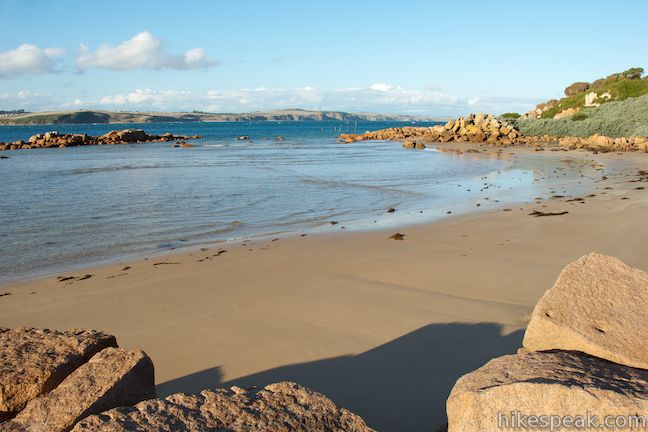
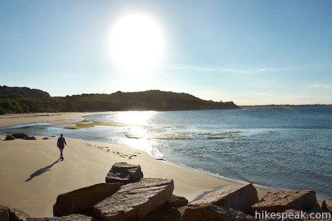
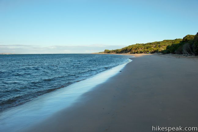
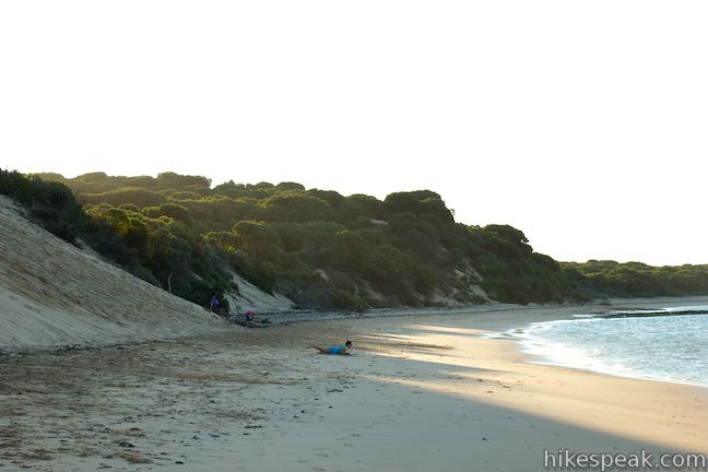
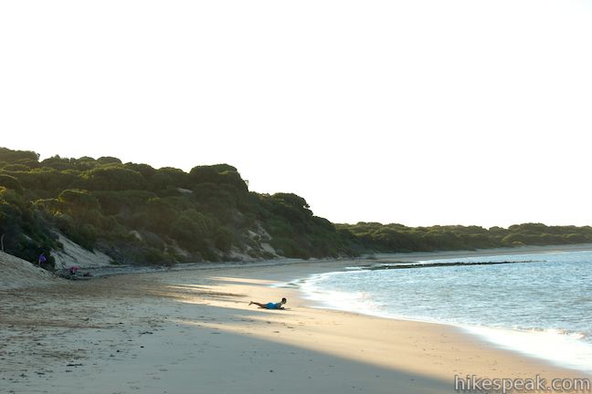
Once you have visited the Old Granite Quarry, you can take a 1.7-kilometer stroll north up the beach. (If the tide is in, it is best to backtrack up to the previous junction, turn right and follow the arrows back to the junction in the muttonbird rookeries, and then turn right again and walk back toward Woolamai Surf Beach.) If you opt for the beach route, you will find that the sand on Cleeland Bight is level and firm, making for easy wave-adjacent walking.
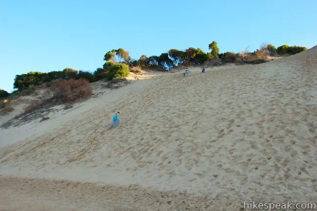
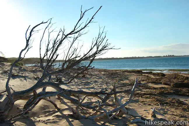
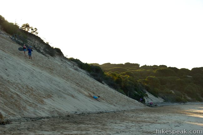
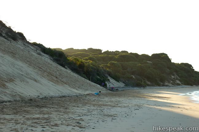
You’ll lose sight of the quarry as you curve around a kink in the coastline, gaining a better view of the bridge to the north that crosses the bay separating Phillip Island from San Remo. Keep walking up the beach until you come to an area where the beach is backed by a steep slope of sand. Some beachgoers actually sled down this sand, speeding down the dune before zipping across the beach and into the ocean. It looks like a lot of fun!
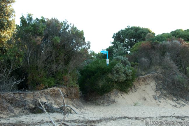
Just past this sledding hill, spot another tall trail post. Turn left here and head inland on a wide sandy track, following the sign for Cape Woolamai Car Park. Trudge through loose sand over rolling dunes terrain for 350 meters to reach Woolamai Beach Road, 150 meters away from the car park at the road end. This end of the trail is marked with a trail sign for Cleeland Bight (handy information for anyone hiking this loop in reverse).
Turn left and walk back down Woolamai Beach Road toward the car park, which is visible from the end of the trail. You will pass a sandy road on the left marked “management vehicles only.” The maintenance road connects to the stairs at the south end of Woolamai Surf Beach. For those who don’t hike down Cleeland Bight, this maintenance road can be used as an alternative to the walk on Woolamai Surf Beach. The road is lined by nice dune vegetation but there is lots of deep sand to trudge through and fewer ocean views than you would enjoy along the pristine beach.
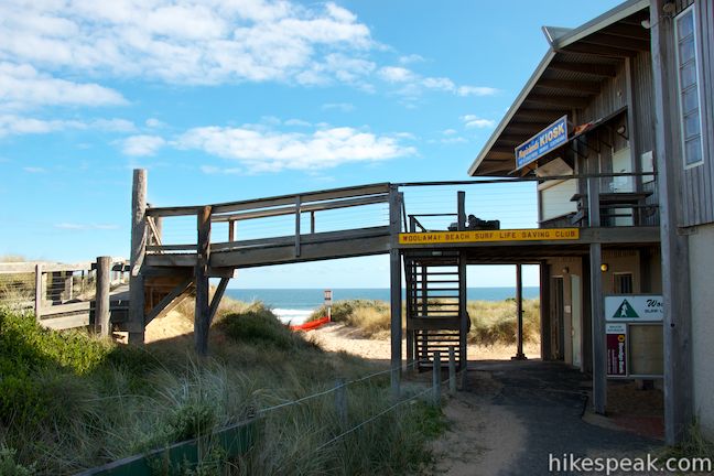
Next to the car park there is a beach cafe with a large deck and public toilets, part of the surf life saving club that looks after Woolamai Beach. Whether you hike one kilometer or 8.5 kilometers, your escape to Cape Woolamai is sure to be a satisfying one. Bikes are allowed on Cape Woolamai, although some of the routes are sandy and not great for biking. Bikers may wish to use the maintenance road, despite the deep sand, to reach the trails beyond Woolamai Surf Beach. Dogs are not allowed. No fee or permit is required to hike through Cape Woolamai State Faunal Reserve, so get out and enjoy!
Directions to the Trailhead
- From Melbourne, take M1 east for approximately 30 kilometers to the exit for South Gippsland Freeway (M420) and drive south for 97 kilometers on M420 following signs for Phillip Island.
- Bear right onto Phillip Island Road (B420) to cross the bridge onto Phillip Island.
- Now continue another 3 kilometers to a intersection with Woolamai Beach Road and turn left.
- Drive 3 kilometers south to the car park at the end of the road.
Trailhead Location
Trailhead address: Woolamai Beach Road, Phillip Island, VIC 3925, Australia
Trailhead coordinates: -38.543936, 145.339985 (38° 32′ 38.16″S 145° 20′ 23.94″E)
View Phillip Island in a larger map
Or view a regional map of surrounding Australian trails, campgrounds, and lodging.


![]()


 | Koala Conservation Centre This 1.2-kilometer loop explores the fantastic boardwalks in Phillip Island's Koala Conservation Centre as well as a longer trail through eucalyptus woodlands. |
 | Pyramid Rock This 0.8-kilometer walk (400 meters one way) takes hikers out onto a grassy point to two overlooks of Pyramid Rock, a triangle-shaped rock island just off the southern coast of Phillip Island. |
 | Summerlands Beach This 1-kilometer out and back return hike brings you to a picturesque surf beach that is taken over by little penguins in the evening. |
 | Nobbies Boardwalk This 1-kilometer walk on Point Grant at the west end of Phillip Island provides excellent coastal views highlighted by Seal Rocks, Nobbies, and the Nobbies Blowhole. |
 | Penguin Parade to the Nobbies This 4-kilometer one-way road can be walked, driven, or biked between the Penguin Parade Visitor Center and the Nobbies Centre, exploring beautiful coastline along the way (for an 8-kilometer out-and-back return hike). |
 | More trails in Australia Explore other destinations in Victoria and Tasmania, Australia. |
 | Big 4 Caravan Park on Phillip Island This holiday park offers convenient cabin and camping accommodations on the east end of Phillip Island. |
- Cape Woolamai on penguins.org.au (opens in a new tab)
- Cape Woolamai Trail Map on penguins.org.au (opens in a new tab)
- Cape Woolamai on visitmelbourne.com (opens in a new tab)
- Short-tailed shearwater (muttonbird) on wikipedia.org (opens in a new tab)
- Cape Woolamai on wikipedia.org (opens in a new tab)
- Cape Woolamai Nature Notes on penguins.org.au (opens in a new tab)
- A walk and bike tracks brochure for Phillip Island from visitbasscoast.com (opens in a new tab)
- Phillip Island walks and cycling tracks guide on visitphillipisland.com (opens in a new tab)
Common Questions about Cape Woolamai on Phillip Island
- Is the trail open?
- Yes. You should expect to find that Cape Woolamai Loop is open. There are no recent reports of trail closures. If you discover that the trail is closed, please help your fellow hikers by reporting a closure.
- Is this trail free to access?
- Yes, Cape Woolamai Loop is free to access. No entrance fee, pass, or permit is required. If you discover that access rules have changed, please provide feedback on your experience.
- How much time does this hike take?
- It takes approximately 2 hours 30 minutes to hike Cape Woolamai Loop. Individual hiking times vary. Add extra time for breaks and taking in the views.
- How long is this hike?
- The hike to Cape Woolamai Loop is a 8.5 km / 5.3 mile loop with 112 meters / 365 feet of elevation change.
- Are dogs allowed on this trail?
- No, dogs are likely not allowed on Cape Woolamai Loop. The trail is primarily open to hikers, bikes.
- Are there ocean views on this hike?
- Yes, Cape Woolamai Loop offers views of the ocean.
- Does this trail go to a summit?
- Yes, Cape Woolamai Loop reaches a summit with panoramic views.
- Where is the trailhead located?
- The trailhead for Cape Woolamai Loop is located in Phillip Island, Victoria.
Trailhead Address:
Woolamai Beach Road
Phillip Island, Victoria 3925
Trailhead Coordinates:
-38.543936, 145.339985 - What are the driving directions to the start of the hike?
To get to the trailhead: From Melbourne, take M1 east for approximately 30 kilometers to the exit for South Gippsland Freeway (M420) and drive south for 97 kilometers on M420 following signs for Phillip Island. Bear right onto Phillip Island Road (B420) to cross the bridge onto Phillip Island. Now continue another 3 kilometers to a intersection with Woolamai Beach Road and turn left. Drive 3 kilometers south to the car park at the end of the road.
View custom Google Maps directions from your current location.
- Are there other trails near Cape Woolamai Loop?
- Yes, you can find other nearby hikes using the Hikespeak Hike Finder Map.

Go the extra miles...
Submit a rating of this hike to go with your comment. Contribute to the average trail rating.