Hikes in Canyonlands National Park
Imagine expansive canyons stretching clear to the horizon. Now place a towering mesa a thousand feet above the canyon rim and picture the view. That is the experience from the Island in the Sky in Canyonlands National Park.
Highlights of Canyonlands National Park


Canyonlands National Park
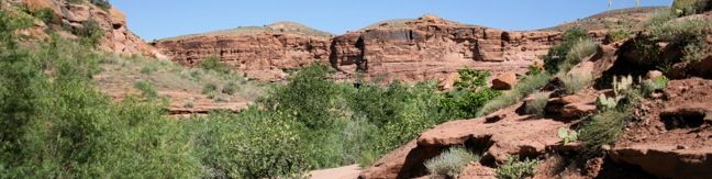
Canyonlands National Park is vast, protecting over 500 square miles of wild canyon country to the west and south of Moab, Utah. Canyonlands is the largest national park in the state. Canyonlands National Park is divided into three districts: Island in the Sky, the Needles, and the Maze. A fee of $30 per vehicle is charged to enter Canyonlands National Park (price as of 2026).
The northernmost district, Island in the Sky, is just a thirty-mile drive from Moab (and the entrance to Arches National Park). A paved road accesses the Needles Area from Monticello, Utah, but 4X4 roads are the only way to access the Maze (other than on foot or boat). The trails through these remote river-carved landscapes possess a pristine beauty all their own.
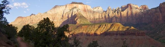
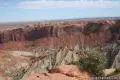
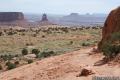
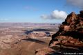
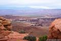
Island in the Sky is a triangle-shaped mesa north of the confluence of the earth-shaping Colorado and Green Rivers. The broad island mesa provides lofty panoramic views. Park roads allow quick passage across the mesa, making it easy to experience a variety of short trails in just one day. Upheaval Dome, Mesa Arch, and Grand View Point are the island’s most prominent landmarks. In addition to trails, the park offers many fine scenic overlooks. Dramatic lighting enhances the views from the mesa, making early morning and late afternoon the best times to hike. Summer temperatures frequently cross into the triple digits, so plan accordingly.
Camping in Canyonlands National Park
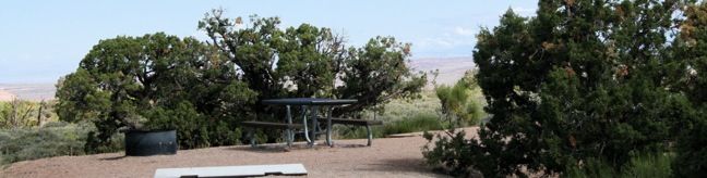
Camping in the Island in the Sky district is scarce, limited to one twelve-site first-come first-serve campground. Fortunately, there are numerous campgrounds operated by the Bureau of Land Management around Moab. Horse Thief Campground is ten miles north of the Island in the Sky Visitor Center and offers sixty sites.
Canyonlands National Park Hikes
This collection of trails in the Island in the Sky district of Canyonlands National Park lists hikes from north to south. The table may also be sorted alphabetically or by distance to help you pick your next hike. Each trail links to its own report complete with photos, GPS maps, elevation profiles, directions, and all the other information needed to locate and enjoy these hikes. You can also view hikes around Canyonlands National Park on the Hike Finder Map.
| Trail | Description | Distance | Location |
|---|---|---|---|
 400 400 | Upheaval Dome This out and back hike visits two overlooks along the rim of a puzzling three-mile wide crater. | 0.6 - 1.7 miles 200 feet | 38.4263, -109.9261 |
 410 410 | Whale Rock This out and back hike ascends a whale-shaped sandstone formation near Upheaval Dome. | 1 mile 250 feet | 38.42685, -109.91401 |
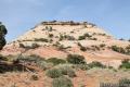 420 420 | Aztec Butte This lollipop loop hike ascends a dome-shaped butte that boasts Puebloan granaries and a nice view of Taylor Canyon. | 1.3 - 1.8 miles 250 feet | 38.39345, -109.88205 |
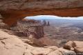 430 430 | Mesa Arch This loop visits a picturesque arch spanning across the mesa’s edge. | 0.7 miles 75 feet | 38.38915, -109.8681 |
 440 440 | Murphy Point This out and back hike visits a west-facing point on the Island in the Sky overlooking canyons carved by the Green River. | 3.6 miles 150 feet | 38.35497, -109.8638 |
 450 450 | White Rim Overlook This out and back hike visits the end of a peninsula in the Island in the Sky with 300-degree views of the canyons below. | 1.8 miles 170 feet | 38.3228, -109.8495 |
 460 460 | Grand View Point This out and back hike travels along the mesa’s edge from Grand View Overlook to the southernmost point on the Island in the Sky. | 2 miles 80 feet | 38.3108, -109.8566 |
Or explore hikes around Canyonlands National Park on the Hike Finder Map