Hikes in the Verdugo Mountains
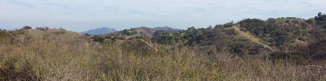
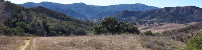
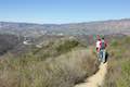
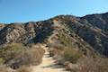
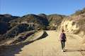
The Verdugos are a small mountain range (with big views) located on the northeast end of the San Fernando Valley, separated from the larger San Gabriel Mountains by Tujunga Valley. Verdugo Peak is the highest point in the range at 3,126 feet. Trailheads at the base of the Verdugo Mountains in the cities of Burbank and Glendale (and other points around the mountain range) offer convenient starting points for rewarding and challenging suburban hikes. Trails in the Verdugo Mountains are usually free, open to mountain bikers and leashed dogs.
Highlights of the Verdugo Mountains


Verdugo Mountains Hiking
This collection of trails in the Verdugo Mountains lists the hikes from west to east. The table may also be sorted alphabetically or by distance to help you pick your next hike. Each trail links to its own report complete with photos, GPS maps, elevation profile, directions, and all the other information needed to locate and enjoy these hikes. An interactive map is also included.
| Trail | Description | Distance | Location |
|---|---|---|---|
 502 502 | La Tuna Canyon Trail This out and back hike ascends a ridge and a pair of canyons in La Tuna Canyon Park on the northwest side of the Verdugo Mountains. | 4.5 miles 975 feet | 34.23314, -118.31137 |
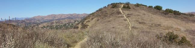
 505 505 | Hostetter Fire Road to Verdugo Peak This out and back hike on the north side of the Verdugo Mountains ascends from La Tuna Canyon to the highest summit in the range. | 7.5 miles 1,400 feet | 34.23395, -118.29118 |
 507 507 | Old Youth Camp Loop in Stough Canyon This lollipop loop passes the ruins of an abandoned camp in the Verdugo Mountains with views across the San Fernando Valley. | 2.6 miles 700 feet | 34.213328, -118.30705 |
 507 507 | Vital Link Trail This out and back hike ascends a steep ridge on the south side of the Verdugo Mountains with satisfying views. | 3 - 5 miles 1,275 - 1,800 feet | 34.209427, -118.291724 |
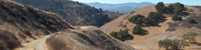
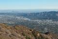 508 508 | Skyline Motorway This out and back hike ascends an abandoned fire road in the Verdugo Mountains with expansive views that include the skyline of downtown Los Angeles. | 6.1 - 6.6 miles 1,625 - 1,825 feet | 34.1953, -118.29373 |
 510 510 | Beaudry Motorway Loop to Tongva Peak This loop climbs to the summit of Tongva Peak on the east end of the Verdugo Mountains. | 6.15 miles 1,475 feet | 34.193363, -118.241163 |
 512 512 | Las Flores Motorway to Mount Thom This out and back hike follows a wide dirt road to the summit of Mount Thom, offering panoramic views from the southeast end of the Verdugo Mountains. | 5.3 miles 1,260 feet | 34.1766, -118.2385 |