Las Virgenes View Trail
in the Santa Monica Mountains
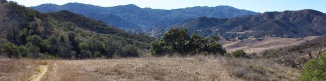
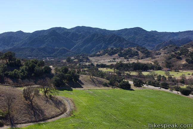
Las Virgenes View Park preserves nearly 700 acres of the Santa Monica Mountains adjacent to Malibu Creek State Park. The park has one established trail, Las Virgenes View Trail, which rises to a panorama-boasting ridge. The trail traverses grasslands and oak woodlands near Las Virgenes Road and then runs up a canyon to a ridge where it forms a small loop with mountain views in all directions. Stray just beyond the loop to the ruins of an old foundation (and more views over the Malibu Creek Watershed) for a 4.95-mile round trip hike with 520 feet of elevation change. A second starting point allows for a truncated 4.3-mile outing.
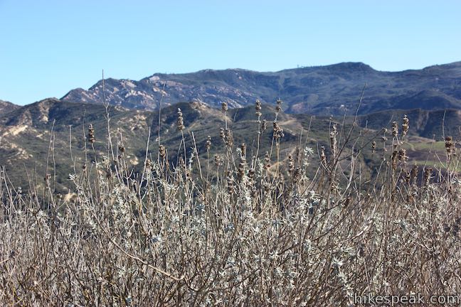
Las Virgenes View Trail is open to hikers with dogs, mountain bikes, and equestrians. The trail has a few shallow descents, but mostly maintains a gradual uphill grade. Some steeper drop-offs along the trail may not appeal to novice riders. Springtime visitors can enjoy wildflowers blooming in the grasses.
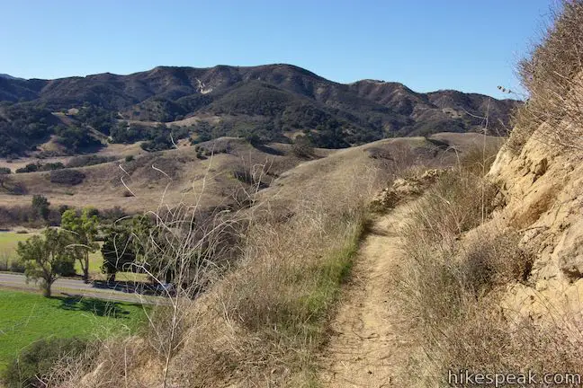
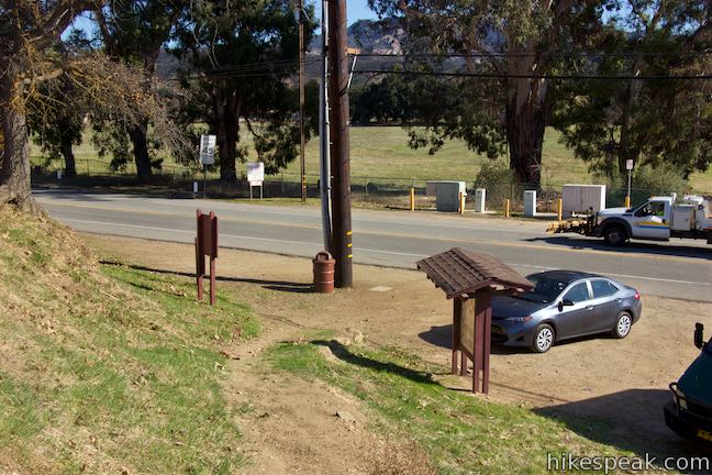
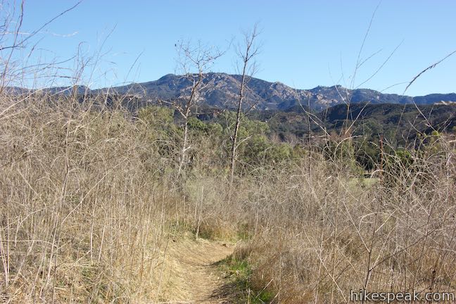
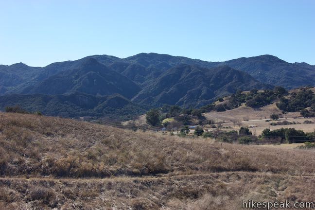
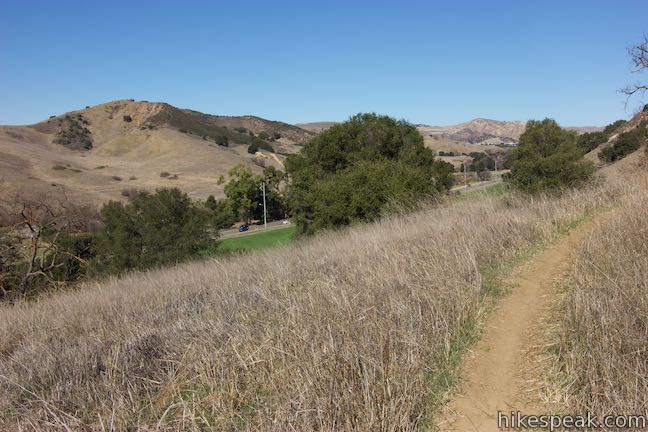
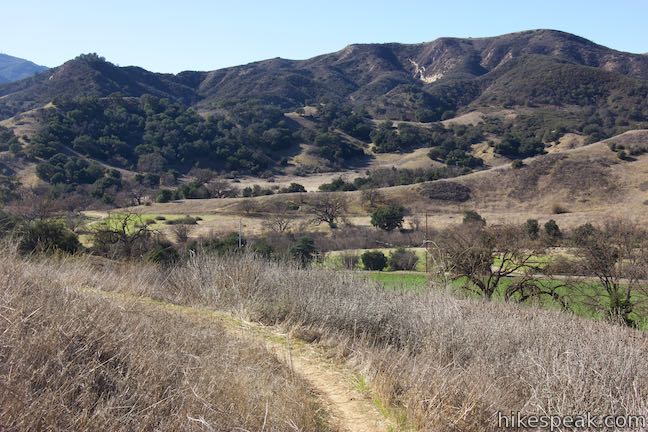
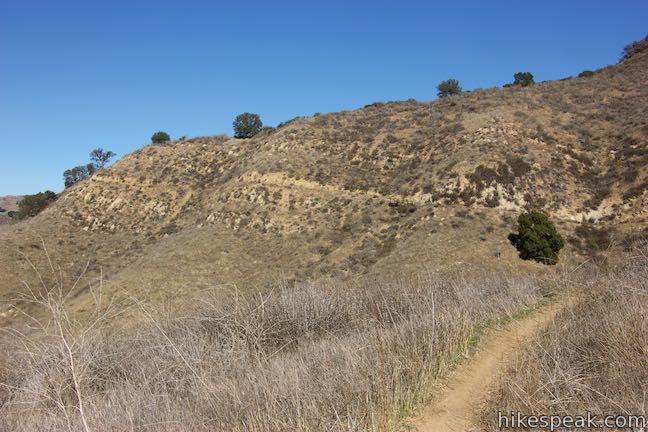
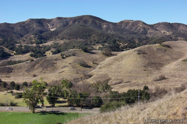
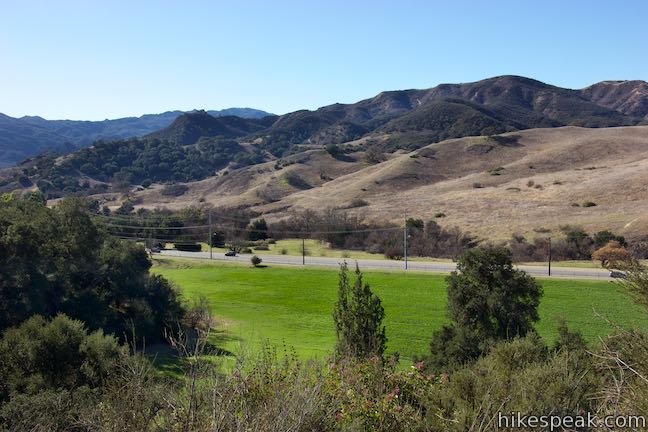
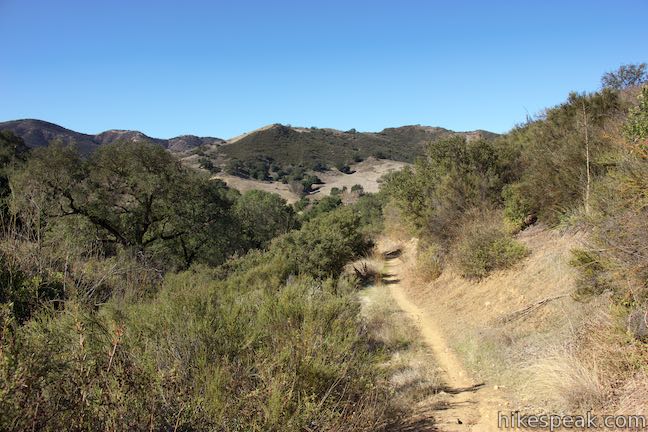
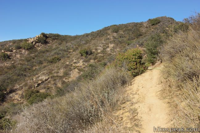
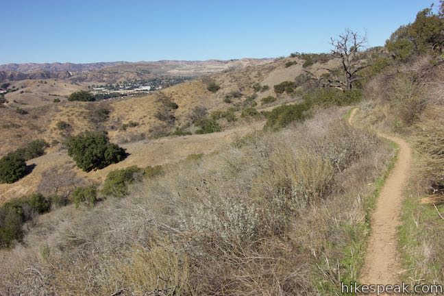
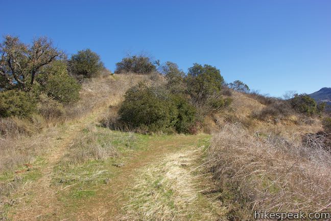
Las Virgenes View Trail starts from a dirt parking area at the intersection of Mulholland Highway and Las Virgenes Road. The trail starts to the right of a kiosk with panels describing the park’s environments. Las Virgenes View Trail goes up switchbacks through tall grasses. Rise over a grassy ridge with views southwest toward the Goat Buttes in Malibu Creek State Park and southeast toward Saddle Peak. Quickly, the trail turns downhill, sacrificing 50 feet that were just gained, and passes alongside Las Virgenes Road, a third of a mile from the start.
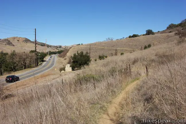
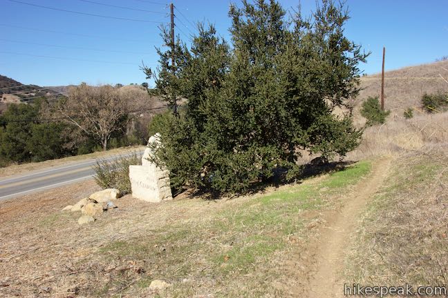
A path connects to Las Virgenes View Trail from a turnout along the road. This may cause you to question why the trail doesn’t start here. Why not indeed? Setting out from this other spot along Las Virgenes Road would trim the hike to 4.3 miles round trip with just over 500 feet of elevation change.
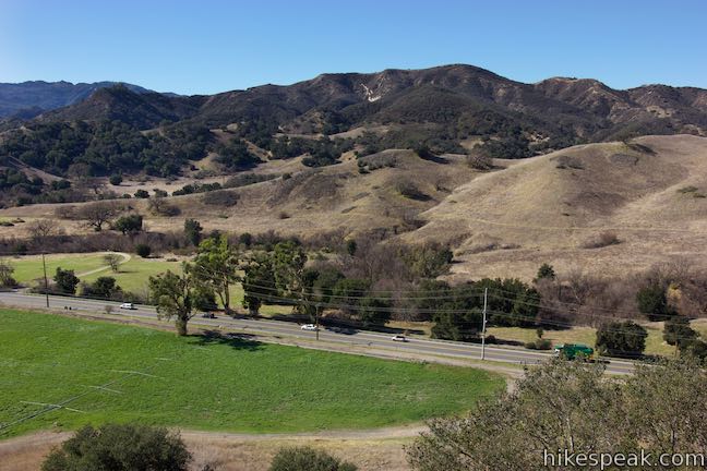
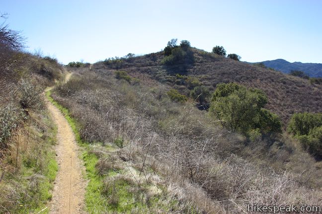
Leaving the road, Las Virgenes View Trail curves to the right toward a draw in the terrain. A hundred yards from the road, pass the trail’s “rest area,” which has a bench and a water fountain (which was out of service in January 2018).
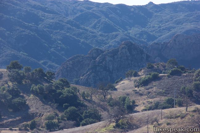
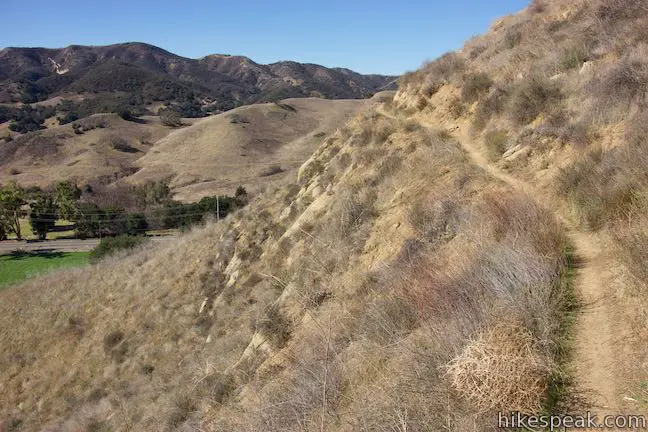
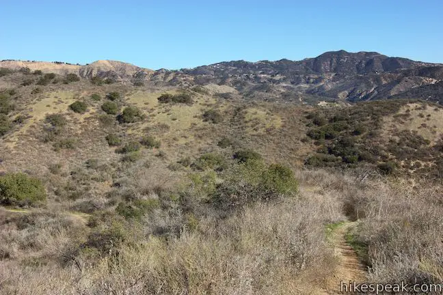
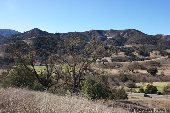
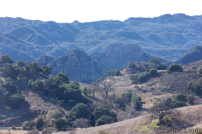
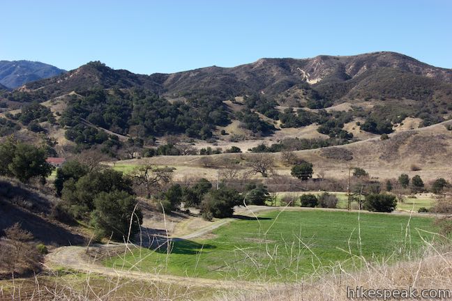
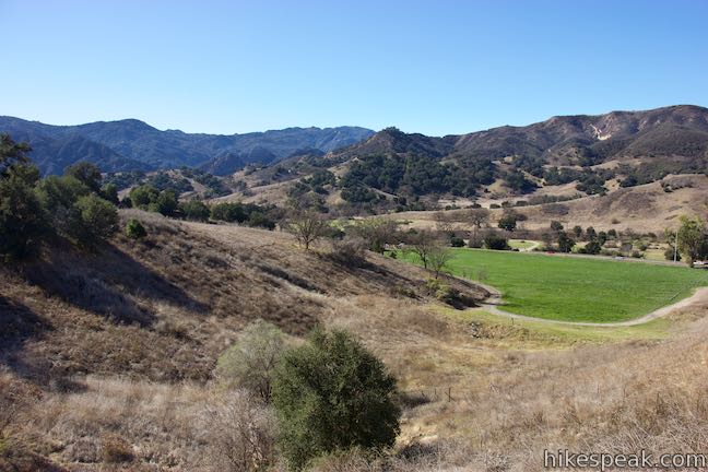
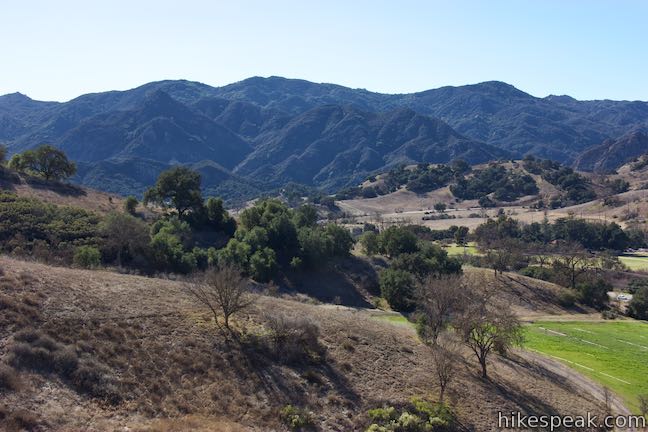
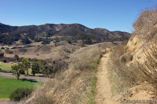
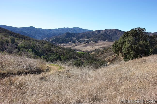
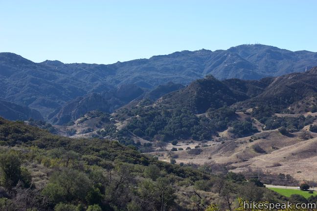
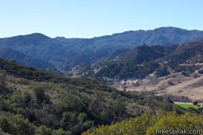
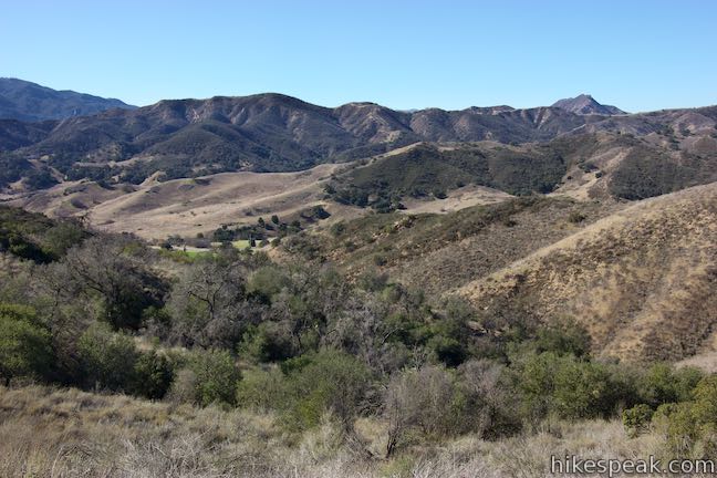
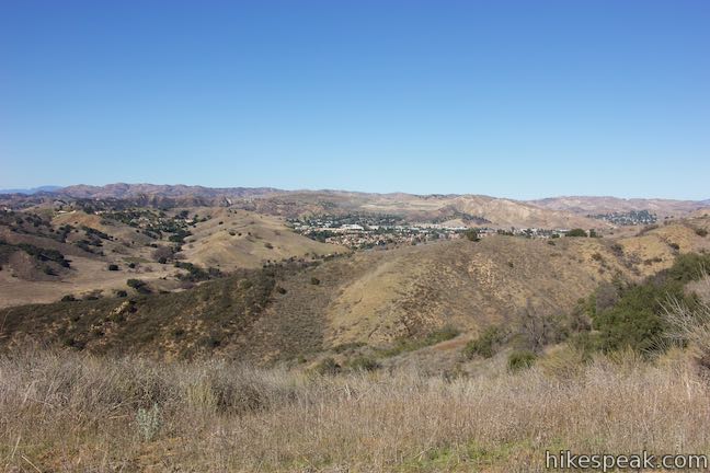
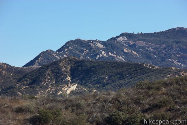
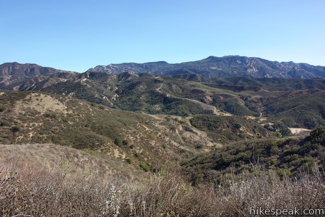
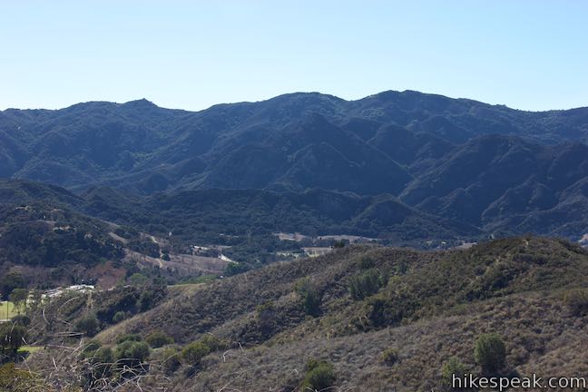
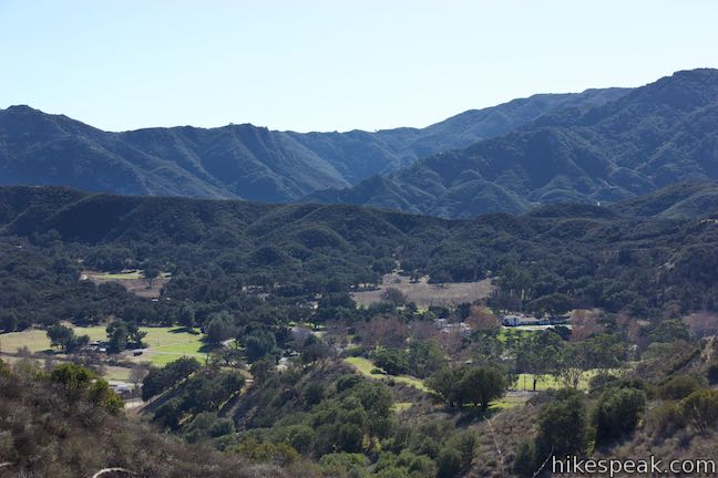
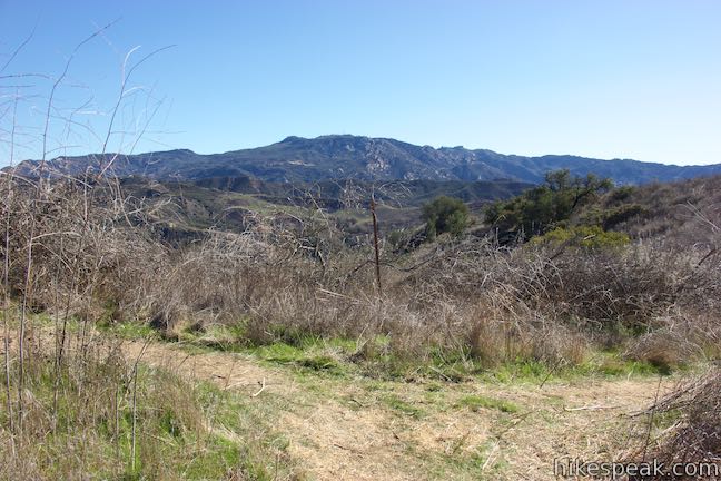
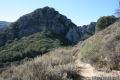
Go around the draw and curve up a rise above Las Virgenes Road. Gaze across the grasses and oaks in Las Virgenes Valley. Look south to admire the distinct rock formation known as the Goat Buttes, backed by taller green ridges.
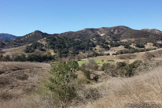
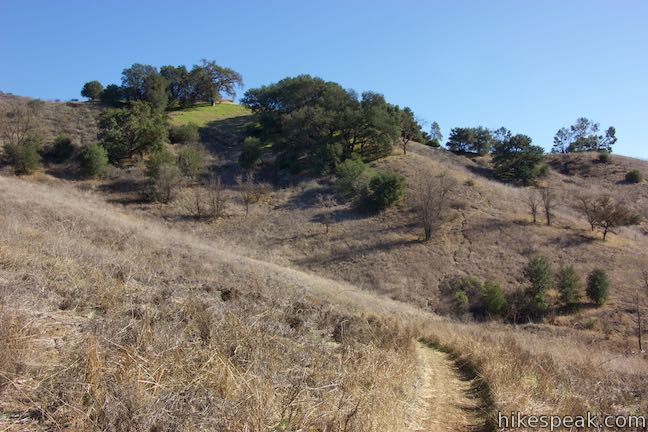
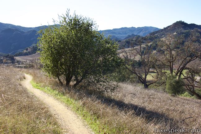
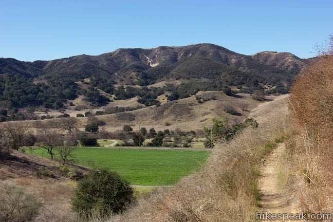
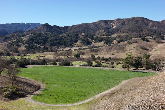
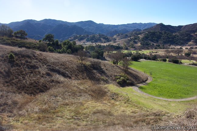
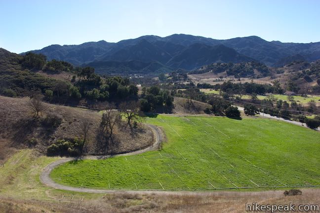
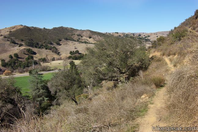
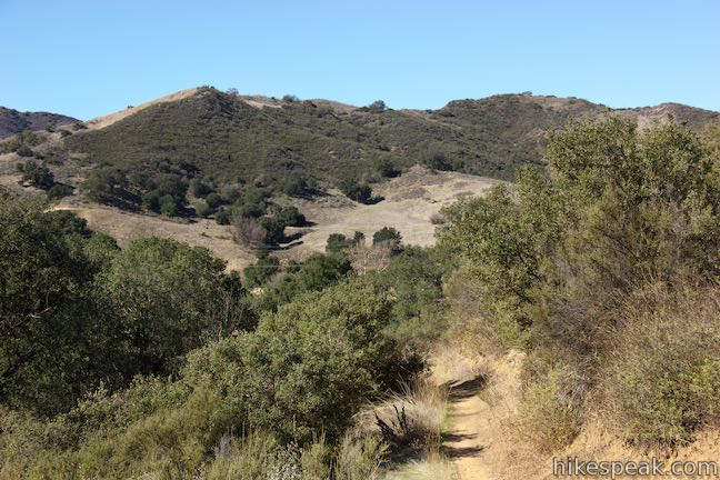
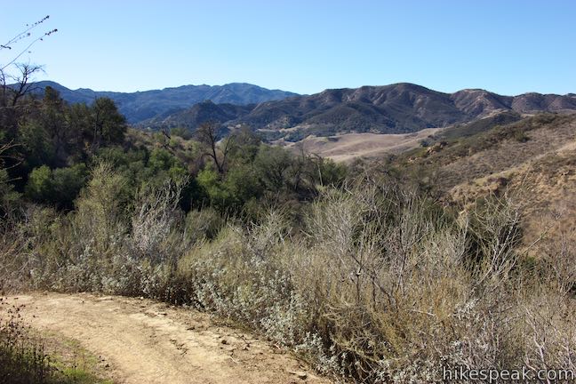
The trail curves east into a grove of oak trees, 2/3 of a mile from the start. Ascend a bit and cross the back of another crease in the slopes east of Las Virgenes Valley. Rise up another ridge and look left over a green manicured pasture. Talepop Loop Trail crosses the top of the ridge on the opposite side of the valley.
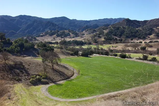
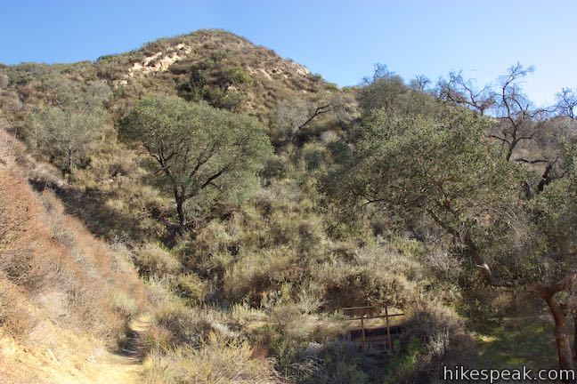
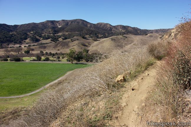
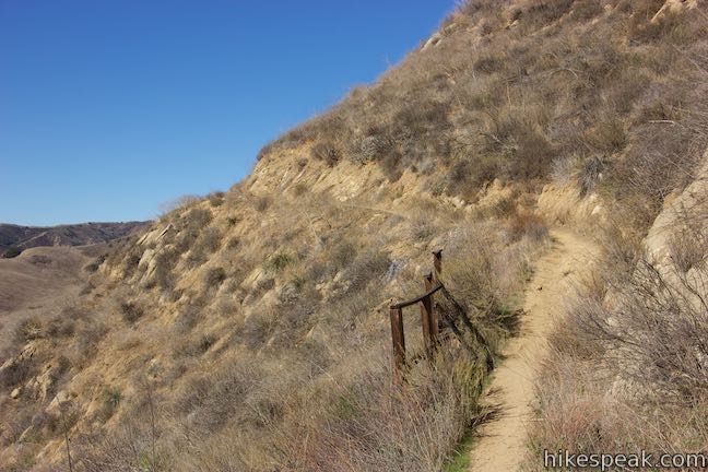
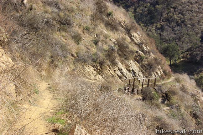
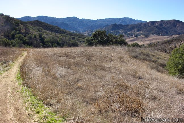
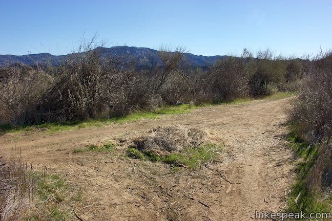
The trail drops off steeply to your left as you cut up a ridge above the pasture. Make your way across another draw on the mountainside and swing up a steep slope, much like the previous one. Pass some old wood railings (a miles from the start) that hint at a historical use for this trail.
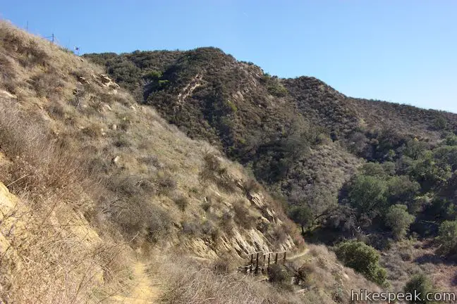
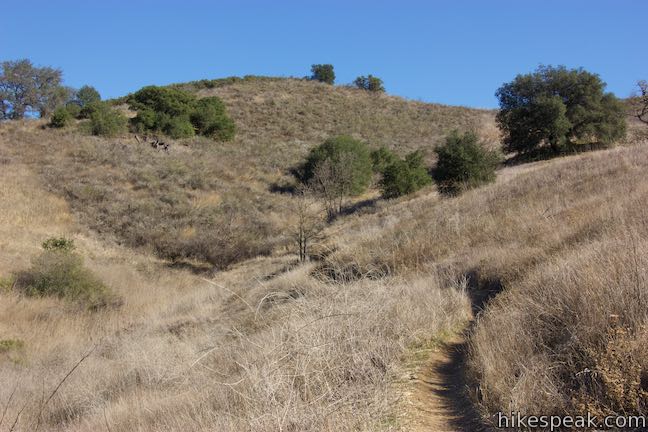
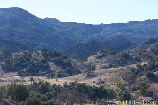
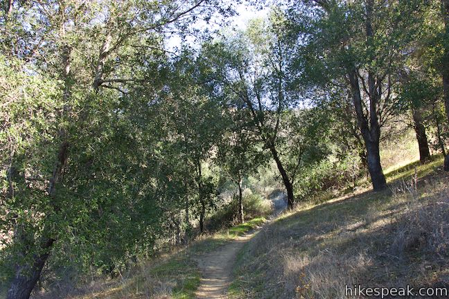
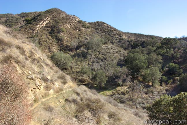
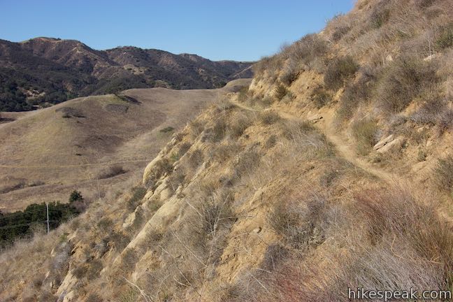
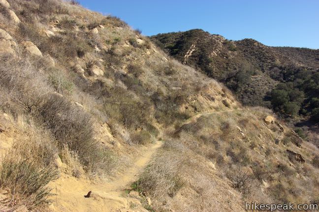
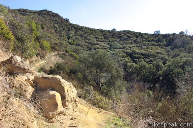
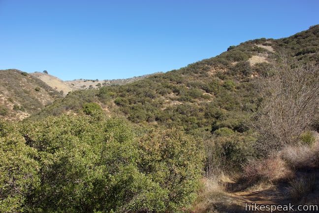
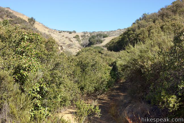
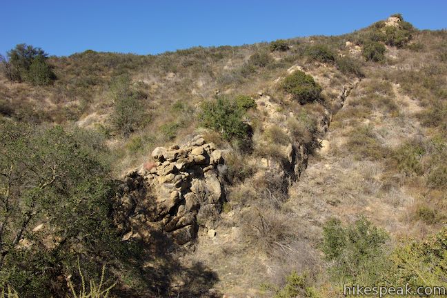
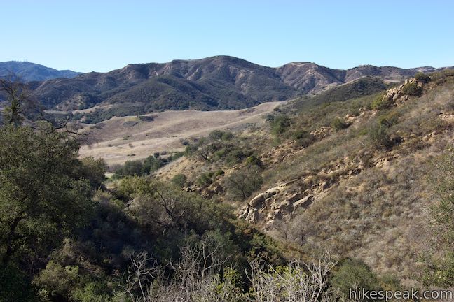
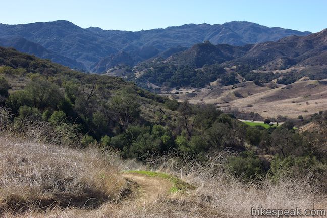
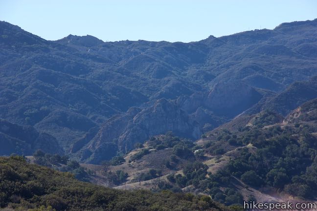
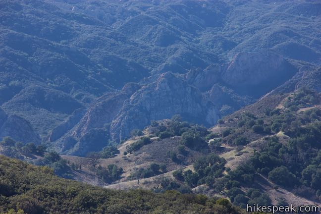
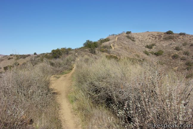
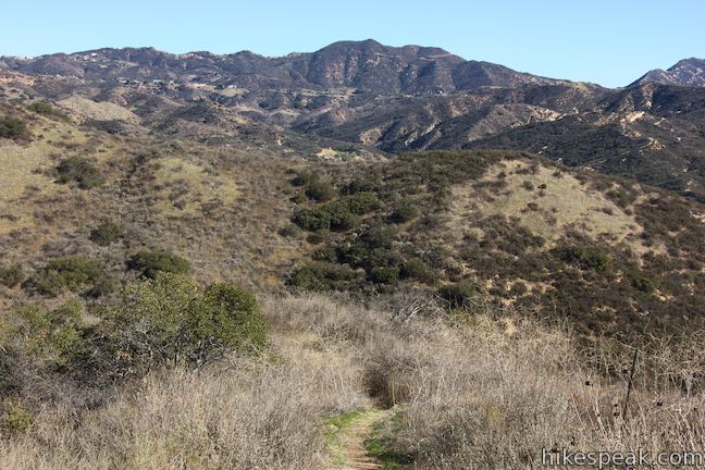
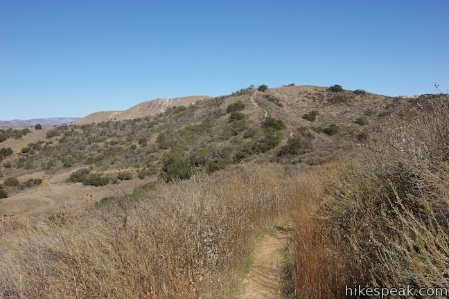
Cresting this bump, the trail turns downhill, sacrificing 100 feet. Go past the north end of the green field. The trail curves to the right and heads northeast up a canyon, finally taking on a remote feel. Venture up through a riparian woodland along a gouge in the mountainside. Distinct sandstone formations angle down the opposite side of the canyon.
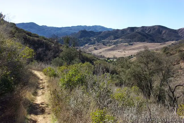
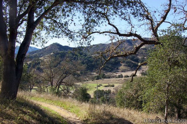
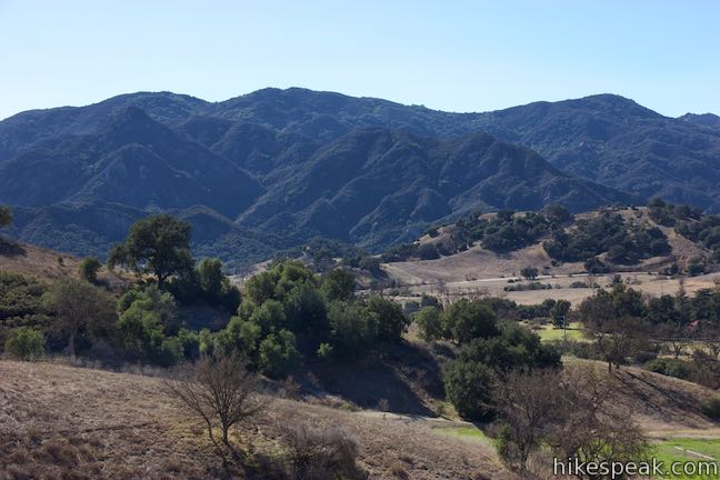
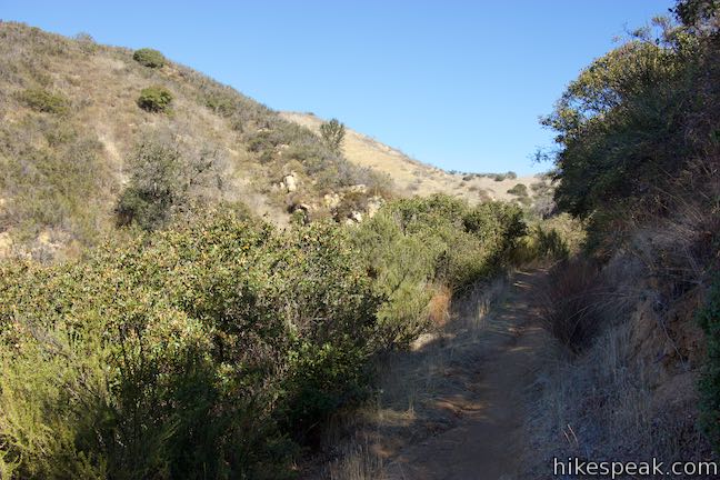
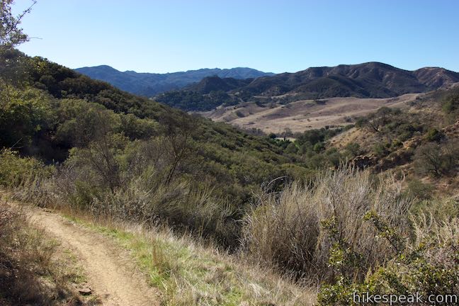
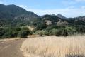
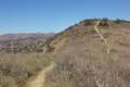
After 0.4 miles in the canyon, and 1.9 miles from the trailhead, Las Virgenes View Trail pops out of the woodland into a grassy area cradled on the mountainside. Gaze back over the mountains to the southwest, admiring the fine surroundings in the foreground and background.
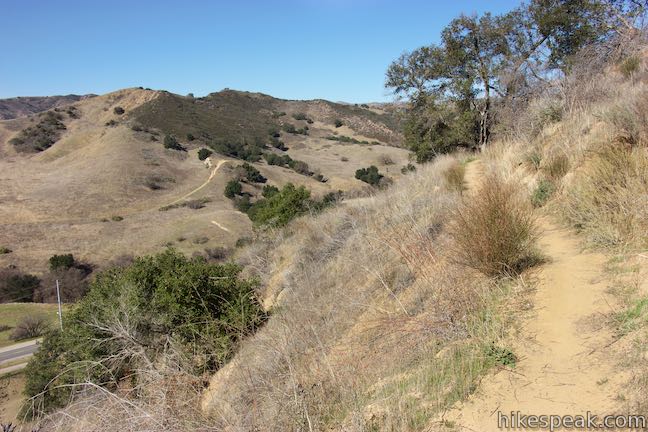
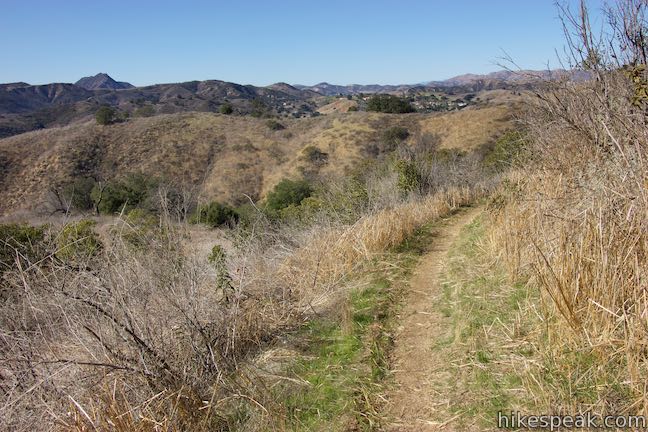
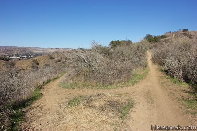
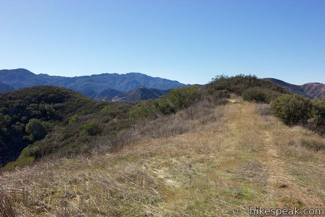
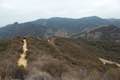
After a few twists and turns, a big switchback to the right sends the trail heading south. In another 0.15 miles, and 2.2 miles from the start, reach a junction on the main ridgeline. Bear right to continue toward Las Virgenes View. If you made a hard left instead, you could follow Las Virgenes View Park Connector Trail (labeled Fire Road on the map at the trailhead) farther northeast up the ridge toward New Millennium Loop Trail.
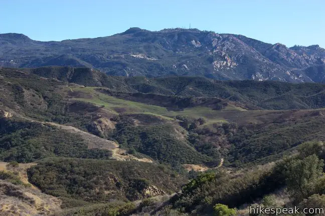
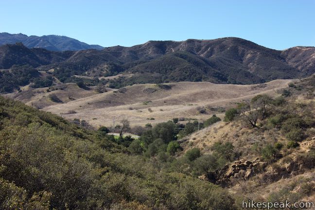
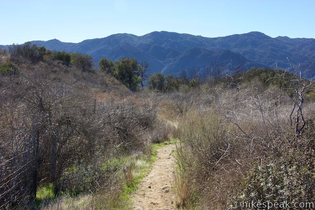
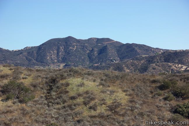
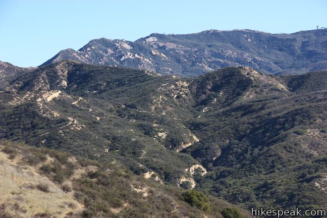
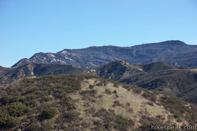
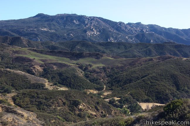
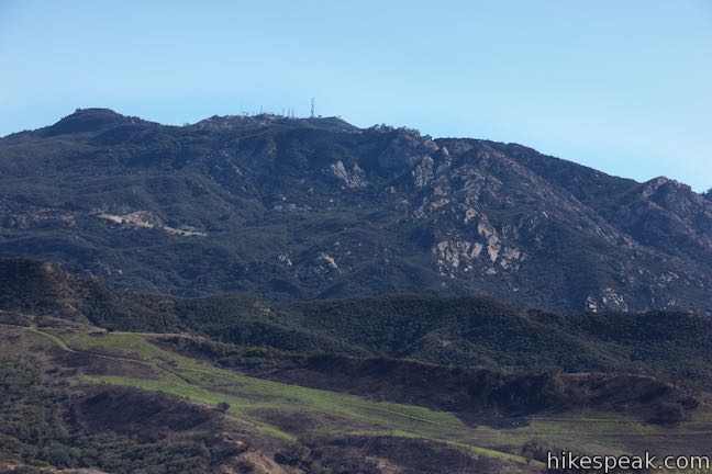
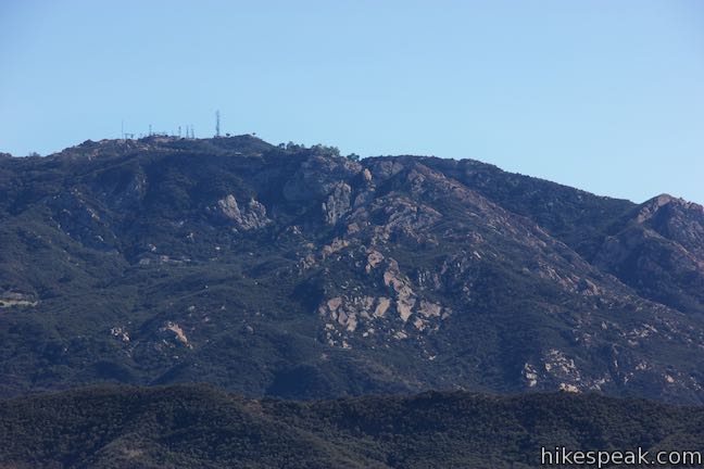
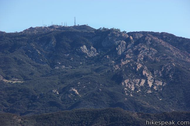
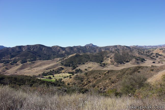
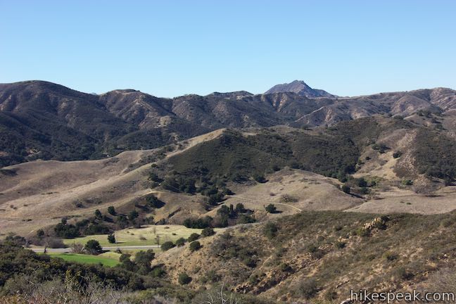
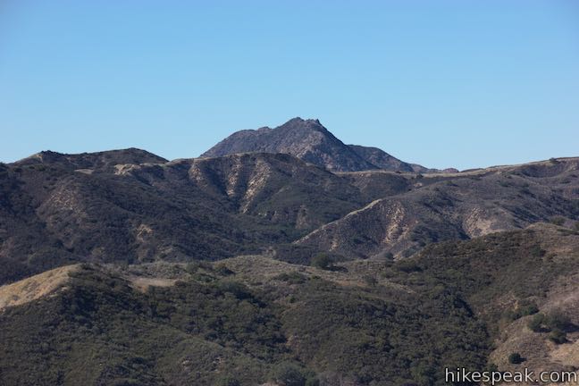
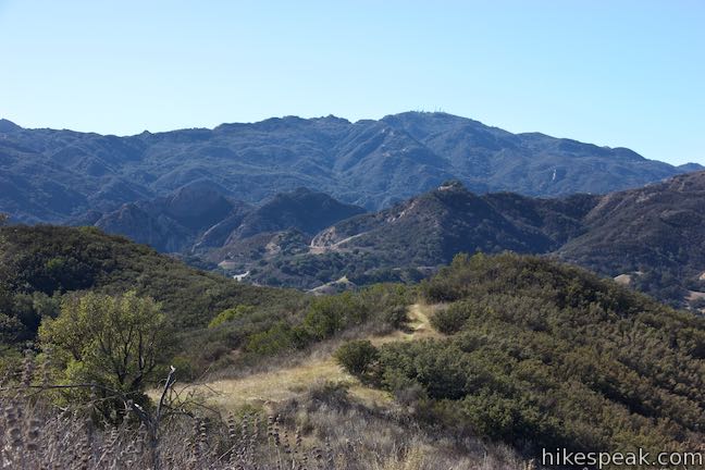
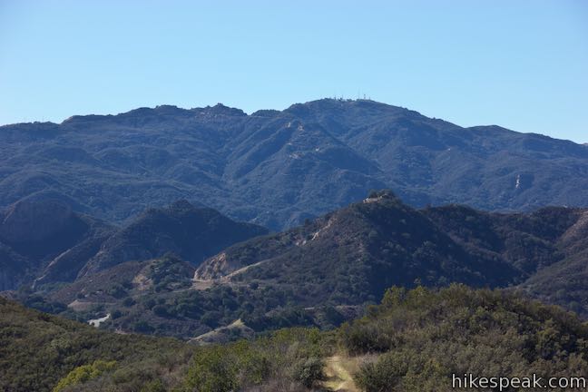
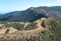
Cross over a shallow dip in the ridge, coming to a junction at the start of a small loop (2.25 miles from the start). The two trails come back together at the other side of a bump on the ridge, where a trail continues south. The left branch is a tenth of a mile long and offers grand views southeast over Stokes Canyon toward Calabasas Peak, Topanga Lookout, and Saddle Peak. The jumbles of sandstone formations on Saddle Peak are particularly engrossing from this perspective. The right branch is 1/8 of a mile long and delivers views to the west that are similar to, but grander than, what you witnessed on the hike up. Ladyface Peak rises prominently to the northeast.
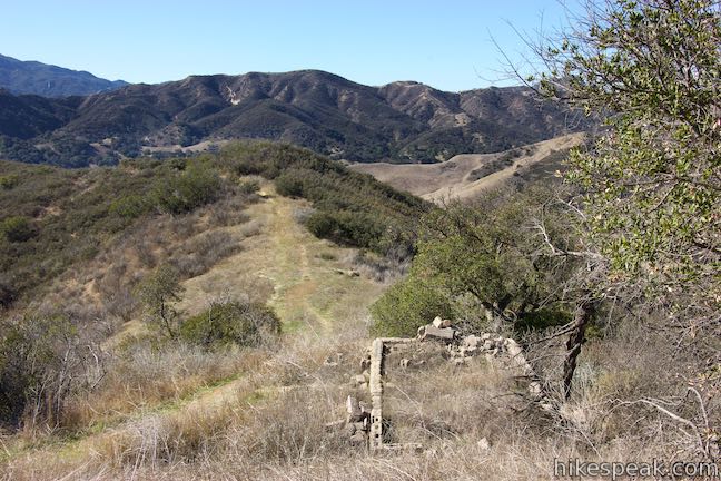
Reaching the junction at the far end of the loop, a question emerges… where is Las Virgenes View? The trail lacks an pronounced overlook, but instead offers a collection of views. Some trail maps have the hike ending at the loop (or before the loop) and the map at the trailhead does not show the loop at all. To expand the experience, follow the trail off the south end of the loop to a crest on the ridge. Through some vegetation, you’ll find even better views southeast over Stokes Canyon toward Saddle Peak. This is the highest point of the hike at 1,120 feet.
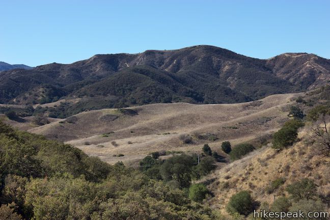
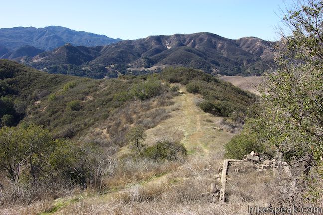
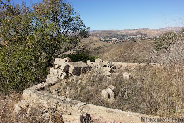
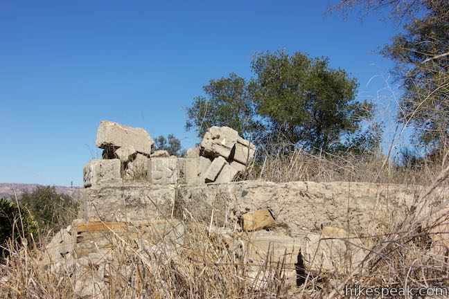
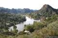
The trail makes a right turn at the crest and drops steeply toward a saddle on the ridge. Partway down the slope, spot the ruins of an old foundation on the right side of the trail. Make your way down and have a look at the ruins. The west-facing slope also offers a good perspective toward Malibu Creek State Park.
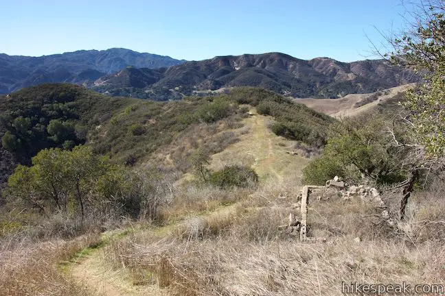
This is a good place to turn around. Ahead, the trail drops to a junction. Beyond that, a path crosses a dip in the ridge, enters chaparral, and fizzles out. A trail to the left drops toward Stokes Canyon Road, but appears to pass through private property.
Leave the ruins, go back up the ridge, cross through the small loop, and then turn left to leave the ridge and take Las Virgenes View Trail back to the start. Las Virgenes View Trail is just under five miles round trip with just over 500 feet of elevation change. The trail junctions are unmarked.
The basic directions for Las Virgenes View Trail are:
- Set out from the Las Virgenes View Park Trailhead (0 miles)
- Pass an alternate trailhead along Las Virgenes Road (0.33 miles)
- Cross hillsides above a pasture and begin up a canyon (1.5 miles)
- Reach the main ridgeline and bear right (2.2 miles)
- Reach the start of a loop and bear right or left (2.25 miles)
- Reach a junction at the south end of the loop and proceed south (2.35 / 2.37 miles)
- Cross and crest in the ridge and follow the trail to the right down to foundation ruins (2.45 / 2.47 miles)
- Explore the ruins and reverse the directions back to the trailhead (4.95 miles)
Woolsey Fire Update: Las Virgenes View Park has reopened following the November 2018 Woolsey Fire. This park is managed by the Mountains Recreation and Conservation Authority. Check the MRCA website for additional visitor information.
Dogs, bikes, and equestrians are welcome on Las Virgenes View Trail. No fee is charged to park at the trailhead and no permit is required to hike Las Virgenes View Trail, so get out and enjoy!
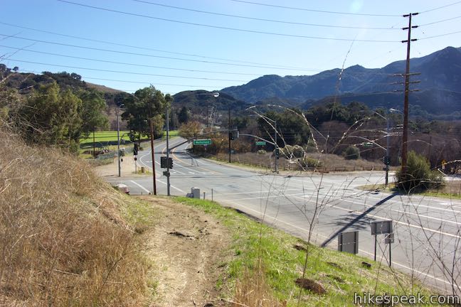
Las Virgenes View Park is located at the northeast corner of the intersection of Mulholland Highway and Las Virgenes Road / Malibu Canyon Road.
Directions to the Trailhead
- Take the 101 Freeway to exit 32 for Las Virgenes Road.
- At the end of the offramp, turn south on Las Virgenes Road.
- Drive 3.3 miles to the intersection with Mulhollad Highway (which has a traffic light).
- Turn left and make an immediate left into the trailhead parking area at the corner for Las Virgenes View Park.
- The other starting point (1/3 of a mile up the trail) is located on the east side of Las Virgenes Road, 0.2 miles north of Mulholland Highway next to a "City of Calabasas" sign.
Trailhead Location
Trailhead address: 26880 Mulholland Highway, Calabasas, CA 91302
Trailhead coordinates: 34.1042, -118.7111 (34° 06′ 15.1″N 118° 42′ 40.0″W)
View Santa Monica Mountains in a larger map
Or view a regional map of surrounding Los Angeles trails and campgrounds.
 | Grassland Trail to Crags Road and Rock Pool This easy 3-mile hike enters Malibu Creek State Park on South Grassland Trail, then forms a loop around Crags Road to visit Rock Pool, a popular park retreat. |
 | M*A*S*H Set This hike visits the site where the exteriors of the television show MASH were filmed, a 4.75-mile trek from the park entrance. |
 | Talepop Loop This 4.75-mile hike climbs 500 feet over a scenic mountain between Liberty Canyon and Las Virgenes Canyon. |
 | Phantom Trail This 4.8-mile round trip hike crosses a panoramic ridge on the north side of Malibu Creek State Park. |
 | Cistern, Lookout, and Cage Creek Trails This team of single tracks make a scenic descent to Century Lake in Malibu Creek State Park, providing a short loop or longer hikes to other destinations. |
 | Lake Vista Trail This 4.1-mile hike beginning from Cistern Trail crosses the west end of Malibu Creek State Park and climbs to a scenic view over Malibu Lake. |
 | Paramount Ranch This segment of the Santa Monica Mountains National Recreation Area includes Western Town, an outdoor set cast as frontier towns in TV and film since the 1950s. There are also several miles of hiking trails to explore. |
 | Anza Loop Trail This 3.8 to 4.5-mile hike follows a historic route through rolling hills in Calabasas south of the 101 Freeway. |
 | Calabasas Stairs This hike to a long flight of stairs off Anza Loop Trail is 1.4 miles round trip (add 0.2 miles for each extra trip up and down the steps). |
 | Heartbreak Hill Trail This 2.1-mile round trip hike offers a condensed workout, shooting up a ridge to a panoramic crest above Agoura Hills in the Santa Monica Mountains. |
 | Calabasas Peak via Calabasas - Cold Creek Trail This 4.5-mile round trip hike starts up a scenic single track formerly know as the Secret Trail and ascends 750 feet to the summit of Calabasas Peak. |
 | Calabasas Peak from Old Topanga Canyon Road This 4.2-mile hike on Calabasas Peak Motorway approaches Calabasas Peak from the northeast, providing big views over Topanga and other parts of the Santa Monica Mountains. |
 | More trails in the Santa Monica Mountains Explore other destinations in the range. |
 | Malibu Creek State Park The year-round campground has 63 sites with picnic tables, fire rings, flush toilets, coin showers, and a dump station. |
Common Questions about Las Virgenes View Trail in the Santa Monica Mountains
- Is the trail open?
- Yes. You should expect to find that Las Virgenes View Trail is open. There are no recent reports of trail closures. If you discover that the trail is closed, please help your fellow hikers by reporting a closure.
- Is this trail free to access?
- Yes, Las Virgenes View Trail is free to access. No entrance fee, pass, or permit is required. If you discover that access rules have changed, please provide feedback on your experience.
- How much time does this hike take?
- It takes approximately 2 hours 15 minutes to hike Las Virgenes View Trail. Individual hiking times vary. Add extra time for breaks and taking in the views.
- How long is this hike?
- The hike to Las Virgenes View Trail is a 4.95 mile out and back with 520 feet of elevation change.
- Are dogs allowed on this trail?
- Yes, dogs are allowed on Las Virgenes View Trail. The trail is open to hikers, dogs, bikes.
- What mountain range is this trail in?
- Las Virgenes View Trail is located in the Santa Monica Mountains.
- Where is the trailhead located?
- The trailhead for Las Virgenes View Trail is located in Calabasas, CA.
Trailhead Address:
26880 Mulholland Highway
Calabasas, CA 91302
Trailhead Coordinates:
34.1042, -118.7111 - What are the driving directions to the start of the hike?
To get to the trailhead: Take the 101 Freeway to exit 32 for Las Virgenes Road. At the end of the offramp, turn south on Las Virgenes Road. Drive 3.3 miles to the intersection with Mulhollad Highway (which has a traffic light). Turn left and make an immediate left into the trailhead parking area at the corner for Las Virgenes View Park. The other starting point (1/3 of a mile up the trail) is located on the east side of Las Virgenes Road, 0.2 miles north of Mulholland Highway next to a "City of Calabasas" sign.
View custom Google Maps directions from your current location.
- Are there other trails near Las Virgenes View Trail?
- Yes, you can find other nearby hikes using the Hikespeak Hike Finder Map.

5 Comments on Las Virgenes View Trail in the Santa Monica Mountains
What hikers are saying:
✨ Generated summary of user commentsThis trail provides a peaceful escape through grasslands and oak woodlands, leading to panoramic ridgeline views. The path offers a versatile experience for those traveling with dogs, bikes, or horses. Rick warns that hikers must remain cautious and respectful of land boundaries, as the ruins at the view spot are located on private property.
“The loop + the ruins spot at the ridge sounds like a perfect mix of nature + history.” Jump to comment ↓
Seth: My family owns the private-property that the “ruins” are on you lead visitors to on the Las Virgenes Trail. We’ve owned it for many generations–the walls were up with a part of a roof when I was a kid–65 or so years ago. Be careful on private land. By the way, we have historically used the trail up from Stokes Road. The land is available for sale or trade.
The trail and and Ruins at the View Spot on this trail are Private Property. If interested in continued access or information regarding purchasing this property contact me. The ruins are our family’s old cabin circa 1930’s.
The Las Virgenes View Trail you describe ends on our private property. If you do wish to continue visiting the view spot on the top of the trail, please support the Santa Monica Mountain Conservancy to purchase our property. They’ve agreed to purchase –at half fair market value as appraised in 2013. The land, and the once brick house has been in the family since the 1920’s. Please let SMMC know you support the purchase.
As with any outdoor activity, it’s a good idea to check the current trail conditions and any alerts or closures before embarking on your hike. This information can usually be found on the official website of the Santa Monica Mountains National Recreation Area or by contacting park authorities.
Enjoy your hike on the Las Virgenes View Trail and soak in the natural beauty of the Santa Monica Mountains!. Like these trek Kanchenjunga Trek trek is famous for its breath taking scenario so thank you for posting the blog giving the information about all the thing
This trail looks so peaceful — grasslands, oak woodland, and panoramic ridgeline views? Sign me up! The loop + the ruins spot at the ridge sounds like a perfect mix of nature + history. 😍 Also nice that it’s dog-, bike-, and horse-friendly. Such a versatile hike