Hikes in Shasta County

Located in Northern California, south of Siskiyou County (which actually contains Mount Shasta), Shasta County has evergreen forests, beautiful lakes and rivers, and wild mountains.

Most of the trails listed here located in Castle Crags State Park at the north end of Shasta County. In Shasta-Trinity National Forest south of the state park, Shasta Lake offers additional hiking and camping.

Castle Crags
A viewing scope at Vista Point in Castle Crags State Park

Hiking in Shasta County

Bailey Cove Trail
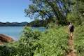
Bailey Cove Trail
This easy 3.1-mile loop circles a hill-covered peninsula on the McCloud Arm of Shasta Lake, providing both lake views and shade.
Crags Trail Castle Dome
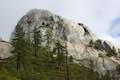
Crags Trail to Castle Dome
This 5.6-mile round trip hike in Castle Crags State Park ascends 2,150-feet through a garden of granite crags to the base of Castle Dome. This hike can be extended to 6 miles round trip by taking a worthy side trail to Indian Springs.
Root Creek Trail Castle Crags
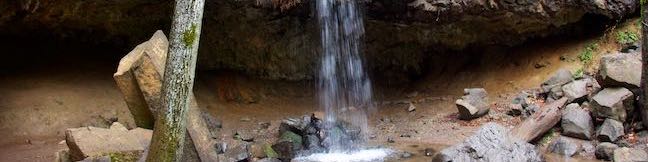
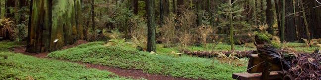
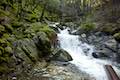
Root Creek Trail
This 2.2-mile round trip hike in Castle Crags State Park takes a level and easy course to a tumbling creek in a mossy forest.
Vista Point Castle Crags
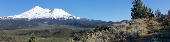
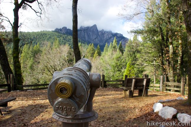
Vista Point Trail
This short hike reaches the principal viewpoint in Castle Crags State Park, which has a great perspective of granite peaks known as the Castle Crags, along with views of Mount Shasta and the surrounding wilderness.


Camping in Shasta County

Campgrounds can also be found through Shasta County, convenient to hiking trails and other outdoor recreation.

Castle Crags State Park Camping
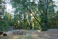
Antlers Campground
This well-shaded 59-site campground has level sites on a bluff next to Shasta Lake.
Castle Crags State Park Camping
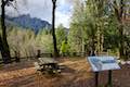
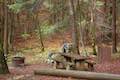
Castle Crags State Park Campground
There are 76 developed campsites within this state park that are nestled within a pine forest with access to nearby trails.


hikespeak
Hedge Creek Falls in Dunsmuir
Hedge Creek Falls is a 35-foot waterfall pouring over a basalt overhang into a wooded ravine above the Sacramento River south of Mount Shasta. A short trail leads to the waterfall from a trailhead right beside an Interstate 5 offramp in Dunsmuir, so this waterfall hike makes a great break from highway travel. The fun trail actually passes behind the waterfall, going underneath the overhang, and continues down to a Sacramento River Overlook, resulting in a never-a-dull-moment 0. ...Read more.
Distance: 0.6 miles · Elevation change: 130 feet
By: Published: February 4, 2019 Last updated: December 5, 2025
Haystack Trail in Klamath National Forest & Mount Shasta
The Haystack is a diminutive volcanic dome with great views of the enormous, snowy mass of Mount Shasta. Haystack Trail presents a 2.55-mile lollipop loop hike that tours the Haystack's summit plateau, boasting broad views in all directions that include Mount Shasta, the Klamath Mountains, and Shasta Valley. This high desert hike passes through juniper and sage that get embellished by spring wildflowers like lupines and Indian paintbrush. ...Read more.
Distance: 2.55 miles · Elevation change: 375 feet
By: Published: March 7, 2018 Last updated: December 5, 2025
Yurok Loop Trail & Hidden Beach in Redwood National Park
Up near the Oregon border, the north coast of California has beautiful unrefined features like driftwood-covered coves and mossy forests. Explore this inviting area on Yurok Loop Trail, a short hike through scenic surroundings. This 1.15-mile circuit passes an ocean vista along a dramatic coastline that faces a cluster of rock islands. The loop crosses a small wooded ridge, overlooking a lagoon. ...Read more.
Distance: 2.25 miles · Elevation change: 120 feet
By: Published: February 13, 2017 Last updated: December 5, 2025
Drury-Chaney Loop Trail in Humboldt Redwoods State Park
Drury-Chaney Loop Trail (also known simply as Drury-Chaney Trail) presents a easy and well graded hike through redwoods in Humboldt Redwoods State Park. The trail is a lollipop loop suitable for wheelchairs and strollers, crossing a surface of compact gravel with 100 feet of elevation change. The 2.4-mile length of this hike splits neatly into three sections: a 0. ...Read more.
Distance: 2.25 miles · Elevation change: 120 feet
By: Published: February 1, 2017 Last updated: April 8, 2026
Grieg-French-Bell Trail in Humboldt Redwoods State Park
Grieg-French-Bell Trail provides access to lovely grove of coast redwoods in Humboldt Redwoods State Park. The ground in this area is covered by a carpet of redwood sorrel that is incredibly beautiful to walk through. Within French Grove, you'll find the Girdled Tree, which had its bark removed to 1901 so that it could be displayed in San Francisco. ...Read more.
Distance: 0.5 miles · Elevation change: 25 feet
By: Published: January 18, 2017 Last updated: April 8, 2026