Yurok Loop Trail & Hidden Beach
in Redwood National Park

Up near the Oregon border, the north coast of California has beautiful unrefined features like driftwood-covered coves and mossy forests. Explore this inviting area on Yurok Loop Trail, a short hike through scenic surroundings. This 1.15-mile circuit passes an ocean vista along a dramatic coastline that faces a cluster of rock islands. The loop crosses a small wooded ridge, overlooking a lagoon. Yurok Loop Trail overlaps California Coastal Trail, which you can take south for half a mile to a path to Hidden Beach. Climb over driftwood and stroll down this secluded gravely cove. The combined hike to Hidden Beach and Yurok Loop is approximately 2.25 miles round trip with 120 feet of elevation change.
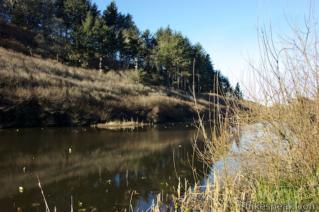
The hike begins from Lagoon Creek Picnic Area, which is alongside Redwood Highway (Highway 101), making it an easy stop for travelers heading up and down the coast. The picnic area has ample parking, restrooms, and of course picnic tables. Lagoon Pond, which borders the picnic area, was created for a logging operation, as a panel explains:
You are looking over land that was near Omen, a northern Yurok village. Later, Euro-American homesteaders came to live near the creek that runs through this sheltered valley. In the 1940s, Crescent Plywood built a mill here, damming the mouth of the lagoon and creating storage for logs until they could be processed. The mill, which at one time employed many Yuroks, was described by locals as an “ugly, smelly place… with the tepee burner going constantly and producing a thick dark smoky haze which hung over the area.” When the mill closed in the 1950s, Del Norte County dismantled the buildings and dam and allowed the pond to evolve back into a wetland.
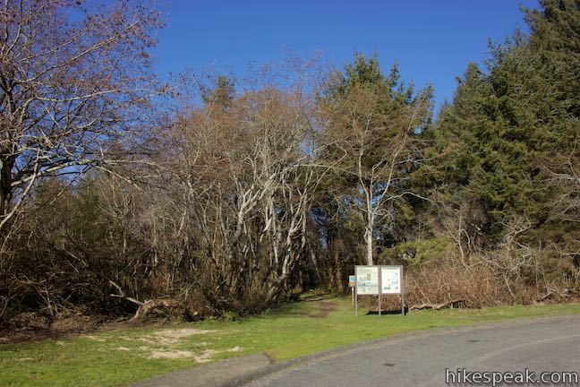
Walk up to the north end of the picnic area by a loop in the parking area road. At the far end, you’ll find the start of the trail, marked by a sign for Coastal Trail, Beach Access, and Yurok Loop Trail. A panel displays a map of Yurok Loop and offers this description:
This one-mile loop takes you to scenic coastal bluffs, through dense alder forests, and along a pathway used by Yuroks and other American Indians for many centuries. Seabirds frequent the offshore rocks, and you may spot a marine mammal or two.
Begin up the trail through an arch of willows, alders, and oaks. Come to a split after less than a tenth of a mile. A less-worn trail parts to the right, next to a sign posting that it leads to beach access and a northern section of Coastal Trail. Bear left to continue with this hike, crossing a footbridge over Lagoon Creek.
On the other side, pass a sign that lists the distance to Hidden Beach at one mile. If you want to hike farther, Klamath River Overlook is four miles away. Proceed south down Coastal Trail and exit the creek-shouldering thicket for your first ocean views. Wilson Beach, at the south end of False Klamath Cove, is to your right. Look up this long slowly curving cove. Large driftwood forms a barrier at the back of the beach. Wilson Beach looks like the type of place you might discover elephant seals stretched out on the sand. Gaze out from the beach toward rock islands just off the coast.
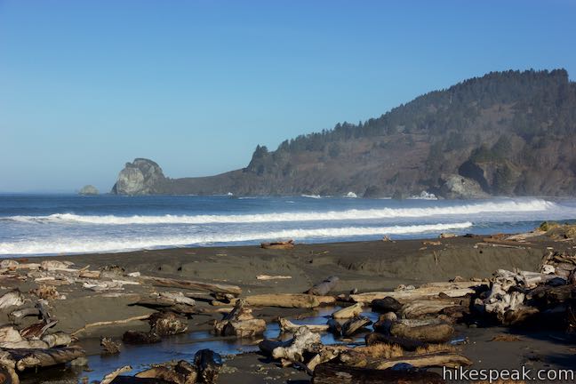
Walk along the back of the beach to another trail split, 0.15 miles from Lagoon Creek Picnic Area. Yurok Loop starts here!
A sign at the junction shows Yurok Loop Trail going to the right and left. An arrow for Coastal Trail goes up to the right (where it is overlapped by Yurok Loop). The loops ocean views are along the coast to the right. If you wish to save these stunning sights for the second half of the loop, bear left at this junction to begin through the forest on the lagoon side of the loop.
East side of Yurok Loop
Going left from the junction, Yurok Loop Trail enters a dense forest of Sitka spruce, Douglas firs, and alders. Ferns cover the ground and moss clings to the sides of the trees. Pass a bench along the trail, 0.3 miles from Lagoon Creek Picnic Area. Have a seat and look out over the lagoon pond that was enlarged in the 1940s and filled with hundreds of peeled logs. The picnic area can be spotted on the other side, backed by Redwood Highway.
Proceed up the gradual trail through the dense forest, which blocks out views of the lagoon. A tenth of a mile past the bench, you will hit the base of a short, steep hill. After topping out, the trail crosses a gully and rises to another crest, half a mile from the start.
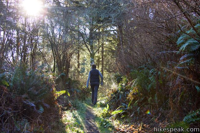
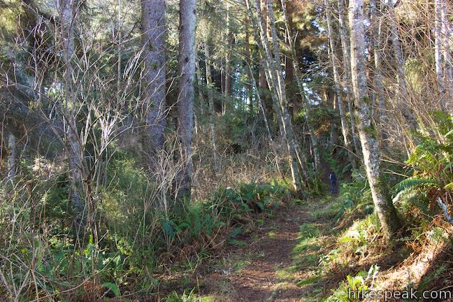
The highway noise becomes drowned out by the more alluring sound of ocean waves as the trail curves to the right and drops to a junction at the south end of the loop. Having hiked 0.55 miles to this point, you could turn right to loop back along Coastal Trail (0.6 miles back to Lagoon Creek Picnic Area). To find your way to Hidden Beach, which is 0.55 miles away, turn left to head south on the Hidden Beach Section of Coastal Trail.
Signs at the southern junction show Coastal Trail going to the north and south while arrow for Yurok Loop point to the east and north. No matter which direction you choose to hike Yurok Loop, the markings at this junction will be easy to read.
Yurok Loop to Hidden Beach
Head south on Coastal Trail and you will exit the trees for views south down the beautiful undeveloped coastline. In the crescent just ahead of you is the cove containing Hidden Beach.
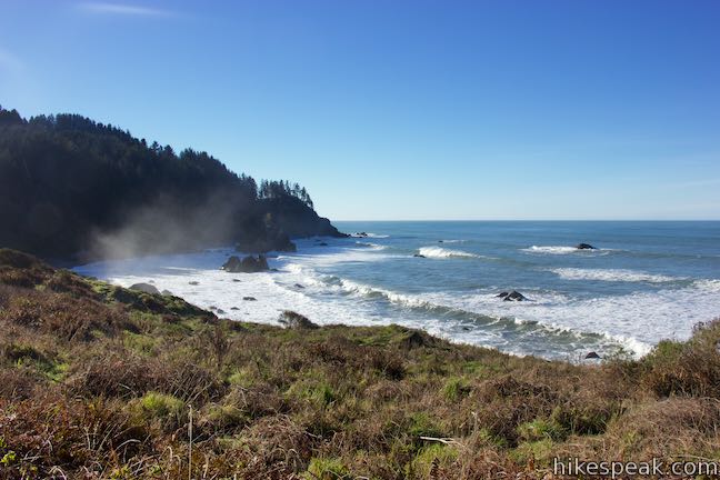
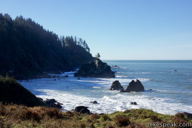
Walk through an area of coastal grasses and blackberry brushes. Enjoy the sun-exposed views for about a quarter mile before the trail passes into another forest. Spruce trees rise along the trail and arch overhead.

You’ll be in the woods for about 1/8 of a mile until you come to a junction with the trail down to Hidden Beach. Leave Coastal Trail by bearing right at the split, passing a sign instructing visitors to keep fires of driftwood. The trail quickly drops to the back of Hidden Beach.
You will reach Hidden Beach at 1.1 miles from Lagoon Creek Picnic Area. Step over and around a jumbled barrier of driftwood logs to the rugged beach. Massive boulders rise out of the gravel and ocean water to the south, leading to an alluring rocky point that juts into the ocean. The beach stretches out to the right, inviting you to stroll up the shore. You can easily walk a tenth of a mile in this direction before boulders start to dominate the coastline.
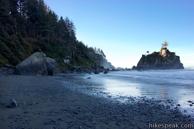
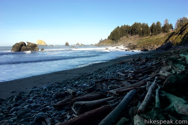
When you are ready to head back, return to Hidden Beach Trail. It is a 1.15-mile back to Lagoon Creek Picnic Area. Hike back up to Coastal Trail and turn left. Retrace your steps for half a mile back to the junction at the south end of Yurok Loop Trail. Stay to the left to proceed on Coastal Trail.
West side of Yurok Loop
Leave the junction at the south end of the loop and hike north up Coastal Trail. The trail slips through alders and finds intermittent ocean views. Upon exiting the forest, the trail glides downhill to a viewpoint at the south end of False Klamath Cove. The map at the trailhead highlights this location for its wildlife viewing.
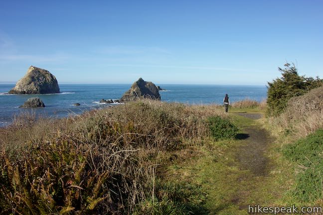
Step out onto a bluff with a steep drop to the surf and look out over rock islands with names like False Klamath Rock and Wilson Rock. Seabirds gather around these massive rocks (a reward for those who carry binoculars). A bench along the trail offers a place to take a seat and gaze out at the Pacific Ocean.
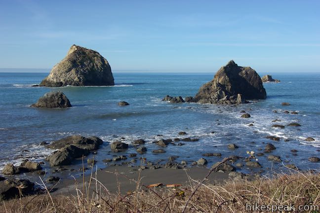
The ocean vista is 0.35 miles from the junction at the south end of Yurok Loop. It is another tenth of a mile down to the junction at the north end of the loop. Leaving the viewpoint, the trail descends away from the ocean, offering views north up False Klamath Cove. The trail slips back into dense forest one last time before returning to the junction at the top of the loop.
Bear left and hike north behind Wilson Beach and across Lagoon Creek. At the junction after the bridge, turn right to head back to the picnic area and complete this hike. On its own Yurok Loop is 1.15 miles round trip. The addition of Hidden Beach brings that distance up to 2.25 miles round trip (not including any beach strolling). Dogs and bikes are not allowed on these trails in Redwood National Park. Parking at Lagoon Creek Picnic Area is free and no permit is required for this hike, so get out and enjoy!
To get to the trailhead: Lagoon Creek Picnic Area is located on the west side of Redwood Highway (Highway 101), 14 miles south of Crescent City and 68 miles north of Eureka. The Tree of Mystery Tourist Attraction is one mile south of Lagoon Creek Picnic Area.
Trailhead address: Lagoon Creek Picnic Area, Redwood Highway, Klamath, CA 95548
Trailhead coordinates: 41.5946, -124.0997 (41° 35′ 40.55″N 124° 05′ 58.91″W)
You may also view a regional map of surrounding Northern California trails and campgrounds.
East side of Yurok Loop


Yurok Loop to Hidden Beach


West side of Yurok Loop


 | Stout Memorial Grove This 0.55-mile hike explores an old growth grove of coastal redwoods in Jedediah Smith Redwoods State Park. |
 | Fern Canyon Trail This one-mile hike explores an incredibly ferny canyon in Prairie Creek Redwoods State Park. |
 | Grieg-French-Bell Trail This half-mile loop in Humboldt Redwoods State Park explores redwood groves dedicated to Grieg, French, and Bell, crossing ground covered in redwood sorrel to visit the Girdled Tree, which had its bark stripped away and sent to San Francisco. |
 | Drury-Chaney Loop Trail This 2.4-mile lollipop loop provides an easy and enchanting hike through redwood trees at the north end of Humboldt Redwoods State Park. |
 | Founders Grove Nature Trail This 0.5 mile loop explores an ancient grove honoring the founders of the Save-the-Redwoods League in Humboldt Redwoods State Park. |
 | Gould Grove Trail This half mile loop explores an old growth redwood forest across from the visitor center in Humboldt Redwoods State Park. |
 | Woodland Trail This 1.25-mile loop explores patches of redwoods surrounded by a shaded oak forest in Richardson Grove Redwoods State Park. |
 | Durphy Creek Trail - Tan Oak Springs Trail - Lookout Point Loop This 3.75-mile loop climbs 1,000 feet to a forest ridge before descending to Lookout Point, where you can enjoy an unimpressive view to the south. |
 | More hikes in Northern California Explore other trails in Northern California, including hikes in coastal parks and around Mount Shasta. |
Go the extra miles...
Submit a rating of this hike to go with your comment. Contribute to the average trail rating.