Hikes to Los Angeles Waterfalls
Numerous waterfalls can be seen on hikes around Los Angeles. Most LA waterfalls are at their best in the early months of the year when rainstorms and runoff from snow provide the fullest flows. Some waterfalls dry out completely in the fall, so timing is important.
The list below offers a general ranking of LA’s waterfall hikes based on two criteria: the beauty of the falls and the quality of the trail to the tumbling waters.
Escondido Falls comes in as the #1 waterfall hike around Los Angeles, but each trail is worth visiting.
Check out each waterfall and pick your own favorite. The list features the average trail rating of each waterfall hike as decided by the visitors of hikespeak.com. After you’ve completed one of these hikes, come back and give it a star rating.
A map with the locations of each LA waterfall hike is below the list. To discover waterfalls outside Los Angeles, you can search for waterfalls on the Hike Finder Map.
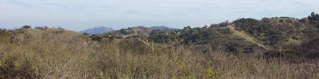
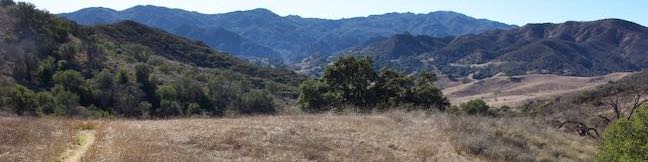
Highlights of Los Angeles Waterfalls


Hikes to Los Angeles Waterfalls


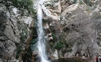
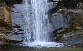
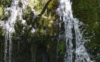
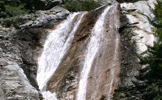
 This 3.8-mile out and back visits a 200-foot waterfall that is split into two tiers. The upper tier is 150 feet tall and stunning after a rainstorm.
US
Trailhead coordinates: 34.0261, -118.78 (34° 01′ 33.95″N 118° 46′ 48″W)
Park Headquarters: (323) 221-9944
Parking Fee: $12
US
Trailhead coordinates: 34.1955, -118.0225 (34° 11′ 43.8″N 118° 01′ 21″W)
Park Headquarters: (626) 574-1613
Access Fee: $Adventure Pass
This 4.8-mile round trip hike leaves from an active rock quarry and progresses up a beautiful canyon to a mesmerizing multi-tiered waterfall.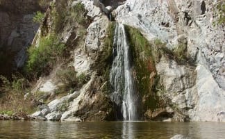
US
Trailhead coordinates: 34.15676, -117.92368 (34° 09′ 24.33″N 117° 55′ 25.24″W)
Park Headquarters: (626) 574-1613
No Entrance Fee: $0
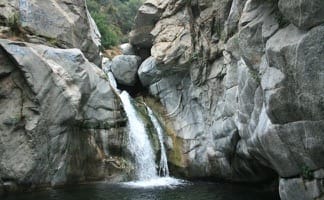
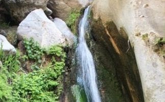
This one-mile hike visits a 50-foot waterfall up one of the most scenic canyons in the range.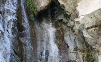
US
Trailhead coordinates: 34.2162, -118.1463 (34° 12′ 58.3″N 118° 08′ 46.7″W)
Park Headquarters: (626) 574-1613
Access Fee: $ Adventure Pass
This 1.6-mile to 3-mile hike in Monrovia Canyon Park follows an enchanting canyon up to the base of the 30-foot waterfall.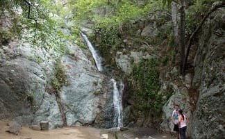
US
Trailhead coordinates: 34.176584, -117.98952 (34° 10′ 35.70″N 117° 59′ 22.27″W)
Monrovia Canyon Park: (626) 256-8246
Access Fee: $ Adventure Pass
 This 4-mile hike ascends a mountain-framed canyon to a 30-foot beauty on the east side of the San Gabriel Mountains.
US
Trailhead coordinates: 34.305323, -118.255444 (34° 18′ 19.2″N 118° 15′ 19.3″W)
Monrovia Canyon Park: (626) 574-1613
No Access Fee: $0
 This 2.5-mile heads down canyon away from Sturtevant Falls toward a 30-foot waterfall. The lush canyon and the babbling creek are quite calming.
US
Trailhead coordinates: 34.1955, -118.0225 (34° 11′ 43.8″N 118° 01′ 21″W)
Park Headquarters: (626) 574-1613
Access Fee: $Adventure Pass
This 4.5-mile hike starts from the Switzer Picnic Area and descends Bear Valley to a spot below the 50-foot waterfall.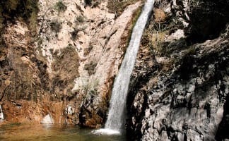
US
Trailhead coordinates: 34.26624, -118.1457 (34° 15′ 58.5″N 118° 08′ 44.5″W)
Park Headquarters: (626) 574-1613
Access Fee: $Adventure Pass
This 3.5-mile hike goes up Eaton Wash to a narrow stretch of Eaton Canyon containing a pleasant 40-foot waterfall.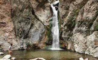
US
Trailhead coordinates: 34.17832, -118.09663 (34° 10′ 42″N 118° 05′ 47.9″W)
Eaton Canyon Natural Area Park and Nature Center: (626) 398-5420
No Entry Fee: $0
 This 3-mile hike leaves from Buckhorn Campground and visits a short waterfall in an enchanting glen of tall pines.
US
Trailhead coordinates: 34.3475, -117.9110 (34° 20′ 51″N 117° 54′ 39.6″W)
Park Headquarters: (626) 574-1613
Access Fee: $Adventure Pass
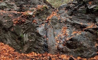
 This 2.5-mile follows a shaded creek to a gorge containing a short often small seasonal waterfall.
US
Trailhead coordinates: 34.0782, -118.56745 (34° 04′ 41.52″N 118° 34′ 02.81″W)
Topanga State Park Headquarters: (310) 455-2465
Access Fee: $0
This 40-foot waterfall is located within Wildwood Park in Thousand Oaks and is reachable via several trails, including a 2.55-mile loop.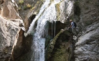
US
Trailhead coordinates: 34.2200, -118.9028 (34° 13′ 12″N 118° 54′ 10″W)
Wildwood Regional Park Headquarters: (805)495-6471
Access Fee: $0
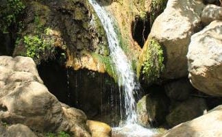
This 1.3-mile round trip hike ventures into a rustic canyon to a double waterfall.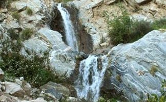
US
Trailhead coordinates: 34.203025, -118.122883 (34° 12′ 10.88″N 118° 07′ 22.37″W)
Park Headquarters: (626) 574-1613
No Access Fee: $0
US
Trailhead coordinates: 34.266172, -117.62684 (34° 15′ 58.21″N 117° 37′ 36.62″W)
Park Headquarters: (626)574-1613
Access Fee: $Adventure Pass
 This easy and level 2.6-mile out and back hike visits the ruins of a burned down ranch and a small waterfall.
US
Trailhead coordinates: 34.03765, -118.7477 (34° 02′ 15.5″N 118° 44′ 51.7″W)
Park Headquarters: (805)370-2301
Access Fee: $0
 This 5.33-mile round trip hike in Placerita Canyon Natural Area follows Canyon Trail to the ruins of Walker Ranch and Waterfall Trail to an elusive falls in a sylvan canyon.
US
Trailhead coordinates: 34.377866, -118.467618 (34° 22′ 40.31″N 118° 28′ 03.42″W)
Park Headquarters: (661)259-7721
Access Fee: $0
This 2.6-mile loop passes a short season cascade that park maps describe as a waterfall.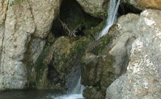
US
Trailhead coordinates: 34.0502, -118.5291 (34° 03′ 00.7″N 118° 31′ 44.8″W)
Park Headquarters: (310)454-1395
Access Fee: $0 – $12
Or explore hikes around Los Angeles on the Hike Finder Map

Awesome site, Seth! I’m heading out to Malibu next week for some hiking/camping with a friend from out of town, and your site is the best resource for great hikes.
I live out in Yucaipa – was wondering if you planned a section on the San Bernardino NF and Mt San Jacinto areas. I just moved out to CA, and I’ve found some great hiking & gorgeous views out this way – e.g., Forest Falls [off 38], Humber Park [Idyllwild] – but I’m always looking for more places to explore.
Again, thanks for the great site,
Charlie
Thanks Charlie! Have a great time in Malibu. Hikespeak will indeed be expanding in to the San Bernardino Mtns and other areas of SoCal soon. Glad you enjoy the site.
hello, how can i get to the waterfalls?
By hiking! Click on the waterfall that interests you. Each trail report comes with its own directions to each waterfall. Have a great time.
What is the name of the waterfall located in downtown Los Angeles that has been closed for decades? The structure is located past Broadway Street. It has a stamp on it that says “Port Morse.”
That would be the Fort Moore Pioneer Memorial Waterfall located on Hill Street north of the 101 FWY
Can you tell me if lower Millard Canyons hike is open? And what are the hours?
Unfortunately, last time I checked with a ranger (which was recently) I was told that Millard Canyon is still closed and recovering from the Station Fire.
Can you tell me which one has the least amount of people and no graffiti.
Is there really graffiti up there? That’s what I hear from some hikers. I know it’s hard to believe people can be so tacky.
There is definitely graffiti at Hermit Falls. You should not (hopefully) see graffiti at other waterfalls. Escondido Falls, Hermit Falls, and Sturtevant Falls can certainly get crowded on weekends. Solstice Canyon, Switzer Falls, Monrovia Falls, and Eaton Falls can get heavy traffic too. Waterfall hikes are popular, but if you hike early on a weekend morning or on weekdays, you can certainly get these waterfalls to yourself.
We’re looking into the Devil’s Canyon hike in the Angeles National Forest. Is the trail open? And do you have a map or directions to the trailhead? It’s our first time in the ANF. Thanks.
That hikes is on my to-do list too. Unfortunately, we’ll both have to wait until the shutdown is over. You can find good descriptions and directions in John W Robinson’s Trails of the Angeles.
I hike to a series of waterfalls up cooks canyon in La Crescenta. You have to hike a bit up the canyon past the trail, but it turns into a forested grotto with waterfalls. You should include this. I would be able to supply photos.
Can you tell me the name of the park near Monrovia where there is a beautiful and easy to walk trail that leads past cute little cabins and eventually to a waterfall? It is not a long walk but very beautiful. Thanks
You’re probably thinking of Monrovia Falls or Sturtevant Falls.
Are any of these waterfalls currently flowing, or are they all dried out until spring?
Are any of the waterfalls flowing at the end of June trying to plan a little hike and I want to go to a waterfall
Hi. Great info, thanks for the posts. I am hoping that some of these falls are kid-friendly (4 year old) either walking or on my shoulders. We want to hike as many as we can before school starts in a couple of weeks. Any recommendations where the falls would have water at this time? Thank you in advance.
Hi – These waterfalls get quite dry by late summer. Even without water, young kids should still enjoy the hikes to Monrovia Falls, Millard Falls, Solstice Canyon, and others.
I don’t know if this will sound familiar, but we hiked a loop once that was all nature going up, then a waterfall. Go a little farther and pass huge cactus plants on the left and the trail opens up to a view of LA and the coast. The whole loop was under 3 miles. I THINK we entered this park off sunset. Would love to find it again. Any ideas?
I suspect you went to Temescal Gateway Park. Was there a bridge near the waterfall? The park is off Sunset and has the views you are describing.
I believe you are describing Temescal Canyon Park, but you may also be describing the trail at Will Rogers State Park, although I don’t believe there is a waterfall there, but there is the Cacti and views at the end.
Hoping someone can help. I’ve been tasked with looking for a hike with waterfalls at the moment, but even better if there was Water pools where we can actually hop in. Any help would be appreciated. Am currently looking at Paradise Falls? Never been.
Unfortunately, you can’t go in the water at Paradise Falls. Last weekend, a friend and I went to Cooper Canyon Falls and it was nice (around 5 miles roundtrip if you go through Buckhart campground). The falls were flowing but the creek is shallow and we didn’t see any swimming holes. We also went to Trail Canyon Falls near Tujunga last month and the falls were flowing (also around 5 miles roundtrip), but the water there was also shallow.
Best of luck finding a suitable trail!
Are any of these waterfalls currently flowing, or are they all dried out ?
San Antonio Falls is a good bet to have water during summer months.
can you hike both Sturvenant falls and Hermit falls in one hike ? do they connect , and how far would that be ?
It is possible to hike to both waterfalls in one outing. Using a connecting trail in the bottom of the canyon, the hike is a bit under 5 miles total. I’ve added more detailed directions to the Hermit Falls write-up.
Hi,
Which of these is the nearest in downtown Los Angeles and accessible by person? Like you can swim or go under the falls? Thank you.
Hi! I’ve been going on a couple of hikes with a 15 month old. Are there any good ones that baby can come along on, that you’d recommend? I was looking into going to Sturtevant Falls. Thank you!
I’m sure that your toddler will love many of these hikes, so it may depend how much elevation you want to tackle. Take a look at Monrovia Falls and Millard Falls, which are short, not too challenging, and offer plenty to fascinate children.
I’d recommend skipping Cooper Canyon Falls and Santa Ynez Falls until your child is old enough to do a bit of scrambling around.
Enjoy the outdoors!