Trail Canyon Falls
in the San Gabriel Mountains
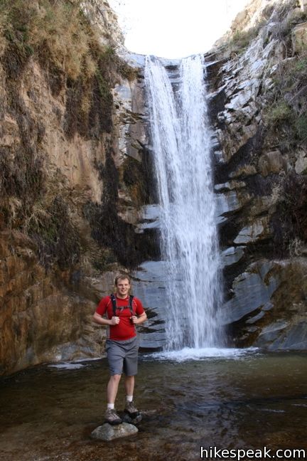
The west side of the San Gabriel Mountains offers fewer trails than the rest of the range, but it is home to one terrific waterfall. This four-mile round trip hike on Trail Canyon Trail tackles 700 feet of elevation gain to reach a sublime 30-foot waterfall.
- Trail Canyon Falls is one of the Los Angeles waterfall hikes.
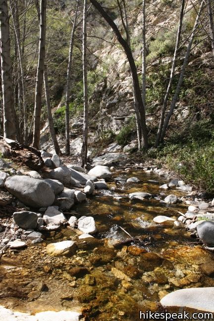
Approach this waterfall via Trail Canyon Trail (a trail so good they named it twice). After 2/3 of a mile walking past cabins along a dirt road, proceed onto a single track trail. Take this trail and follow Golden Creek up a canyon shaded with alders and sycamores.
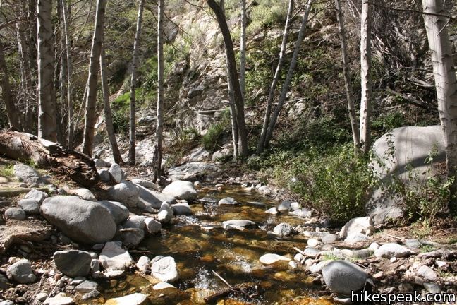
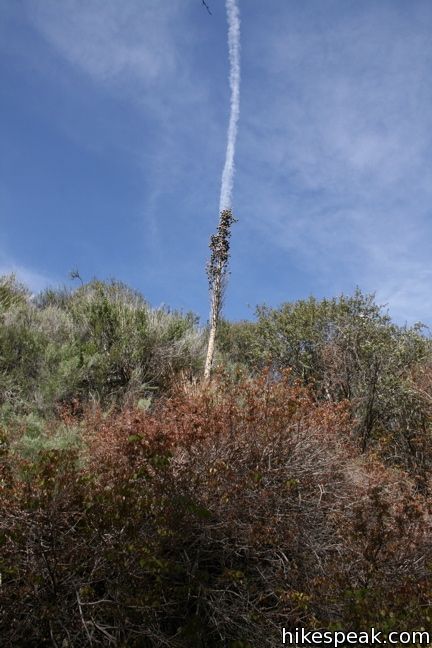
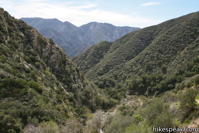
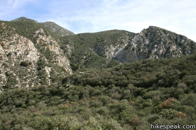
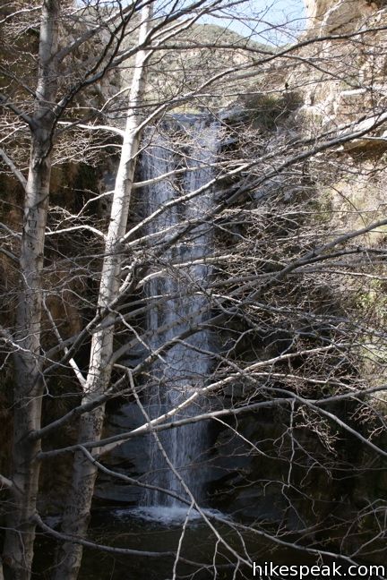
The trail crosses the stream a few times before climbing the wall of Big Tujunga Canyon. Glimpses of Trail Canyon Falls can be seen ahead. This area was badly burned by the 2009 Station Fire, which likely cleared away vegetation to increase visibility of the waterfall.
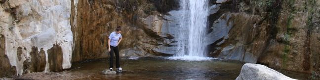
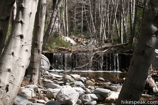
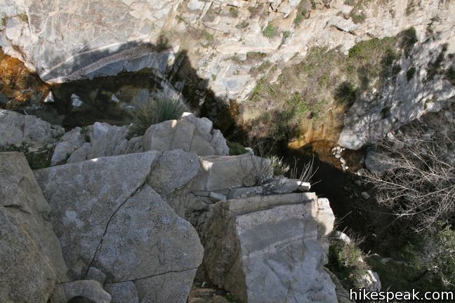
You can also enjoy broad views of the canyon and the mountains above. The trail makes its way around the side of the canyon, rising to an elevation close to 2,500 feet. Trail Canyon Trail levels out as it approaches a large granite landing above the falls. This is a great spot to stop for a snack and enjoy the creek. The trail reaches pools in the creek above Trail Canyon Falls and you can walk down the granite to the brink of the waterfall.
Trail Canyon Trail proceeds up the canyon from the waterfall to Tom Lucas Trail Camp. The brink of Trail Canyon Falls is 1.9 miles from the trailhead and offers a reasonable spot to tunr around.
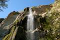
For a closer view of Trail Canyon Falls, backtrack a tenth of a mile along the trail to a footpath that leads down into the canyon. The path descends a steep bank of dirt through brush, and may require agility and shoes with good traction. In fact, this path may completely unsafe due to fire damage and loose, steep terrain, so use discretion.
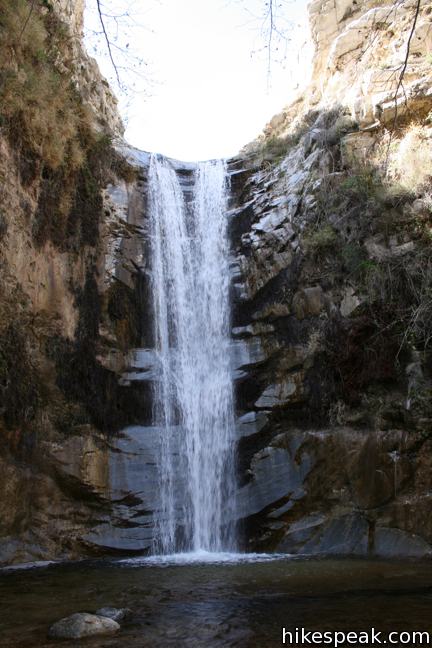
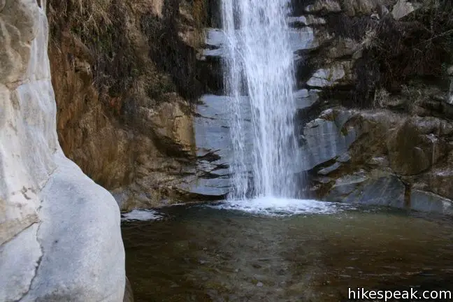
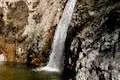
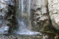
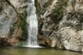
If you make it down to the canyon floor, you will be greeted with an outstanding view of Trail Canyon Falls. The 30-foot waterfall spills over a smooth wall into a shallow pool. In winter or early spring, when rain water fills the creek, the waterfall is quite impressive.
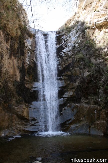
Considering the effort it will take to get back up the trail, break for a moment and enjoy. An alternative return route is to bushwhack and rock-hop down the creek to get back to the trail.
Dogs are welcome on Trail Canyon Trail. It is free to park at the trailhead (a National Forest Adventure Pass is no longer required). No permit is needed to hike to Trail Canyon Falls in the San Gabriel Mountains, so get out and enjoy!
The 2009 Station fire scorched the areas surrounding Trail Canyon Trail, resulting in a long-term trail closure. Look for signs of natures rebounding renewal.
Directions to the Trailhead
- From the 210 Freeway in Sunland, between Pasadena and the junction of the 5 and 405 Freeways, head north on Sunland Boulevard until it becomes Foothill Boulevard.
- After another mile, turn left on Mount Gleason Avenue.
- One and a third miles later, make a right on Big Tujunga Canyon Road.
- After 3.4 miles, turn left up the hard-to-spot Trail Canyon Road.
- (a sign for Trail Canyon Trail is visible from the opposite direction).
- Follow this road for 0.4 miles to a large parking lot where the hike begins (bear right at one intersection along the road to descend into the canyon).
- You may discover a closed gate at the bottom of Trail Canyon Road.
- If so, park at the bottom of Big Tujunga Canyon Road and walk 0.4 miles up to the trailhead.
Trailhead Location
Trailhead address: 19600 North Trail Canyon Road, Angeles National Forest, Tujunga, CA 91042
Trailhead coordinates: 34.305323, -118.255444 (34° 18′ 19.2″N 118° 15′ 19.3″W)
View San Gabriel Mountains in a larger map
Or view a regional map of surrounding Los Angeles trails and campgrounds.
 | Hostetter Fire Road to Verdugo Peak This 7.5-mile round trip hike on the north side of the Verdugo Mountains ascends from La Tuna Canyon to the highest summit in the range. |
 | La Tuna Canyon Trail This 4.5-mile round trip hike ascends a ridge and a pair of canyons in La Tuna Canyon Park on the northwest side of the Verdugo Mountains. |
 | Los Pinetos Waterfall This 5.33-mile round trip hike in Placerita Canyon Natural Area follows Canyon Trail to the ruins of Walker Ranch and Waterfall Trail to an elusive falls in a sylvan canyon. |
 | Switzer Falls This 4.5-mile hike starts out above and finishes below a 50-foot tall waterfall. |
 | More trails in the San Gabriel Mountains Explore other destinations in the range. |
 | Millard Falls This one mile hike visits a 50-foot waterfall up one of the most scenic canyons in the range. |
 | Eaton Canyon Falls This 3.5-mile hike goes up Eaton Wash to a narrow stretch of Eaton Canyon containing a pleasant 40-foot waterfall. |
 | Paradise Falls This 40-foot waterfall is located within Wildwood Park in Thousand Oaks and is reachable via several trails. |
 | Escondido Falls This 3.8-mile out and back hike visits a 200-foot waterfall that is split into two tiers. The upper tier is 150 feet tall and stunning after a rainstorm. |
 | More waterfalls around Los Angeles Explore other waterfalls in the Santa Monica and San Gabriel Mountains. |
Common Questions about Trail Canyon Falls in the San Gabriel Mountains
- Is the trail open?
- Yes. You should expect to find that Trail Canyon Trail is open. There are no recent reports of trail closures. If you discover that the trail is closed, please help your fellow hikers by reporting a closure.
- Is this trail free to access?
- Yes, Trail Canyon Trail is free to access. No entrance fee, pass, or permit is required. If you discover that access rules have changed, please provide feedback on your experience.
- How much time does this hike take?
- It takes approximately 2 hours 15 minutes to hike Trail Canyon Trail. Individual hiking times vary. Add extra time for breaks and taking in the views.
- How long is this hike?
- The hike to Trail Canyon Trail is a 4 mile out and back with 700 feet of elevation change.
- Are dogs allowed on this trail?
- Yes, dogs are allowed on Trail Canyon Trail. The trail is open to hikers, dogs.
- Will I see a waterfall on this hike?
- Yes, Trail Canyon Trail features a waterfall.
- What mountain range is this trail in?
- Trail Canyon Trail is located in the San Gabriel Mountains.
- Where is the trailhead located?
- The trailhead for Trail Canyon Trail is located in Tujunga, CA.
Trailhead Address:
19600 North Trail Canyon Road
Tujunga, CA 91042
Trailhead Coordinates:
34.30533, -118.25536 - What are the driving directions to the start of the hike?
To get to the trailhead: From the 210 Freeway in Sunland, between Pasadena and the junction of the 5 and 405 Freeways, head north on Sunland Boulevard until it becomes Foothill Boulevard. After another mile, turn left on Mount Gleason Avenue. One and a third miles later, make a right on Big Tujunga Canyon Road. After 3.4 miles, turn left up the hard-to-spot Trail Canyon Road. (a sign for Trail Canyon Trail is visible from the opposite direction). Follow this road for 0.4 miles to a large parking lot where the hike begins (bear right at one intersection along the road to descend into the canyon). You may discover a closed gate at the bottom of Trail Canyon Road. If so, park at the bottom of Big Tujunga Canyon Road and walk 0.4 miles up to the trailhead.
View custom Google Maps directions from your current location.
- Are there other trails near Trail Canyon Trail?
- Yes, you can find other nearby hikes using the Hikespeak Hike Finder Map.

27 Comments on Trail Canyon Falls in the San Gabriel Mountains
What hikers are saying:
✨ Generated summary of user commentsThis trail offers a scenic journey through diverse landscapes, ranging from sun-drenched rocky areas to shaded, lush ravines. Hikers should prepare for several stream crossings and a steep, narrow scramble involving a rope to reach the base of the falls. Arlene advises paying close attention to your surroundings as the path lacks clear signage after the private property, making it easy to lose the way or overshoot the waterfall. Stay alert for reports of an unleashed, aggressive dog near the cabin at the trailhead.
I was following up on this posting and seeking out an Adventure Pass. According to the USDA Forest Service this trail is Free and does NOT require the pass. The site mentions recent changes so maybe this has become free after posting.
https://www.fs.usda.gov/detailfull/r5/home/?cid=stelprdb5404142&width=full#aanf
I was just curious to find out if it’s still difficult to reach the waterfalls per your note on your website. I would love to go hiking to this place but don’t want to hike only to find out I can’t reach the waterfalls? Thank you in advance for your help
Charity
NOTE: While the Trail Canyon area of the Angeles National Forest reopened to the public in 2012, there is a large wash-out along the trail and other damaged from the 2009 Station Fire that has made it difficult to reach the waterfall.
Yes, it is very difficult to reach the falls. This will not change, as the trail is not maintained. Half way to the falls, the trail begins switch-backing up the left-hand side of the canyon. This stretch of the trail is impassible, without running the risk of falling into the abyss. It is extremely dangerously narrow, and should you trip, there is nothing to break your fall.
I accessed the falls yesterday through an alternative route: I resorted to traveling off of designated trails. I literally scrambled along the side of the stream, and in some cases in the stream, to the base of the waterfall. It was fairly difficult scrambling and bush-whacking, because there is no clear path there. There are too many thickets. I got scratched all over the place. It was worth it though. The falls were quite a spectacle. There was a moderate amount of water, considerably less than the pictures above. It was still very pretty.
Should you attempt this scrambling/bushwhacking, be very careful about tripping on slabs of rocks along the stream if you get your boots wet in the stream, as I did. I tripped a few times, but I was not quite as careful as I would have been if I had more daylight. Allow at least four hours before the gate closes.
can you please confirm or deny if a adventure pass will be necessary in June. We plan to come with our Cub Scout pack and need the details to prepare all in advance. Parking fee? and or pass necessary ?
Thank you
According to the national forest, this is now a free trailhead and no adventure pass is required.
Has anyone done the hike recently? Is the fall still visible? Saw a yelp posting from 2 weeks ago and poster said there was no fall.
I hiked it today 7 – 26 – 2013 no-falls. We haven’t had any rain in like 4 or 5 months. You have to go in winter if you wanna see some big time falls! The trail is washed out in like 7 or 8 places watch your footing on this trail please.
No falls, but there should be water in the creek still, correct?
On May 3, 2014, I hiked to the fall. The first 0.5 miles appear to be treacherous due to fallen trees, crossing streams, etc. After that the trail seem to be more well defined and normal. The only thing is that you need to scramble to get to the canyon floor to enjoy the fall from the bottom. It looked really steep, so I passed andto decided to stay at the top area of the fall – ample fresh and clean water to enjoy.
The hike up to the falls is awesome and worth the trek. The trail will take you all the way to Tom Lucas Camp and Condor Peak. This is no easy stroll in the park and make sure you take the 10 essentials.Check out my video for Trail Canyon Falls and some other videos that I posted of my adventures.
Subscribe & Like
Trail Canyon Falls
https://www.youtube.com/watch?v=VbOzfGQsUsU
Check out my other videos
Josephine Peak Guide
https://www.youtube.com/watch?v=rExkpF2jfGE
Strawberry Peak Video
https://www.youtube.com/watch?v=wCdec7qGqAs
Distance: 3 miles round trip
Elevation Gain: 700 ft
Hike Time: 2 hours
Difficulty: Moderate
Trail Condition: OK, but a few difficult spots
Hike Type: Out and Back
Animals: Dog friendly
Activities : Hiking & Running
I hiked this trail yesterday. The falls are completely dry. Hiking to the falls seemed fairly easy. Getting there is a good bit of uphill though (although never that harsh). I hiked at least twice the distance past the falls until the trail petered off into the brush and was too overgrown. It’s worth hiking past the falls (dry or not) for a while. Never did it seem treacherous. This trail really does have all the beautiful aspects of hiking in Angeles National Forest… desert-like rocky areas, lush green ravines where water flows, shade and tall trees, sunny open mountains, panoramic 360 views, blooming flowers (seemingly year round). It’s a pretty trail, flowing falls or not. I brought a liter of water and hiked for about 4 hours or so (2 hours in, 2 hours out). The trail gets a little hard to spot at points but with just a little looking around you will find it again, it’s hard to miss, for the most part it is always running creek-side. People put up markers and cairns to make it easier. But it could use another round of tidying past the falls. I want to know how far it actually goes!
I went to the falls in early February and the waterfall is present. Not quite to the degree that we see in the pictures above, but still present.
its may of 2016 Anybody been here recently? Is the waterfall accesible? Is there still water flowing??
We went to the Trail Canyon Fall today. Overall trail condition is good. Lots of water due to tremendous amount of rainfall in LA recently. Be sure to bring walking sticks to help you get through many stream crossings. The way down to the waterfall is not easy but I wouldn’t say difficult. My dog and I went down in less than 1 minute. Plenty of people carry small dogs and not to experienced hikers made their way up and down without too much difficulty. However, like all outdoor activity, do be careful on your way up and down to the waterfall
Hello there
is there a secure and safe parking lot to park our car ? this is my first experience , thank you for your time and understanding
7/23/17 I was there this Sunday and we hiked two miles, but there’s was no waterfall,but somebody told me it’s almost a total of 10 miles round trip is that true? I’m kind of confused here!
The 10-mile distance could be for a hike going farther up Trail Canyon Trail. The waterfall is a couple miles up, but can be dry and hard to see in summer months.
Anyone hike this recently? Still free to park? Any water? Thx!
Lots of water from all the rain! You need to cross streams several times. Didn’t go down to the waterfall, but could see it from the top of the trail towards the end. We just parked at the entrance and it was free.
I’ve done this trail a few times and really enjoy it. I’m wondering if anyone has tried making it to the waterfall walking through the canyon floor? Essentially continuing on the canyon floor instead of taking the switch-backs up the left-hand side of the canyon.
There is a vicious unleashed pit bull at the cabin at the trailhead. Be aware
wut
Did this trail in early May and the falls has good water after a very wet winter. It’s a terrific hike because it’s not too easy yet not too hard. It’s just right. About two hours total if you hike steady and leave time to look at the falls. The only challenge is repelling down to the bottom of the falls, which takes some balance and can be scary if you’re unaccustomed to scrambling down rocky, dirt scree. But it’s doable for most people. Highly recommended in the spring after a good winter.
My husband and I went this trail yesterday for the first time. We were unsure where to park at first because there are no clear parking signs. We just parked along the road. We got there about 9am and there was just a small group and a man with his dog not very busy at first. I am very new to hiking but it was a great challenge for beginners. A bit of crossing water and NO SIGNS AFTER THE PRIVATE PROPERTY We didnt get lost and we miss the waterfall and walked right over it! Walked for another 20 mins thinking our eyes were playing tricks on how big it was but nope! We didnt see it until we backtracked and looked over a cliff to see the waterfall from up top! The extra hike pass the waterfall was a good hike as well but you will get lost if you dont pay very close attention to your surroundings. We talked to a pair and they mentioned that there are two ways to get to the waterfall…up and around then down the sketchy rope (the way we took) or walk along the stream at the bottom.
Around 12ish we walked back from the waterfall and there were so many people coming in which make for a bit more danger because the hike is narrow and high and people brought their dogs….which I dont think should be on the trail after a certain point or off leash. Watch out for too much dog poop because no one picks up after their pets
Bring lots of water, a snack and wear sun protection!
Does hikespeak provide gpx files for their referenced trails?
Not at this time, but this is a feature that might get added in the future.
Do we have to schedule the hike? Is there set hours?