Los Pinetos Waterfall via Canyon Trail & Waterfall Trail in Placerita Canyon Natural Area
Located on the west end of the San Gabriel Mountains, Placerita Canyon Natural Area (also know as Placerita Canyon State Park) is an interesting park that has something for everyone. There are easy canyon trails and tougher backcountry tracks, along with a nature center and an Ecology Trail that offers an easy loop for those interested in local plants. The park has history too. Gold was discovered in Placerita Canyon in 1842, and a century later the canyon rushed onto the silver screen as a backdrop for westerns.
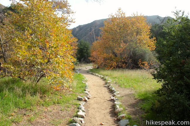
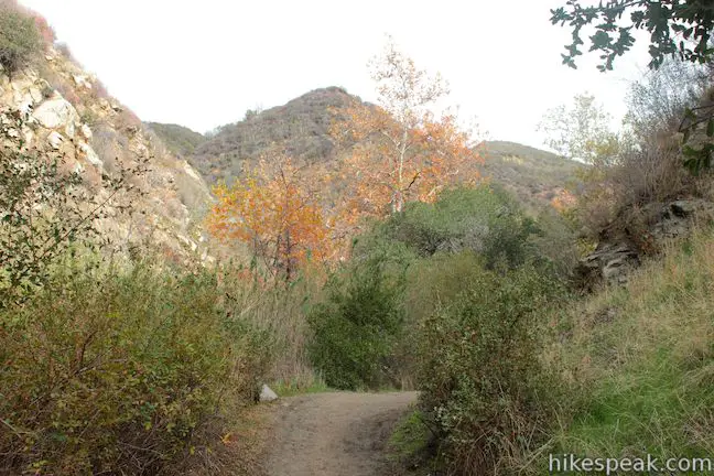
The main trail in Placerita Canyon, the causally named Canyon Trail, offers an easy 4-mile round trip hike with 300 feet of elevation change. The sycamore-lined stroll takes you to Walker Ranch, a group campground at the ruins of an old ranch. You can continue another 2/3 of a mile up Waterfall Trail into Los Pinetos Canyon where, if you time it right, you can see an elusive waterfall. It is 5 1/3 miles round trip to Los Pinetos Waterfall with 560 feet of elevation change.
- Los Pinetos Waterfall is one of the Los Angeles waterfall hikes.
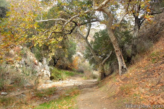
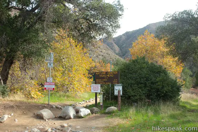
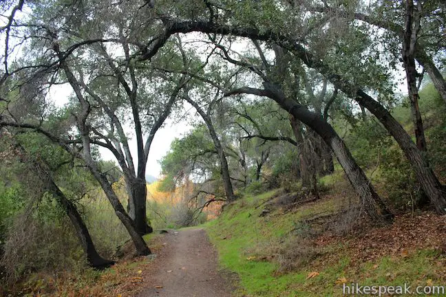
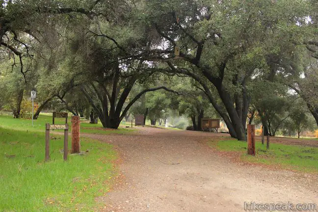
Outside the Nature Center in Placerita Canyon you will spot a large sign labeled “Main Trailhead,” pointing you in the direction of a half dozen park trails. Walk past the sign and across Placerita Creek to the start of Canyon Trail on the south bank. Turn left and begin hiking up this level path alongside the creek.
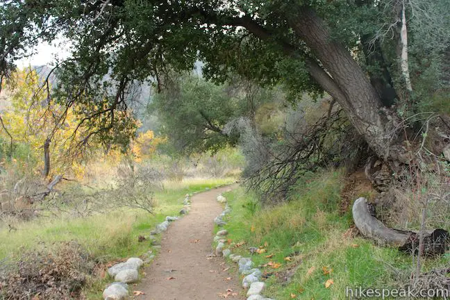
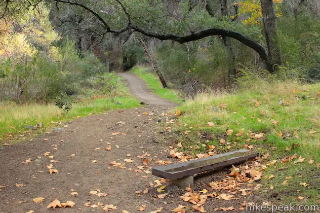
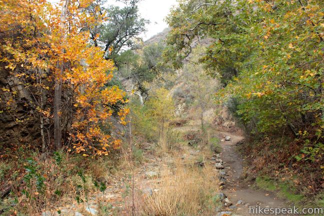
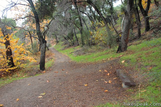
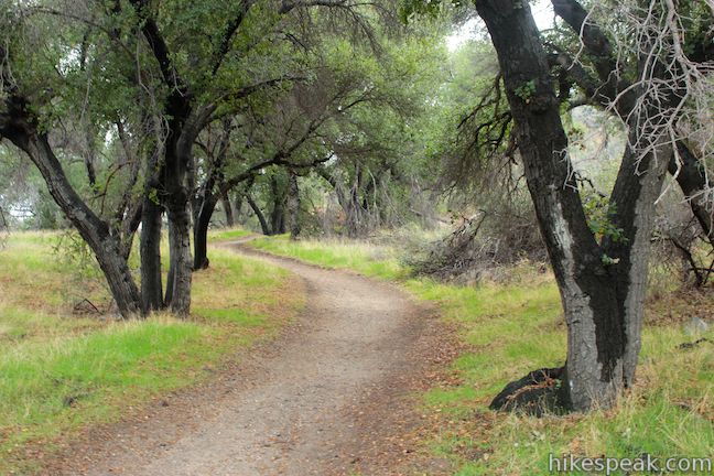
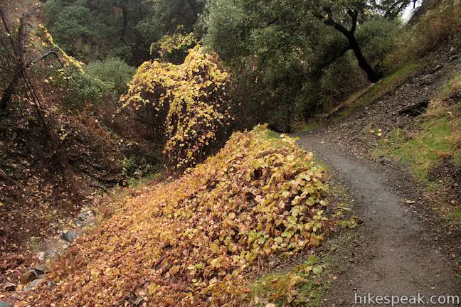
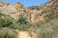
The trail primarily sticks with the south side of the creek, following the canyon east up a gradual grade to Walker Ranch. If you are in the mood to linger beneath the sycamores, three benches along Canyon Trail provide spots to stop and relax. Posts every half-mile let you know where you stand between Walker Ranch and the Nature Center.
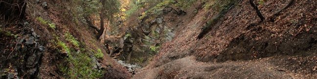
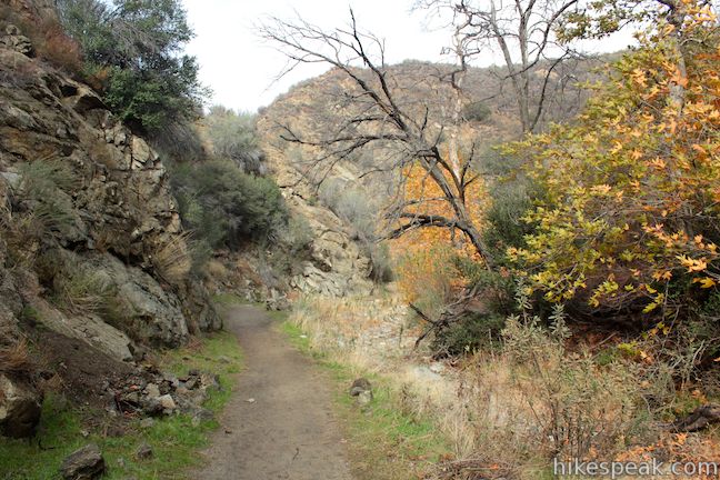
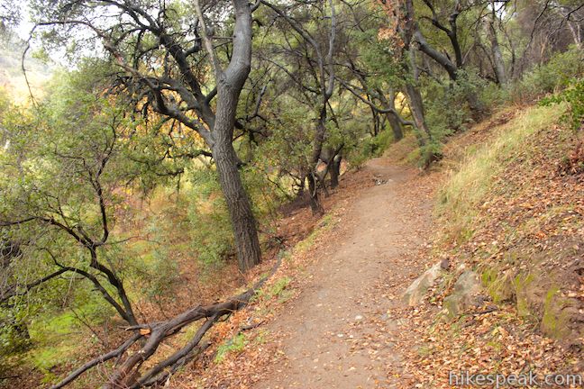
Three-quarters of a mile from the start, you will pass through a dramatic kink in the canyon where the canyon walls become steep and pinch together. The canyon widens again as you continue up the trail.
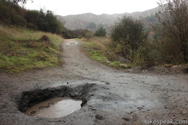
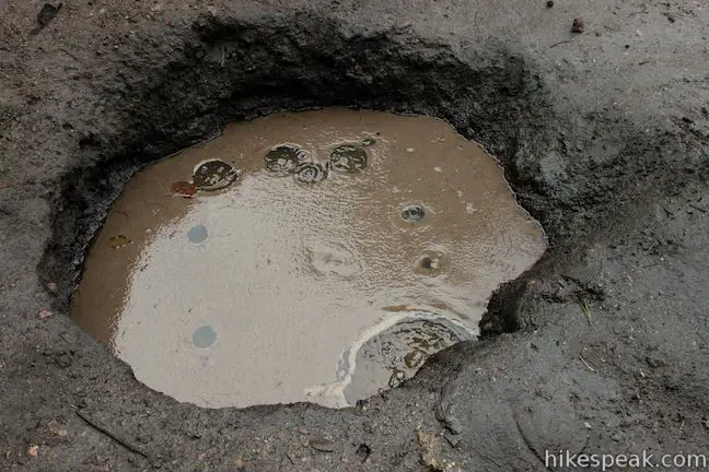
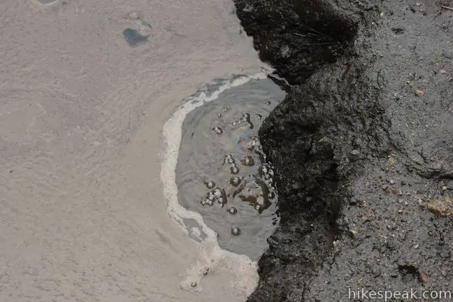
Just after the 1.5-mile marker, you will pass a small pool on the right side of the trail. This is a miniature oil seep where “white oil” naturally bubbles to the surface.
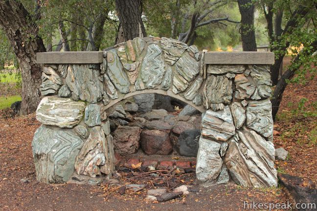
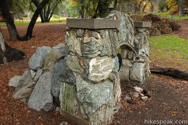
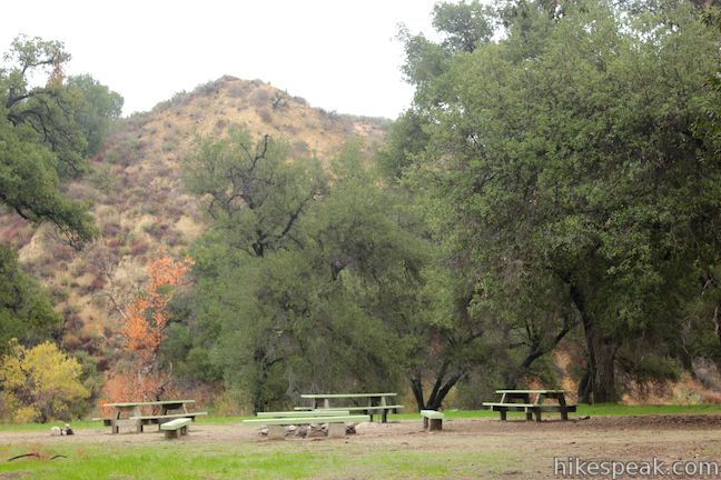
Canyon Trail slips through a grove of live oaks to arrive at Walk Ranch, which has been converted into a group campground. Passing picnic tables and fire rings, you will spot an impressive stone fireplace left over from one of the cottages built by Frank Walker and his family on this site a century ago.
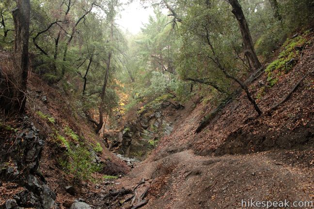
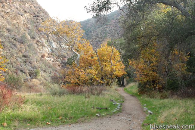
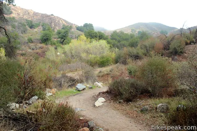
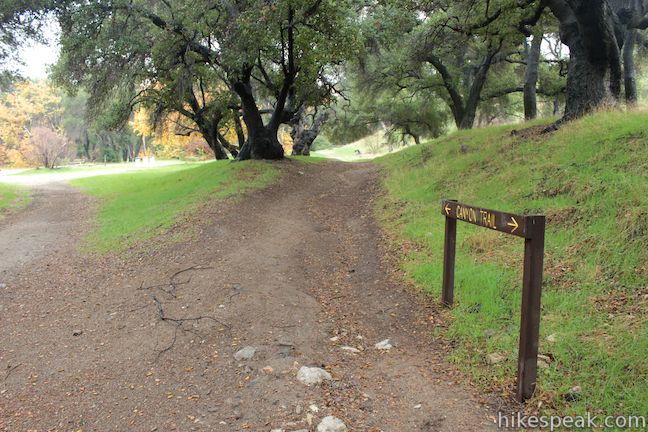
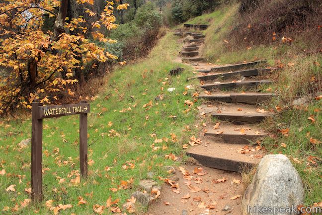
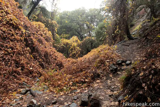
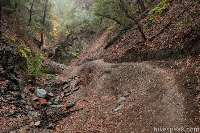
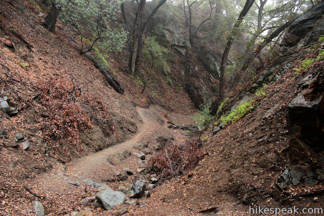
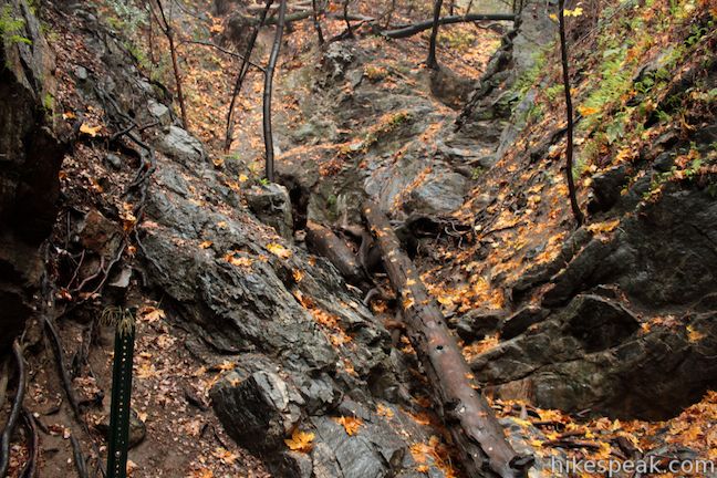
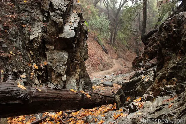
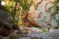
Right after you pass a junction with Los Pinetos Trail (not the route to Los Pinetos Waterfall), Canyon Trail will come to a junction with Waterfall Trail, two miles from the start. Turn right to reach the falls. The dirt single track heads across a field into a branch of Placerita Canyon called Los Pinetos Canyon. As the canyon walls draw together, a short flight of wooden steps that will take you into a narrow ravine.
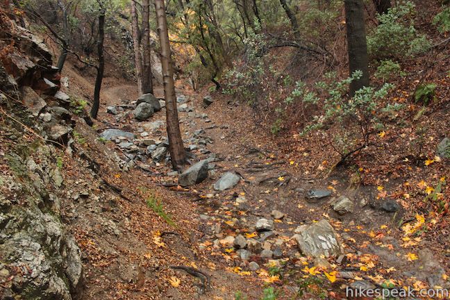
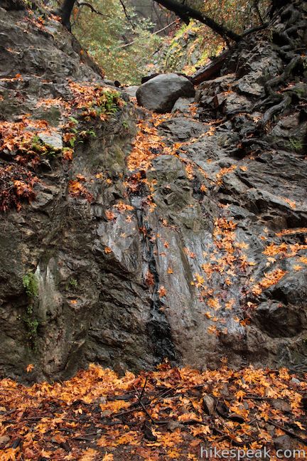
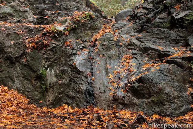
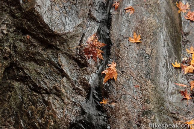
A half dozen creek crossings are below Los Pinetos Waterfall. If the creek is flowing, you should expect to get your feet wet. Most of the year, the canyon is dry and you will have no trouble progressing up Waterfall Trail. You might feel like an early gold-seeking adventurer as you push up the narrow sylvan canyon. About a tenth of a mile from the top, the canyon splits. Take the right fork continuing up the trail to Los Pinetos Waterfall. As the canyon curves to the left, you’ll see the canyon walls close around the top of the dirt trail. This is the end of Waterfall Trail. Climb up a few boulders to reach the waterfall.
Los Pinetos Waterfall is about 15 feet tall, tumbling down a smooth wall of dark metamorphic rock. The fleeting waterfall only truly gushes after a major rainfall, so you are encouraged to plan your trip after a strong spring storm. The waterfall (as shown) was practically invisible after a couple days of light winter rain. Even if you aren’t lucky enough to catch an appearance of Los Pinetos Waterfall, this is still a fun trek.
Return the way you came down Waterfall Trail and Canyon Trail. Placerita Canyon in the San Gabriel Mountains is a California State Park operated by Los Angeles County so Placerita Canyon Natural Area and Placerita Canyon State Park refer to the same area. The Placerita Canyon Nature Center is open Tuesday through Sunday from 9 a.m. to 5 p.m. Dogs are welcome on this hike and no fee or permit is required, so get out and enjoy!
Directions to the Trailhead
- Drive up the 5 Freeway to Newhall Pass and take exit 162 for Route 14.
- Drive 2.6 miles north on Route 14 and take exit 3 for Placerita Canyon Road.
- Turn right at the bottom of the ramp and drive 1.5 miles to the entrance of Placerita Canyon Natural Area, which will be on your right.
- Pull into the park and make your way to the trailhead next to the nature center.
Trailhead Location
Trailhead address: 19152 Placerita Canyon Road, Newhall, CA 91321
Trailhead coordinates: 34.377866, -118.467618 (34° 22′ 40.31″N 118° 28′ 03.42″W)
View San Gabriel Mountains in a larger map
Or view a regional map of surrounding Los Angeles trails and campgrounds.


 | Ecology Trail This 2/3 of a mile lollipop loop will introduce you to numerous local plants along with views of Placerita Canyon. |
 | Vasquez Rocks Natural Area Park This 3.4 to 5.9-mile loop offers a dose of desert hiking close to Los Angeles, exploring striking sandstone formations that are frequently used as movie backdrops. |
 | Fish Canyon Narrows This hike of ten miles or more explores an enchanting narrow canyon on the east side of the Angeles National Forest in the Sierra Pelona Mountains, a small mountain range north of Santa Clarita. |
 | Towsley View Loop Trail This 5.4-mile loop explores two canyons and scenic ridges in the Santa Susana Mountains, passing the narrows of Towsley Gorge in Towsley Canyon. |
 | Rocky Peak This 4.75-mile hike rises to a 2,715-foot summit in Rocky Peak Park within the Santa Susana Mountains between Chatsworth and Simi Valley. |
 | Trail Canyon Falls This 4-mile hike ascends a mountain-framed canyon to a 30-foot beauty on the east side of the San Gabriel Mountains. |
 | Hostetter Fire Road to Verdugo Peak This 7.5-mile round trip hike on the north side of the Verdugo Mountains ascends from La Tuna Canyon to the highest summit in the range. |
 | La Tuna Canyon Trail This 4.5-mile round trip hike ascends a ridge and a pair of canyons in La Tuna Canyon Park on the northwest side of the Verdugo Mountains. |
 | More trails in the Los Angeles Explore other destinations in the Santa Monica Mountains, San Gabriel Mountains, and elsewhere. |
- Placerita Canyon in Afoot & Afield Los Angeles County by Jerry Schad (opens in a new tab)
- Los Pinetos Waterfall via Canyon Trail & Waterfall Trail on sandiegoreader.com (also by Jerry Schad) (opens in a new tab)
- Los Pinetos Waterfall via Canyon Trail & Waterfall Trail on geekhiker.com (opens in a new tab)
- The official website for Placerita Canyon Park and Nature Center (opens in a new tab)
Common Questions about Los Pinetos Waterfall via Canyon Trail & Waterfall Trail in Placerita Canyon Natural Area
- Is the trail open?
- Yes. You should expect to find that Canyon Trail & Waterfall Trail to Los Pinetos Waterfall is open. There are no recent reports of trail closures. If you discover that the trail is closed, please help your fellow hikers by reporting a closure.
- Is this trail free to access?
- Yes, Canyon Trail & Waterfall Trail to Los Pinetos Waterfall is free to access. No entrance fee, pass, or permit is required. If you discover that access rules have changed, please provide feedback on your experience.
- How much time does this hike take?
- It takes approximately 2 hours 30 minutes to hike Canyon Trail & Waterfall Trail to Los Pinetos Waterfall. Individual hiking times vary. Add extra time for breaks and taking in the views.
- How long is this hike?
- The hike to Canyon Trail & Waterfall Trail to Los Pinetos Waterfall is a 5.33 mile out and back with 560 feet of elevation change.
- Are dogs allowed on this trail?
- Yes, dogs are allowed on Canyon Trail & Waterfall Trail to Los Pinetos Waterfall. The trail is open to hikers, dogs.
- Will I see a waterfall on this hike?
- Yes, Canyon Trail & Waterfall Trail to Los Pinetos Waterfall features a waterfall.
- Are there ruins on this trail?
- Yes, you can encounter ruins on Canyon Trail & Waterfall Trail to Los Pinetos Waterfall.
- What mountain range is this trail in?
- Canyon Trail & Waterfall Trail to Los Pinetos Waterfall is located in the San Gabriel Mountains.
- Where is the trailhead located?
- The trailhead for Canyon Trail & Waterfall Trail to Los Pinetos Waterfall is located in Newhall, CA.
Trailhead Address:
19152 Placerita Canyon Road
Newhall, CA 91321
Trailhead Coordinates:
34.377866, -118.467618 - What are the driving directions to the start of the hike?
To get to the trailhead: Drive up the 5 Freeway to Newhall Pass and take exit 162 for Route 14. Drive 2.6 miles north on Route 14 and take exit 3 for Placerita Canyon Road. Turn right at the bottom of the ramp and drive 1.5 miles to the entrance of Placerita Canyon Natural Area, which will be on your right. Pull into the park and make your way to the trailhead next to the nature center.
View custom Google Maps directions from your current location.
- Are there other trails near Canyon Trail & Waterfall Trail to Los Pinetos Waterfall?
- Yes, you can find other nearby hikes using the Hikespeak Hike Finder Map.

14 Comments on Los Pinetos Waterfall via Canyon Trail & Waterfall Trail in Placerita Canyon Natural Area
What hikers are saying:
✨ Generated summary of user commentsHikers appreciate this gentle, well-maintained path for its abundant shade and family-friendly atmosphere. The trail offers sightings of local wildlife like snakes and squirrels, though visitors should watch for bee swarms near the canyon area. Arturo recommends staying alert near the waterfall as the dry conditions can make it easy to miss, and caution is necessary on slippery mud if climbing above the falls to find the rope swing.
“The trail is well shaded and there's plenty of green to keep you interested.” Jump to comment ↓
Really sweet! Love it!!
A gentle and well maintained trail. Definitely a family trail, it’s great for kids. There is a lot of interesting things on the trail including a lot of wildlife.
am loooking for hikes with some history, anywhere special I could find some of these hikes?? Appreciate the info very much!!!
Have you hiked up to San Vicente Mountain? That’s a good one with a well presented history.
I just did this hike yesterday after seeing this post and really liked it. The “waterfall” at least had some water flowing since there was all that rain a week back. The photos on here must be from a little bit ago though cause now when you hike there, there were wooden railings around that oil seep. I saw about a 3 foot long snake only about 5 minutes into the hike stretched across the trail which was cool to see. A lot of squirrels, a few chipmunks, and some birds. At least no tarantulas like they had on some signs in the old camp ground.!! I don’t like spiders.! If you hike to the end and see this waterfall, you can climb up above it and keep going a bit and see another small waterfall and then a tire rope swing above that second waterfall. Just be careful hiking back down that first waterfall, my shoes became slippery with mud so went barefoot to get better grip.
Ran the trail to the waterfall today for a training run. Nice trail, not too much elevation gain and very dry. So dry that I think I ran past the waterfall about 20 yards because I didn’t notice it. The trail is well shaded and there’s plenty of green to keep you interested. The drought here is very visible but overall I loved the run, easy access and really very beautiful.
Hi there, I am looking for a hike near Santa Clarita that has a 3000 ft elevation, any ideas?
is it easy to get lost here? i want to show my friends nature
We took the canyon trail in hopes of branching off to the waterfall, but we ran into hikers coming from the waterfall trail who warned us of a swarm of bees along the trail. We ended up turning around at the picnic area at the end of the Canyon Trail. Nice, easy hike with lots of shade for this hot weather!
Just went there today, the Waterfall trail got washed out due to all the rain!! County official in the Nature Center said the damage was pretty extensive – a retaining wall on the trail got wiped out – and he wasn’t sure when the trail would reopen. So just a heads up if you plan to visit!! (Sidenote: you want a glute burner, check out the Manzanita Mt. Trail and the Firebreak Ridge Trail)
Went to check out the Canyon Trail to the waterfall, still closed.
Still closed as of June 7, 2018.
Still closed as of October 2018
Still closed as of January 2019.