Ecology Trail
in Placerita Canyon Natural Area
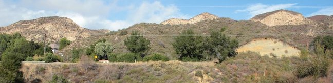
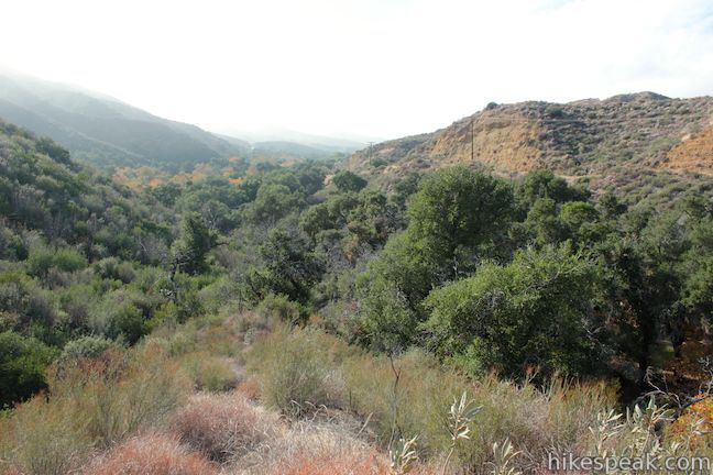
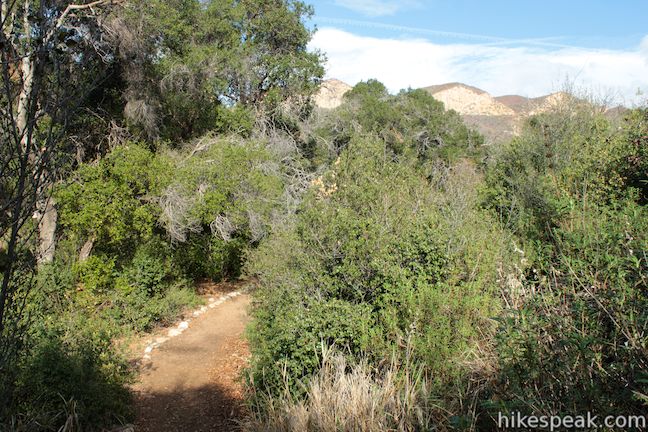
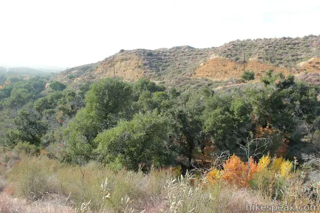
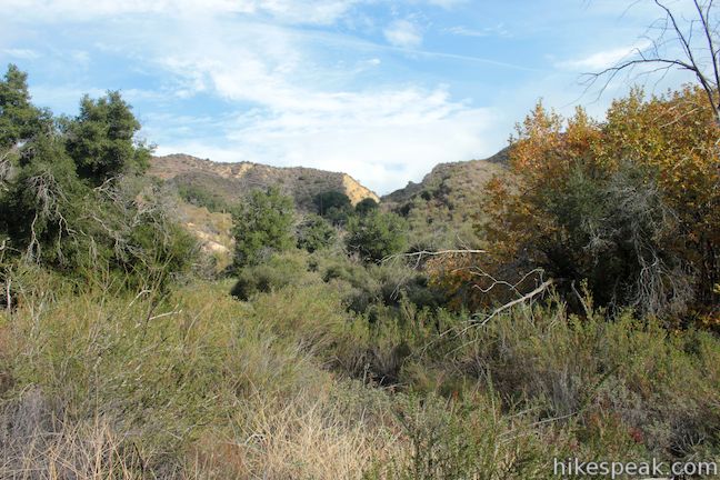
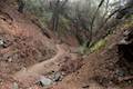
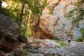
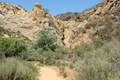
Placerita Canyon Natural Area is an interesting park on the west end of the San Gabriel Mountains near Newhall Pass. Gold was discovered in Placerita Canyon in 1842, and a century later the canyon rushed onto the silver screen as a backdrop for westerns. Today, the park is home to the Placerita Canyon Nature Center where you can learn about local plants and animals. Tucked behind the nature center, you’ll find the Ecology Trail, a 2/3 of a mile lollipop loop offering an outdoor course on local vegetation. There is just 100 feet of easy elevation change along the loop as you explore oak woodland, chaparral, and riparian plant communities. Sightseeing is included with botany lesson, as the top of the loop delivers a nice view over Placerita Canyon.
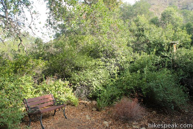
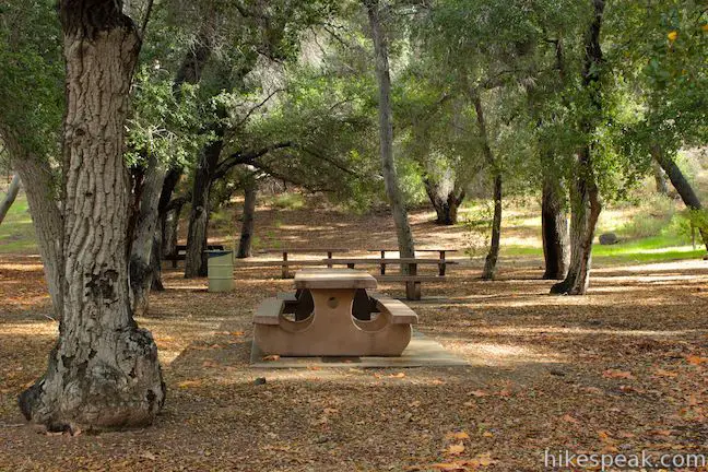
Walk through the Placerita Canyon Nature Center, taking a moment to look at the caged red-tailed hawk and check out the exhibits on other plants and animals. You’ll find the start of the Ecology Trail out the backdoor of the Nature Center.
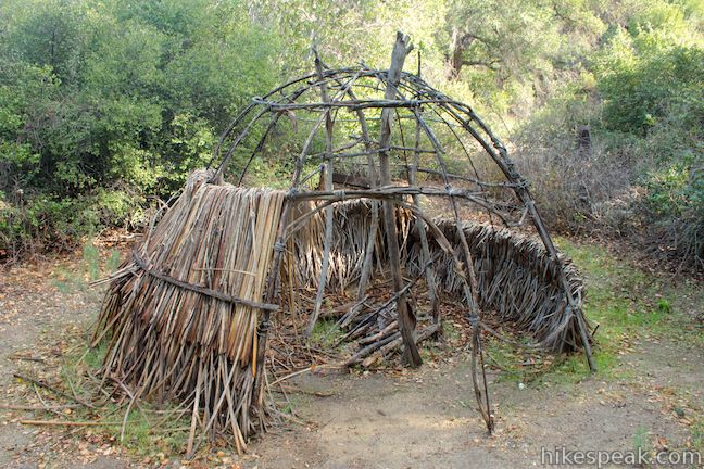
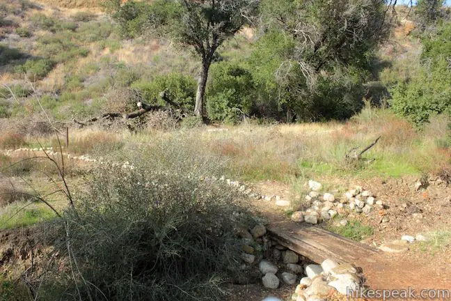
Make a right at an immediate junction to continue northeast up the dirt trail. You’ll pass a model of a Native American hut before coming to the start of the loop. Bear right to hike Ecology Trail in a counterclockwise direction. All junctions will be well marked.
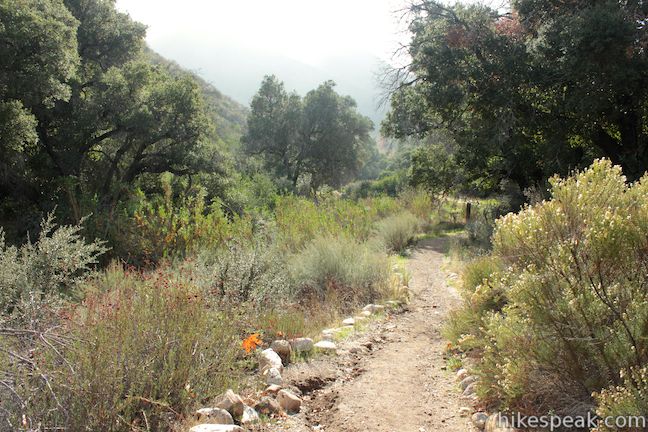
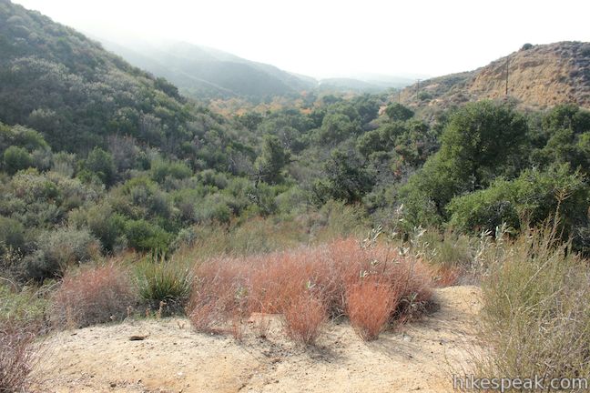
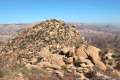
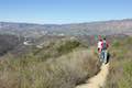
As you take this casual stroll, you won’t be left to guess what kinds of plants you are walking past because everything is identified along the trail. The loop passes scrub oaks, yerba santa, giant wild rye, and mule fat (just to name a few). After a gradual switching climb, reach a landing on a ridge with a broad view southwest down Placerita Canyon. Enjoy the perch before completing the loop and returning to the nature center.
If you are looking for a longer hike, Placerita Canyon Natural Area also boasts a 5.33-mile round trip hike to Los Pinotes Waterfall. The Placerita Canyon Nature Center is open Tuesday through Sunday from 9 a.m. to 5 p.m. Dogs are welcome on this hike and no fee or permit required, so get out and enjoy!
Directions to the Trailhead
- Drive up the 5 Freeway to Newhall Pass and take exit 162 for Route 14.
- Drive 2.6 miles north on Route 14 and take exit 3 for Placerita Canyon Road.
- Turn right at the bottom of the ramp and drive 1.5 miles to the entrance of Placerita Canyon Natural Area, which will be on your right.
- Pull into the park and make your way to the nature center.
Trailhead Location
Trailhead address: 19152 Placerita Canyon Road, Newhall, CA 91321
Trailhead coordinates: 34.377866, -118.540882 (34° 22′ 41.70″N 118° 28′ 01.71″W)
View San Gabriel Mountains in a larger map
Or view a regional map of surrounding Los Angeles trails and campgrounds.


 | Los Pinetos Waterfall This 5.33-mile round trip hike in Placerita Canyon Natural Area follows Canyon Trail to the ruins of Walker Ranch and Waterfall Trail to an elusive falls in a sylvan canyon. |
 | Vasquez Rocks Natural Area Park This 3.4 to 5.9-mile loop offers a dose of desert hiking close to Los Angeles, exploring striking sandstone formations that are frequently used as movie backdrops. |
 | Fish Canyon Narrows This hike of ten miles or more explores an enchanting narrow canyon on the east side of the Angeles National Forest in the Sierra Pelona Mountains, a small mountain range north of Santa Clarita. |
 | Towsley View Loop Trail This 5.4-mile loop explores two canyons and scenic ridges in the Santa Susana Mountains, passing the narrows of Towsley Gorge in Towsley Canyon. |
 | Rocky Peak This 4.75-mile hike rises to a 2,715-foot summit in Rocky Peak Park within the Santa Susana Mountains between Chatsworth and Simi Valley. |
 | Trail Canyon Falls This 4-mile hike ascends a mountain-framed canyon to a 30-foot beauty on the east side of the San Gabriel Mountains. |
 | Hostetter Fire Road to Verdugo Peak This 7.5-mile round trip hike on the north side of the Verdugo Mountains ascends from La Tuna Canyon to the highest summit in the range. |
 | La Tuna Canyon Trail This 4.5-mile round trip hike ascends a ridge and a pair of canyons in La Tuna Canyon Park on the northwest side of the Verdugo Mountains. |
 | More trails in the Los Angeles Explore other destinations in the Santa Monica Mountains, San Gabriel Mountains, and elsewhere. |
Common Questions about Ecology Trail in Placerita Canyon Natural Area
- Is the trail open?
- Yes. You should expect to find that Placerita Canyon Ecology Trail is open. There are no recent reports of trail closures. If you discover that the trail is closed, please help your fellow hikers by reporting a closure.
- Is this trail free to access?
- Yes, Placerita Canyon Ecology Trail is free to access. No entrance fee, pass, or permit is required. If you discover that access rules have changed, please provide feedback on your experience.
- How much time does this hike take?
- It takes approximately 15 minutes to hike Placerita Canyon Ecology Trail. Individual hiking times vary. Add extra time for breaks and taking in the views.
- How long is this hike?
- The hike to Placerita Canyon Ecology Trail is a 0.65 mile lollipop loop with 100 feet of elevation change.
- Are dogs allowed on this trail?
- Yes, dogs are allowed on Placerita Canyon Ecology Trail. The trail is open to hikers, dogs.
- Is Placerita Canyon Ecology Trail good for kids?
- Yes, this hike is likely suitable for children. It is relatively short (0.65 miles) with manageable elevation gain.
- What mountain range is this trail in?
- Placerita Canyon Ecology Trail is located in the San Gabriel Mountains.
- Where is the trailhead located?
- The trailhead for Placerita Canyon Ecology Trail is located in Newhall, CA.
Trailhead Address:
19152 Placerita Canyon Road
Newhall, CA 91321
Trailhead Coordinates:
34.377866, -118.467675 - What are the driving directions to the start of the hike?
To get to the trailhead: Drive up the 5 Freeway to Newhall Pass and take exit 162 for Route 14. Drive 2.6 miles north on Route 14 and take exit 3 for Placerita Canyon Road. Turn right at the bottom of the ramp and drive 1.5 miles to the entrance of Placerita Canyon Natural Area, which will be on your right. Pull into the park and make your way to the nature center.
View custom Google Maps directions from your current location.
- Are there other trails near Placerita Canyon Ecology Trail?
- Yes, you can find other nearby hikes using the Hikespeak Hike Finder Map.

Hi Seth – minor note: that is a model of a Tataviam tribe hut, not Chumash. The Tataviam were inland people, Chumash primarily coastal.
Corrected. Thanks!