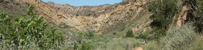
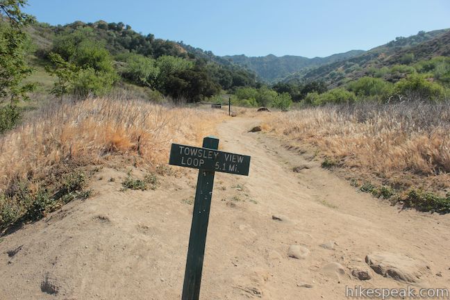
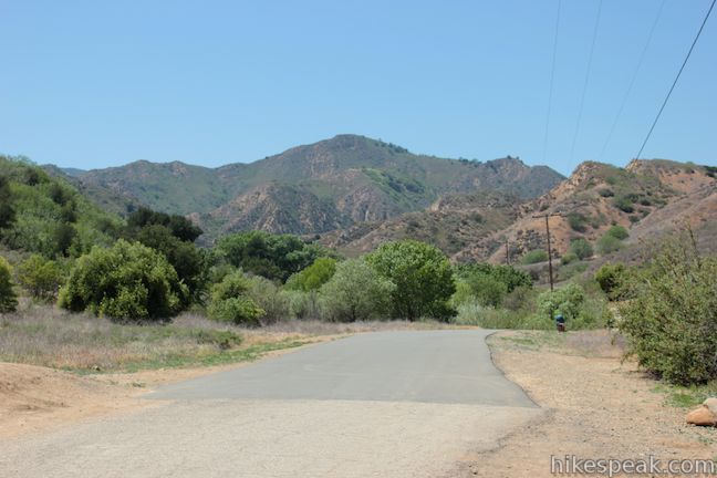
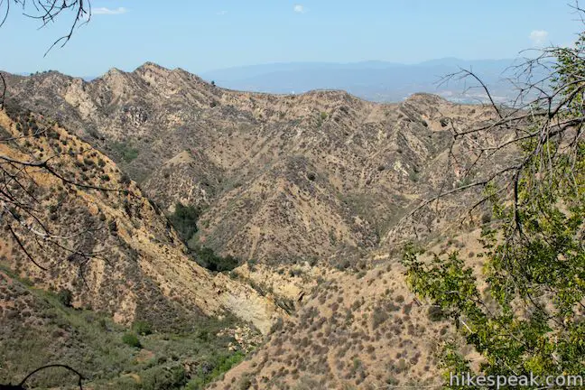
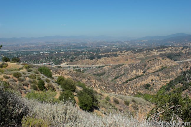
Ed Davis Park in Towsley Canyon is an impressive segment of Santa Clarita Woodlands Park, located on the north side of the Santa Susana Mountains at the north end of Los Angeles County. The trailhead is located just off the 5 Freeway north of the San Fernando Valley, not far from Six Flags Magic Mountain. You don’t need a ticket for an adventure in this park, which has its share of natural attractions, like the narrows of Towsley Gorge and seeps of oil and liquid asphalt that pool along the trail. Towsley View Loop Trail delivers a scenic hike up two canyons and across the ridges in between, passing pleasant oak groves and panoramic views. The 5.4-mile loop has 1,075 feet of elevation gain. If you are looking for something shorter, the park also boasts Canyon View Loop Trail, which is just 1.9 miles long.
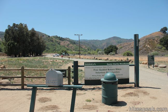
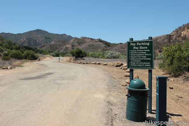
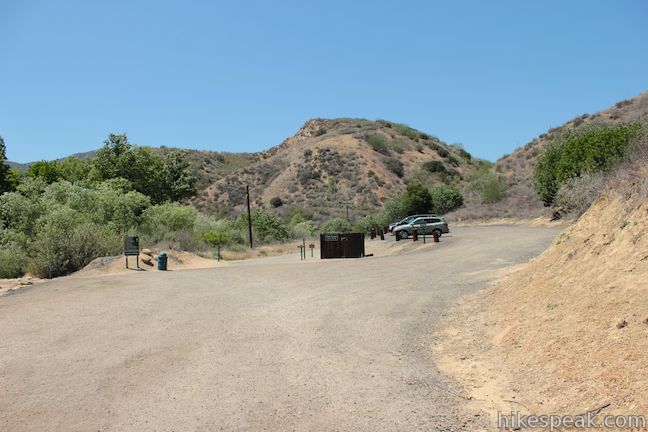
Ed Davis Park in Towsley Canyon has free parking and pay parking. The pay lots largely serve as overflow parking when the free lots fill, so if you are hiking on a busy weekend, try to arrive early. The first free lot is right along The Old Road at the bottom of Towsley Canyon Road. Drive a tenth of a mile up Towsley Canyon Road to a larger free lot. This is the ideal parking area, and there is pay parking another tenth of a mile up Towsley Canyon Road.
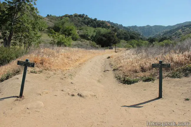
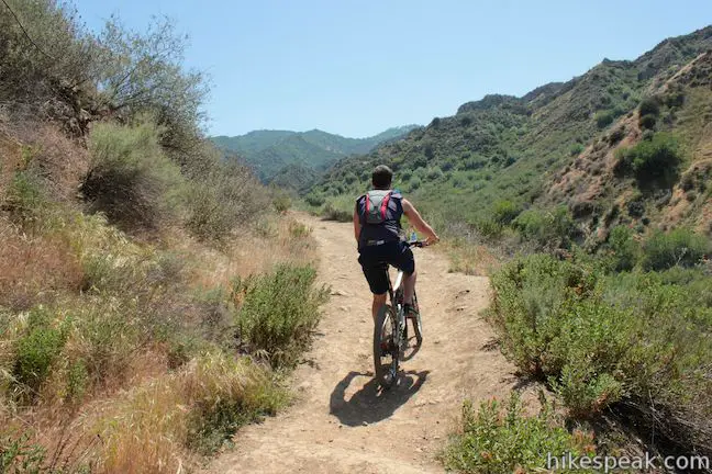
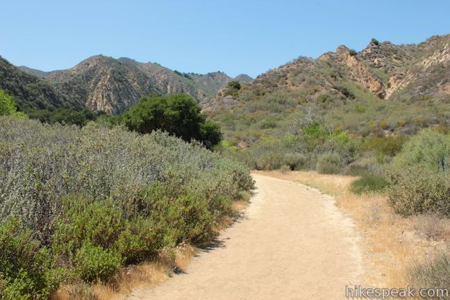
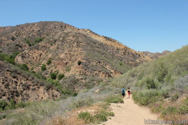
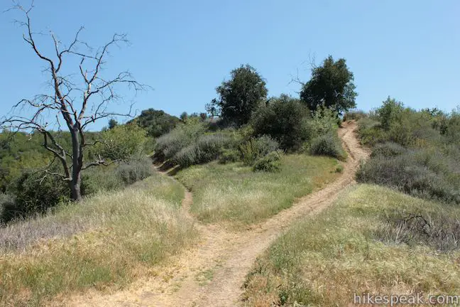
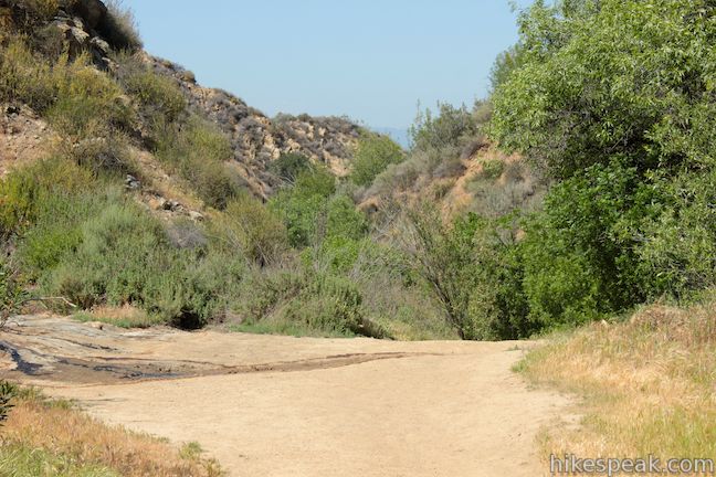
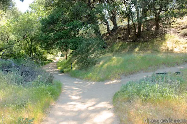
Begin hiking up Towsley Canyon Road. Just before you reach the pay lot, you will come to the trailhead marking the start of the loop, on the left (south) side of Towsley Canyon Road. There are two trail posts framing the start of a dirt trail that read Towsley View Loop and Canyon View Loop. The trails are open to hikers and mountain bikers in both directions. You can either take Towsley View Loop clockwise and have a steep climb at the start followed by a gradual descent, or hike the loop in a counterclockwise direction and enjoy a tapered ascent followed by a steeper descent.
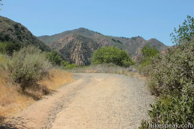
For the more gradual ascent, hiking the loop in a counterclockwise direction, continue up Towsley Canyon Road, following the directions for the picnic area, lodge, and ranger station. Walk along the road for 0.45 miles to reach one last parking lot at the end of the paved road. Proceed straight up the gravel road past the ranger station and the lodge, cloaked by trees on the left.
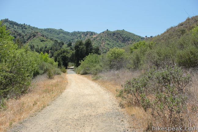
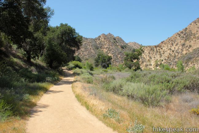
After another third of a mile, stay to the left on the wide road past a path that breaks off to the right. There are a few spurs along Towsley View Loop Trail, but you will always stick to the most worn track.
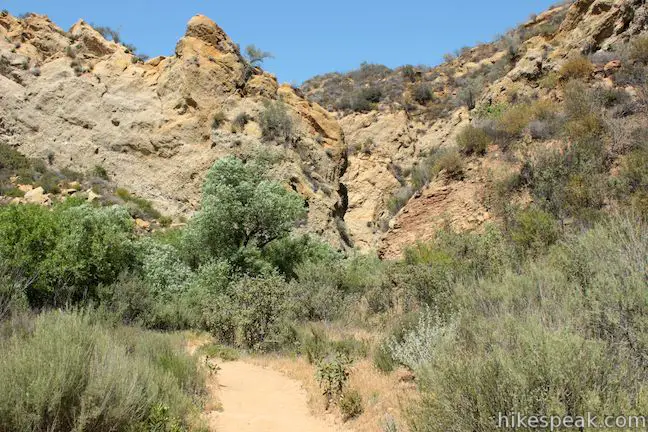
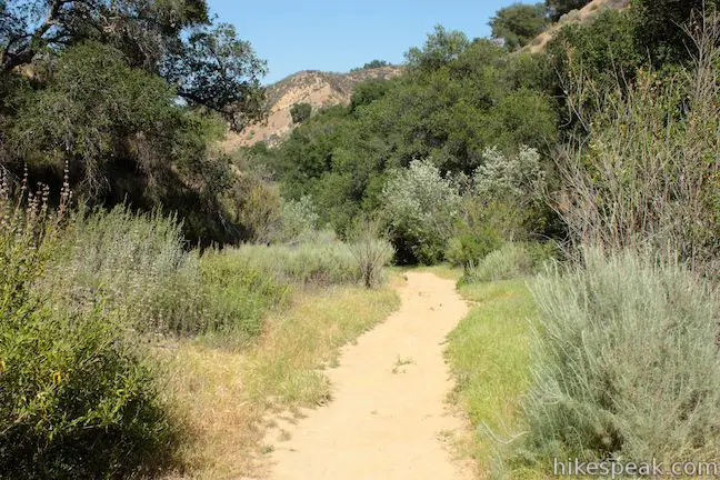
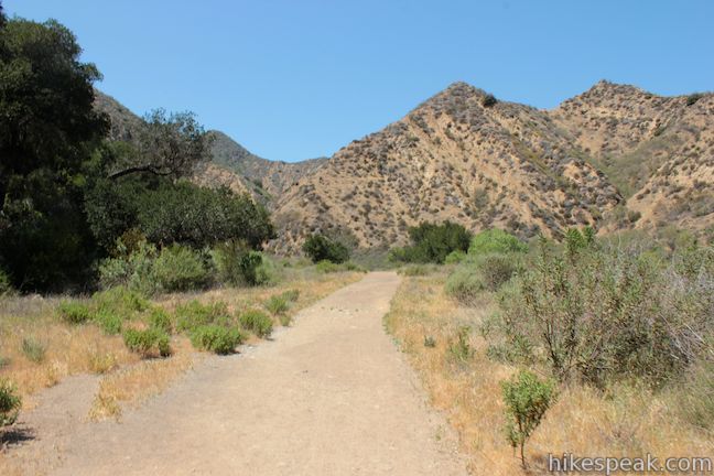
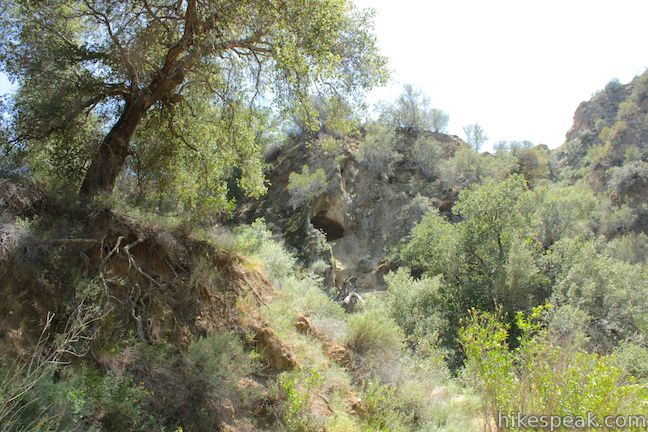
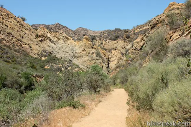
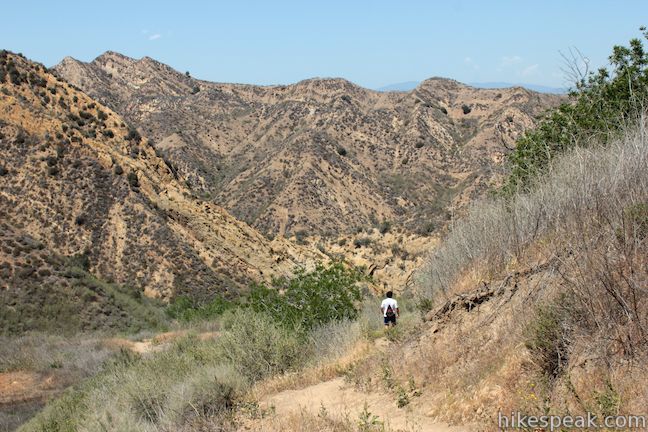
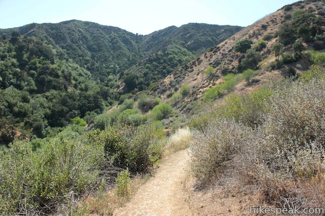
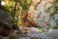
As you hike through patches of shade, the canyon walls gradually become steeper and closer together until you are standing at the bottom of a V-shaped canyon with 200-foot walls on both sides. Things get even tighter as the walls angle into near vertical cliffs. These are the narrows of Towsley Gorge, reached 0.9 miles from the end of the pavement and 1.45 miles from the start.
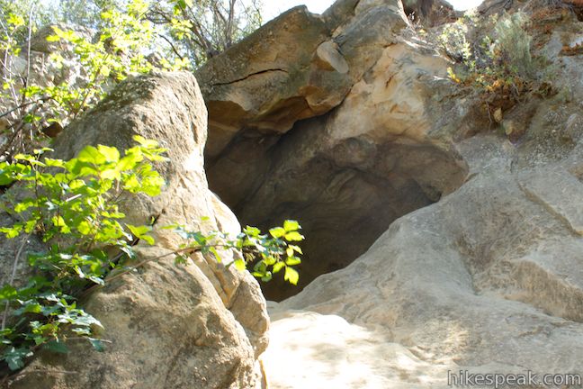
When the canyon bends to the left, look out for a path on the left up to a cave formed on the wall of the narrows. Rock climbers can definitely have some fun exploring this area.
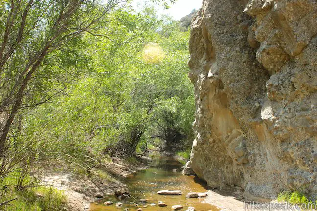
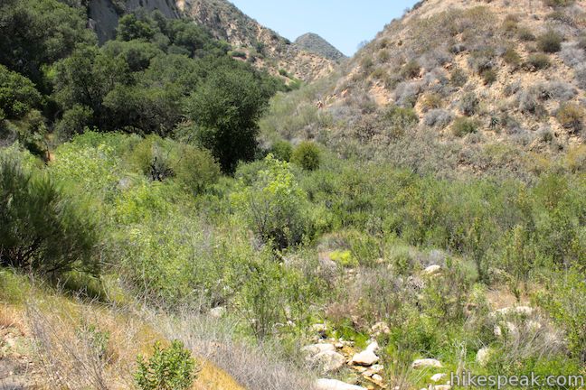
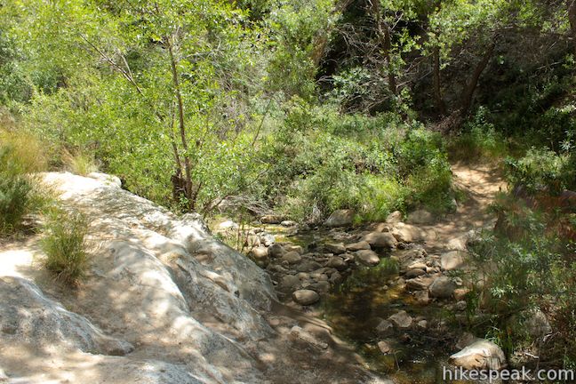
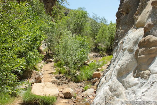
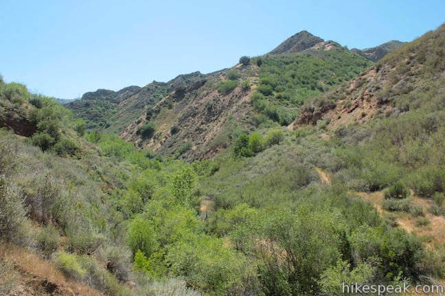
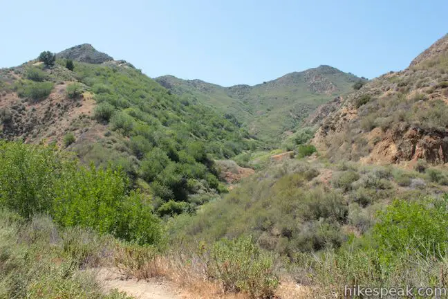
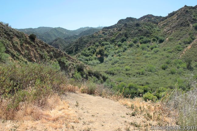
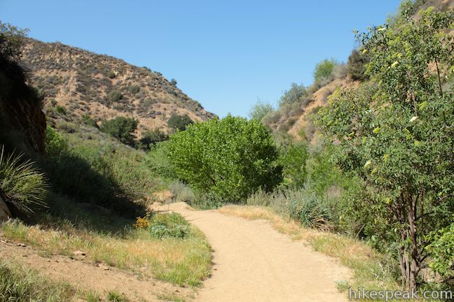
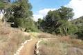
Rock hop across Towsley Creek a couple times to make your way through the narrows. After about 0.2 miles, the narrows suddenly widen to reveal a large backcountry stretch of Towsley Canyon. Follow the dirt single track up the left (east) side of the sage-covered canyon. There will be a trail post directing you this way, leading you away from a path that breaks off up the right side of the creek. While you have already gained 225 feet of elevation over the first 1.65 miles, this is the true start of the steady ascent.
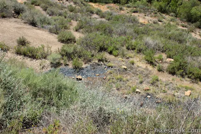
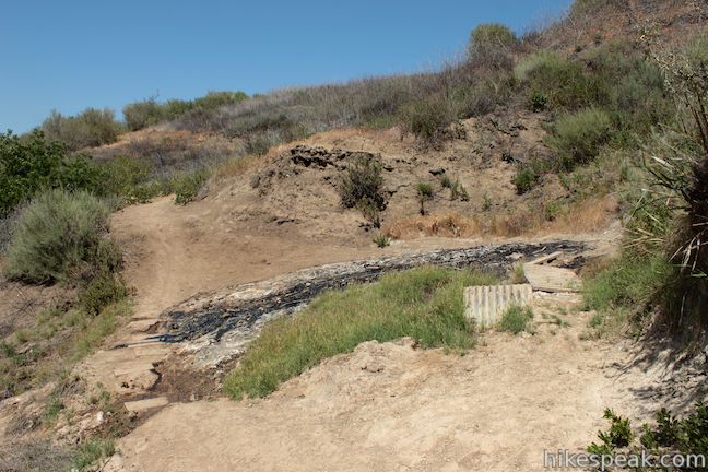
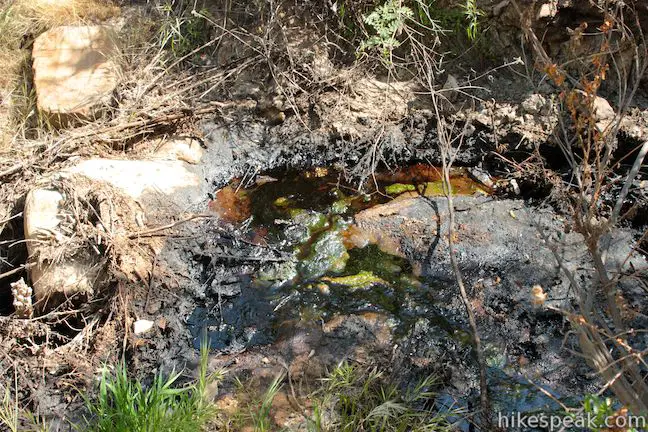
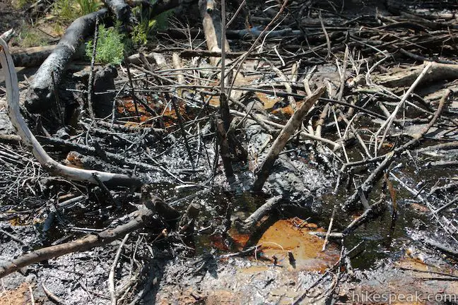
Towsley View Loop Trail leaves the creek and angles out of the bottom of the canyon, passing a few pools of oil and liquid asphalt that seep out from the wall of the canyon. Towsley Canyon was used by Chevron for oil production for over a century before the land was transferred to the public to become a park. Look down off the right side of the trail to spot dark glossy pools of oil that remind hikers of the area’s active drilling history as well as its robust seismic activity.
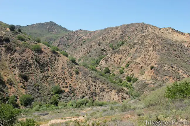
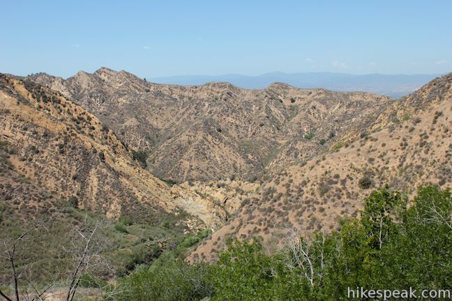
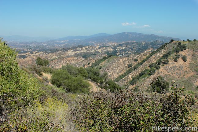
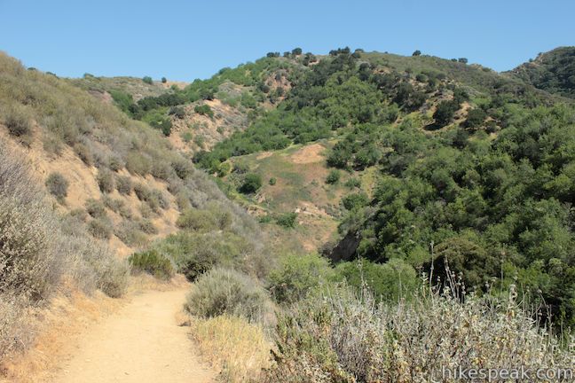
A quarter mile past the exit of the narrows, reach a horseshoe bend to the left. This marks the start of the switchbacks, but before you launch into the climb, walk straight for a few paces to an overlook. Spot more dark seeps below and gain a clear view up the green and wild Towsley Canyon to the south.
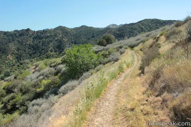
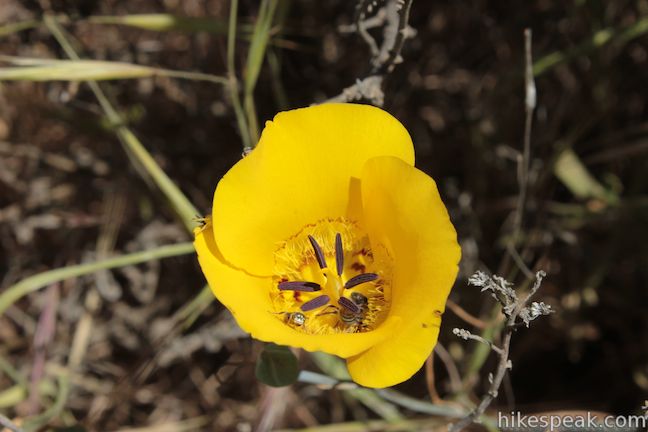
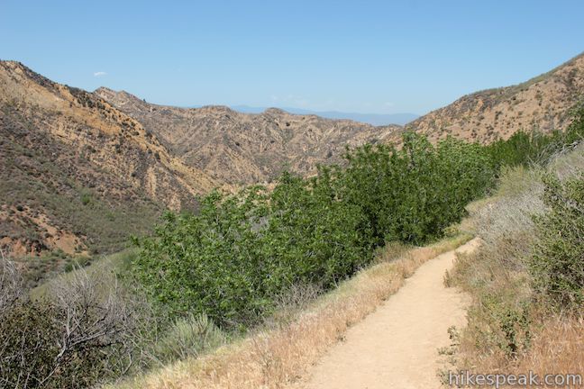
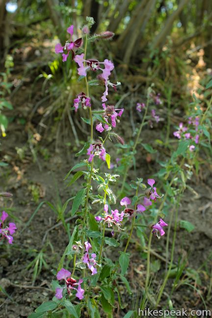
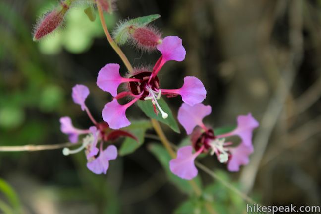
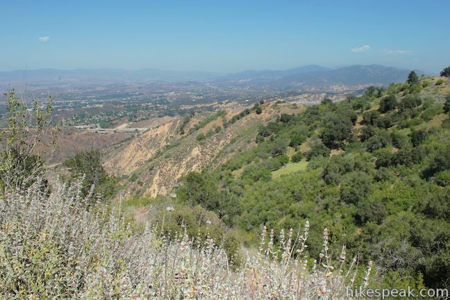
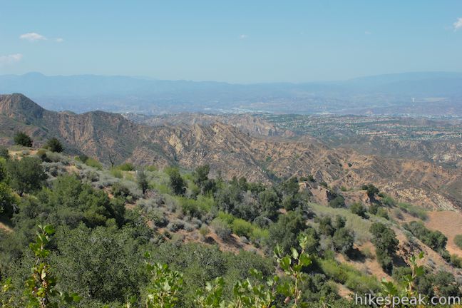
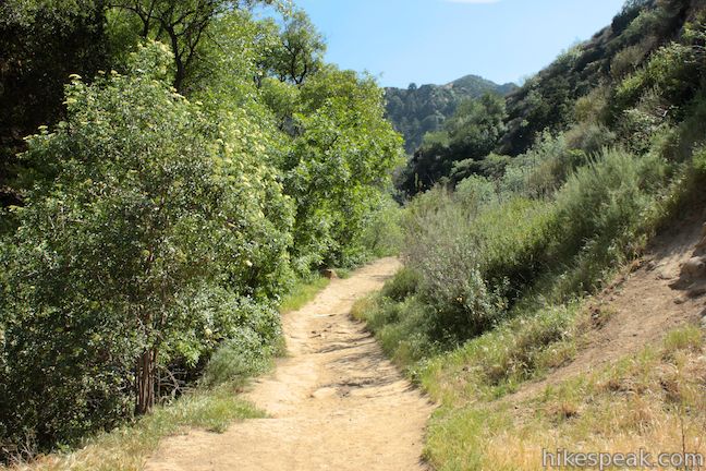
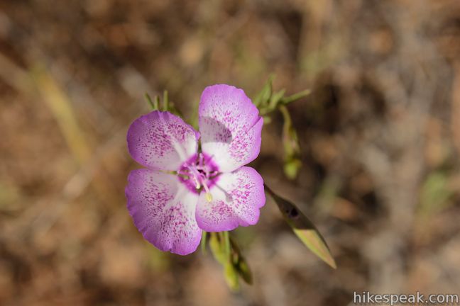
Starting up the switchbacks, you will quickly ascend to views north back toward the narrows, framed by pocketed rock walls of orange sandstone. The views over Towsley Canyon expand as you tackle 2/3 of a mile of long switchbacks, gaining 400 feet. California walnut trees flourish along the trail to provide patches of shade. You may catch a whiff of sulfur as you approach the top of the switchbacks, another sign that Towsley Canyon is active below the surface. In the spring, wildflowers like clarkia bloom along the trail, but the grasses brown in the fall.

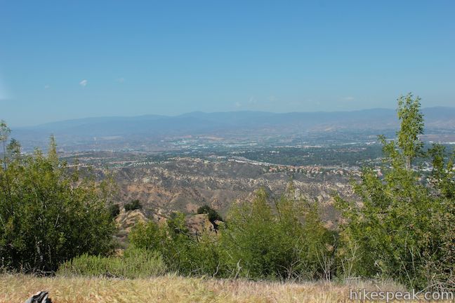
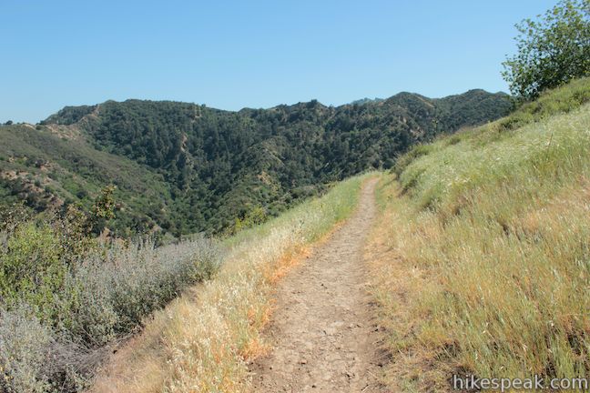
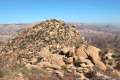
When you reach the ridge above Towsley Canyon, the single track tapers to a gradual ascent. At 2.9 miles from the start you will pass a fallen tree on the left that is a great makeshift bench. Rest your legs and enjoy lofty views over the Santa Clarita Valley to the northeast.
Just past the fallen tree, the trail splits, but only for a couple hundred feet. The track to the left presents more views over the Santa Clarita Valley and looks southeast toward Newhall Pass, while the right split ascends a bump on the ridge, passing a short bench just before the trails come back together.
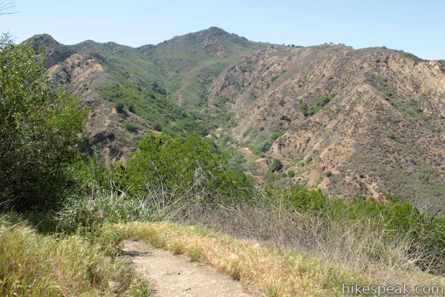
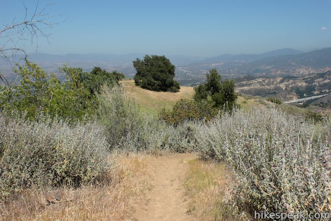
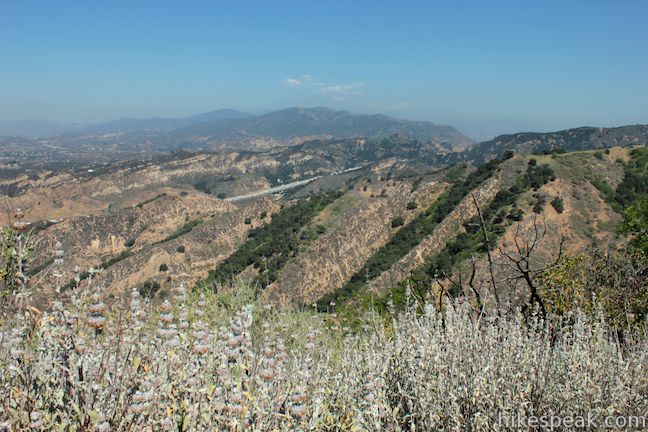
Towsley View Loop Trail continues across the rippling ridges between Towsley Canyon and Wiley Canyon. Live oaks and other trees offer occasional windows across the Santa Clarita Valley toward the San Gabriel Mountains. When you reach another split in the trail, at 0.3 miles from the fallen tree, bear right. This will present you with a nice view over Wiley Canyon to the south before the trails come back together. This is the high point of the hike, at 2,450 feet, and it’s all downhill from here.
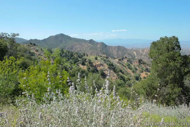
Towsley View Loop Trail passes to the left of a couple grand oaks on a grassy bump on the ridge (that look like inviting places to picnic). The gradually descending trail makes a large U-shaped bend around the end of the ridge, offering panoramic views. Look over the rugged Towsley Canyon to the north, get a sweep of Santa Clarita Valley to the east, and end with views into the oak-covered Wiley Canyon to the south.
Make your way toward Wiley Canyon. After a horseshoe bend to the left, the trail makes a steep descent, temporarily splitting to explore a few angles down the dusty mountainside.
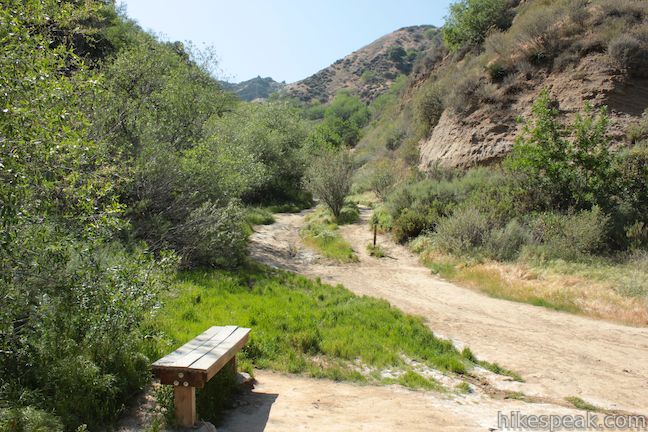
The descent becomes more moderate as you get to the back of Wiley Canyon, 4.05 miles from the start. A U-turn sends you down a second steeper section, dropping about 175 feet in 0.15 miles to the canyon bottom. A bench here offers a break for those in need. The trail angles to the left down the canyon past more oil seeps, including some in the creek that flows down the canyon. The water looks chocked by oil, but the surrounding plants seem to tolerate it, and tall oaks quickly appear to shade the trail.
After hiking 3/4 of a mile down the canyon from the bench, come to a trail junction. Canyon View Loop Trail sets off to the left while Towsley View Trail proceeds to the right, gradually descending another 0.35 miles to Towsley Canyon Road. When you reach the road, turn right to return to the free parking lot.
Canyon View Loop Trail, which offers a shorter loop in the park (1.9 miles), skirts the ridges between Wiley Canyon and Towsley Canyon. The trail ends near the parking lot at the end of Towsley Canyon Road, alongside Towsley Lodge, an old ranch house that is available for day and overnight rentals.
There is a $7 fee to park a vehicle in the two pay lots (price as of 2013) but you should be able to visit Ed Davis Park in Towsley Canyon for free. The park is open from sunrise to sunset. No permit is required to hike Towsley View Trail and dogs and mountain bikes are welcome, so get our and enjoy!
Directions to the Trailhead
- Take the 5 Freeway to exit 166 for Calgrove Boulevard (located 7 miles north of the merger of the 5 and 405 Freeways.
- At the end of the off-ramp, turn southwest on Calgrove Boulevard, which immediately becomes The Old Road.
- A quarter mile from the freeway, turn left up Towsley Canyon Road, where there are signs and a mailbox for the park.
- Drive a tenth of a mile up Towsley Canyon Road to the parking area on the right.
- The lot is labeled by a sign that reads, Rivendale Ranch at Towsley Canyon and the free parking is provided by the City of Santa Clarita.
Trailhead Location
Trailhead address: 24255 The Old Road, Newhall, CA 91381
Trailhead coordinates: 34.35766, -118.55698 (34° 21′ 27.57″N 118° 33′ 25.12″W)
View Towsley View Loop Trail in a larger map
Or view a regional map of surrounding Los Angeles trails and campgrounds.


 | Fish Canyon Narrows This hike of ten miles or more explores an enchanting narrow canyon on the east side of the Angeles National Forest in the Sierra Pelona Mountains, a small mountain range north of Santa Clarita. |
 | Vasquez Rocks Natural Area Park This 3.4 to 5.9-mile loop offers a dose of desert hiking close to Los Angeles, exploring striking sandstone formations that are frequently used as movie backdrops. |
 | Los Pinetos Waterfall This 5.33-mile round trip hike in Placerita Canyon Natural Area follows Canyon Trail to the ruins of Walker Ranch and Waterfall Trail to an elusive falls in a sylvan canyon. |
 | Ecology Trail This 2/3 of a mile lollipop loop will introduce you to numerous local plants along with views of Placerita Canyon. |
 | Rocky Peak This 4.75-mile hike rises to a 2,715-foot summit in Rocky Peak Park within the Santa Susana Mountains between Chatsworth and Simi Valley. |
 | More trails in Los Angeles Explore other hiking destinations around Los Angeles. |
- Towsley View Loop Trail in Afoot & Afield Los Angeles by Jerry Schad (opens in a new tab)
- Towsley View Loop Trail on scvhiker.blogspot.com (opens in a new tab)
- Towsley View Loop Trail on calihike.blogspot.com (opens in a new tab)
- The official trail map for Ed Davis Park in Towsley Canyon (opens in a new tab)
- The official MRCA webpage for Ed Davis Park in Towsley Canyon (opens in a new tab)
Common Questions about Towsley View Loop Trail in Ed Davis Park in Towsley Canyon
- Is the trail open?
- Yes. You should expect to find that Towsely View Loop Trail is open. There are no recent reports of trail closures. If you discover that the trail is closed, please help your fellow hikers by reporting a closure.
- Is this trail free to access?
- Yes, Towsely View Loop Trail is free to access. No entrance fee, pass, or permit is required. If you discover that access rules have changed, please provide feedback on your experience.
- How much time does this hike take?
- It takes approximately 3 hours to hike Towsely View Loop Trail. Individual hiking times vary. Add extra time for breaks and taking in the views.
- How long is this hike?
- The hike to Towsely View Loop Trail is a 5.4 mile loop with 1075 feet of elevation change.
- Are dogs allowed on this trail?
- Yes, dogs are allowed on Towsely View Loop Trail. The trail is open to hikers, dogs, bikes.
- What mountain range is this trail in?
- Towsely View Loop Trail is located in the Santa Susana Mountains.
- Where is the trailhead located?
- The trailhead for Towsely View Loop Trail is located in Newhall, CA.
Trailhead Address:
24255 The Old Road
Newhall, CA 91381
Trailhead Coordinates:
34.35766, -118.55698 - What are the driving directions to the start of the hike?
To get to the trailhead: Take the 5 Freeway to exit 166 for Calgrove Boulevard (located 7 miles north of the merger of the 5 and 405 Freeways. At the end of the off-ramp, turn southwest on Calgrove Boulevard, which immediately becomes The Old Road. A quarter mile from the freeway, turn left up Towsley Canyon Road, where there are signs and a mailbox for the park. Drive a tenth of a mile up Towsley Canyon Road to the parking area on the right. The lot is labeled by a sign that reads, Rivendale Ranch at Towsley Canyon and the free parking is provided by the City of Santa Clarita.
View custom Google Maps directions from your current location.
- Are there other trails near Towsely View Loop Trail?
- Yes, you can find other nearby hikes using the Hikespeak Hike Finder Map.

12 Comments on Towsley View Loop Trail in Ed Davis Park in Towsley Canyon
What hikers are saying:
✨ Generated summary of user commentsThis trail offers a rewarding workout with steady inclines that lead to stunning views of the canyons and city. While the switchbacks can feel endless, the presence of ancient fossils and scenic vistas makes the journey a favorite for many.
Is there a trail from Towsley Park to Oat Mtn in Chatsworth? or a trail in Towsley Park that takes you to the fire road that goes to Oat Mtn? thanks
Interesting idea, but I don’t think so.
Weldon Canyon trail will take you to the fire road that will pass Oat Mountain. East Canyon will also take you to the fire road and continues on to Granada Hills.
will Towsley Canyon Park be closed on Thanksgiving Day?
Great hike. I started in the late afternoon. I did the counterclockwise route and it was much easier on the legs. The Switchbacks can make you a little crazy cuz u dont know when it will end and reach the top, but be patient and enjoy the stunning views and u ascend higher and taking in the stunning views of the canyons and the city. Overall was reallt nice and a good workout. Did it in 2 hours.
I would look into the new elder trail at Towsley in the Rivendale space. I haven’t did it yet. Anyone done it?
Yes, many times on the Elder Trail. Nice gradual elevation gains. Great scenery. Many fossils. About 40 min or so. I really enjoy it. One of my favorite in all of LA county.
I just hiked this trail counterclockwise yesterday and it was very enjoyable. It has a really good incline that will get your heart rate going, and a great view of Santa Clarita at the top. The trail sign says 5.3 miles, but it’s barely a 5 mile hike starting and ending at your car. I hiked it with my app, called MapMyHike, to see the distance and elevation, which the app said was 2465ft at its highest(a 1376ft elevation gain). I would definitely recommend this hike to others, just be vigilant about your surroundings. I came across a rattlesnake trying to cross the trail and it was not happy to see me. It rattled at me before it slithered back the way it came, and I was able to pass it after a few minutes.
I hike the trail the other day, was looking for the small one, Canyon View Loop but ended up doing the long one 5.4 miles, does anyone know how to do the small one, do you just turn around at top?
If you hiked the big loop in a counterclockwise direction, you should have passed a junction with Canyon View Loop Trail as you were coming down Wiley Canyon, 0.35 miles from the end of the loop (the junction is marked on the trail map).
If you want to hike Canyon View Loop Trail, start the bigger in the opposite direction (clockwise) and hike up the bottom of Wiley Canyon to Canyon View Loop Trail.
Coyotes are usually seen but never until today there was a bobcat about 1/2 mile in from the Towsley Loop trail where the sign states 4.3 miles at the start of it. This is if you enter from the Canyon Loop sign to the left of the parking. It was 8am. Sometimes I see dogs off leash so fyi =)
Did this hike yesterday with my wife, first hike since the lock down.
Covid observation: Most people are very respectful and cover their face when they pass by.
There are a few that don’t. We had one unmasked asshole cough without covering his orifice as he approached. Pretty tough time restraining myself, I was tempted to fling him off the trail.