
Most trails around Los Angeles have now closed.
You are about to read an unusual post for a hiking website, written during the coronavirus pandemic. Hikespeak.com is in no way qualified to offer medical advice. If the government issues any rules or guidelines that contradict something written here, ignore hikespeak and follow the recommendations of government and medical professionals. Please, please, please preserve your own safety and the safety of those around you.
Is it safe to go hiking during the coronavirus outbreak?
If you are sick, stay home, call a medical professional, and get the treatment you need. If you are not sick, an important way to slow the spread of COVID-19 is also to stay home whenever possible and practice “social distancing.” Stay home.
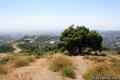
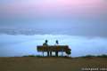
According to experts interviewed by the LA Times, hiking is an activity that people can still enjoy with a low risk of transmitting the coronavirus. An occasional hike could benefit your mental health. Take comfort in the tranquility of sunrises and sunsets. Take pleasure in the beauty of a blooming flower, the shade of a ridgetop oak, or the touch of a refreshing breeze.
The LA Times article offers the following recommendations for hikers looking to get outdoors:
- Tell someone where you’re going
- Carry a phone
- Bring water
- Minimize contact with others by hiking early or late in the day
- Don’t overdue it (keep hikes short and flat if you’re not a regular hiker)
- Stick to wider trails that make it easier to keep a 6-foot social distance from other hikers
Being prepared and knowing your limits – that’s good advice any time you go hiking. Only using trails that allow for safe distances from other people – that’s criteria for hiking in a crisis.
Where should you hike during the coronavirus outbreak?
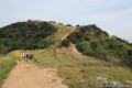
If you are heading outdoors, places that typically have high concentrations of visitors, like Runyon Canyon and Griffith Park, are probably not the best places to go right now. Many other beautiful parklands around Los Angeles receive fewer visitors. Hiking on weekdays and early in the morning are also good ways to limit your interaction with other hikers.
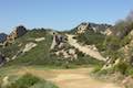
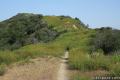
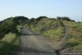
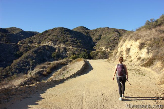
Below is a list of hikes that stick to wider fire roads (as opposed to single-track trails) where it will be easier to maintain good distances from other hikers.
Be safe and follow government guidelines. Stay up to date with the latest coronavirus information from the County of Los Angeles Public Health Department.
MRCA CLOSURE UPDATE: On March 22, the Mountains Recreation & Conservation Association (MRCA) which operates many of the parks around Los Angeles, particularly in the Santa Monica Mountains, has CLOSED ALL PARKS to protect the health and safety of all during the COVID-19 outbreak. Due to extra, unsafe use and people spending more time in the parks than is needed to exercise, the parks made the heavy decision to close. Hopefully, this action can be undone safely in the near future.
Most other trails around Los Angels have now also closed. Do not visit the trails listed below until public safety allows that the rules can be relaxed.
Stay home. Save lives. No matter how young you are or how healthy you feel, stay home as much as you can.
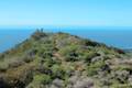
Wide trails in the Santa Monica Mountains
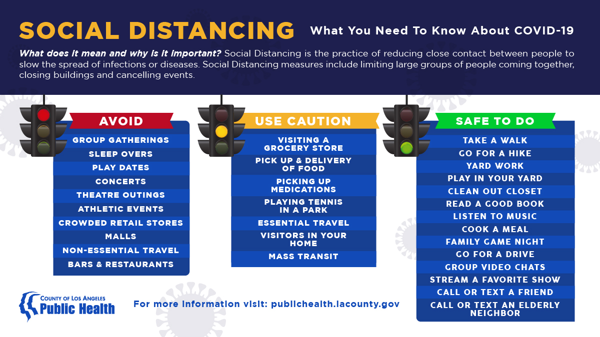
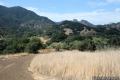
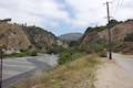
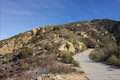
 | Calabasas Peak from Stunt Road This 3.6-mile hike on Calabasas Peak Motorway approaches Calabasas Peak from the south, ascending through sandstone formations to panoramic views of the Santa Monica Mountains and San Fernando Valley. |
 | Getty View Park This 3-mile out and back hike crosses East Sepulveda Fire Road (Casiano Fire Road) on a ridge east of the 405 Freeway that offers light traffic and plentiful views of the Getty Museum and Santa Monica Bay. |
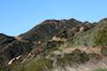
 | Grassland Trail to Crags Road and Rock Pool This easy 3-mile hike enters Malibu Creek State Park on South Grassland Trail, then forms a loop around Crags Road to visit Rock Pool, a popular park retreat. AVOID CROWDS. |
 | Hub Junction from Reseda Boulevard This 5.3 to 5.45-mile hike from the edge of the San Fernando Valley goes through Topanga State Park to a scenic junction at the crossroads of the Eastern Santa Monica Mountains. Extend the trek to 6.85 miles round trip by summiting Temescal Peak or to 7.95 miles round trip by taking a loop to Eagle Rock. |
 | Lower Canyonback Trail This 4.2 mile hike ascends Canyonback Ridge from Kenter Ave. in Brentwood to the Mountain Gate Country Club Estates. |
 | M*A*S*H Set This hike visits the site where the exteriors of the television show MASH were filmed, a 4.75-mile trek in Malibu Creek State Park. AVOID CROWDS. |
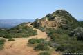
 | Mesa Peak from Corral Canyon Road This 6.5-mile hike travels along a ridge adorned with sandstone outcroppings to approach a peak with ocean views over Malibu. Shorten the outing to 5.35 miles round trip by stopping at a crest above Mesa Peak with a prominent boulder. |
 | Mesa Peak from Malibu Canyon Road (Piuma Trailhead) This 6.5-mile round trip hike ascends 1,375 feet up the Backbone Trail from Malibu Creek State Park to a subtle summit with substantial ocean views. |
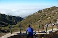
 | Parker Mesa Overlook from Paseo Miramar This steep 5.7-mile out-and-back begins down the ridge south of the overlook and delivers knockout ocean views. |
 | Parker Mesa Overlook from Trippet Ranch This 6.7-mile round trip hike heads up to the overlook from the opposite direction, starting at Trippet Ranch, Topanga State Park’s main trailhead. |
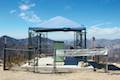
 | San Vicente Mountain from Mulholland Drive This 2-mile hike approaches the peak from the east and offers views to the north and south en route to the old Nike Missile site. |
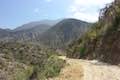
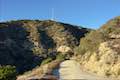
 | Summit to Summit Motorway This mostly unpaved road along the ridge between the tops of Old Topanga Canyon Road and Topanga Canyon Boulevard provides a 6 to 6.6-mile hike with panoramic views over the Santa Monica Mountains and the San Fernando Valley (with the potential for shorter and longer hikes). |
 | Sullivan Canyon This 8.5-mile round trip hike follows a wide trail up the center of a sycamore-filled canyon. |
 | Sullivan Ridge A prominent lone-standing Live Oak along Sullivan Ridge makes a natural turnaround point and a 7.5 to 8.3 mile round trip hike. |
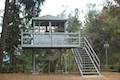
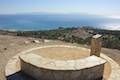
 | Topanga Lookout This 2-mile visits the site of an old fire tower that still offers great views of the surrounding mountains. |
 | Tuna Canyon Park This 1.6 to 5.1-mile hike offers spectacular ocean views from a less-visited park between Topanga and Malibu. |
 | Upper Canyonback Trail This 3 mile hike descends Canyonback Ridge from Mulholland Drive to the Mountain Gate Country Club Estates. |
 | Westridge Trail to San Vicente Mountain This 7.4-mile hike travels a scenic ridge between a Brentwood neighborhood and a summit that was once used as a Nike Missile site. |
Wide trails in the San Gabriel Mountains
Being more remote, many trails in the San Gabriel Mountains are able to provide solitude from other hikers. Single-track trails are common, but fire roads are available.
 | Gould Mesa Trail Camp via Gabrielino Trail This 5.1-mile round trip hike follows Gabrielino Trail up a canyon along the Arroyo Seco to a trail camp just inside Angeles National Forest. |
 | Gould Mesa Trail Camp via Gould Mesa Road This road descends 1.15 miles to a junction with Gabrielino Trail near Gould Mesa Trail Camp in Angeles National Forest, presenting a steep 2.4-mile round trip route to the campground with 525 feet of elevation change. |
 | Henninger Flats via Mount Wilson Toll Road This 6-mile round trip hike ascends 1,325 feet to a trail camp, tree nursery, lookout tower, and visitor center on a landing in the San Gabriel Mountains operated by the Los Angeles County Fire Department. The hike can easily be extended to 8.7 miles by exploring a loop above Henninger Flats. |
 | Inspiration Point & Mount Lowe Trail Camp This 7.25-mile round trip hike descends Mount Lowe Road into the San Gabriel Mountains to a historic scenic overlook and a trail camp built on interesting ruins. |
 | Mount Lowe Road & Sunset Ridge Trail to Cape of Good Hope This pair of trails can be combined for a 5.2-mile round trip hike to a historic viewpoint called Cape of Good Hope. Follow the old route of Mount Lowe Railway to the ruins on Echo Mountain to extend the hike by two miles round trip or bring the distance up to 11.85 miles by visiting Echo Mountain, Inspiration Point, Mount Lowe Trail Camp, and other landmarks. |
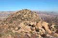
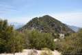 | San Gabriel Peak from Mount Disappointment Fire Road This 6,161 foot peak is reachable via a 4-mile round-trip trail from Mt. Disappointment Fire Road. |
 | Vetter Mountain This 3.8 or 4.4-mile hike ascends from Charlton Flats Picnic Area to Vetter Mountain, where there are exceptional 360-degree view from the site of an old fire lookout tower. |
Wide trails in the other places around Los Angeles
 | Cherry Canyon Park This 2.5-mile hike in the San Rafael Hills rises to panoramic views at Ultimate Destination Vista Point and a summit with an old lookout tower. |
 | Beaudry Motorway Loop to Tongva Peak This 6.15-mile loop climbs 1,475 feet to the summit of Tongva Peak on the east end of the Verdugo Mountains. |
 | Hostetter Fire Road to Verdugo Mountain This 7.5-mile round trip hike up La Tuna Canyon reaches the highest summit in the Verdugo Mountains, a small mountain range north of Burbank. |
 | Las Flores Motorway to Mount Thom This 5.3-mile hike follows a wide dirt road to the summit of Mount Thom, offering panoramic views from the southeast end of the Verdugo Mountains. |
 | LMU Trail This easy hike of up to 4.7 miles round trip follows the Westchester Bluffs west below the campus of Loyola Marymount University. |
 | Portuguese Bend Reserve This 5.15-mile double loop explores the scenic coastal hillsides and canyons in Portuguese Bend Reserve on the Palos Verdes Peninsula and can easily be shortened to 3 miles round trip by omitting the lower loop. |
 | Rocky Peak This 4.75-mile hike rises to a 2,715-foot summit in Rocky Peak Park within a rugged mountain range between Chatsworth and Simi Valley. |
Hiking during the COVID-19 pandemic
Has hiking helped you cope with social distancing? Share your experience with a comment.
Do your part to stay out of harms way and keep others safe.
