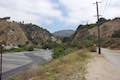
Gould Mesa Trail Camp from Angeles Crest Highway
in the San Gabriel Mountains
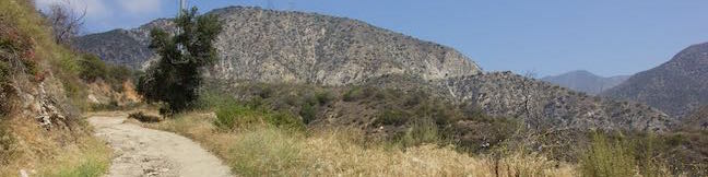
Gould Mesa Trail Camp is a hike-in campground in the front range of the San Gabriel Mountains, quite close to cities like Altadena and La Cañada Flintridge. The most obvious route to Gould Mesa is Gabrielino Trail. For something that’s about half as long and twice as steep, you can take Gould Mesa Road, which drops 525 feet over 1.15 miles going from Angeles Crest Highway down a ridge and into the canyon where Gould Mesa Trail Camp sits along a mountain stream, the Arroyo Seco. Gould Mesa Road (Forest Road 2N69) connects to Gabrielino Trail alongside the campground and can also be used to venture farther up the canyon.
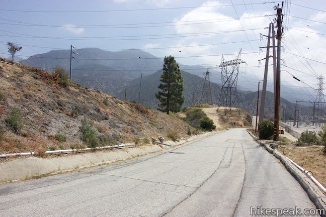
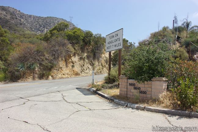
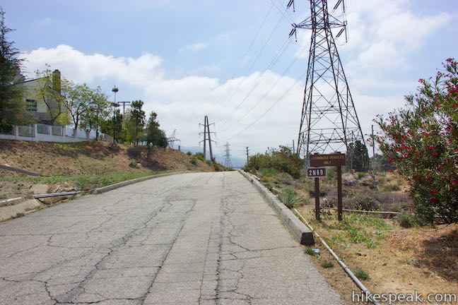
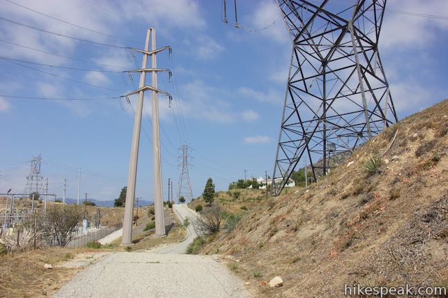
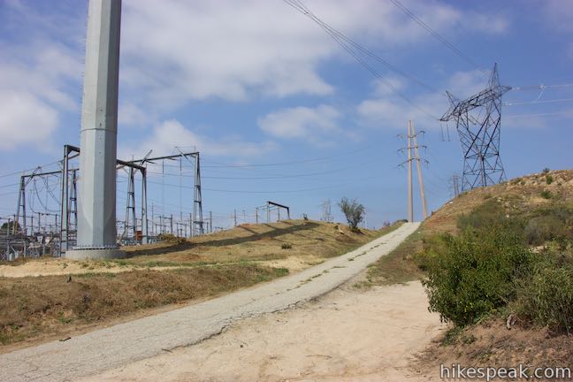
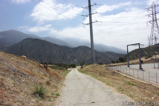
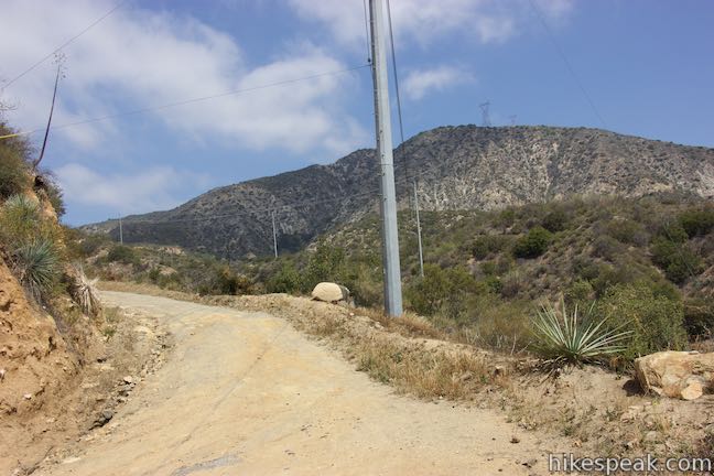
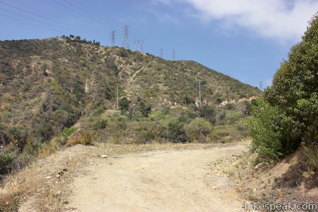
Start from Angeles Crest Highway, just above the homes in La Cañada Flintridge, and a couple miles from Interstate 210. Walk a hundred yards to a brown gate and continue past a marker for Forest Road 2N69 (also called Gould Mesa Road or Gould Mesa Fire Road). The road remains paved for the first half mile. Tall electrical towers connecting to a large substation on the right obscure the early scenery. Getting away from the substation, you will start to discover views over the canyon and up into the San Gabriel Mountains.
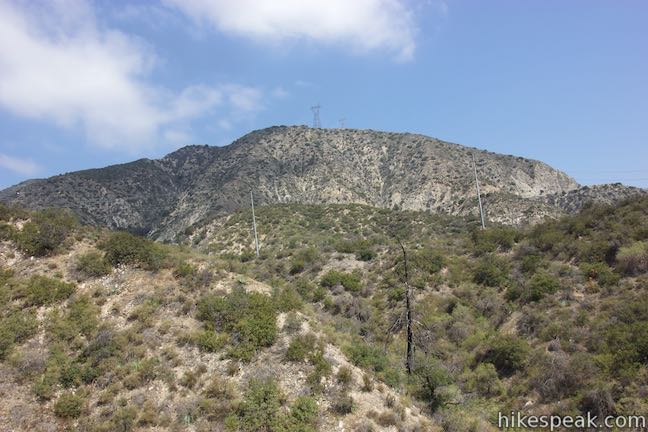
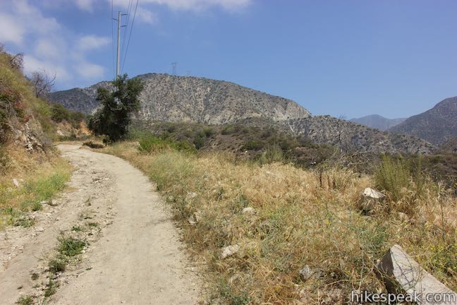
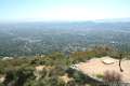
Pass some dirt utility roads on the left as the road curves to the right, heading downhill steeply to the end of the pavement. It’s a dirt road from here, swinging down a ridge into the canyon. A trio of horseshoe bends ease the descent, which is still pretty rapid, dropping 410 feet over the last 0.65 miles (you’ll appreciate these switchbacks on the tougher hike back up the canyon). Landings on the ridge provide good places to pause and admire the surroundings. You can look down the canyon toward the San Gabriel Valley, look across the canyon toward the steep ridges of Brown Mountain, or look up the canyon toward Hoyt Mountain, Josephine Peak, and more of the San Gabriels.
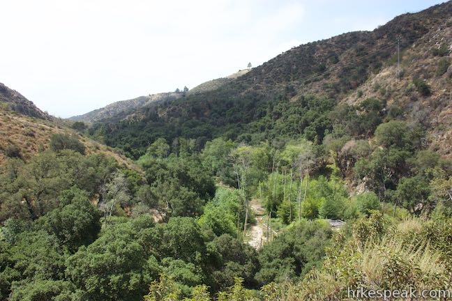
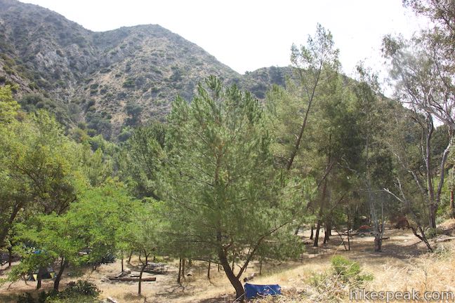
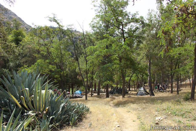
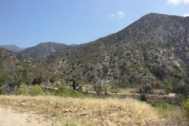
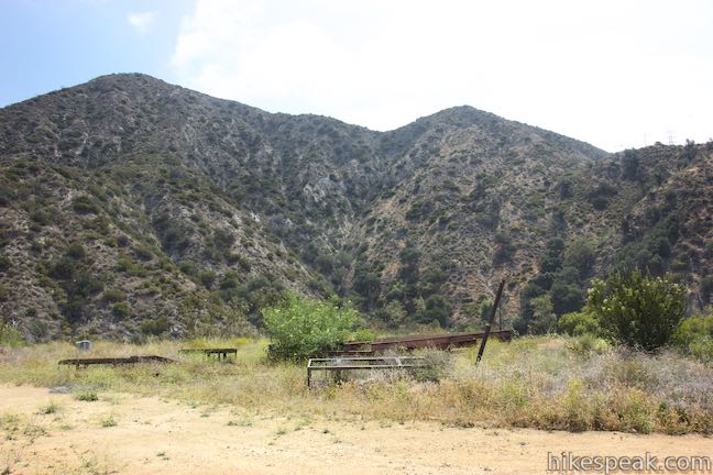
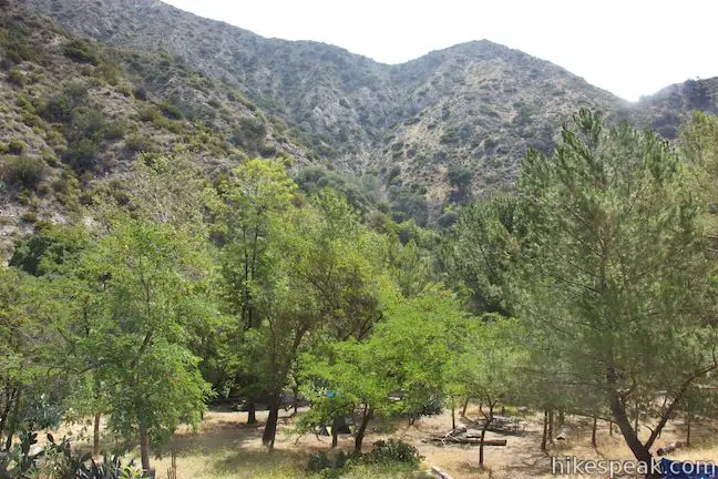
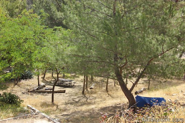
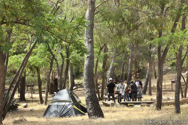
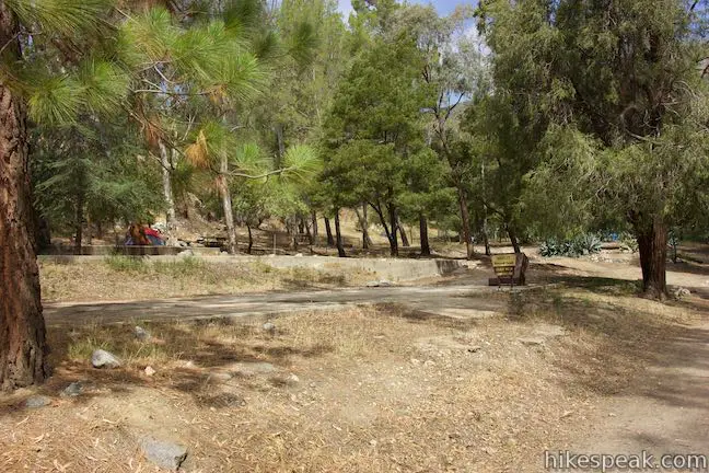
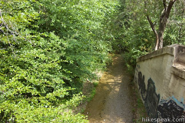
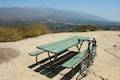
The wide road is rough and rocky, eventually coming down alongside Gould Mesa Trail Camp to a junction with Gabrielino Trail. This junction is 2.6 miles from the start of Gabrielino Trail, the other route to Gould Mesa Trail Camp. The campground has five first-come first-served sites that enjoy partial shade. Just across Gabrielino Trail is the Arroyo Seco where children can play in calm, shallow water. The stream provides a source of water than campers can treat and use. A few picnic tables are spread around the campground, which has one vault toilet. There are a few fire rings at sites in the campground. However, a posted sign states that camp stoves only are allowed and not ground fires. Downed logs throughout the campground provide natural benches for sitting.
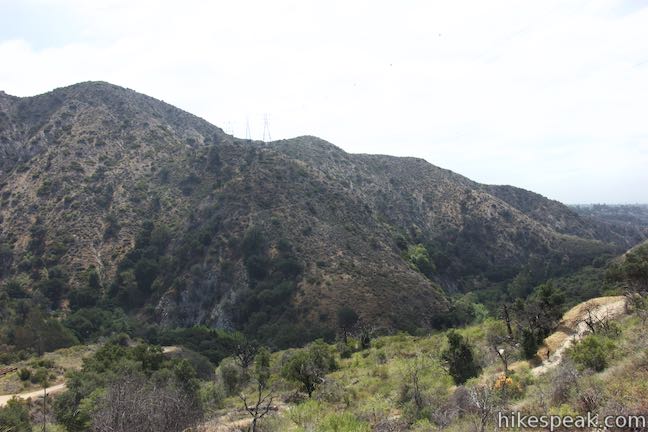
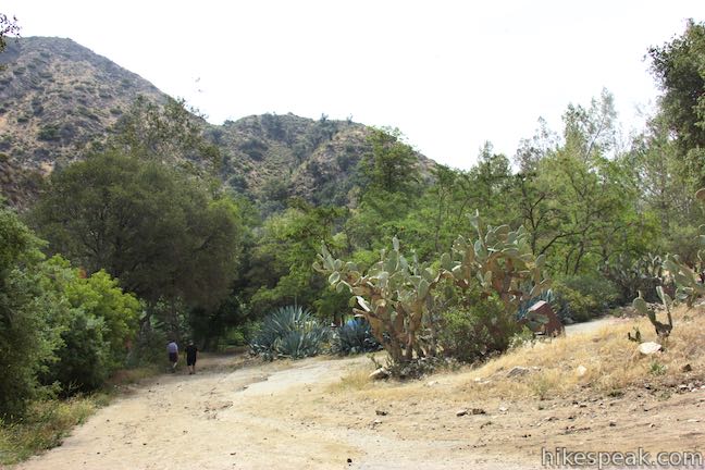
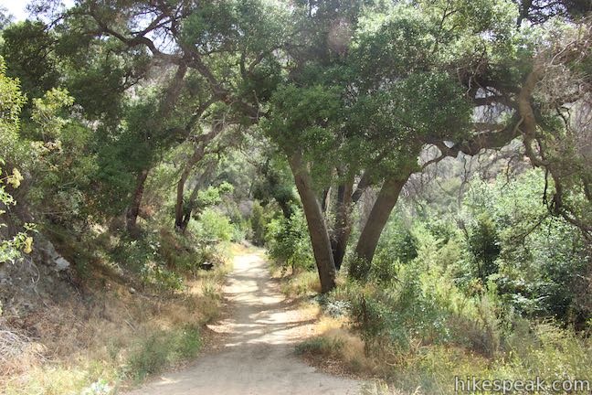
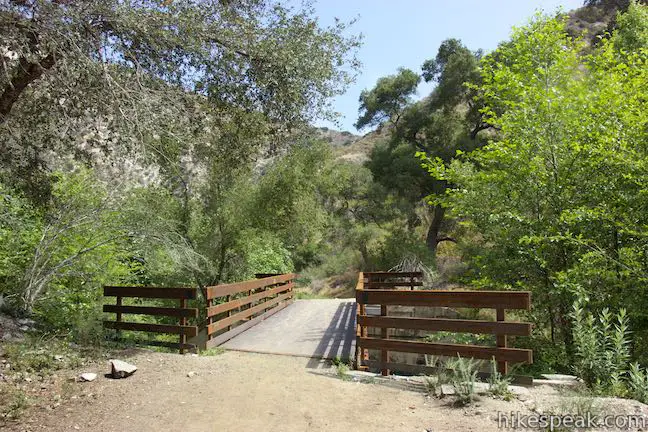
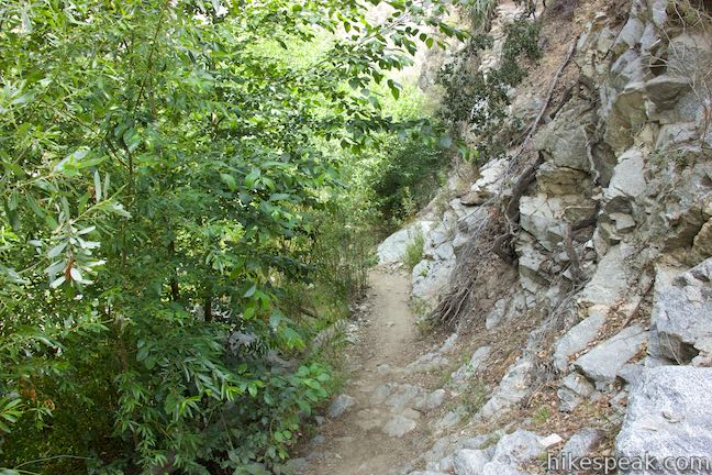
Below the campground, Gabrielino Trail ventures down the canyon along Arroyo Seco. In the other direction, Gabrielino Trail continues farther up the canyon, hugging the west side of the canyon past an old stone staircase left behind from an old cabin. At 0.3 miles above the junction with Gould Mesa Road, the trail crosses a bridge to the east side of Arroyo Seco. Almost instantly, the trail narrows to a rough single track.
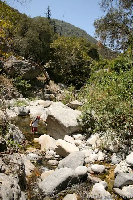
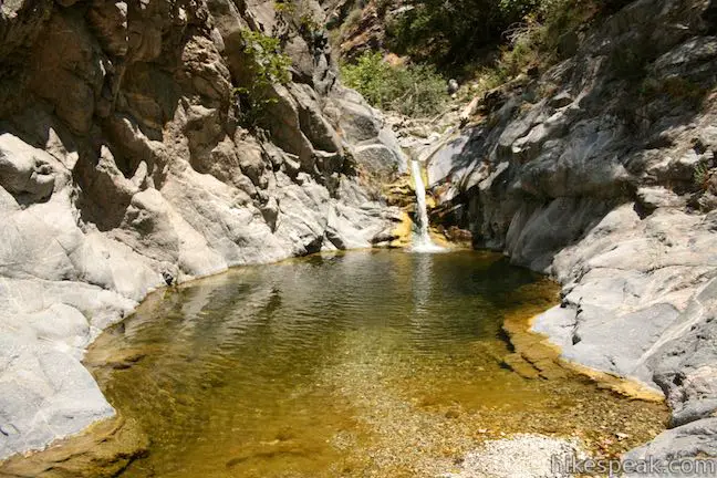
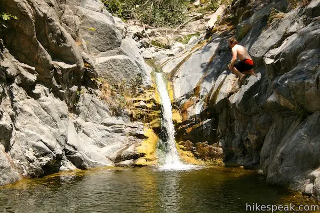
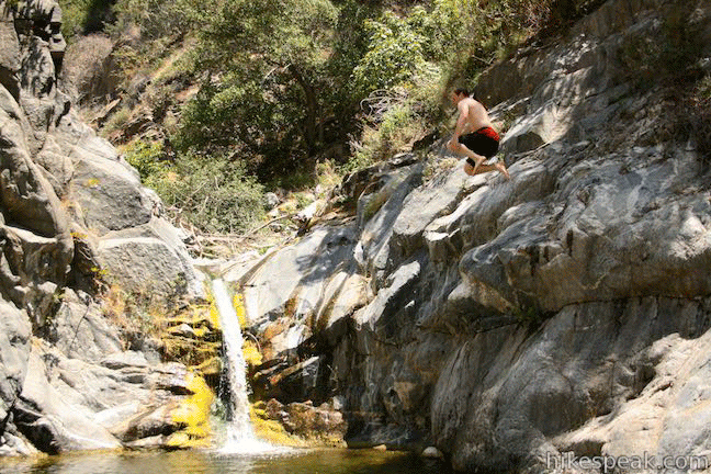
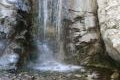
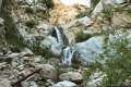
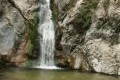
If you continue farther up the canyon, Gabrielino Trail becomes harder to follow. The trail goes through a pair of picnic areas and reaches Oakwilde Trail Camp about 2.5 miles from Gould Mesa Trail Camp. Gabrielino Trail, to the extent that it is still intact, ascends from the canyon bottom here and heads farther into the mountains, eventually passing Switzer Falls. Sticking with Arroyo Seco, you can rock hop up an adventurous area of the stream called Royale Gorge, where there is a 10-foot waterfall and a swimming hole, about 5 miles from Gould Mesa Trail Camp (photos and GIF below).
Gould Mesa Trail Camp has five hike-in campsites, although there appears to be space for a few more campers than that. Sites cannot be reserved and are first-come first-served. Expect the campground to be full and busy on weekends. Being close to the city, Gould Mesa may have more of a party atmosphere than campgrounds deeper in the mountains. Dogs and bikes are allowed on Gould Mesa Road and on Gabrielino Trail (as well as in the campground). The upside down hike to Gould Mesa Trail Camp via Gould Mesa Road is 2.4 miles round trip with 525 feet of elevation change. No fee or permit is required to hike Gould Mesa Road or stay overnight at Gould Mesa Trail Camp (you do not need an adventure pass), so get out and enjoy!
Directions to the Trailhead
- Drive 2 miles up Angeles Crest Highway to first parking area on right after you pass the golf course (if you see a sign listing what roads are open and closed, you went too far).
- Park in the paved turnout and walk a few yards up the road to the top of Gould Mesa Road.
- A big sign is posted next to the intersection that reads, Turn on headlights next 7 miles.
Trailhead Location
Trailhead address: 5825 Angeles Crest Highway, La Cañada Flintridge, CA 91011
Trailhead coordinates: 34.22295, -118.1906 (34° 13′ 22.61″N 118° 11′ 26.16″W)
You may also view a regional map of surrounding Los Angeles trails and campgrounds.


Royale Gorge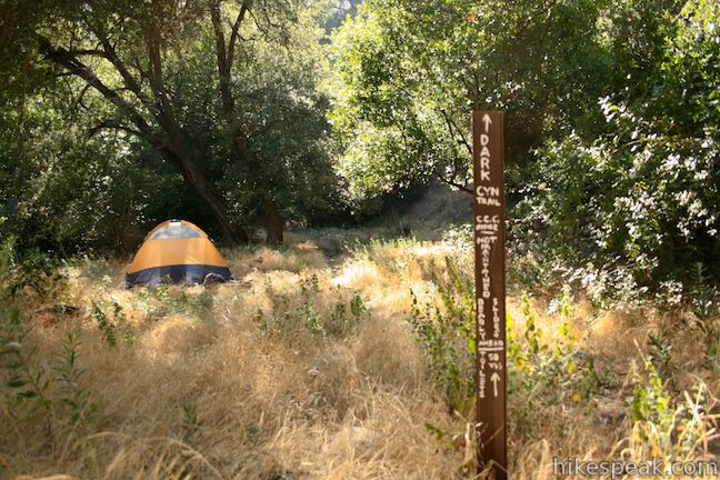
 | Gabrielino Trail to Gould Mesa Trail Camp This 5.1-mile round trip hike follows Gabrielino Trail up a canyon along the Arroyo Seco to a trail camp just inside Angeles National Forest. |
 | Cherry Canyon Park This 2.5-mile hike in the San Rafael Hills rises to panoramic views at Ultimate Destination Vista Point and a summit with an old lookout tower. |
 | Millard Falls This one mile hike visits a 50-foot waterfall up one of the most scenic canyons in the range. |
 | Dawn Mine This 6-mile hike from Millard Campground leads past Millard Falls to an old gold mine. |
 | Echo Mountain via Sam Merrill Trail This 5.8-mile hike visits a historic railway and ruins from a century old resort overlooking Pasadena. |
 | Rubio Canyon Trail This 1.3-mile round trip hike ventures into a rustic canyon to a double waterfall. |
 | Eaton Canyon Falls This 3.5-mile hike goes up Eaton Wash to a narrow stretch of Eaton Canyon containing a pleasant 40-foot waterfall. |
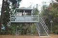 | Henninger Flats via Mount Wilson Toll Road This 6-mile round trip hike ascends 1,325 feet to a trail camp, tree nursery, lookout tower, and visitor center on a landing in the San Gabriel Mountains operated by the Los Angeles County Fire Department. The hike can easily be extended to 8.7 miles by exploring a loop above Henninger Flats. |
 | More trails in the Los Angeles Explore other destinations in the Santa Monica Mountains, San Gabriel Mountains, and elsewhere. |
- The official webpage for Gould Mesa Trail Camp (opens in a new tab)
- A San Diego Reader article by Jerry Schad about Royale Gorge (opens in a new tab)
- Gould Mesa Trail Camp on hipcamp.com (opens in a new tab)
- Gabrielino Trail on wikipedia.org (opens in a new tab)
- The official website of the Angeles National Forest (opens in a new tab)
Common Questions about Gould Mesa Trail Camp from Angeles Crest Highway in the San Gabriel Mountains
- Is the trail open?
- Yes. You should expect to find that Gould Mesa Fire Road is open. There are no recent reports of trail closures. If you discover that the trail is closed, please help your fellow hikers by reporting a closure.
- Is this trail free to access?
- Yes, Gould Mesa Fire Road is free to access. No entrance fee, pass, or permit is required. If you discover that access rules have changed, please provide feedback on your experience.
- How much time does this hike take?
- It takes approximately 1 hour 15 minutes to hike Gould Mesa Fire Road. Individual hiking times vary. Add extra time for breaks and taking in the views.
- How long is this hike?
- The hike to Gould Mesa Fire Road is a 2.4 mile out and back with 525 feet of elevation change.
- Are dogs allowed on this trail?
- Yes, dogs are allowed on Gould Mesa Fire Road. The trail is open to hikers, bikes, dogs.
- What mountain range is this trail in?
- Gould Mesa Fire Road is located in the San Gabriel Mountains.
- Where is the trailhead located?
- The trailhead for Gould Mesa Fire Road is located in La Cañada Flintridge, CA.
Trailhead Address:
5825 Angeles Crest Highway
La Cañada Flintridge, CA 91011
Trailhead Coordinates:
34.22295, -118.1906 - What are the driving directions to the start of the hike?
To get to the trailhead: Drive 2 miles up Angeles Crest Highway to first parking area on right after you pass the golf course (if you see a sign listing what roads are open and closed, you went too far). Park in the paved turnout and walk a few yards up the road to the top of Gould Mesa Road. A big sign is posted next to the intersection that reads, Turn on headlights next 7 miles.
View custom Google Maps directions from your current location.
- Are there other trails near Gould Mesa Fire Road?
- Yes, you can find other nearby hikes using the Hikespeak Hike Finder Map.

Go the extra miles...
Submit a rating of this hike to go with your comment. Contribute to the average trail rating.