Hikes in Griffith Park
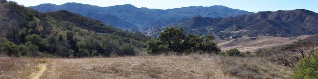
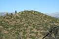
Griffith Park preserves over 4,200 acres at the east end of the Santa Monica Mountains and is one of America’s largest urban parks. Griffith Park is just five miles from downtown Los Angeles, protecting an area of the “Hollywood Hills” between Interstate 5 and the 101 Freeway.
Discovering Griffith Park Hikes
Griffith Park is a cherished recreation hub for Angelenos and tourists alike, offering something for everyone. The park has many miles of trail, tennis courts, golf courses, a zoo, a merry-go-round, museums, trains, and landmarks like Hollywood Sign, the Griffith Observatory, and the Greek Theater.
Griffith Park caters to hikers with a variety of interests.
Want to explore the Batcave from the 1960s Batman series? Hike to Bronson Cave. It’s really short!
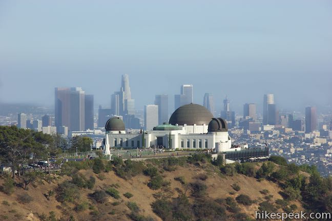
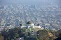
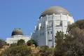
Want to learn about the stars that aren’t memorialized on Hollywood Boulevard? Hike to Griffith Observatory.
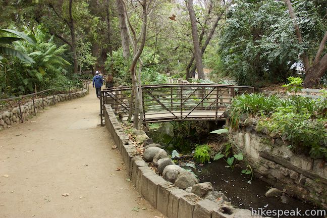
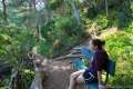
Need to mellow out on a shaded path? Stroll through Frendell or Amir’s Garden. (Ferndell Trail combines easily with a hike to Griffith Observatory.)
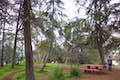
Want to picnic in weird abandoned zoo exhibits? Of course you do! Bring lunch to Old Zoo Picnic Area.
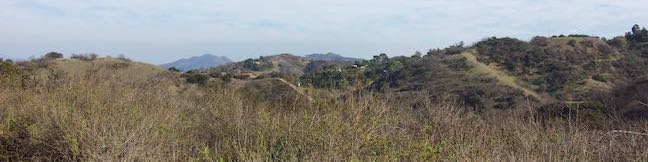
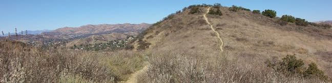
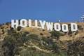
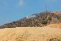
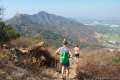
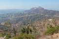
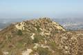
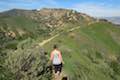
Want a lofty view? Hike up Mount Hollywood or Mount Lee (home of the Hollywood Sign).
Mount Hollywood
Rising over the center of Griffith Park behind the Griffith Observatory, Mount Hollywood has the most panoramic views over Los Angeles. While it isn’t the park’s highest peak, Mount Hollywood does rise to 1,625 feet. Picking a hike to the summit is a bit like deciding how much ice cream you want: one scoop, two scoops, or three scoops.
- For a single summit serving, hike up to Mount Hollywood from Griffith Observatory or Western Canyon (parking fees and restrictions apply).
- For a two-summit circuit, start near the Greek Theater and hike Glendale Peak – Mount Hollywood Loop.
- To get the most exercise, make the three-summit selection and explore a cluster of peaks named Mount Chapel, Mount Bell, and Mount Hollywood.
Which route to Mount Hollywood peaks your interest?
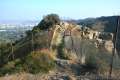
Mount Lee and the Hollywood Sign
If you want a closer view of the Hollywood Sign, four recommended hiking routes lead to the summit of Mount Lee, just behind the big white letters.
- Brush Canyon Trail is 6.4 miles round trip with 1,1050 feet of elevation change and has fine views over Hollywood along the way.
- Hollyridge Trail is shorter and easier at 3.5 miles round trip with 750 feet of elevation change, but parking can be limited.
- Burbank Peak Trail ascends to the Wisdom Tree before crossing Cahuenga Peak (the highest point in Griffith Park) to reach Mount Lee and is 3 miles round trip with 875 feet of elevation change.
- Innsdale Drive presents the best head-on views of the Hollywood Sign and is 4.6 miles round trip with 750 feet of elevation change.
- Griffith Observatory to the Hollywood Sign provides a 5th option with a longer 8.8-mile route with 575 feet of elevation change that crosses Mount Hollywood to get over to Mount Lee.
Read more about these Hollywood Sign Hikes.
Hikes in Griffith Park
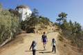
These hikes are listed from west to east, but may also be sorted alphabetically or by distance to help you find the hike you’re looking for. The listed hikes link to write-ups with complete descriptions and directions as well as GPS maps, elevation profiles, and lots of photos. Even through it is more of a Griffith-Park-adjacent outing, Hollywood Reservoir is included on this list. Dogs are allowed on all trails in Griffith Park. Bikes are not allowed on dirt trails, but can use paved roads.
| Trail | Description | Distance | Location |
|---|---|---|---|
 446 446 | Burbank Peak This out and back hike climbs to the Wisdom Tree perched at the west end of Griffith Park. | 1.6 miles 740 feet | 34.1331, -118.3364 |
 447 447 | Cahuenga Peak This out and back hike ascends a dirt single track to Cahuenga Peak and the adjacent Mount Lee, home of the Hollywood Sign. | 3 miles 875 feet | 34.1331, -118.3364 |
 450 450 | Mount Lee and the Hollywood Sign via Innsdale Drive & Mulholland Highway This out and back hike combines trails and streets to deliver some of the very best views of the Hollywood Sign on the way to the summit of Mount Lee above the sign. | 4.6 miles 750 feet | 34.130, -118.327 |
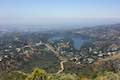 451 451 | Hollywood Sign - Hollywood Reservoir Loop This hike combines trails and streets to visit the Hollywood Sign on Mount Lee, neighboring Cahuenga Peak and Burbank Peak, and Lake Hollywood Reservoir. | 5.4 - 7.4 miles 1,070 feet | 34.12805, -118.3273 |
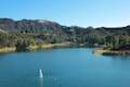 452 452 | Lake Hollywood Reservoir Walking Trail This easy loop circles a peaceful fence-enclosed reservoir in the hills below the Hollywood Sign. | 3.5 miles 50 feet | 34.1288, -118.3363 |
 455 455 | Mount Lee and the Hollywood Sign via Hollyridge Trail This hike ascends from Beachwood Canyon to the summit of Mount Lee behind the Hollywood Sign. | 3.5 miles 750 feet | 34.12935, -118.31474 |
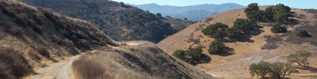
 460 460 | Mount Chapel, Mount Bell, and Mount Hollywood This undulating loop tops three prominent summits on a panoramic tour of Griffith Park. | 5.7 miles 675 feet | 34.12935, -118.31474 |
 465 465 | Mount Lee and the Hollywood Sign via Brush Canyon Trail This out and back hike crosses Griffith Park from Canyon Drive to the top of Mount Lee, directly behind the landmark Hollywood Sign. | 6.4 - 7.1 miles 1,050 feet | 34.12485, -118.3136 |
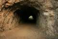 470 470 | Bronson Cave This short easy hike visits a man-made cave recognizable as the Batcave from the Batman TV series and hundreds of other locations on TV and film. | 0.66 miles 50 feet | 34.12446, -118.31425 |
 471 471 | Mount Hollywood This 1,625-foot peak is a star of Griffith Park with panoramic views that can be reached from Griffith Observatory on a steep 1.4-mile hike or a scenic 2.65-mile trek and from lower in the park in Western Canyon for a hike of around 4.2 miles. | 1.4 - 4.8 miles 500 - 925 feet | 34.12093, -118.30042 |
 472 472 | Griffith Observatory to the Hollywood Sign This hike travels from one Griffith Park landmark to another, taking a lengthy route across Mount Hollywood. | 8.8 miles 575 feet | 34.12093, -118.30042 |
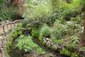 473 473 | Ferndell Trail This relaxing hike goes through a tropical garden in the lushest little canyon in Griffith Park and can be extended to explore more of Western Canyon. | 0.5 - 1.75 miles 65 - 260 feet | 34.10935, -118.3076 |
 474 474 | Griffith Observatory via West Observatory Trail This partial loop goes from Western Canyon up ridges to Griffith Observatory, getting sweeping views over Los Angeles and Griffith Park along the way. | 2.1 miles 540 feet | 34.11325 -118.3075 |
 475 475 | Griffith Observatory via East Observatory Trail This hike from Vermont Canyon Avenue up to Griffith Park's great observatory delivers excellent views over Los Angeles along the way. | 1.5 miles 380 feet | 34.11835, -118.295 |
 477 477 | Glendale Peak - Mount Hollywood Loop This hike tops two summits in Griffith Park that both have awesome views. | 4.15 miles 765 feet | 34.12184, -118.29679 |
 478 478 | Glendale Peak This hike visits a less known summit on the southeast side of Griffith Park with views that deserve more attention. | 2.55 - 3.3 miles 330 - 405 feet | 34.1208, -118.2934 |
 479 479 | Cedar Grove & Vista View Point Loop This hike on the southeast side of Griffith Park follows paved and unpaved trails to two park attractions, a quiet grove with a picnic area and a helipad with panoramic views. | 2.3 miles 400 feet | 34.11865, -118.28615 |
 480 480 | Amir's Garden This hike reaches a relaxing garden on the east side of Griffith Park that is a pleasant retreat for hikers. | 1 miles 275 feet | 34.145, -118.29385 |
 490 490 | Old Zoo Picnic Area This short hike explores the abandoned exhibits and animal cages in the ruins of the old LA Zoo in Griffith Park. | 0.5 miles 50 feet | 34.135, -118.2867 |
 492 492 | Bee Rock This hive-shaped point on the east side of Griffith Park can be reached via a pair of loop hikes. | 1.7 - 4 miles 600 feet | 34.131, -118.284 |
 495 495 | Beacon Hill This out and back or loop hike in Griffith Park climbs to the easternmost summit in the Santa Monica Mountains. | 2.75 - 3.9 miles 500 feet | 34.131, -118.284 |