The Hollywood Sign via Innsdale Drive, Mulholland Highway, and Mount Lee Drive in Griffith Park
With the public access closure of the trailhead at the top of Beachwood Drive for the Hollyridge Trail, hikers have lost a key route to the Hollywood Sign on Mount Lee. Those wanting to hike to the sign are now being encouraged to start up Brush Canyon Trail from a trailhead on Canyon Drive for a 6.4-mile hike to Mount Lee’s famous sign. While this is a great option for those with the time and energy for a longer hike in the park, a shorter route still exists that presents superb Hollywood Sign views from the get-go.
Mix dirt fire roads, paved trails, and residential streets on a route up Innsdale Drive, Mulholland Highway, and Mount Lee Drive past some of the area’s very best views of the Hollywood Sign! The ascent is 2.25 miles long, gaining 750 feet of elevation. Throw in a short but worthwhile spur to a selfie-servicing overlook and the hike comes to a total of 4.6 miles round trip.
Those wishing for more can form a loop by tagging on Mount Lee’s neighbors, Cahuenga Peak and Burbank Peak, and then take the short route around Lake Hollywood Reservoir for a 5.4-mile hike or take the scenic route around the reservoir for a 7.4-mile loop (Hollywood Sign – Hollywood Reservoir Loop).
Be a good neighbor: If you take this hike, consider behaving in a way that minimizes your impact on the neighborhood (stay on the trail, turn off speakers, keep yourself and pets off private property, and obey legitimate signage). The closure of Hollyridge Trail has shown that access in this area is not a certainty, so enjoy these trails and roads courteously.
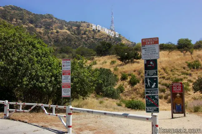
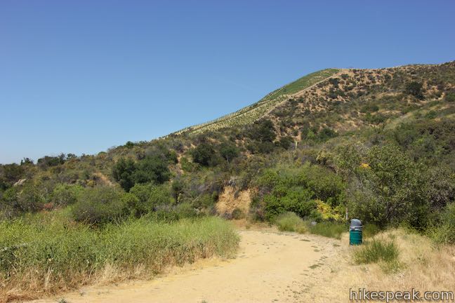
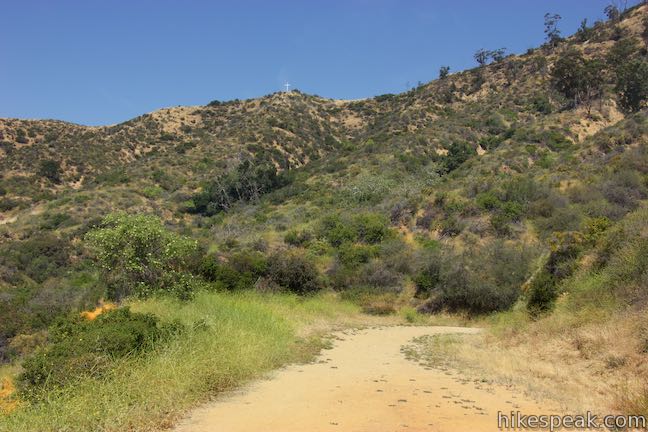
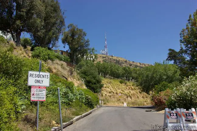
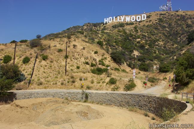
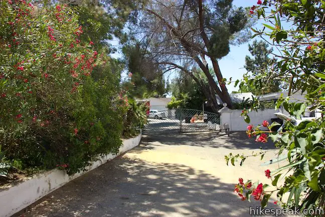
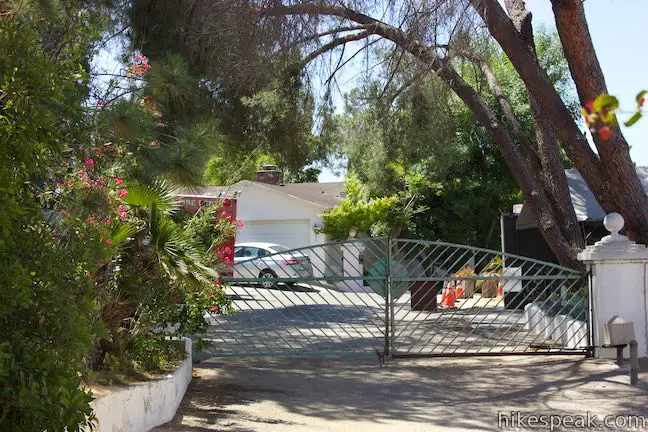
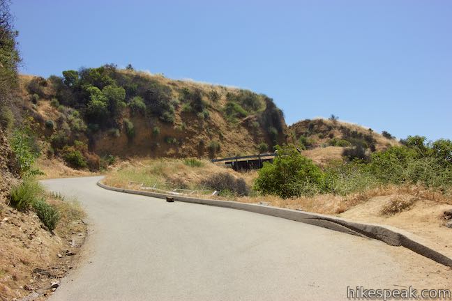
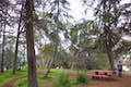
Street parking is required for this hike (unless you get dropped off by a ride share service). Find parking on nearby Tahoe Drive or Canyon Lake Drive, which runs up a hill to the trailhead. The top of Canyon Lake Drive curves to the right and comes to a gated dirt road. This is the start of the hike.
Innsdale Trail
Over the opening 0.45 miles on Innsdale Drive, you’ll enjoy two things:
- The hike’s longest stretch of dirt trail
- The best views looking up at the Hollywood Sign
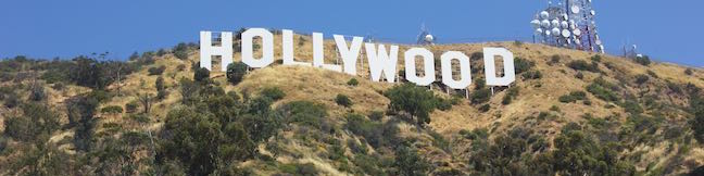
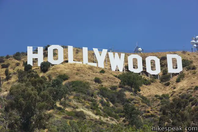
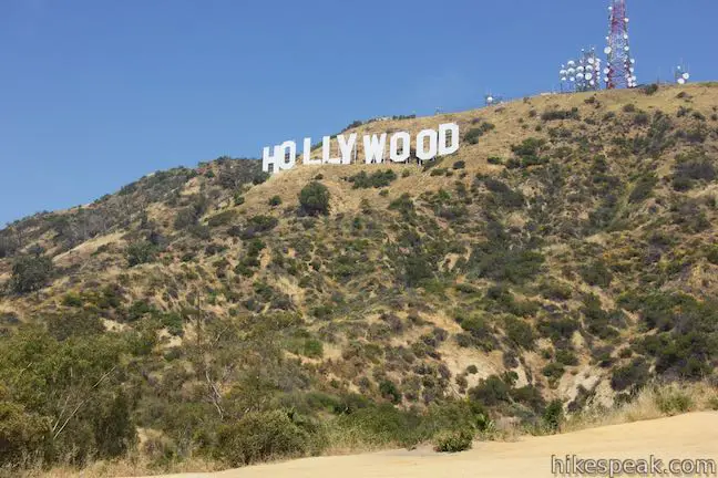
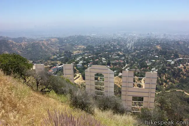
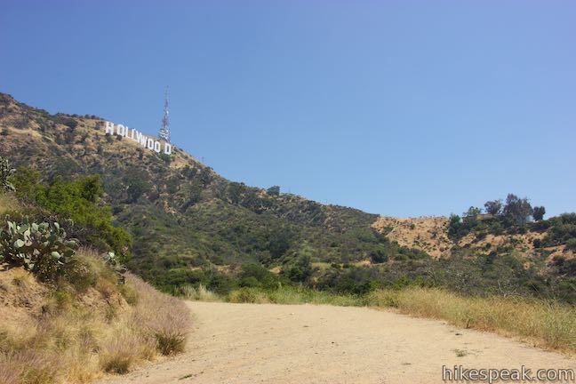
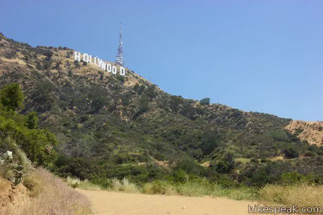
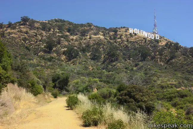
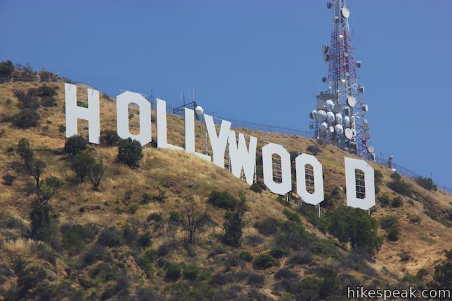
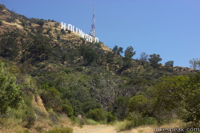
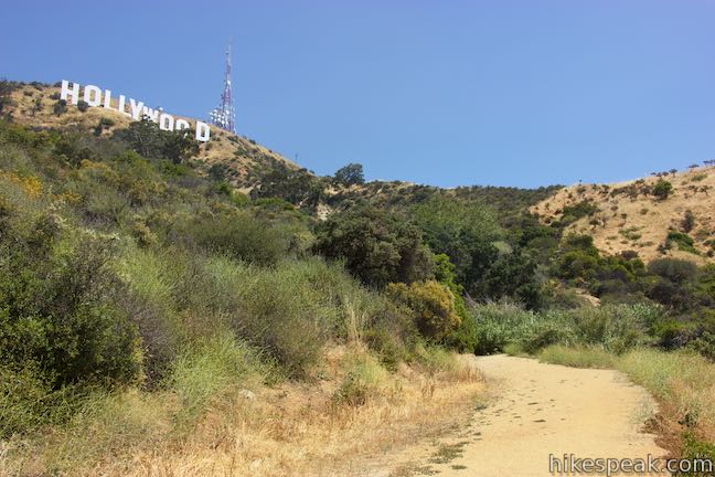
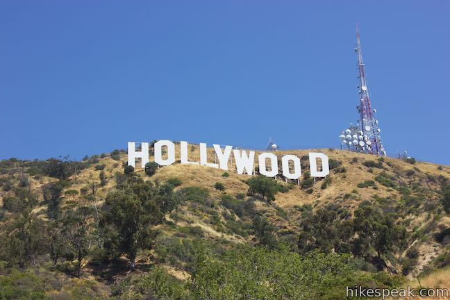
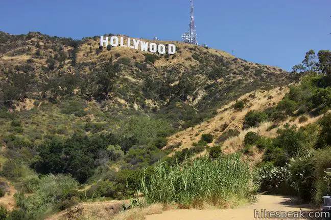
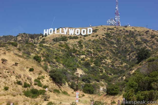
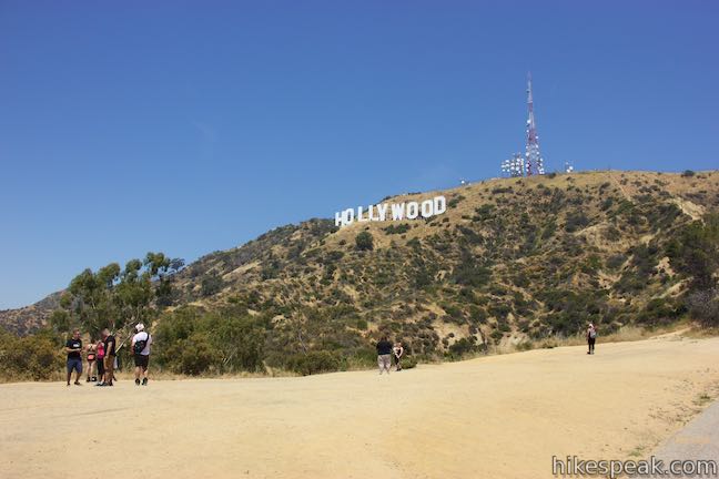
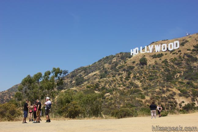
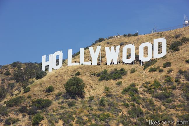
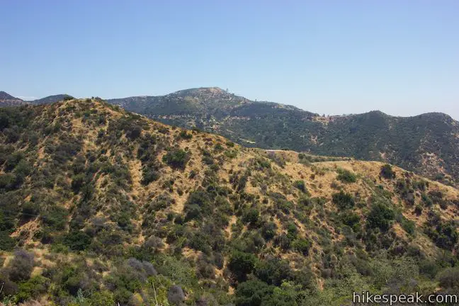
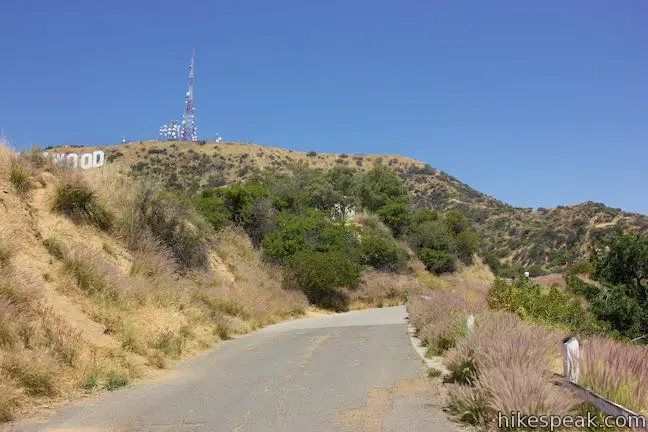
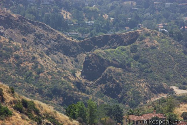
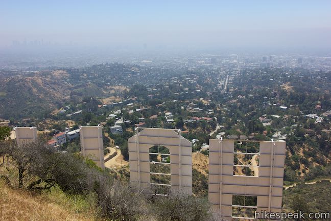
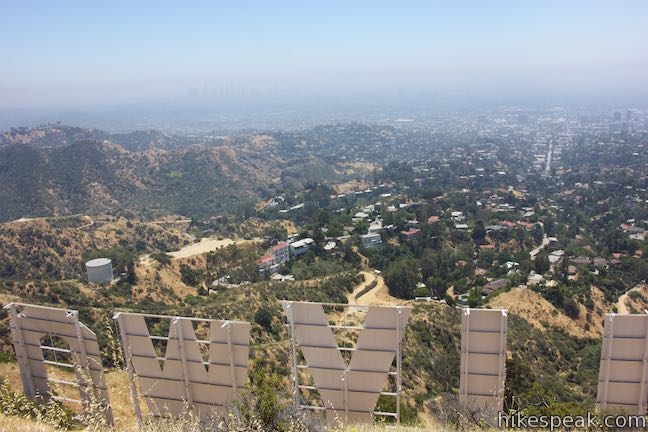
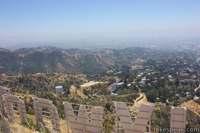
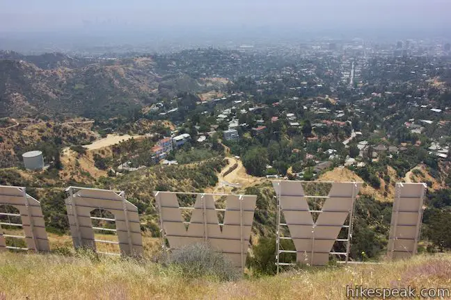
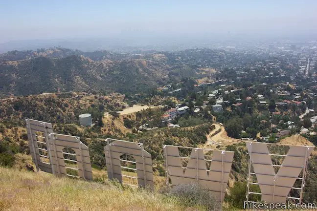
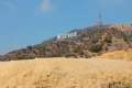
The Hollywood Sign is visible right from the start as the wide dirt trail eases around bends in the mountainside below the giant letters. The sign was originally constructed in 1923 and spelt ‘Hollywoodland’ to promote the neighborhood below the mountain. The advertisement evolved into one of the world’s most recognizable landmarks (although the sign lacks national landmark status). The Hollywood Sign got a facelift in 1979 when the current 45-foot tall letters were installed.

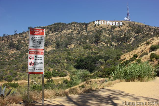
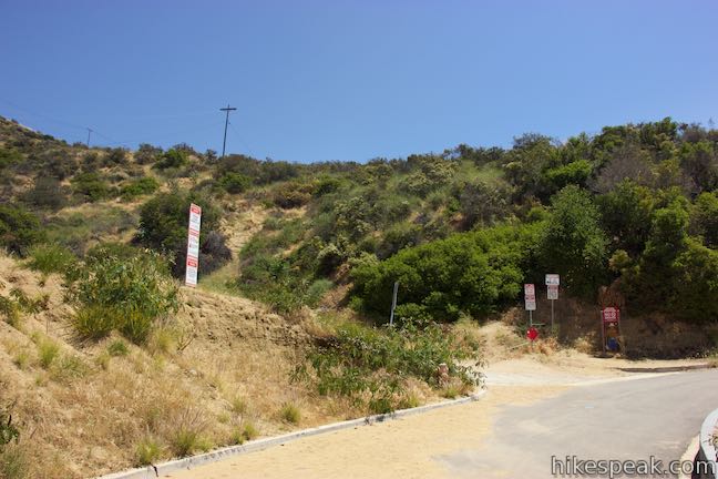
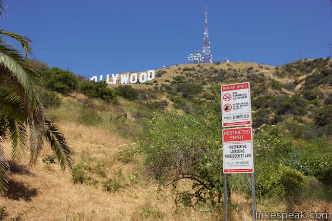
About a quarter mile up the trail, the Hollywood Sign seems to be directly overhead. Stay on the trail and do not disobey the “Restricted Entry” signs posted along the trail by the Mountain Fire District. Straying off trail is a no-no that can be penalized by fines and arrests.
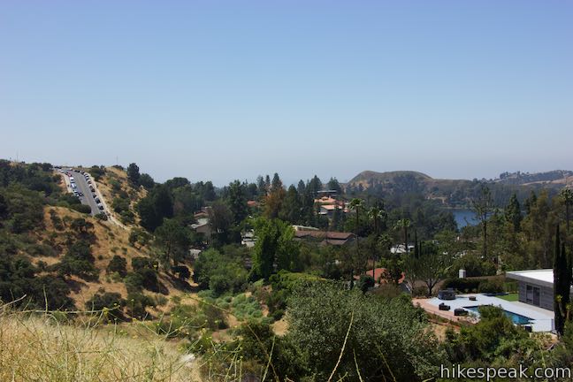
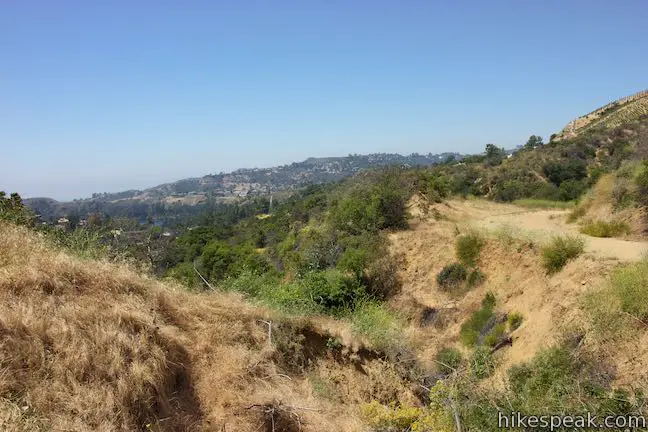
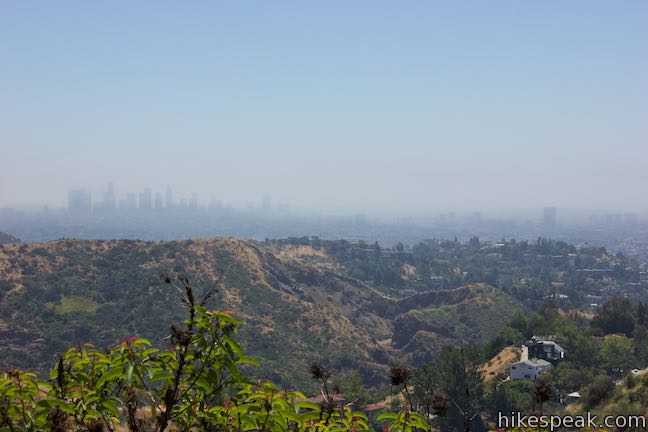
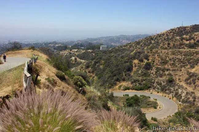
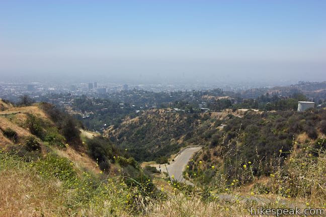
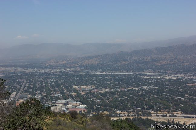
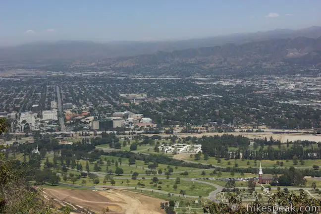
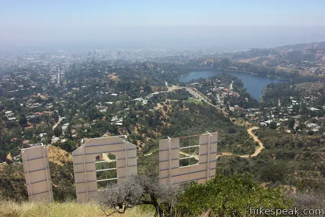
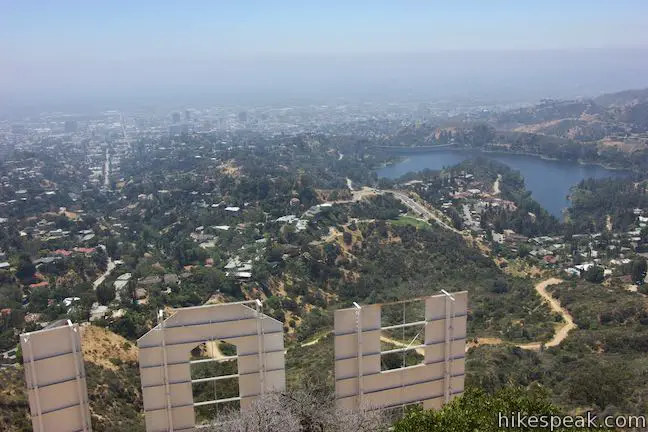
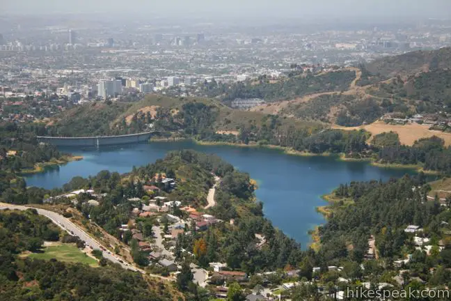
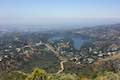
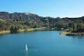
Look to your right, away from the sign, to see Lake Hollywood Park and the unofficial Hollywood Sign viewing area at the other end of Canyon Lake Drive. Just beyond that, Lake Hollywood Reservoir appears to southwest. Downtown Hollywood is behind that.
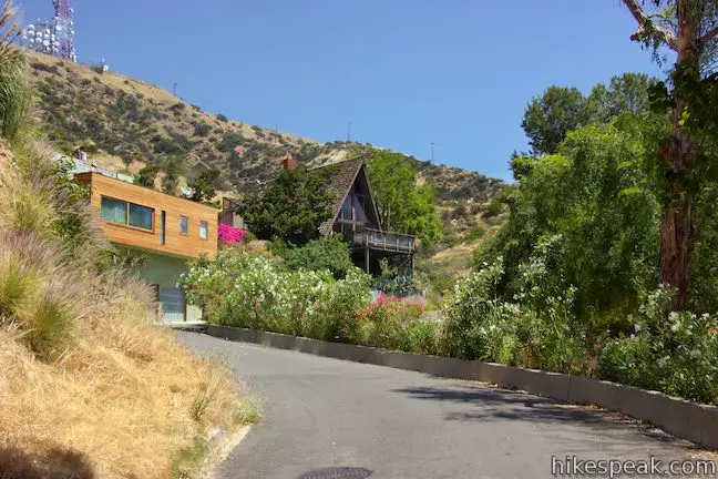
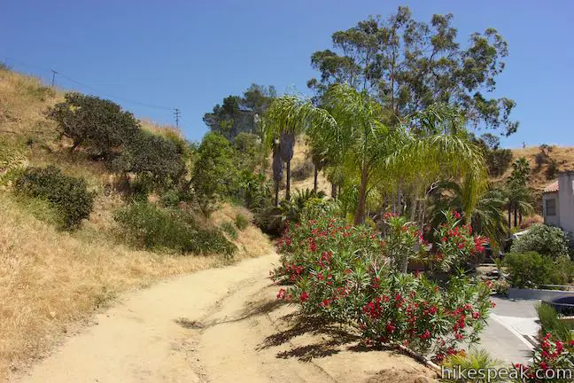
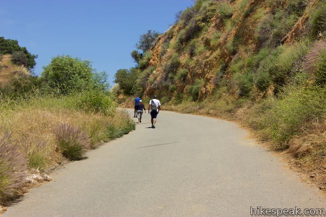
Eventually, unpaved Innsdale Drive (Innsdale Trail) heads to the right toward houses along a street called Mulholland Highway. As you approach the end of the trail, you’ll want to look over your shoulder for those Hollywood Sign sights.
Cross over a chain at the top of the trail as you exit Griffith Park. Make a point to look back when you reach the paved road. The top of the trail is not marked as a trailhead. Instead, it just looks like a driveway between homes. You’ll need to be able to identify the trail on the hike down, so note the location!
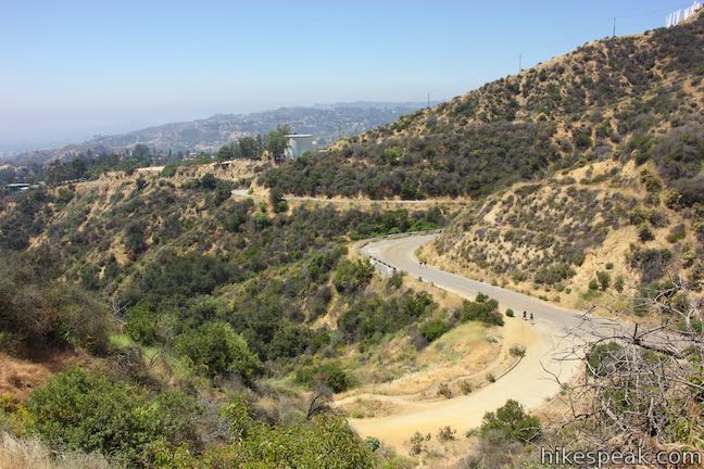
Mulholland Highway
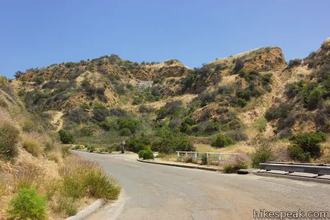
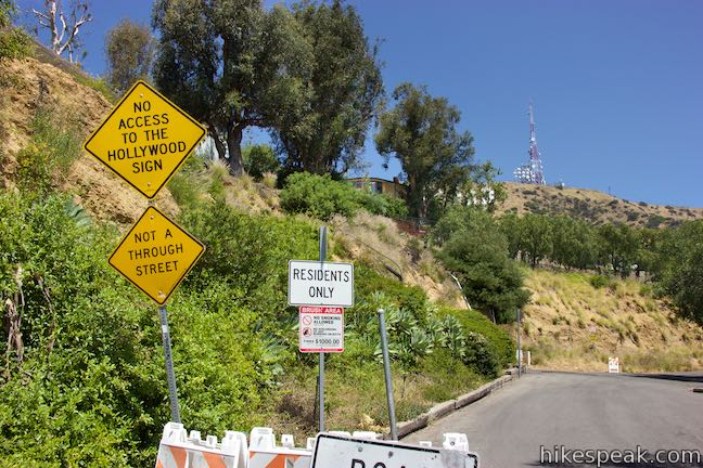
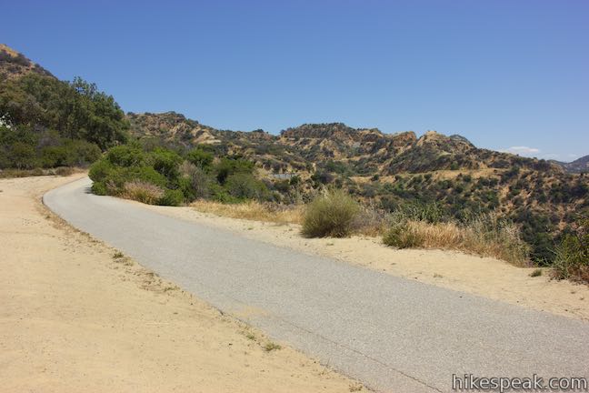
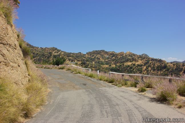
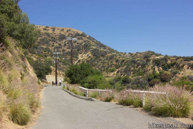
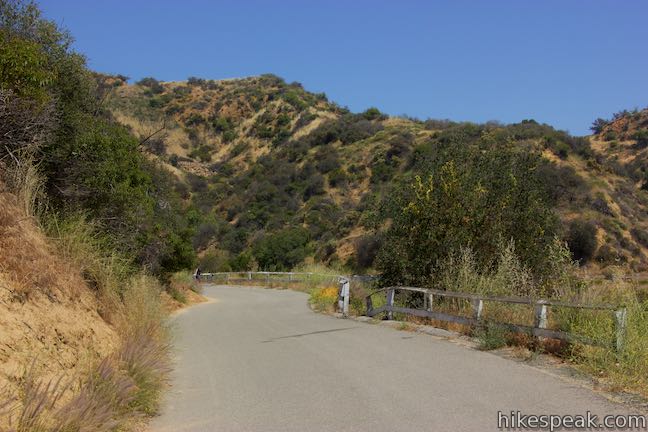
Having hiked 0.45 miles, turn left up Mulholland Highway and walk along the shoulder, being mindful of the traffic. Turn left at the next intersection, which hosts a collection of foreboding signs and barriers that imply that the road is off limits. Walk up the road past the barricades, staying off people’s driveways and property so that you aren’t actually trespassing.
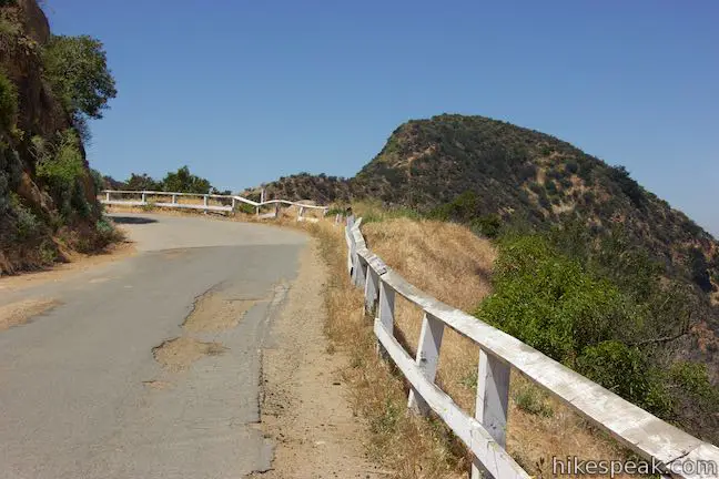
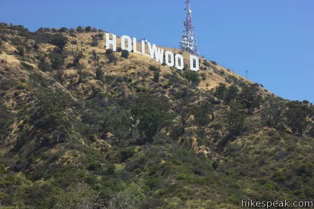
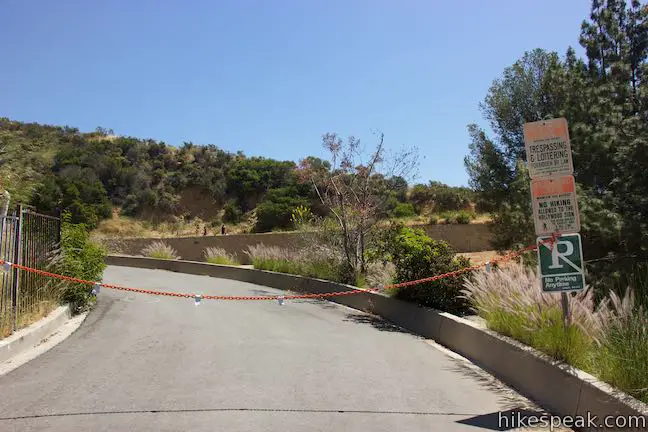
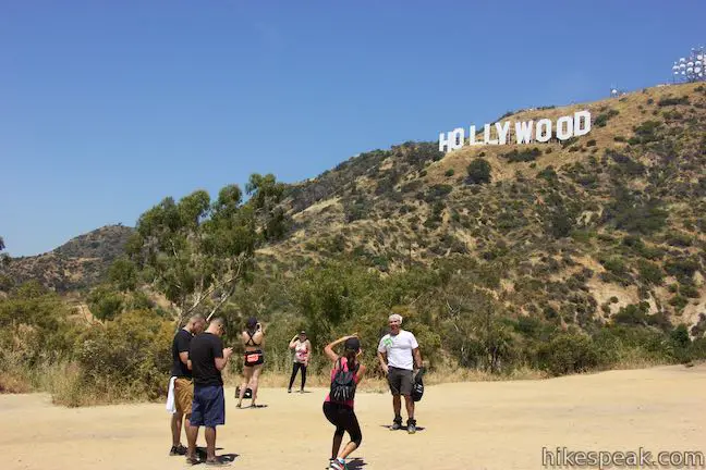
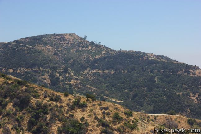
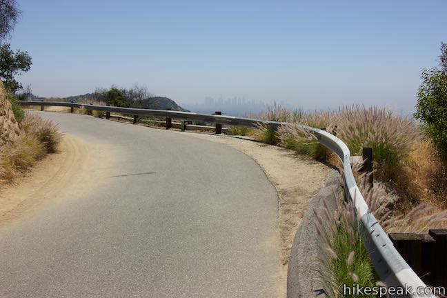
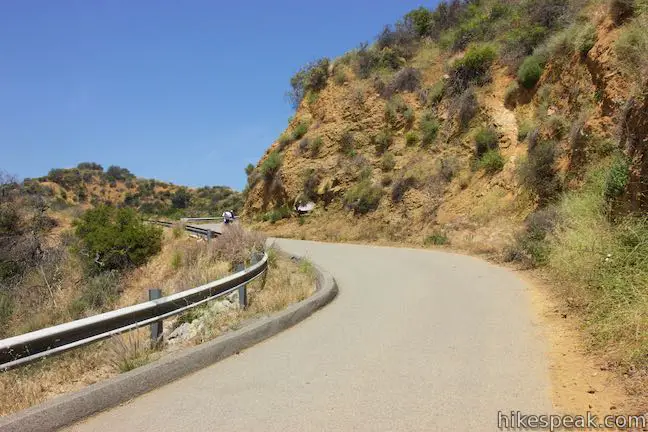
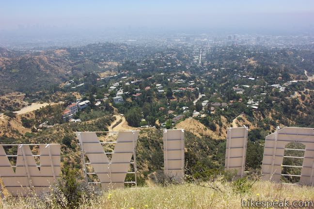
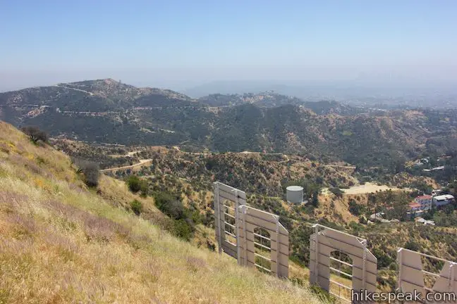
The road (which is still Mulholland Highway) curves to the right and meets a chain and signs in front of one last house. Cross the chain to proceed up the road, which curves to the right and becomes unpaved. As you round this bend, the Hollywood Sign soars overhead. You can’t get much closer than this! If you need to snap a new profile pic, this is probably the best spot, but the hike does offer one more good viewpoint facing the Hollywood Sign.

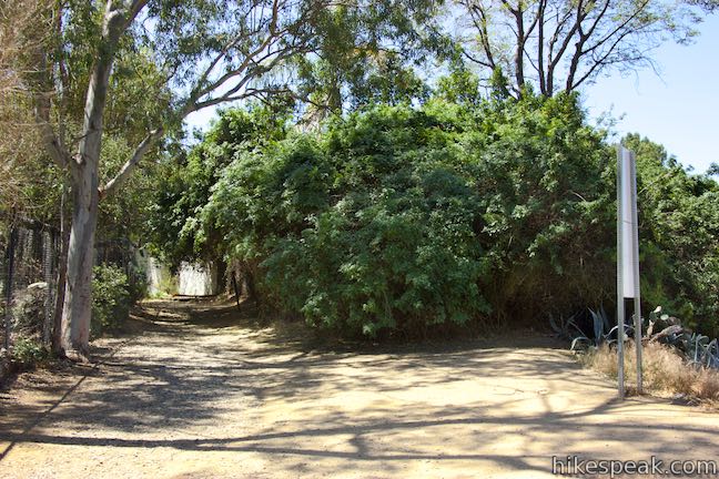
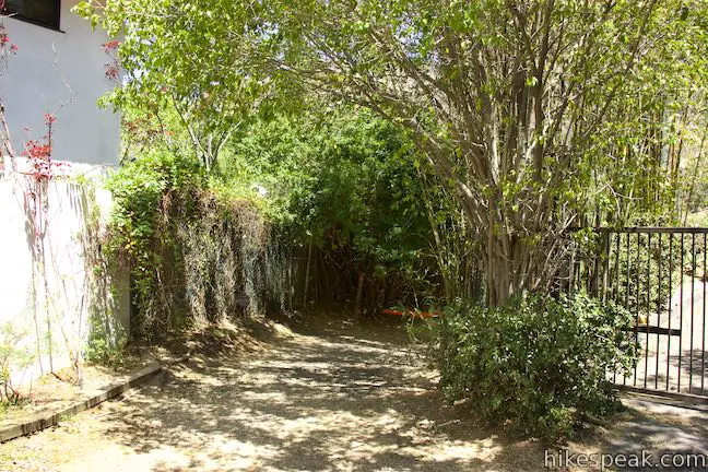
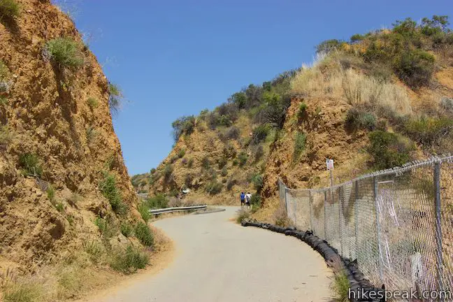
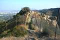
Stay on the road and do not stray into the off-limits area above, marked with the restricted entry signs from the Mountain Fire District. Proceed up unpaved Mulhollad Highway, which wraps around a ridge above houses at the top of the Hollywoodland Neighborhood. The trail rounds a bend and gets closer to the houses. The trail is separated from a driveway by a row of bushes and the dirt trail comes to an end, 0.9 miles from the trailhead, merging with the driveway in front of a teal gate at the top of Deronda Drive.
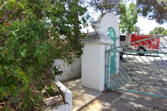
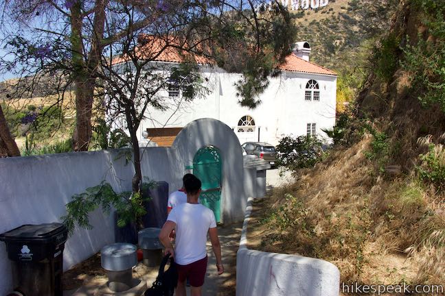
Turn left just in front of the gate to take some almost hidden steps up to Mount Lee Drive. Also, look over your shoulder to see where the trail joins the driveway so that you will recognize it on the hike back. The steps go along a wall to a paved road just beyond a fire gate at the top of Deronda Drive. This new trail is Mount Lee Drive, which leads to the summit behind the Hollywood Sign.
Mount Lee Drive
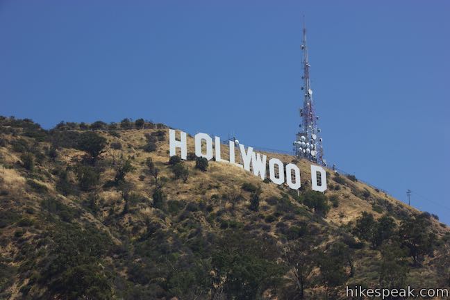
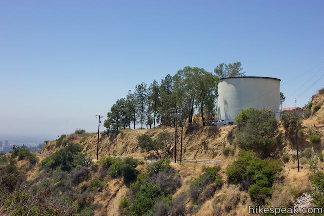
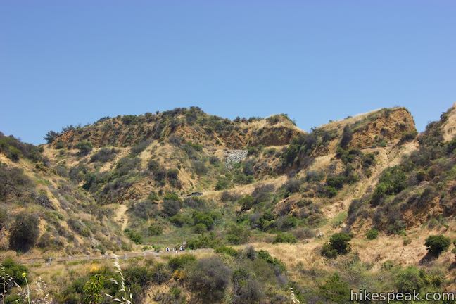
An immediate junction at the bottom of Mount Lee Drive presents a paved spur to the left that goes 200 yards up to Tyrolian Tank. Unless you’re a big fan of holding tanks, you’ll probably only want to walk 100 yards up this spur to Hollywood Sign View.
Venture up the side trail to a dirt landing with a broad, if slightly indirect, view of the sign. Have you not already taken a photo where you appear to be holding up the sign in your hand thanks to the magic of forced perspective? Take that picture here if you haven’t, post it, and start racking up likes as you continue up the mountain.
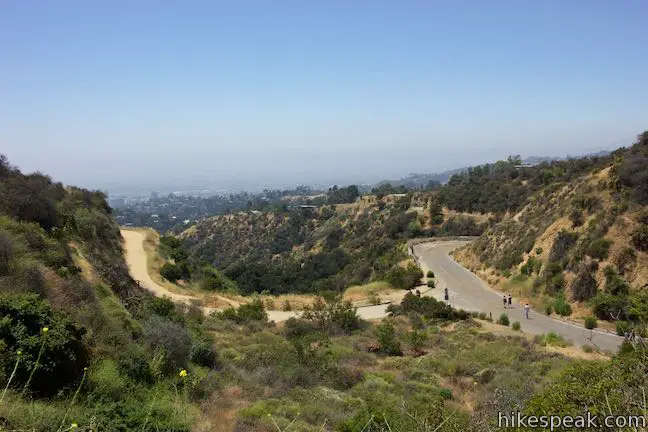
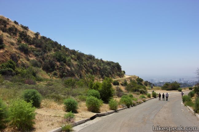
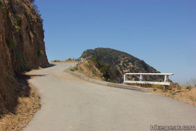
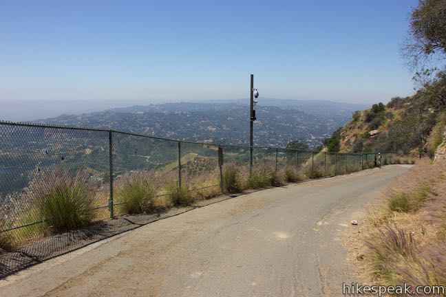
Return to the junction and turn left to hike all the way up to the Hollywood Sign on Mount Lee Drive. What remains is a paved 1.35-mile ascent to the top of Mount Lee, gaining just over 500 feet. The sign-facing views basically end here, so if you’ve got all the photos you need, you could hike back down for a 1.9-mile round trip outing with 265 feet of elevation change.
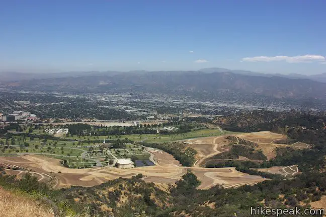
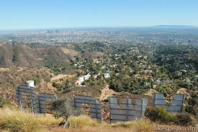
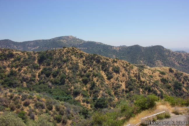
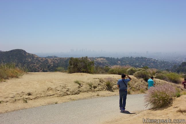
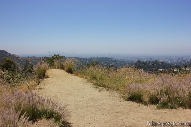
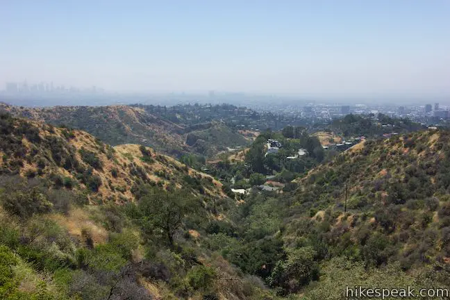
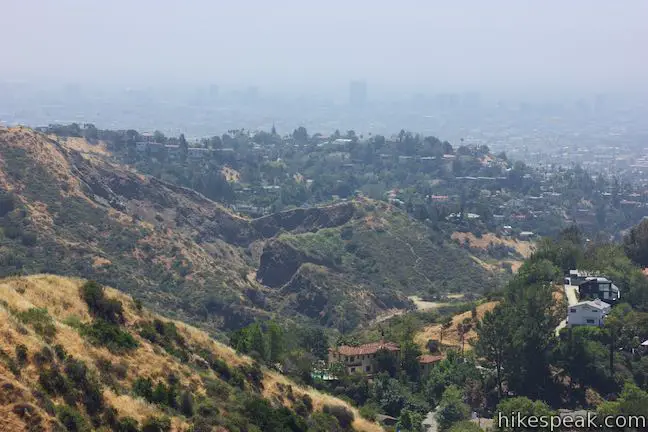
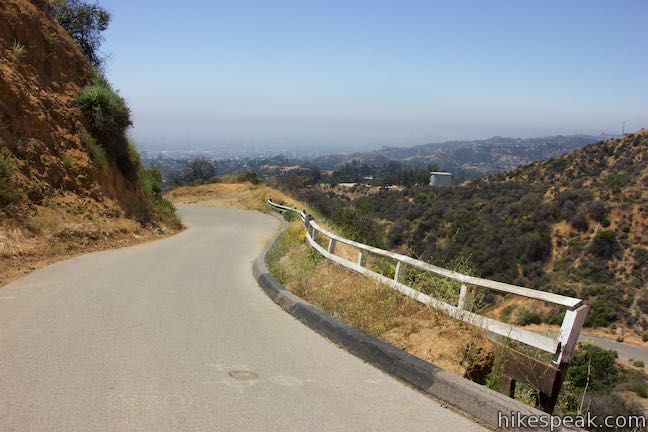
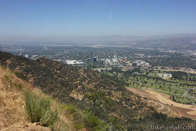
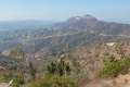
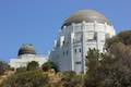
As you hike up Mount Lee Drive, look east into Griffith Park where Mount Hollywood rises above Griffith Observatory. Curve around a couple ridges for an interesting perspective south over the quarried area by Bronson Cave (aka the Batcave). The skyline of downtown Los Angeles rises to the southeast.
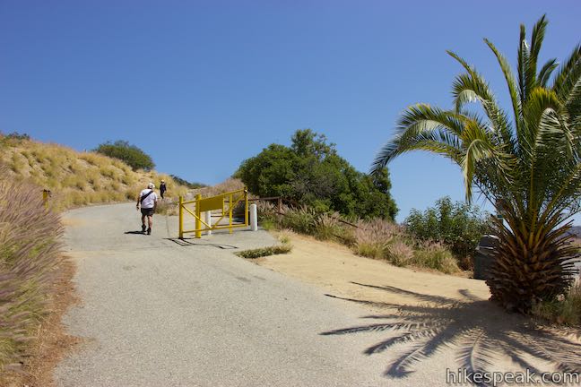
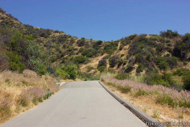
Come to a junction with unpaved Mulholland Fire Road, which goes east and connects to Hollyridge Trail and Brush Canyon Trail to facilitate other hikes to the Hollywood Sign. Stay to the left to proceed up Mount Lee Drive for another 0.95 mile.
Next, Mount Lee Drive makes a sweeping bend to the right and rises to views back across the junction and out over Los Angeles.
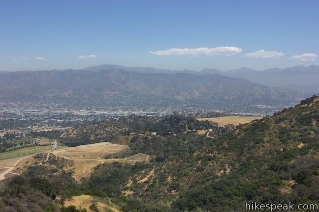
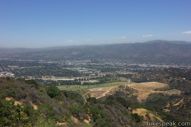
Pass to the east side of a ridge along a fence that prevents trail cutting from the other side. The road ascends to the north side of the mountain for a view over Burbank, the Verdugo Mountains, and the San Gabriel Mountains.
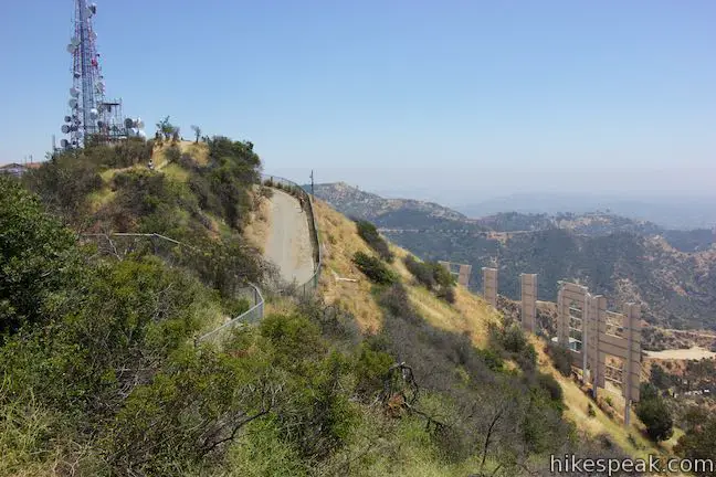
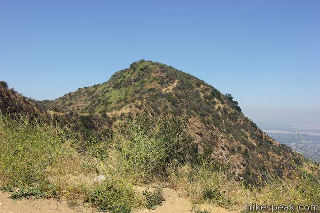
At the top of Mount Lee, the road makes a horseshoe bend to the left, passing a plaque and a junction with Aileen Getty Ridge Trail, which crosses a ridge to Cahuenga Peak.
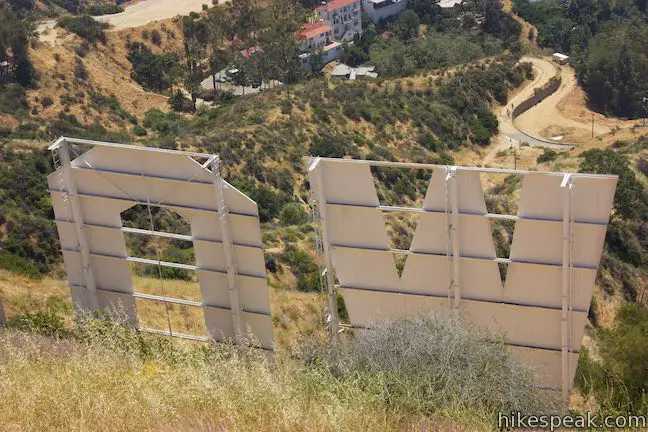
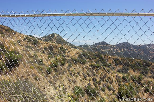
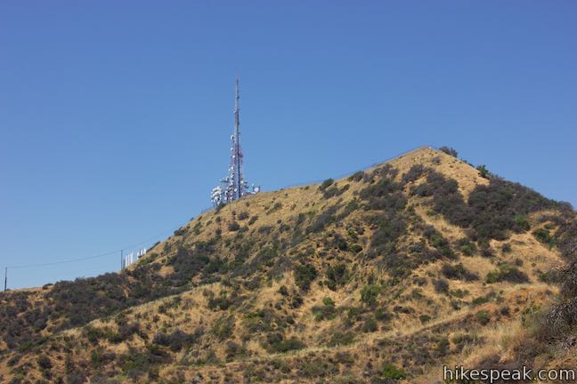
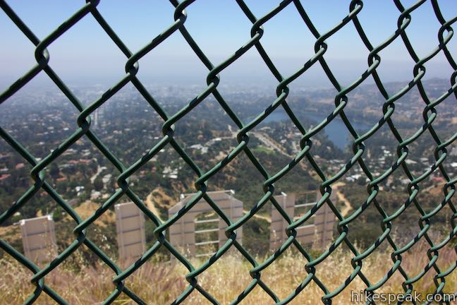
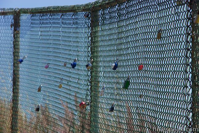
Around the bend in Mount Lee Drive, you will find yourself right on top of the H in Hollywood. A tall chain-link fence keeps hikers from approaching the tall white letters and restricts the view. Visitors have begun putting locks on the fence as through it were Paris’s Pont des Arts, further obscuring the perspective over the Hollywood Sign.
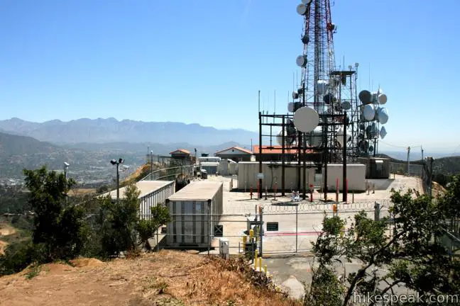
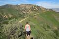
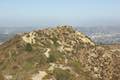
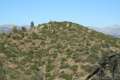
Walk up along the fence to a closed-off area full of radio towers and take the dirt path to the left up to the true summit, twenty feet above the road. The 1,700-foot mountain offers sweeping views of the eastern ridges and peaks of the Santa Monica Mountains and the city below. Picture everywhere you can see the Hollywood Sign from and that’s what’s in sight (if it’s not too hazy).

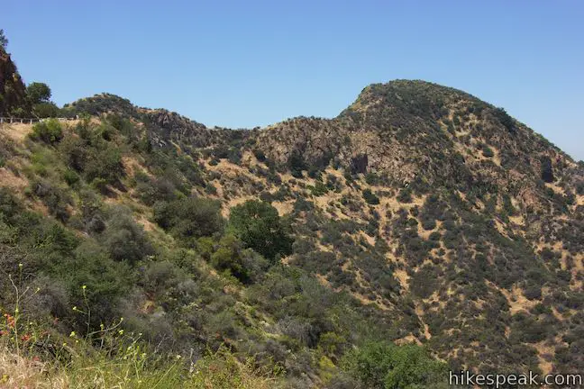
If you came this far and have the energy for a bit more, extending the hike out to Cahuenga Peak is a great addition. Walk 0.15 miles down from the summit to the outside of the big bend in the road where Aileen Getty Ridge Trail begins. Follow this narrow, rugged trail west over an undulating ridge to Caheunga Peak. The terrain drops off steeply on both sides of the ridge, delivering dramatic views. Follow Aileen Getty Ridge Trail for a third of a mile to the 1,820-foot summit of Cahuenga Peak, Griffith Park’s highest point.
Recent history: Cahuenga Peak was spared from developed by citizens who blocked a housing project and contributed to the Save the Sign Campaign. The land was purchased in April or 2010 and donated to Los Angeles to join Griffith Park. Aileen Getty Ridge Trail takes its name from an indispensable donor to that effort.
The dirt single-track trail to the less-visited summit of Cahuenga Peak is a nice change from the wide paved roads leading up to the Hollywood Sign. Those hiking to Cahuenga Peak from Mount Lee can form the Hollywood Sign – Hollywood Reservoir Loop by continuing on Aileen Getty Ridge Trail to Burbank Peak and down to the streets below.
After enjoying Mount Lee (and it’s neighbor Cahuenga Peak), return the way you came for a 4.6-mile (or 5.3-mile) round trip hike.
The basic directions for this hike are:
- Start from the north end of Canyon Lake Drive and hike east up Innsdale Drive (0 miles)
- Reach the top of Innsdale Drive and turn left onto Mulholland Highway (0.45 miles)
- Turn left at the next intersection to continue up Mulholland Highway (0.55 miles)
- Cross a chain and pass a Hollywood Sign photo-op on Mulholland Highway (0.65 miles)
- Reach the top of Mulholland Highway and turn left up a passage around gates to Mount Lee Drive (0.9 miles)
- Turn left up a spur to Hollywood Sign View (0.9 miles)
- Admire the perspective from Hollywood Sign View (0.95 miles)
- Return to Mount Lee Drive and turn left (1 mile)
- Pass through a junction with Mulholland Fire Road (1.4 miles)
- Round the bend just below the summit, passing Aileen Getty Ridge Trail to Cahuenga Peak (2.2 miles)
- Reach the top of Mount Lee above the Hollywood Sign (2.35 miles)
Check out this breakdown of the trails to the Hollywood Sign to compare the routes to Mount Lee or consider other hikes in Griffith Park.
This hike to the Hollywood Sign is dog friendly. Bikes are not allowed on unpaved trails in Griffith Park. No fee is required to park at the trailhead or visit Griffith Park. No permit is needed to hike these trails to the Hollywood Sign, so get out and enjoy!
Directions to the Trailhead
- Exit the 101 Freeway onto Barham Boulevard and drive north for 1/3 of a mile.
- Turn right at the light onto Lake Hollywood Drive.
- Take this winding road for half a mile up to an intersection with Wonder View Drive.
- Bear right to stay on Lake Hollywood Drive for another mile, passing Lake Hollywood Reservoir.
- Turn left up Tahoe Drive and go a quarter mile to Canyon Lake Drive.
- The trailhead is to the left, a tenth of a mile up Canyon Lake Drive where the street ends.
- Park along the street.
Trailhead Location
Trailhead address: 6300 Innsdale Drive, Los Angeles, CA 90068
Trailhead coordinates: 34.130, -118.327 (34° 07′ 48″N 118° 19′ 37.2″W)
View Griffith Park in a larger map
Or view a regional map of surrounding Los Angeles trails and campgrounds.


 | Hollywood Sign - Hollywood Reservoir Loop This 5.4 to 7.4-mile loop combines trails and streets to visit the Hollywood Sign on Mount Lee, neighboring Cahuenga Peak and Burbank Peak, and Lake Hollywood Reservoir. |
 | Lake Hollywood Reservoir Walking Trail This 3.5-mile loop circles a peaceful fence-enclosed reservoir in the hills below the Hollywood Sign. |
 | Burbank Peak This 1.6-mile round trip hike climbs to the Wisdom Tree perched at the west end of Griffith Park. |
 | Cahuenga Peak This 3-mile hike on Burbank Peak Trail and Aileen Getty Ridge Trail ascends to Cahuenga Peak and the adjacent Mount Lee, home of the Hollywood Sign. |
 | Mount Lee and the Hollywood Sign via Hollyridge Trail This 3.5-mile hike ascends 750 feet to reach the summit of Mount Lee behind the Hollywood Sign. |
 | Mount Lee and the Hollywood Sign via Brush Canyon Trail This 6.4-mile hike crosses Griffith Park from Canyon Drive to the top of Mount Lee directly behind the landmark Hollywood Sign. |
 | Bronson Cave This short easy hike visits a man-made cave recognizable as the Batcave from the 1960s Batman TV series and hundreds of other locations on TV and film. |
 | Mount Chapel, Mount Bell, and Mount Hollywood This 5.7-mile loop tops three prominent summits on a panoramic tour of Griffith Park. |
 | Griffith Observatory to the Hollywood Sign This 8.8-mile hike travels from one Griffith Park landmark to another, crossing Mount Hollywood along the way. |
 | Mount Hollywood This 1,625-foot peak is a star of Griffith Park with panoramic views that can be reached from Griffith Observatory on a steep 1.4-mile hike or a scenic 2.65-mile trek and from lower in the park in Western Canyon for a hike of around 4.2 miles. |
 | Ferndell Trail This relaxing half-mile hike goes through a tropical garden in the lushest little canyon in Griffith Park. Explore farther on a 1.75-mile hike in Western Canyon or venture up to the Griffith Observatory to see more of the park. |
 | Griffith Observatory via West Observatory Trail This 2.1-mile hike ascends from Western Canyon up ridges to Griffith Observatory, getting sweeping views over Los Angeles and Griffith Park along the way. |
 | Griffith Observatory via East Observatory Trail This 1.5-mile hike from Vermont Canyon Avenue up to Griffith Park's great observatory delivers excellent views over Los Angeles along the way. |
 | Glendale Peak This hike is around three miles long and visits a less known summit on the southeast side of Griffith Park with views that deserve more attention. |
 | Glendale Peak - Mount Hollywood Loop This 4.15-mile hike tops two summits in Griffith Park that both have awesome views. |
 | Cedar Grove & Vista View Point Loop This 2.3-mile loop on the southeast side of Griffith Park follows paved and unpaved trails to two park attractions, a quiet grove with a picnic area and a helipad with panoramic views. |
 | Bee Rock This hive-shaped point on the east side of Griffith Park is reached via a 1.7 to 4-mile round trip hike. |
 | Old Zoo Picnic Area This half-mile hike explores the abandoned exhibits and animal cages in the ruins of the old LA Zoo in Griffith Park. |
 | Beacon Hill This 2.75 to 3.9-mile hike in Griffith Park climbs 500 feet to the easternmost summit in the Santa Monica Mountains. |
 | Amir's Garden This one-mile hike reaches a relaxing garden on the east side of Griffith Park that is a pleasant retreat for hikers. |
 | More trails in the Santa Monica Mountains Explore other destinations in the range. |
- Mount Lee on summitpost.org (opens in a new tab)
- Mount Lee on wikipedia.org (opens in a new tab)
- The Los Angeles website for Griffith Park (opens in a new tab)
- Hollywood Sign Hikes on hollywoodsignhikes.com (opens in a new tab)
- Lake Hollywood Park and Innsdale Trails via Mulholland Highway on modernhiker.com (opens in a new tab)
- Hike to the HOLLYWOOD Sign on thetrailmaster.com (opens in a new tab)
- The Hollywood Sign Hike on thebrassy.com (opens in a new tab)
- Hollywood Sign and Mount Lee Summit Hike on inkedwithwanderlust.com (opens in a new tab)
Common Questions about The Hollywood Sign via Innsdale Drive, Mulholland Highway, and Mount Lee Drive in Griffith Park
- Is the trail open?
- Yes. You should expect to find that Innsdale Drive - Mulholland Highway - Mount Lee Drive is open. There are no recent reports of trail closures. If you discover that the trail is closed, please help your fellow hikers by reporting a closure.
- Is this trail free to access?
- Yes, Innsdale Drive - Mulholland Highway - Mount Lee Drive is free to access. No entrance fee, pass, or permit is required. If you discover that access rules have changed, please provide feedback on your experience.
- How much time does this hike take?
- It takes approximately 2 hours 15 minutes to hike Innsdale Drive - Mulholland Highway - Mount Lee Drive. Individual hiking times vary. Add extra time for breaks and taking in the views.
- How long is this hike?
- The hike to Innsdale Drive - Mulholland Highway - Mount Lee Drive is a 4.6 mile out and back with 750 feet of elevation change.
- Are dogs allowed on this trail?
- Yes, dogs are allowed on Innsdale Drive - Mulholland Highway - Mount Lee Drive. The trail is open to hikers, dogs.
- What mountain range is this trail in?
- Innsdale Drive - Mulholland Highway - Mount Lee Drive is located in the Santa Monica Mountains.
- Where is the trailhead located?
- The trailhead for Innsdale Drive - Mulholland Highway - Mount Lee Drive is located in Los Angeles, CA.
Trailhead Address:
6300 Innsdale Drive
Los Angeles, CA 90068
Trailhead Coordinates:
34.130, -118.327 - What are the driving directions to the start of the hike?
To get to the trailhead: Exit the 101 Freeway onto Barham Boulevard and drive north for 1/3 of a mile. Turn right at the light onto Lake Hollywood Drive. Take this winding road for half a mile up to an intersection with Wonder View Drive. Bear right to stay on Lake Hollywood Drive for another mile, passing Lake Hollywood Reservoir. Turn left up Tahoe Drive and go a quarter mile to Canyon Lake Drive. The trailhead is to the left, a tenth of a mile up Canyon Lake Drive where the street ends. Park along the street.
View custom Google Maps directions from your current location.
- Are there other trails near Innsdale Drive - Mulholland Highway - Mount Lee Drive?
- Yes, you can find other nearby hikes using the Hikespeak Hike Finder Map.

14 Comments on The Hollywood Sign via Innsdale Drive, Mulholland Highway, and Mount Lee Drive in Griffith Park
What hikers are saying:
✨ Generated summary of user commentsThis trail offers a rewarding experience filled with scenic lookouts that delight families and solo explorers alike. While the route is not always straightforward, hikers find success by ignoring unofficial deterrents like neighborhood chains or cones to stay on the path, though the area above the trail remains strictly closed. Phil recommends parking at Lake Hollywood Park and returning via the streets to enjoy a different perspective of the area.
“We had a wonderful hike full of look-outs!” Jump to comment ↓
But is it okay to cross the chains? i’d like to take this trail but i don’t want to be arrested or have a fine.
You can cross the chains to stay on the roads & trails. Do observe the signs to stay out of the area above the trail, which is truly closed off to hikers.
Are dogs allowed?
Yes they are – on leash of course.
Hello Hikespeak, we want to hike this trail to reach the back of the Hollywood sign in a couple of weeks. Is there any update on your description above? Are the chains still allowed to cross and the little passage (pic no. 38) is open, too? Google maps pictures are old ones from 2014 and I cannot see any passage. Thanks in advance for a short reply.
Thanks, Hikespeak! We have been wanting to do this hike for some time. The trail is not straightforward, but we made it with your clear directions on everything from where to park to not being deterred by chains, cones or signs put up by the neighbors.
Great information, thank you. We did the walk Friday the 12th and it was exactly how you explained. Parked at Lake Hollywood park then walked in through Innsdale drive and then came back via the streets for a different perspective.
I’m planning on doing this hike next week early in the morning. Are there any changes that you’re aware of? Thanks in advance.
Just did it and it was great! Thanks for the map and step by step instructions
Our family (kids 5, 11, 14) hiked this route today and were so happy. Your instructions were spot on and so easy to follow. The views were great. Thanks for a great post.
Thank you so much for sharing! We had a wonderful hike full of look-outs!
There is no date on this hike information, but I do see numerous questions dating back to 2017. Is this hike information still valid for November 2022 hike? This will be my first trip to CA and I’ll be solo, so I’m looking for current info.
Hey, did you find everything okay?
Coming for the first time this year, but all the info on Innsdale is very dated. Bit worried about all the trespassing signs seen on google maps.
[…] HOLLYWOOD’S CROWN JEWEL: YOUR PATH TO ICONIC VIEWS! […]