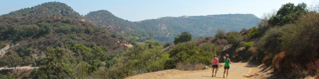
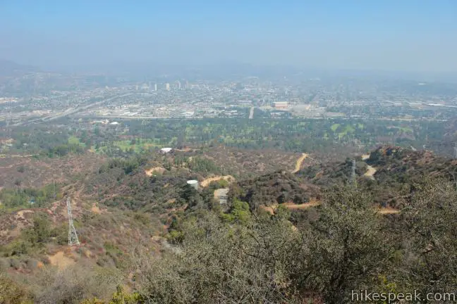
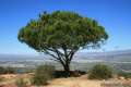
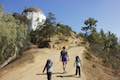
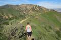
If you’re interested in getting some exercise with panoramic views over Griffith Park, consider hiking a loop to the summit’s of three park peaks: Mount Chapel, Mount Bell, and Mount Hollywood.
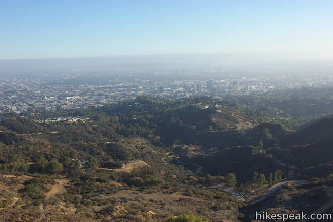
Starting from Hollyridge Trail at the top of Beachwood Drive, this 5.7-mile loop ascends 675 vertical feet, from 950 feet at the trailhead to 1,625 feet at the summit of Mount Hollywood, the tallest of the three peaks. The loop has several ups and downs that multiply the effort for elevation. This 3-summit trek mixes wide, gradual trails with a couple steep, rugged climbs to reach towering views over Hollywood, downtown Los Angeles, and much of the Southland.
Bad News: The Hollyridge Trailhead was closed to the public in April of 2017. The directions from that trailhead will remain on this site, should the trailhead be reopened. (Yes, it should!).
The slightly longer alternative to Hollyridge Trail is to hike up Brush Canyon Trail from Canyon Drive. Doing so extends the round trip distance to 6.3 miles. The Canyon Drive Trailhead is down at 640 feet, so the difference between the top of bottom of the hike jumps to 985 feet. Turn-by-turn directions for both routes are below.
Starting on Hollyrige Trail
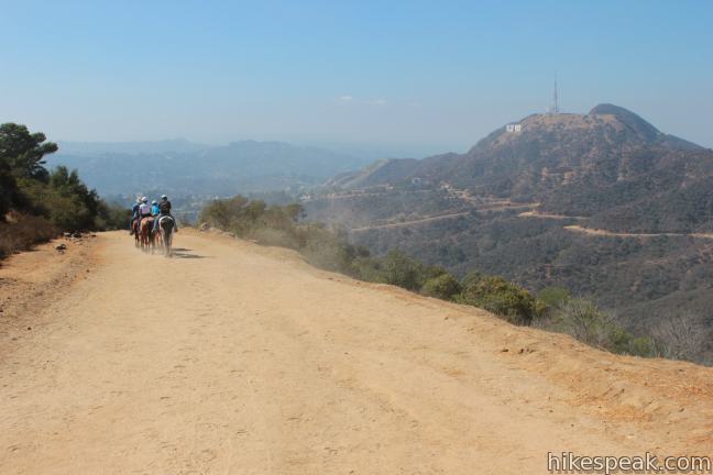
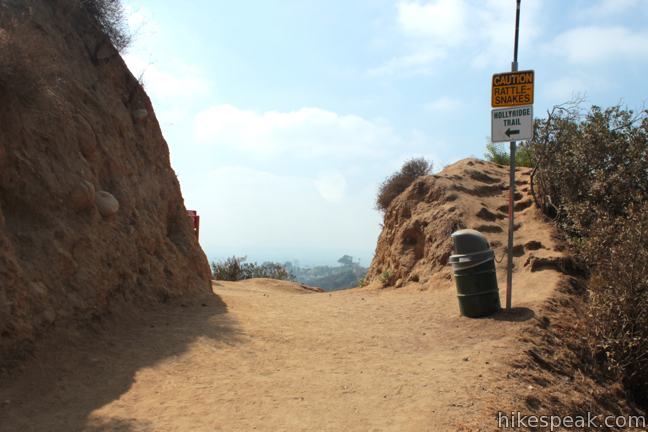
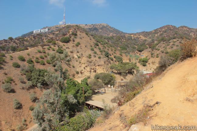
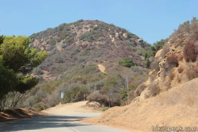
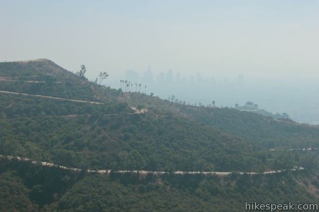
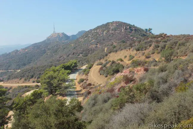
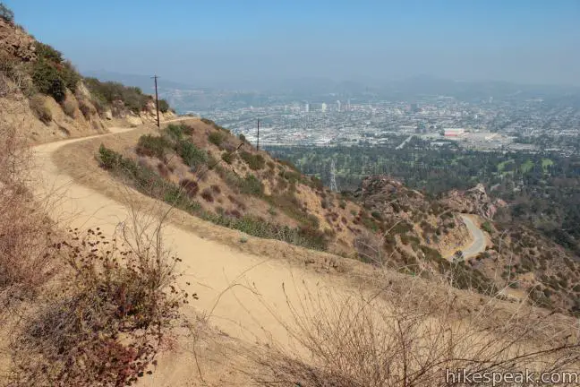
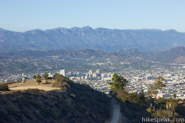
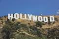
Set out from a trailhead at the top of Beachwood Drive (just before the Sunset Ranch horse stables but above the gate for Sunset Ranch). Venture a short distance up a wide, dirt trail to a T and turn left up Hollyridge Trail. After a tenth of a mile hiking north up the ridge, you’ll get a good view of the Hollywood Sign. It is an angled perspective of the sign, but all nine letters are visible. Stay straight on Hollyridge Trail past a horse trail coming up from Sunset Ranch and continue another quarter mile up to a junction with Mulholland Fire Road. Turn right at this T (0.45 miles from the start) and proceed east in the direction of Mount Hollywood, whose summit is visible above the Griffith Observatory.
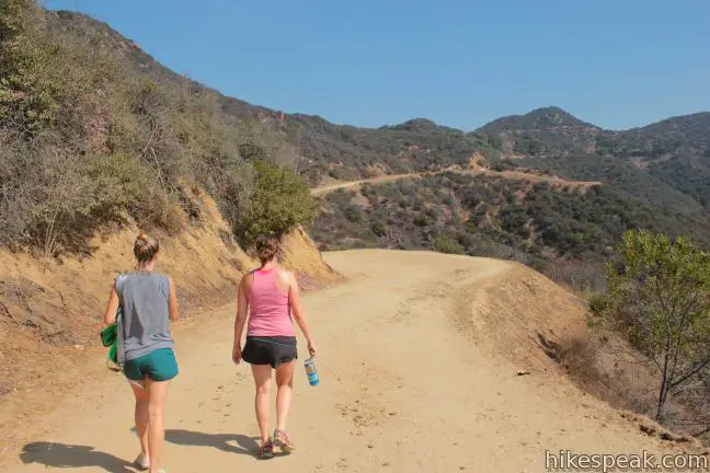
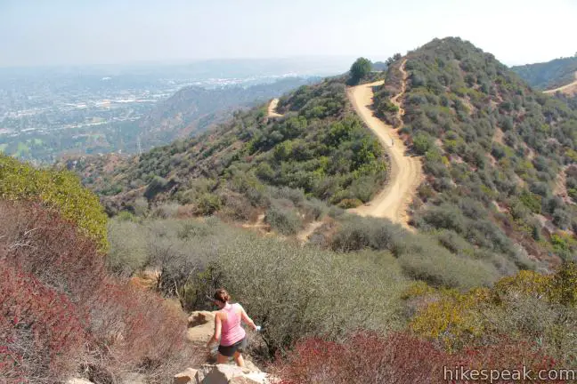
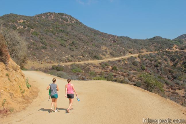
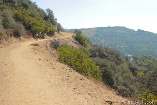
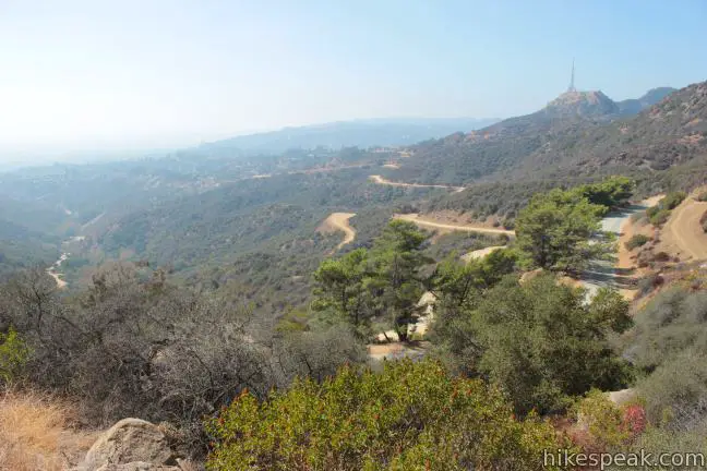
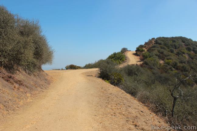
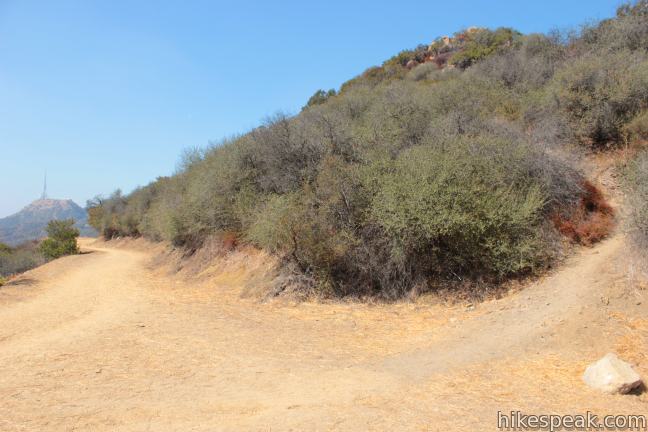
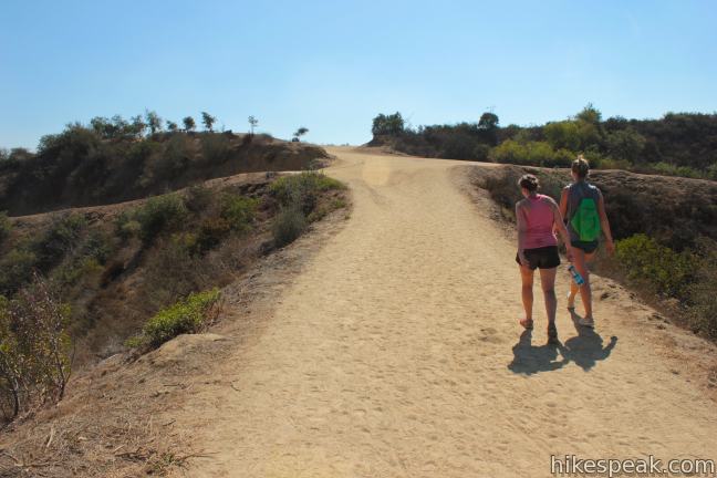
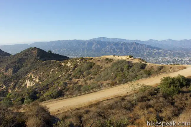
Mulholland Fire Road winds over ridges, offering a gradual climb and open views. One mile into the hike, you will come to a junction with the top of Brush Canyon Trail. Proceed to the left up Mulholland Fire Road to continue toward Mounts Chapel, Bell, and Hollywood.
Starting on Brush Canyon Trail
Leaving from the end of Canyon Drive, Brush Canyon Trail can be used as an alternative to Hollyridge Trail for a slightly longer and steeper start to the three-peak loop.
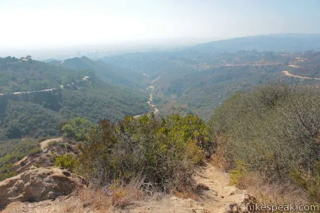
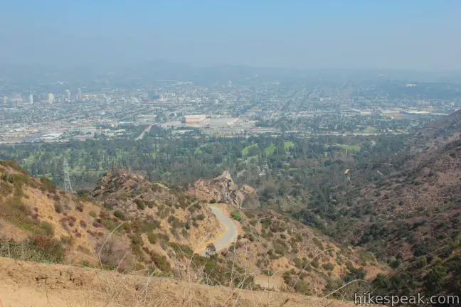
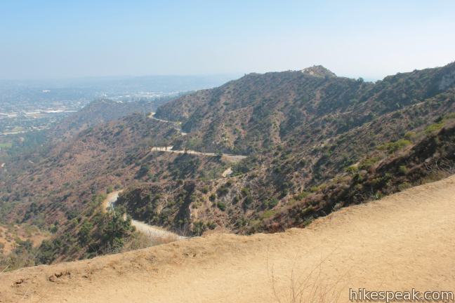
Leave the north end of Canyon Drive and hike around the gate up the center of a wide canyon on Brush Canyon Trail. The dirt road finds the east side of the canyon and climbs above the trees on a sun-exposed route. Brush Canyon Trail rounds the top of the canyon and comes to an overlook at 1.25 miles with vies over Los Angeles.
Just above the overlook, and 1.3 miles from the start, Brush Canyon Trail meets Mulholland Fire Road. Turn right to ascends toward the peaks to the east.
Hiking to Mount Chapel, Mount Bell, and Mount Hollywood
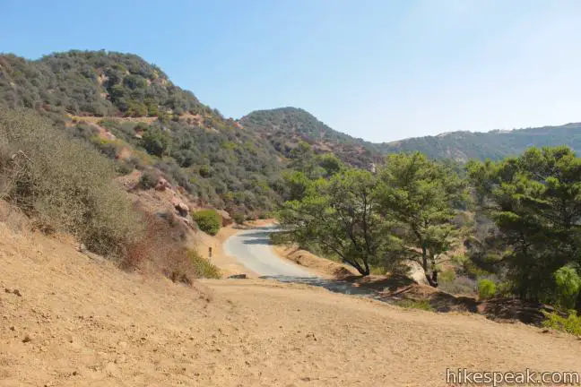
After another 0.3 miles, Mulholland comes to an end at a junction with Mount Hollywood Drive, which is paved but closed to vehicle traffic. To start with the westernmost of the three peaks, Mount Chapel, turn left and hike 1/6 of a mile to the first bend in the road. On the outside of this curve, find a dirt road breaking off to the left up Mount Chapel (just across from a dirt road on the right heading up Mount Bell).
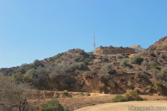
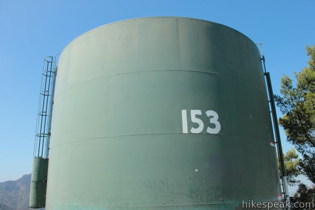
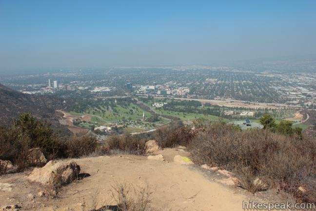
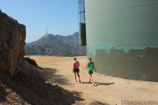
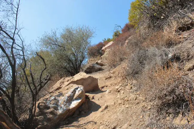
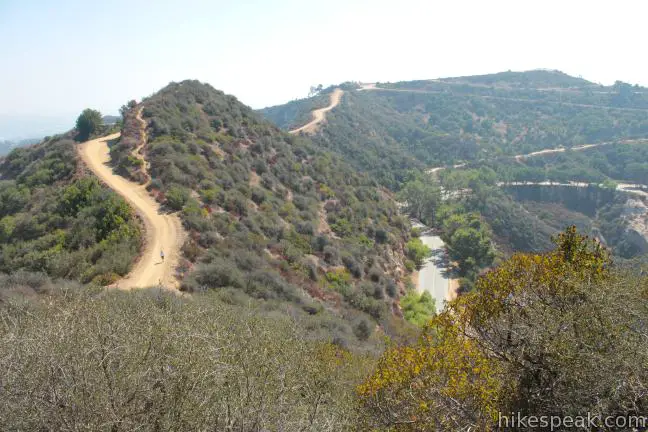
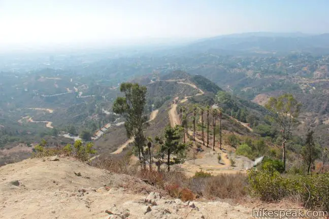
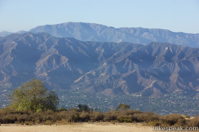
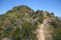
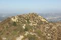
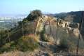
Stride up the dirt road, which wraps around to the north side of Mount Bell to deliver views down the other side of Griffith Park over Forest Lawn Cemetery, Glendale, and the San Fernando Valley. After a 0.3-mile ascent, the road ends alongside a green water tower. Head up the path behind the tower and make the steep and rocky climb to the 1,614-foot summit of Mount Chapel.
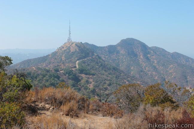
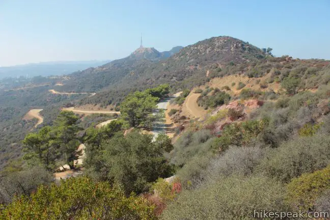
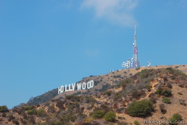
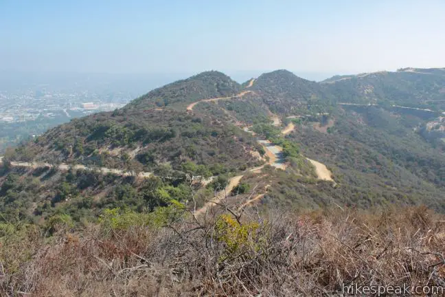
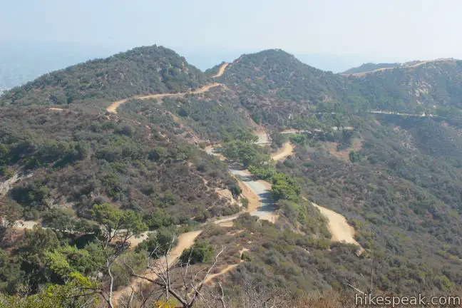
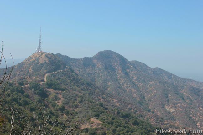
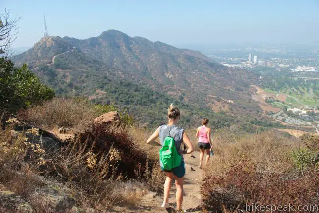
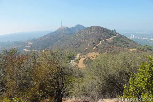
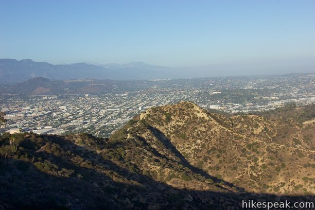
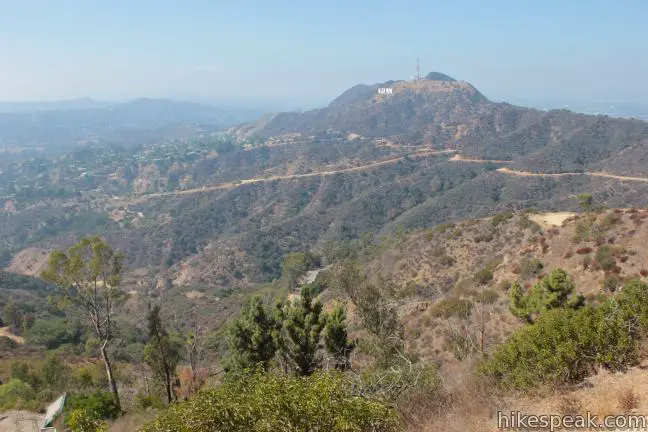
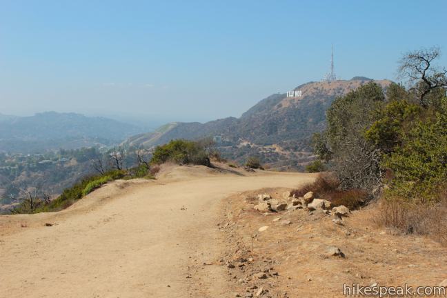
Looking down the ridge to the west, you will spot the radio tower-covered summit of Mount Lee followed by Cahuenga Peak, the highest point in Griffith Park at 1,820 feet. In the other direction, the ridge rises through Mount Bell to the east, before bending south toward Mount Hollywood. It is a 1.85-mile hike from Hollyridge Trail to the panoramic summit of Mount Chapel (2.15 miles via Brush Canyon Trail).
After enjoying the views from the hike’s first summit, descend Mount Chapel to Mount Hollywood Drive. Cross it and begin up the dirt road toward Mount Bell. Stay to the right at the next junction and follow the trail around the south side of Mount Bell. When the road reaches a saddle between the summit and a shorter bump on the ridge, turn left and backtrack up the east face of Mont Bell, following another rugged and steep path to the second summit.
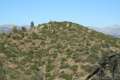
At 1,582 feet, Mount Bell rises above Brush Canyon and offers a nice view southwest down the canyon toward Hollywood. The loop’s second summit offers greater views over the northeast side of Griffith Park toward Glendale and the Verdugo Mountains. You’ll hike 0.78 miles between Mount Chapel and Mount Bell for a total of 2.63 miles from the start via Hollyridge Trail (2.93 miles via Brush Canyon Trail).
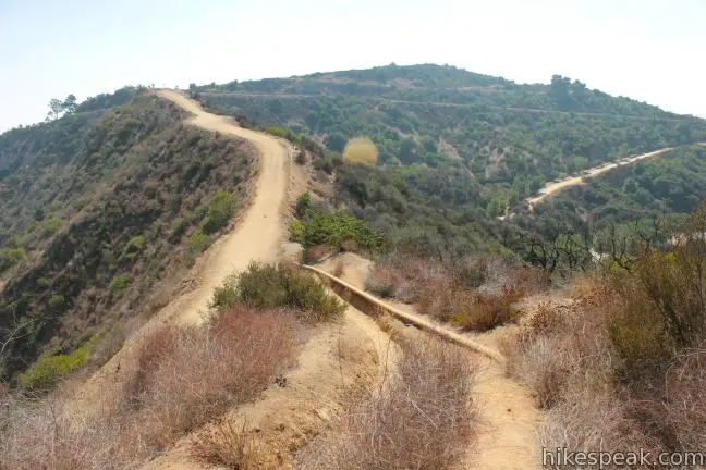
Descend from the summit to the dirt road and continue east from Mount Bell. On the other side of the mini-summit on the ridge, the dirt road narrows and drops to another dirt road.
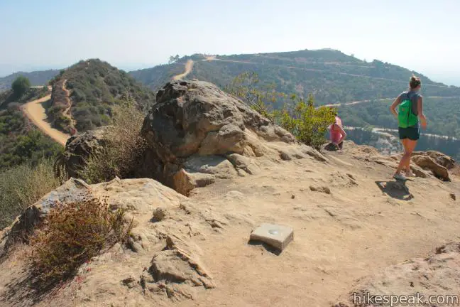
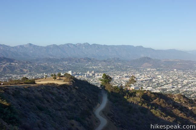
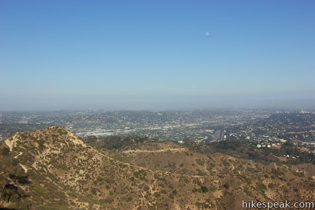
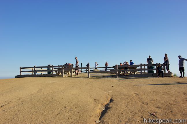
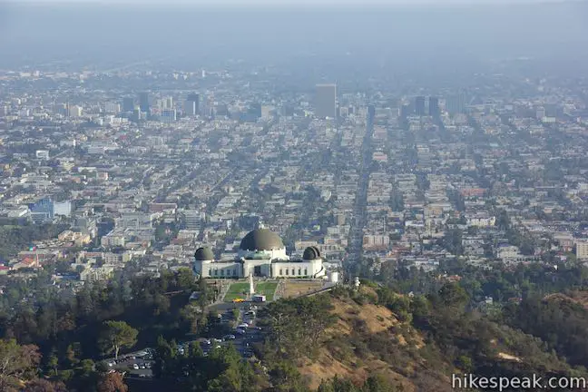
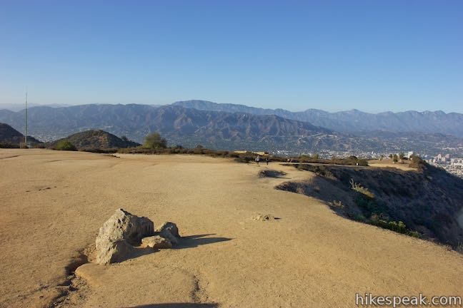
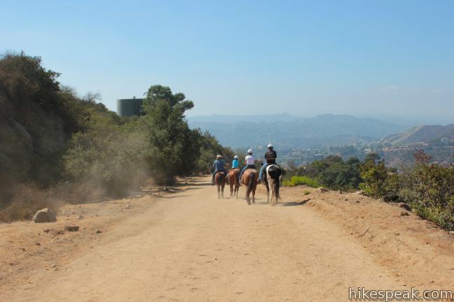
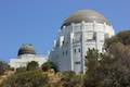
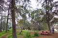
Turn right and hike up to a four-way junction on the north side of Mount Hollywood. East Ridge Trail descends to the left toward Dante’s View and Glendale Peak. Three Mile Trail descends to the right toward Mount Hollywood Drive and will be used to loop back after visiting the summit. Go straight through the junction and pass a small picnic area. The trail curls to the right and rises gradually over the final 0.2 miles to the top of Mount Hollywood. Unlike the first two summits, which are covered in boulders and brush, the crown of Mount Hollywood is bare except for a large fenced-in overlook and a hitching post for horses.
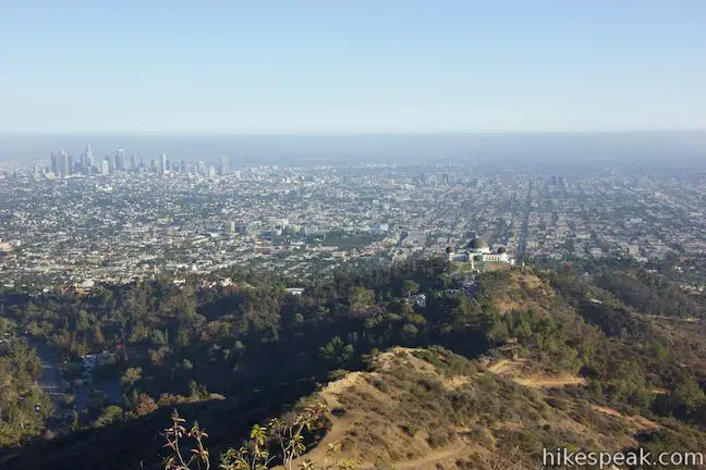
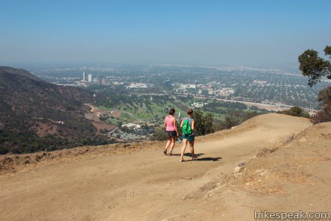
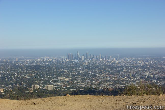
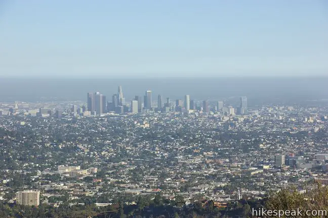
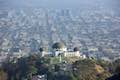
Look south over the Griffith Observatory toward the skyline of downtown Los Angeles. The views from the loop’s highest summit are truly sweeping. Even the Hollywood Sign on Mount Lee is visible from the 1,625-foot summit of Mount Hollywood. You’ll hike 0.67 miles between Mount Bell and Mount Hollywood, putting the final summit 3.3 miles from the start of the hike and 2.4 miles from the finish via Hollyridge Trail (or 3.6 miles from Canyon Drive and 2.7 miles from the finish via Brush Canyon Trail).
While a few trails lead down from Mount Hollywood, the simplest way back to the trailhead is to return to the four-way junction just north of the summit and turn left. This trail, called Three Mile Trail, descends 0.6 miles to Mount Hollywood Drive, offering a good perspective of Mount Bell and Mount Chapel, along with views of Mount Lee and the Hollywood Sign farther to the west.
Turn right at the bottom of Three Mile Trail and hike 0.3 miles up the paved road to the top of Mulholland Fire Road. Turn left down Mulholland and retrace your steps back to the trailhead where you began:
- Hike 0.85 miles down Mulholland Fire Road, turn left down Hollyridge Trail, and descend 0.45 miles to the starting point above Beachwood Drive.
- Hike 0.3 miles down Mulholland Fire Road, turn left down Brush Canyon Trail, and descend 1.3 miles down to Canyon Drive.
This three-summit hike offers satisfying views and a vigorous workout. Those who would like to make things a little tougher can bolster the hike by beginning on Brush Canyon Trail, which adds 0.6 miles round trip and 310 feet of elevation change compared to Hollyridge Trail.
Those truly looking to outdo themselves can add Mount Lee and Cahuenga Peak to the itinerary for a 9-mile hike (beginning from Hollyridge Trail) that bags five summits.
For a shorter hike, set out for Mount Hollywood from Griffith Observatory or Western Canyon.
Variations aside, the 5.7-mile loop to Mount Chapel, Mount Bell, and Mount Hollywood is plenty challenging and rewarding. No fee or permit is required to hike in Griffith Park and dogs are welcome, so get out and enjoy!
The basic directions from the hike from Hollyridge Trail to Mount Chapel, Mount Bell, and Mount Hollywood are:
- Begin up Hollyridge Trail from a trailhead above Beachwood Drive (0 miles)
- Reach the top of Hollyridge Trail and turn right on Mulholland Fire Road (0.45 miles)
- Continue east past the top of Brush Canyon Trail (1 mile)
- Reach the top of Mulholland Fire Road and turn left up Mount Hollywood Drive (1.3 miles)
- Reach a junction between Mount Chapel and Mount Bell and turn left toward Mount Chapel (1.47 miles)
- Reach the end of the road up Mount Chapel and find the path next to the water tower going up to the summit (1.77 miles)
- Climb a short steep trail to the 1,614-foot summit of Mount Chapel (1.85 miles)
- Descend to Mount Hollywood Drive, cross it, and hike up the dirt road toward Mount Bell (2.23 miles)
- Come to a saddle east of Mount Bell and turn left up a path to the top of Mount Bell (2.55 miles)
- Climb a short steep trail to the 1,582-foot summit of Mount Bell (2.63 miles)
- Descend the path and turn left to proceed east (2.71 miles)
- Turn right onto Mount Hollywood Trail (2.87 miles)
- Cross through a junction with East Ridge Trail and 3 Mile Trail Junction to continue south (3.1 miles)
- Reach a viewpoint at the 1.625-foot summit (3.3 miles)
- Return to the junction and turn left down 3 Mile Trail (3.5 miles)
- At the bottom of 3-Mile Trail, turn right up paved Mount Hollywood Drive (4.1 miles)
- Meet Mulholland Fire Road and turn left to close the loop (4.4 miles)
- Hike down Mulholland Fire Road and turn left down Hollyridge Trail (5.25 miles)
- End at the Hollyridge Trailhead above Beachwood Drive (5.7 miles)
The basic directions from the hike from Brush Canyon Trail to Mount Chapel, Mount Bell, and Mount Hollywood are:
- Begin up Brush Canyon Trail from Canyon Drive (0 miles)
- At the top of Brush Canyon Trail, turn right up Mulholland Fire Road (1.3 miles)
- Reach the top of Mulholland Fire Road and turn left up Mount Hollywood Drive (1.6 miles)
- Reach a junction between Mount Chapel and Mount Bell and turn left toward Mount Chapel (1.77 miles)
- Reach the end of the road up Mount Chapel and find the path next to the water tower going up to the summit (2.07 miles)
- Climb a short steep trail to the 1,614-foot summit of Mount Chapel (2.15 miles)
- Descend to Mount Hollywood Drive, cross it, and hike up the dirt road toward Mount Bell (2.53 miles)
- Come to a saddle east of Mount Bell and turn left up a path to the top of Mount Bell (2.85 miles)
- Climb a short steep trail to the 1,582-foot summit of Mount Bell (2.93 miles)
- Descend the path and turn left to proceed east (3.01 miles)
- Turn right onto Mount Hollywood Trail (3.17 miles)
- Cross through a junction with East Ridge Trail and 3 Mile Trail Junction to continue south (3.4 miles)
- Reach a viewpoint at the 1.625-foot summit (3.7 miles)
- Return to the junction and turn left down 3 Mile Trail (3.8 miles)
- At the bottom of 3-Mile Trail, turn right up paved Mount Hollywood Drive (4.4 miles)
- Meet Mulholland Fire Road and turn left to close the loop (4.7 miles)
- Turn left down Brush Canyon Trail (5 miles)
- End at the Brush Canyon Trailhead at the top of Canyon Drive (6.3 miles)
Parking on Beachwood Drive and the surrounding streets in by permit only from 8 a.m. to 6 p.m. on Saturdays, Sundays, and holidays, making it harder to visit the trail on those days. The parking restrictions start at the intersection of Beachwood Drive and Westshire Drive, over half a mile from the trailhead.
Directions to the Trailhead
Hollyridge Trailhead:
- Take the 101 Freeway to the Gower Street Exit (8C).
- From the southbound off ramp, turn left on Gower Street, make the first right on Franklin Avenue, and an immediate left on Beachwood Drive.
- From the northbound off ramp, turn right at the bottom of the ramp onto Beachwood Drive and cross Franklin Avenue.
- Proceed north on Beachwood Drive for 2 miles to the gate at the top of Beachwood Drive outside Sunset Ranch.
- The trailhead is on the right up an ascent beyond this gate with limited parking.
- Hikers may be forced to park on the street south of the gate.
- With the closure of the Hollyridge Trailhead, use Canyon Drive instead.
Brush Canyon Trailhead:
- From Franklin Avenue, north of the 101 Freeway and Hollywood Boulevard, turn north on Canyon Drive (between Bronson Avenue and Van Ness Avenue) and drive 1.4 miles to the trailhead.
- A small parking area is on the left at the end of the road, past a larger lot on the right that can also be used.
Trailhead Location
Trailhead address: Hollyridge Trailhead, 3400 N. Beachwood Drive, Griffith Park, Los Angeles, CA 90068
Trailhead coordinates: 34.12935, -118.31474 (34° 07′ 45.66″N 118° 18′ 53.06″W)
Trailhead address: Brush Canyon Trailhead, 3200 Canyon Drive, Griffith Park, Los Angeles, CA 90068
Trailhead coordinates: 34.12485, -118.3136 (34° 07′ 29.46″N 118° 18′ 48.95″W)
View Griffith Park in a larger map
Or view a regional map of surrounding Los Angeles trails and campgrounds.


 | Mount Lee and the Hollywood Sign via Hollyridge Trail This 3.5-mile hike ascends 750 feet to reach the summit of Mount Lee behind the Hollywood Sign. |
 | Mount Lee and the Hollywood Sign via Brush Canyon Trail This 6.4-mile hike crosses Griffith Park from Canyon Drive to the top of Mount Lee directly behind the landmark Hollywood Sign. |
 | Hollywood Sign via Innsdale Drive, Mulholland Highway, and Mount Lee Drive This 4.6-mile round trip hike combines trails and streets to deliver some of the very best views of the Hollywood Sign on the way to the summit of Mount Lee above the sign. |
 | Burbank Peak This 1.6-mile round trip hike climbs to the Wisdom Tree perched at the west end of Griffith Park. |
 | Cahuenga Peak This 3-mile hike on Burbank Peak Trail and Aileen Getty Ridge Trail ascends to Cahuenga Peak and the adjacent Mount Lee, home of the Hollywood Sign. |
 | Bronson Cave This short easy hike visits a man-made cave recognizable as the Batcave from the 1960s Batman TV series and hundreds of other locations on TV and film. |
 | Mount Hollywood This 1,625-foot peak is a star of Griffith Park with panoramic views that can be reached from Griffith Observatory on a steep 1.4-mile hike or a scenic 2.65-mile trek and from lower in the park in Western Canyon for a hike of around 4.2 miles. |
 | Ferndell Trail This relaxing half-mile hike goes through a tropical garden in the lushest little canyon in Griffith Park. Explore farther on a 1.75-mile hike in Western Canyon or venture up to the Griffith Observatory to see more of the park. |
 | Griffith Observatory via West Observatory Trail This 2.1-mile hike ascends from Western Canyon up ridges to Griffith Observatory, getting sweeping views over Los Angeles and Griffith Park along the way. |
 | Griffith Observatory via East Observatory Trail This 1.5-mile hike from Vermont Canyon Avenue up to Griffith Park's great observatory delivers excellent views over Los Angeles along the way. |
 | Glendale Peak This hike is around three miles long and visits a less known summit on the southeast side of Griffith Park with views that deserve more attention. |
 | Glendale Peak - Mount Hollywood Loop This 4.15-mile hike tops two summits in Griffith Park that both have awesome views. |
 | Cedar Grove & Vista View Point Loop This 2.3-mile loop on the southeast side of Griffith Park follows paved and unpaved trails to two park attractions, a quiet grove with a picnic area and a helipad with panoramic views. |
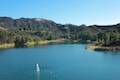 | Lake Hollywood Reservoir Walking Trail This 3.5-mile loop circles a peaceful fence-enclosed reservoir in the hills below the Hollywood Sign. |
 | Bee Rock This hive-shaped point on the east side of Griffith Park is reached via a 1.7 to 4-mile round trip hike. |
 | Old Zoo Picnic Area This half-mile hike explores the abandoned exhibits and animal cages in the ruins of the old LA Zoo in Griffith Park. |
 | Beacon Hill This 2.75 to 3.9-mile hike in Griffith Park climbs 500 feet to the easternmost summit in the Santa Monica Mountains. |
 | Amir's Garden This one-mile hike reaches a relaxing garden on the east side of Griffith Park that is a pleasant retreat for hikers. |
 | More trails in the Santa Monica Mountains Explore other destinations in the range. |
Common Questions about Mount Hollywood, Mount Bell, and Mount Chapel in Griffith Park
- Is the trail open?
- Yes. You should expect to find that Mount Chapel, Mount Bell, and Mount Hollywood Loop is open. There are no recent reports of trail closures. If you discover that the trail is closed, please help your fellow hikers by reporting a closure.
- Is this trail free to access?
- Yes, Mount Chapel, Mount Bell, and Mount Hollywood Loop is free to access. No entrance fee, pass, or permit is required. If you discover that access rules have changed, please provide feedback on your experience.
- How much time does this hike take?
- It takes approximately 2 hours 45 minutes to hike Mount Chapel, Mount Bell, and Mount Hollywood Loop. Individual hiking times vary. Add extra time for breaks and taking in the views.
- How long is this hike?
- The hike to Mount Chapel, Mount Bell, and Mount Hollywood Loop is a 5.7 mile lollipop loop with 675 feet of elevation change.
- Are dogs allowed on this trail?
- Yes, dogs are allowed on Mount Chapel, Mount Bell, and Mount Hollywood Loop. The trail is open to hikers, dogs.
- Does this trail go to a summit?
- Yes, Mount Chapel, Mount Bell, and Mount Hollywood Loop reaches a summit with panoramic views.
- What mountain range is this trail in?
- Mount Chapel, Mount Bell, and Mount Hollywood Loop is located in the Santa Monica Mountains.
- Where is the trailhead located?
- The trailhead for Mount Chapel, Mount Bell, and Mount Hollywood Loop is located in Los Angeles, CA.
Trailhead Address:
3400 N. Beachwood Drive
Los Angeles, CA 90068
Trailhead Coordinates:
34.12935, -118.31474 - What are the driving directions to the start of the hike?
To get to the trailhead: Hollyridge Trailhead: Take the 101 Freeway to the Gower Street Exit (8C). From the southbound off ramp, turn left on Gower Street, make the first right on Franklin Avenue, and an immediate left on Beachwood Drive. From the northbound off ramp, turn right at the bottom of the ramp onto Beachwood Drive and cross Franklin Avenue. Proceed north on Beachwood Drive for 2 miles to the gate at the top of Beachwood Drive outside Sunset Ranch. The trailhead is on the right up an ascent beyond this gate with limited parking. Hikers may be forced to park on the street south of the gate. With the closure of the Hollyridge Trailhead, use Canyon Drive instead.
Brush Canyon Trailhead: From Franklin Avenue, north of the 101 Freeway and Hollywood Boulevard, turn north on Canyon Drive (between Bronson Avenue and Van Ness Avenue) and drive 1.4 miles to the trailhead. A small parking area is on the left at the end of the road, past a larger lot on the right that can also be used.
View custom Google Maps directions from your current location.
- Are there other trails near Mount Chapel, Mount Bell, and Mount Hollywood Loop?
- Yes, you can find other nearby hikes using the Hikespeak Hike Finder Map.

5 Comments on Mount Hollywood, Mount Bell, and Mount Chapel in Griffith Park
What hikers are saying:
✨ Generated summary of user commentsThis trail presents significant access challenges that can lead to frustration when encountering guarded neighborhood entry points. Navigating these restrictions is essential, as visitors find that while entry is blocked at certain gates, exiting through those same areas is generally permitted when arriving from an alternative trailhead. Guards maintain strict instructions to limit entry, which requires hikers to seek out open access points like Canyon Drive to begin their trek.
The entrance via Beechwood is currently closed, and guards have strict instruction not to let people up unless you can prove you have a sunset ranch appointment. They do not however, stop you coming out that way if you entered the trails elsewhere.
Its meant to only be for 5 weeks – so I’m guessing it’ll open early May 2014 but many suspect this is the start of a permanent shut down.
do you know if it is still closed, and if so, how else might you enter this trail
thanks, Lana
The trailhead at the top of Beachwood Drive is still closed, but the Canyon Drive Trailhead is open.
Hi – Has this trailhead been re-opened? Thanks!
Yes, it has. Sorry for the missing update.