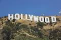
Want to hike to the Hollywood Sign? One way to get there is a 6.4-mile hike through Griffith Park that summits Mount Lee directly behind the iconic lettering. Beyond just gazing up at the sign, the hike offers the opposite perspective, a chance to look down at the city below. The moderate day hike gains 1,050 feet of elevation over wide fire roads, and the last mile is actually paved.
Note: Shorter hikes to the Hollywood Sign are also available. Alternative routes set out on Innsdale Trail ad Hollyridge Trail to Mount Lee. The Hollywood Sign can also be reached by a steeper hike across adjacent Cahuenga Peak.
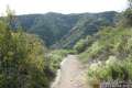
Brush Canyon Trail
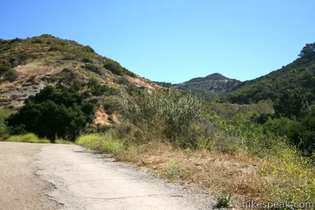
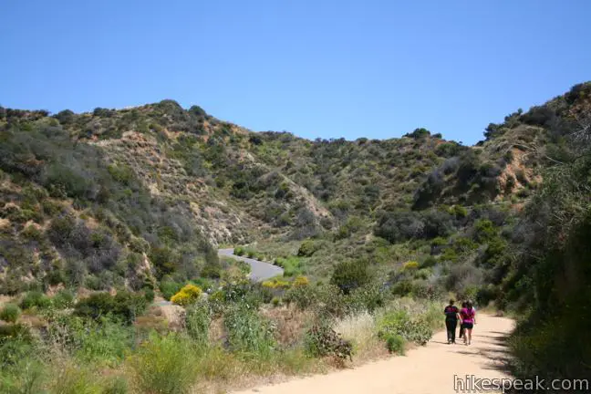
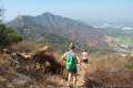
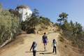
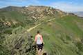
Begin this hike to the Hollywood Sign from the north end of Canyon Drive. After parking in the free lots along the road, hike around the gate up the center of a wide canyon on Brush Canyon Trail. The dirt road finds the east side of the canyon and climbs above the trees. Plan on being completely sun-exposed from this point on.
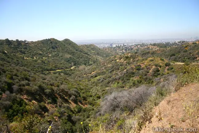
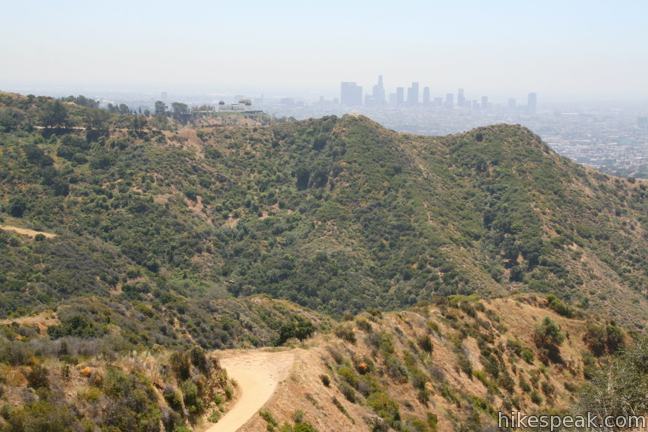
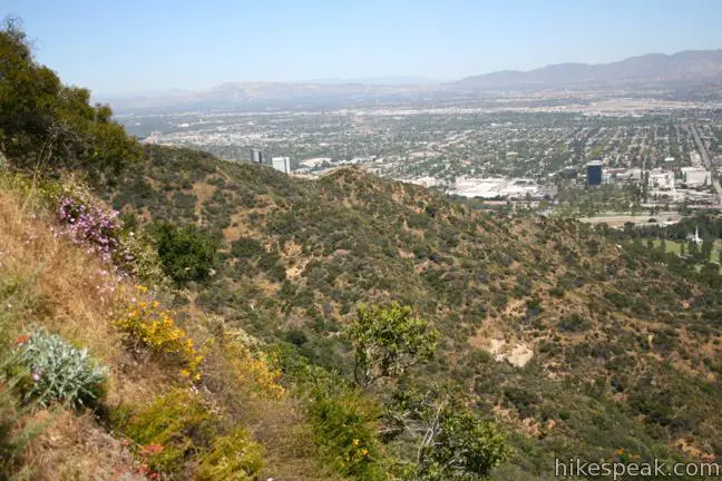
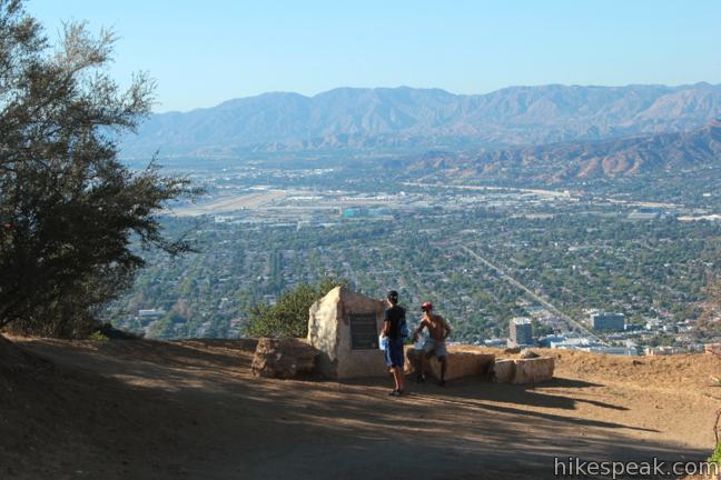
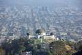
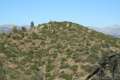
Brush Canyon Trail rounds the top of the canyon and comes to an overlook at 1.25 miles. The view down on Los Angeles is so satisfying that many hikers turn around right here.
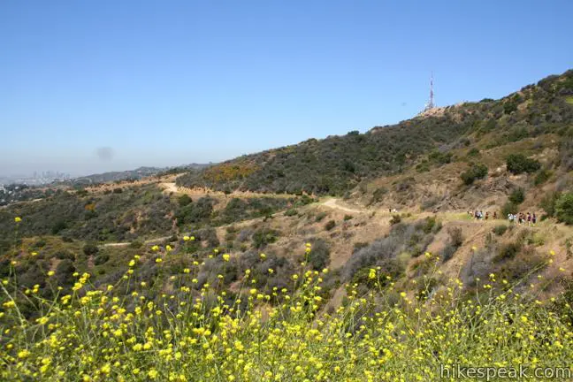
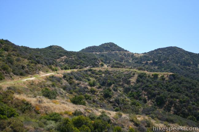
Just above the overlook, Brush Canyon Trail merges with Mulholland Fire Road. Turn left and continue west toward Mount Lee.
Mulholland Fire Road
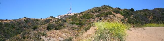
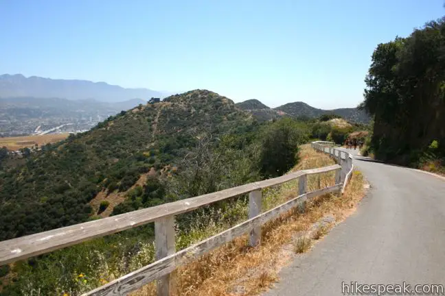
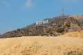
The hike continues across Mulholland Fire Road with intermittent side views of the Hollywood Sign that reassure you that you are heading in the correct direction.
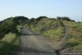
The road levels out some as it winds around a few ridges. Bear right at a junction with Hollyridge Trail coming up from Beachwood Drive and the horse stables at Sunset Ranch. Hike past another overlook and continue along Mulholland until the trail hits Mount Lee Drive, 2.25 miles from the start.
Mount Lee Drive
At the end of Mulholland Fire Road, Mount Lee Drive descends to the left for 0.4 miles to a spur to Hollywood Sign View, which is more easily reached on the hike to the Hollywood Sign via Innsdale Drive, Mulholland Highway, and Mount Lee Drive.
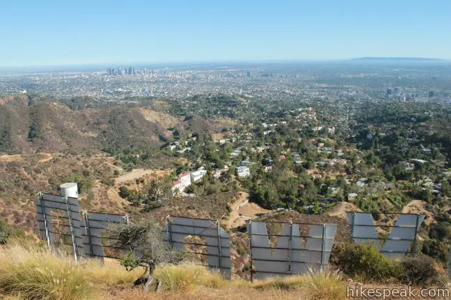
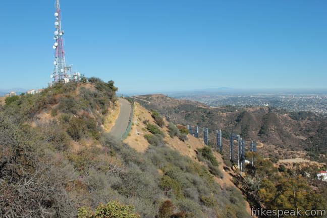
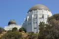
Turn right up Mount Lee Drive and follow the winding, paved road to the summit, gaining 430 feet in 0.95 miles. As you climb, look east for a nice view of the Griffith Observatory. The road eventually ascends to the north side of the mountain for a view over Burbank, the Verdugo Mountains, and the San Gabriel Mountains.
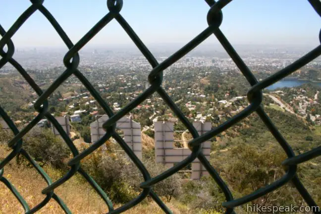
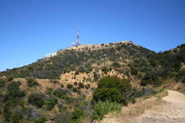
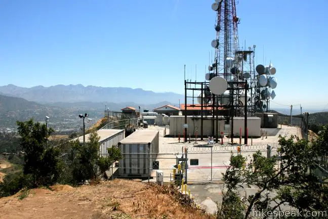
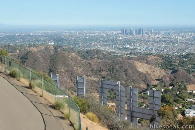
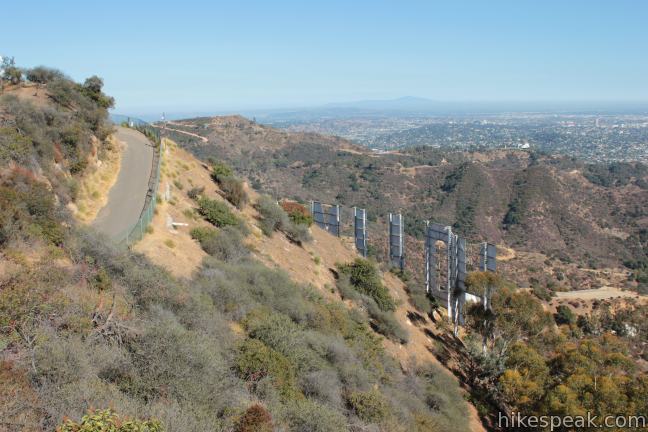
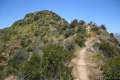
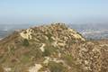
At the top of the mountain, the road makes a horseshoe bend to the left, passing a plaque and a junction with Aileen Getty Ridge Trail, which crosses a ridge to Cahuenga Peak. Around the bend in Mount Lee Drive, you will find yourself right on top of the H in Hollywood. A tall chain-link fence keeps hikers from approaching the tall white letters and obscures the view.
Walk up along the fence to a closed-off area full of radio towers and take the dirt path to the left up to the true summit, twenty feet above the road. The 1,700-foot mountain offers sweeping views of the eastern ridges and peaks of the Santa Monica Mountains and the city below. Picture everywhere you can see the Hollywood Sign from and that’s what’s in sight.
Aileen Getty Ridge Trail
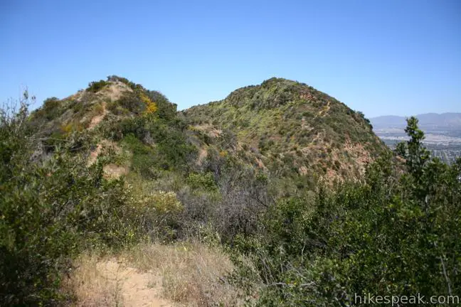
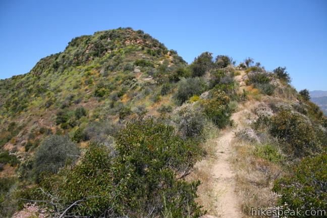
If you hiked all the way up Mount Lee from Brush Canyon Trail (3.2 miles) and have the energy for a bit more, extending the hike out to Cahuenga Peak is highly recommended. At 0.15 miles from the top, at the outside of the big bend in the road, find Aileen Getty Ridge Trail and follow this narrow, rugged path west over the ridge to Caheunga Peak.
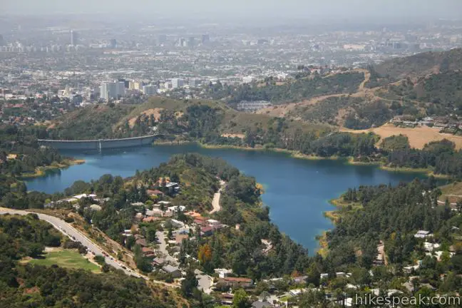
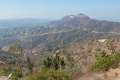
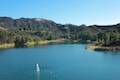
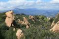
The terrain drops off steeply on both sides of the ridge, delivering dramatic views that include Lake Hollywood to the southwest. Follow Aileen Getty Ridge Trail for a third of a mile to the 1,820-foot summit of Cahuenga Peak, which was spared from developed by citizens who blocked a housing project and contributed to the Save the Sign campaign. The land was purchased in April or 2010 and donated to the city to become part of Griffith Park.
Aileen Getty Ridge Trail continues down the west side of Cahuenga Peak to Burbank Peak. The single-track trail to the less-visited summit is a nice change from the wide fire roads leading up to the Hollywood Sign.
After enjoying one or both peaks, simply return the way you came. It is 6.4 miles to Mount Lee and back, or 7.1 miles if you include Cahuenga Peak.
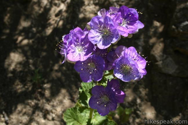
This is a dog-friendly hike and a seasonal drinking hole for dogs can be found about half a mile up Brush Canyon Trail. No fee or permit is required to visit Griffith Park.
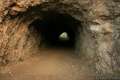
For more hiking, compare the other trails to the Hollywood Sign or consider additional hikes in Griffith Park. A bit more fun can be found by heading southeast from the trailhead on a dirt fire road to Bronson Cave. After 1/4 mile, turn left into a quarry with a cinematic tunnel made famous for its portrayal of the Batcave in the TV version of Batman from the 1960s.
The basic directions for Brush Canyon Trail to Mount Lee are:
- Hike north from the end of Canyon Drive (0 miles)
- Reach the top of Brush Canyon Trail and turn left onto Mulholland Fire Road (1.3 miles)
- Stay to the right past the top of Hollyridge Trail (1.9 miles)
- Turn right up Mount Lee Drive (2.15 miles)
- Round the bend just below the summit, passing Aileen Getty Ridge Trail to Cahuenga Peak (3.05 miles)
- Reach the top of Mount Lee above the Hollywood Sign (3.2 miles)
Directions to the Trailhead
- From Franklin Avenue, north of the 101 Freeway and Hollywood Boulevard, turn north on Canyon Drive (between Bronson Avenue and Van Ness Avenue).
- Drive 1.4 miles to the trailhead.
- There is a larger parking lot on the right.
- If that is full there is a smaller parking area on the left.
Trailhead Location
Trailhead address: 3200 Canyon Drive, Griffith Park, Los Angeles, CA 90068
Trailhead coordinates: 34.12485, -118.3136 (34° 07′ 29.46″N 118° 18′ 48.95″W)
View Griffith Park in a larger map
Or view a regional map of surrounding Los Angeles trails and campgrounds.


 | Bronson Cave This short easy hike visits a man-made cave recognizable as the Batcave from the 1960s Batman TV series and hundreds of other locations on TV and film. |
 | Mount Lee and the Hollywood Sign via Hollyridge Trail This 3.5-mile hike ascends 750 feet to reach the summit of Mount Lee behind the Hollywood Sign. |
 | Mount Chapel, Mount Bell, and Mount Hollywood This 5.7-mile loop tops three prominent summits on a panoramic tour of Griffith Park. |
 | Hollywood Sign via Innsdale Drive, Mulholland Highway, and Mount Lee Drive This 4.6-mile round trip hike combines trails and streets to deliver some of the very best views of the Hollywood Sign on the way to the summit of Mount Lee above the sign. |
 | Cahuenga Peak This 3-mile hike on Burbank Peak Trail and Aileen Getty Ridge Trail ascends to Cahuenga Peak and the adjacent Mount Lee, home of the Hollywood Sign. |
 | Griffith Observatory to the Hollywood Sign This 8.8-mile hike travels from one Griffith Park landmark to another, crossing Mount Hollywood along the way. |
 | Mount Hollywood This 1,625-foot peak is a star of Griffith Park with panoramic views that can be reached from Griffith Observatory on a steep 1.4-mile hike or a scenic 2.65-mile trek and from lower in the park in Western Canyon for a hike of around 4.2 miles. |
 | Ferndell Trail This relaxing half-mile hike goes through a tropical garden in the lushest little canyon in Griffith Park. Explore farther on a 1.75-mile hike in Western Canyon or venture up to the Griffith Observatory to see more of the park. |
 | Griffith Observatory via West Observatory Trail This 2.1-mile hike ascends from Western Canyon up ridges to Griffith Observatory, getting sweeping views over Los Angeles and Griffith Park along the way. |
 | Griffith Observatory via East Observatory Trail This 1.5-mile hike from Vermont Canyon Avenue up to Griffith Park's great observatory delivers excellent views over Los Angeles along the way. |
 | Glendale Peak This hike is around three miles long and visits a less known summit on the southeast side of Griffith Park with views that deserve more attention. |
 | Glendale Peak - Mount Hollywood Loop This 4.15-mile hike tops two summits in Griffith Park that both have awesome views. |
 | Cedar Grove & Vista View Point Loop This 2.3-mile loop on the southeast side of Griffith Park follows paved and unpaved trails to two park attractions, a quiet grove with a picnic area and a helipad with panoramic views. |
 | Bee Rock This hive-shaped point on the east side of Griffith Park is reached via a 1.7 to 4-mile round trip hike. |
 | Old Zoo Picnic Area This half-mile hike explores the abandoned exhibits and animal cages in the ruins of the old LA Zoo in Griffith Park. |
 | Beacon Hill This 2.75 to 3.9-mile hike in Griffith Park climbs 500 feet to the easternmost summit in the Santa Monica Mountains. |
 | Amir's Garden This one-mile hike reaches a relaxing garden on the east side of Griffith Park that is a pleasant retreat for hikers. |
 | Lake Hollywood Reservoir Walking Trail This 3.5-mile loop circles a peaceful fence-enclosed reservoir in the hills below the Hollywood Sign. |
 | More trails in the Santa Monica Mountains Explore other destinations in the range. |
 | Westridge Trail to San Vicente Mountain This 7.4-mile hike travels a scenic ridge between a Brentwood neighborhood and a summit that was once used as a Nike Missile site. |
 | Mandeville Canyon to San Vicente Mountain Loop This 5-mile hike incorporating a few trails, taking a DWP road up to Westridge to visit San Vicente Mountain, before crossing Mulholland Drive and Canyonback Ridge to return to Mandeville Canyon via Hollyhock Fire Road. |
 | Sandstone Peak This 6.25-mile loop summits the tallest peak in the Santa Monica Mountains. |
 | Parker Mesa Overlook This steep out-and-back hike rewards the effort with excellent views of the Pacific Ocean. |
 | Stunt High Trail to Saddle Peak This 7.5-mile hike combines Stunt High Trail and a section of the Backbone Trail to visit the 6th tallest summit in the Santa Monica Mountains. |
- Mount Lee on modernhiker.com (opens in a new tab)
- Mount Lee on summitpost.org (opens in a new tab)
- Mount Lee on wikipedia.org (opens in a new tab)
- Cahuenga Peak on wikipedia.org (opens in a new tab)
- Cahuenga Peak on summitpost.org (opens in a new tab)
- More trails in Griffith Park on Dan's Hiking Pages (opens in a new tab)
- City of Los Angeles website for Griffith Park (opens in a new tab)
Common Questions about Brush Canyon Trail to Mount Lee and the Hollywood Sign in Griffith Park
- Is the trail open?
- Yes. You should expect to find that Brush Canyon Trail to Mount Lee is open. There are no recent reports of trail closures. If you discover that the trail is closed, please help your fellow hikers by reporting a closure.
- Is this trail free to access?
- Yes, Brush Canyon Trail to Mount Lee is free to access. No entrance fee, pass, or permit is required. If you discover that access rules have changed, please provide feedback on your experience.
- How much time does this hike take?
- It takes approximately 3 hours 15 minutes to hike Brush Canyon Trail to Mount Lee. Individual hiking times vary. Add extra time for breaks and taking in the views.
- How long is this hike?
- The hike to Brush Canyon Trail to Mount Lee is a 6.4 mile out and back with 1050 feet of elevation change.
- Are dogs allowed on this trail?
- Yes, dogs are allowed on Brush Canyon Trail to Mount Lee. The trail is open to hikers, dogs.
- Does this trail go to a summit?
- Yes, Brush Canyon Trail to Mount Lee reaches a summit with panoramic views.
- What mountain range is this trail in?
- Brush Canyon Trail to Mount Lee is located in the Santa Monica Mountains.
- Where is the trailhead located?
- The trailhead for Brush Canyon Trail to Mount Lee is located in Los Angeles, CA.
Trailhead Address:
3000 Canyon Drive
Los Angeles, CA 90068
Trailhead Coordinates:
34.12485, -118.3136 - What are the driving directions to the start of the hike?
To get to the trailhead: From Franklin Avenue, north of the 101 Freeway and Hollywood Boulevard, turn north on Canyon Drive (between Bronson Avenue and Van Ness Avenue). Drive 1.4 miles to the trailhead. There is a larger parking lot on the right. If that is full there is a smaller parking area on the left.
View custom Google Maps directions from your current location.
- Are there other trails near Brush Canyon Trail to Mount Lee?
- Yes, you can find other nearby hikes using the Hikespeak Hike Finder Map.

27 Comments on Brush Canyon Trail to Mount Lee and the Hollywood Sign in Griffith Park
What hikers are saying:
✨ Generated summary of user commentsThis trail serves as a fun introduction to Los Angeles with spectacular views of the Hollywood sign. Hikers recommend starting early on clear days to avoid the heat and carrying plenty of water for the steady climb. Chris warns that the parking lot sees regular car break-ins, while street parking outside the park results in frequent tickets or towing. Mountain bikes are prohibited on the dirt trails, though paved roads remain accessible for cyclists.
“It is a fun "intro to LA" hike.” Jump to comment ↓
I hiked this trail with the L.A. Meetup group and loved every minute of it.
Thanks for the detailed post.
I’ve done this hike a few times from Canyon Drive. It’s great. Excellent directions and photos. Thank you.
I hiked this last May. It is a fun “intro to LA” hike. It was less of a slip hazard than a lot of other trails. I was wearing loafers because I didn’t have any sneakers with me at the time and it wasn’t too bad (although I would recommend good sneakers instead!). Views are great. It is popular, but was not excessively crowded or loud. A great half-day activity for active out-of-town guests any time except the hottest part of summer (take plenty of water and go slow and enjoy).
What would you say the difficulty of this hike, via Brush Canyon trail, would be? Thanks!
First mile and a quarter lower moderate- steady climb. Rest of hike to Mt. Lee, easy. Go on a clear day and not on a hot day, unless you start early. Take water. Add short fun hike to Cahuenga Peak, but somewhat challenging due to steep and rocky trail . . . just go slow and wear lug soles if you want to do Cahuenga.
[…] More information about this hike: Trail information from hikespeak.com […]
This is a general question about trail lengths on this site. When it says 6.4 miles, does that mean out and back, or just one way?
Hi- Thanks for the question. For almost all of the hikes on this site, the overall distance given is for the round trip for the whole hike, either an out-and-back return hike or a loop. There are a few hikes that are listed as one-way shuttle hikes, but those will be obviously described that way. For this hike, 6.4 miles is how far you will hike from start to finish (up to the summit and back down). Enjoy!
[…] Tim, Richard, and Adam for a hike up to the back of the Hollywood Sign using the 6.4 mile round-trip Brush Canyon Trail. My original choice, the shorter Hollyridge Trail, was closed due to “maintenance” […]
Great hike and great directions. There weren’t too many people and the views were just spectacular. I highly recommend it!
[…] Brush Canyon Trail – 6.4 miles round trip Hollyridge Trail – 3.5 miles round trip Wonder View Trail – 3 miles round trip […]
[…] you must plan every minute detail, hikespeak has broken this venture down step by step, and hollywoodsignhikes has excellent directions to […]
In the early 70’s I started from Burbank, hiking through the cemetery and up the hill until I came out on the other side, at the Hollywood sign. The sign seemed to be in pitiful condition at the time, full of bullet holes. Memorable hike.
Im kinda confuse about this .. first time go hike. Me and my friend want to go to Brush canyon Trail to Mount Lee & the Hollywood sign. Where is good to meet? I saw the address 3000 canyon Dr. Griffth park. However im not sure that address is start point or whole trail address…
The hike starts from the end of Canyon Drive. You can meet in the small parking area there or meet outside the park and drive up in one car to save on space.
So that address is ok place to meet? 3000 canyon dr.
Hello we want to go behind the sign and see the view from there. Is there a sortest hike please to go behind ? thank you
this is my first time to go and check the sign, and im from Nevada and thinking taking my mountain bike with me. can you ride bike going to those trails?
Bikes aren’t allowed on dirt trails in Griffith Park. However, Mount Hollywood Drive (paved but closed to vehicles) is open to bikes and has excellent views of the Hollywood Sign (without actually reaching the sign).
[…] more roundabout, laid-back option is through Brush Canyon Trail. Walk up Canyon Drive until it turns into a dirt road. When you hit Mulholland Trail, swing left […]
Is this trail open to mountain bikers?
Hi! Is this a good trail to get a view of the entire Hollywood sign from the front on the trail itself, AND get up behind the sign? Or is there another better one you recommend?
This article is outdated as the parking lot that is refered to is constantly packed and cars get broken into on a regular basis. There is limited street parking outside the park and cars get tickets or towed on a regular basis.
Hi, I just want to know how early we can actually get there? Is there a gate or specific park hours? I checked online and it says park hours are 8 to 6, but I have gone to Griffith park earlier than that. I just want to avoid crowds and hopefully some of the heat.
[…] Brush Canyon Trail to the Hollywood Sign […]
[…] You can still get to the vista point above the sign using the Brush Canyon Trail, but the hike to the Hollywood sign using this route is a 6.4-mile trek out and back. It isn’t a walk you should try without good directions, which you can find at Hikespeak […]
[…] up to Hollyridge from Canyon Drive, you can embark on a more roundabout, more relaxed hike via Brush Canyon Trail. Walk up Canyon Drive until it turn into a dirt road. When you hit Mulholland Trail, you’ll […]