Griffith Observatory sits on a ridge between Vermont Canyon Road and Western Canyon Road on the slopes of Mount Hollywood in Griffith Park. Griffith Observatory is a true Los Angeles landmark that can be appreciated by arriving by trail instead of driving up the park roads. Take West Observatory Trail if you wish to hike to Griffith Observatory from Western Canyon or follow these directions to hike to Griffith Observatory from Vermont Canyon Road. The two trails join up below Griffith Observatory for a unified final ascent. The 1.5-mile round trip hike up East Observatory Trail has 380 feet of elevation change and fine views of the observatory and the city it serves.
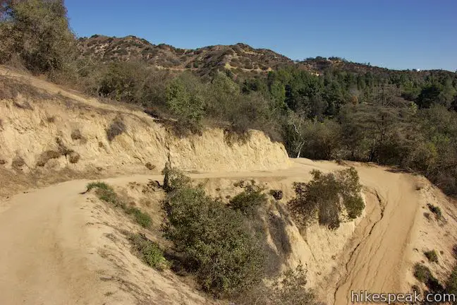
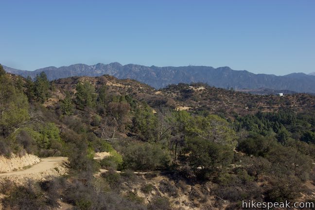
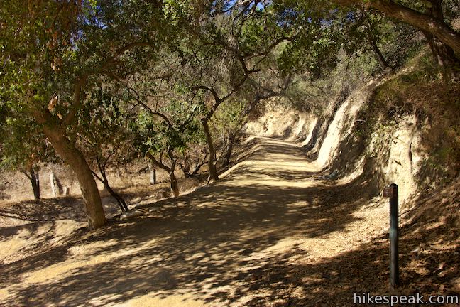
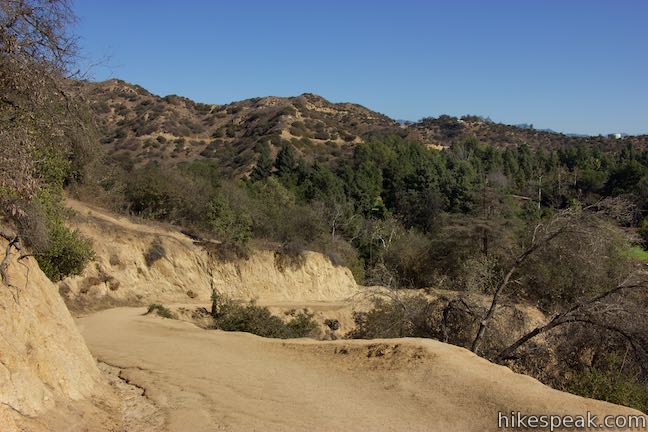
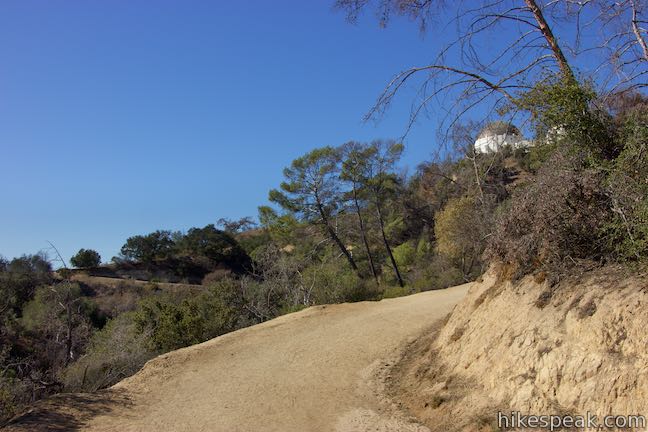
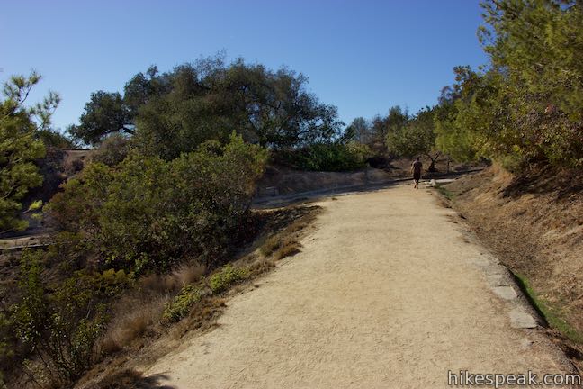
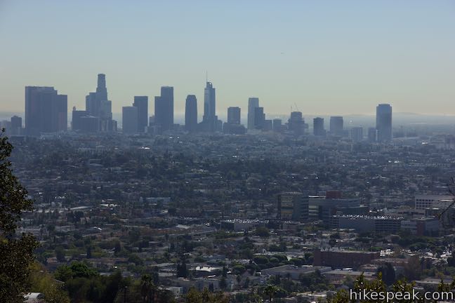
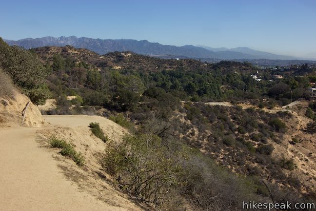
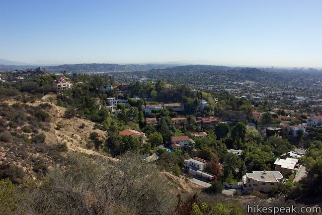
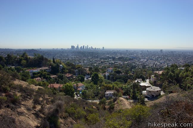
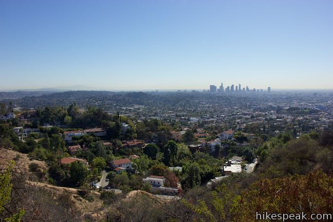
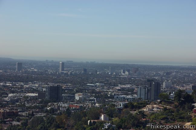
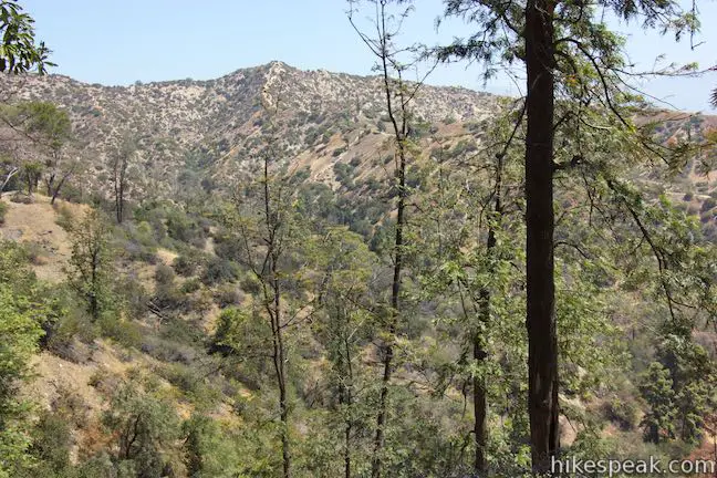
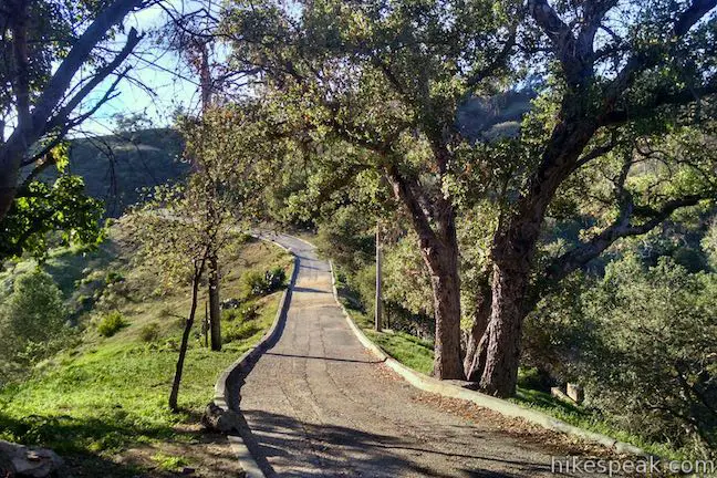
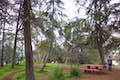
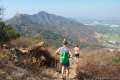
The trailhead is located on the west side of Vermont Canyon Road south of the Greek Theater at an intersection with Boy Scout Road (shown on some maps as Vista Del Valle Drive). Parking can be found along Boy Scout Road, but the trail begins back at the northwest corner of the intersection by a small picnic area. A sign at the trailhead reads, “Boy Scout Trail to Griffith Observatory.” If you are prepared to hike, begin up the wide trail, going through pronounced bends to the right and left. After gaining some early elevation, look down over the Vermont Canyon area of Griffith Park, which has a golf course and tennis courts. The trail tapers out after its early rise and winds west along the south face of a ridge. Look out over Los Feliz homes toward downtown Los Angeles. On occasion, Griffith Observatory will pop into view above the brush on the ridge in front of you.
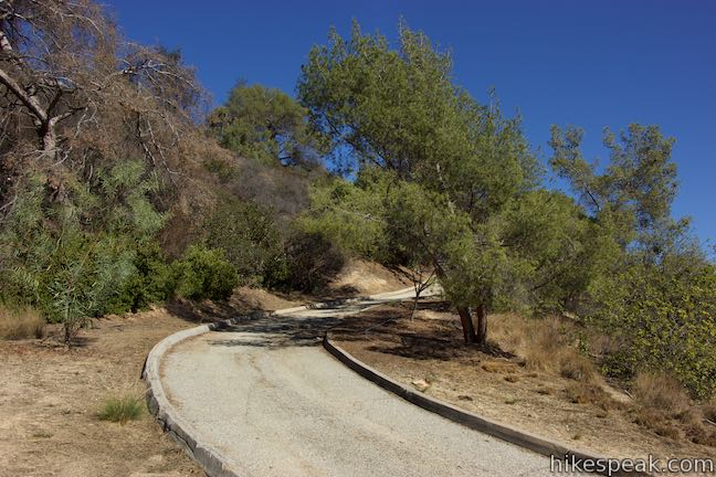
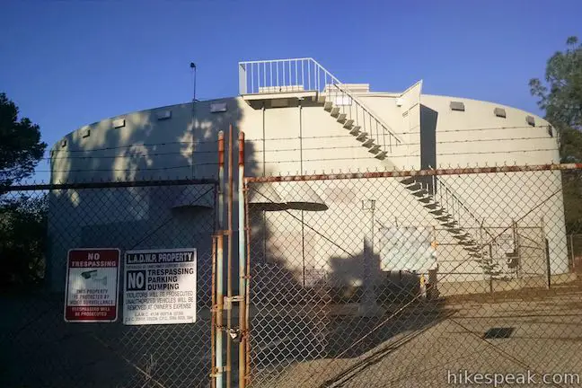
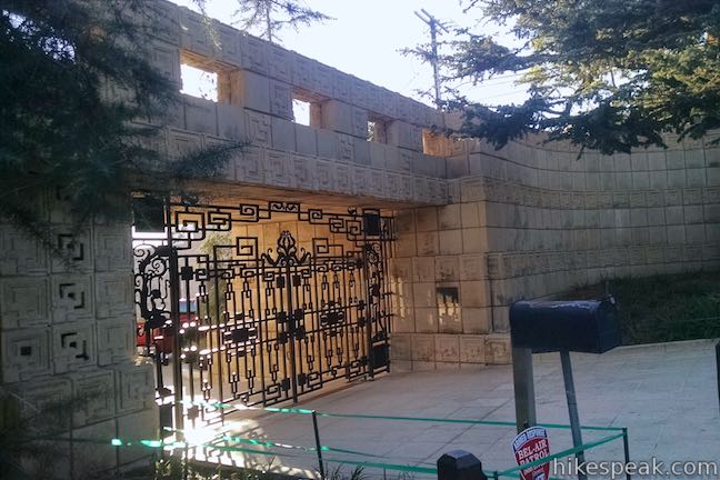
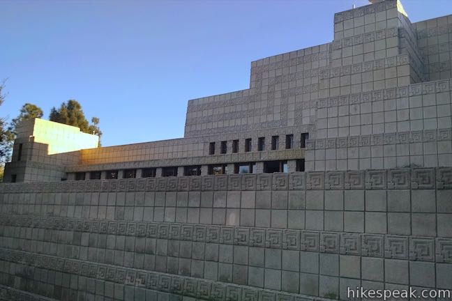
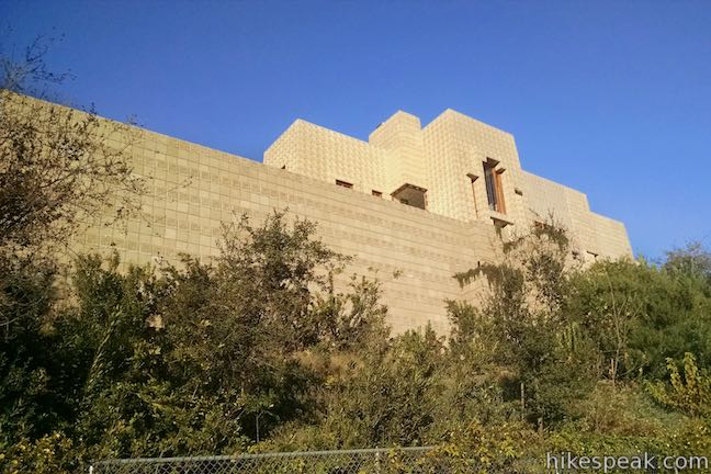
After 0.35 miles of hiking, meet a paved trail coming up from Glendower Avenue. This short paved trail into Griffith Park is just a quarter mile long, rising to a holding tank up the slope to your right. If you’re a fan of Frank Lloyd Wright, you could walk down this trail to Glendower Road, take that to an intersection with Glendower Avenue and walk 0.2 miles east to the Ennis House, which was built in 1924 and is not open for tours (exterior photos below). This extension would increase the hike by 0.8 miles round trip. Otherwise turn right up the paved trail. You will immediately come to another junction where the wide dirt trail resumes. Turn left to continue hiking up East Observatory Trail.
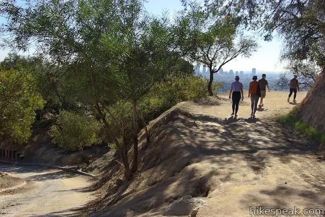
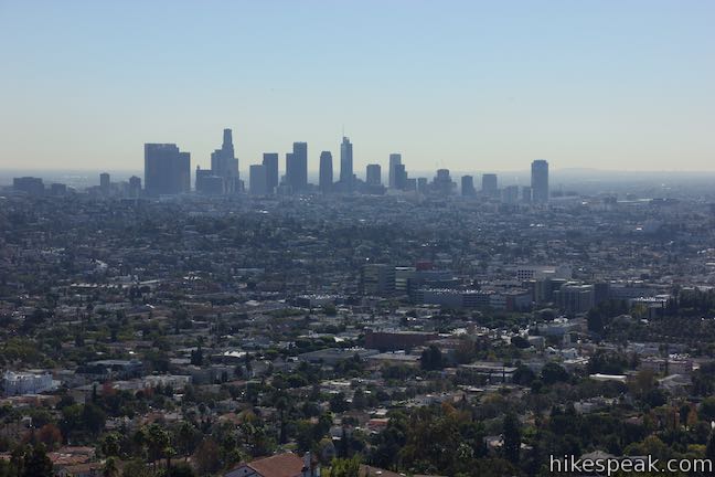
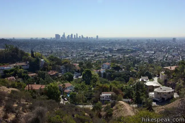
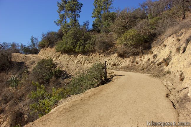
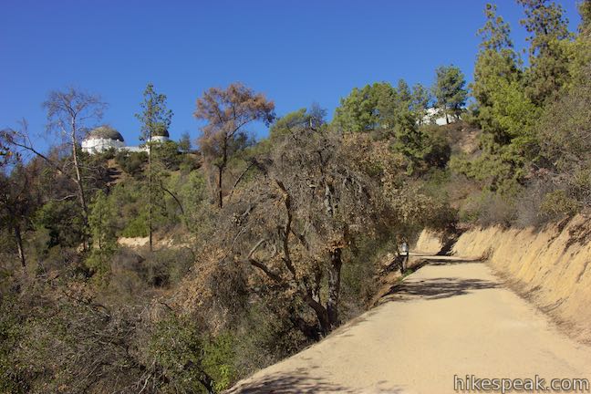
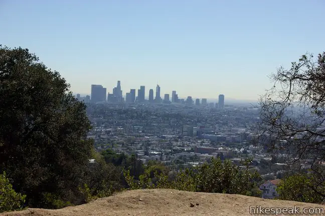
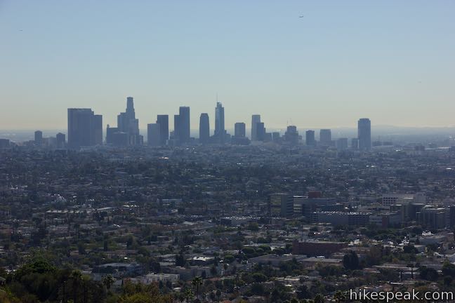
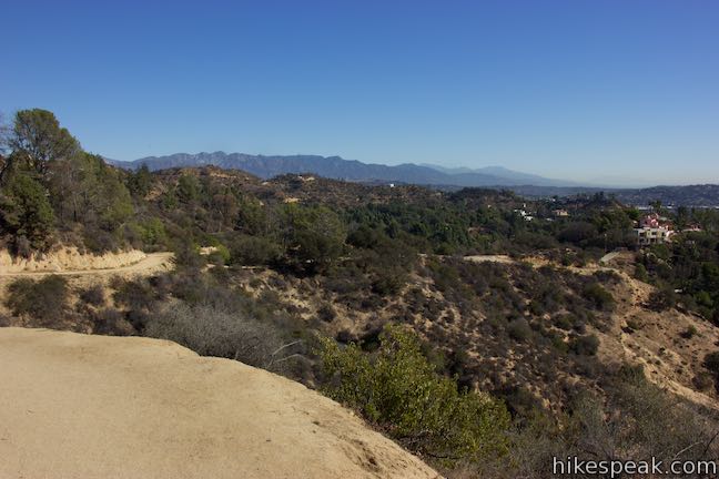
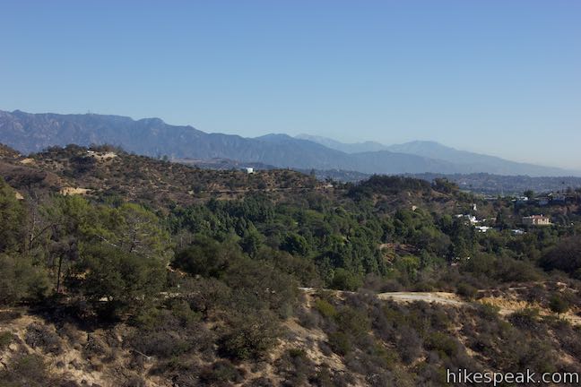
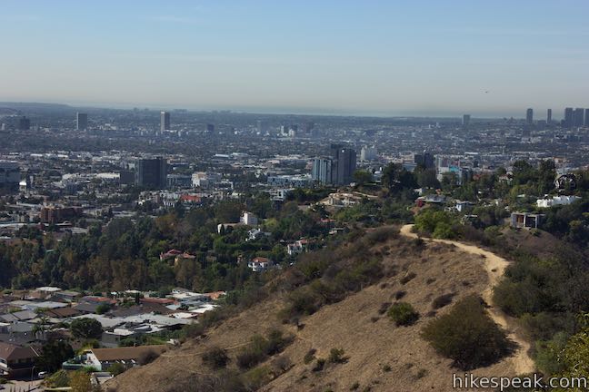
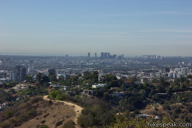
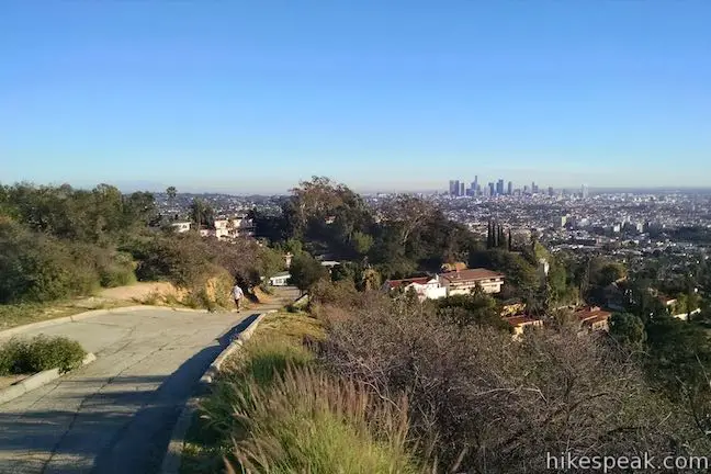
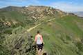
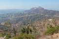
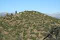
As you leave the junction, the trail offers a knockout view of the Los Angeles skyline. East Observatory Trail cuts a weaving path along the side of the ridge, rising higher above Los Feliz. Enjoy broad views over Los Angeles and look back down the trail toward the San Gabriel Mountains, which appears over Glendale Peak and the easternmost ridges of Griffith Park. San Gabriel Peak and Mount Wilson rise to prominence in the front country of the range. If you have clear conditions and sharp eyesight (or a pair of binoculars), you should be able to spot the tops of Mount Wilson Observatory. Observatories abound!
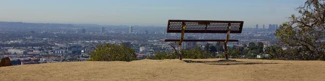
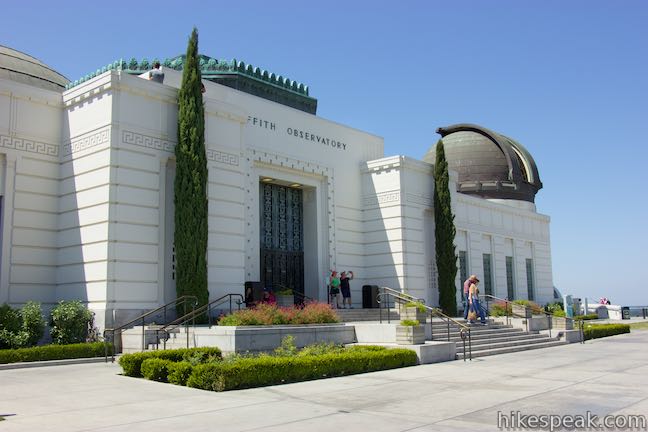
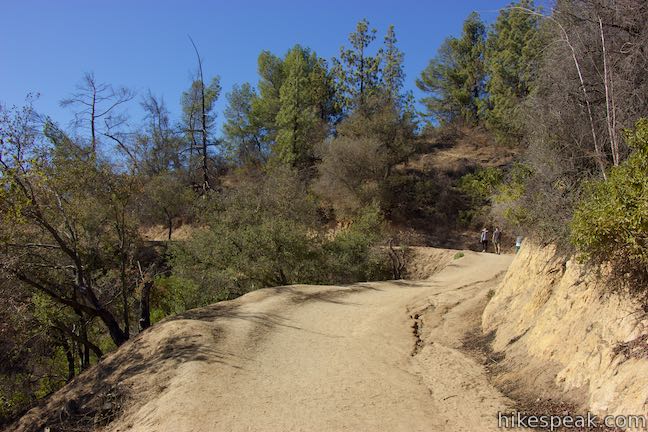
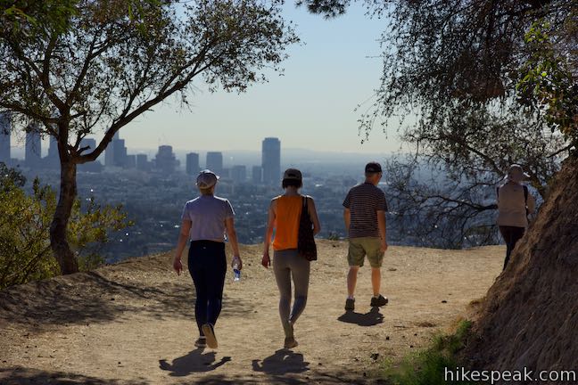
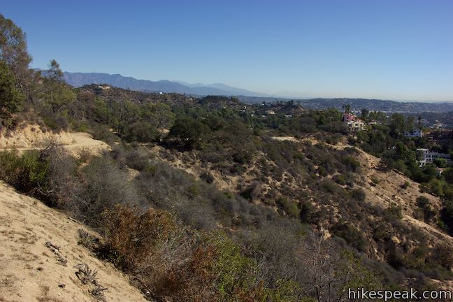
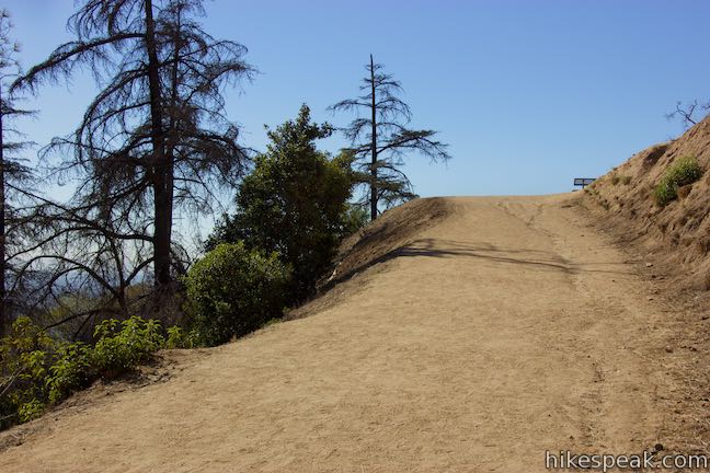
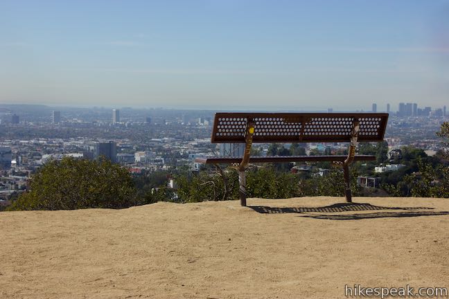
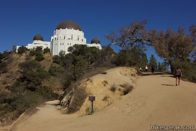
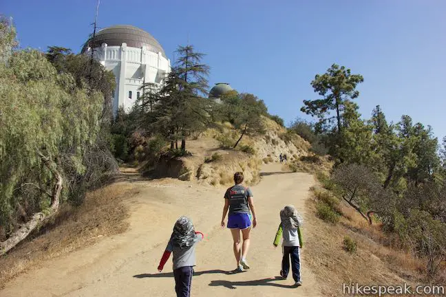
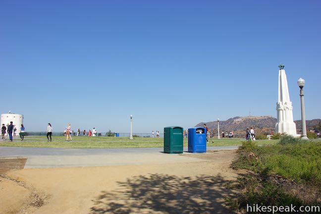
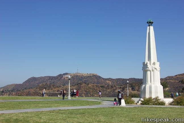
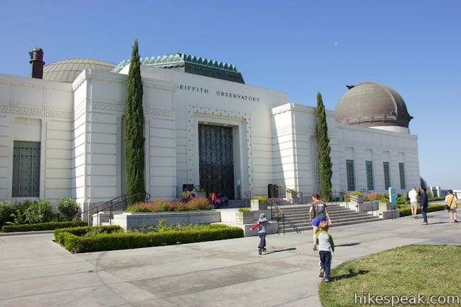
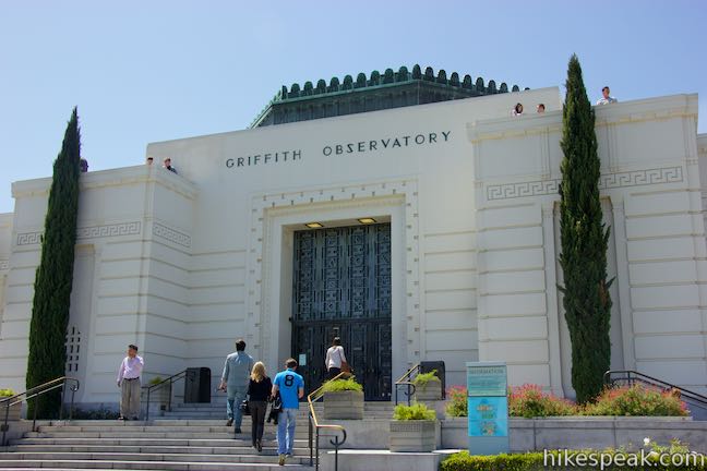
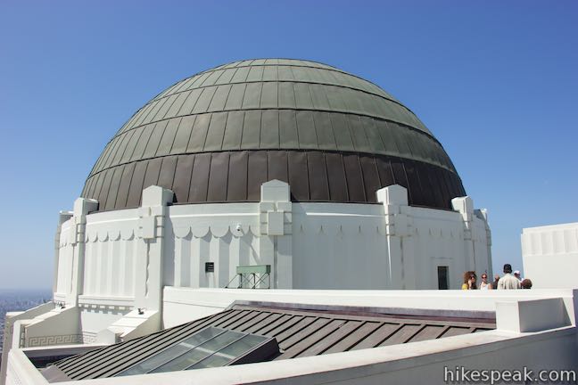
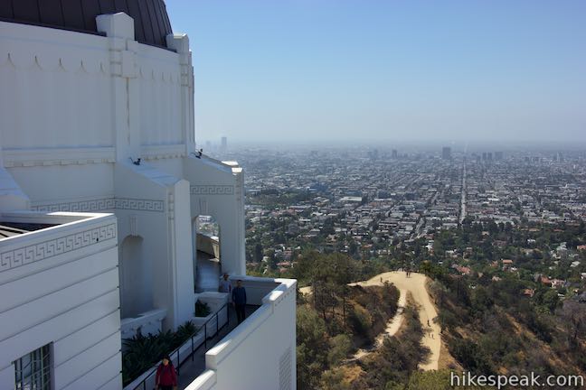
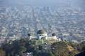
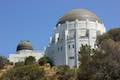
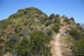
After just over half a mile of hiking, come to a 4-way junction by a bench with a view. West Observatory Trail is straight ahead of you, descending the opposite side of the ridge. Take the first trail on the right to ascend north toward Griffith Observatory. This unified upper section of the trail is shared with hikers coming up West Observatory Trail. The meeting of the trail presents a great view of Griffith Observatory, whose grand white domes are both imposing and elegant, built in an art deco style with influences of moderne, modified Greek, and beaux-arts.
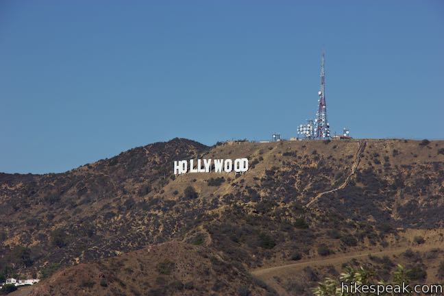
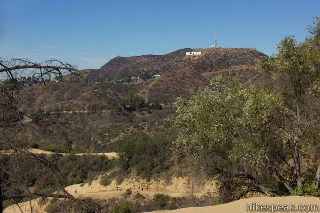
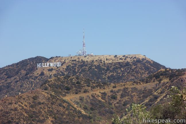
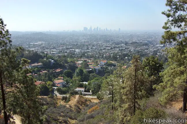
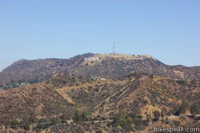
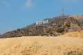
There are other reasons to take some time to look around. The junction offers the hike’s first views of another Griffith Park icon, the Hollywood Sign. The big white letter are easy to read from this vantage. Have a seat on the bench and gaze out over Hollywood toward the coastline to the southwest. If conditions are clear, you will see the shimmering ocean. The skyline of downtown Los Angeles rises to the southeast to complete the view.
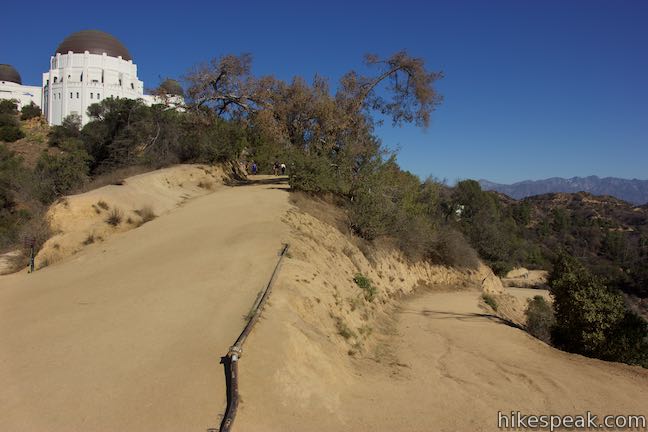
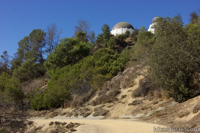
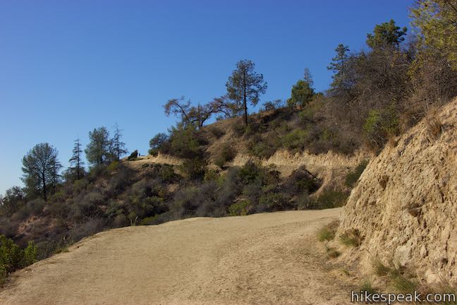
Leave the junction on the wide trail heading straight up the ridge to Griffith Observatory. The trail rises into some pines that provide intermittent windows over the east side of Griffith Park. Pass below the eastern wall of the observatory and follow the trail through one final swing to the left to come up to the corner of the lawn on the north side of Griffith Observatory.
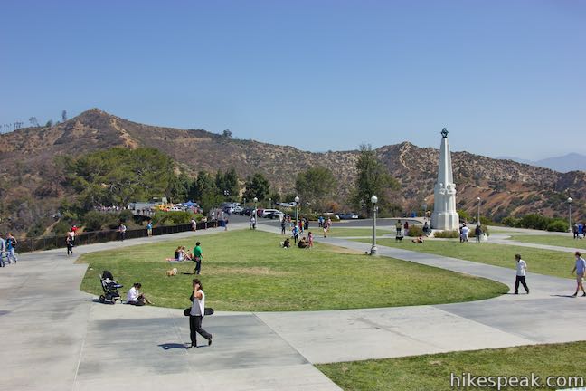
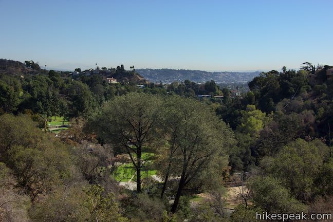
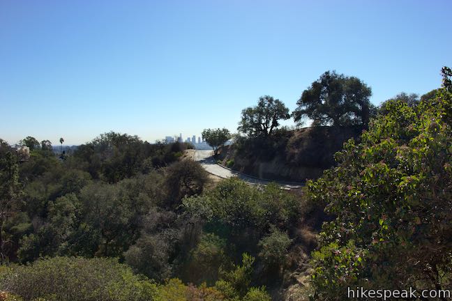
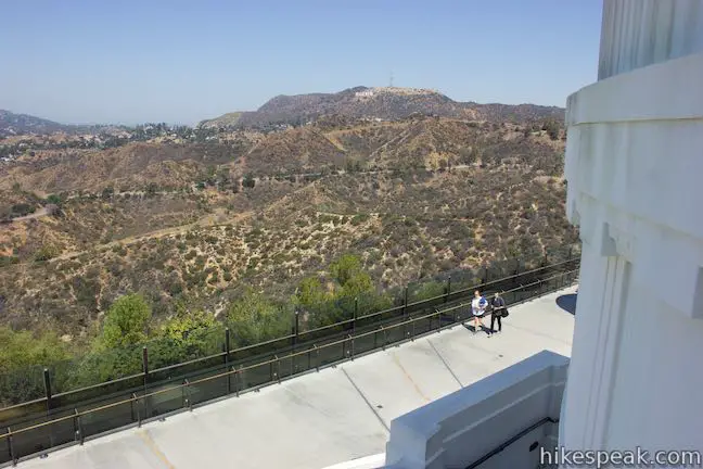
Reach the top after 3/4 of a mile of hiking from the Boy Scout Trailhead by Vermont Canyon Road. Walk across the lawn for views looking east toward the Hollywood Sign on Mount Lee. You can also look north toward Mount Hollywood, which could be reached by walking across the parking lot to a trail to the summit. If you are just in it for the hike, you can turn around outside the observatory for a 1.5-mile round trip outing with 380 feet of elevation change. Otherwise, it’s time to step inside the Griffith Observatory, explore its exhibits, and take staircases up to viewpoints on the roof.
Visiting Griffith Observatory
We can thank the redundantly named patron Griffith Griffith for this eponymously named park and observatory. Griffith donated 3,905 acres of land to the City of Los Angeles in 1896 to give the city a great public park and improve the lives of its citizens. A panel inside the Griffith Observatory explains that:
When Colonel Griffith made his offer to Los Angeles in 1896, the city’s population was roughly 100,000. The land he wanted to donate was a sparsely developed area a mile outside the city limits. The Los Angeles City Council worried people would not travel that far and new roads would cost too much. Fortunately, the council voted to accept the gift. Today Griffith Park sits at the center of a busy metropolitan area of 10 million people.
In 1912, Griffith gave the city funding to build an observatory in the park. He believed that the public should have easy access to astronomy, which is why the observatory is free to the public and not located on a remote mountain top that might have better conditions for studying the stars. Griffith died in 1919, before he could see the beautiful realization of his dream. Construction began in 1933, based on initial designs by Russell Porter, and the soon-to-be-iconic observatory opened to the public in 1935. Griffith Observatory has been operated by the City of Los Angeles Department of Parks and Recreation ever since.
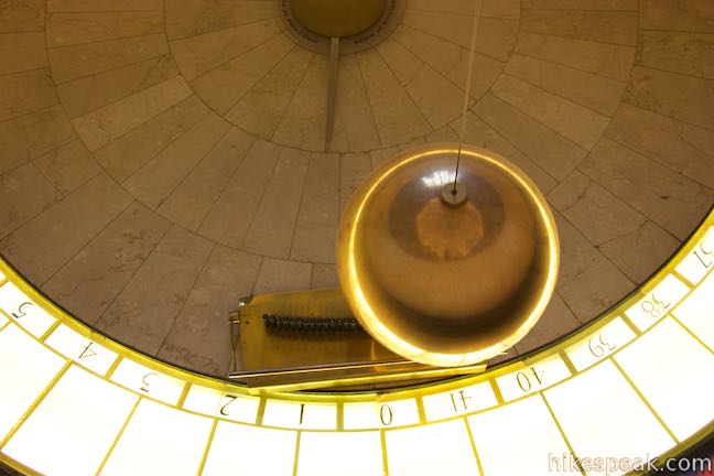
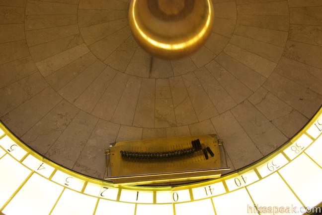
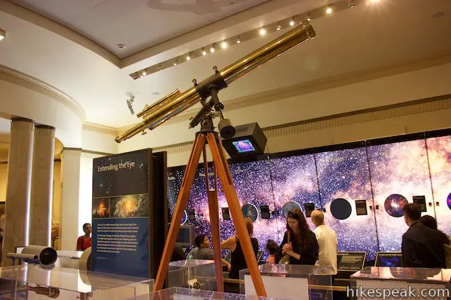
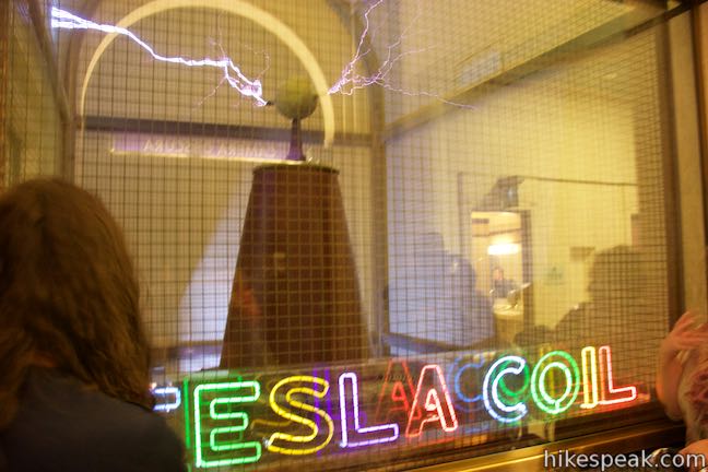
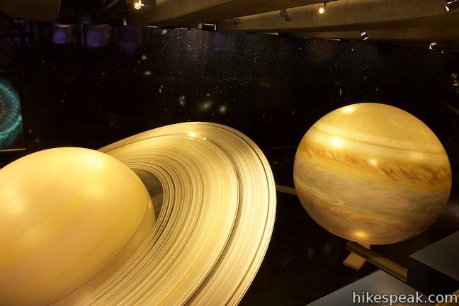
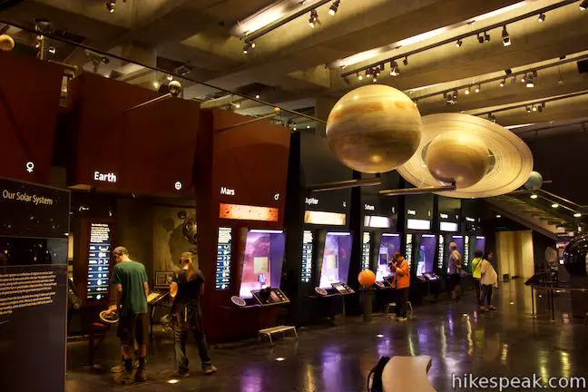
Step inside and learn about Earth, neighboring plants, and stars. Inside the lobby, a Foucault pendulum knocks over pegs as it swings back and farther, turned by an effect of the Earth’s rotation. In a room to the left, check out an electrifying Tesla coil and admire old telescopes. To the right, learn more about our closest star, the sun. There is more to see downstairs too, like a series of scales that show what you would weigh on the moon and other plants in the solar system. The observatory has a theater and a planetarium for additional learning.
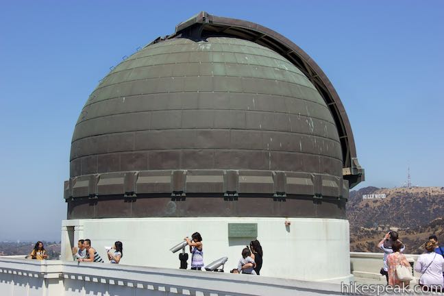
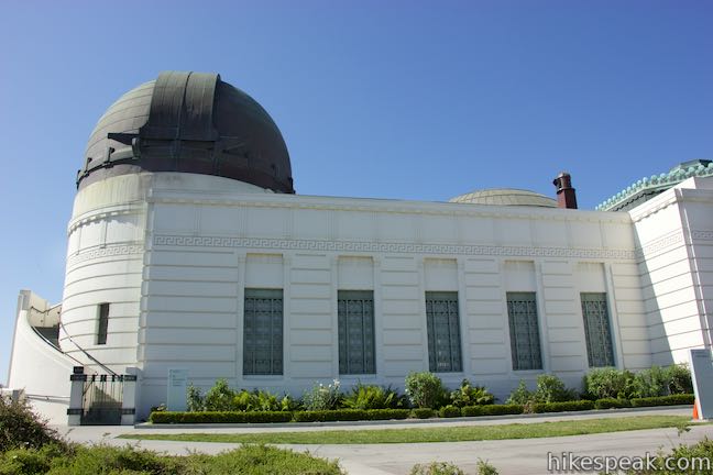
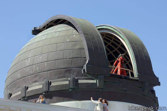
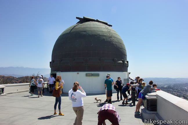
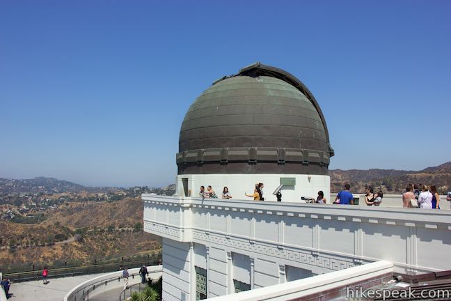
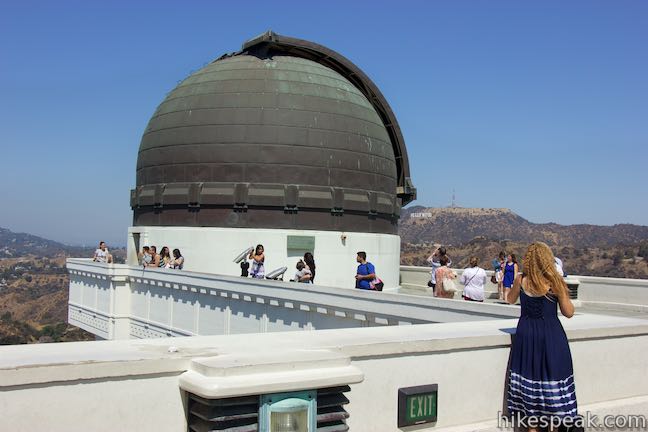
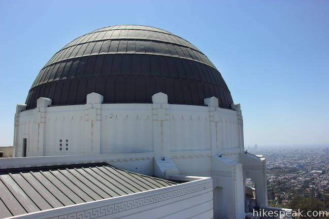
When you go back outside the observatory, climb steps up either the west or east side of the building and walk across the roof, taking in sweeping views as you pass between the large domes housing the observatory’s telescopes.
Griffith Observatory is open Tuesday through Friday from noon to 10 p.m. On weekends, the observatory opens at 10 a.m. and closes at 10 p.m. Admission to Griffith Observatory and the rest of Griffith Park (including most parking) is and always has been free. You will need to purchase tickets to enjoy planetarium shows and some other presentations inside the observatory.
If you decide not to hike, be aware that the parking area up by Griffith Observatory fills up very fast and now costs $4 per hour. Public transit is a more economical way to reach Griffith Observatory. The DASH Observatory Bus operated by the Los Angeles Department of Transportation (LADOT) travels between the Vermont/Sunset Metro Red Line station and Griffith Observatory, operating from noon to 10 p.m. on Monday through Friday and 10 a.m. to 10 p.m. on Saturday and Sunday (as of 2018). Visit the Griffith Observatory’s Getting There page for more information.
Bikes are not allowed on dirt trails in Griffith Park, but dogs are welcome. The paved trail off the end of Glendower Road is open to bikes, but East Observatory Trail is not. There are lots of other trails in Griffith Park to explore. No permit is required to hike to Griffith Observatory and visiting Griffith Park is free, so get out and enjoy!
Directions to the Trailhead
- From Interstate 5, take exit 141 for Los Feliz Boulevard.
- Go west on Los Feliz Boulevard for 1.4 miles and turn right up Vermont Avenue.
- Drive about half a mile up to the first intersection within the park, just after the north and south lanes of the road come together.
- Turn left up the unsigned Boy Scout Road (labeled as Vista Del Valle Road on Google maps).
- The intersection is across from parking area for the golf course.
- If you reach the signed intersection with Commonwealth Avenue, you just missed the turn.
- Find parking along Boy Scout Road.
- The trail begins beside a picnic area at the bottom of the road, at the northwest corner of the intersection with Vermont Canyon Road.
Trailhead Location
Trailhead address: Vermont Canyon Road & Vista Del Valle Drive, Los Angeles, CA 90027
Trailhead coordinates: 34.11835, -118.295 (34° 07′ 06.05″N 118° 17′ 42″W)
View Griffith Park in a larger map
Or view a regional map of surrounding Los Angeles trails and campgrounds.


Ennis House & Glendower Road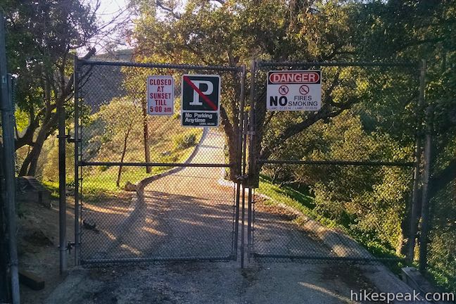
 | Cedar Grove & Vista View Point Loop This 2.3-mile loop on the southeast side of Griffith Park follows paved and unpaved trails to two park attractions, a quiet grove with a picnic area and a helipad with panoramic views. |
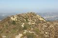
 | Glendale Peak This hike is around three miles long and visits a less known summit on the southeast side of Griffith Park with views that deserve more attention. |
 | Glendale Peak - Mount Hollywood Loop This 4.15-mile hike tops two summits in Griffith Park that both have awesome views. |
 | Mount Hollywood This 1,625-foot peak is a star of Griffith Park with panoramic views that can be reached from Griffith Observatory on a steep 1.4-mile hike or a scenic 2.65-mile trek and from lower in the park in Western Canyon for a hike of around 4.2 miles. |
 | Griffith Observatory to the Hollywood Sign This 8.8-mile hike travels from one Griffith Park landmark to another, crossing Mount Hollywood along the way. |
 | Griffith Observatory via West Observatory Trail This 2.1-mile hike ascends from Western Canyon up ridges to Griffith Observatory, getting sweeping views over Los Angeles and Griffith Park along the way. |
 | Ferndell Trail This relaxing half-mile hike goes through a tropical garden in the lushest little canyon in Griffith Park. Explore farther on a 1.75-mile hike in Western Canyon or venture up to the Griffith Observatory to see more of the park. |
 | Bronson Cave This short easy hike visits a man-made cave recognizable as the Batcave from the 1960s Batman TV series and hundreds of other locations on TV and film. |
 | Mount Lee and the Hollywood Sign via Brush Canyon Trail This 6.4-mile hike crosses Griffith Park from Canyon Drive to the top of Mount Lee directly behind the landmark Hollywood Sign. |
 | Mount Chapel, Mount Bell, and Mount Hollywood This 5.7-mile loop tops three prominent summits on a panoramic tour of Griffith Park. |
 | Mount Lee and the Hollywood Sign via Hollyridge Trail This 3.5-mile hike ascends 750 feet to reach the summit of Mount Lee behind the Hollywood Sign. |
 | Hollywood Sign via Innsdale Drive, Mulholland Highway, and Mount Lee Drive This 4.6-mile round trip hike combines trails and streets to deliver some of the very best views of the Hollywood Sign on the way to the summit of Mount Lee above the sign. |
 | Cahuenga Peak This 3-mile hike on Burbank Peak Trail and Aileen Getty Ridge Trail ascends to Cahuenga Peak and the adjacent Mount Lee, home of the Hollywood Sign. |
 | Lake Hollywood Reservoir Walking Trail This 3.5-mile loop circles a peaceful fence-enclosed reservoir in the hills below the Hollywood Sign. |
 | Beacon Hill This 2.75 to 3.9-mile hike in Griffith Park climbs 500 feet to the easternmost summit in the Santa Monica Mountains. |
 | Old Zoo Picnic Area This half-mile hike explores the abandoned exhibits and animal cages in the ruins of the old LA Zoo in Griffith Park. |
 | Bee Rock This hive-shaped point on the east side of Griffith Park is reached via a 1.7 to 4-mile round trip hike. |
 | Amir's Garden This one-mile hike reaches a relaxing garden on the east side of Griffith Park that is a pleasant retreat for hikers. |
 | More trails in the Santa Monica Mountains Explore other destinations in the range. |
- East Observatory Trail on Dan's Hiking Pages (opens in a new tab)
- East Observatory Trail on modernhiker.com (opens in a new tab)
- Griffith Observatory on wikipedia.org (opens in a new tab)
- The official website for Griffith Observatory (opens in a new tab)
- The City of Los Angeles website for Griffith Park (opens in a new tab)
Common Questions about Griffith Observatory via East Observatory Trail in Griffith Park
- Is the trail open?
- Yes. You should expect to find that East Observatory Trail to Griffith Observatory is open. There are no recent reports of trail closures. If you discover that the trail is closed, please help your fellow hikers by reporting a closure.
- Is this trail free to access?
- Yes, East Observatory Trail to Griffith Observatory is free to access. No entrance fee, pass, or permit is required. If you discover that access rules have changed, please provide feedback on your experience.
- How much time does this hike take?
- It takes approximately 45 minutes to hike East Observatory Trail to Griffith Observatory. Individual hiking times vary. Add extra time for breaks and taking in the views.
- How long is this hike?
- The hike to East Observatory Trail to Griffith Observatory is a 1.5 mile out and back with 380 feet of elevation change.
- Are dogs allowed on this trail?
- Yes, dogs are allowed on East Observatory Trail to Griffith Observatory. The trail is open to hikers, dogs.
- Is East Observatory Trail to Griffith Observatory good for kids?
- Yes, this hike is likely suitable for children. It is relatively short (1.5 miles) with manageable elevation gain.
- What mountain range is this trail in?
- East Observatory Trail to Griffith Observatory is located in the Santa Monica Mountains.
- Where is the trailhead located?
- The trailhead for East Observatory Trail to Griffith Observatory is located in Los Angeles, CA.
Trailhead Address:
Vermont Canyon Road
Los Angeles, CA 90027
Trailhead Coordinates:
34.11835, -118.295 - What are the driving directions to the start of the hike?
To get to the trailhead: From Interstate 5, take exit 141 for Los Feliz Boulevard. Go west on Los Feliz Boulevard for 1.4 miles and turn right up Vermont Avenue. Drive about half a mile up to the first intersection within the park, just after the north and south lanes of the road come together. Turn left up the unsigned Boy Scout Road (labeled as Vista Del Valle Road on Google maps). The intersection is across from parking area for the golf course. If you reach the signed intersection with Commonwealth Avenue, you just missed the turn. Find parking along Boy Scout Road. The trail begins beside a picnic area at the bottom of the road, at the northwest corner of the intersection with Vermont Canyon Road.
View custom Google Maps directions from your current location.
- Are there other trails near East Observatory Trail to Griffith Observatory?
- Yes, you can find other nearby hikes using the Hikespeak Hike Finder Map.

I highly recommend this hike. It’s an easy hike that I’ve done many times and makes for an enjoyable approach to this world-class observatory. It should be noted that parking near the observatory is no longer free and is, in fact, quite expensive at $4/hour.