Cahuenga Peak and Mount Lee via Burbank Peak Trail and Aileen Getty Ridge Trail in Griffith Park
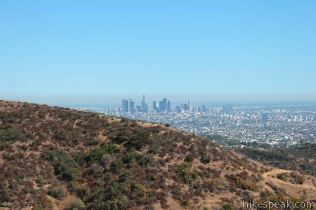
Cahuenga Peak is the highest summit in Griffith Park with excellent views of Los Angeles, Burbank, and that iconic landmark – the Hollywood Sign. Visit the Cahuenga Peak, Burbank Peak, and Mount Lee on a rugged two-trail outing.
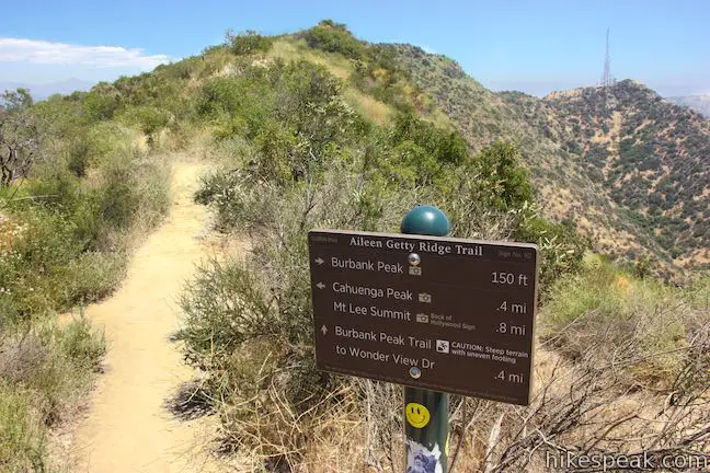
- Burbank Peak Trail (formerly Wonder View Trail) climbs from the west, passing a mini-summit viewpoint on the ridge of Cahuenga Peak known as Burbank Peak (home of the Wisdom Tree)
- Aileen Getty Ridge Trail goes from Burbank Peak up over the top of Cahuenga Peak and along a ridge to the Hollywood Sign at the top of Mount Lee
Combine Burbank Peak Trail and Aileen Getty Ridge Trail for a hike to three summits that is 3 miles round trip with 875 feet of elevation change.
Burbank Peak Trail and Aileen Getty Ridge Trail Peak are rugged single tracks that provide a good workout and more solitude that other hikes to the Hollywood Sign. This route is a shorter alternative to the tradition 6.4-mile hike from Brush Canyon Trail to the Hollywood Sign or the 3.5-mile hike from Hollyridge Trail to the Hollywood Sign.
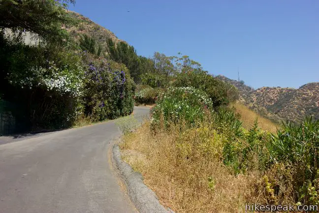
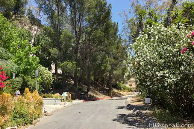
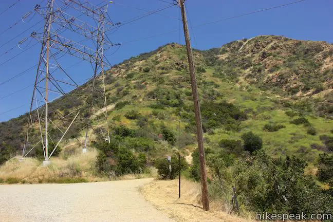
The first thing to note is that parking is not available at the trailhead or along the top of Wonder View Drive. Don’t be dissuaded. Instead, utilize the free street parking along Lake Hollywood Drive and walk a paved quarter mile up Wonder View Drive to the start of the trail.
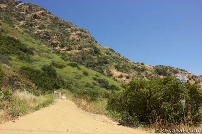
Pass around the yellow gate at the top of Wonder View Drive and come to a large dirt landing next to a holding tank. Turn right off the dirt road up a single track marked with a sign for Burbank Peak Trail.
Burbank Peak Trail
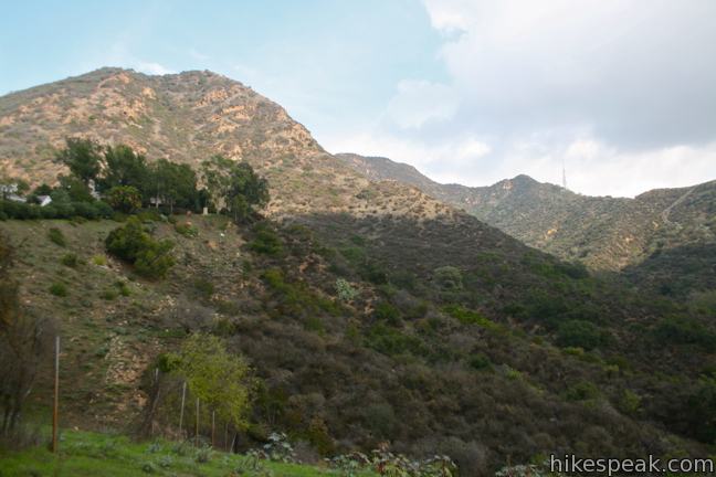
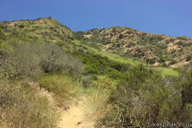
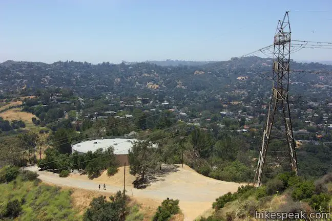
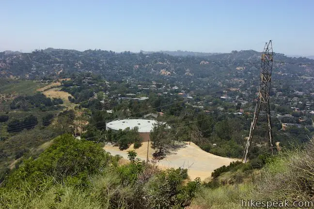
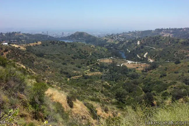
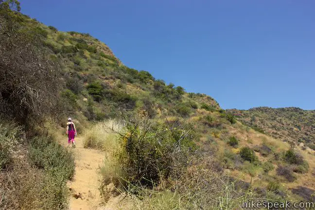
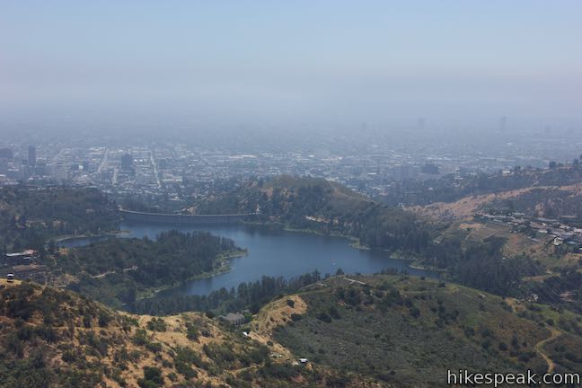
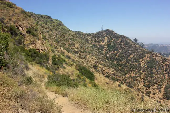
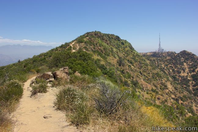
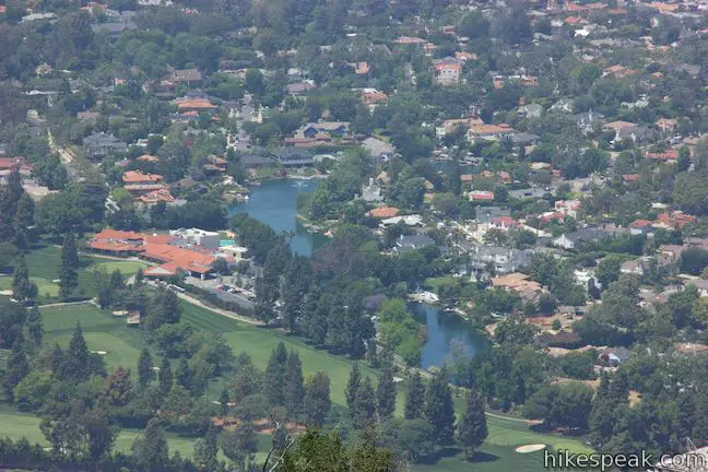
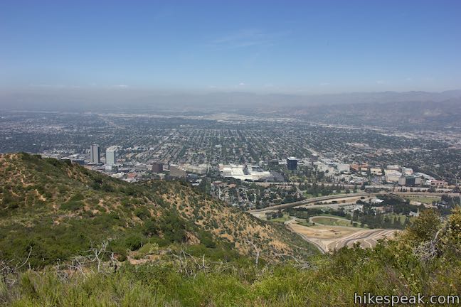
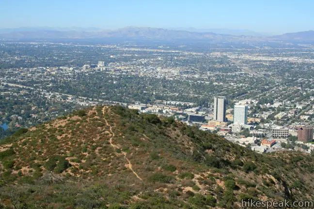
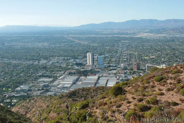
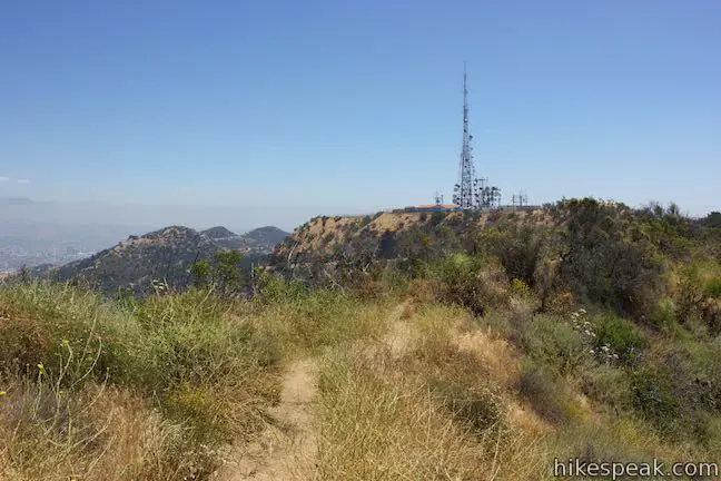
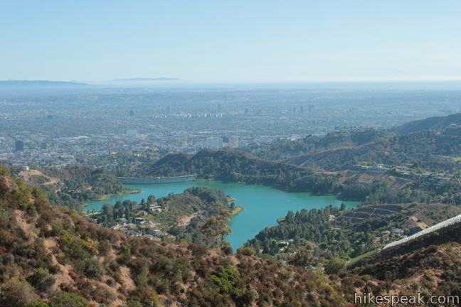
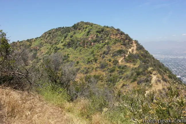
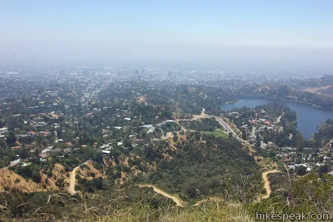
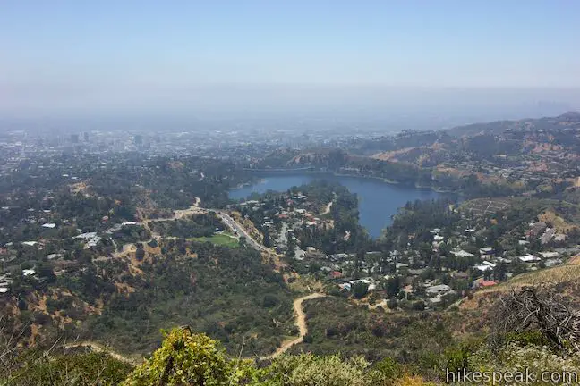
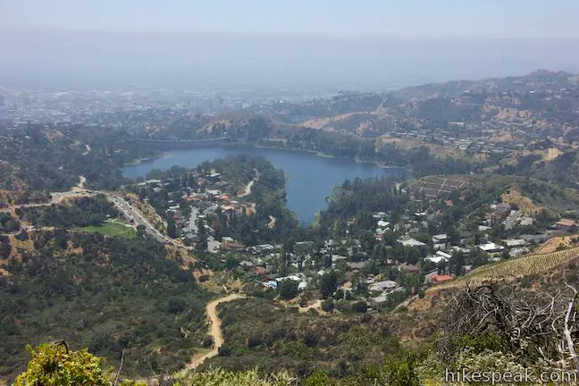
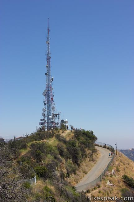
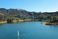
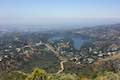
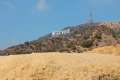
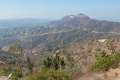
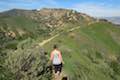
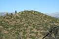
Burbank Peak Trail, which was previously called Wonder View Trail, heads east and rises quickly up the side of the mountain. Radio towers atop Mount Lee become visible straight ahead, offering a marker for the ultimate destination. To the right, you can look out from the mountainside down a canyon toward Lake Hollywood Reservoir.
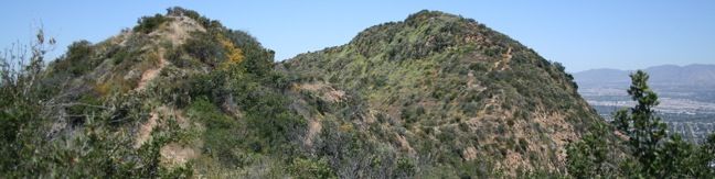
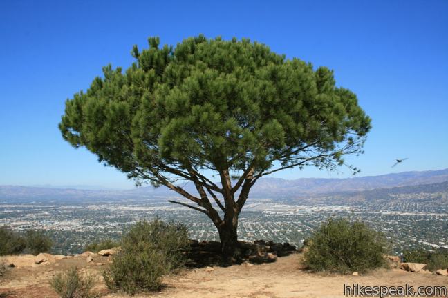
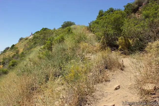
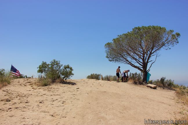
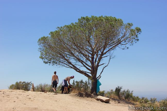
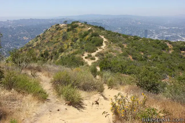
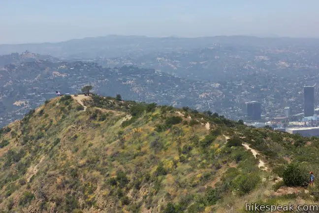
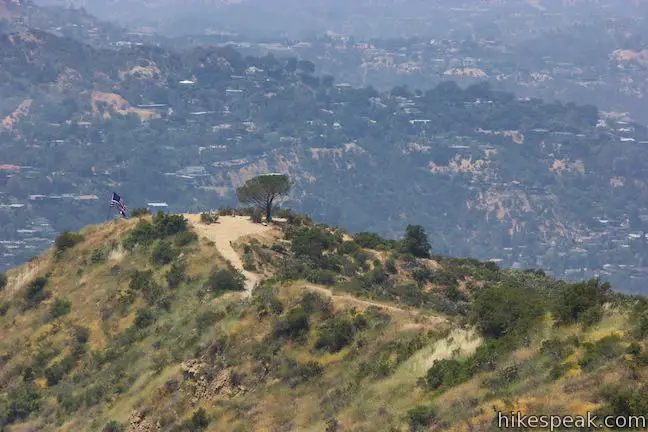
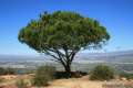
Less than half a mile from the end of the road (and 550 feet higher), the steep rocky trail comes to a marked junction on a ridge that runs east up Cahuenga Peak. To the right, Aileen Getty Ridge Trail pushes up Cahuenga Peak. To the left, Burbank Peak Trail extends a short distance farther to a point at the end of the ridge that has a well-positioned tree named the Wisdom Tree.
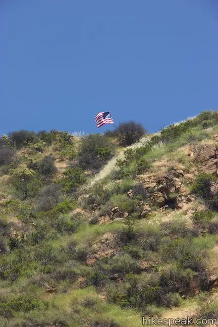
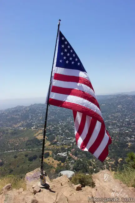
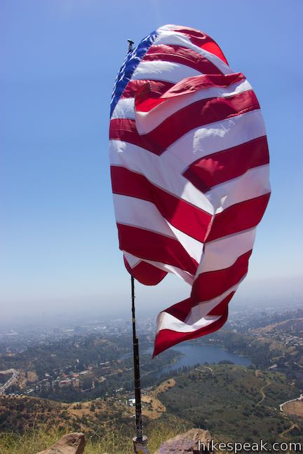
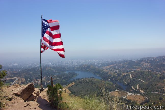
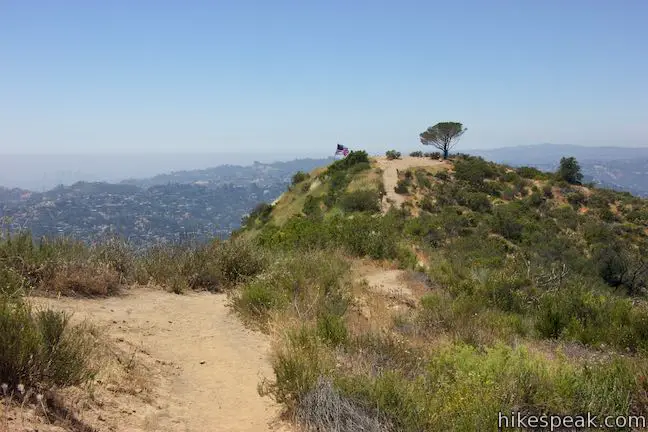
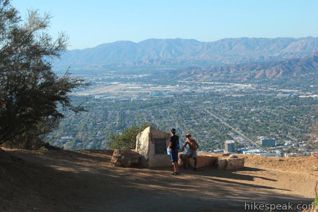
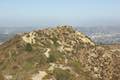
Rest beside the Wisdom Tree and take in broad views over Burbank and Hollywood. Universal Studios and Toluca Lake lie below the peak. A trail register beneath the Wisdom Tree is used by visitors leaving notes at the tree. An American Flag flies next to the peak that is part of a potentially unofficial September 11th Memorial. The 1,690-foot crest that the Wisdom Tree stands over is called Burbank Peak. If you turned around here, the round trip distance for the Wisdom Tree hike would be 1.6 miles, but why not hike even higher?
Aileen Getty Ridge Trail
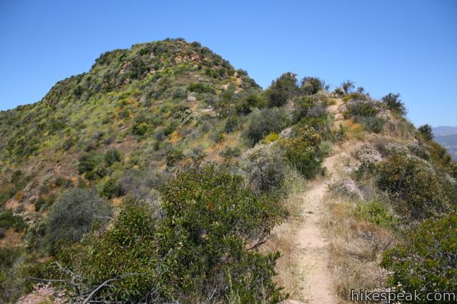
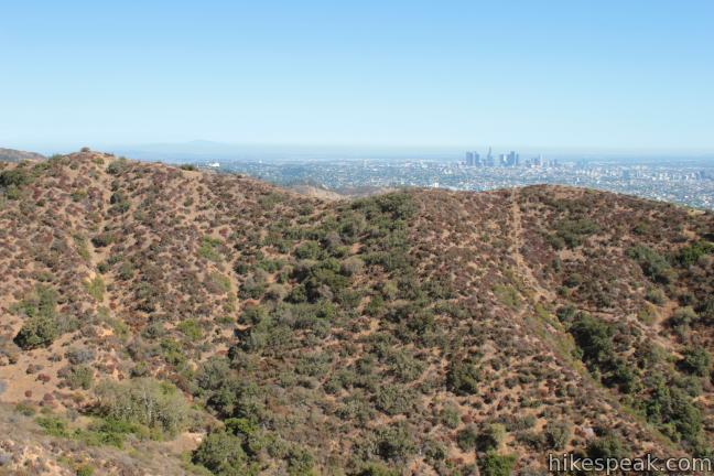
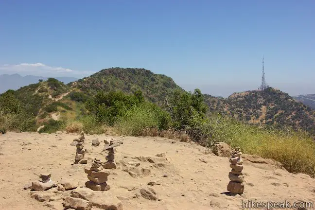
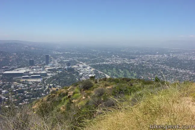
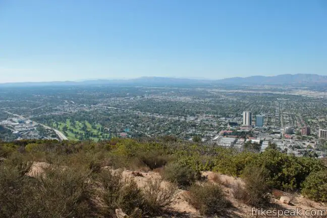
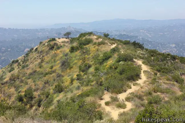
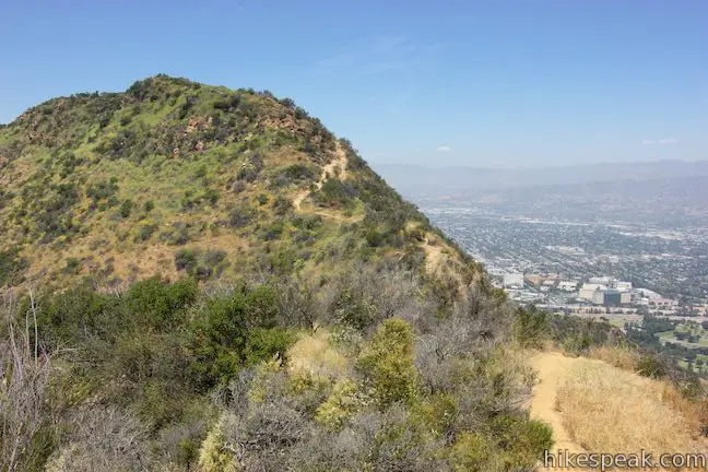
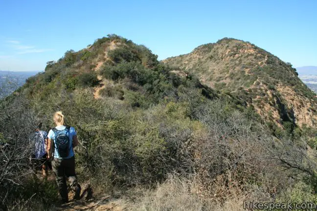
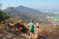
Follow Aileen Getty Ridge Trail east along the ridge toward Cahuenga Peak. The hike is more gradual now, climbing 145 feet over 1/3 mile to the summit. Looking over your shoulder, you’ll get nice views of Burbank Peak and more distant ridges in the Santa Monica Mountains.
Cahuenga Peak is the twelfth highest summit in the Santa Monica Mountains at 1,820 feet and offers excellent views over the east side of the range.
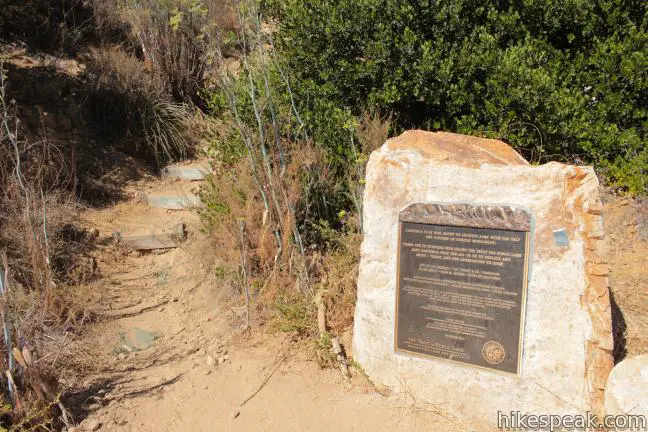
Cahuenga Peak is linked to Hollywood history because it was purchased in the 1930s by Howard Hughes. Hughes desired to build a home on Cahuenga Peak for Ginger Rogers. She refused and the peak remained undeveloped. Decades later a group of investors set out to build a housing development on the peak. This time it was the citizens of Los Angeles who refused. In April of 2010, Cahuenga Peak was rescued from impending development by the Save the Sign Campaign, which purchased the peak and donated it to Los Angeles to become part of Griffith Park.
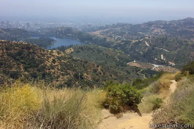
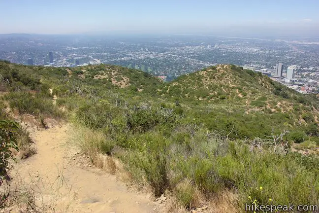
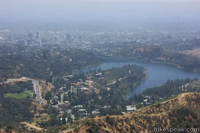
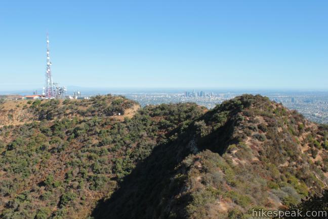
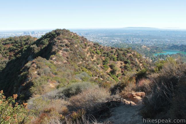
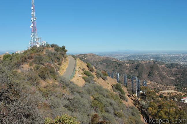
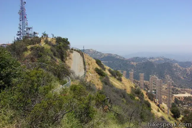
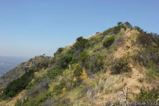
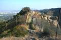
Continuing east from the summit, Aileen Getty Ridge Trail drops across a saddle that connects Cahuenga Peak to Mount Lee. This section of the hike is the most rugged, with steep rock steps. As you cross the saddle, enjoy nice views of Lake Hollywood to the south.
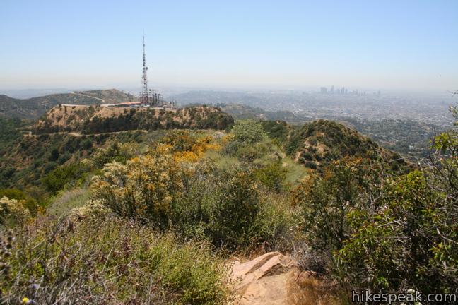
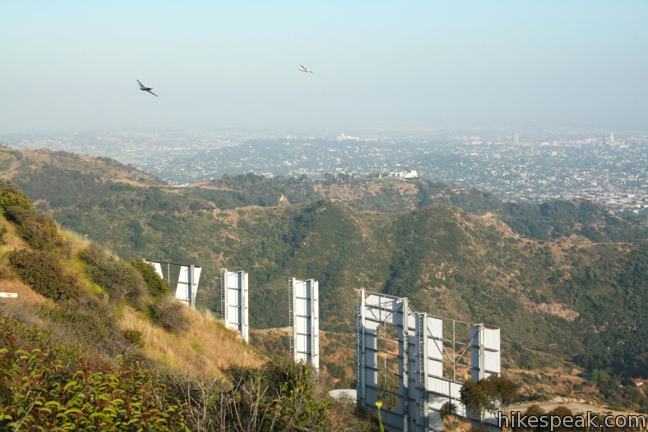
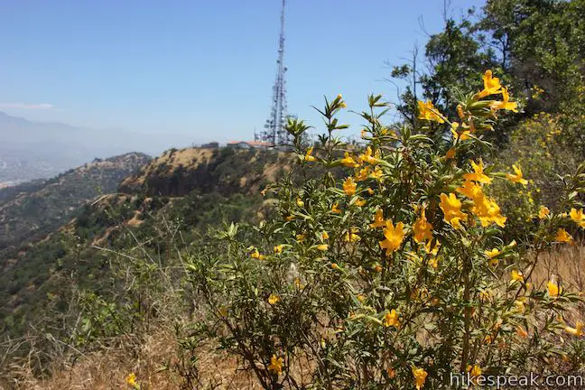
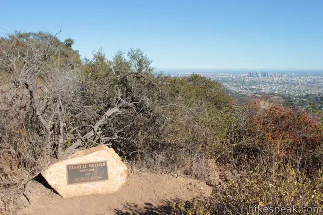
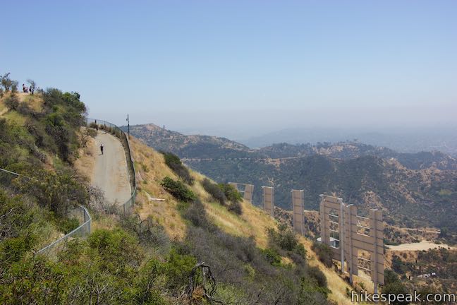
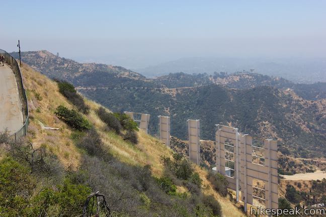
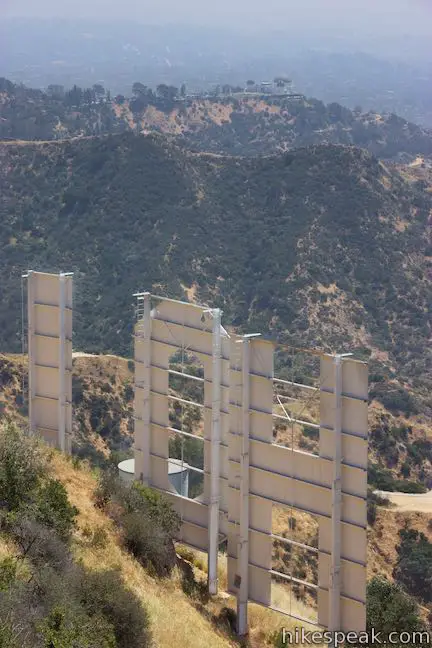
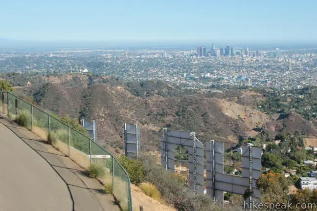
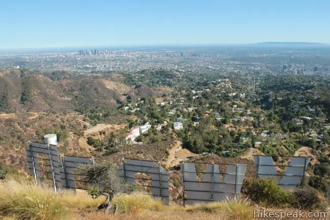
The main attraction is just ahead. Go over a shorter undulation in the ridge for a clear perspective of the backside of the Hollywood Sign (at what is now called Hugh Hefner Overlook). To get closer, follow the single-track to its end and step out on Mount Lee Drive. Hang a right and take the paved road up to the top of Mount Lee for a view of the back of the tall famous letters through a chain-link fence.
Mount Lee is 120 feet shorter and less than 0.4 mile from Cahuenga Peak, making it easy to visit both summits.
After taking in the view from above this LA landmark, simply return the way you came for a three-mile round trip hike.
Burbank Peak Trail and Aileen Getty Ridge Trail provide a great outing for those who want to see the Hollywood Sign, but prefer to hike rugged single tracks instead of refined paved and dirt fire roads. This hike has a fair amount of elevation over a relatively short distance, making it a fulfilling hike that is great for entertaining out-of-town visitors.
No fee or permit is required to hike Cahuenga Peak, so get out and enjoy! Check out this breakdown of the trails to the Hollywood Sign to compare the routes to Mount Lee or consider other hikes in Griffith Park.
Directions to the Trailhead
- Exit the 101 Freeway onto Barham Boulevard and drive north for 1/3 of a mile.
- Turn right at the light onto Lake Hollywood Drive.
- Take this winding road for half a mile up to an intersection with Wonder View Drive.
- Park along the street and begin hiking up Wonder View Drive.
- If you drive another quarter mile down Lake Hollywood Drive, you will reach the trailhead for Lake Hollywood Reservoir Walking Trail.
Trailhead Location
Trailhead address: Wonder View Drive & Lake Hollywood Drive, Los Angeles, CA 90068
Trailhead coordinates: 34.1331, -118.3364 (34° 07′ 59.15″N 118° 20′ 11.03″W)
View Griffith Park in a larger map
Or view a regional map of surrounding Los Angeles trails and campgrounds.


 | Burbank Peak This 1.6-mile round trip hike climbs to the Wisdom Tree perched at the west end of Griffith Park. |
 | Lake Hollywood Reservoir Walking Trail This 3.5-mile loop circles a peaceful fence-enclosed reservoir in the hills below the Hollywood Sign. |
 | Hollywood Sign via Innsdale Drive, Mulholland Highway, and Mount Lee Drive This 4.6-mile round trip hike combines trails and streets to deliver some of the very best views of the Hollywood Sign on the way to the summit of Mount Lee above the sign. |
 | Hollywood Sign - Hollywood Reservoir Loop This 5.4 to 7.4-mile loop combines trails and streets to visit the Hollywood Sign on Mount Lee, neighboring Cahuenga Peak and Burbank Peak, and Lake Hollywood Reservoir. |
 | Mount Lee and the Hollywood Sign via Hollyridge Trail This 3.5-mile hike ascends 750 feet to reach the summit of Mount Lee behind the Hollywood Sign. |
 | Mount Lee and the Hollywood Sign via Brush Canyon Trail This 6.4-mile hike crosses Griffith Park from Canyon Drive to the top of Mount Lee directly behind the landmark Hollywood Sign. |
 | Mount Chapel, Mount Bell, and Mount Hollywood This 5.7-mile loop tops three prominent summits on a panoramic tour of Griffith Park. |
 | Bronson Cave This short easy hike visits a man-made cave recognizable as the Batcave from the 1960s Batman TV series and hundreds of other locations on TV and film. |
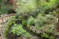 | Ferndell Trail This relaxing half-mile hike goes through a tropical garden in the lushest little canyon in Griffith Park. Explore farther on a 1.75-mile hike in Western Canyon or venture up to the Griffith Observatory to see more of the park. |
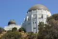 | Griffith Observatory via West Observatory Trail This 2.1-mile hike ascends from Western Canyon up ridges to Griffith Observatory, getting sweeping views over Los Angeles and Griffith Park along the way. |
 | Griffith Observatory via East Observatory Trail This 1.5-mile hike from Vermont Canyon Avenue up to Griffith Park's great observatory delivers excellent views over Los Angeles along the way. |
 | Griffith Observatory to the Hollywood Sign This 8.8-mile hike travels from one Griffith Park landmark to another, crossing Mount Hollywood along the way. |
 | Mount Hollywood This 1,625-foot peak is a star of Griffith Park with panoramic views that can be reached from Griffith Observatory on a steep 1.4-mile hike or a scenic 2.65-mile trek and from lower in the park in Western Canyon for a hike of around 4.2 miles. |
 | Glendale Peak This hike is around three miles long and visits a less known summit on the southeast side of Griffith Park with views that deserve more attention. |
 | Glendale Peak - Mount Hollywood Loop This 4.15-mile hike tops two summits in Griffith Park that both have awesome views. |
 | Cedar Grove & Vista View Point Loop This 2.3-mile loop on the southeast side of Griffith Park follows paved and unpaved trails to two park attractions, a quiet grove with a picnic area and a helipad with panoramic views. |
 | Bee Rock This hive-shaped point on the east side of Griffith Park is reached via a 1.7 to 4-mile round trip hike. |
 | Old Zoo Picnic Area This half-mile hike explores the abandoned exhibits and animal cages in the ruins of the old LA Zoo in Griffith Park. |
 | Beacon Hill This 2.75 to 3.9-mile hike in Griffith Park climbs 500 feet to the easternmost summit in the Santa Monica Mountains. |
 | Amir's Garden This one-mile hike reaches a relaxing garden on the east side of Griffith Park that is a pleasant retreat for hikers. |
 | More trails in the Santa Monica Mountains Explore other destinations in the range. |
- Burbank Peak, Cahuenga Peak, and Mount Lee on socalhiker.net (opens in a new tab)
- Burbank Peak, Cahuenga Peak, and Mount Lee on modernhiker.com (opens in a new tab)
- Burbank Peak, Cahuenga Peak, and Mount Lee on Dan's Hiking Pages (opens in a new tab)
- Cahuenga Peak on summitpost.org (opens in a new tab)
- Cahuenga Peak on wikipedia.org (opens in a new tab)
- Hikes to the Hollywood Sign on theloverspassport.com (opens in a new tab)
- The dedication of Aileen Getty Ridge Trail on patch.com (opens in a new tab)
- City of Los Angeles website for Griffith Park (opens in a new tab)
Common Questions about Cahuenga Peak and Mount Lee via Burbank Peak Trail and Aileen Getty Ridge Trail in Griffith Park
- Is the trail open?
- Yes. You should expect to find that Wonder View Drive, Burbank Peak Trail, and Aileen Getty Ridge Trail is open. There are no recent reports of trail closures. If you discover that the trail is closed, please help your fellow hikers by reporting a closure.
- Is this trail free to access?
- Yes, Wonder View Drive, Burbank Peak Trail, and Aileen Getty Ridge Trail is free to access. No entrance fee, pass, or permit is required. If you discover that access rules have changed, please provide feedback on your experience.
- How much time does this hike take?
- It takes approximately 1 hour 45 minutes to hike Wonder View Drive, Burbank Peak Trail, and Aileen Getty Ridge Trail. Individual hiking times vary. Add extra time for breaks and taking in the views.
- How long is this hike?
- The hike to Wonder View Drive, Burbank Peak Trail, and Aileen Getty Ridge Trail is a 3 mile out and back with 875 feet of elevation change.
- Are dogs allowed on this trail?
- Yes, dogs are allowed on Wonder View Drive, Burbank Peak Trail, and Aileen Getty Ridge Trail. The trail is open to hikers, dogs.
- Does this trail go to a summit?
- Yes, Wonder View Drive, Burbank Peak Trail, and Aileen Getty Ridge Trail reaches a summit with panoramic views.
- What mountain range is this trail in?
- Wonder View Drive, Burbank Peak Trail, and Aileen Getty Ridge Trail is located in the Santa Monica Mountains.
- Where is the trailhead located?
- The trailhead for Wonder View Drive, Burbank Peak Trail, and Aileen Getty Ridge Trail is located in Los Angeles, CA.
Trailhead Address:
Wonder View Drive
Los Angeles, CA 90068
Trailhead Coordinates:
34.1331, -118.3364 - What are the driving directions to the start of the hike?
To get to the trailhead: Exit the 101 Freeway onto Barham Boulevard and drive north for 1/3 of a mile. Turn right at the light onto Lake Hollywood Drive. Take this winding road for half a mile up to an intersection with Wonder View Drive. Park along the street and begin hiking up Wonder View Drive. If you drive another quarter mile down Lake Hollywood Drive, you will reach the trailhead for Lake Hollywood Reservoir Walking Trail.
View custom Google Maps directions from your current location.
- Are there other trails near Wonder View Drive, Burbank Peak Trail, and Aileen Getty Ridge Trail?
- Yes, you can find other nearby hikes using the Hikespeak Hike Finder Map.

29 Comments on Cahuenga Peak and Mount Lee via Burbank Peak Trail and Aileen Getty Ridge Trail in Griffith Park
What hikers are saying:
✨ Generated summary of user commentsThis trail is a hidden treasure that offers a challenging workout with rewarding views of the Hollywood hills. The path is notoriously steep and demands good physical condition, especially when navigating loose rocks and sudden drop-offs. Michael warns that visitors should carry plenty of water and stay alert for signs of mountain lions in the area.
Wow, this hike has been ruined by the publicity. There used to be a cool ammo box with notebooks you could write in, and things hung from the tree. That’s all gone now, and people have been setting fires up there at night. Eventually one will get out of control. And eventually someone will damage the tree. People were climbing it today. Too bad the people can’t respect what was cool about this place before.
The ammo box is still there. Sincerely, someone who went up to the tree today. The stuff is still inside. You can still write in it.
The box, notebooks and pens is still there, it might have been nailed to the top of the tree but looks like it was taken down and now on the ground. This place is a hidden treasure. I was thinking to bring a hammock up there. Someone brought a lawn chair to the 9-11 memorial on the left of the tree and it’s really awesome. People should hide notes and other treats on the tree that would so great!
I am a lazy bum who prefers talking about what he used to do instead of getting out and doing it. I have been to Cahuenga Peak many times as I lived in Hollywood for 23 years. I am not one who likes scary drop-offs, but I do like good elevation gain, at least back when I was doing this in the 80s. I left LA in ’91.
I was there many times and never saw another person, certainly never a swarm of them – but things change and I would not be shocked to see more traffic, which could be said for anyplace on earth other than brutally hot or cold areas, and even those will be taken it time.
Anyway, funny thing about me not liking steep drop-offs was the first time I was up in the hills near Cahuenga Peak (without knowing it’s name or even caring) was with a buddy who got ahead of me on the saddle connecting Mt Lee with Cahuenga Peak. I stood back and watched. It looked like he was climbing a steep cliff. I told him I don’t like risky business, I wanted no part of the cliff. “It’s not a cliff”, he yelled out, “come on man, this is nothing.”
But like a cat that goes into a panic and nothing you can say will change it, I was too scared to move on. Where I stood was good enough. But later I bought a cheap pair of hiking boots, really cheap ones but great as far as I was concerned. They made me feel more confident about grip. Then one day I read about Cahuenga Peak in a book called “50 Day Hikes in L.A.” and thought it sounded like a good workout, and not dangerous either. So I went up the trail myself and loved it. When I got to the top I took a right and went to the edge of the ridge where it bumped into a steep decline down some rocks, nothing dangerous though. It was then that I realized I was standing on the very rocks that had scared me weeks before when I saw my friend ascending them. After realizing how stupid I had been weeks before I began to take the peak from all angles, Burbank, Griffith Park, The Hollywood Resevoir, about 6 different ways. I really enjoyed it up there. It would be a place I’d take a visitor if I lived there today. The only difference is they might have to lead the way as I haven’t taken a good non stop elevation in some time. Thanks for reading.
TJ
[…] Here is a list of trails in Los Angeles, my personal favorite has been one we did off Barham Blvd. You can do the infamous Runyon Canyon but to me, it’s overrated. It’s over crowded […]
7/24/2014 Hiked up last evening with my wife and grandson. Was a good experience (4th time for me. I love liking in these hills. the trails are clear enough but don’t go without some water! There is evidence of mountain lion presence but I have never seen one face to face. Lizards and rabbits is mostly what I have seen; two skunks and some coyote and deer. Great views!
How steep is this trail really? The pictures don’t seem too bad but then again I’m getting mixed signals from the comments. Some comments seem like its a nice hike/good workout and others people are terrified to even go any farther? Please help
This trail definitely has steep parts and will give you a good workout. Enjoy!
I just hiked up to the sign via this trail on 6/6/15 and wow is it steep! I took my 62 year old mother who could only make it to the tree and had to stop before the sign. Be prepared for a steep climb most of the way as well as some drop offs and loose rocks. This is not an easy way up and anyone who is not prepared should take the long way via Griffith Observatory.
How long does it take to reach the summit of this trail to the Hollywood sign?
It is just over a mile from the trailhead to the top of Cahuenga Peak. Given the elevation change, plan on ascending for at least half an hour. From there it will take 10-15 minutes to get over to Mount Lee.
Charles pierce planted that tree in the 70s. Mcdonalds was giving out mini christmas trees with meals. He planted it and hiked water to it weekly.
[…] It was a short but strenuous hike. We took the Burbank Peak Trail which was about a 3 mile round trip. I think it was the steepest hike I’ve ever done […]
[…] Wonder View Trail – 3 miles round trip […]
The article says “Burbank Peak Trail (formerly Wonder View Trail)”. Where is that defined officially?
Hello. THIS HIKE IS NOT EASY! if you are not an experienced hiker this trail is not for you. The scenery is beautiful, however, the majority of the trail is either straight up or straight down and is quite difficult.
Thank you! Everyone else seems to gloss over that fact!
Whenever I make it to this part of Griffith Park, I always go to Cahuenga Peak. I love this trail a lot and always have since I was a kid.
??
The last time I was at the trailhead, in 2017, on a Saturday morning, there were loads of people beginning the hike. This was the opposite of what it was like when I made occasional trips up Wonder Drive on my bicycle.
The trail is steep. This shouldn’t be attempted by anyone not in good physical condition.
Mayor Garcetti remarked that all trails will re-open this Saturday, May 9. I hope this includes Griffith Park.
Any one knows if this trail opened?
It’s currently indefinitely closed due to Covid.
Hoping to get back to USA, maybe next summer (2022) – we were supposed to be there in summer 2020.
Are you still allowed access to the Burbank Peak Trail – if you look at street view on Google Maps for example, there are various signs at the junction of Lake Hollywood Drive / Wonder View Drive saying “No access to Hollywood Sign” / “Not a Through Street”…??? Thanks for any replies.
[…] designated trails for hikes to the Hollywood Sign: Mt. Hollywood Trail, Brush Canyon Trail, and Cahuenga Peak Trail. There are also viewpoints of the sign city-wide. Two popular views are at the corner of Hollywood […]
[…] the morning, it leaves a whole day to enjoy whatever it is you enjoy when you get the chance: say, a long walk through Griffith Park in Los Angeles, or a session at the skate park in Grant Park in Chicago. (Me, I’m going […]
[…] side. It is considered relatively easy. Parking can be found off North Vermont Canyon Road. The Cahuenga Peak Trail can be completed in less time but is a little more challenging as you’re climbing uphill and […]
[…] Cahuenga Peak Trail – 3.0 mile loop trail with about 900ft elevation gain (1 hour 30 minutes) […]
[…] You can view a rundown of this trail and the details of reaching it here. […]