Hollywood Sign – Hollywood Reservoir Loop
in Los Angeles
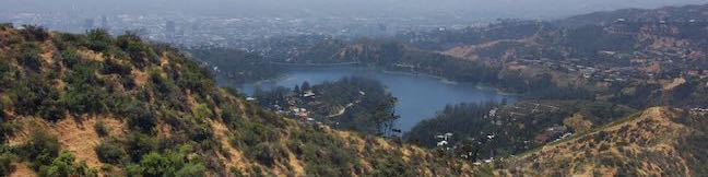
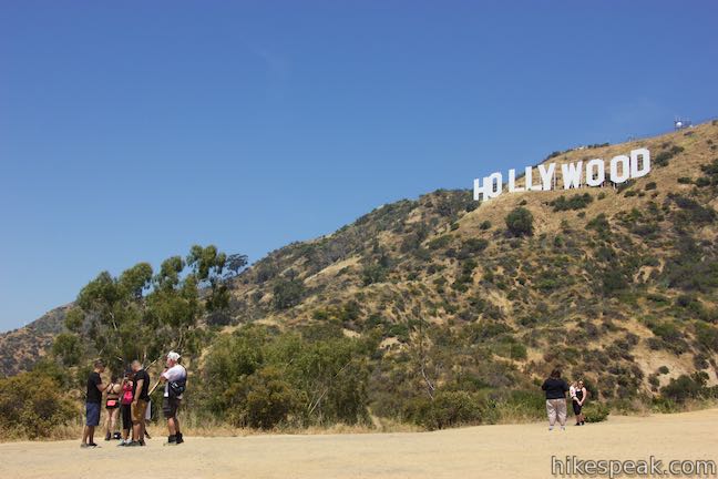
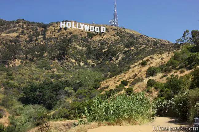
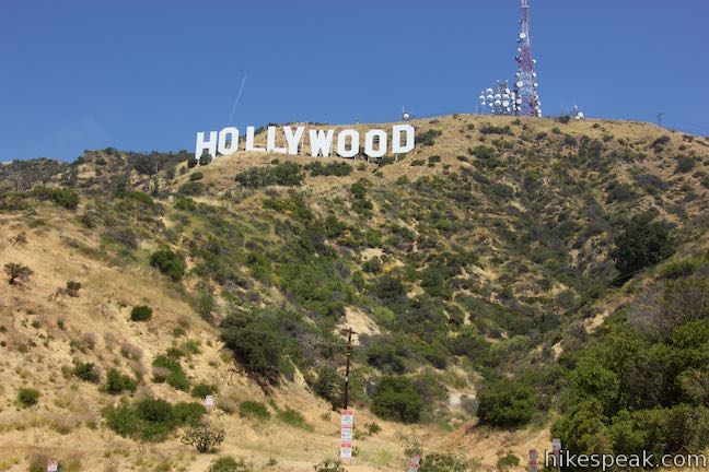
You might not realize that Hollywood has a lake until you look down on it from the top of Mount Lee by the Hollywood Sign. Numerous hikes lead to the Hollywood Sign and a level hiking trail wraps around Lake Hollywood Reservoir. To visit the Hollywood Sign, three peaks on the west side of Griffith Park, and Lake Hollywood, set out on the Hollywood Sign – Hollywood Reservoir Loop.
The route of Hollywood Sign – Hollywood Reservoir Loop
- Begin up trails through a neighborhood with backyard views of the Hollywood Sign.
- Rise to the summit of Mount Lee, the mountain behind the those big white letters.
- Head west along a ridge to Cahuenga Peak and Burbank Peak.
- Descend to Lake Hollywood Reservoir.
- Take a scenic route around the lake or a shorten route for a loop that is 7.4 or 5.4 miles round trip with 1,070 feet of elevation change.
Hollywood Sign – Hollywood Reservoir Loop combines multiple trails, and streets. Long stretches of the circuit are paved.
While you can start this loop from multiple points, these directions begin from the intersection of Tahoe Drive and Canyon Lake Drive, where street parking can usually be found. By starting here and following the loop in a counter clockwise direction, you will:
- Get the climb out of the way first
- Have good options to turn back early if needed
- Save the decision for whether to talk the short or long route around Lake Hollywood Reservoir for the end of the hike
The basic directions for the Hollywood Sign – Hollywood Reservoir Loop are:
- Leave Tahoe Drive and walk up to the north end of Canyon Lake Drive (0 miles)
- Turn right to hike east on unpaved Innsdale Drive (0.15 miles)
- Reach the top of Innsdale Drive and turn left onto Mulholland Highway (0.6 miles)
- Turn left at the next intersection to continue up Mulholland Highway (0.7 miles)
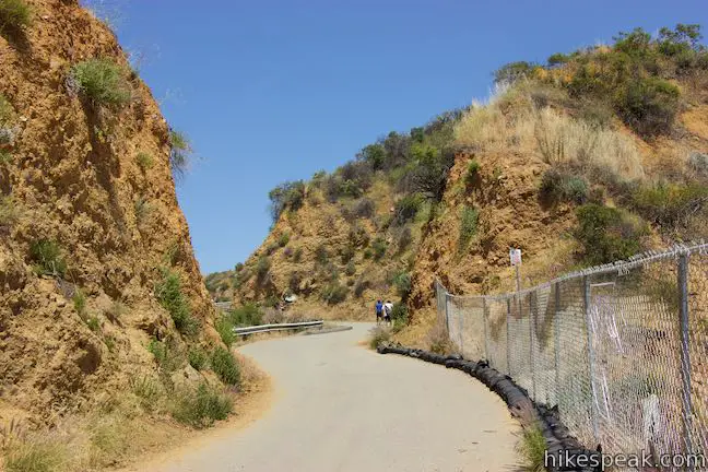
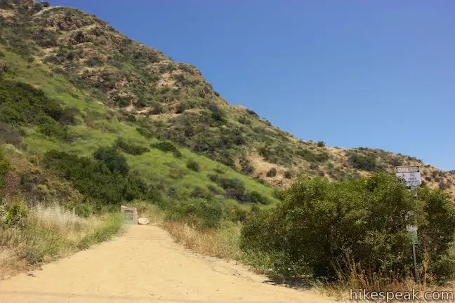
- Cross a chain and pass a Hollywood Sign photo-op on Mulholland Highway (0.8 miles)
- At the top of Mulholland Highway, turn left up a passage around gates to Mount Lee Drive (1.05 miles)
- Turn left up a spur to Hollywood Sign View (1.05 miles)
- Admire the perspective from Hollywood Sign View (1.1 miles)
- Return to Mount Lee Drive and turn left (1.15 miles)
- Pass through a junction with Mulholland Fire Road (1.55 miles)
- Pass Aileen Getty Ridge Trail on a curve in the road below the summit (2.35 miles)
- Reach the top of Mount Lee above the Hollywood Sign (2.5 miles)
- Backtrack to Aileen Getty Ridge Trail and turn left to head west (2.65 miles)
- Cross the summit of Cahuenga Peak and continue down the ridge (2.95 miles)
- Pass the top of Burbank Peak Trail (3.3 miles)
- Stand by the Wisdom Tree on Burbank Peak (3.35 miles)
- Backtrack to the previous junction and turn down Burbank Peak Trail (3.4 miles)
- At the bottom of the trail, turn left down Wonder View Drive (3.85 miles)
- At the bottom of Wonder View Drive, turn left down Lake Hollywood Drive (4.15 miles)
- Come to the North Gate Entrance and turn right onto Lake Hollywood Reservoir Walking Trail (4.4 miles)
- Cross Mulholland Dam and turn left (5.65 miles)
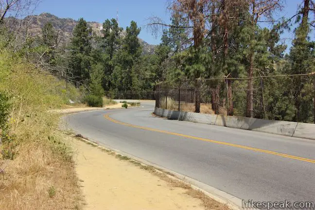
- Exit through the Tahoe Gate onto Lake Hollywood Drive and turn right up Tahoe Drive (7.15 miles)
- Return to the intersection with Canyon Lake Drive where the loop began (7.4 miles)
Alternatively, when you come down Lake Hollywood Drive to the North Gate, continue another 0.75 miles on Lake Hollywood Drive. Approach the Tahoe Gate and turn left up Tahoe Drive to walk back to the trailhead for the 5.4-mile version of the loop. Anyone hiking with a dog will need to select this shorter option.
Hiking Hollywood Sign – Hollywood Reservoir Loop
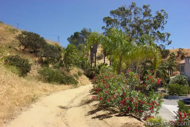
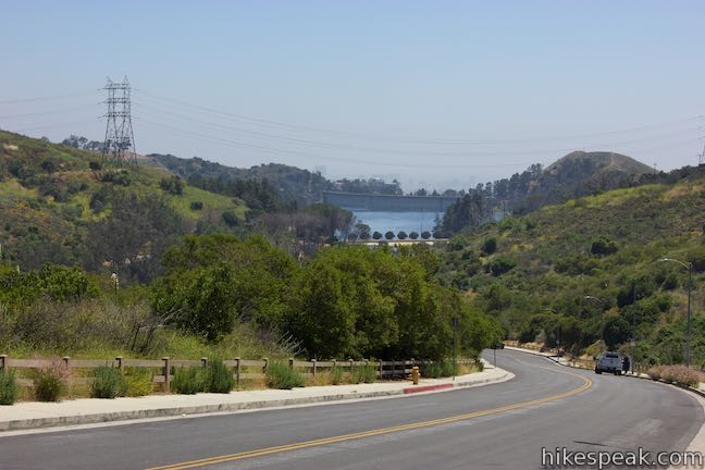
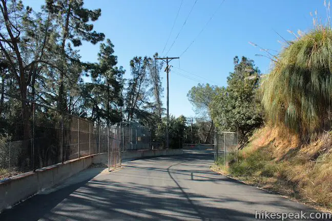
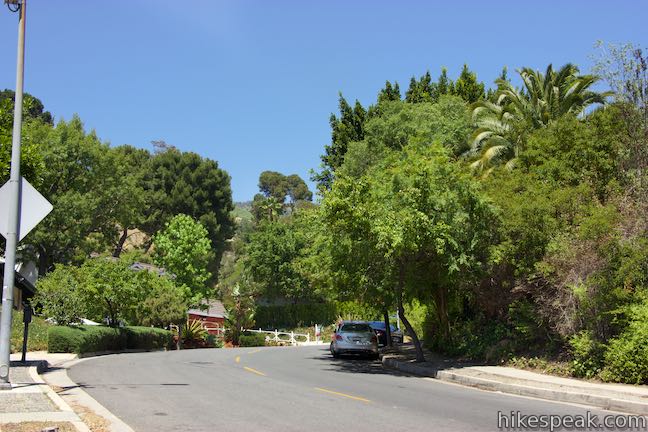
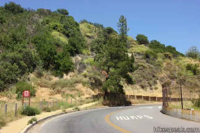
Set out up Canyon Lake Drive from the intersection with Tahoe Drive near Lake Hollywood Park. Walk 0.15 miles up the sidewalk, quickly gaining nearly 100 feet of elevation. Follow the top of the road as it bends to the right and approaches a gate in front of a wide dirt trail. Proceed onto this trail, called Innsdale Drive.
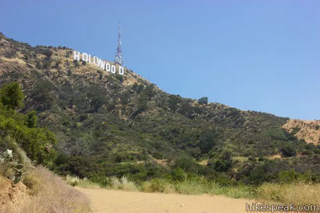
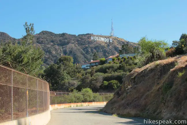
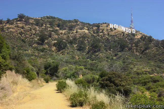
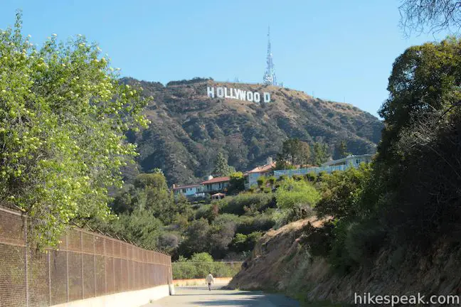
The next 0.45 miles are unpaved and have awesome feel-like-a-tourist views of the Hollywood Sign. The big white letters get even closer as the trail eases its way east around bends in the mountainside.
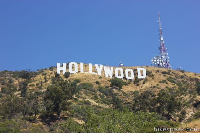
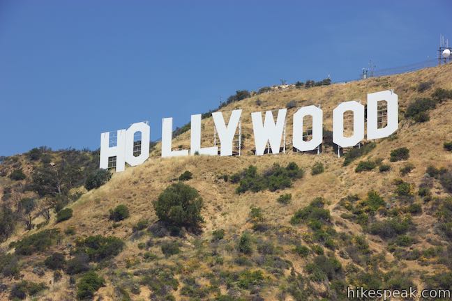
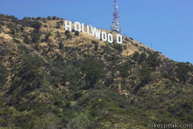
The Hollywood Sign was originally constructed in 1923 and spelt ‘Hollywoodland’ to promote the neighborhood below the mountain. The advertisement evolved into one of the world’s most recognizable landmarks (although the sign lacks national landmark status). The Hollywood Sign got a facelift in 1979 when the current 45-foot tall letters were installed.
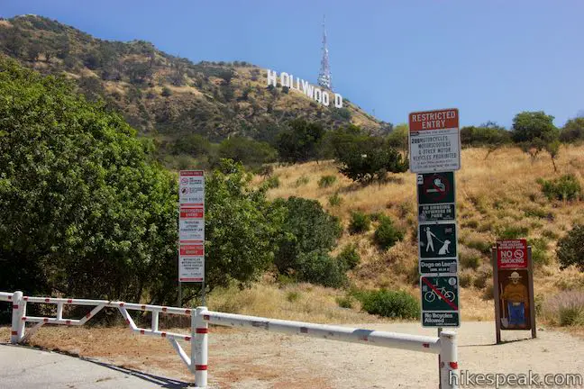
It is important to stay on the hiking trail and obey the “Restricted Entry” signs posted above the trail by the Mountain Fire District. Visitors are not allowed to walk right up to the base of the Hollywood Sign, so straying off trail is a no-no that can be penalized by fines and arrests.
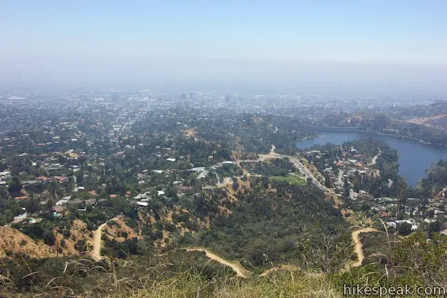
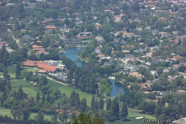
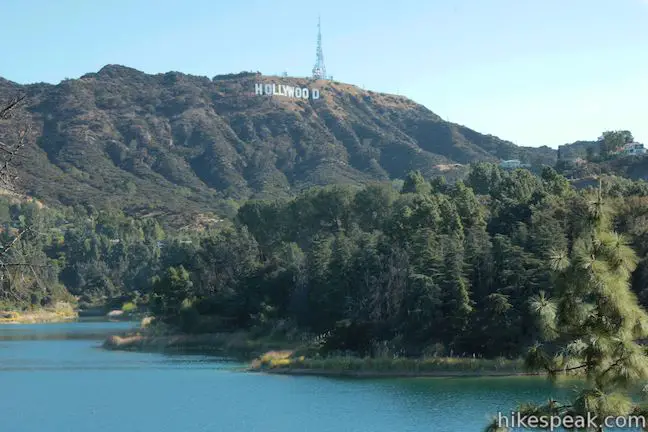
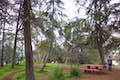
If you look to your right as you hike, Lake Hollywood Park and the unofficial Hollywood Sign viewing area are visible at the other end of Canyon Lake Drive. Just beyond that, Lake Hollywood Reservoir appears to southwest.
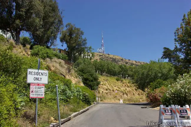
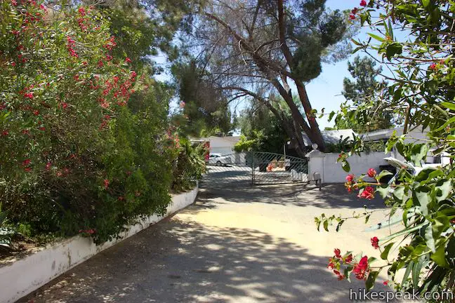
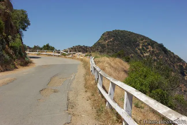
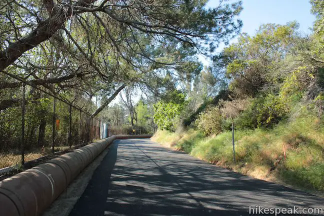
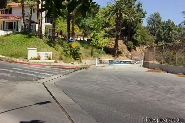
Innsdale Drive dissects a small piece of Griffith Park and eventually curves to the right toward houses along a street called Mulholland Highway. Cross over a chain at the top of the trail and come out onto Mulholland Highway. The top of the trail looks more like a driveway wedged between houses than a public trail.
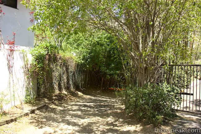
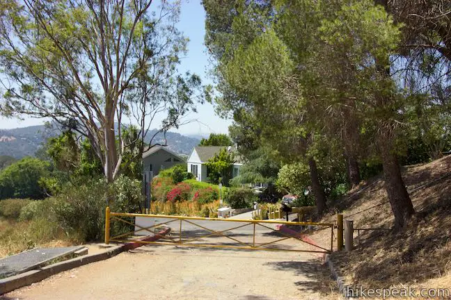
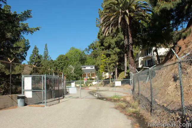
Turn left and walk up Mulholland Highway to an intersection that hosts a collection of threatening signs and barriers that imply that the road is off limits. Turn left again and walk up the road past the barricades, staying off people’s driveways and property so that you aren’t actually trespassing.
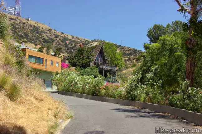
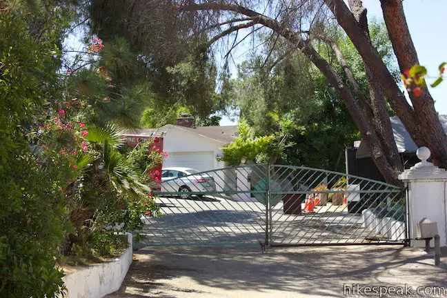
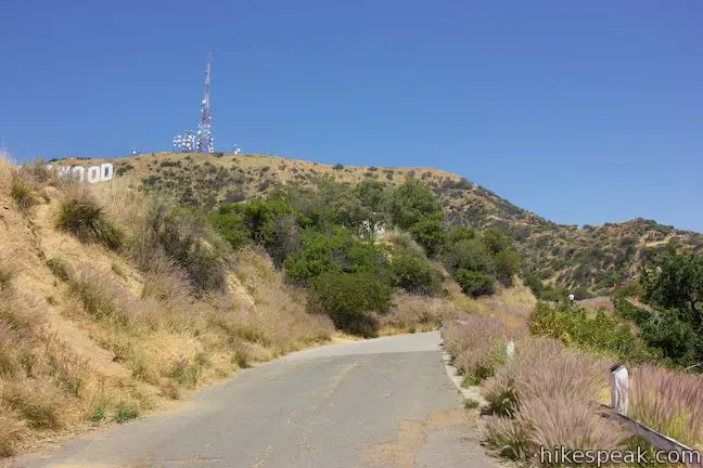
The road (which is still Mulholland Highway) curves to the right and meets a chain and signs in front of one last house. Cross the chain to proceed up the road, which curves to the right and becomes unpaved. As you round this bend, the Hollywood Sign soars overhead. You can’t get much closer than this! If you need to snap a new profile pic, this is probably the best spot, but the hike does offer another viewpoint facing the Hollywood Sign.
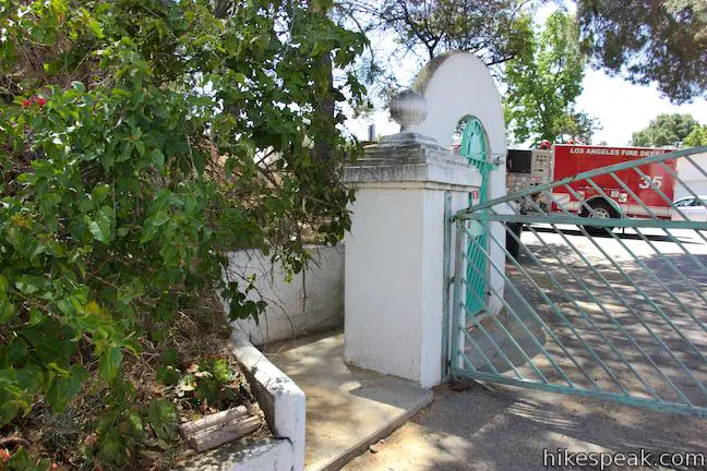
Stay on the road and do not stray into the off-limits area above, marked with the restricted entry signs from the Mountain Fire District. Unpaved Mulhollad Highway wraps around a ridge above houses at the top of the Hollywoodland neighborhood. The trail gets closer to the houses and becomes separated from a driveway by a row of bushes. In the end, the dirt trail merges with the driveway in front of a teal gate at the top of Deronda Drive.
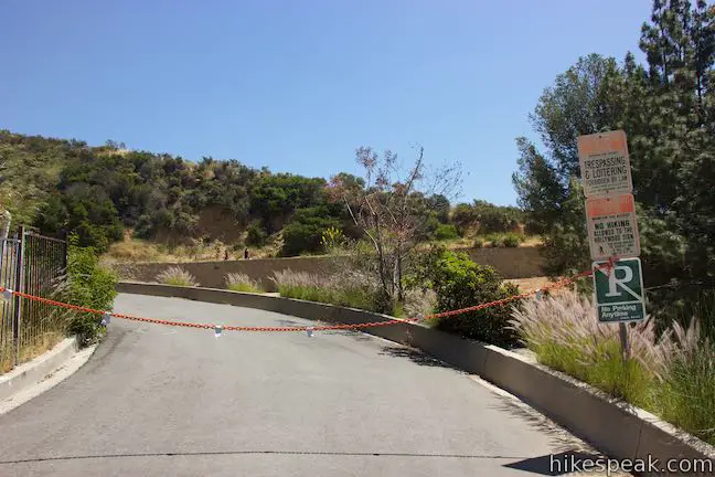
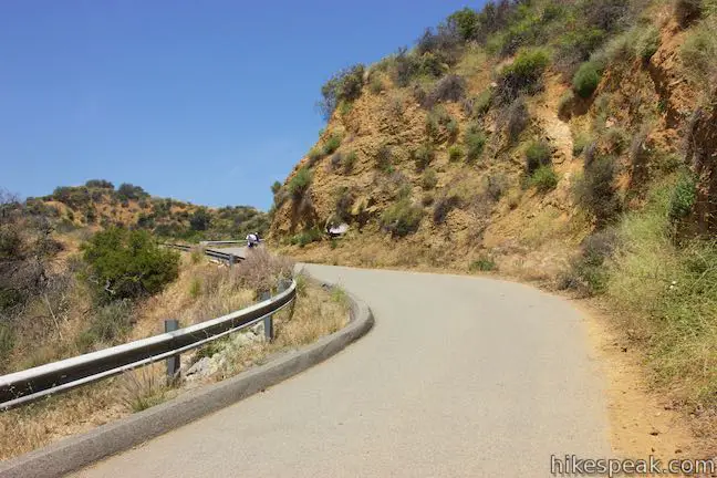
Turn left just in front of the gate to take an almost hidden passage up to Mount Lee Drive. The steps go along a wall to a paved road just beyond a fire gate at the top of Deronda Drive. This new trail is Mount Lee Drive, which leads to the summit behind the Hollywood Sign.
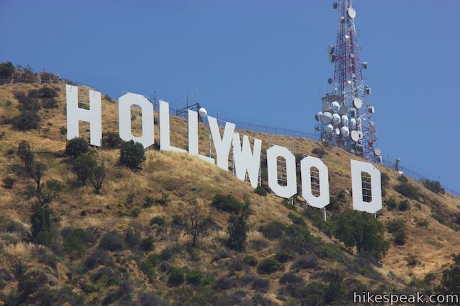
An immediate junction at the bottom of Mount Lee Drive presents a paved spur to the left that goes 200 yards up to Tyrolian Tank. Unless you’re a big fan of holding tanks, you’ll probably only want to walk 100 yards up this spur to Hollywood Sign View. Venture up the side trail to a dirt landing with a broad, if slightly indirect, look at the Hollywood Sign.
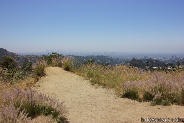
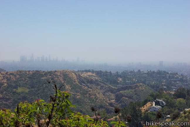
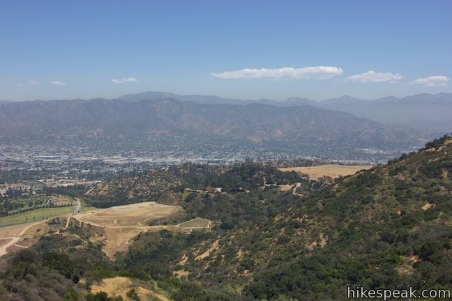
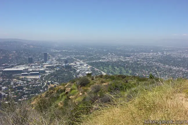
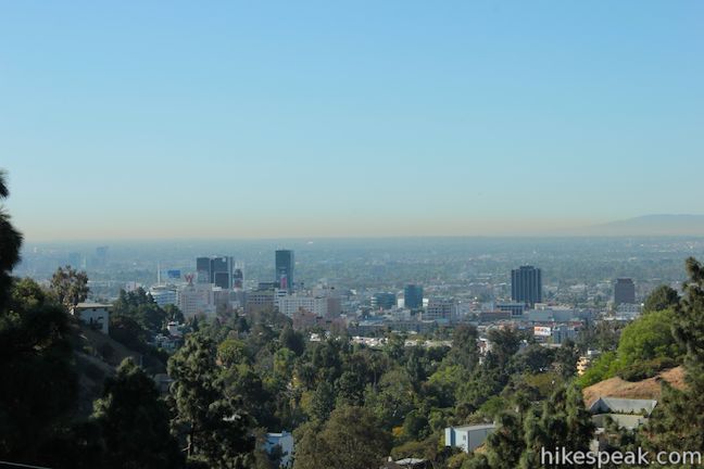
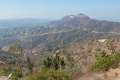
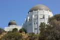
Backtrack to the junction and turn left to hike all the way up to the Hollywood Sign on Mount Lee. The sign-facing views become scarce as you hike up Mount Lee Drive, so gaze east toward Mount Hollywood, which rises above Griffith Observatory. Curve around a couple ridges for an interesting perspective south over the quarried area by Bronson Cave (aka the Batcave). The skyline of downtown Los Angeles rises to the southeast.

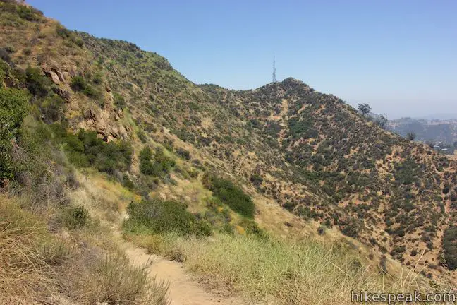
Come to a junction with unpaved Mulholland Fire Road, which goes east and connects to Hollyridge Trail and Brush Canyon Trail to facilitate other hikes to the Hollywood Sign. Stay to the left to proceed up Mount Lee Drive. Hike up through a sweeping bend to the right with views back across the junction and out over Los Angeles.
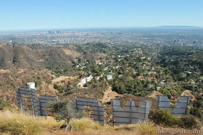
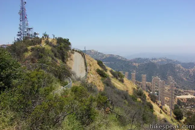
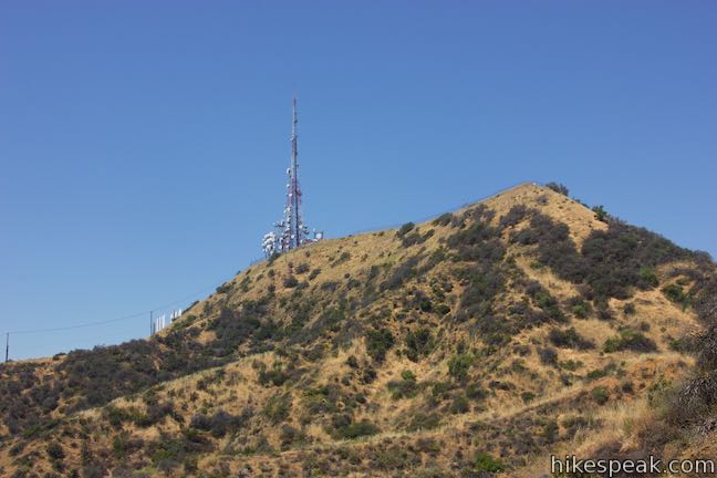
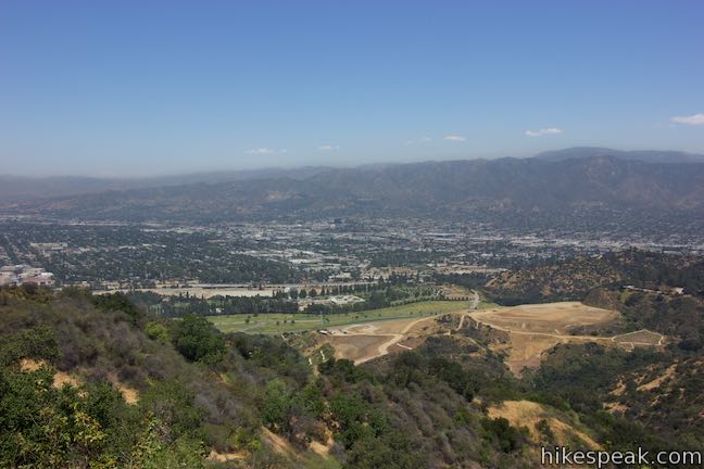
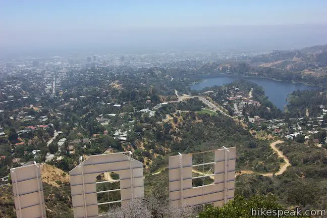
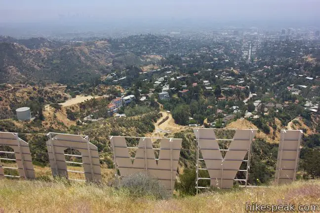
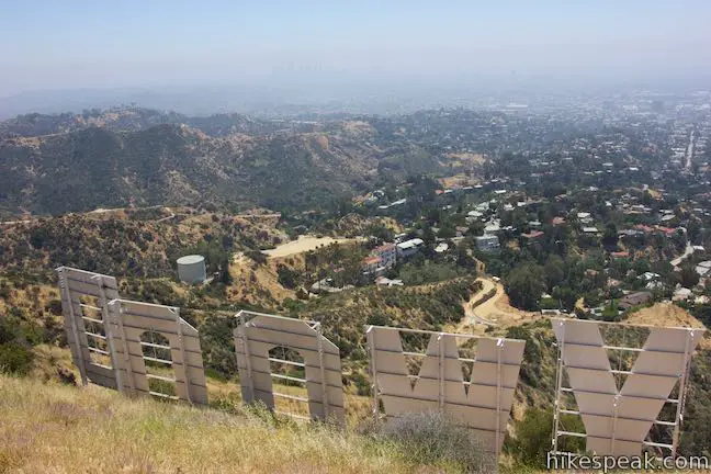
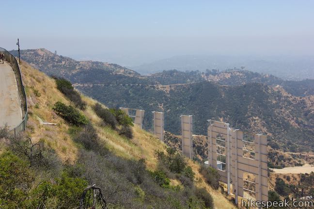
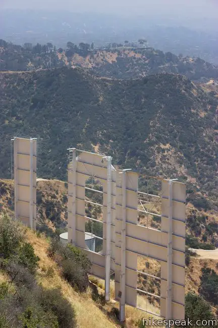
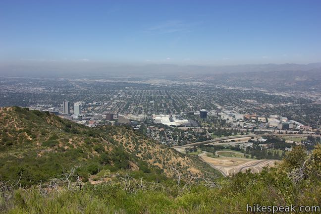
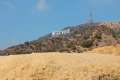
Follow the road up along a ridge to the north side of the mountain, revealing new views over Burbank, the Verdugo Mountains, and the San Gabriel Mountains. The road curves up the east side of Mount Lee. Near the top, the road makes a horseshoe bend to the left and passes a plaque at the junction with Aileen Getty Ridge Trail. Just after the bend, you’ll discover that you are directly above the ‘H’ in the Hollywood Sign. A tall chain-link fence keeps hikers from approaching the big white letters and also hinders the view.
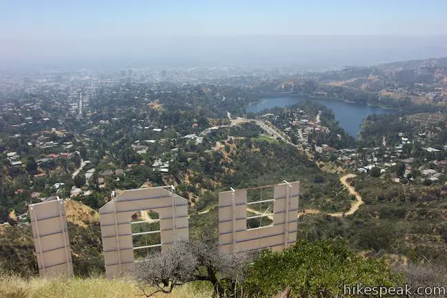
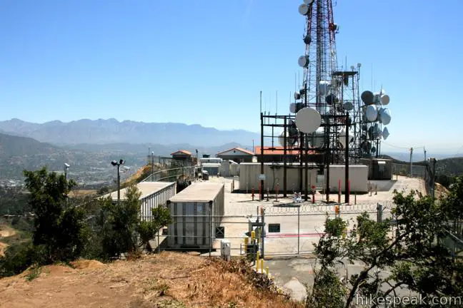
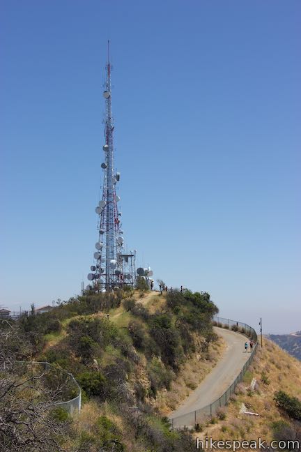
Walk up along the fence to a closed-off area full of radio towers on a flattened part of the mountaintop. To the left, find a dirt path up to the true summit, twenty feet above the road. The 1,700-foot peak offers a fence-free perspective of the Hollywood Sign and the cities below.
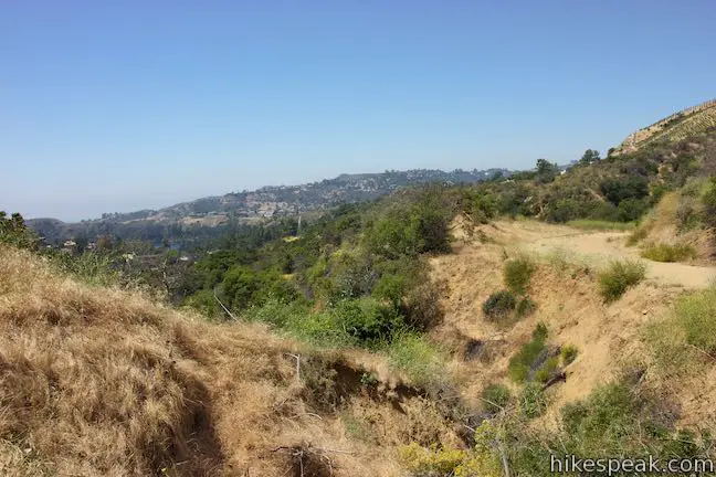
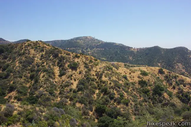
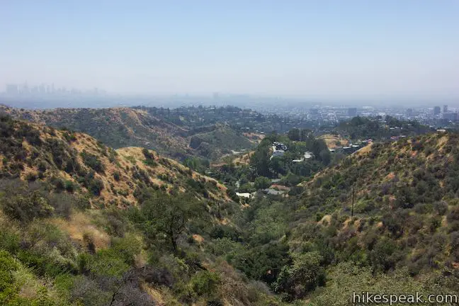
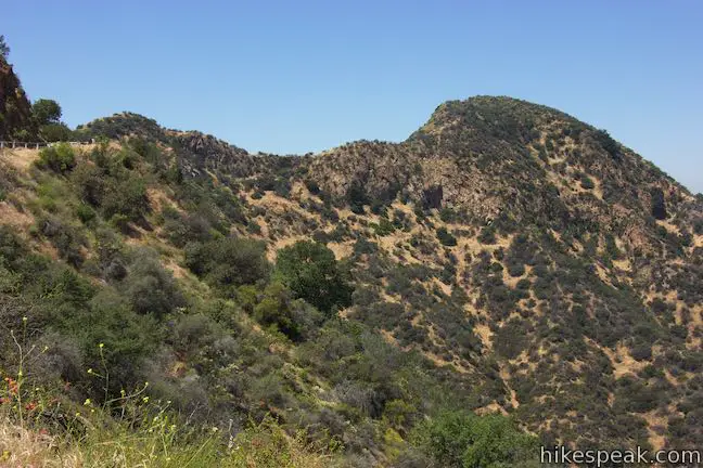
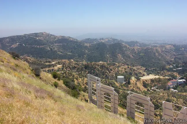
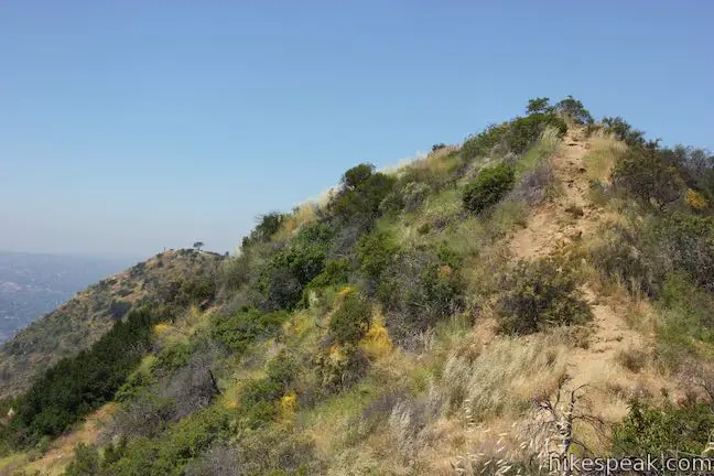
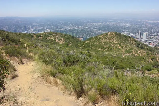
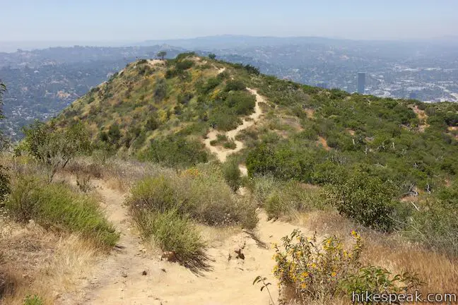
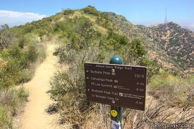
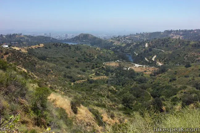
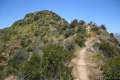
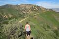
To proceed with the loop, walk back down Mount Lee Road to the bend with the junction with Aileen Getty Ridge Trail. Turn left to hike west across an undulating ridge toward Cahuenga Peak. The narrow, rugged trail crosses a crest that presents side views of Mount Lee and the Hollywood Sign. The perch also has views over Lake Hollywood Reservoir and the rest of Los Angeles.
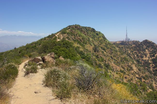
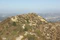
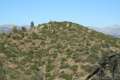
Proceed across the bumpy single track, which is a fun change from the wide paved trail you took up Mount Lee. Ascend to the 1,820-foot summit of Cahuenga Peak, which is the highest point in Griffith Park and the twelfth tallest summit in the Santa Monica Mountains.
Recent history: Cahuenga Peak was spared from developed by citizens who blocked a housing project and contributed to the Save the Sign Campaign. The land was purchased in April or 2010 and donated to Los Angeles to join Griffith Park. Aileen Getty Ridge Trail takes its name from an indispensable donor to that effort.
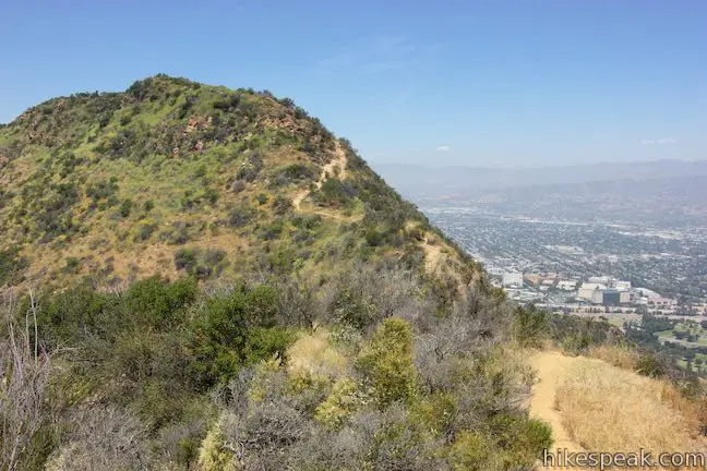
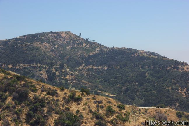
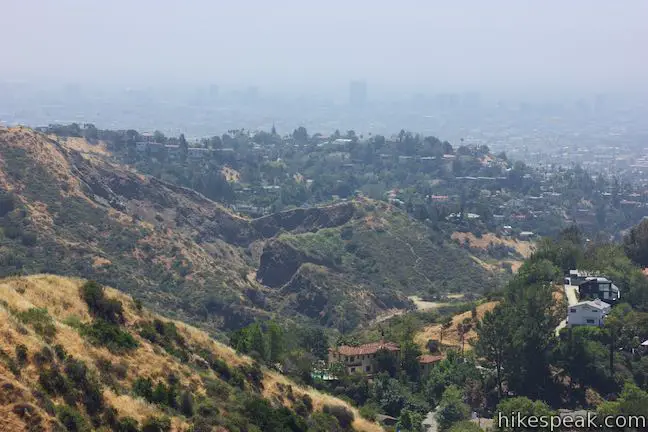
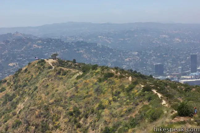
Cahuenga Peak is 120 feet taller than Mount Lee and has major views. Look east toward Mount Lee and other mountains in Griffith Park. Gaze north across Glendale toward the Verdugo and San Gabriel Mountains. As you leave the summit and continue west down Aileen Getty Ridge Trail, you’ll face Burbank Peak, which is back by rows of ridges in the Santa Monica Mountains.
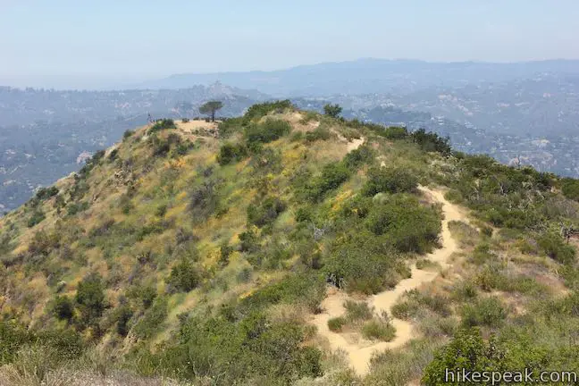
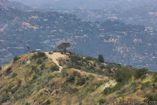
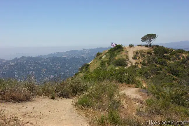
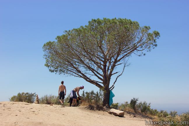
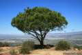
Aileen Getty Ridge Trail goes through a gradual stretch, dropping 145 feet over the next 1/3 to a mile. Pass a signed junction at the top of Burbank Peak Trail and walk a short distance out to a point at the end of the ridge marked with a long pine named the Wisdom Tree. Visitors leave messages for this stand-out tree, which survived a 2009 wildfire that burned the slopes to the north.
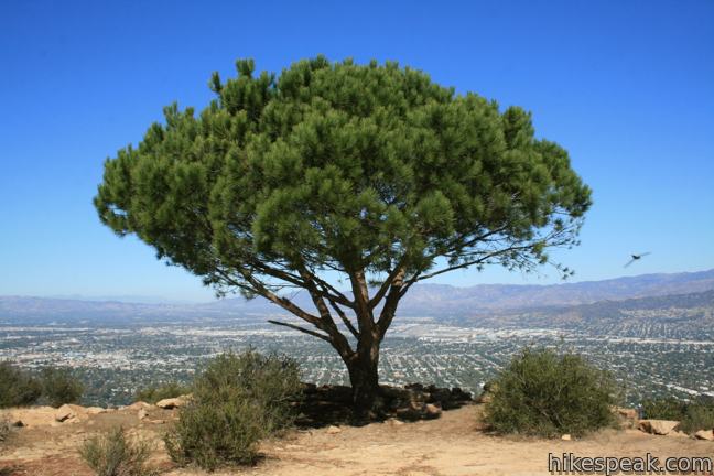
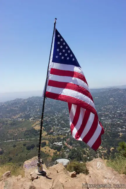
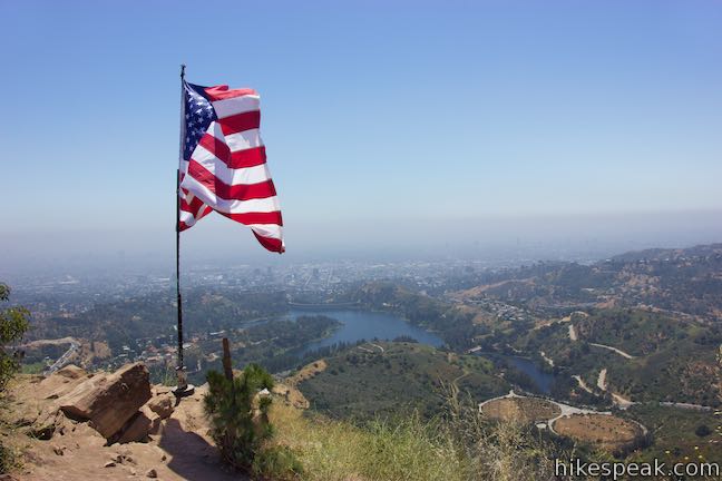
At an elevation of 1,690 feet, Burbank Peak has views into the Santa Monica Mountains west of Griffith Park. Rest beside the Wisdom Tree and take in broad views over Burbank and Hollywood. Universal Studios and Toluca Lake lie below the peak. An American Flag flies beside the peak that is part of a potentially unofficial September 11th Memorial.
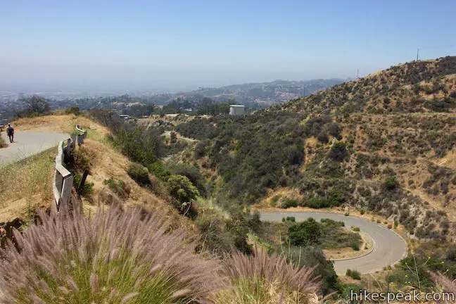
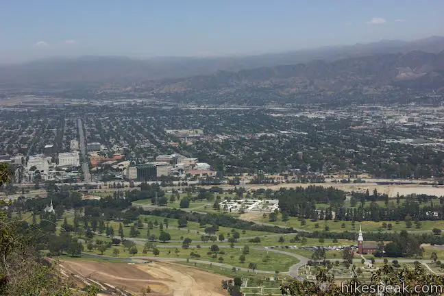
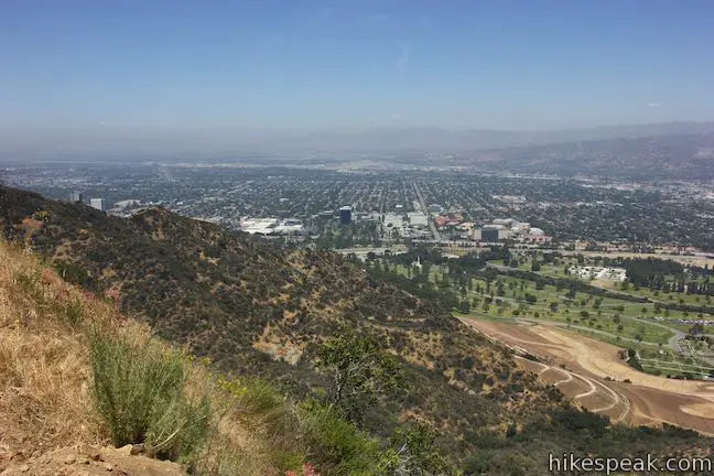
Scoot back to the junction and turn right to descend Burbank Peak Trail. While this single-track demands a thigh-burning climb in the other direction, hiking down the steep trail is easy work. Enjoy views looking out from the mountain toward downtown Los Angeles and Lake Hollywood Reservoir.
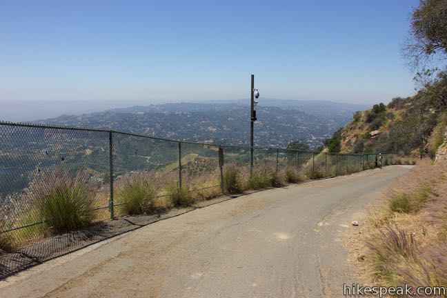
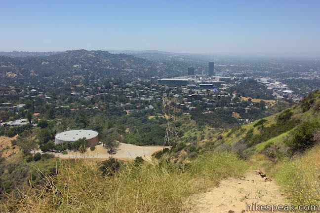
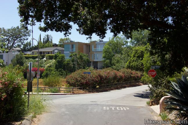
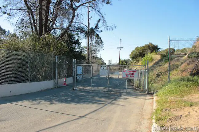
After less than half a mile, Burbank Peak Trail comes to an end at a large dirt landing by a holding tank. Turn left and walk down Wonder View Drive. Cross a yellow gate, where the pavement starts, and walk a quarter mile down a sidewalk-free residential street to Lake Hollywood Drive. Turn left at the intersection and walk down a steep hill for a quarter mile to North Gate at the northwest corner of Lake Hollywood Reservoir Walking Trail.
Cross to the south side of the road if you’re opting for the scenic route around the lake on the walking trail (2.75 miles) or continue straight on the sidewalk along Lake Hollywood Drive (0.75 miles) for a more direct but less scenic route back to Tahoe Drive. Both routes are quite level.
To take the hiking trail around Lake Hollywood Reservoir for the grand 7.4-mile loop, walk through the North Gate onto Hollywood Reservoir Walking Trail. You’ll find a water fountain at the gate, in case you need to refill a bottle.
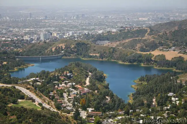
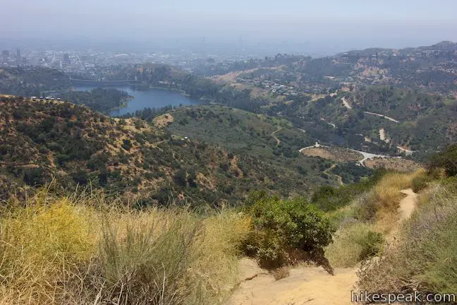
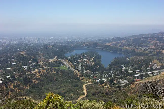
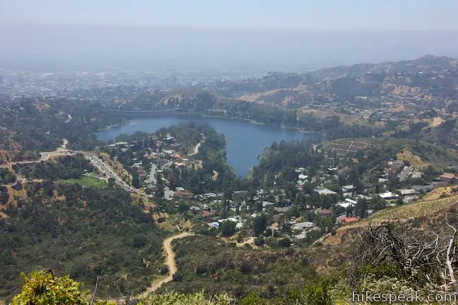
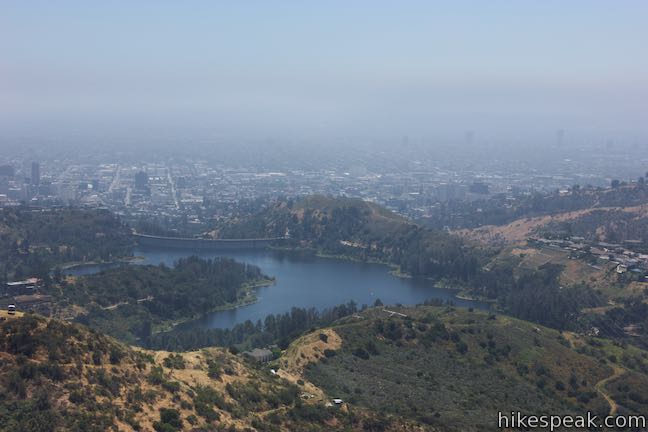
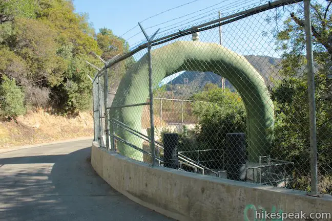
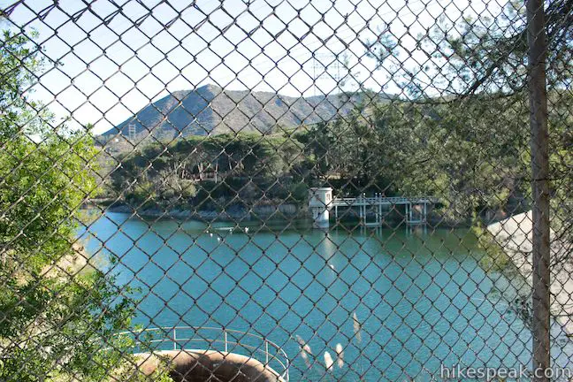
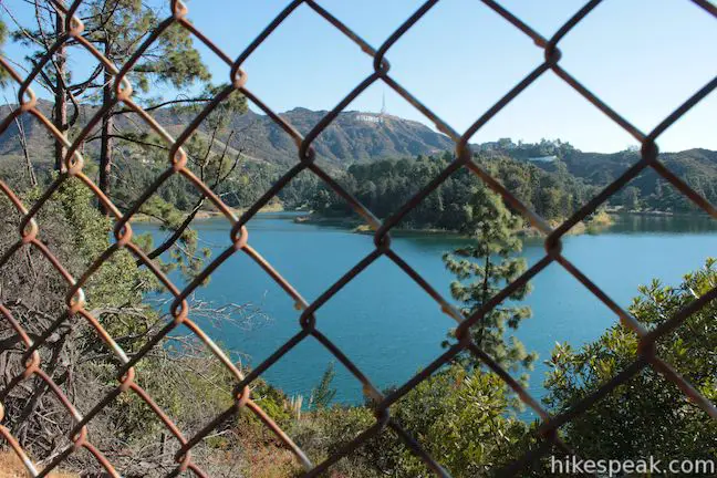
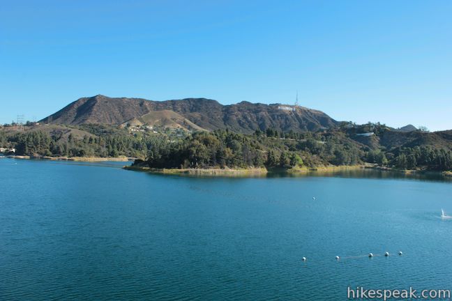
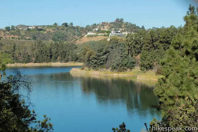
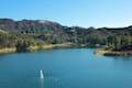
Hike south on the walking trail, which is a paved service road bordered by a 10-foot tall chain line fence that surrounds the reservoir. Lake Hollywood Reservoir is managed by LADWP as an emergency water source. An upper reservoir will come into view through the fence and pines along the trail. This smaller reservoir is separated from a larger lower reservoir by a dam.
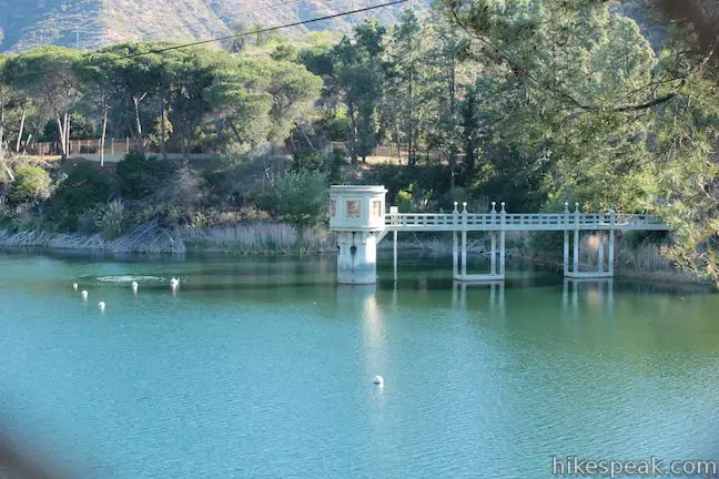
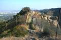
Hike down the trail beside the larger reservoir. The trail bends and curves like the shore of the lake. Eventually, you will turn left and cross the thousand foot long dam at the south end of the reservoir. The beautifully constructed Mulholland Dam was built in 1924 with 172,000 cubic yards of concrete.
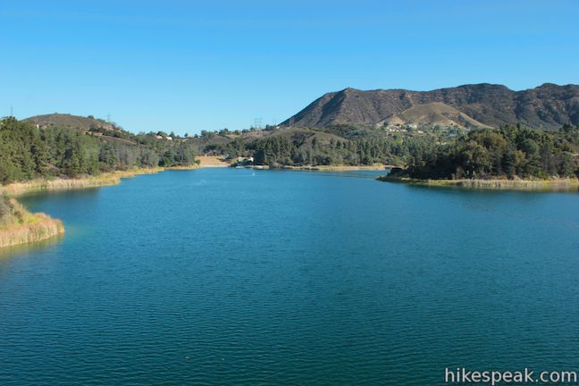
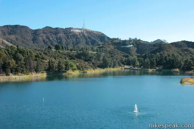
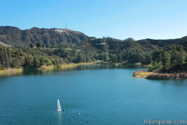
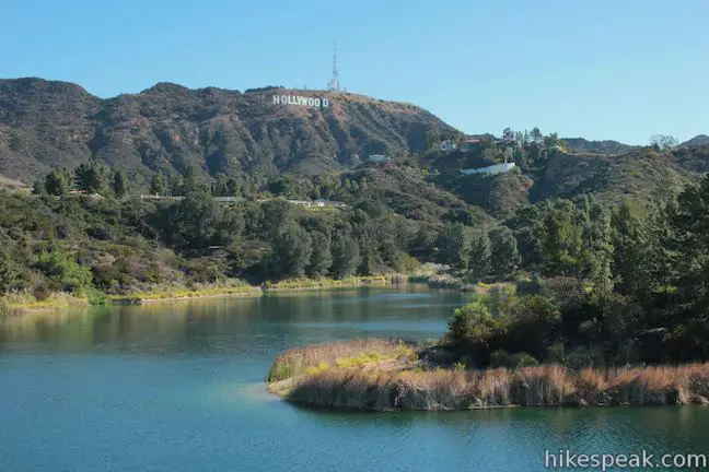
Views of Hollywood Reservoir are scarcer going forward, so linger on Mulholland Dam and enjoy a broad unchained perspective across the blue water. The beaming white letters of the Hollywood Sign are above the lake on the far side.
Unlike other nearby urban reservoirs, Lake Hollywood has several inlets and bends that give it a natural looking form. In the opposite direction, look south from the dam over pines toward the tall buildings along Hollywood Boulevard and Sunset Boulevard.
Cross Mulholland Dam and pass the Weidlake Gate on the right. Turn left to proceed with the loop up the east side of the reservoir. The trail lines you up for nice views of the Hollywood Sign – a sign that you are heading in the right direction. Curl around a canyon above one of the reservoir’s major inlets and proceed to the Tahoe Gate near the northeast side of Hollywood Reservoir.
Pass through the gate at the end of the trail and come to an intersection with Tahoe Drive. Turn right and hike a quarter mile up this road to your vehicle, completing the Hollywood Sign – Hollywood Reservoir Loop. Tahoe Drive has a bit of a hill, but nothing compared to the ascent at the beginning of the hike.
More details and photos can be found on the pages for each leg of this loop:
- Innsdale Drive to the Hollywood Sign
- Aileen Getty Ridge Trail to Cahuenga Peak
- Burbank Peak
- Lake Hollywood Reservoir Walking Trail
Trails in Griffith Park close at sunset and access to Hollywood Reservoir is also restricted at night. The gates around Hollywood Reservoir open daily at 6:30 a.m. and are locked around sunset. Start this loop early enough to hike around the reservoir before the gates are locked (or opt for the short route along the lake that does not have gates).
Dogs are allowed on trails in Griffith Park but are not permitted on Lake Hollywood Reservoir Walking Trail (those with dogs can opt for the short route that sticks to Lake Hollywood Drive). Bikes can use Lake Hollywood Walking Trail, but cannot use the unpaved trails in Griffith Park along this loop. The street parking is free and no permit is required to hike the Hollywood Sign – Hollywood Reservoir Loop, so get out and enjoy!
Directions to the Trailhead
- From the 101 Freeway exit on Barham Boulevard and drive north for 1/3 of a mile.
- Turn right at the light onto Lake Hollywood Drive.
- Take this winding road for half a mile up to the intersection with Wonder View Drive and continue down Lake Hollywood Drive for another miles.
- Come to a stop sign by a gate for Lake Hollywood and turn left up Tahoe Drive.
- Proceed for 1/3 of a mile to a T-intersection with Canyon Lake Drive.
- Find street parking here.
- The hike begins up Canyon Lake Drive to your right.
Trailhead Location
Trailhead address: Canyon Lake Drive & Tahoe Drive, Los Angeles, CA 90068
Trailhead coordinates: 34.12805, -118.3273 (34° 07′ 41″N 118° 19′ 38.3″W)
View Griffith Park in a larger map
Or view a regional map of surrounding Los Angeles trails and campgrounds.
Innsdale Drive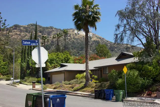


Mulholland Drive


Hollywood Sign View & Mount Lee Drive


Aileen Getty Ridge Trail


Burbank Peak Trail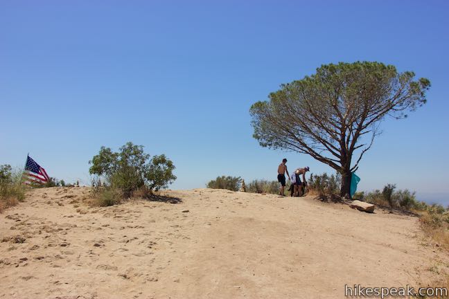


Lake Hollywood Reservoir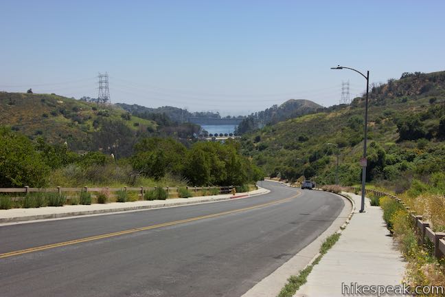


The short route around Lake Hollywood Reservoir
 | Lake Hollywood Reservoir Walking Trail This 3.5-mile loop circles a peaceful fence-enclosed reservoir in the hills below the Hollywood Sign. |
 | Hollywood Sign via Innsdale Drive, Mulholland Highway, and Mount Lee Drive This 4.6-mile round trip hike combines trails and streets to deliver some of the very best views of the Hollywood Sign on the way to the summit of Mount Lee above the sign. |
 | Burbank Peak This 1.6-mile round trip hike climbs to the Wisdom Tree perched at the west end of Griffith Park. |
 | Cahuenga Peak This 3-mile hike on Burbank Peak Trail and Aileen Getty Ridge Trail ascends to Cahuenga Peak and the adjacent Mount Lee, home of the Hollywood Sign. |
 | Mount Lee and the Hollywood Sign via Hollyridge Trail This 3.5-mile hike ascends 750 feet to reach the summit of Mount Lee behind the Hollywood Sign. |
 | Mount Lee and the Hollywood Sign via Brush Canyon Trail This 6.4-mile hike crosses Griffith Park from Canyon Drive to the top of Mount Lee directly behind the landmark Hollywood Sign. |
 | Bronson Cave This short easy hike visits a man-made cave recognizable as the Batcave from the 1960s Batman TV series and hundreds of other locations on TV and film. |
 | Mount Chapel, Mount Bell, and Mount Hollywood This 5.7-mile loop tops three prominent summits on a panoramic tour of Griffith Park. |
 | Griffith Observatory to the Hollywood Sign This 8.8-mile hike travels from one Griffith Park landmark to another, crossing Mount Hollywood along the way. |
 | Mount Hollywood This 1,625-foot peak is a star of Griffith Park with panoramic views that can be reached from Griffith Observatory on a steep 1.4-mile hike or a scenic 2.65-mile trek and from lower in the park in Western Canyon for a hike of around 4.2 miles. |
 | Ferndell Trail This relaxing half-mile hike goes through a tropical garden in the lushest little canyon in Griffith Park. Explore farther on a 1.75-mile hike in Western Canyon or venture up to the Griffith Observatory to see more of the park. |
 | Griffith Observatory via West Observatory Trail This 2.1-mile hike ascends from Western Canyon up ridges to Griffith Observatory, getting sweeping views over Los Angeles and Griffith Park along the way. |
 | Griffith Observatory via East Observatory Trail This 1.5-mile hike from Vermont Canyon Avenue up to Griffith Park's great observatory delivers excellent views over Los Angeles along the way. |
 | Glendale Peak This hike is around three miles long and visits a less known summit on the southeast side of Griffith Park with views that deserve more attention. |
 | Glendale Peak - Mount Hollywood Loop This 4.15-mile hike tops two summits in Griffith Park that both have awesome views. |
 | Cedar Grove & Vista View Point Loop This 2.3-mile loop on the southeast side of Griffith Park follows paved and unpaved trails to two park attractions, a quiet grove with a picnic area and a helipad with panoramic views. |
 | Bee Rock This hive-shaped point on the east side of Griffith Park is reached via a 1.7 to 4-mile round trip hike. |
 | Old Zoo Picnic Area This half-mile hike explores the abandoned exhibits and animal cages in the ruins of the old LA Zoo in Griffith Park. |
 | Beacon Hill This 2.75 to 3.9-mile hike in Griffith Park climbs 500 feet to the easternmost summit in the Santa Monica Mountains. |
 | Amir's Garden This one-mile hike reaches a relaxing garden on the east side of Griffith Park that is a pleasant retreat for hikers. |
 | More trails in the Santa Monica Mountains Explore other destinations in the range. |
Common Questions about Hollywood Sign – Hollywood Reservoir Loop in Los Angeles
- Is the trail open?
- Yes. You should expect to find that Hollywood Sign - Hollywood Reservoir Loop is open. There are no recent reports of trail closures. If you discover that the trail is closed, please help your fellow hikers by reporting a closure.
- Is this trail free to access?
- Yes, Hollywood Sign - Hollywood Reservoir Loop is free to access. No entrance fee, pass, or permit is required. If you discover that access rules have changed, please provide feedback on your experience.
- How much time does this hike take?
- It takes approximately 3 hours 45 minutes to hike Hollywood Sign - Hollywood Reservoir Loop. Individual hiking times vary. Add extra time for breaks and taking in the views.
- How long is this hike?
- The hike to Hollywood Sign - Hollywood Reservoir Loop is a 7.4 mile loop with 1070 feet of elevation change.
- Are dogs allowed on this trail?
- Yes, dogs are allowed on Hollywood Sign - Hollywood Reservoir Loop. The trail is open to hikers, dogs (except on Lake Hollywood Reservoir Walking Trail).
- Is there a lake on this hike?
- Yes, Hollywood Sign - Hollywood Reservoir Loop visits a lake.
- What mountain range is this trail in?
- Hollywood Sign - Hollywood Reservoir Loop is located in the Santa Monica Mountains.
- Where is the trailhead located?
- The trailhead for Hollywood Sign - Hollywood Reservoir Loop is located in Los Angeles, CA.
Trailhead Address:
Canyon Lake Drive
Los Angeles, CA 90068
Trailhead Coordinates:
34.12805, -118.3273 - What are the driving directions to the start of the hike?
To get to the trailhead: From the 101 Freeway exit on Barham Boulevard and drive north for 1/3 of a mile. Turn right at the light onto Lake Hollywood Drive. Take this winding road for half a mile up to the intersection with Wonder View Drive and continue down Lake Hollywood Drive for another miles. Come to a stop sign by a gate for Lake Hollywood and turn left up Tahoe Drive. Proceed for 1/3 of a mile to a T-intersection with Canyon Lake Drive. Find street parking here. The hike begins up Canyon Lake Drive to your right.
View custom Google Maps directions from your current location.
- Are there other trails near Hollywood Sign - Hollywood Reservoir Loop?
- Yes, you can find other nearby hikes using the Hikespeak Hike Finder Map.

Thank you so much!!! Six of us did this loop this morning and had the best time! Your directions and tips were spot on??- really appreciate it and already have friends asking about it!
This was a great hike to see all sides of the Hollywood sign. The gradual grade up makes the elevation not seem so daunting. Unfortunately, Aileen Getty Ridge Trail is closed due to COVID, so we had to walk down the way we came.