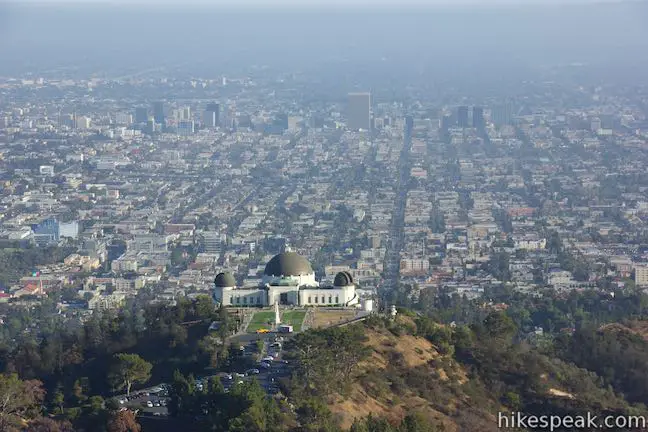
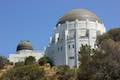
Are you trying to get from the Griffith Observatory to the Hollywood Sign? Perhaps Google Maps lead you to Griffith Observatory when you were trying to get driving directions to the Hollywood Sign or maybe you are just eager to hike between Griffith Park’s two biggest landmarks. It is possible to walk from Griffith Observatory to the Hollywood Sign. However, the route is not direct and other trailheads are recommended for hikes to the Hollywood Sign.
Driving up to the Hollywood Sign is not allowed, but a shuttle sometimes operates that takes visitors to the summit.
The hike from Griffith Observatory to the Hollywood Sign on Mount Lee is 8.8 miles round trip (4.4 miles each way). The trailhead and the summit are separated by 575 feet of elevation, but because this route crosses a mountain in between, the hike actually has two ascents of 425 feet and 525 feet. The trail leaving Griffith Observatory takes you up Mount Hollywood, which is the mountain just above the observatory. The route goes right past the summit, so adding the top of Mount Hollywood is easy to do and only extends the outing by 0.4 miles.
For something shorter, hikers can bypass Mount Hollywood and start the hike at the bottom of Mount Hollywood Drive. This paved road is closed to vehicles and begins from an intersection near Griffith Observatory where Western Canyon Road and West Observatory Road meet. Starting on Mount Hollywood Drive trims the round trip distance by about two miles and bypasses Mount Hollywood (details below).
Another alternative for those not wanting to take such a long hike to the Hollywood Sign is to hike from the Griffith Observatory to Mount Hollywood instead. This manageable 2.65-mile hike delivers excellent views of both the Observatory and the Hollywood Sign (along with the rest of Los Angeles).
Directions from Griffith Observatory to the Hollywood Sign
- Start from Charlie Turner Trailhead at the parking area by Griffith Observatory and begin up Mount Hollywood Hiking Trail (0 miles)
- Hike straight through a junction with West Trail on the left (0.2 miles)
- Cross a saddle and curve left past the steeper route rising to the right (0.23 miles)
- Reach a multi-point junction and continue straight, passing a couple trails up to the top of Mount Hollywood (1 mile)
- Go through Dante’s View and turn left up East Ridge Trail (1.3 miles)
- Hike up to a 4-way junction and proceed straight to head west down 3 Mile Trail – If you turn left instead, you can hike the final 0.2 miles up to the summit of Mount Hollywood (1.4 miles)
- Reach the bottom of 3 Mile Trail and turn left up Mount Hollywood Drive (2 miles)
- Turn left down Mulholland Fire Road (2.3 miles)
- Pass the top of Brush Canyon Trail on the left (2.6 miles)
- Pass the top of Hollyridge Trail on the left (3.2 miles)
- Turn right up Mount Lee Road (3.45 miles)
- Reach the Hollywood Sign at the summit of Mount Lee (4.4 miles)
Hike description from Griffith Observatory to the Hollywood Sign
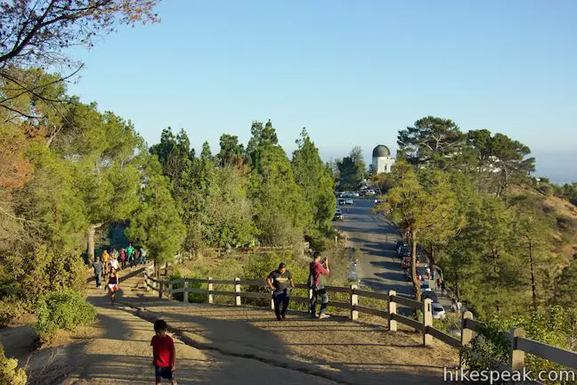
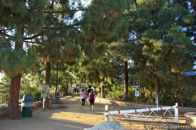
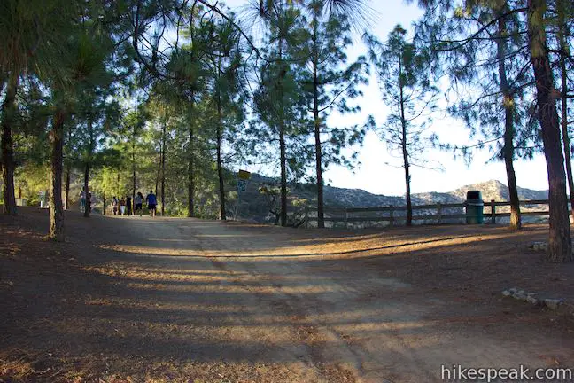
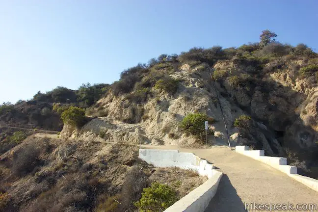
Set out from Charlie Turner Trailhead, which is on the opposite side of the parking area for Griffith Observatory. A tree dedicated to George Harrison grows beside the trailhead next to a sign for Mount Hollywood Hiking Trail. Head up the wide trail along a ridge through a pine forest. After turning downhill, you will come to a junction at 0.2 miles from the start where the trail meets West Trail, which ascends from Western Canyon. Continue straight on Mount Hollywood Hiking Trail.
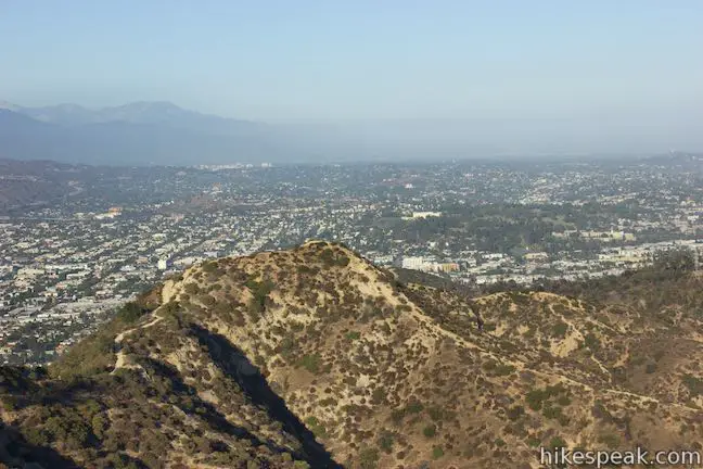
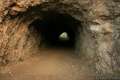
Cross a saddle to the south face of Mount Hollywood. Below the saddle, Mount Hollywood Tunnel cuts through the earth, connecting Vermont Canyon Road with Western Canyon Road.
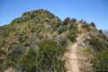
On the other side of the saddle, Mount Hollywood Hiking Trail (Charlie Turner Trail) curves to the left and begins a gradual, scenic ascent. A trail parting to the right, which begins with a few rocky steps, offers a more arduous hike to the summit. This steep single track ascends 465 feet in 0.47 miles, heading almost straight up the side of Mount Hollywood. This route intersects Mount Hollywood Hiking Trail after 0.32 miles at a multi-point junction and could be used to abbreviate this hike.
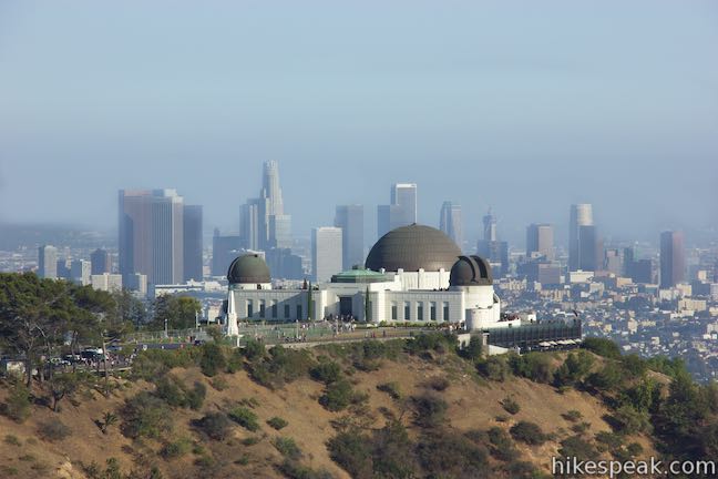
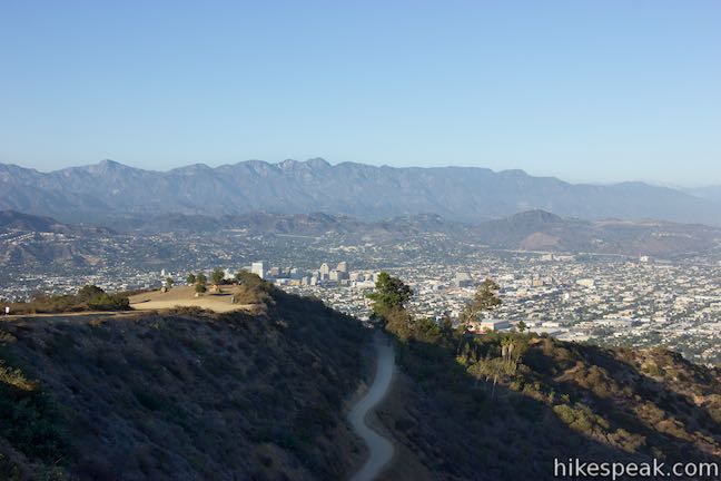
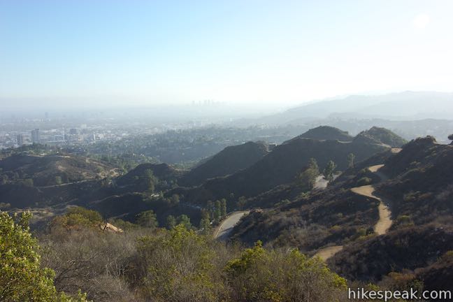
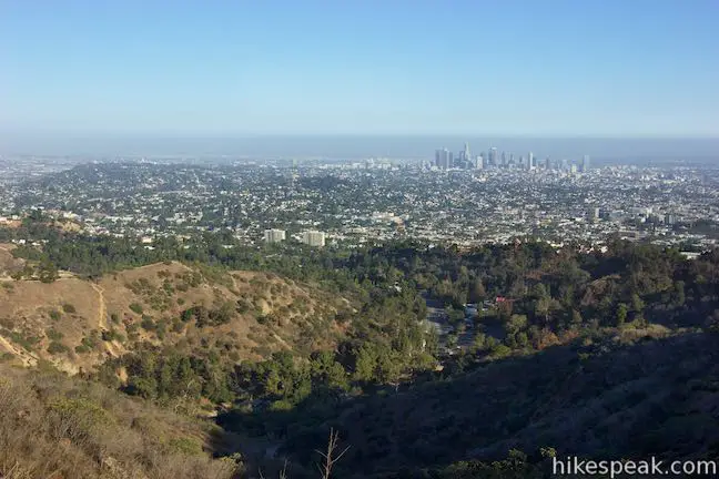
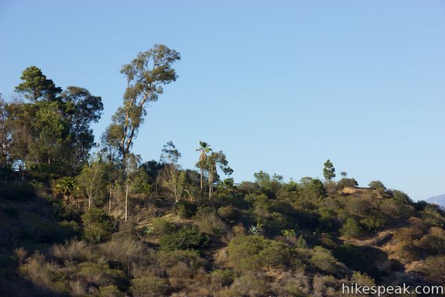
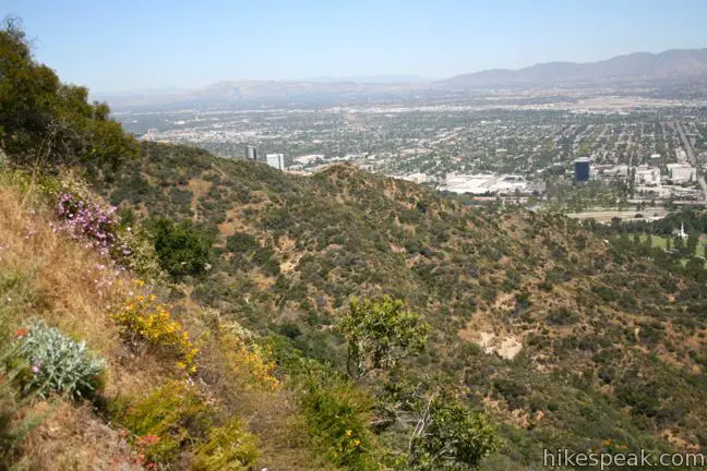
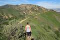
For something scenic and leisurely, stick with Mount Hollywood Hiking Trail. The wide dirt trail angles northwest and goes gradually up the mountain. Find fantastic perspectives of Griffith Observatory backed by the city of Los Angeles.
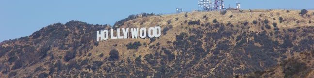
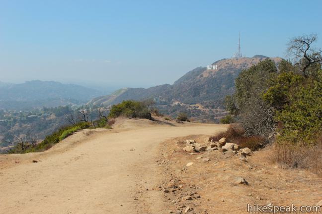
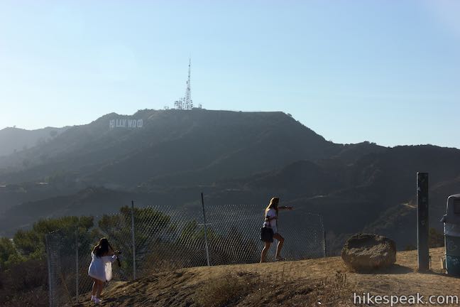
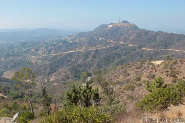
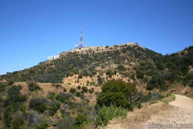
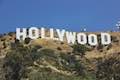
Go around a horseshoe bend to the right to appreciate the landmark you’re striving for, the Hollywood Sign. The big white letters are mounted on the top of Mount Lee to the west.
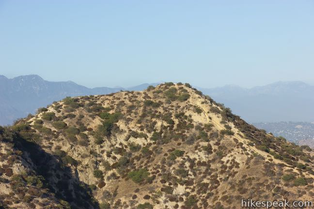
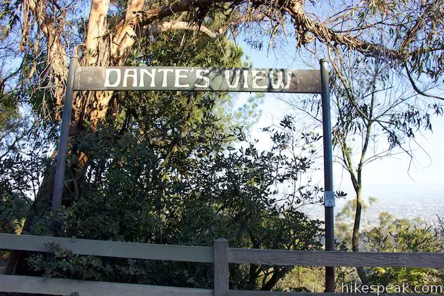
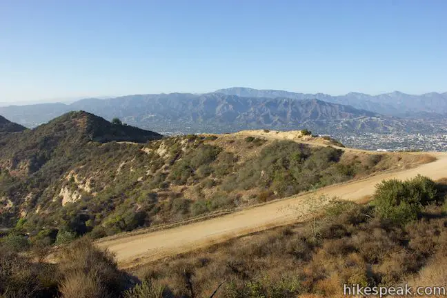
Mount Hollywood Hiking Trail leads east now and rises toward a 6-point junction one mile from the trailhead. The steeper route up from the junction below will be on your right, hugging the west side of a ridge. Just past that, a path goes out to a landing on the ridge above a steeper descent. Straight ahead, the wide dirt trail switches to the southeast side of Mount Hollywood and approaches gardens at Dante’s View. On the left, a rough, steep path cuts up the mountain to the summit, reaching it in just 0.15 miles with 195 feet of elevation gain. Another trail on the left, representing a sharp left turn, is a wide dirt trail that wraps up the west side of Mount Hollywood, passing a vista point with palm trees and benches. Taking this far left trail gets you to the summit in 0.5 miles and is a good option for those wishing to summit Mount Hollywood before proceeding to Mount Lee. Continue straight to visit Dante’s View and head around to the other side of Mount Hollywood.
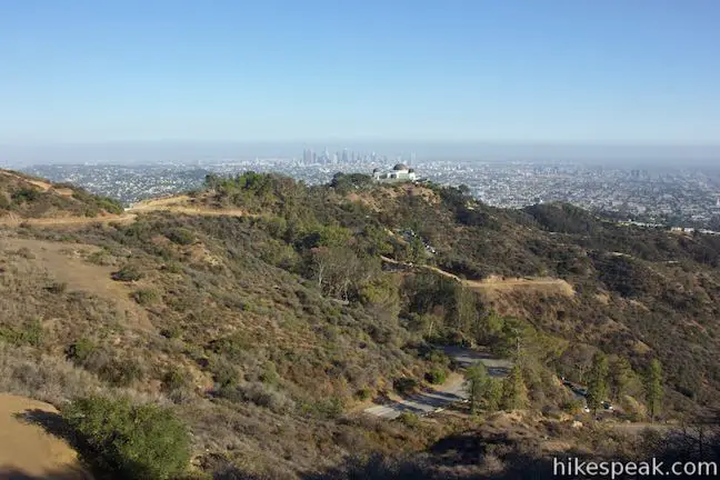
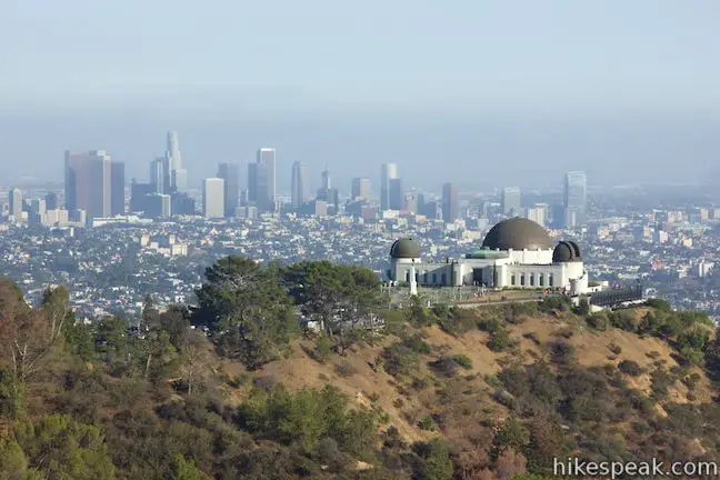
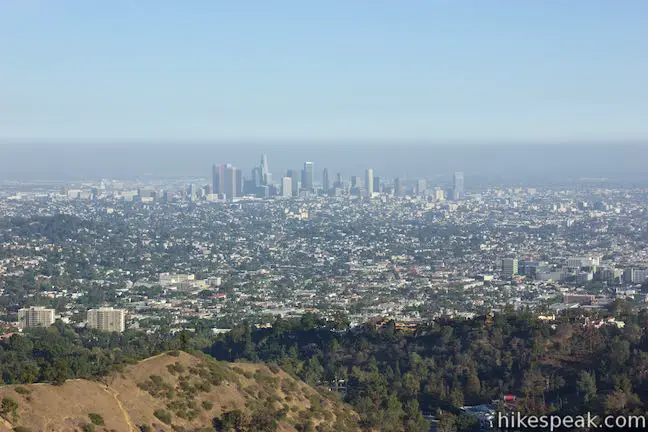
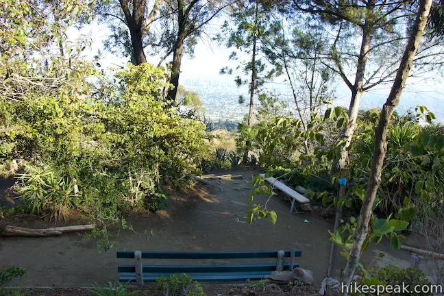
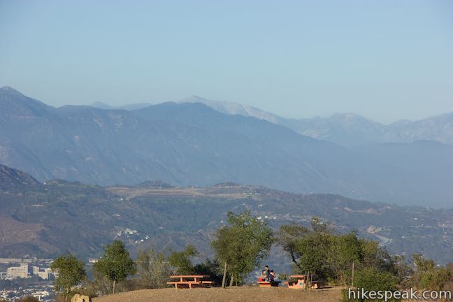
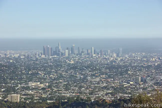
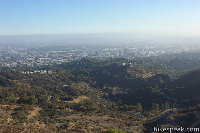
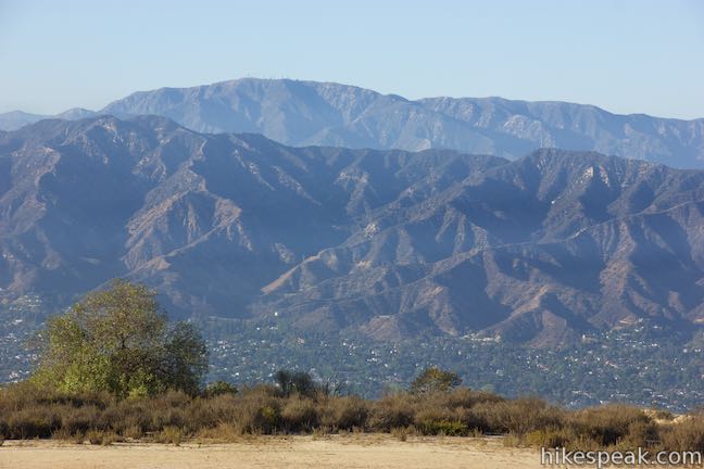
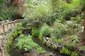
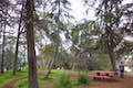
Cross through the multi-point junction on the wide trail, gradually ascending the southeast side of the mountain. Below you is Vermont Canyon, which cradles the Greek Theater. Hike into a garden of trees on the east side of Mount Hollywood. This area is called Dante’s View and has benches and picnic tables surrounded by a variety of plants. Dante’s View looks toward the skyline of downtown with additional views to the northeast over Glendale and the San Gabriel Mountains. Water is available for dogs to get a drink and Dante’s View is a nice spot to linger.
On the far side of the gardens at Dante’s View, reach a junction with East Ridge Trail which comes up Hogback Ridge from Glendale Peak. Turn left to ascend a tenth of a mile to a 4-way junction. To the right, a wide trail ventures north toward Mount Bell. To the left, another trail heads to the summit of Mount Hollywood. If you aren’t extending the hike to visit Mount Hollywood, hike straight through the junction to go west down Three Mile Trail.
Mount Hollywood Extension
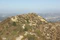
If you turn left at the junction above Dante’s View, you will reach the summit of Mount Hollywood in another 0.2 miles of hiking, or 1.6 miles from Griffith Observatory. Pass hitching posts for horses and walk into a viewing area on the summit where you can take in the sights.
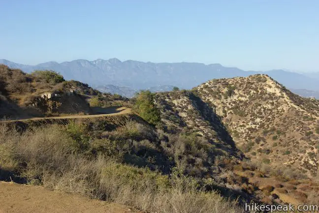
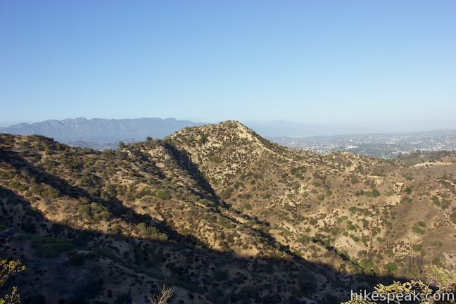
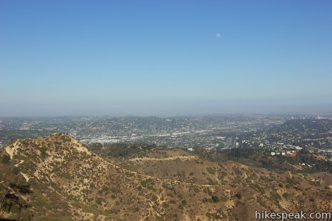
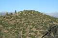
Look down the ridge to the south over Griffith Observatory toward the city of Los Angeles. On a clear day, you’ll see the coast to the west, along with rows of ridges in the Santa Monica Mountains. The big letters on Mount Lee are easy to read to the west. The Verdugo Mountains are to the north, backed by the San Gabriel Mountains, which rise even higher. Look for towers and observatory domes on Mount Wilson to the northeast. The San Gabriel Valley extends to the east beyond the San Rafael Hills. Mount Hollywood has a fine 360-degree panorama over the Southland and it’s easy to see why the summit is a popular hiking destination in Griffith Park.
Mount Hollywood to Mount Lee
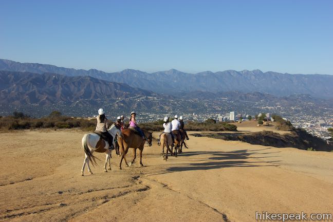
Return to the four-way junction north of the summit and head west down Three Mile Trail. You won’t be on this trail for three miles. Instead, the trail ends after 0.6 miles when it hits Mount Hollywood Drive, a paved road that is only open to hikers, bikers, horses, and park vehicles.
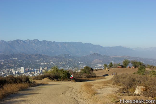
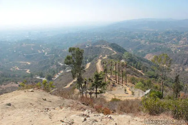
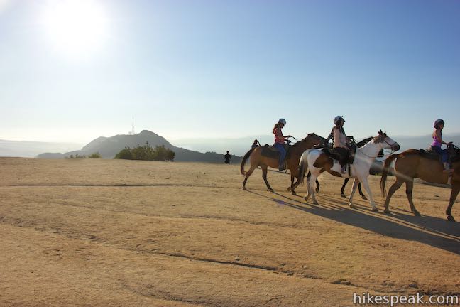
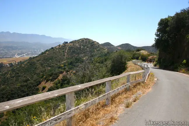
Turn right and walk 0.3 miles up this road, enjoying views to the west toward Mount Lee and the Hollywood Sign. The next junction you reach will be with Mulholland Fire Road. Turn left down this wide dirt trail.
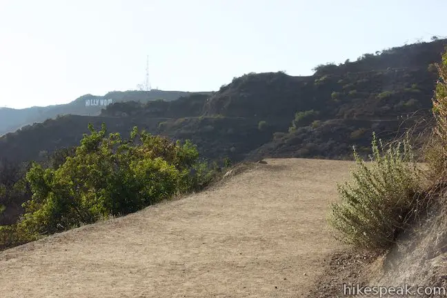
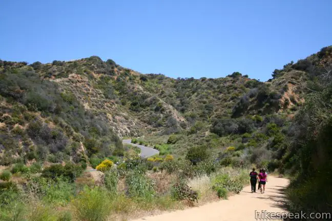
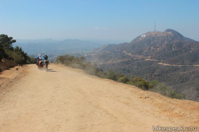
Mulholland Fire Road goes west, descending to a junction with Brush Canyon Trail after 0.3 miles. Stay to the right to avoid sacrificing too much elevation and stick with Mulholland Fire Road as it winds westward around ridges. Intermittent profile views of the Hollywood Sign offer reassurance that you are heading in the correct direction. After another 0.6 miles on Mulholland Fire Road, stay to the right through a junction with Hollyridge Trail, which comes up from Beachwood Drive and the horse stables at Sunset Ranch. The trails at both of these junctions offer more convenient access to the Hollywood Sign.
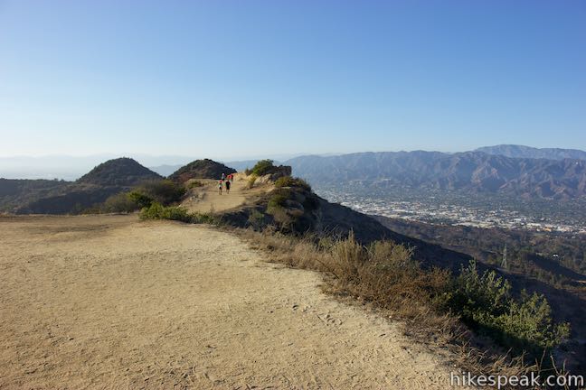
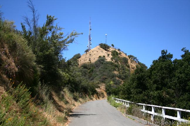
Pass an overlook along the last quarter mile of Mulholland Fire Road and come to an intersection with Mount Lee Road, which is paved and leads up to the summit that is home to the Hollywood Sign. Turn right and follow the winding road up the mountain, gaining 430 feet in the final 0.95 miles. As you climb, look east for great views of your starting point, the Griffith Observatory.
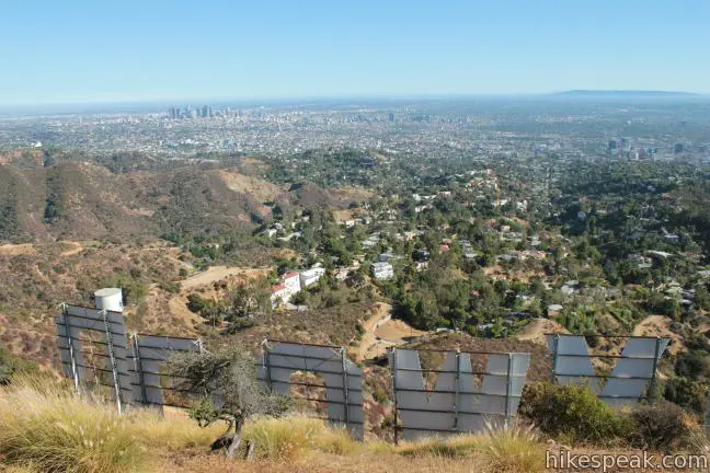
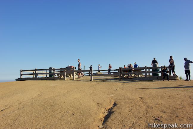
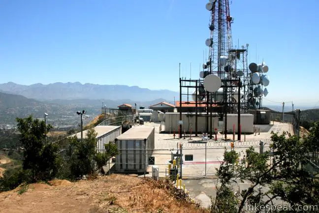
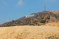
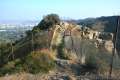
Mount Lee Road ascends to the north side of the mountain to offer views over Burbank toward the Verdugo Mountains. As you approach the top of Mount Lee, the road makes a horseshoe bend to the left, passing a plaque and a junction with Aileen Getty Ridge Trail, which crosses a ridge to Cahuenga Peak. Around the bend in Mount Lee Road, you will find yourself right on top of the first letter on the Hollywood Sign. Look through a tall chain-link fence toward the giant H and the other letters on the mountainside below. The fence obscures the views and keeps hikers from approaching the tall white letters.
Walk up along the fence to a closed-off area full of radio towers where you can take a dirt path to the left up to the true summit, twenty feet above the road. The 1,700-foot mountain offers sweeping views of the eastern ridges and peaks of the Santa Monica Mountains and the city below. Lake Hollywood Reservoir looks particularly appealing to the southeast.
To get back to the Griffith Observatory, you’ll have to turn around here and hike 4.4 miles back the way you came. If that distance seems to great, you could hike down Mount Lee Road to Mulholland Fire Road, take that for a quarter mile and turn down Hollyridge Trail to Beachwood Drive and catch a ride back to the Observatory, saving yourself about 2.5 miles of hiking.
Shorter Alternative
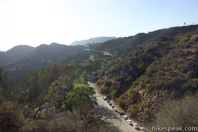
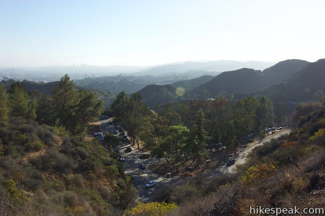
The parking area at Griffith Observatory fills up completely on weekends and busy weekdays. If you can’t find parking at the observatory and instead park near the intersection of Western Canyon Road and West Observatory Road, you can take a 7-mile round trip hike to the Hollywood Sign that bypasses Mount Hollywood. This is a sensible, scenic, and uncomplicated route for those who don’t mind hiking a stretch of pavement.
From the T-intersection at the top of Western Canyon Road, walk to the left, heading away from West Observatory Road toward the tunnel to Vermont Canyon Road. Make an immediate left up Mount Hollywood Drive. A gate near the bottom of this paved road is usually closed to prevent vehicle traffic. Limited parking is available at the start of Mount Hollywood Drive and along the neighboring roads.
Hike 1.4 miles up Mount Hollywood Drive, passing the bottom of Three Mile Trail 0.3 miles before reaching Dirt Mulholland Drive. Turn left there and continue to the Hollywood Sign by following the directions above.
Other hikes to the Hollywood Sign
Brush Canyon Trail – 6.4 miles round trip with 1,050 feet of elevation change
Hollyridge Trail – 3.5 miles round trip with 750 feet of elevation change
Burbank Peak Trail – 3 miles round trip with 875 feet of elevation change
Innsdale Drive – 4.6 miles round trip with 750 feet of elevation change
Parking at Griffith Observatory
Although it was once free (and very congested), it costs $10 per hour to park in the Observatory Parking Lot and along West Observatory Road and Western Canyon Road near Griffith Observatory (price as of 2023). Public transit is a more economical way to reach Griffith Observatory. The DASH Observatory Bus operated by the Los Angeles Department of Transportation (LADOT) travels between the Vermont/Sunset Metro Red Line station and Griffith Observatory, operating from noon to 10 p.m. on Monday through Friday and 10 a.m. to 10 p.m. on Saturday and Sunday (as of 2023). Visit the Griffith Observatory’s Getting There page for more information.
Hiking to the Griffith Observatory via East Observatory Trail or West Observatory Trail can also be done to avoid the paid parking (and enjoy additional views).
Directions to the Trailhead
Griffith Observatory Trailhead:
- From Interstate 5, take exit 141 for Los Feliz Boulevard.
- Go west on Los Feliz Boulevard for 2.4 miles.
- Turn right up Fern Dell Drive and drive 0.4 miles into Griffith Park where Fern Dell Drive becomes Western Canyon Road.
- Drive another 1.6 miles to the top of Western Canyon Road.
- Turn right and drive 0.3 miles up West Observatory Trail to reach the parking area where Mount Hollywood Hiking Trail begins.
- From the 101 Freeway, take exit 8 for Hollywood Boulevard.
- Drive east for five blocks on Hollywood Boulevard and turn left up Western Avenue.
- After crossing Franklin Avenue, Western Avenue goes up a steep hill, turns to the right, and becomes Los Feliz Boulevard.
- Make the first left up Fern Dell Drive, drive 0.4 miles into Griffith Park where Fern Dell Drive becomes Western Canyon Road.
- Drive another 1.6 miles to the top of Western Canyon Road.
- Turn right and drive 0.3 miles up West Observatory Trail to the parking area where Mount Hollywood Hiking Trail begins.
Trailhead Location
Trailhead address: Griffith Observatory Trailhead, 2800 East Observatory Road, Los Angeles, CA 90027
Trailhead coordinates: 34.12093, -118.30042 (34° 07′ 15.34″N 118° 18′ 01.51″W)
View Griffith Park in a larger map
Or view a regional map of surrounding Los Angeles trails and campgrounds.


 | Mount Hollywood This 1,625-foot peak is a star of Griffith Park with panoramic views that can be reached from Griffith Observatory on a steep 1.4-mile hike or a scenic 2.65-mile trek and from lower in the park in Western Canyon for a hike of around 4.2 miles. |
 | Ferndell Trail This relaxing half-mile hike goes through a tropical garden in the lushest little canyon in Griffith Park. Explore farther on a 1.75-mile hike in Western Canyon or venture up to the Griffith Observatory to see more of the park. |
 | Griffith Observatory via West Observatory Trail This 2.1-mile hike ascends from Western Canyon up ridges to Griffith Observatory, getting sweeping views over Los Angeles and Griffith Park along the way. |
 | Griffith Observatory via East Observatory Trail This 1.5-mile hike from Vermont Canyon Avenue up to Griffith Park's great observatory delivers excellent views over Los Angeles along the way. |
 | Glendale Peak This hike is around three miles long and visits a less known summit on the southeast side of Griffith Park with views that deserve more attention. |
 | Glendale Peak - Mount Hollywood Loop This 4.15-mile hike tops two summits in Griffith Park that both have awesome views. |
 | Cedar Grove & Vista View Point Loop This 2.3-mile loop on the southeast side of Griffith Park follows paved and unpaved trails to two park attractions, a quiet grove with a picnic area and a helipad with panoramic views. |
 | Bronson Cave This short easy hike visits a man-made cave recognizable as the Batcave from the 1960s Batman TV series and hundreds of other locations on TV and film. |
 | Mount Lee and the Hollywood Sign via Brush Canyon Trail This 6.4-mile hike crosses Griffith Park from Canyon Drive to the top of Mount Lee directly behind the landmark Hollywood Sign. |
 | Mount Chapel, Mount Bell, and Mount Hollywood This 5.7-mile loop tops three prominent summits on a panoramic tour of Griffith Park. |
 | Mount Lee and the Hollywood Sign via Hollyridge Trail This 3.5-mile hike ascends 750 feet to reach the summit of Mount Lee behind the Hollywood Sign. |
 | Hollywood Sign via Innsdale Drive, Mulholland Highway, and Mount Lee Drive This 4.6-mile round trip hike combines trails and streets to deliver some of the very best views of the Hollywood Sign on the way to the summit of Mount Lee above the sign. |
 | Cahuenga Peak This 3-mile hike on Burbank Peak Trail and Aileen Getty Ridge Trail ascends to Cahuenga Peak and the adjacent Mount Lee, home of the Hollywood Sign. |
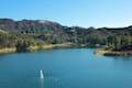 | Lake Hollywood Reservoir Walking Trail This 3.5-mile loop circles a peaceful fence-enclosed reservoir in the hills below the Hollywood Sign. |
 | Beacon Hill This 2.75 to 3.9-mile hike in Griffith Park climbs 500 feet to the easternmost summit in the Santa Monica Mountains. |
 | Old Zoo Picnic Area This half-mile hike explores the abandoned exhibits and animal cages in the ruins of the old LA Zoo in Griffith Park. |
 | Bee Rock This hive-shaped point on the east side of Griffith Park is reached via a 1.7 to 4-mile round trip hike. |
 | Amir's Garden This one-mile hike reaches a relaxing garden on the east side of Griffith Park that is a pleasant retreat for hikers. |
 | More trails in the Santa Monica Mountains Explore other destinations in the range. |
- Mount Lee on summitpost.org (opens in a new tab)
- Mount Lee on wikipedia.org (opens in a new tab)
- Griffith Observatory on wikipedia.org (opens in a new tab)
- The official website for Griffith Observatory (opens in a new tab)
- The City of Los Angeles website for Griffith Park (opens in a new tab)
- The hikespeak.com webpage for Griffith Park (opens in a new tab)
Common Questions about Griffith Observatory to the Hollywood Sign in Griffith Park
- Is the trail open?
- Yes. You should expect to find that Griffith Observatory to the Hollywood Sign is open. There are no recent reports of trail closures. If you discover that the trail is closed, please help your fellow hikers by reporting a closure.
- Do I need a permit for this hike?
- Yes. Parking fee at Griffith Observatory.
- How much time does this hike take?
- It takes approximately 4 hours to hike Griffith Observatory to the Hollywood Sign. Individual hiking times vary. Add extra time for breaks and taking in the views.
- How long is this hike?
- The hike to Griffith Observatory to the Hollywood Sign is a 8.8 mile out and back with 575 feet of elevation change.
- Are dogs allowed on this trail?
- Yes, dogs are allowed on Griffith Observatory to the Hollywood Sign. The trail is open to hikers, dogs.
- Is Griffith Observatory to the Hollywood Sign a difficult hike?
- This hike should be considered strenuous. Hikers should be prepared for a workout covering 8.8 miles and 575 feet of climbing.
- Does this trail go to a summit?
- Yes, Griffith Observatory to the Hollywood Sign reaches a summit with panoramic views.
- What mountain range is this trail in?
- Griffith Observatory to the Hollywood Sign is located in the Santa Monica Mountains.
- Where is the trailhead located?
- The trailhead for Griffith Observatory to the Hollywood Sign is located in Los Angeles, CA.
Trailhead Address:
2800 East Observatory Road
Los Angeles, CA 90027
Trailhead Coordinates:
34.12093, -118.30042 - What are the driving directions to the start of the hike?
To get to the trailhead: Griffith Observatory Trailhead: From Interstate 5, take exit 141 for Los Feliz Boulevard. Go west on Los Feliz Boulevard for 2.4 miles. Turn right up Fern Dell Drive and drive 0.4 miles into Griffith Park where Fern Dell Drive becomes Western Canyon Road. Drive another 1.6 miles to the top of Western Canyon Road. Turn right and drive 0.3 miles up West Observatory Trail to reach the parking area where Mount Hollywood Hiking Trail begins.
From the 101 Freeway, take exit 8 for Hollywood Boulevard. Drive east for five blocks on Hollywood Boulevard and turn left up Western Avenue. After crossing Franklin Avenue, Western Avenue goes up a steep hill, turns to the right, and becomes Los Feliz Boulevard. Make the first left up Fern Dell Drive, drive 0.4 miles into Griffith Park where Fern Dell Drive becomes Western Canyon Road. Drive another 1.6 miles to the top of Western Canyon Road. Turn right and drive 0.3 miles up West Observatory Trail to the parking area where Mount Hollywood Hiking Trail begins.
View custom Google Maps directions from your current location.
- Are there other trails near Griffith Observatory to the Hollywood Sign?
- Yes, you can find other nearby hikes using the Hikespeak Hike Finder Map.

[…] not accepted on DASH buses), and the route takes you to Griffith Observatory where you can access hiking trails. (Note that the Hollywood Sign hike is quite strenuous, so come prepared! Also, make sure you check […]
August 2023 update: parking at the observatory is now $10 per hour instead of $4, and must be paid at a kiosk in advance.