Cedar Grove and Vista View Point
in Griffith Park
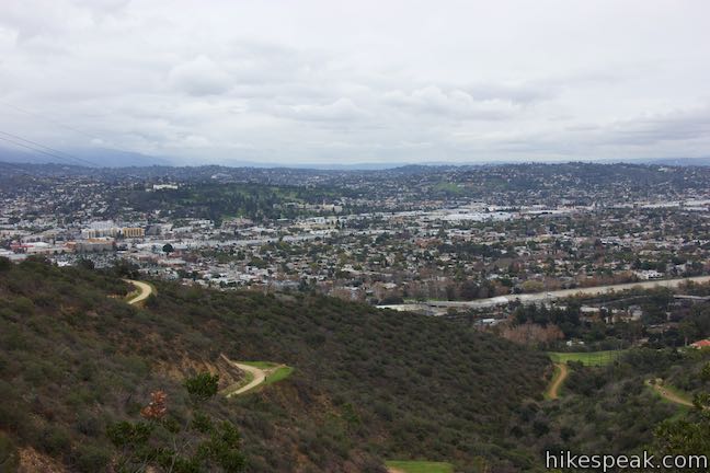
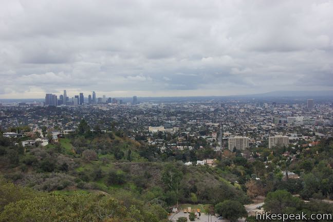
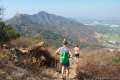
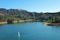
Away from many of the tourists drawn to Griffith Park’s great landmarks (like Griffith Observatory and the Hollywood Sign), you’ll find locals enjoying views of their city from Vista View Point, also know as the helipad site. This overlook along Vista Del Valle Drive presents a broad perspective over downtown Los Angeles, Hollywood, and Griffith Park sites like the Greek Theater and the observatory. Vista View Point could be reached as a spur along the hike up to Glendale Peak, but those open to walking on pavement can follow the route described here, traveling up Vista Del Valle Drive past Cedar Grove Picnic Area, which provides tranquil shade and additional views over Los Angeles. This loop to Cedar Grove and Vista View Point is 2.3 miles round trip with 400 feet of elevation change. About 3/4 of the loop is on pavement, so any pair of walking shoes will do the trick for this hike.
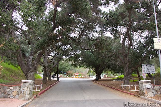
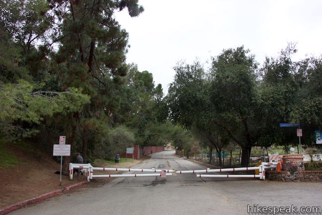
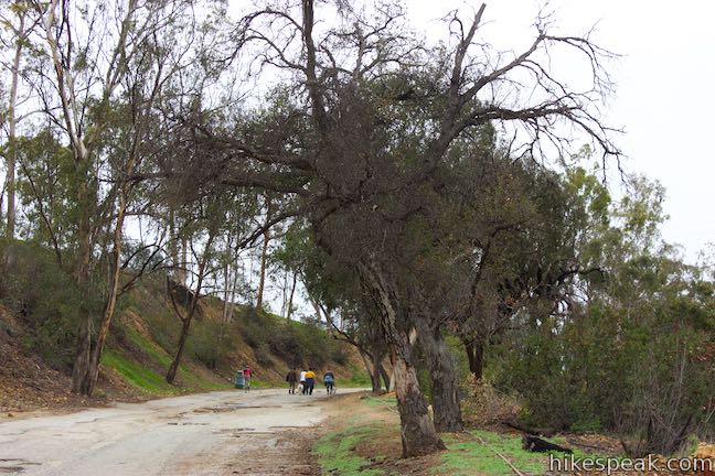
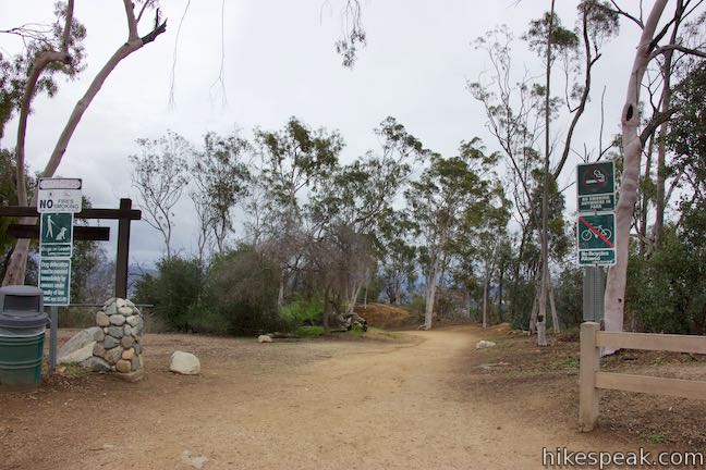
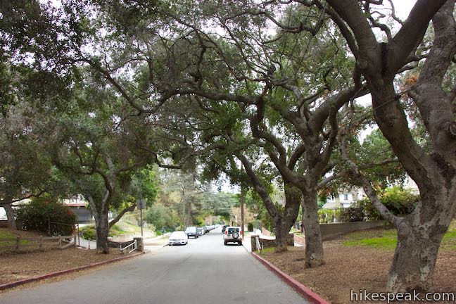
Set out from the top of Commonwealth Avenue in a Los Feliz neighborhood bordering Griffith Park (street parking should be available). Walk up the road through a white gate (that should be open) framed by stone walls. In 50 yards, you will come to a split in the road. Bear left, passing around a white gate (that should be closed). Now walk 0.2 miles up Commonwealth Canyon Drive. Fairways on Roosevelt Municipal Golf Course will appear to your left.
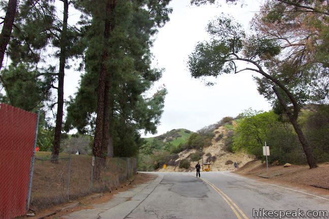
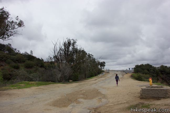
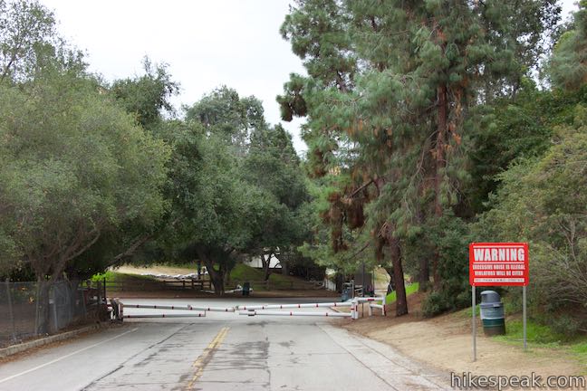
The next intersection you reach is with Vista Del Valle Drive, which weaves its way up around to the east side of Griffith Park and is closed to vehicle traffic. Turn right up this paved trail, beginning the loop portion of the hike.
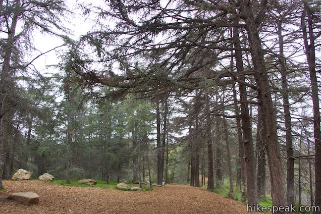
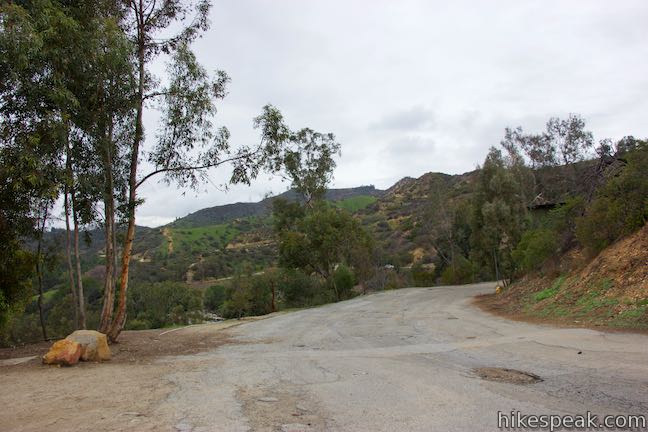
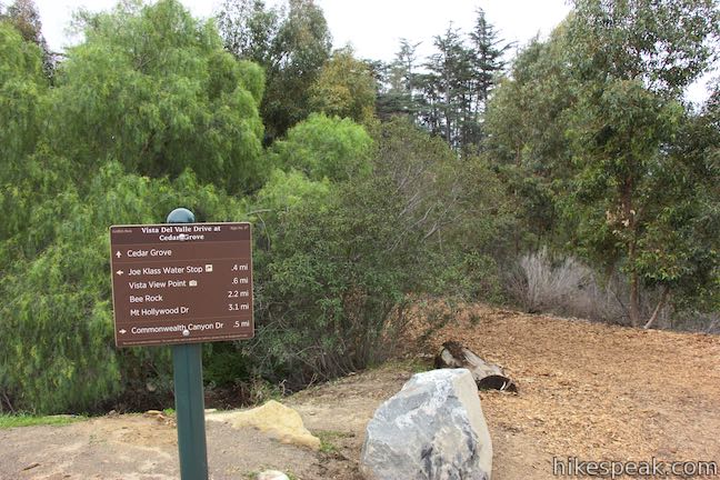
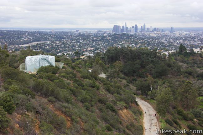
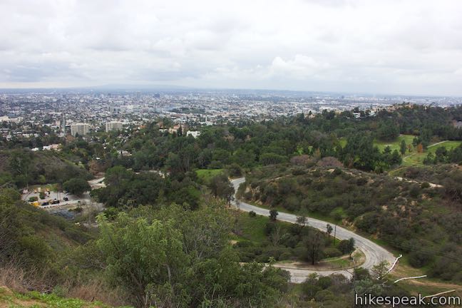
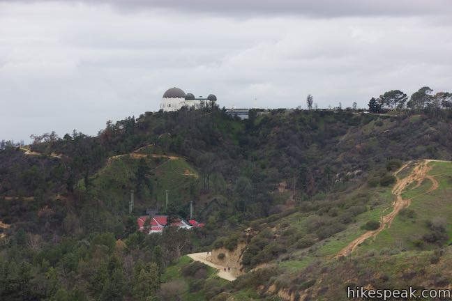
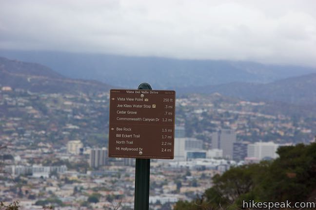
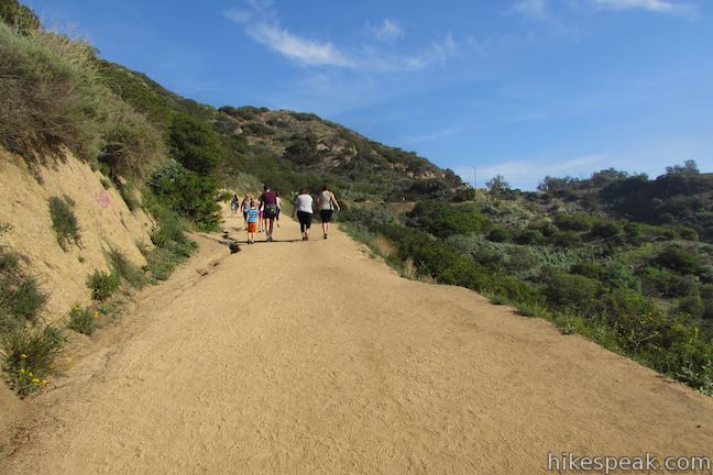
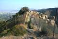
Vista Del Valle Drive rises gradually, arcing around ridges and draws in the terrain. A holding tank comes into view above the trail and you will pass alongside the tank after visiting Cedar Grove. Hike half a mile up Vista Del Valle Drive to a pronounced curve to the left. On the outside of the curve, you will find a trail parting to the right that is marked with a sign for Cedar Grove.
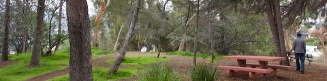
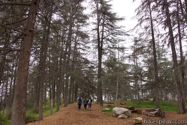
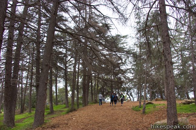
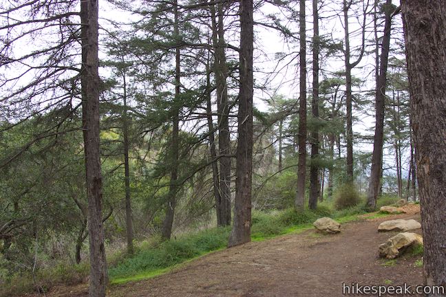
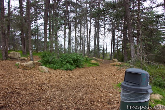
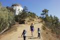
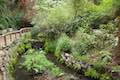
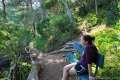
Turn right and begin down a dirt and mulch trail into a planted grove that graces a landing on the ridge. Walk a short way down the trail to a small loop within Cedar Grove. Find picnic tables and a bench looking out over the neighborhoods bordering Griffith Park. Cedar Grove is 0.8 miles and 225 feet above your starting point on Commonwealth Avenue, which is visible below.
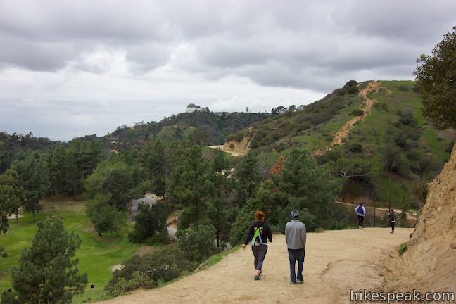
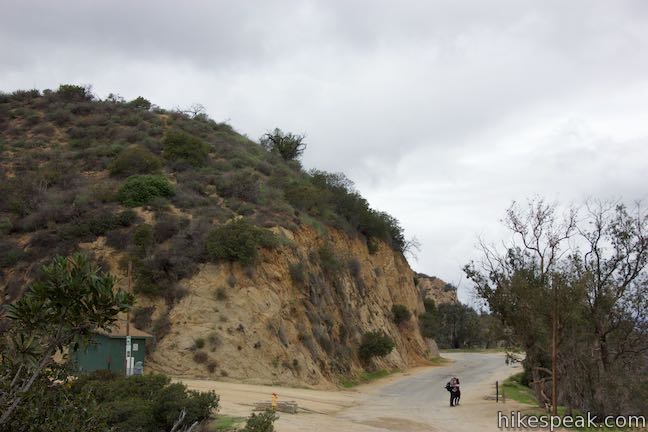
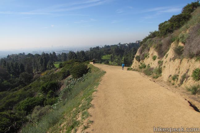
Relax in Cedar Grove and then return to Vista Del Valle Drive. Turn right to continue the hike. After completing the curve, you will ascend past the holding tank seen earlier. The drive then curves to the right and offers views to the southeast that include downtown Los Angeles.
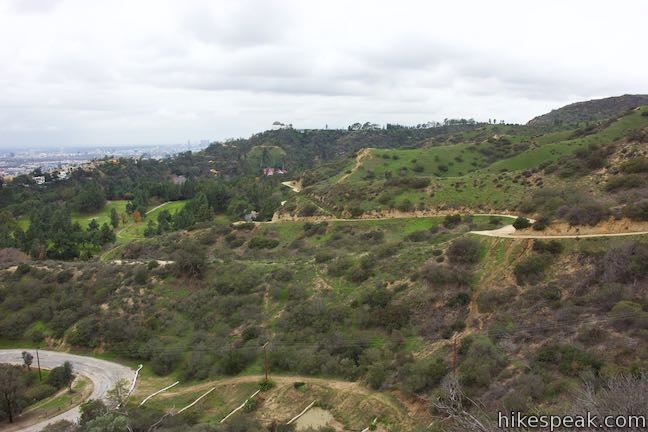
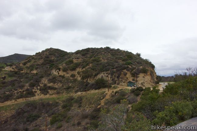
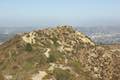
The trail buckles back to the left at a horseshoe bend known as Joe Klass Water Stop Junction. A trail on the right drops down to Five Points Junction near the summit of Beacon Hill (a possible hike extension of about 0.8 miles round trip.)
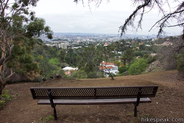
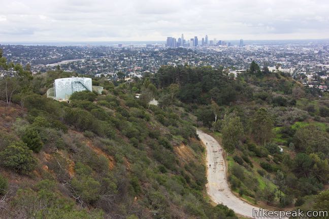
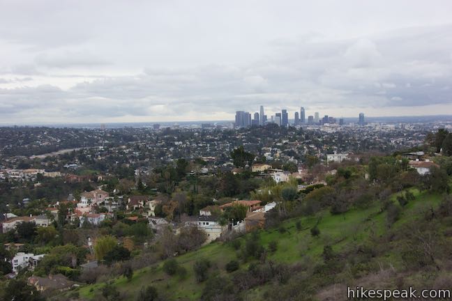
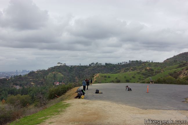
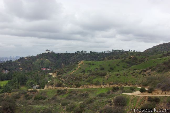
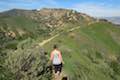
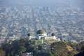
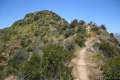
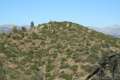
Proceed up Vista Del Valle Drive over a crest leading to a paved area that extends off and above the left side of the road. This is Vista View Point.
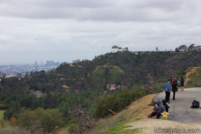
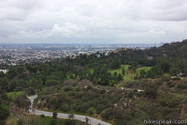
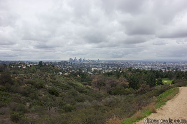
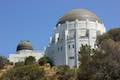
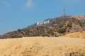
Vista View Point offers a good look at downtown Los Angeles to the southeast. Hollywood and other areas of LA stretch out to the southwest. Griffith Observatory stands above a ridge to the west and below that you’ll spot the red seats of the Greek Theater. Turning a bit more to your right, you can gaze higher into Griffith Park to Mount Hollywood to the northwest.
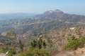
Having hiked 1.55 miles up to Vista View Point, you can take a shorter route back down that allows you to form a loop. Continue north on Vista Del Valle Drive for a tenth of a mile to a junction with two trails leaving to the left. Riverside Trail is first and heads downhill. The second Trail, known as East Ridge Trail or Hogback Trail goes uphill toward Glendale Peak and Mount Hollywood (hiking to the top of Glendale Peak would extend this outing by 0.8 miles).
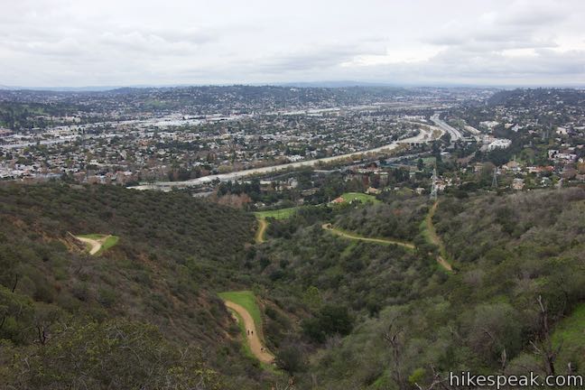
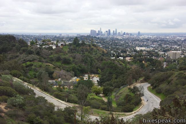
Take Riverside Trail and begin descending from Vista Del Valle Drive. You will be on this wide dirt trail for 0.35 miles. The trail heads west, putting you in line for views of Griffith Observatory. To the south, you can look out over the bottom of Vista Del Valle Drive toward Hollywood.
Riverside Trail drops into Aberdeen Canyon on the west side of Glendale Peak. As Riverside Trail bottoms out and begins to rise, the single-track Aberdeen Trail embarks up the canyon to the right. You want to turn left and leave Riverside Trail here onto a worn path down to Commonwealth Canyon Drive, which is just below the trail and easy to see.
Walk down to Commonwealth Canyon Drive and turn left again. Walk along this road for a tenth of a mile to find yourself back at the intersection with the bottom of Vista Del Valle Drive. Pass through the intersection, closing the loop, and hike 0.2 miles back down Commonwealth Canyon Drive to the street where you started.
This hike to Cedar Grove and Vista View Point is 2.3 miles round trip and dog friendly. Cedar Grove Trail and Riverside Trail do not allow bikes (like all unpaved trails in Griffith Park). Bikes are allowed on Commonwealth Canyon Drive and Vista Del Valle Drive (which connects to Mount Hollywood Drive for a larger loop through the park that is quite rewarding). No permit is necessary to enjoy this hike and parking along Commonwealth Avenue is free, so get out and enjoy!
The basic directions for this hike are:
- Start from the top of Commonwealth Avenue and bear left up Commonwealth Canyon Drive (0 miles)
- Turn right up Vista Del Valle Drive (0.2 miles)
- Turn right on Cedar Grove Trail (0.7 miles)
- Loop around Cedar Grove (0.8 miles)
- Return to Vista Del Valle Drive and turn right (0.9 miles)
- Reach Vista View Point (1.55 miles)
- Turn left down Riverside Trail (1.65 miles)
- Turn left on a path to Commonwealth Canyon Drive and turn left again (2 miles)
- Pass Vista Del Valle Drive to close the loop (2.1 miles)
- Return to the top of Commonwealth Avenue (2.3 miles)
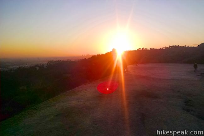
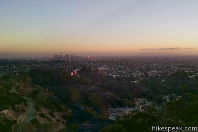
Wondering what the view is like at sunset? Here’s what it looks like when the sun is setting over Griffith Observatory:
Directions to the Trailhead
- Take Interstate 5 to the Los Feliz Boulevard Exit (141).
- Drive west on Los Feliz Boulevard for 1.3 miles, going up the hill to an intersection with Commonwealth Avenue, which has a traffic light.
- Turn right and drive 0.4 miles up Commonwealth Avenue.
- Park near the top of the road where allowed.
Trailhead Location
Trailhead address: 2650 N Commonwealth Avenue, Los Angeles, CA 90027
Trailhead coordinates: 34.11865, -118.28615 (34° 07′ 07.14″N 118° 17′ 10.14″W)
View Griffith Park in a larger map
Or view a regional map of surrounding Los Angeles trails and campgrounds.


 | Glendale Peak This hike is around three miles long and visits a less known summit on the southeast side of Griffith Park with views that deserve more attention. |
 | Glendale Peak - Mount Hollywood Loop This 4.15-mile hike tops two summits in Griffith Park that both have awesome views. |
 | Griffith Observatory via East Observatory Trail This 1.5-mile hike from Vermont Canyon Avenue up to Griffith Park's great observatory delivers excellent views over Los Angeles along the way. |
 | Griffith Observatory via West Observatory Trail This 2.1-mile hike ascends from Western Canyon up ridges to Griffith Observatory, getting sweeping views over Los Angeles and Griffith Park along the way. |
 | Ferndell Trail This relaxing half-mile hike goes through a tropical garden in the lushest little canyon in Griffith Park. Explore farther on a 1.75-mile hike in Western Canyon or venture up to the Griffith Observatory to see more of the park. |
 | Mount Hollywood This 1,625-foot peak is a star of Griffith Park with panoramic views that can be reached from Griffith Observatory on a steep 1.4-mile hike or a scenic 2.65-mile trek and from lower in the park in Western Canyon for a hike of around 4.2 miles. |
 | Griffith Observatory to the Hollywood Sign This 8.8-mile hike travels from one Griffith Park landmark to another, crossing Mount Hollywood along the way. |
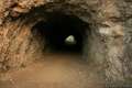 | Bronson Cave This short easy hike visits a man-made cave recognizable as the Batcave from the 1960s Batman TV series and hundreds of other locations on TV and film. |
 | Mount Lee and the Hollywood Sign via Brush Canyon Trail This 6.4-mile hike crosses Griffith Park from Canyon Drive to the top of Mount Lee directly behind the landmark Hollywood Sign. |
 | Mount Chapel, Mount Bell, and Mount Hollywood This 5.7-mile loop tops three prominent summits on a panoramic tour of Griffith Park. |
 | Mount Lee and the Hollywood Sign via Hollyridge Trail This 3.5-mile hike ascends 750 feet to reach the summit of Mount Lee behind the Hollywood Sign. |
 | Hollywood Sign via Innsdale Drive, Mulholland Highway, and Mount Lee Drive This 4.6-mile round trip hike combines trails and streets to deliver some of the very best views of the Hollywood Sign on the way to the summit of Mount Lee above the sign. |
 | Cahuenga Peak This 3-mile hike on Burbank Peak Trail and Aileen Getty Ridge Trail ascends to Cahuenga Peak and the adjacent Mount Lee, home of the Hollywood Sign. |
 | Lake Hollywood Reservoir Walking Trail This 3.5-mile loop circles a peaceful fence-enclosed reservoir in the hills below the Hollywood Sign. |
 | Beacon Hill This 2.75 to 3.9-mile hike in Griffith Park climbs 500 feet to the easternmost summit in the Santa Monica Mountains. |
 | Old Zoo Picnic Area This half-mile hike explores the abandoned exhibits and animal cages in the ruins of the old LA Zoo in Griffith Park. |
 | Bee Rock This hive-shaped point on the east side of Griffith Park is reached via a 1.7 to 4-mile round trip hike. |
 | Amir's Garden This one-mile hike reaches a relaxing garden on the east side of Griffith Park that is a pleasant retreat for hikers. |
 | More trails in the Santa Monica Mountains Explore other destinations in the range. |
- Cedar Grove and Vista View Point on spiralaim.com (opens in a new tab)
- Cedar Grove on thelosangelesbeat.com (opens in a new tab)
- Griffith Park Helipad (Vista View Point) on yelp.com (opens in a new tab)
- Griffith Park on lamountains.com (opens in a new tab)
- The City of Los Angeles website for Griffith Park (opens in a new tab)
Common Questions about Cedar Grove and Vista View Point in Griffith Park
- Is the trail open?
- Yes. You should expect to find that Cedar Grove and Vista View Point is open. There are no recent reports of trail closures. If you discover that the trail is closed, please help your fellow hikers by reporting a closure.
- Is this trail free to access?
- Yes, Cedar Grove and Vista View Point is free to access. No entrance fee, pass, or permit is required. If you discover that access rules have changed, please provide feedback on your experience.
- How much time does this hike take?
- It takes approximately 1 hour 15 minutes to hike Cedar Grove and Vista View Point. Individual hiking times vary. Add extra time for breaks and taking in the views.
- How long is this hike?
- The hike to Cedar Grove and Vista View Point is a 2.3 mile loop with 400 feet of elevation change.
- Are dogs allowed on this trail?
- Yes, dogs are allowed on Cedar Grove and Vista View Point. The trail is open to hikers, dogs.
- What mountain range is this trail in?
- Cedar Grove and Vista View Point is located in the Santa Monica Mountains.
- Where is the trailhead located?
- The trailhead for Cedar Grove and Vista View Point is located in Los Angeles, CA.
Trailhead Address:
2650 N Commonwealth Avenue
Los Angeles, CA 90027
Trailhead Coordinates:
34.11865, -118.28615 - What are the driving directions to the start of the hike?
To get to the trailhead: Take Interstate 5 to the Los Feliz Boulevard Exit (141). Drive west on Los Feliz Boulevard for 1.3 miles, going up the hill to an intersection with Commonwealth Avenue, which has a traffic light. Turn right and drive 0.4 miles up Commonwealth Avenue. Park near the top of the road where allowed.
View custom Google Maps directions from your current location.
- Are there other trails near Cedar Grove and Vista View Point?
- Yes, you can find other nearby hikes using the Hikespeak Hike Finder Map.

Go the extra miles...
Submit a rating of this hike to go with your comment. Contribute to the average trail rating.