Glendale Peak
in Griffith Park
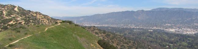
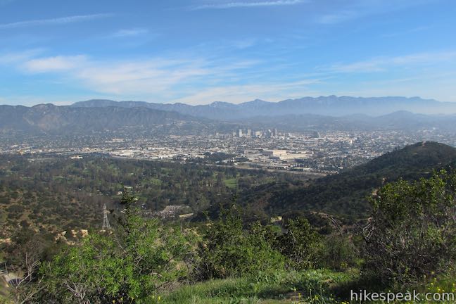
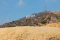
Mount Hollywood and Mount Lee might get the bulk of the summit-bagging hikers in Griffith Park, but Glendale Peak is a fine target of its own, hosting grand views of downtown Los Angeles, the San Gabriel Valley, and the San Gabriel Mountains. The 1,190-foot peak pokes out above the southeast side of Griffith Park at the end of a ridge that runs down from Mount Hollywood. Set out for Glendale Peak from Commonwealth Canyon Drive or Vermont Canyon Road (across from the Greek Theater) for a hike of 2.55 to 3.3 miles round trip with 330 to 405 feet of elevation change (less elevation for the longer hike).
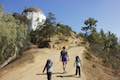
This hike up to Glendale Peak uses two wide dirt trails, Riverside Trail and East Ridge Trail (also known as Hogback Trail) to find a short single track to the summit. Aberdeen Trail can be used as an alternate route, up or down from the peak. This narrow trail passes through a surprisingly secluded canyon for this area of Griffith Park. Hikers with more time can continue up the ridge from Glendale Peak to Mount Hollywood for a 4.15-mile loop.
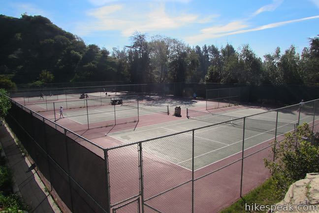
Start this hike either from Vermont Canyon Road or from the Vermont Canyon Tennis Complex on Commonwealth Canyon Drive. Beginning from the tennis courts lowers the round trip distance by half a mile but increases the elevation change by 75 feet. If you’re hiking the loop to Glendale Peak and Mount Hollywood, it makes more sense to start from Vermont Canyon Road.
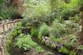
Vermont Canyon Trailhead
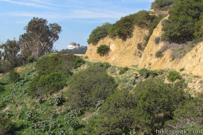
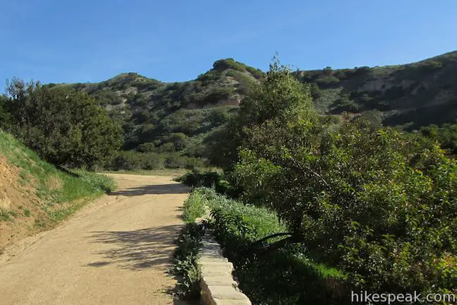
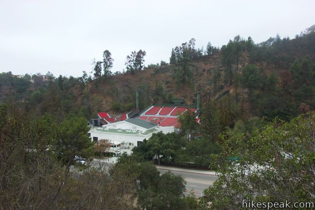
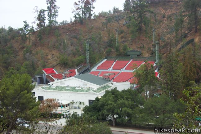
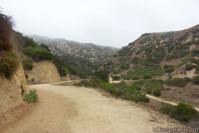
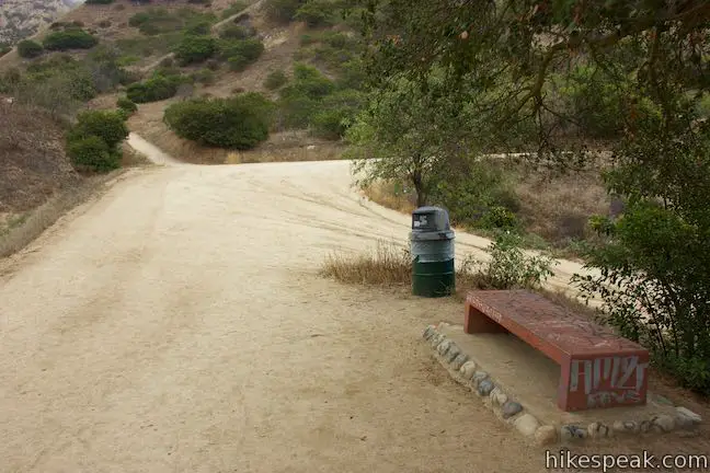
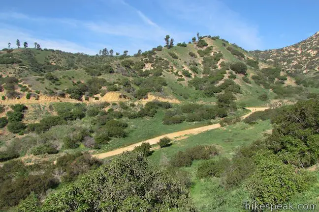
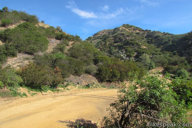
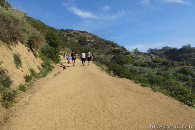
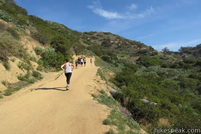
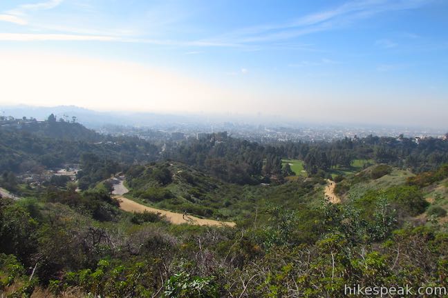
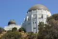
Set out up Riverside Trail, venturing east from Vermont Canyon Road just above the Greek Theater. The trail goes uphill for a tenth of a mile, rising to a nice view of the music venue below Griffith Observatory. Curving to the left, the wide dirt trail takes a gradual course along the side of a ridge, dipping across a canyon to a junction with the trail up from the tennis courts, half a mile from the start. A bench at this junction is placed below a little shade. Proceed straight to reach Glendale Peak.
Vermont Canyon Tennis Complex
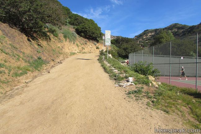
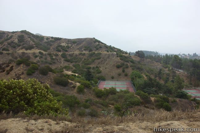
Set out from a parking area at the tennis complex along Commonwealth Canyon Drive and head up the trail between the tennis courts into the canyon above. Meet Riverside Trail after a quarter mile and turn right to hike to Glendale Peak.
Riverside Trail
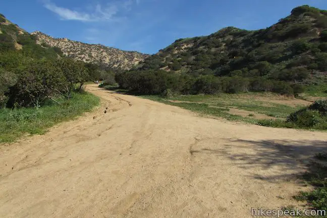
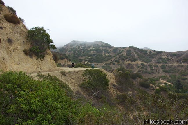
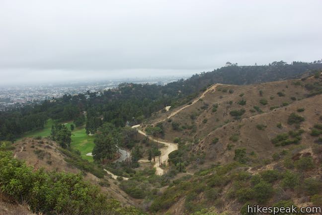
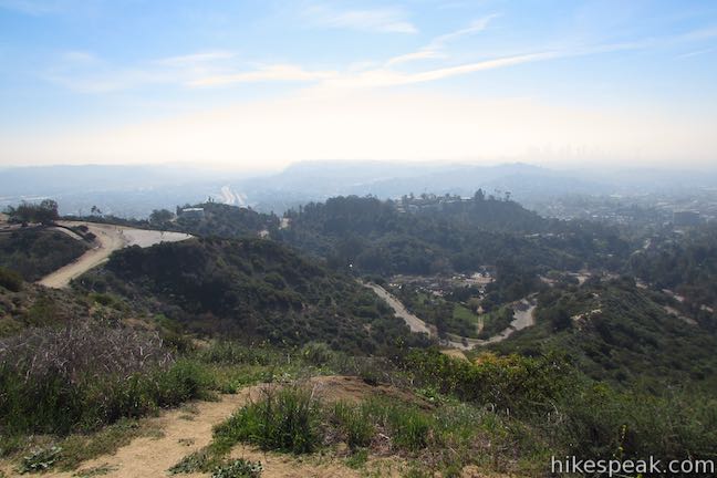
Hike east on Riverside Trail from the junction above the tennis courts, taking this trail for another 0.75 miles. Riverside Trail wraps around ridges where you can look west toward Griffith Observatory and south toward the skyline of downtown Los Angeles. Go downhill, getting momentarily close to Commonwealth Canyon Drive. At this point on the left, an unmarked trail heads up Aberdeen Canyon, 0.4 miles from the junction above the tennis courts. This is Aberdeen Trail, which this write-up will include as an option for the hike down.
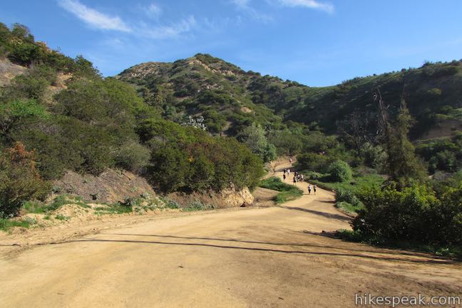
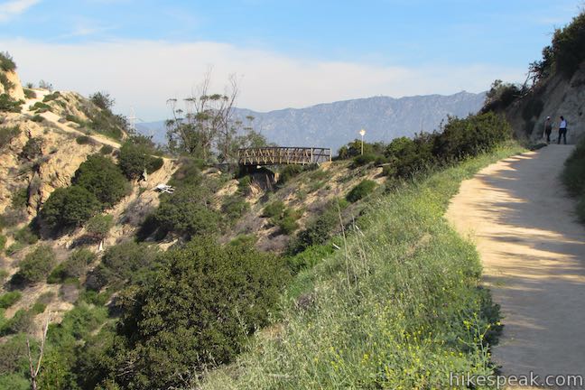
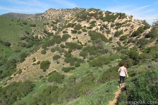
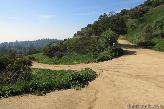
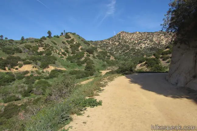
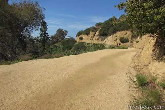
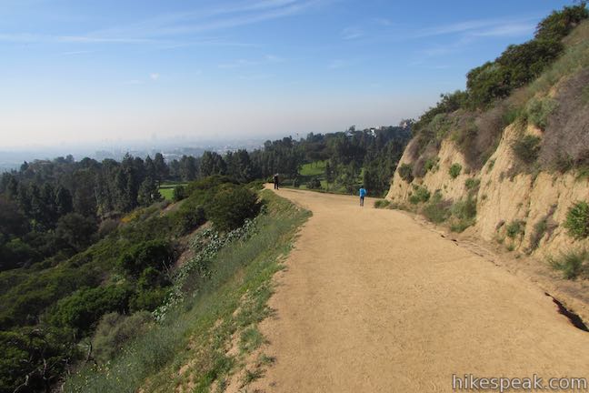
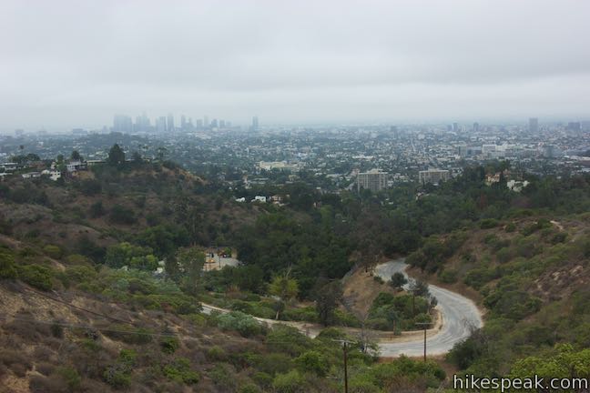
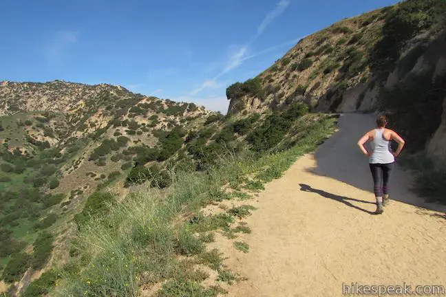
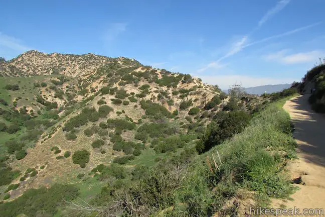
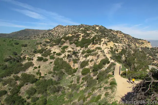
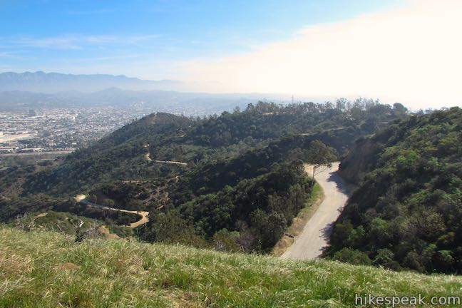
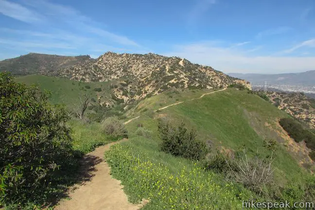
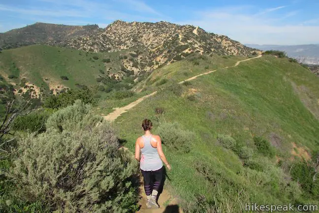
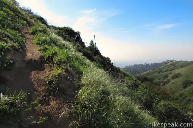
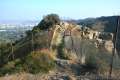
Riverside Trail stops oscillating and begins a more determined ascent of the ridge below Glendale Peak. At either 1 or 1.25 miles from the start of the hike (depending on the trailhead you chose), Riverside Trail meets Vista Del Valle Drive, a paved trail through Griffith Park. An overlook often used as a filming location, called Vista View Point, is a short distance up the road to the right. To continue toward Glendale Peak, make a sharp left turn at the top of Riverside Trail onto East Ridge Trail (also known as Hogback Trail), before you actually meet the paved road. There isn’t a marker for East Ridge Trail, but rather a sign that reads “Bridle Trail” next to a small green building.
East Ridge Trail
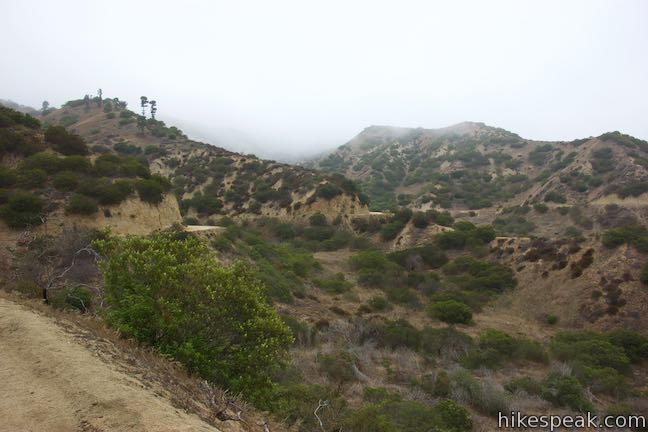
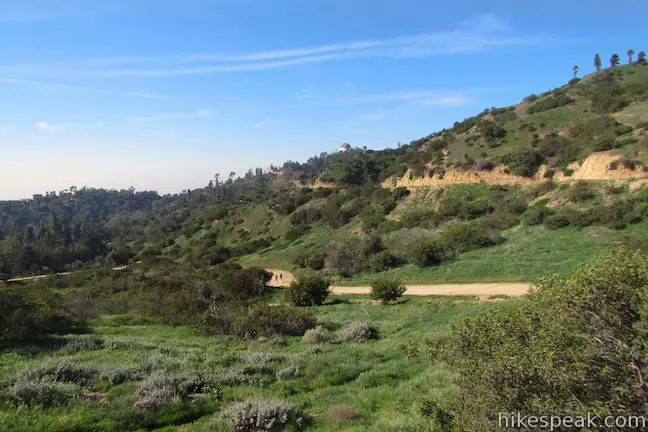
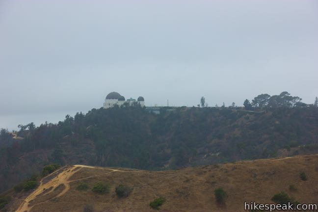
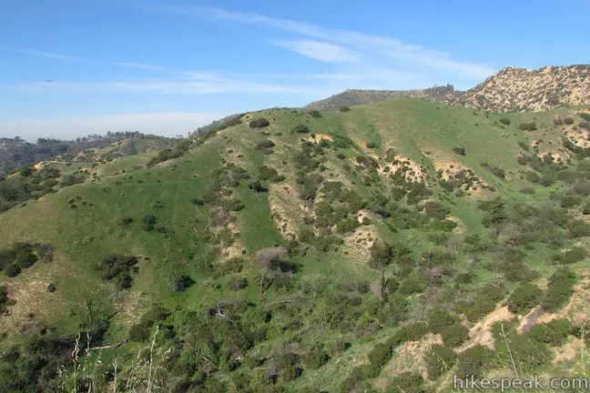
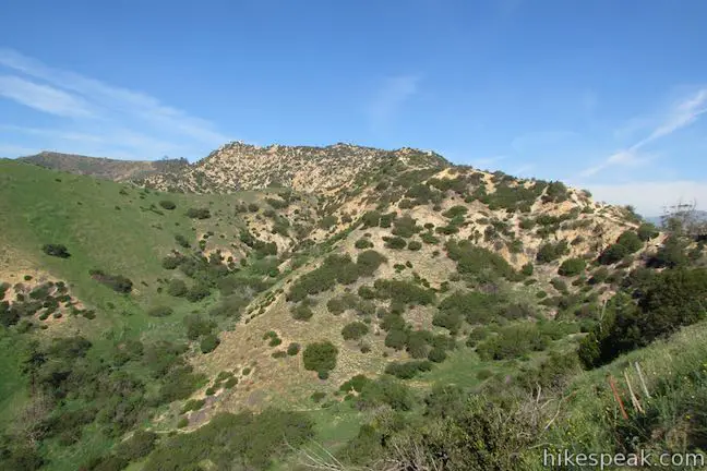
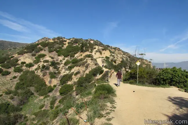
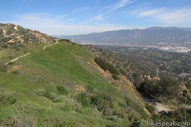
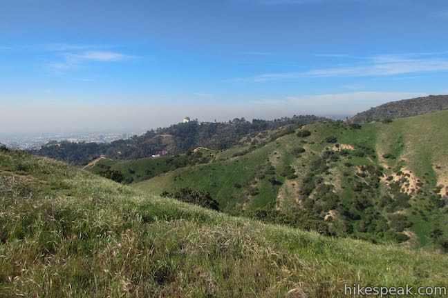
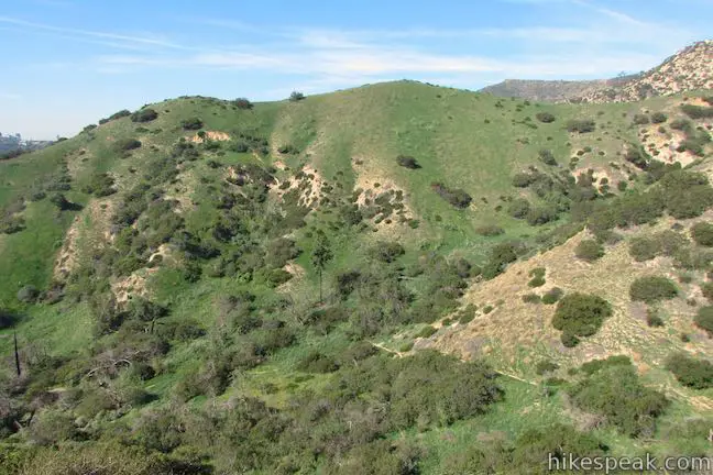
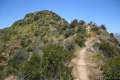
East Ridge Trail ascends for 1.25 miles to Mount Hollywood, crossing a spur to the summit of Glendale Peak after a quarter mile. The junction by Vista Del Valle Drive is below the south side of Glendale Peak. East Ridge Trail ventures around the west side of Glendale Peak to approach the short summit from the north.
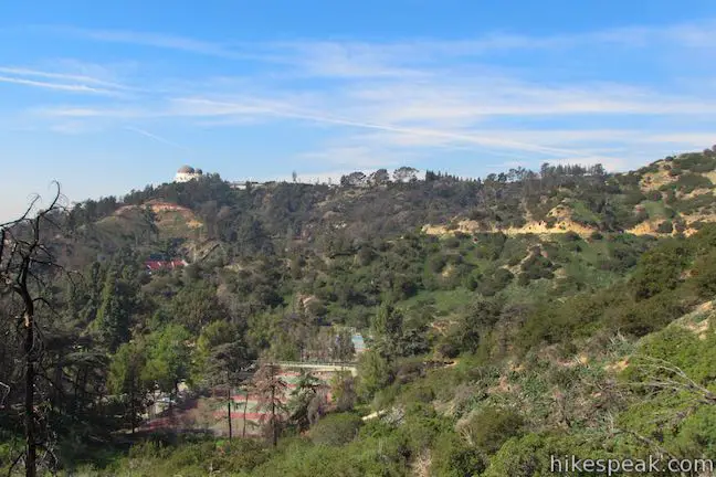
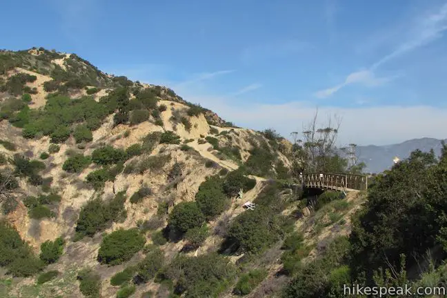
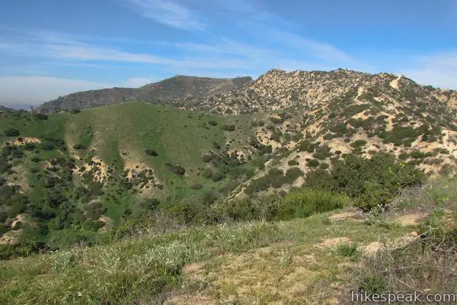
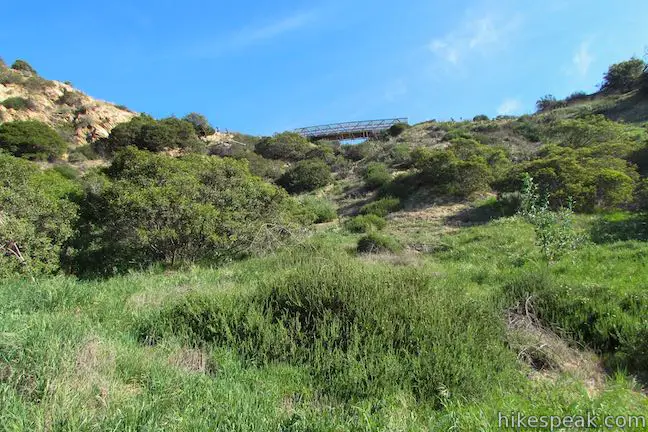
Look down across Aberdeen Canyon as you hike up East Ridge Trail and gaze north toward Mount Hollywood, the central peak in Griffith Park. East Ridge Trail approaches a short bridge that spans a gap in the ridgeline. Before this, on the left, a hard-to-spot single track descends to the left. This is Aberdeen Trail. Just in front of the bridge, Henry’s Trail to Glendale Peak parts to the right. A panel marks the junction, memorializing Henry Shamma, a former local leader for the Sierra Club who frequently guided hikers to the summit. Turn right to visit the summit.
Henry’s Trail to Glendale Peak
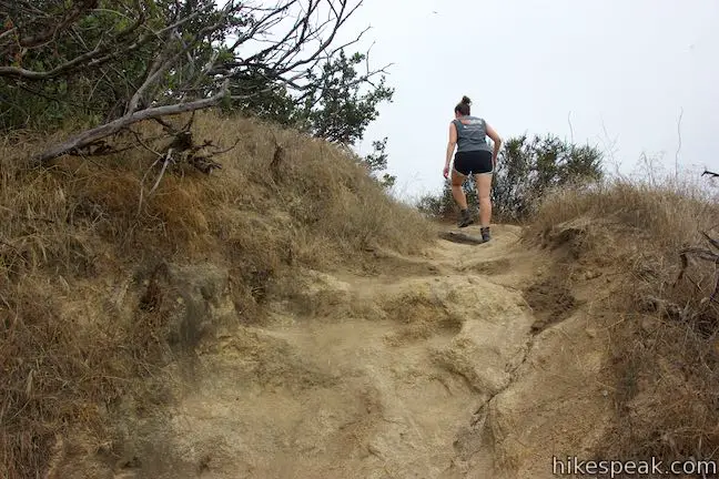
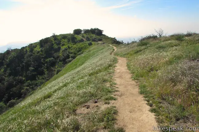
The dirt single track launches into a short steep ascent to climb above East Ridge Trail. After that, hike south along the ridge to the crest of Glendale Peak.
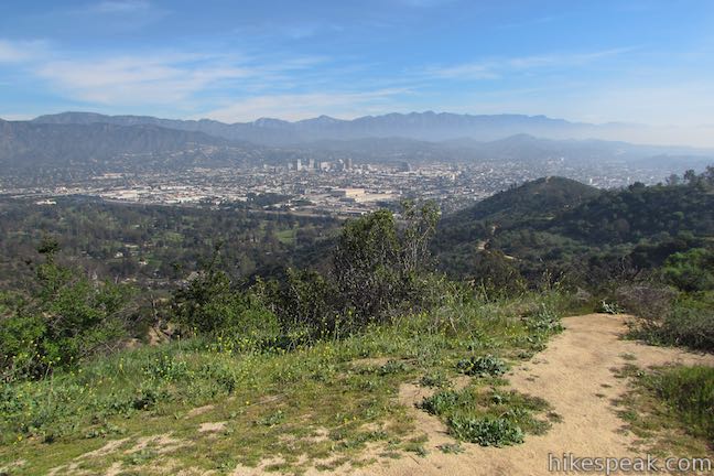
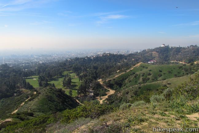
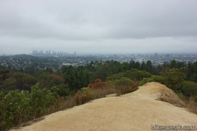
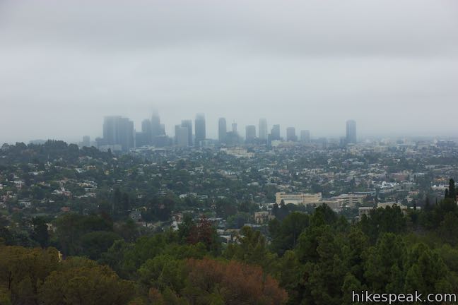
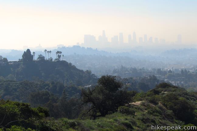
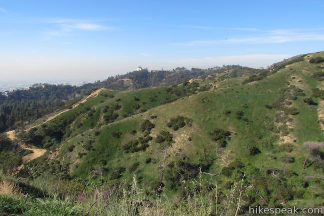
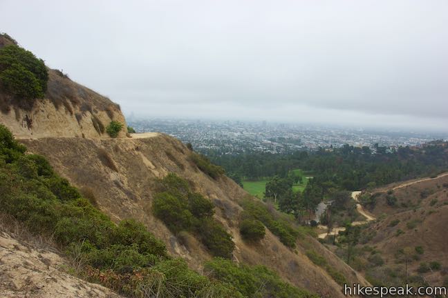
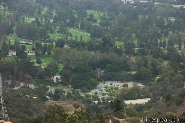
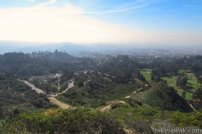
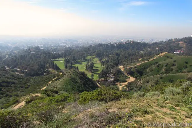
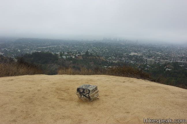
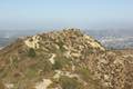
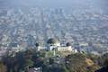
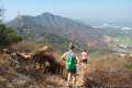
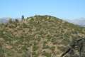
While not the most dominant summit in Griffith Park, Glendale Peak punches above its weight with sweeping views from a vantage at the southeast end of the Santa Monica Mountains. Look south over Los Feliz toward downtown Los Angeles. Turn left to look east across the San Gabriel Valley, which is bordered to the north by the San Gabriel Mountains. Glendale Peak offers a fine view for an undemanding urban hike.
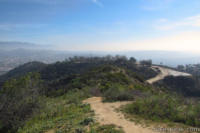
Leaving Glendale Peak, you have a few options. Hike 1.4 miles back to the Vermont Canyon Tennis Complex for a 2.8-mile round trip hike or venture 1.65 mile back to the trailhead on Vermont Canyon Road for a 3.3-mile hike. If you’ve got a fever for more summit views, you can also continue up East Ridge Trail to Mount Hollywood and loop back to Vermont Canyon Road.
Aberdeen Trail
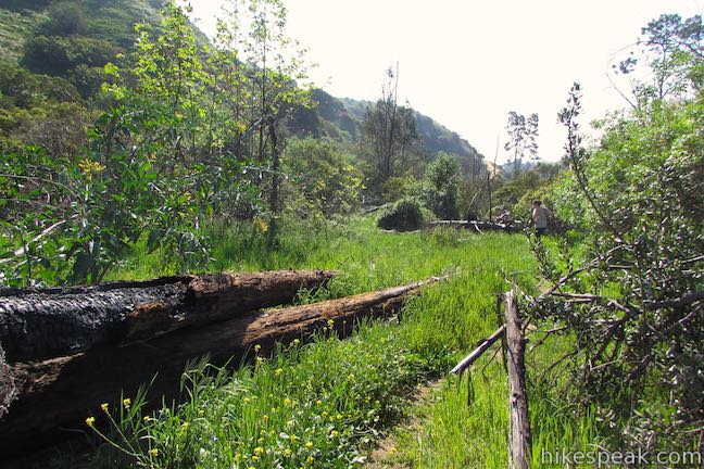
If you’re hiking back down from Glendale Peak, you can trim the return distance by 0.25 miles while exploring Aberdeen Canyon (creating a lollipop loop hike of 2.55 or 3.05 miles). Make your way from Glendale Peak down to East Ridge Trail and turn left (away from the bridge). Backtrack a couple hundred feet along this trail to find a narrow track plunging down the grassy slope below. Take this unmarked path, which is the top of Aberdeen Trail.
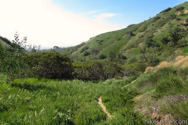
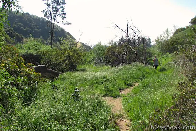
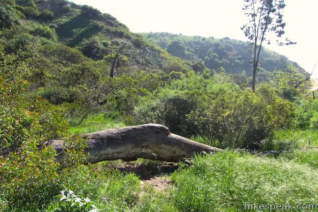
The route down to the canyon floor is steep and loose. This use trail will not be appropriate for all hikers and all footwear. Look up at the bridge as you come down the mountainside. Things mellow out when you reach the base of the slope where the trail turns left and heads down the bottom of Aberdeen Canyon. The single track weaves through thickets of brush. This is definitely a less-visited area of Griffith Park.
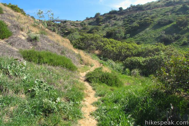
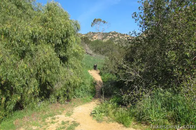
After a third of a mile on the single track, you will suddenly exit the brush onto Riverside Trail. Turn right to hike back to your starting point. After 0.4 miles, you will come back to the junction above the tennis courts. Turn left to return to that trailhead, hiking a quarter mile, or continue straight on Riverside Trail for half a mile to return to Vermont Canyon Road.
Beginning from Vermont Canyon Tennis Complex, the basic directions for this loop are:
- Hike up to Riverside Trail and turn right (0.25 miles)
- Pass Aberdeen Trail (0.65 miles)
- Turn left on East Ridge Trail (1 mile)
- Turn right on Henry’s Trail, just before the bridge (1.25 miles)
- Summit Glendale Peak (1.4 miles)
- Return to East Ridge Trail and turn left (1.55 miles)
- Turn right down Aberdeen Trail (1.57 miles)
- Turn right on Riverside Trail (1.9 miles)
- Turn left down the trail to the tennis courts (2.3 miles)
- Return to the parking area (2.55 miles)
No permit is required to hike to Glendale Peak and Griffith Park has free entry and parking (just avoid visiting when shows are happening at the Greek). Bikes are not allowed on these dirt trails in Griffith Park, but you can bring dogs, so get out and enjoy!
Directions to the Trailhead
- From Interstate 5, take exit 141 for Los Feliz Boulevard.
- Go west on Los Feliz Boulevard for 1.4 miles and turn right up Vermont Avenue.
- The start of Riverside Trail is one mile up this road on the right.
- To reach the other trailhead, take Vermont Avenue for 0.6 miles and turn right on Commonwealth Avenue (following the sign for Vermont Canyon Tennis Complex).
- Go 0.2 miles and turn left into the parking area in front of the tennis courts.
Trailhead Location
Trailhead address: North Vermont Canyon Road, Griffith Park, Los Angeles, CA 90027
Trailhead coordinates: 34.12184, -118.29679 (34° 07′ 18.62″N 118° 17′ 48.44″W)
Vermont Canyon Tennis Complex address: Commonwealth Canyon Road (Commonwealth Avenue), Griffith Park, Los Angeles, CA, 90027
Vermont Canyon Tennis Complex coordinates: 34.1208, -118.2934 (34° 07′ 14.88″N 118° 17′ 36.24″W)
View Griffith Park in a larger map
Or view a regional map of surrounding Los Angeles trails and campgrounds.
Vermont Canyon Tennis Complex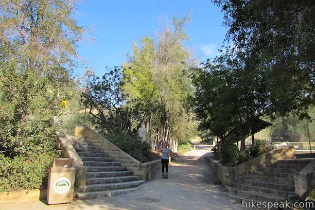

Riverside Trail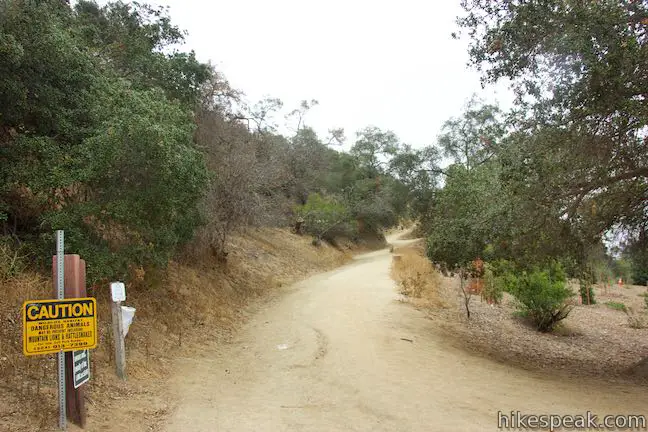


East Ridge Trail


Henry's Trail to Glendale Peak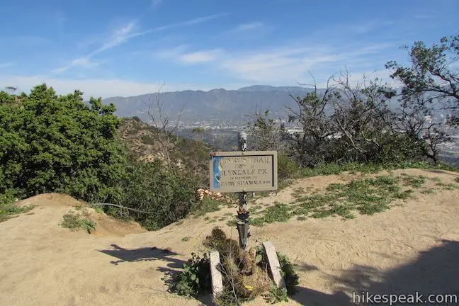


Aberdeen Trail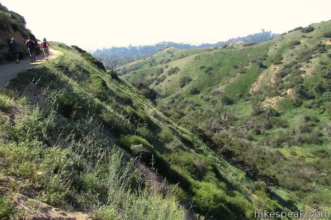

 | Glendale Peak - Mount Hollywood Loop This 4.15-mile hike tops two summits in Griffith Park that both have awesome views. |
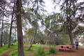 | Cedar Grove & Vista View Point Loop This 2.3-mile loop on the southeast side of Griffith Park follows paved and unpaved trails to two park attractions, a quiet grove with a picnic area and a helipad with panoramic views. |
 | Griffith Observatory via East Observatory Trail This 1.5-mile hike from Vermont Canyon Avenue up to Griffith Park's great observatory delivers excellent views over Los Angeles along the way. |
 | Griffith Observatory via West Observatory Trail This 2.1-mile hike ascends from Western Canyon up ridges to Griffith Observatory, getting sweeping views over Los Angeles and Griffith Park along the way. |
 | Ferndell Trail This relaxing half-mile hike goes through a tropical garden in the lushest little canyon in Griffith Park. Explore farther on a 1.75-mile hike in Western Canyon or venture up to the Griffith Observatory to see more of the park. |
 | Mount Hollywood This 1,625-foot peak is a star of Griffith Park with panoramic views that can be reached from Griffith Observatory on a steep 1.4-mile hike or a scenic 2.65-mile trek and from lower in the park in Western Canyon for a hike of around 4.2 miles. |
 | Bronson Cave This short easy hike visits a man-made cave recognizable as the Batcave from the 1960s Batman TV series and hundreds of other locations on TV and film. |
 | Mount Lee and the Hollywood Sign via Brush Canyon Trail This 6.4-mile hike crosses Griffith Park from Canyon Drive to the top of Mount Lee directly behind the landmark Hollywood Sign. |
 | Mount Chapel, Mount Bell, and Mount Hollywood This 5.7-mile loop tops three prominent summits on a panoramic tour of Griffith Park. |
 | Mount Lee and the Hollywood Sign via Hollyridge Trail This 3.5-mile hike ascends 750 feet to reach the summit of Mount Lee behind the Hollywood Sign. |
 | Hollywood Sign via Innsdale Drive, Mulholland Highway, and Mount Lee Drive This 4.6-mile round trip hike combines trails and streets to deliver some of the very best views of the Hollywood Sign on the way to the summit of Mount Lee above the sign. |
 | Cahuenga Peak This 3-mile hike on Burbank Peak Trail and Aileen Getty Ridge Trail ascends to Cahuenga Peak and the adjacent Mount Lee, home of the Hollywood Sign. |
 | Lake Hollywood Reservoir Walking Trail This 3.5-mile loop circles a peaceful fence-enclosed reservoir in the hills below the Hollywood Sign. |
 | Beacon Hill This 2.75 to 3.9-mile hike in Griffith Park climbs 500 feet to the easternmost summit in the Santa Monica Mountains. |
 | Old Zoo Picnic Area This half-mile hike explores the abandoned exhibits and animal cages in the ruins of the old LA Zoo in Griffith Park. |
 | Bee Rock This hive-shaped point on the east side of Griffith Park is reached via a 1.7 to 4-mile round trip hike. |
 | Amir's Garden This one-mile hike reaches a relaxing garden on the east side of Griffith Park that is a pleasant retreat for hikers. |
 | More trails in the Santa Monica Mountains Explore other destinations in the range. |
Common Questions about Glendale Peak in Griffith Park
- Is the trail open?
- Yes. You should expect to find that Vermont Canyon Tennis Complex to Glendale Peak (with Aberdeen Trail) is open. There are no recent reports of trail closures. If you discover that the trail is closed, please help your fellow hikers by reporting a closure.
- Is this trail free to access?
- Yes, Vermont Canyon Tennis Complex to Glendale Peak (with Aberdeen Trail) is free to access. No entrance fee, pass, or permit is required. If you discover that access rules have changed, please provide feedback on your experience.
- How much time does this hike take?
- It takes approximately 1 hour 30 minutes to hike Vermont Canyon Tennis Complex to Glendale Peak (with Aberdeen Trail). Individual hiking times vary. Add extra time for breaks and taking in the views.
- How long is this hike?
- The hike to Vermont Canyon Tennis Complex to Glendale Peak (with Aberdeen Trail) is 2.55 - 3.3 miles (out and back / lollipop loop) with 330 to 405 feet of elevation change.
- Are dogs allowed on this trail?
- Yes, dogs are allowed on Vermont Canyon Tennis Complex to Glendale Peak (with Aberdeen Trail). The trail is open to hikers, dogs.
- Does this trail go to a summit?
- Yes, Vermont Canyon Tennis Complex to Glendale Peak (with Aberdeen Trail) reaches a summit with panoramic views.
- What mountain range is this trail in?
- Vermont Canyon Tennis Complex to Glendale Peak (with Aberdeen Trail) is located in the Santa Monica Mountains.
- Where is the trailhead located?
- The trailhead for Vermont Canyon Tennis Complex to Glendale Peak (with Aberdeen Trail) is located in Los Angeles, CA.
Trailhead Address:
North Vermont Canyon Road
Los Angeles, CA 90027
Trailhead Coordinates:
34.12184, -118.29679 - What are the driving directions to the start of the hike?
To get to the trailhead: From Interstate 5, take exit 141 for Los Feliz Boulevard. Go west on Los Feliz Boulevard for 1.4 miles and turn right up Vermont Avenue. The start of Riverside Trail is one mile up this road on the right.
To reach the other trailhead, take Vermont Avenue for 0.6 miles and turn right on Commonwealth Avenue (following the sign for Vermont Canyon Tennis Complex). Go 0.2 miles and turn left into the parking area in front of the tennis courts.
View custom Google Maps directions from your current location.
- Are there other trails near Vermont Canyon Tennis Complex to Glendale Peak (with Aberdeen Trail)?
- Yes, you can find other nearby hikes using the Hikespeak Hike Finder Map.

Our family hikes to the sign yesterday. We are from Pa and found directions from the gps however trying to figure out exactly the trail we took. The place we parked had a little parking area to the right and to the left was like a picnic area someone actually having a bday party there. The sign at the bottom of the trail said 1.8 miles to the Hollywood sigh however we met someone on the trak that said it is really about 4 miles. Along the way you could look down to the left and see where the horses were kept and then we did pass people on horses closer to the top. When we made it to the sign the view was from the front of the letters. What was the trail called and exactly how many miles was it and what what was the elevation at the top?
[…] Glendale Peak […]