Heartbreak Hill Trail
in the Santa Monica Mountains
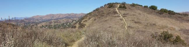
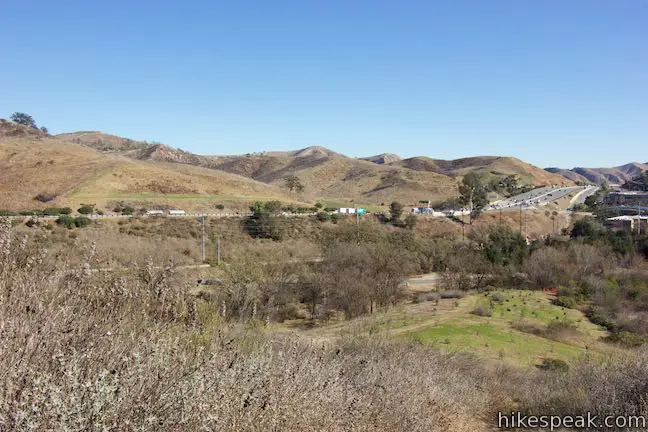
The heart pounding on Heartbreak Hill comes from the heavy dose of elevation on this short trail, which climbs 600 feet in a little over a mile. The trail is steep from the start, but does taper out before a rapid rise to Heartbreak Ridge, just below a summit crest. The hike is easy-to-reach, setting out from Agoura Road near the Liberty Canyon Exit of the 101 Freeway. The top of the hike is panoramic, with great perspectives of Ladyface Peak, other members of the Santa Monica Mountains, and the Simi Hills to the north. This out and back hike on Heartbreak Hill Trail is 2.1 miles round trip.
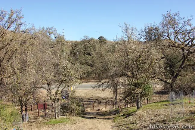
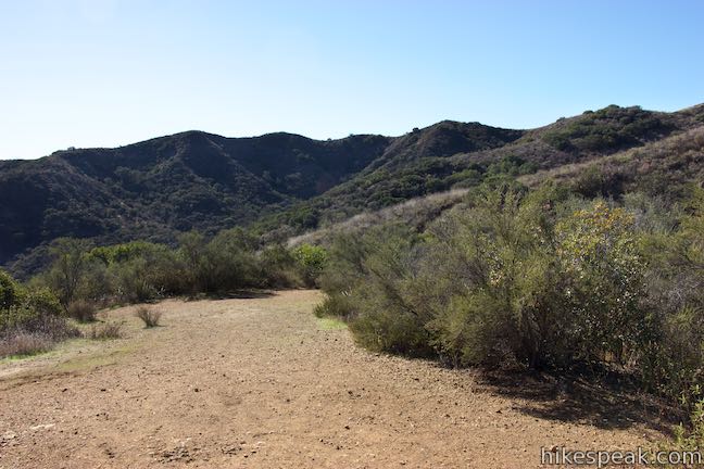
Heartbreak Hill Trail (also known as Liberty Ridge Trail) begins from a fairly large trailhead parking area on the south side of Agoura Road, about a quarter mile west of Liberty Canyon Road.
A sign beside the trailhead notes that this is the proposed future site of a wildlife bridge that would span across the 101 Freeway to improve the habitat for mountain lions (and reduce inbreeding), while lowering traffic accidents on the 101 Freeway caused by animals.
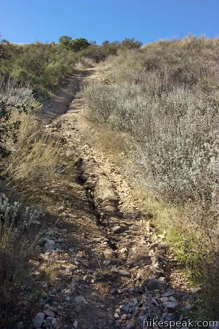
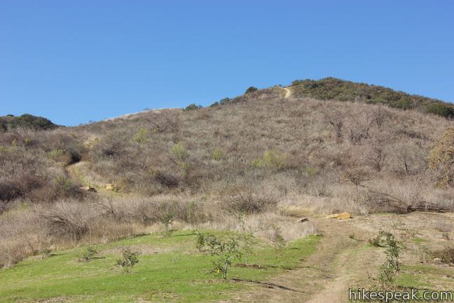
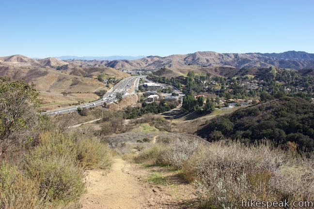
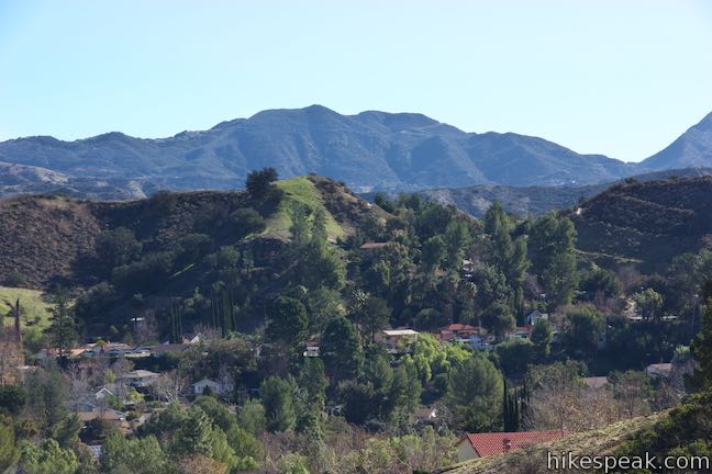
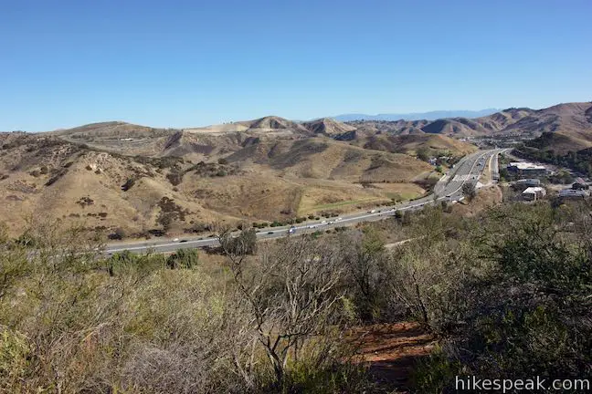
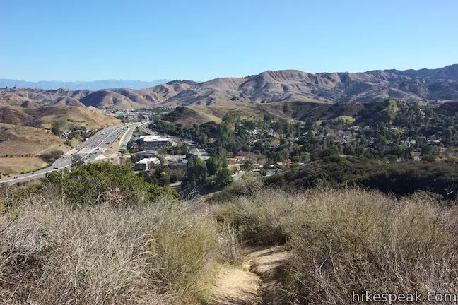
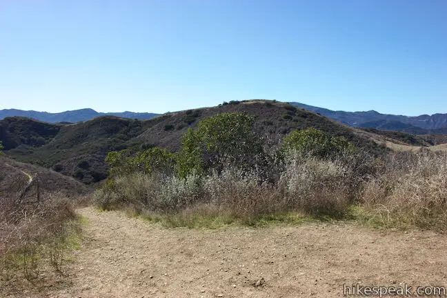
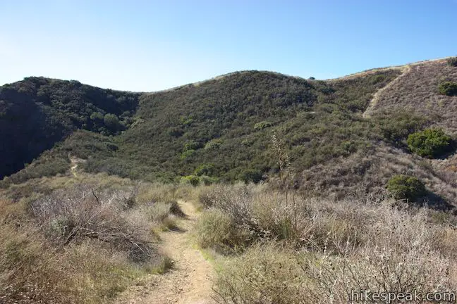
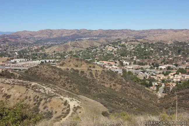
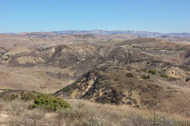
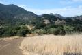
Begin up the trail, which curves to the right across a field past planted trees. Without wasting any time, Heartbreak Hill Trail tilts uphill. Ascend a steep, rutted single track that is lined by sagebrush. The views are behind you as you climb, so look over your shoulder across Liberty Canyon and east up the 101 Freeway. The green ridges of the Santa Monica Mountains rise to the south and east, including Calabasas Peak and Saddle Peak.
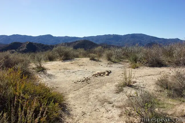
After 0.3 miles of hiking, the ascent stops – at least temporarily. Reach a small clearing off the right side of the trail with some views looking north. Proceed up the trail, which curves to the left, briefly heading south before angling west again to continue the climb.
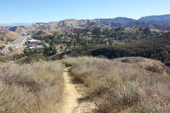
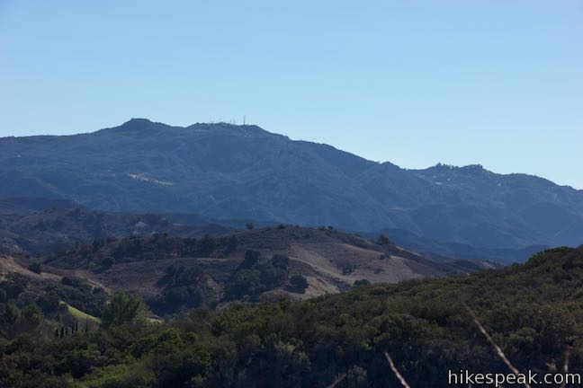
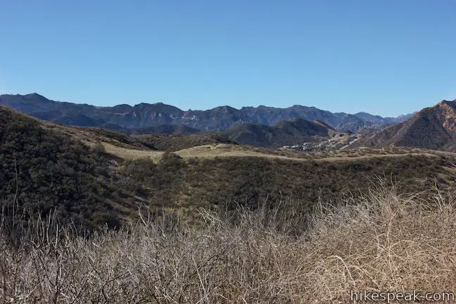
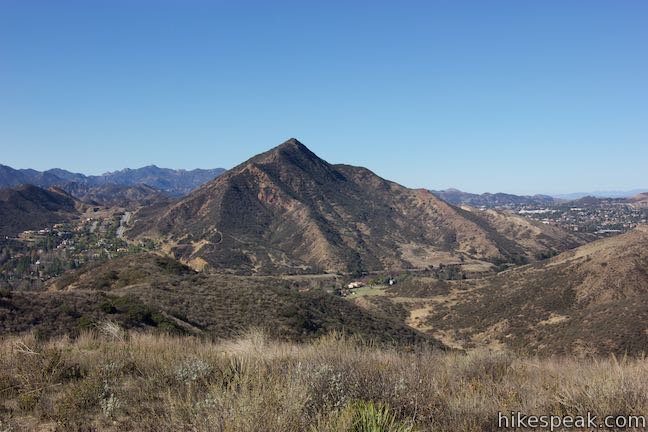
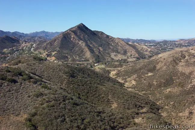
Similar to the trail below, the views to the south and east continue to expand. At half a mile from the trailhead, in which 500 feet are gained, arrive at the second landing, which presents a taste of the vistas observed at the top. Ladyface Peak is visible to the west. To the southwest is the main ridgeline of Heartbreak Ridge, including the hike’s summit destination.
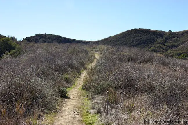
Those who only want a short workout could turn around at the second landing for a 1-mile round trip hike with 500 feet of elevation change. For those of you keeping track of the math, it would seem like there is only 100 feet to climb over the next 0.55 miles to the top of Heartbreak Hill. Although much of the remaining trail is that gentle, Heartbreak Hill Trail actually sacrifices some elevation to reach the base of a super steep push up to the main ridgeline.
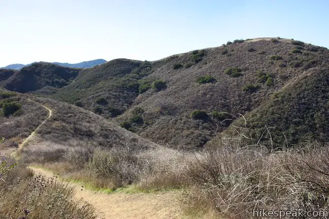
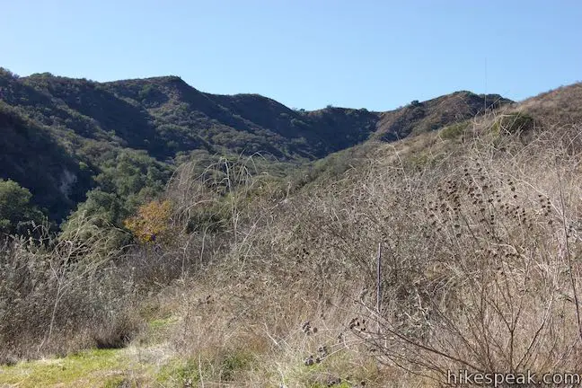
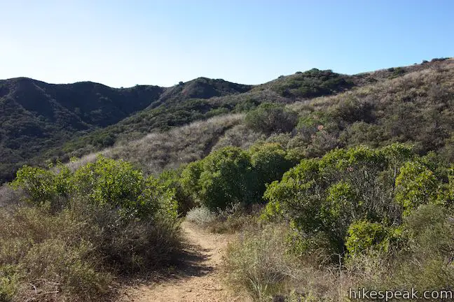
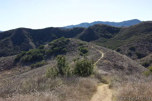
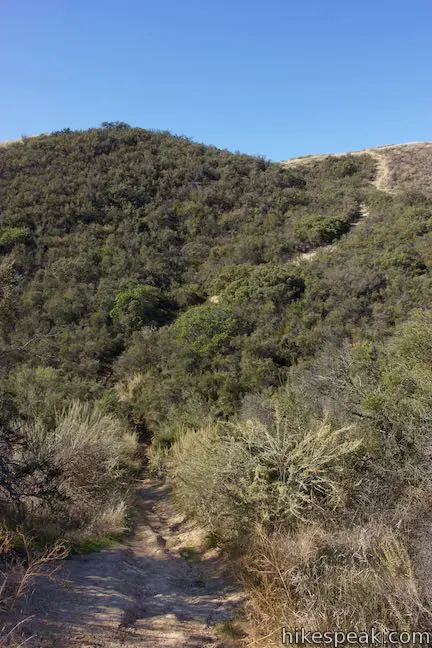
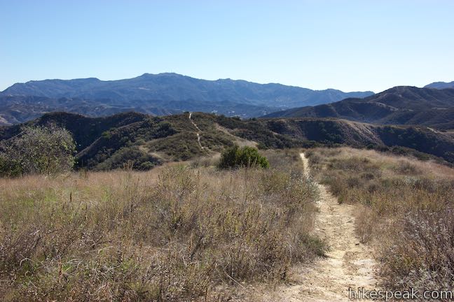
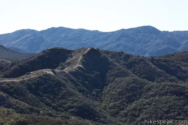
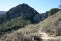
Turn left at the second landing and follow Heartbreak Hill Trail south across a dip in the terrain. Make your way through pleasant sagebrush as the trail rises to a subtle crest. The chaparral-covered wall of Heartbreak Ridge rises in front of you. To your right, spot the crest in the ridge that you’ll be summiting.
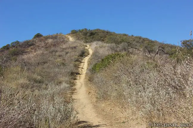
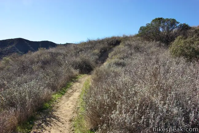
The trail travels downhill for a tenth of a mile, crossing a gully on the side of Heartbreak Ridge. After bottoming out, ascend toward a short, but steep climb to the top of the ridge. Over the next 125 yards, the trail gains 150 feet. Make your own tiny switchbacks to help ascend this steep, loose, and rutted section of the trail. You may need to put a hand on the ground for extra stability up this passage. While the first half mile of the hike is demanding, this is Heartbreak Hill Trail’s greatest challenge.
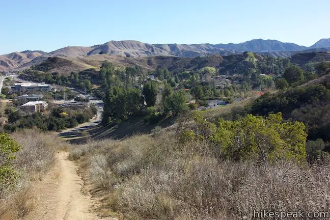
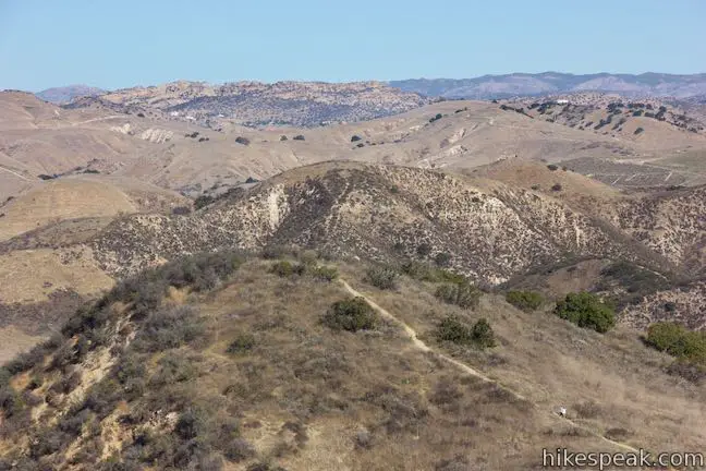
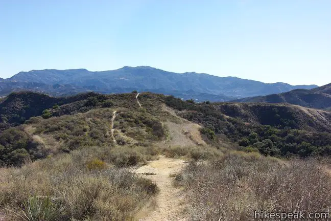
Make your way to the top, where a T-junction with Heartbreak Ridge Trail provides a scenic spot to catch your breath. Turn right and follow this trail up to a crest on the ridge that is the highest point of this short hike. To the left, Heartbreak Ridge Trail ventures south along the ridgeline, crossing numerous crests before intersecting Phantom Trail in Malibu Creek State Park. Admire the southward view from the junction, as well as the perspective back over the trail you hiked up.
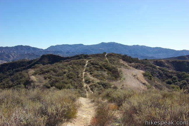
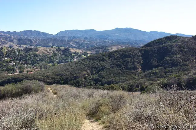
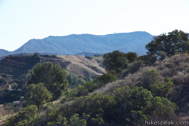
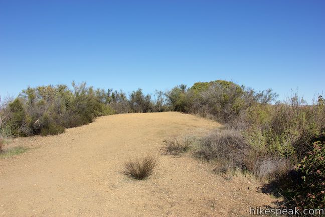
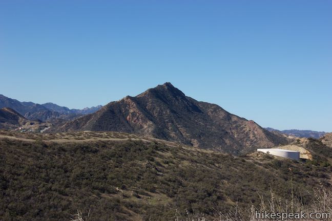
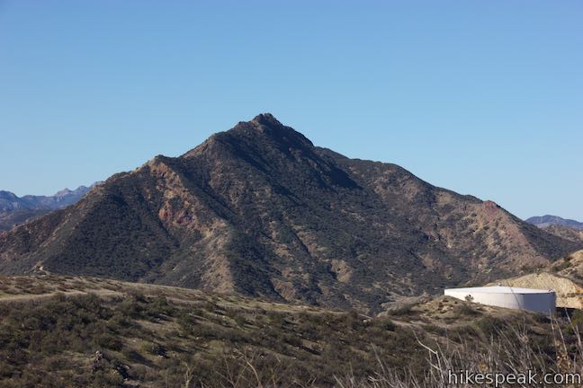
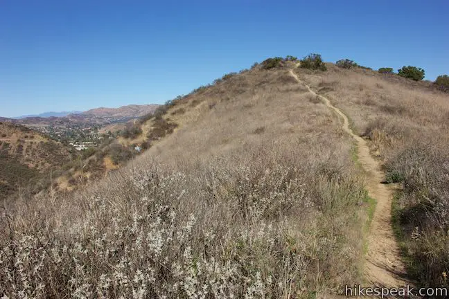
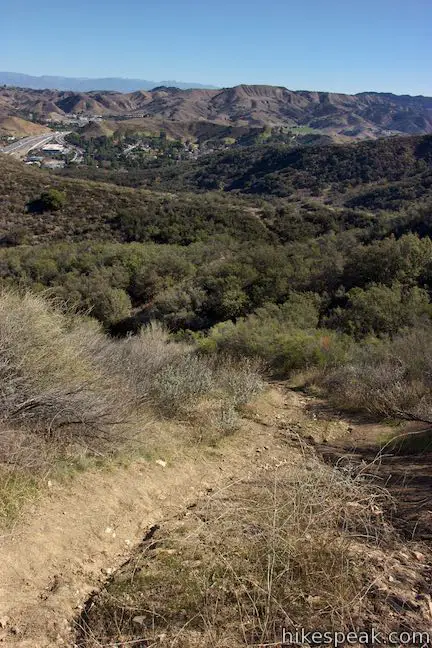
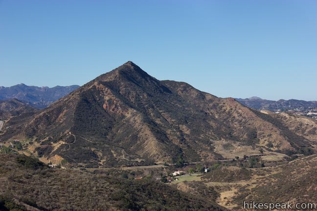
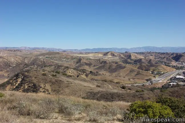
Hike north for the final tenth of a mile, rising to a summit crest at the north end of Heartbreak Ridge (1.05 miles from the trailhead). This perch has an excellent perspective west toward Ladyface Peak. While you’ll struggle to find the face of a lady in the shape of this mountain, it does rise to a picturesque point. A neighborhood is cradled in the valley south of Ladyface Peak, along Kanan Road. The Boney Mountains section of the Santa Monica Mountains stand tall in the distance to the southwest.

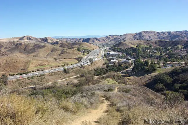
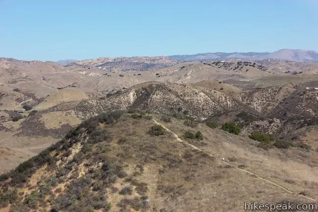
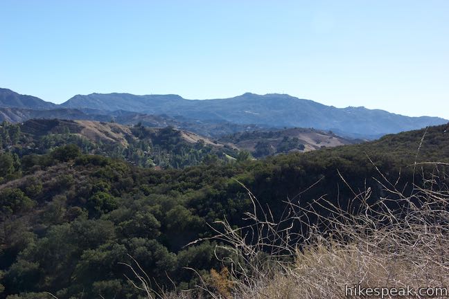
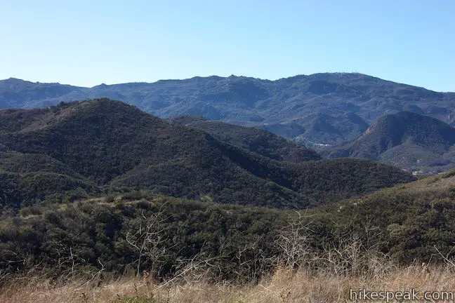
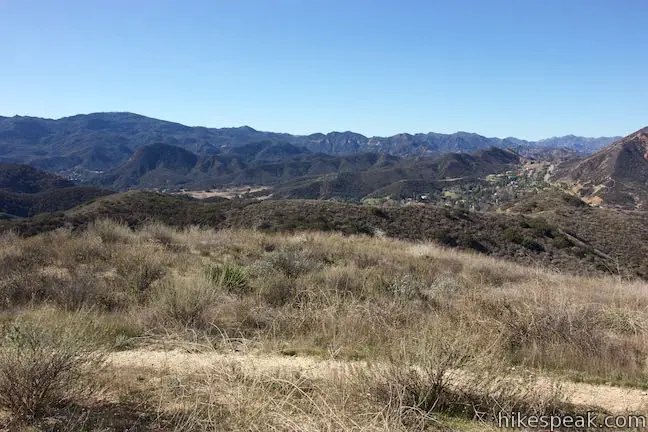
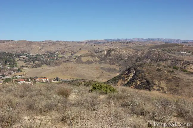
Looking south from Heartbreak Hill, undulations in the ridge lead to mountains in Malibu Creek State Park. The tower-topped summit of Castro Peak rises a bit higher than the rest. Saddle Peak and Calabasas Peak lie to the southwest. The 101 Freeway stretches east toward the San Fernando Valley. To the north, The Simi Hills build toward the Santa Susana Mountains. Neighborhoods in Agoura Hills border the 101 Freeway to the northwest.
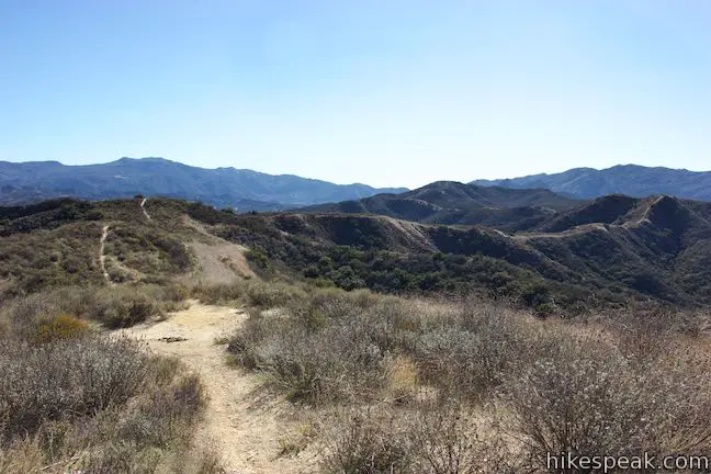
Although Heartbreak Hill isn’t the most pronounced summit, the 360-degree views are wonderful. Heartbreak Ridge Trail continues off the north side of the summit, following the ridgeline northwest toward a white holding tank. Those eager to form a loop can hike down to the end of Heartbreak Ridge Trail, pass the holding tank, and proceed onto roads where three right turns lead back to the trailhead along Agoura Road.

If you don’t want to walk on roads, return the way you came. Hike south from the summit back to the unmarked junction with Heartbreak Hill Trail. Turn left, carefully descend the slippery and steep section, and make your way back to the trailhead.
Heartbreak Hill Trail is within a Santa Monica Mountains Conservancy Zone Parkland. Dogs are allowed on leashes. Bikes seem to be prohibited. No permit is required for this hike and parking at the trailhead is free, so get out and enjoy!
Woolsey Fire Update: This trailhead has reopened following the November 2018 Woolsey Fire. This park is managed by the Mountains Recreation and Conservation Authority. Check the MRCA website for additional visitor information. Viewed from the 101 Freeway after the fire, Heartbreak Hill Trail appears to be completely burned by the fire
Directions to the Trailhead
- From the San Fernando Valley, travel west on the 101 Freeway North to exit 34 for Liberty Canyon Road.
- Turn left at the end of the offramp and travel south to the first intersection.
- Turn right on Agoura Road and drive a quarter mile to the trailhead, which has a dirt parking area just off the south (left) side of the road.
- From Thousand Oaks, travel east on the 101 Freeway South to exit 34 for Liberty Canyon Road.
- Turn right at the end of the offramp and make an immediate right onto Agoura Road.
- Drive a quarter mile to find the trailhead on the left.
- .
Trailhead Location
Trailhead address: 27570 Agoura Road, Agoura Hills, CA 91301
Trailhead coordinates: 34.1370, -118.7289 (34° 08′ 13.2″N 118° 43′ 44.0″W)
View Santa Monica Mountains in a larger map
Or view a regional map of surrounding Los Angeles trails and campgrounds.


 | Phantom Trail This 4.8-mile round trip hike crosses a panoramic ridge on the north side of Malibu Creek State Park. |
 | Anza Loop Trail This 3.8 to 4.5-mile hike follows a historic route through rolling hills in Calabasas south of the 101 Freeway. |
 | Calabasas Stairs This hike to a long flight of stairs off Anza Loop Trail is 1.4 miles round trip (add 0.2 miles for each extra trip up and down the steps). |
 | Grassland Trail to Crags Road and Rock Pool This easy 3-mile hike enters Malibu Creek State Park on South Grassland Trail, then forms a loop around Crags Road to visit Rock Pool, a popular park retreat. |
 | M*A*S*H Set This hike visits the site where the exteriors of the television show MASH were filmed, a 4.75-mile trek from the park entrance. |
 | Talepop Loop This 4.75-mile hike climbs 500 feet over a scenic mountain between Liberty Canyon and Las Virgenes Canyon. |
 | Cistern, Lookout, and Cage Creek Trails This team of single tracks make a scenic descent to Century Lake in Malibu Creek State Park, providing a short loop or longer hikes to other destinations. |
 | Lake Vista Trail This 4.1-mile hike beginning from Cistern Trail crosses the west end of Malibu Creek State Park and climbs to a scenic view over Malibu Lake. |
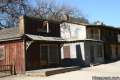 | Paramount Ranch This segment of the Santa Monica Mountains National Recreation Area includes Western Town, an outdoor set cast as frontier towns in TV and film since the 1950s. There are also several miles of hiking trails to explore. |
 | More trails in the Santa Monica Mountains Explore other destinations in the range. |
 | Malibu Creek State Park The year-round campground has 63 sites with picnic tables, fire rings, flush toilets, coin showers, and a dump station. |
Common Questions about Heartbreak Hill Trail in the Santa Monica Mountains
- Is the trail open?
- Yes. You should expect to find that Heartbreak Hill Trail is open. There are no recent reports of trail closures. If you discover that the trail is closed, please help your fellow hikers by reporting a closure.
- Is this trail free to access?
- Yes, Heartbreak Hill Trail is free to access. No entrance fee, pass, or permit is required. If you discover that access rules have changed, please provide feedback on your experience.
- How much time does this hike take?
- It takes approximately 1 hour 15 minutes to hike Heartbreak Hill Trail. Individual hiking times vary. Add extra time for breaks and taking in the views.
- How long is this hike?
- The hike to Heartbreak Hill Trail is a 2.1 mile out and back with 600 feet of elevation change.
- Are dogs allowed on this trail?
- Yes, dogs are allowed on Heartbreak Hill Trail. The trail is open to hikers, dogs.
- What mountain range is this trail in?
- Heartbreak Hill Trail is located in the Santa Monica Mountains.
- Where is the trailhead located?
- The trailhead for Heartbreak Hill Trail is located in Agoura Hills, CA.
Trailhead Address:
27570 Agoura Road
Agoura Hills, CA 91301
Trailhead Coordinates:
34.137, -118.7289 - What are the driving directions to the start of the hike?
To get to the trailhead: From the San Fernando Valley, travel west on the 101 Freeway North to exit 34 for Liberty Canyon Road. Turn left at the end of the offramp and travel south to the first intersection. Turn right on Agoura Road and drive a quarter mile to the trailhead, which has a dirt parking area just off the south (left) side of the road.
From Thousand Oaks, travel east on the 101 Freeway South to exit 34 for Liberty Canyon Road. Turn right at the end of the offramp and make an immediate right onto Agoura Road. Drive a quarter mile to find the trailhead on the left.
View custom Google Maps directions from your current location.
- Are there other trails near Heartbreak Hill Trail?
- Yes, you can find other nearby hikes using the Hikespeak Hike Finder Map.

Go the extra miles...
Submit a rating of this hike to go with your comment. Contribute to the average trail rating.