Calabasas Stairs
in the Santa Monica Mountains
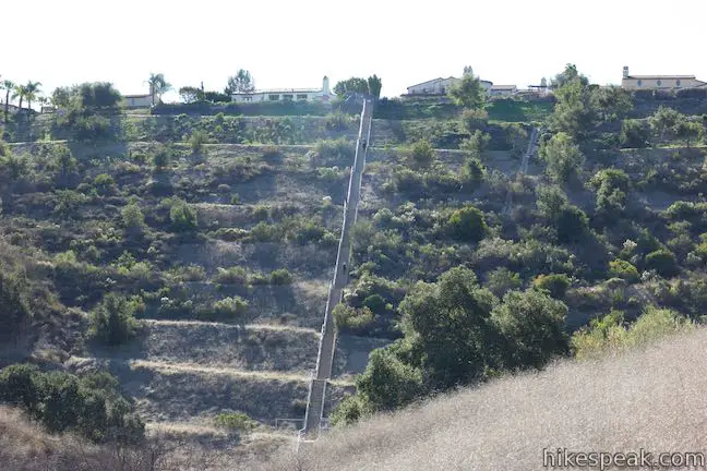
Do you want to combine a hike with a stair workout? If the answer is yes, head for the Calabasas Stairs, a long, straight flight of 375 steps that climb a slope in the Santa Monica Mountains below a Calabasas neighborhood. It is a 0.6-mile hike from Calabasas Road (just off Highway 101) to the base of the steps. Venturing to the top of the steps and back to the road is 1.4 miles round trip with 330 feet of elevation change (every repetition on the stairs adds 0.2 miles to the outing).
To reach the Calabasas Stairs, you’ll hike half a mile up Anza Loop Trail. If the beginning of this trail does not make you want to interrupt the hike with a giant concrete staircase… exploring the full loop is another option. Also, if you’d like to tackle a short hike that’s as steep as a staircase, but without the steps, you can check out nearby Heartbreak Hill Trail.
Hiking to the Calabasas Stairs
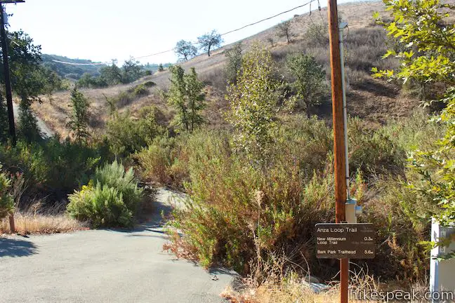
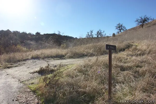
Set out from Juan Bautista de Anza East Trailhead, which is located off Calabasas Road, just south of the 101 Freeway. Don’t take the dirt trail going west from the end of the road (this is another branch of Anza Loop Trail). Instead, find mile marker 0.06 and take a paved trail dropping off the south side of the road. A metal chain crosses this paved trail as it plunges to a gully. A sign to the right reads, “Anza Loop Trail (3.7 mi round trip).”
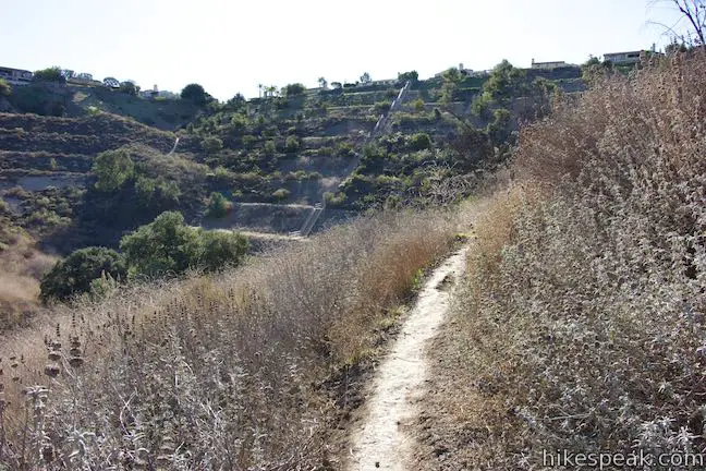
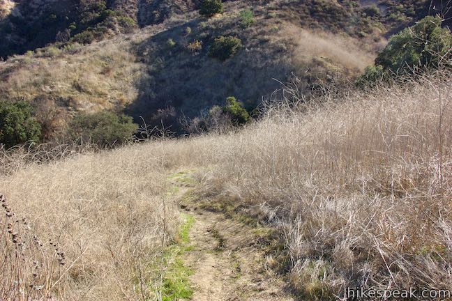
Follow this short stretch of introductory pavement as it dips across the gully and curves to the left. Rise to the end of the pavement, just 0.05 miles from the start. Take the dirt single-track parting to the right, next to a sign for Anza Loop Trail with a not-so-helpful directional arrow. Venture up the single-track trail, heading south toward the Calabasas Stairs.

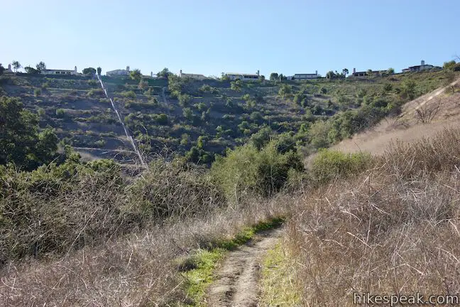
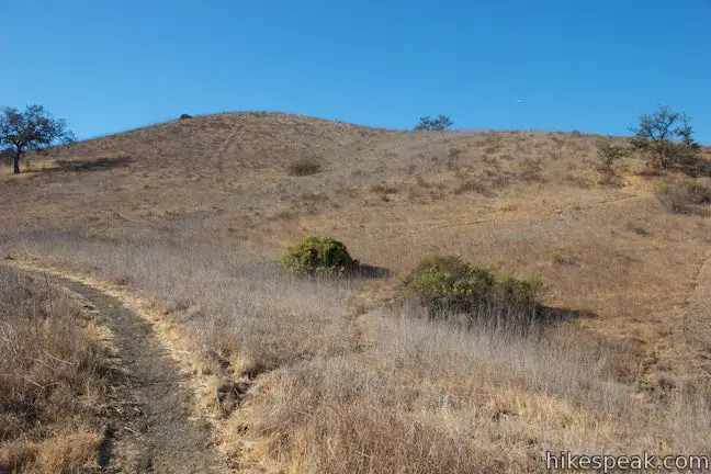
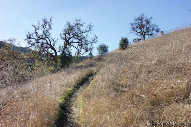
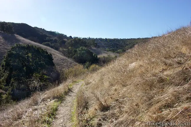
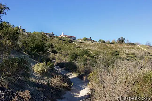
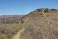
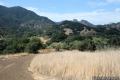
The trail goes gradually uphill across a grassland that slopes from right to left. Pass a solitary oak and make your way up to a second confusingly-marked junction, 0.2 miles from the start. At this split in the trail, one branch drops to the left toward trees gathered in the drainage below. This is New Millennium Loop Trail. Bear right instead and proceed up Anza Loop Trail.
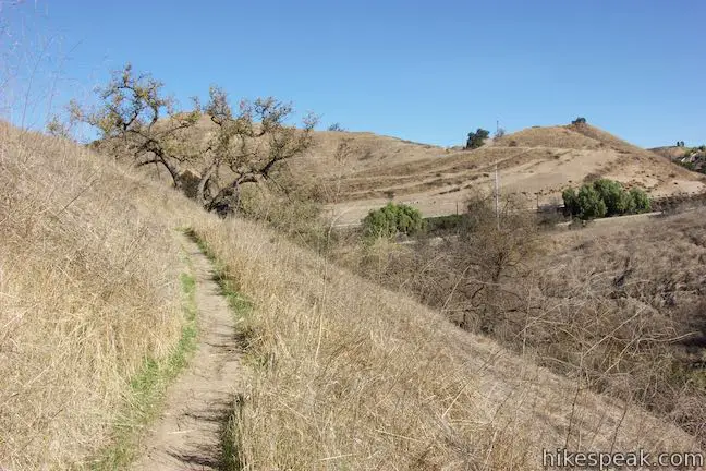
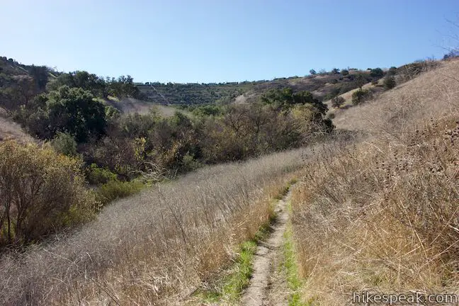
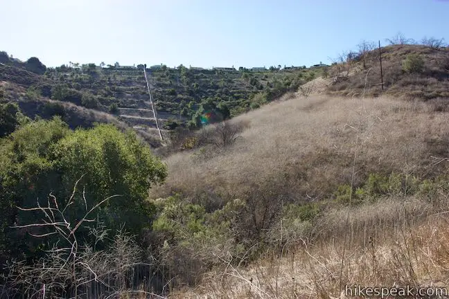
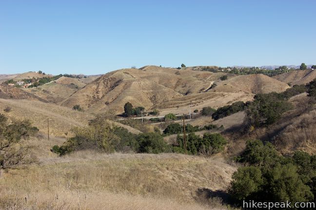
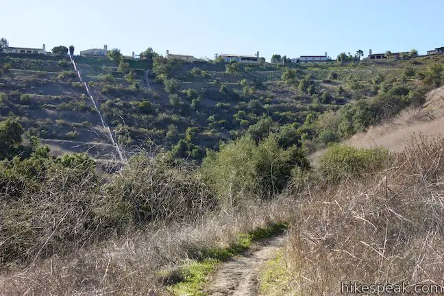
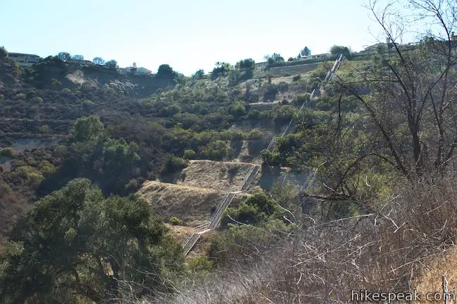
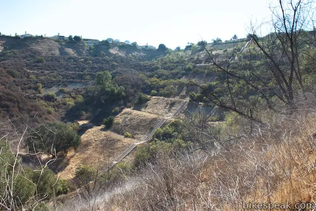
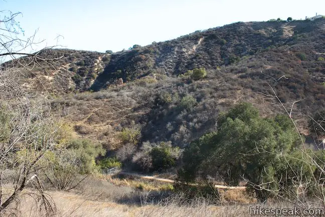
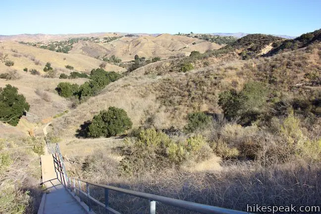
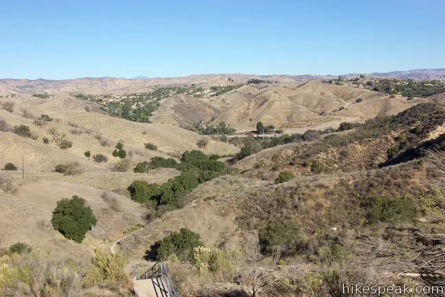
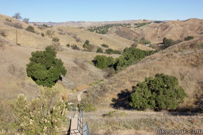
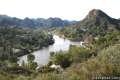
The trail weaves through creases in the grassy ridges, offering perspectives back toward the 101 Freeway and the hills beyond. Ahead of you, the Calabasas Stairs come into view, cutting down the center of a manicured bowl in the landscape that is topped by a row of houses in the neighborhood above.
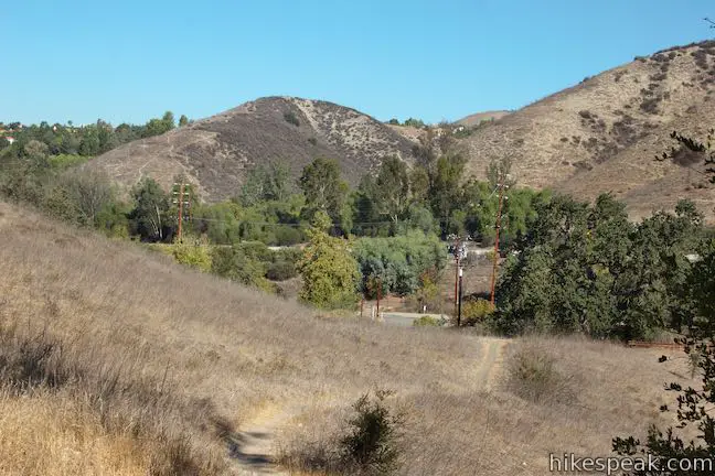
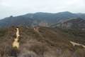
After 0.4 miles of hiking, come around a bend to find head-on views of the staircase. At this point, you may be tempted to take one of the footpaths angling across the ravine toward the Calabasas Stairs. However, it is more sensible to stick with the trail for another tenth of a mile, reaching a shorter approach to the base of the staircase.
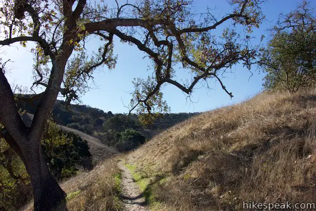
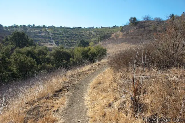
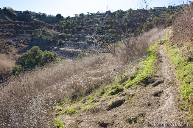
Wrap around a crease in the terrain that takes you away from the stairs. Next, ascend a slope that is higher than the base of the staircase itself. (It’s good to get the extra exercise, right?)
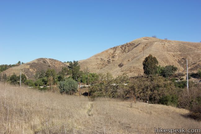
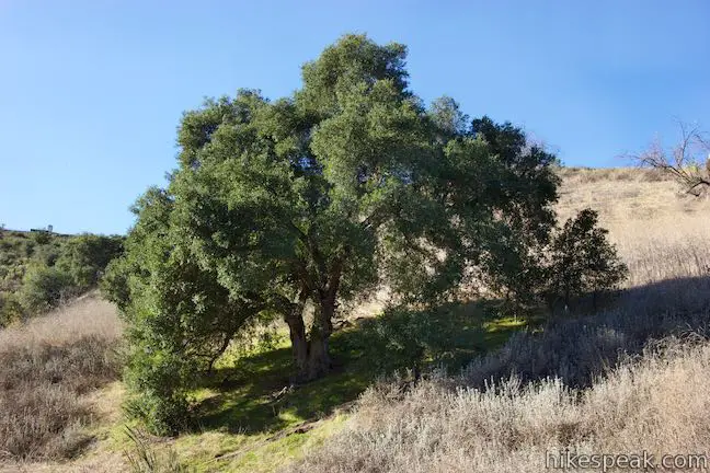
After half a mile of hiking, come to an unmarked split. Anza Loop Trail continues up the slope to the right. Turn left and descend a steep rutted track toward a lone oak beneath the staircase.
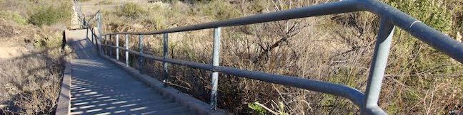
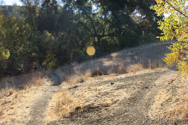
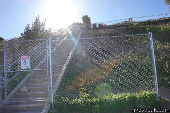
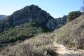
Ease your way down past the tree and cross a drainage channel to a paved walkway. Turn right and walk up to a gate at the bottom of the Calabasas Stairs. This gate should be open, while a gate near the top of the steps will be locked closed.
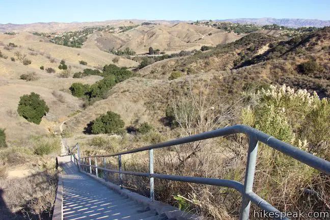
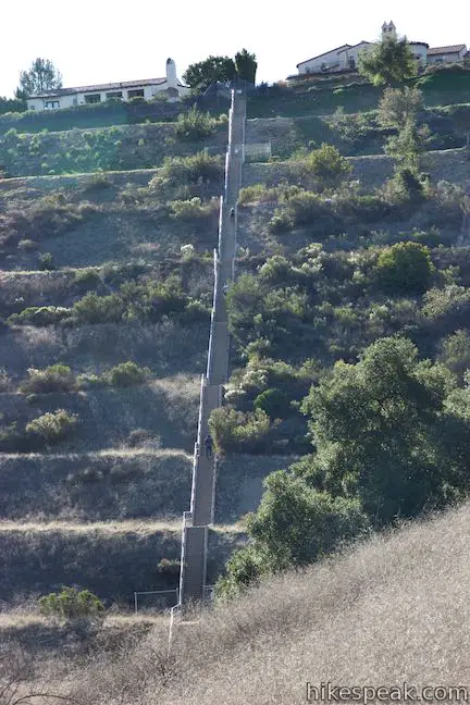
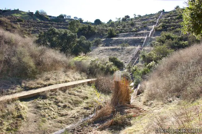
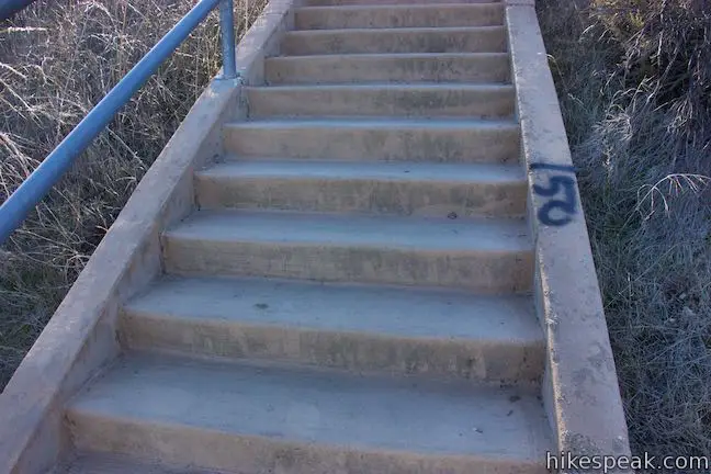
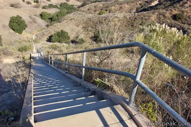
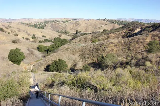
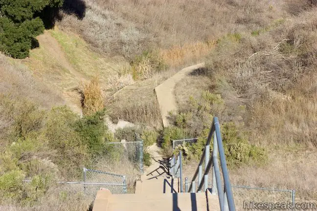
The Calabasas Stairs take a straight shot southeast, rising a total of 375 steps. Every 25th step has been numbered with spray paint, so monitoring your climb is easy. The staircase is broken up by a handful of landings, where you can take a deep breath before heading even higher.

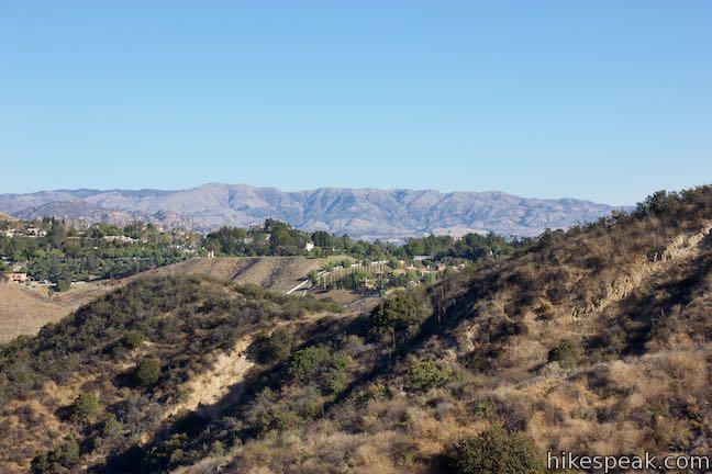
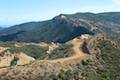
The view from the top of Calabasas Stairs is actually pretty broad, looking back over the landscape you crossed toward the 101 Freeway. The Simi Hills, the Santa Susana Mountains, and a bit of the San Fernando Valley are visible to the northeast.
The stairs are a tenth of a mile long and climb 185 feet of elevation (the riser for each step is about 6 inches tall). One trip up the staircase results in a 1.4-mile round trip hike with 330 feet of elevation change. If you go up and down the steps 4 time, for example, that would be a 2-mile round trip outing.
When you’re ready to leave the Calabasas Stairs, return the way you came. The hike to the stairs is short, but not completely straightforward.
The basic directions to the Calabasas Stairs are:
- Hike south from Calabasas Road (0 miles)
- At the end of the paved trail, turn right up a single track (0.05 miles)
- Bear right at the next marked split (0.2 miles)
- Descend to the left from an unmarked split (0.5 miles)
- Cross a drainage channel and bear right to reach the base of the Calabasas Stairs (0.6 miles)
- Climb to the top of the Calabasas Stairs (0.7 miles)
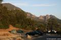
Anza Loop Trail allows hikers to bring dogs, but bikes are not allowed. No permit is required for this hike in Santa Monica Mountains Conservancy Zone Parkland. Parking along Calabasas Road is free, so get out and enjoy!
- For other staircase hikes around Los Angeles, check out Baldwin Hills Scenic Overlook and Murphy Ranch from Sullivan Ridge.
2021 update: Readers report that new parking restrictions may be posted on Calabasas Road.
Directions to the Trailhead
- From Los Angeles and the San Fernando Valley, go west on the 101 Freeway North to exit 30 for Calabasas Parkway.
- At the end of the offramp, bear left onto Ventura Boulevard.
- Make an immediate left onto Parkway Calabasas.
- Cross over the freeway and turn right on Calabasas Road.
- Drive 1.5 miles down this road to the trailhead on the left, just before the end of the road.
- Halfway down Calabasas Road, you'll need to bear left past Mureau Road to stay committed to Calabasas Road.
- Coming from the Conejo Valley, go east on the 101 Freeway South to exit 30 for Calabasas Parkway.
- Bear left at the end of the offramp onto Calabasas Road.
- Drive 1.2 miles west on Calabasas Road to the trailhead.
Trailhead Location
Trailhead address: Calabasas Road, Calabasas, CA 91302
Trailhead coordinates: 34.1499, -118.6769 (34° 08′ 59.6″N 118° 40′ 36.8″W)
View Santa Monica Mountains in a larger map
Or view a regional map of surrounding Los Angeles trails and campgrounds.


 | Anza Loop Trail This 3.8 to 4.5-mile hike follows a historic route through rolling hills in Calabasas south of the 101 Freeway. |
 | Heartbreak Hill Trail This 2.1-mile round trip hike offers a condensed workout, shooting up a ridge to a panoramic crest above Agoura Hills in the Santa Monica Mountains. |
 | Calabasas Peak via Calabasas - Cold Creek Trail This 4.5-mile round trip hike starts up a scenic single track formerly know as the Secret Trail and ascends 750 feet to the summit of Calabasas Peak. |
 | Calabasas Peak from Old Topanga Canyon Road This 4.2-mile hike on Calabasas Peak Motorway approaches Calabasas Peak from the northeast, providing big views over Topanga and other parts of the Santa Monica Mountains. |
 | Grassland Trail to Crags Road and Rock Pool This easy 3-mile hike enters Malibu Creek State Park on South Grassland Trail, then forms a loop around Crags Road to visit Rock Pool, a popular park retreat. |
 | M*A*S*H Set This hike visits the site where the exteriors of the television show MASH were filmed, a 4.75-mile trek from the park entrance. |
 | Talepop Loop This 4.75-mile hike climbs 500 feet over a scenic mountain between Liberty Canyon and Las Virgenes Canyon. |
 | Phantom Trail This 4.8-mile round trip hike crosses a panoramic ridge on the north side of Malibu Creek State Park. |
 | Cistern, Lookout, and Cage Creek Trails This team of single tracks make a scenic descent to Century Lake in Malibu Creek State Park, providing a short loop or longer hikes to other destinations. |
 | Lake Vista Trail This 4.1-mile hike beginning from Cistern Trail crosses the west end of Malibu Creek State Park and climbs to a scenic view over Malibu Lake. |
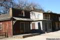 | Paramount Ranch This segment of the Santa Monica Mountains National Recreation Area includes Western Town, an outdoor set cast as frontier towns in TV and film since the 1950s. There are also several miles of hiking trails to explore. |
 | More trails in the Santa Monica Mountains Explore other destinations in the range. |
 | Malibu Creek State Park The year-round campground has 63 sites with picnic tables, fire rings, flush toilets, coin showers, and a dump station. |
Common Questions about Calabasas Stairs in the Santa Monica Mountains
- Is the trail open?
- Yes. You should expect to find that Calabasas Stairs Hike is open. There are no recent reports of trail closures. If you discover that the trail is closed, please help your fellow hikers by reporting a closure.
- Is this trail free to access?
- Yes, Calabasas Stairs Hike is free to access. No entrance fee, pass, or permit is required. If you discover that access rules have changed, please provide feedback on your experience.
- How much time does this hike take?
- It takes approximately 45 minutes to hike Calabasas Stairs Hike. Individual hiking times vary. Add extra time for breaks and taking in the views.
- How long is this hike?
- The hike to Calabasas Stairs Hike is a 1.4 mile out and back with 330 feet of elevation change.
- Are dogs allowed on this trail?
- Yes, dogs are allowed on Calabasas Stairs Hike. The trail is open to hikers, dogs.
- Is Calabasas Stairs Hike good for kids?
- Yes, this hike is likely suitable for children. It is relatively short (1.4 miles) with manageable elevation gain.
- What mountain range is this trail in?
- Calabasas Stairs Hike is located in the Santa Monica Mountains.
- Where is the trailhead located?
- The trailhead for Calabasas Stairs Hike is located in Calabasas, CA.
Trailhead Address:
Calabasas Stairs
Calabasas, CA 91302
Trailhead Coordinates:
34.1499, -118.6769 - What are the driving directions to the start of the hike?
To get to the trailhead: From Los Angeles and the San Fernando Valley, go west on the 101 Freeway North to exit 30 for Calabasas Parkway. At the end of the offramp, bear left onto Ventura Boulevard. Make an immediate left onto Parkway Calabasas. Cross over the freeway and turn right on Calabasas Road. Drive 1.5 miles down this road to the trailhead on the left, just before the end of the road. Halfway down Calabasas Road, you'll need to bear left past Mureau Road to stay committed to Calabasas Road.
Coming from the Conejo Valley, go east on the 101 Freeway South to exit 30 for Calabasas Parkway. Bear left at the end of the offramp onto Calabasas Road. Drive 1.2 miles west on Calabasas Road to the trailhead.
View custom Google Maps directions from your current location.
- Are there other trails near Calabasas Stairs Hike?
- Yes, you can find other nearby hikes using the Hikespeak Hike Finder Map.

8 Comments on Calabasas Stairs in the Santa Monica Mountains
What hikers are saying:
✨ Generated summary of user commentsHikers are intrigued by the origin of these stairs and concerned about access challenges. Pamela warns that car break-ins are a serious concern, as evidenced by shattered glass and smashed windows at the trailhead. Parking is strictly prohibited in the immediate area due to red-painted curbs and frequent enforcement, so visitors should prepare for potential fines.
Who built the Calabasas stairs and curious how long it has been there?
GTE California built the stairs to access their communication towers when Road was closed due to fires
The stairs were built sometime between 8/22/2002 and 6/3/2003 (per satellite imagery), contemporaneous with the construction of the neighborhood above the stairs. Nobody really knows for what purpose, although there are some theories floating around the internet. The stairs lead to a stormwater discharge structure at the bottom. My opinion, for what little it’s worth, is that the purpose of the stairs has something to do with that structure. I suspect the real answer is on a permit application somewhere in the City of Calabasas Building and Safety Division
Do you need to book going to the stairs in advance?
So I’ve been going to the stairs for a few months now. The other day on January 8thI drove to the location and noticed all 11 cars already there had tickets on them for parking violation. Each one of those tickets was a $58 fine. Upon noticing those tickets I looked for No parking signs. And there are quite a few no parking anytime signs there now. I don’t know if they were there before…. if they were I did not notice them.
Either way though. They are there now. And so that location is essentially closed to the public. Anyone know if it’s a new thing or a permanent thing?
I was there yesterday and Parking area was painted red, there is only red sidewalk and “no parking anytime” signs in the area, there is a sign that says to call Santa Monica Mountains National Recreation Area 310-456-7049
I was there yesterday and Parking area was painted red, there is only red sidewalk and “no parking anytime” signs in the area, there is a sign that says to call Santa Monica Mountains National Recreation Area 310-456-7049
I have hiking there for the last month a couple times a week. I saw a bunch of glass along the side where cars park. I started leaving my purse at work just in case and sure enough my car window was broken out and they searched through my car but didn’t get anything. I talked to several people and they too are getting their windows smashed out. I wish there was a way to get security or cameras or something. This person or persons need to be caught.