Saddle Peak
in the Santa Monica Mountains

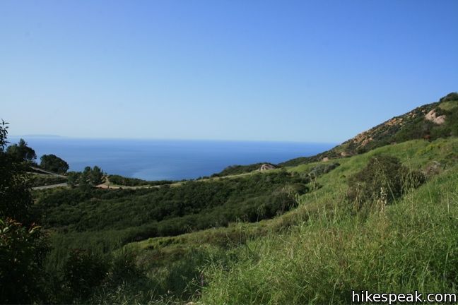
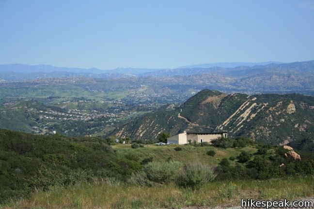
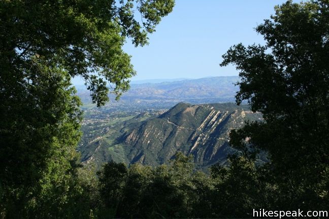
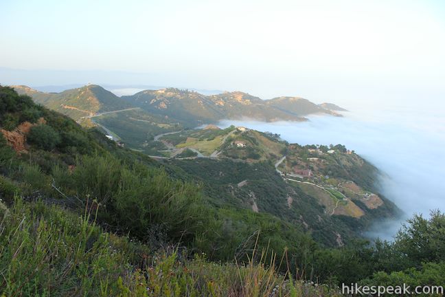
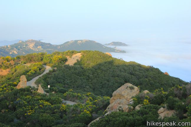
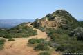
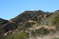
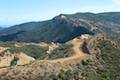
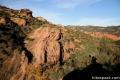
At a saddle in the Santa Monica Mountains 2,375 feet above the Pacific Ocean and three miles from the coast, the Backbone Trail crosses Stunt Road, creating a high trailhead for nearby destinations like Saddle Peak. The 2-mile round trip hike to the summit climbs just 450 feet but offers fantastic views of Malibu and the Santa Monica Mountains.

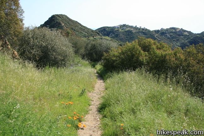
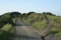
Pick up the Backbone Trail and go west up the center of the V formed by the intersection of Stunt Road and Schueren Road. If you walk a short way down Stunt Road (descending 25 feet), you’ll find a sign for the Stunt Peak Trail marking another start to the Backbone Trail to Saddle Peak. These two routes quickly merge.
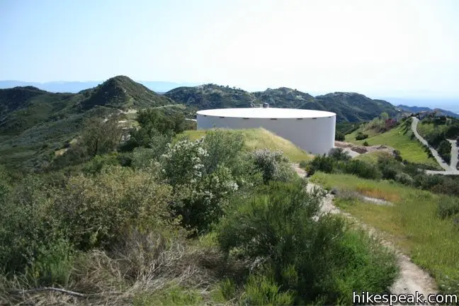
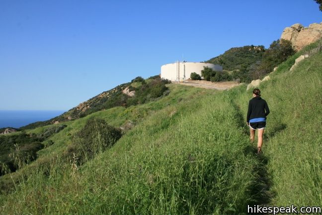
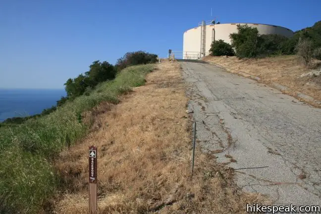
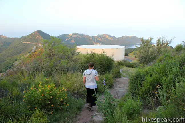
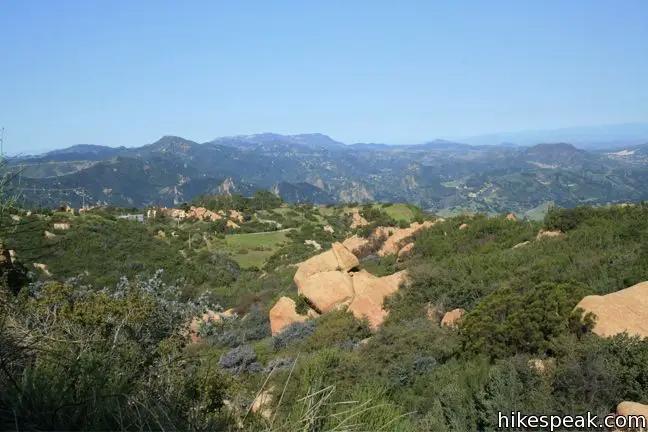
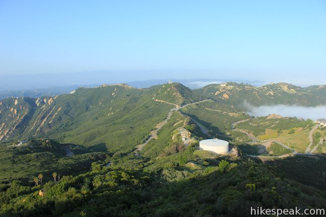
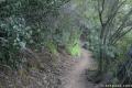
After a short distance, the Backbone Trail crosses a section of pavement to the left of a large municipal water tank. Beyond, the trail becomes a single track, which gradually ascends the east side of Saddle Peak.
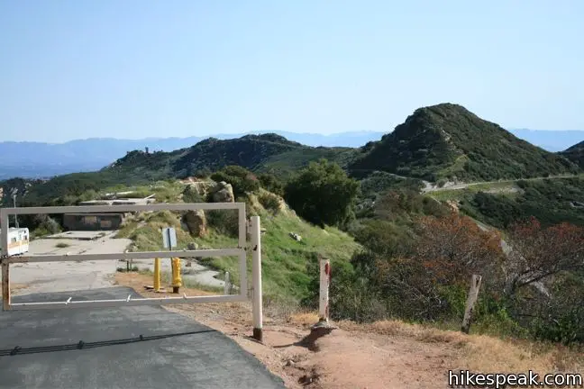
Just 0.7 miles from the start, turn left at a junction with a trail heading to the summit. Straight ahead the Backbone Trail continues down to Piuma Road (and farther to Malibu Canyon Road). Hikers can take this section of the Backbone Trail to reach Saddle Peak from Stunt High Trail.
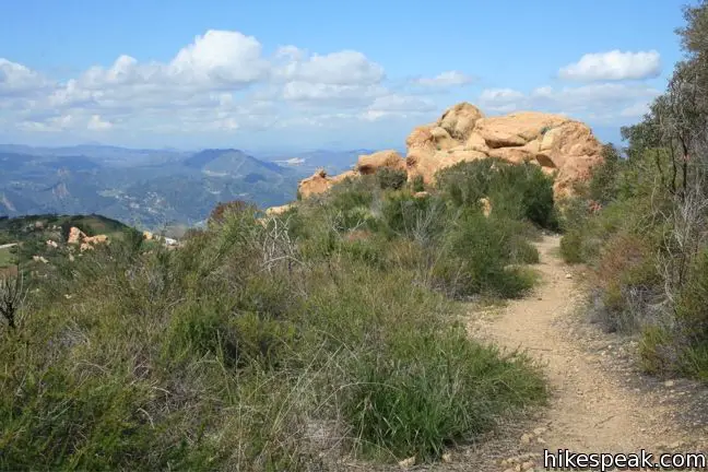
A short distance from the junction, make another left, heading up to the 2,805-foot summit. Straight ahead, a lower overlook along Saddle Peak Road faces south and offers great views over Malibu.
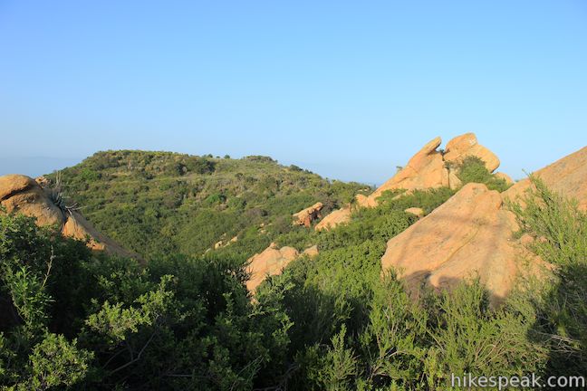
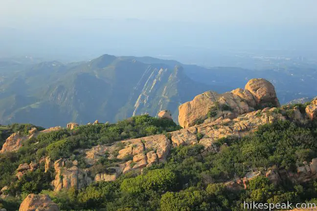
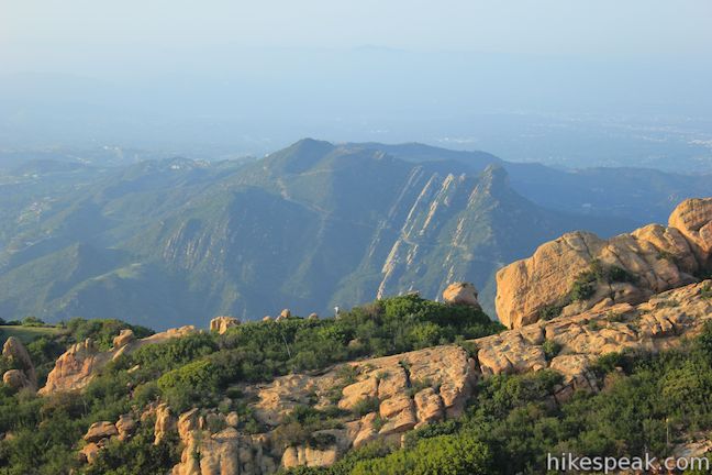
Saddle Peak is the sixth tallest point in the range and presents and broad perspective east toward Santa Monica Bay. Enjoy the panoramas and return the way your came. Dogs and bikes are not allowed on this trail. No fee or permit is required to hike to Saddle Peak, so get out enjoy!

Directions to the Trailhead
- From PCH, turn inland on Las Flores Road (across from Duke's Restaurant).
- Drive 3.4 miles up this narrow twisting canyon and turn right onto Rambla Pacifico Street.
- After 0.6 miles, make a sharp right onto Schueren Rd. and take that for 1.8 miles to the intersection with Stunt Road.
- Turn left and park along the side of the road.
- The trailhead for Topanga Lookout is across from the trailhead for Saddle Peak so there will be likely be a few vehicles parked here.
- From the 101 Freeway, exit Las Virgenes Road and head south toward Malibu.
- After 2.8 miles turn left (east) on Mulholland Highway.
- Turn right on Stunt Road after 4 miles, and drive another 4 miles to the top of the road at the intersection with Schueren Road.
Trailhead Location
Trailhead address: Stunt Road & Schueren Road, Malibu, CA 90265
Trailhead coordinates: 34.08081, -118.6472 (34° 04′ 50.9″N 118° 38′ 49.9″W)
View Santa Monica Mountains in a larger map
Or view a regional map of surrounding Los Angeles trails and campgrounds.


Saddle Peak by hikespeak.
 | Topanga Lookout This 2-mile visits the site of an old fire tower that still offers great views of the surrounding mountains. |
 | Stunt High Trail to Saddle Peak This 7.5-mile hike combines Stunt High Trail and a section of the Backbone Trail to visit the 6th tallest summit in the Santa Monica Mountains. |
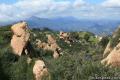
 | Calabasas Peak from Stunt Road This 3.6-mile hike on Calabasas Peak Motorway approaches Calabasas Peak from the south, ascending through sandstone formations to panoramic views of the Santa Monica Mountains and San Fernando Valley. |
 | Calabasas Peak from Old Topanga Canyon Road This 4.2-mile hike on Calabasas Peak Motorway approaches Calabasas Peak from the northeast, providing big views over Topanga and other parts of the Santa Monica Mountains. |
 | Calabasas Peak via Calabasas - Cold Creek Trail This 4.5-mile round trip hike starts up a scenic single track formerly know as the Secret Trail and ascends 750 feet to the summit of Calabasas Peak. |
 | Red Rock Canyon Park The trails in the beautifully sculpted Red Rock Canyon are 2.5 and 5.2 miles in length. |
 | Hondo Canyon This section of the Backbone Trail crosses fields of grains and forests of bays, climbing 1,550 feet over 3.8 miles to a small ocean view. Extend the hike to Topanga Lookout for an incredible perspective over the Santa Monica Mountains. |
 | Tuna Canyon Park This 1.6 to 5.1-mile hike offers spectacular ocean views from a less-visited park between Topanga and Malibu. |
 | More trails in the Santa Monica Mountains Explore other destinations in the range. |
 | Temescal Canyon This 2.6-mile loop offers a variety of scenery and decent exercise, despite its relative brevity. |
 | Ocean View Trail - Canyon View Trail Loop This 3.1-mile loop demands more effort than Zuma Canyon Trail and provides great ocean and canyon views. |
 | The Grotto This 3-mile out and back hike visits a remote grotto in the Santa Monica Mountains National Recreation Area. |
 | Westridge Trail to San Vicente Mountain This 7.4-mile hike travels a scenic ridge between a Brentwood neighborhood and a summit that was once used as a Nike Missile site. |
Common Questions about Saddle Peak in the Santa Monica Mountains
- Is the trail open?
- Yes. You should expect to find that Backbone Trail to Saddle Peak is open. There are no recent reports of trail closures. If you discover that the trail is closed, please help your fellow hikers by reporting a closure.
- Is this trail free to access?
- Yes, Backbone Trail to Saddle Peak is free to access. No entrance fee, pass, or permit is required. If you discover that access rules have changed, please provide feedback on your experience.
- How much time does this hike take?
- It takes approximately 1 hour 15 minutes to hike Backbone Trail to Saddle Peak. Individual hiking times vary. Add extra time for breaks and taking in the views.
- How long is this hike?
- The hike to Backbone Trail to Saddle Peak is a 2 mile out and back with 450 feet of elevation change.
- Are dogs allowed on this trail?
- No, dogs are likely not allowed on Backbone Trail to Saddle Peak. The trail is primarily open to hikers.
- Are there ocean views on this hike?
- Yes, Backbone Trail to Saddle Peak offers views of the ocean.
- Does this trail go to a summit?
- Yes, Backbone Trail to Saddle Peak reaches a summit with panoramic views.
- What mountain range is this trail in?
- Backbone Trail to Saddle Peak is located in the Santa Monica Mountains.
- Where is the trailhead located?
- The trailhead for Backbone Trail to Saddle Peak is located in Malibu, CA.
Trailhead Address:
Stunt Road & Schueren Road
Malibu, CA 90265
Trailhead Coordinates:
34.08082, -118.6472 - What are the driving directions to the start of the hike?
To get to the trailhead: From PCH, turn inland on Las Flores Road (across from Duke's Restaurant). Drive 3.4 miles up this narrow twisting canyon and turn right onto Rambla Pacifico Street. After 0.6 miles, make a sharp right onto Schueren Rd. and take that for 1.8 miles to the intersection with Stunt Road. Turn left and park along the side of the road. The trailhead for Topanga Lookout is across from the trailhead for Saddle Peak so there will be likely be a few vehicles parked here.
From the 101 Freeway, exit Las Virgenes Road and head south toward Malibu. After 2.8 miles turn left (east) on Mulholland Highway. Turn right on Stunt Road after 4 miles, and drive another 4 miles to the top of the road at the intersection with Schueren Road.
View custom Google Maps directions from your current location.
- Are there other trails near Backbone Trail to Saddle Peak?
- Yes, you can find other nearby hikes using the Hikespeak Hike Finder Map.

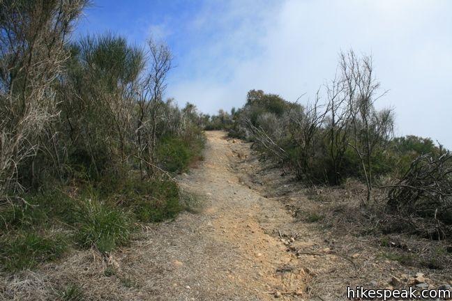
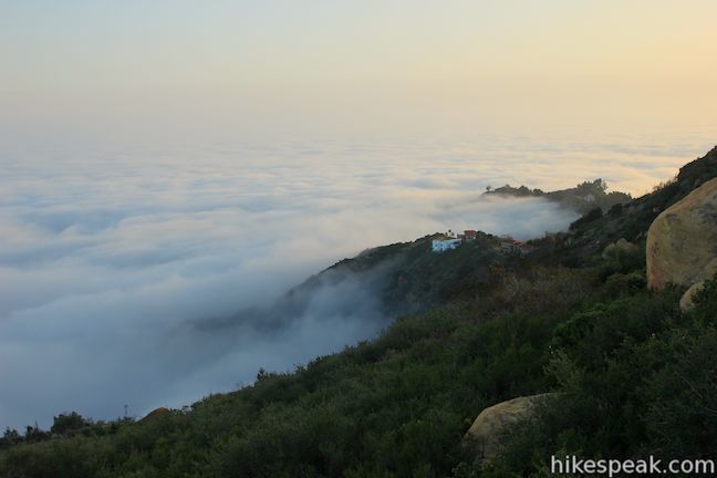
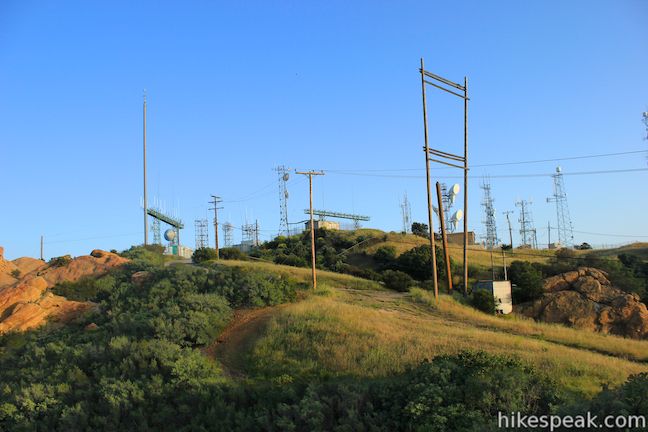
The eastern summit used to be part of Nike Missile Site LA78, it had an antenna tower similar to the one at San Vicente Mtn Park. There is nothing left now but a flat top mountain. Was up in the clouds Sunday 6/30, did not get the usual spectacular view of the bay and Catalina, perfect day for hike if a bit chilly.