Temescal Canyon Loop
in the Santa Monica Mountains
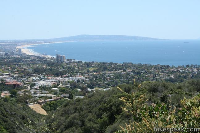
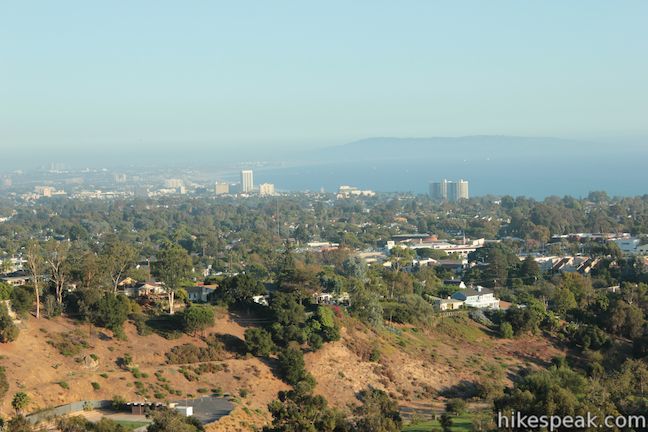
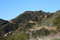
Temescal Canyon Loop offers a good workout along with ocean and canyon views. Temescal Gateway Park is situated just off Sunset Blvd in the Pacific Palisades, and this convenient urban location makes Temescal Canyon Loop a very popular hike. The basic dimensions of the loop is 2.6 miles with 860 feet of elevation gain, but the hike can be expanded to four miles or longer thanks to a variety of extensions. If the elevation seems too extreme, skip the Ridge Trail and enjoy a relaxing out-and-back along Canyon Trail instead, a level trail along the bottom of the canyon that makes up half of the loop.
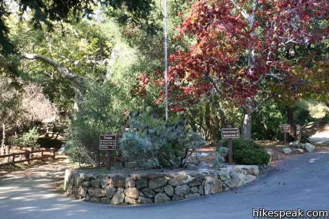
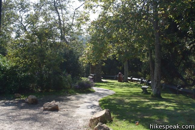
To reach the main trailhead: Cross the string of parking lots at the base of Temescal Gateway Park. Just past the bathrooms and general store, take the mulch road to the left following signs for Ridge Trail. After a few hundred feet, turn up the stars on the left next to the mileage sign for Ridge Trail and begin the loop.
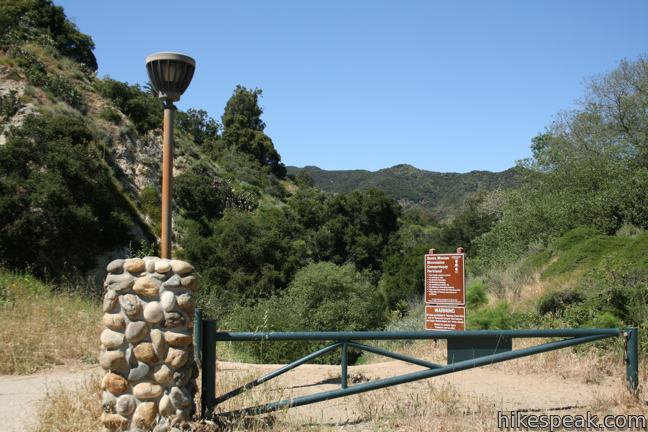
To avoid walking through so many parking lots: Head to the lot on the southwest end of Temescal Gateway Park along Sunset Boulevard. If you park along Sunset (for free) this lot is east to walk to. Behind a metal gate and a stone pillar, a wide dirt trail heads down to a metal flood control structure. A single track continues along the creek charting a course parallel to the park road to the base of Temescal Ridge Trail. This 0.4-mile trail adds a little more nature to the start of the hike.
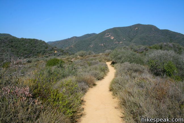
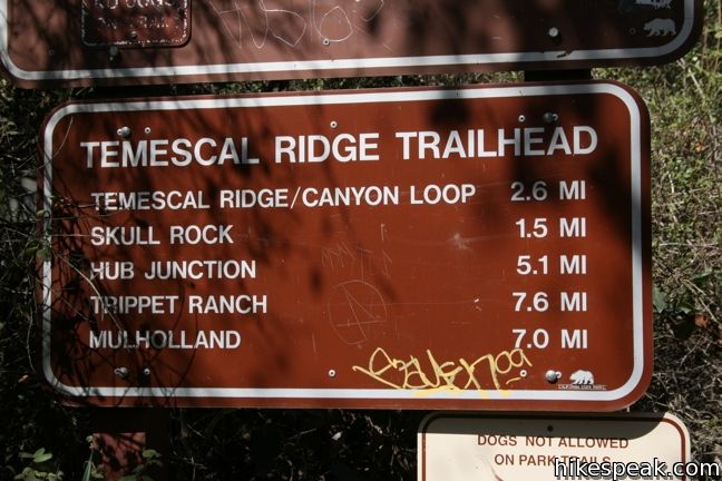
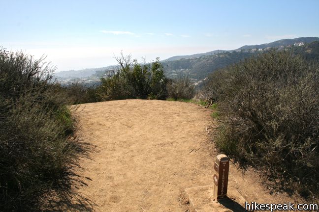
From the four-way junction between Temescal Ridge Trail and Temescal Canyon Trail, head up the ridge and begin the 860-foot climb. After less than a quarter mile, the trail enters Topanga State Park where dogs are prohibited.
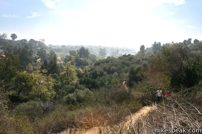
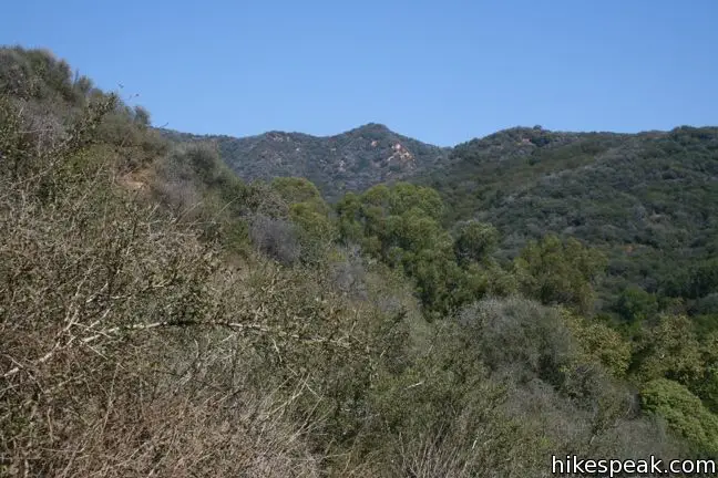
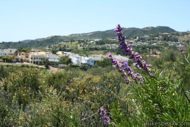
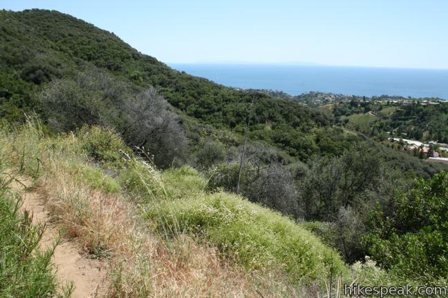
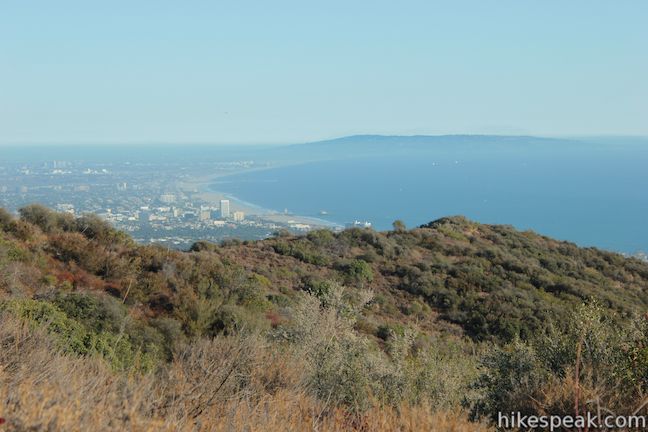
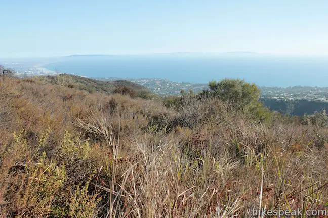
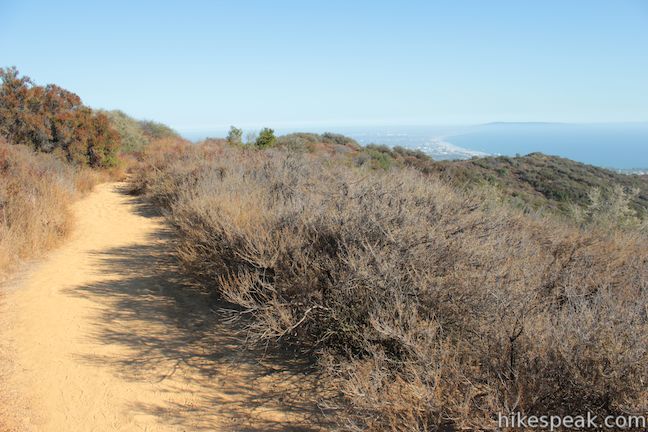
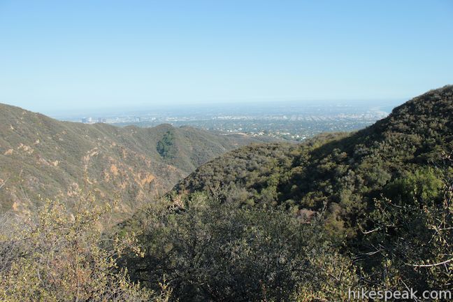
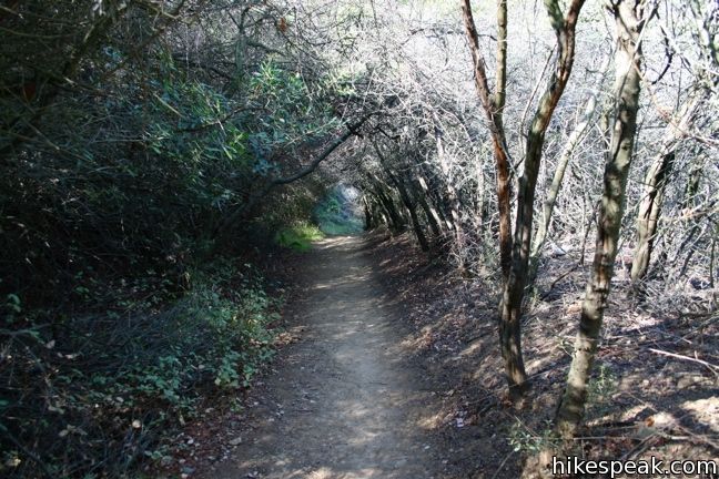
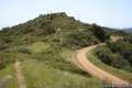
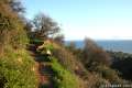
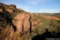
Chaparral arches over much of the trail, not eliminating the nice views of the Palisades and the Pacific Ocean beyond. The sustain climb leads to a junction with Leacock Trail after 0.8 miles. This is the first of two connection trails that can be used to access Temescal Ridge from Bienveneda Avenue. For those already on the ridge, these trails can be used to extend the hike by 2/3 of a mile, avoiding the last 100 feet of elevation gain and the crowds on Temescal Ridge.
To expand the loop: Turn left on Leacock Trail hiking west toward wide ocean views. Make a right with a meeting with a footpath traveling down a small ridge. Turn right again, 1/4 mile from Temescal Ridge Trail on to Bienveneda Trail, avoiding dropping down to the road itself. The next 3/4 of a mile of less-traveled single track brings you back up to Temescal Ridge Trail just a short distance from the junction with Temescal Canyon Trail.
To stick to the main loop: Hike another 0.4 miles up Temescal Ridge, climbing to greater heights before descending past the Bienveneda Trail junction down to the junction with Temescal Canyon Trail.
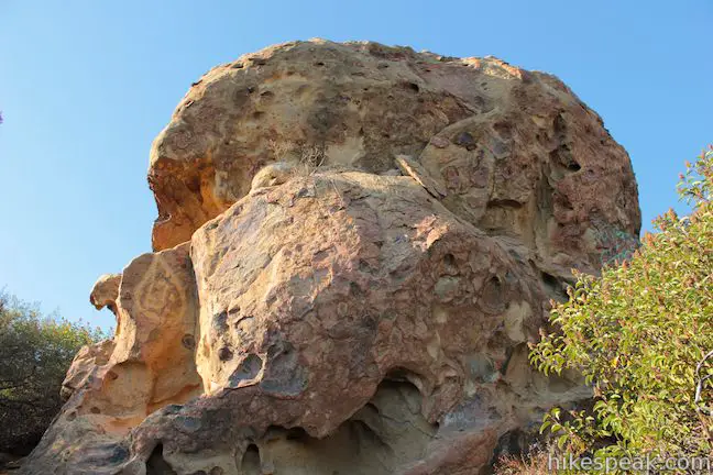
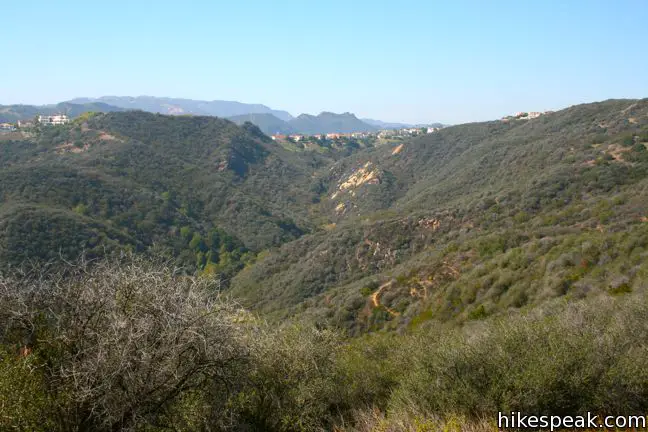
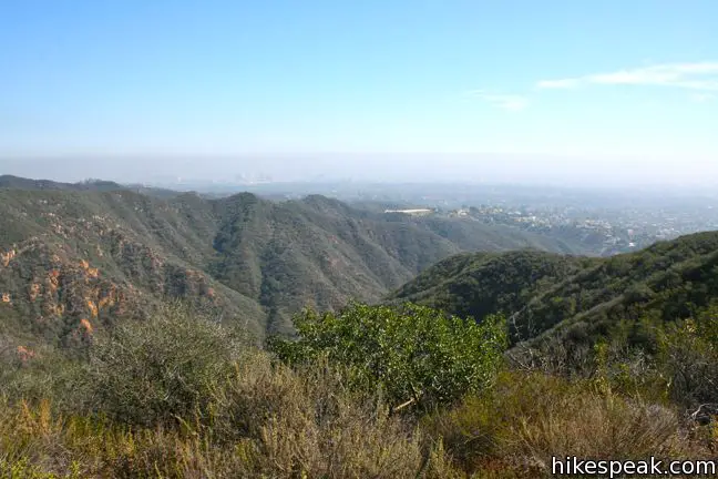
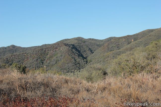
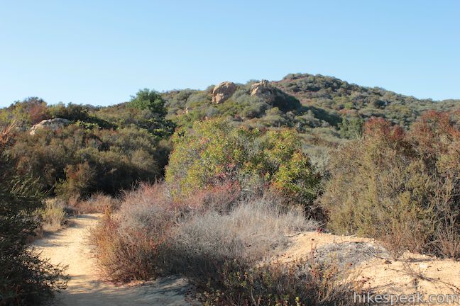
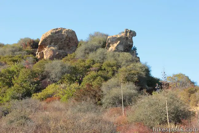
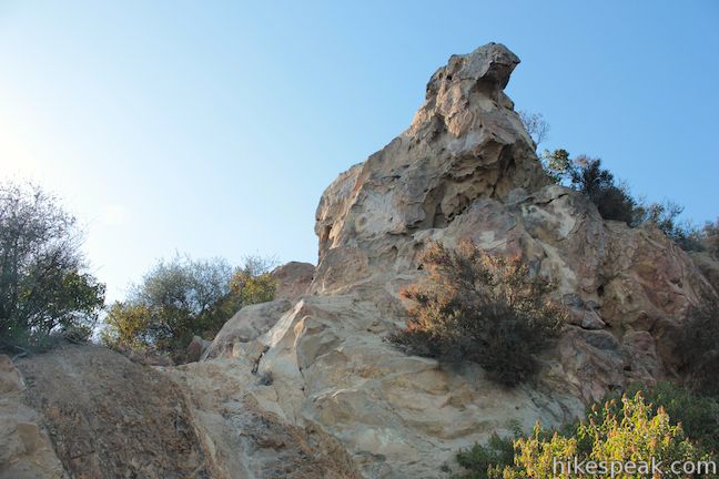
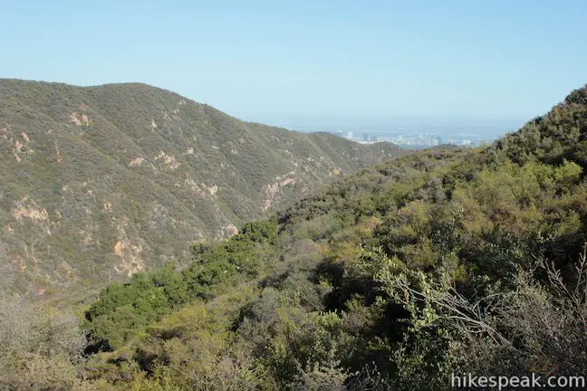
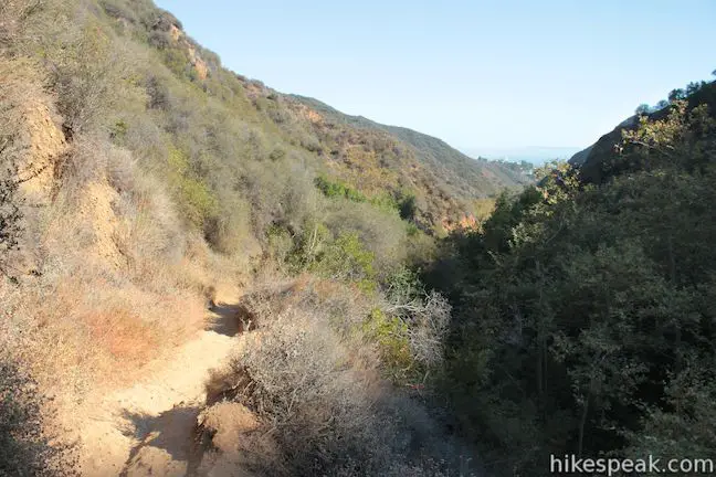
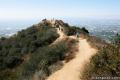
Temescal Ridge Trail extends to the left going deeper into the Santa Monica Mountains toward Temescal Peak. The ridge trail passes Skull Rock, a sandstone formation with cranial resemblance, 0.6 miles from the junction (with 250 feet of elevation gain). This outcropping provides sweeping views over Santa Monica Bay and is a fun side trail.
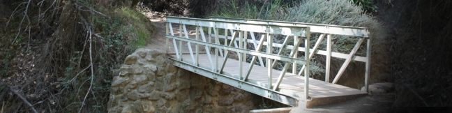
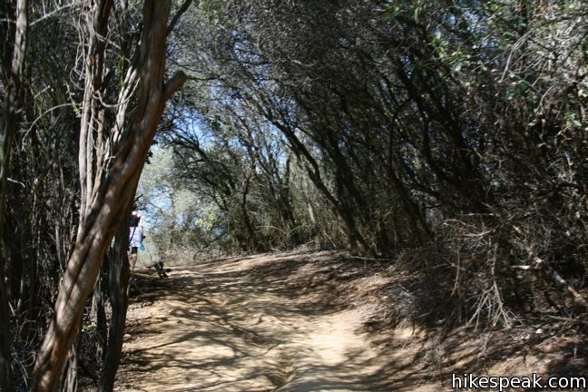
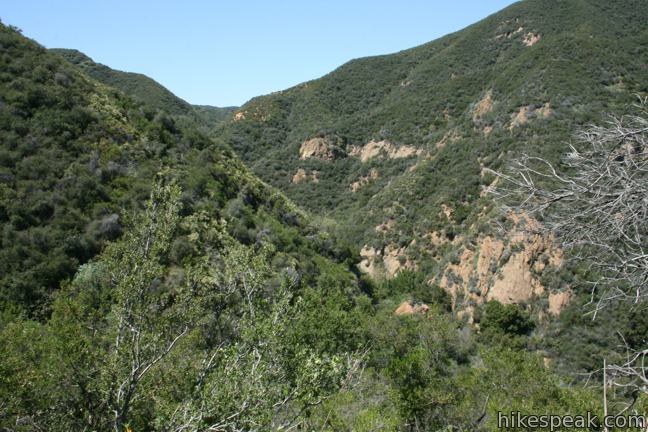
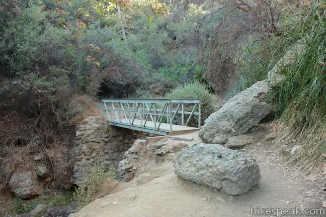
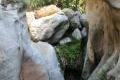
To continue on the loop, turn right and descend into Temescal Canyon. Temescal Canyon Trail drops through chaparral and heavier vegetation, reaching the canyon floor after 0.4 miles at a white footbridge. Cross the wooden bridge just downstream of a small seasonal cascade described on maps as a waterfall.
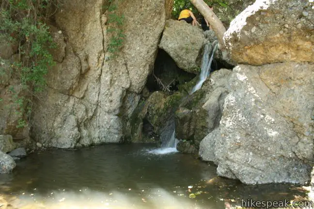
A larger cascade just below the bridge can be reached by venturing briefly off trail. This is worth checking out in the spring, but is not very impressive when the creek is dry.
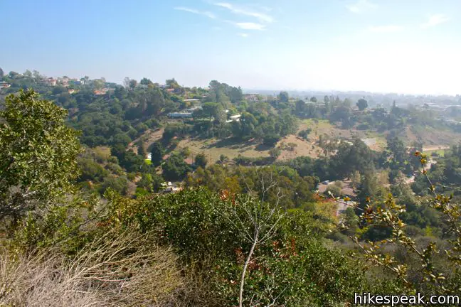
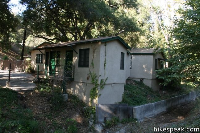
After another half mile of gradual descent, the trail tapers our, transforming into an easy stroll through pleasant groves. When the trail reaches an abandoned brick building at the top of the developed region of the canyon, you may continue down the wide road, or head to the right following the single track behind the cabins along the wall of the canyon. The wide trail to the left is less interesting, following the creek past several cabins on the way back to the parking lot. Near the bottom of this trail, you will pass Rivas Canyon Trail, which heads east over the ridge to Will Rogers State Historic Park.
The parallel single trail on the right side of the canyon aims back to the junction at the start of the loop. From here one can hike 0.4 miles down Temescal Canyon Trail to Sunset Boulevard, or get off at the start of the loop to head down toward the bathrooms and parking lots.
Options and distances:
- The basic loop – 2.6 miles
- The loop beginning from Temescal Canyon Trail at Sunset Boulevard – 3.4 miles
- The loop with the Bienveneda Trail extension – 3.25 miles
- The loop beginning from Temescal Canyon Trail at Sunset Boulevard with the Bienveneda Trail extension – 4.05 miles
- The loop with the Skull Rock Extension – 3.8 miles
- The loop beginning from Temescal Canyon Trail at Sunset Boulevard with the Skull Rock extension – 4.6 miles
- The loop beginning from Temescal Canyon Trail at Sunset Boulevard with the Bienveneda Trail extension and the Skull Rock extension – 5.25 miles
Of course, you could also hike farther up Temescal Ridge beyond Skull Rock or take Rivas Canyon Trail over to Will Rogers State Park, but that would create too many options to list.
Enjoy your hike in Temescal Gateway Park. Dogs are not welcome on Temescal Ridge Trail, only along the bottom of the canyon. Free parking can be found along Temescal Canyon Road and Sunset Blvd. Parking inside the park is $12 per vehicle (Price as of 2024). Those who park in the lot should exercise caution passing through the intersection with the camera that issues tickets to drivers who do not come to a full stop.
Directions to the Trailhead
- Temescal Gateway Park is located at the top of Temescal Canyon Road at an intersection with Sunset Blvd, one mile from PCH.
Trailhead Location
Trailhead address: Sunset Boulevard & Temescal Canyon Road, Pacific Palisades, CA 90272
Trailhead coordinates: 34.0502, -118.5291 (34° 03′ 00.7″N 118° 31′ 44.8″W)
View Santa Monica Mountains in a larger map
Or view a regional map of surrounding Los Angeles trails and campgrounds in a larger map.


 | Rivas Canyon This 2.1-mile (one way) trail crosses a lush secluded canyon connecting Temescal Gateway Park to Will Rogers State Park. |
 | Skull Rock This 1.5-mile hike descends Temescal Ridge to a head-shaped formation with great views over Santa Monica Bay. |
 | Temescal Peak This 5.8 to 7.6-mile hike ascends Temescal Ridge to a summit with sweeping views over Topanga State Park and the Santa Monica Mountains. |
 | Santa Ynez Falls This 2.5-mile follows a shaded creek to a gorge containing a short waterfall. |
 | Parker Mesa Overlook This steep out-and-back hike rewards the effort with excellent views of the Pacific Ocean. |
 | Los Liones Trail This hike visits a lust canyon with ocean views, a potential start of the hike to Parker Mesa Overlook. |
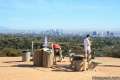 | Inspiration Point This easy 2.25-mile loop in Will Rogers State Historic Park leads to an overlook with views from Santa Monica Bay to downtown LA. |
 | Murphy Ranch This 3.85-mile loop descending from Sullivan Ridge Fire Road into Rustic Canyon, where hikers can visit abandoned buildings with unusual occupants. |
 | More trails in the Santa Monica Mountains Explore other destinations in the range. |
 | Runyon Canyon Tour Hollywood's most popular dog park on loops of various lengths, offering good exercise and views over Los Angeles. |
 | Red Rock Canyon The trails in the beautifully sculpted Red Rock Canyon are 2.5 and 5.2 miles in length. |
 | Calabasas Peak This 3.6-mile hike travels an easy-to-follow fire road, climbing 900 feet to panoramic views of the Santa Monica Mountains and San Fernando Valley. |
 | Zuma Canyon Ocean View - Canyon View Trails Loop This 3.1-mile loop demands more effort than Zuma Canyon Trail and provides great ocean and canyon views. |
 | Talepop Loop This 4.75-mile hike climbs 500 feet over a scenic mountain between Liberty Canyon and Las Virgenes Canyon on the north end of Malibu Creek State Park. |
Common Questions about Temescal Canyon Loop in the Santa Monica Mountains
- Is the trail open?
- Yes. You should expect to find that Temescal Canyon Loop is open. There are no recent reports of trail closures. If you discover that the trail is closed, please help your fellow hikers by reporting a closure.
- Do I need a permit for this hike?
- Yes. Park Entrance Fee.
- How much time does this hike take?
- It takes approximately 1 hour 30 minutes to hike Temescal Canyon Loop. Individual hiking times vary. Add extra time for breaks and taking in the views.
- How long is this hike?
- The hike to Temescal Canyon Loop is a 2.6 mile loop with 860 feet of elevation change.
- Are dogs allowed on this trail?
- No, dogs are likely not allowed on Temescal Canyon Loop. The trail is primarily open to hikers.
- Will I see a waterfall on this hike?
- Yes, Temescal Canyon Loop features a waterfall.
- Are there ocean views on this hike?
- Yes, Temescal Canyon Loop offers views of the ocean.
- What mountain range is this trail in?
- Temescal Canyon Loop is located in the Santa Monica Mountains.
- Where is the trailhead located?
- The trailhead for Temescal Canyon Loop is located in Pacific Palisades, CA.
Trailhead Address:
Temescal Canyon Road
Pacific Palisades, CA 90272
Trailhead Coordinates:
34.0502, -118.5291 - What are the driving directions to the start of the hike?
To get to the trailhead: Temescal Gateway Park is located at the top of Temescal Canyon Road at an intersection with Sunset Blvd, one mile from PCH.
View custom Google Maps directions from your current location.
- Are there other trails near Temescal Canyon Loop?
- Yes, you can find other nearby hikes using the Hikespeak Hike Finder Map.

17 Comments on Temescal Canyon Loop in the Santa Monica Mountains
What hikers are saying:
✨ Generated summary of user commentsHikers enjoy the beautiful canyon and ocean views found along this moderate loop, especially when the waterfall flows after a rain. Shannon appreciates the challenging incline that provides a solid workout for those seeking a climb. Be cautious when driving through the parking lot, as cameras strictly monitor stop signs and issue expensive tickets via mail. Dogs are restricted to the first half mile of the trail, so plan accordingly if bringing a pet.
“The Temescal Canyon Loop is a great moderate hike with beautiful views of the canyon and ocean.” Jump to comment ↓
[…] twice a week I’ve been hiking Temescal Canyon Trail in the Pacific Palisades. It’s a great hike. Just the right length with lots of great […]
am wondering if the park/ trail is open as of 05/09?
I want to get to your trail by bus. How far and steep is it from the busstop to your trailhead?
There are bus stops at the intersection of Sunset Boulevard & Temescal Canyon Road, just outside the park. You can start hiking here along the creek on Temescal Canyon Trail, which is pretty level for the first 0.4 miles leading to the start of the loop.
One of my favorite hikes in SoCal!!! I am an avid hiker and my best hike to date is just shy of 30 miles for a day hike. The incline is my favorite part about Temescal, many of my friends become winded just climbing up to the top. : )
[…] Temescal Canyon Gateway Park trail to Skull Rock is by far one of my favorite hikes in Los Angeles, which is why I am […]
are strollers allowed on the canyon loop trail @ temescal canyon?
What is the parking entrance fee?
Unless it’s gone up, the fee to park is $7. Roadside parking outside Temescal Gateway Park is free.
It said $10 today, but I parked on Sunset for free.
Which part of the area are dogs allowed and how far is that hike?
Dogs can go about half a mile up Temescal Canyon Trail. Take a look at the Temescal Gateway Park Trail Map to see where dogs are allowed.
I got a ticket for not stopping at the stop sign located in the parking lot. Watch out! There’s a camera. The ticket comes in the mail and is issued by the Park Rangers. Over $100.
Its easy to roll the stop cause you’re looking out for all the pedestrians walking on the road, they’ve got it set up perfectly, bet they make more on ticket-cam than parking fees
Damn!:(
Yes. I got a ticket too after hiking about a month ago and not aware. I stopped and then drove off so got a 100.00 ticket. Really never going there again. Plus no water in the waterfall – all dried out. I’ll stay on San Bernardino side where there is better hiking areas than that one, and with waterfalls.
The Temescal Canyon Loop is a great moderate hike with beautiful views of the canyon and ocean. It’s about 2.6 miles, so not too long, but with a decent incline. Parking can get tricky on weekends, so try to arrive early. Definitely worth it, especially after rain when the falls are flowing!