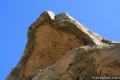
Skull Rock
in the Santa Monica Mountains
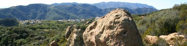
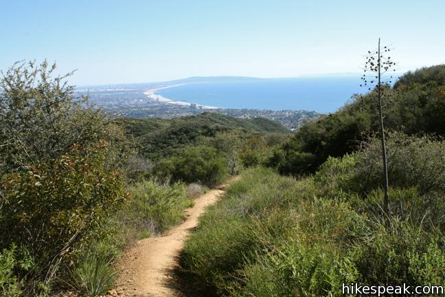
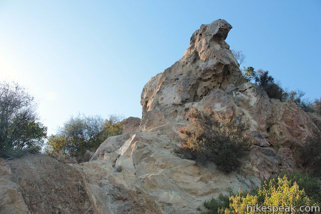
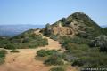
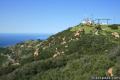
Skull Rock sits on the shoulders of Temescal Ridge north of Temescal Gateway Park, delivering broad views over Santa Monica Bay. The head-shaped sandstone formation can be reach as an extension of Temescal Canyon Loop, bringing the hike to 3.8 miles. Skull Rock can also be reached via trailheads farther up Temescal Ridge. The nearest trailhead, located in the Palisades Highlands, provides a scenic 1.5-mile hike with 275 feet of elevation gain.
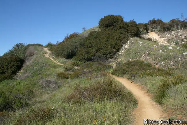
Skull Rock is perched an elevation of 1,400 feet and the trailhead is at approximately 1,550 feet, but this is not a gradual downhill hike because in the between, the trail rises to 1,675 feet. The hike climbs to the spine of Temescal Ridge from the west, before dropping down to Skull Rock.
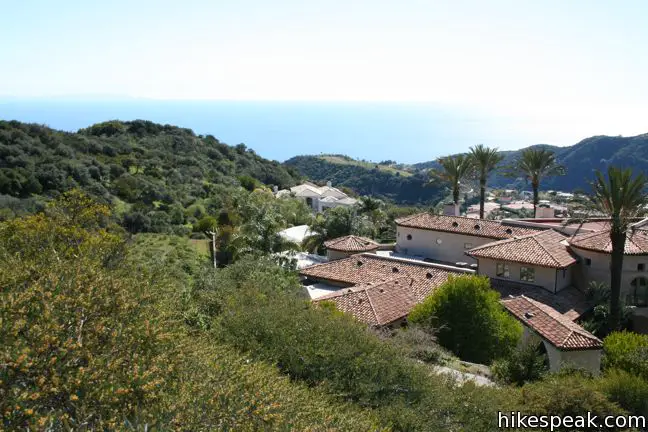
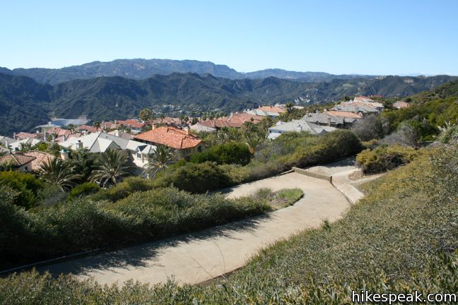
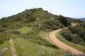
The makeup of the trail at the start is rather unique. A concrete road switches up a steep slope composed of numerous drainage ditches. As you leave the affluent development off Palisades Drive, views of the Pacific Ocean and surrounding mountains expand. After 0.2 miles, the concrete ends and there is dirt to tread on for the duration.
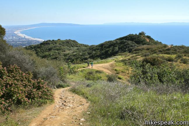
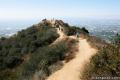
A quarter mile from the start, Palisades Highlands Access Trail reaches Temescal Ridge Trail. Turn right and proceed half a mile to Skull Rock. About halfway down the ridge, the trail swings to the right and descends to the destination. At the same time, a single track continues straight over a small rise, rejoining the trail on the other side.
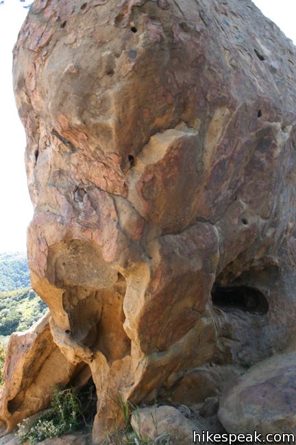
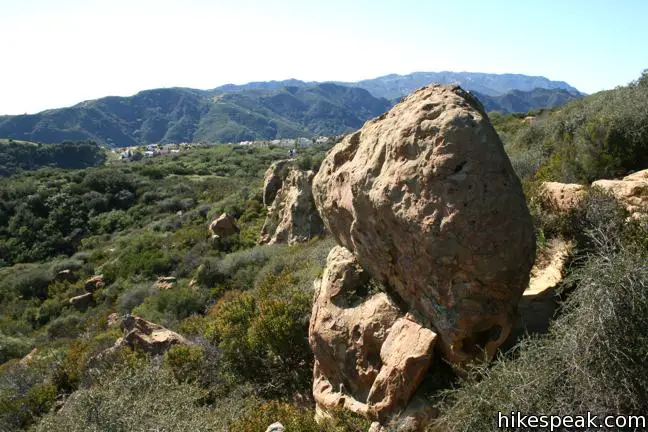
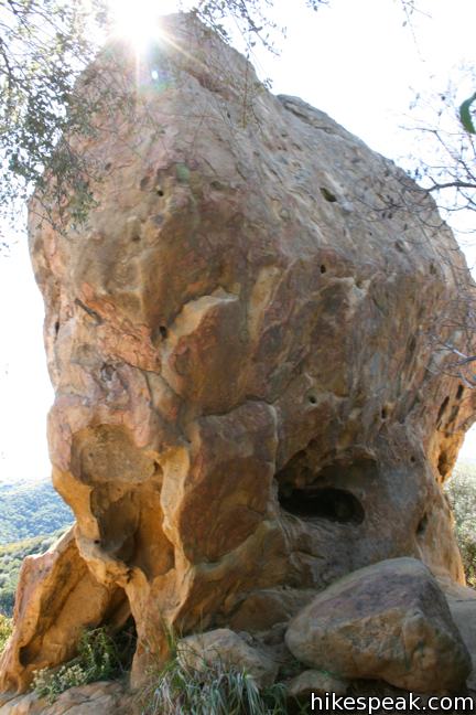
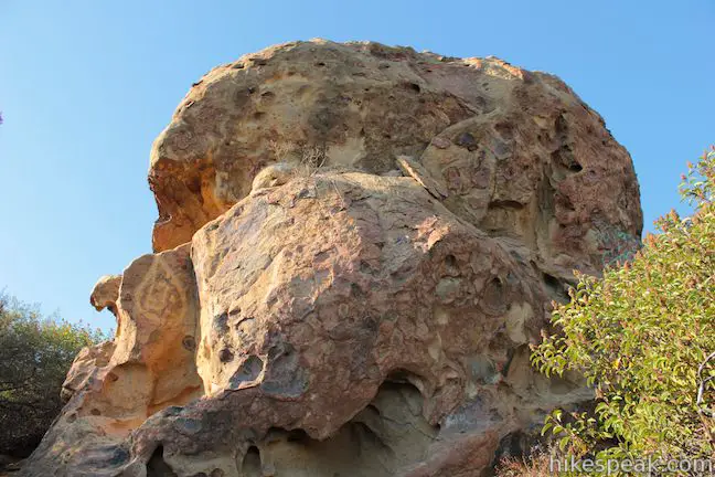
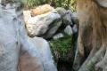
Skull Rock occupies a landing with great views down the ridge toward Santa Monica Bay. There are footpaths breaking off to the right toward the top of the outcropping. Make your way across the landing, or continue down the trail to see Skull Rock from below. Brief off-trail scrambling will bring you up to (and possibly inside) the unique sandstone formation. Nearby outcroppings are fun to explore as well.
Expansive ocean and canyon views make this a very charming short trek. Find a rock to sit on for a while, before hiking back up the ridge and down Palisades Highlands Access Trail for a 1.5-mile out and back hike.
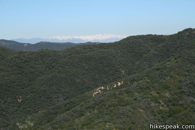
To extend the hike: Continue up Temescal Ridge Trail to Green Peak (0.85 miles farther), or Temescal Peak (2.65 miles farther), or even deeper into Topanga State Park to places like Eagle Rock. Skull Rock is most often visited from below as a side trip on Temescal Canyon Loop. Temescal Ridge Trail above Skull Rock sees far fewer visitors and provides surprisingly secluded hiking. Dogs are not allowed on this hike, and Mountain bikes are not allowed on Temescal Ridge below the Palisades Highlands Access Trail junction. No fee or permit is required to visit Skull Rock, so get out and enjoy!
Directions to the Trailhead
- From Sunset Boulevard, half a mile east of PCH, head north on Palisades Drive.
- After 3.3 miles, continue straight on Chastain Parkway for another half a mile.
- Turn right on Via Las Palmas, and drive two short blocks up to the trailhead parking on the left.
- The trail will be on the right.
Trailhead Location
Trailhead address: Via Las Palmas, Pacific Palisades, CA 90272
Trailhead coordinates: 34.07631, -118.5462 (34° 04′ 34.71″N 118° 32′ 46.3″W)
You may also view a regional map of surrounding Los Angeles trails and campgrounds.


 | Temescal Peak This 5.8 to 7.6-mile hike ascends Temescal Ridge to a summit with sweeping views over Topanga State Park and the Santa Monica Mountains. |
 | Temescal Canyon This 2.6-mile loop offers a variety of scenery and decent exercise, despite its relative brevity. |
 | Rivas Canyon This 2.1-mile (one way) trail crosses a lush secluded canyon connecting Temescal Gateway Park to Will Rogers State Park. |
 | Santa Ynez Falls This 2.5-mile follows a shaded creek to a gorge containing a short waterfall. |
 | Eagle Rock from Santa Ynez Canyon This 7.4-mile hike takes the long route from a canyon in the Pacific Palisades up to the panoramic sandstone summit. |
 | Parker Mesa Overlook This steep out-and-back hike rewards the effort with excellent views of the Pacific Ocean. |
 | Los Liones Trail This hike visits a lust canyon with ocean views, a potential start of the hike to Parker Mesa Overlook. |
 | More trails in the Santa Monica Mountains Explore other destinations in the range. |
 | Topanga Lookout This 2-mile visits the site of an old fire tower that still offers great views of the surrounding mountains. |
 | Saddle Peak from the Backbone Trail This 2-mile hike approaches Saddle Peak from the east. |
 | Runyon Canyon Tour Hollywood's most popular dog park on loops of various lengths, offering good exercise and views over Los Angeles. |
 | Lizard's Mouth in Santa Barbara This half-mile hike visits a unique rock formation with amazing views over Santa Barbara and the Pacific. |
Common Questions about Skull Rock in the Santa Monica Mountains
- Is the trail open?
- Yes. You should expect to find that Palisades Highlands to Skull Rock is open. There are no recent reports of trail closures. If you discover that the trail is closed, please help your fellow hikers by reporting a closure.
- Is this trail free to access?
- Yes, Palisades Highlands to Skull Rock is free to access. No entrance fee, pass, or permit is required. If you discover that access rules have changed, please provide feedback on your experience.
- How much time does this hike take?
- It takes approximately 45 minutes to hike Palisades Highlands to Skull Rock. Individual hiking times vary. Add extra time for breaks and taking in the views.
- How long is this hike?
- The hike to Palisades Highlands to Skull Rock is a 1.5 mile out and back with 275 feet of elevation change.
- Are dogs allowed on this trail?
- No, dogs are likely not allowed on Palisades Highlands to Skull Rock. The trail is primarily open to hikers.
- Is Palisades Highlands to Skull Rock good for kids?
- Yes, this hike is likely suitable for children. It is relatively short (1.5 miles) with manageable elevation gain.
- Are there ocean views on this hike?
- Yes, Palisades Highlands to Skull Rock offers views of the ocean.
- What mountain range is this trail in?
- Palisades Highlands to Skull Rock is located in the Santa Monica Mountains.
- Where is the trailhead located?
- The trailhead for Palisades Highlands to Skull Rock is located in Pacific Palisades, CA.
Trailhead Address:
Via Las Palmas
Pacific Palisades, CA 90272
Trailhead Coordinates:
34.07631, -118.5462 - What are the driving directions to the start of the hike?
To get to the trailhead: From Sunset Boulevard, half a mile east of PCH, head north on Palisades Drive. After 3.3 miles, continue straight on Chastain Parkway for another half a mile. Turn right on Via Las Palmas, and drive two short blocks up to the trailhead parking on the left. The trail will be on the right.
View custom Google Maps directions from your current location.
- Are there other trails near Palisades Highlands to Skull Rock?
- Yes, you can find other nearby hikes using the Hikespeak Hike Finder Map.

I visited skull rock this past weekend (2/14/15) and came across two rather large honeycombs filled with bees. We came across them when we hit camel rock and eagle rock and turned left to wade through brush to get to skull rock. One was about halfway to skull rock, on our right hand side, affixed to the large boulder. The other was on our right hand side, when facing and scaling skull rock. They were avoidable, but worth mentioning so anyone with allergies stick to the mail trails. Also, we came across a rattle snake on this path, so please be mindful and do not bring your dogs!
Good tips thank you!
I visited Skull Rock as a teenager with my friends in the 1970’s…a lifetime ago. The cave is inviting with beautiful views of the Pacific Ocean!!