Fish Canyon Falls
in the San Gabriel Mountains
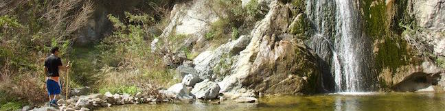
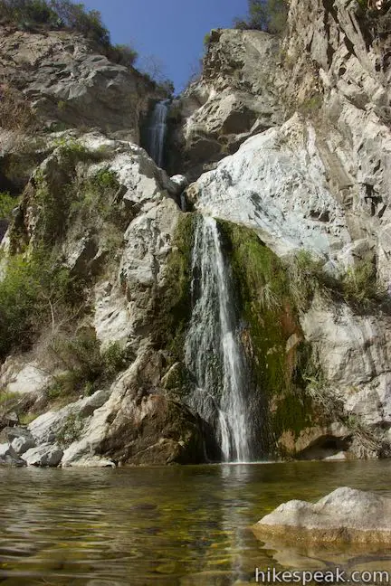
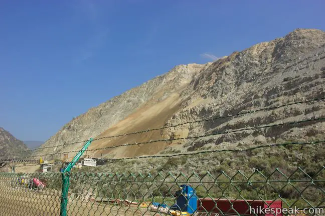
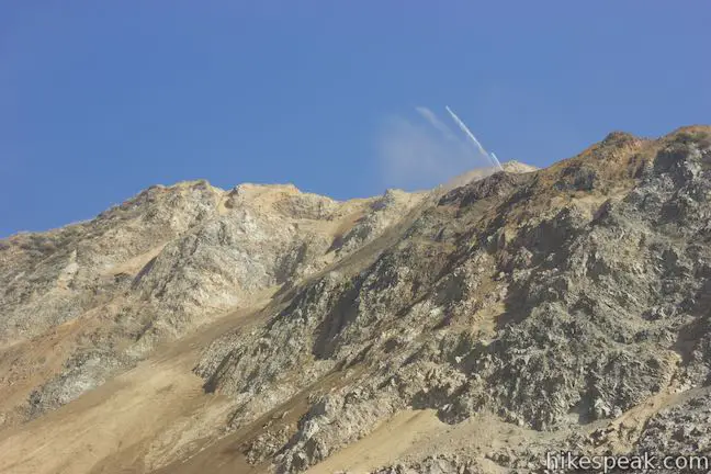
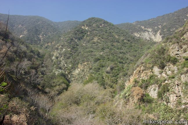
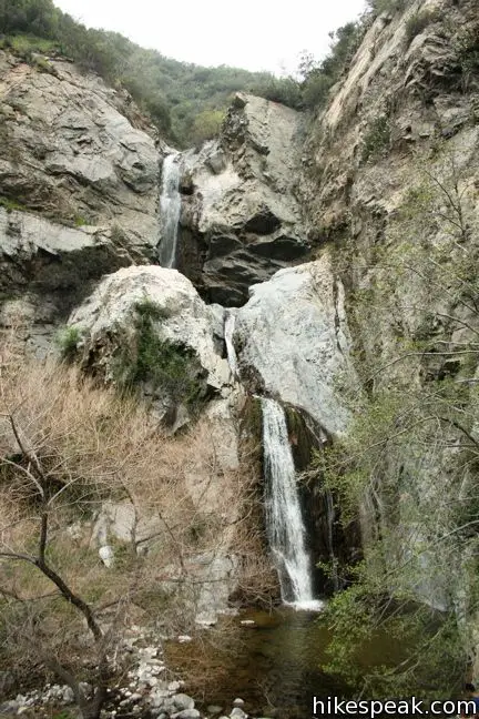
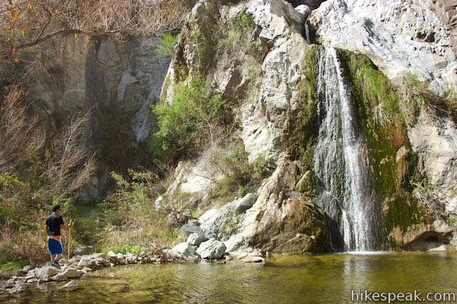
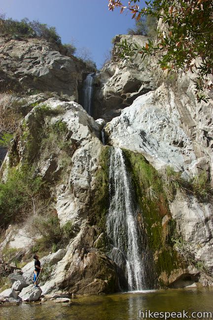
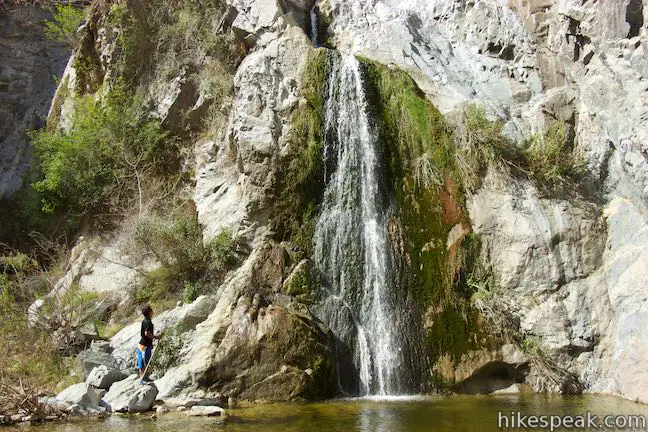
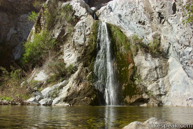
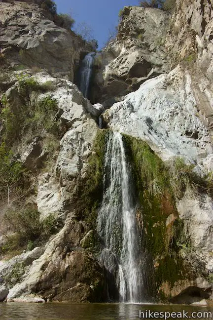
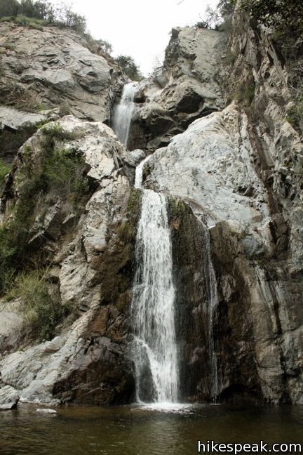
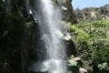
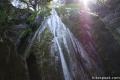
Fish Canyon Falls is beautiful three-tiered waterfall that drops over eighty feet in a canyon in the front range of the San Gabriel Mountains near Azusa. Early spring is the perfect time to visit the dynamic waterfall, when the water flows well and the canyon is green. A rock quarry occupies the bottom of Fish Canyon and for many years Fish Canyon Falls Trail could only be reached by shuttle on special access days. The trail is now open seven days a week for all to enjoy. To accomplish this, an access trail passes through the rock quarry up to Fish Canyon Falls Trail. The total distance for the hike to Fish Canyon Falls is 4.8 miles round trip with 650 feet of elevation change. Despite the unusual beginning, Fish Canyon Falls Trail is an excellent hike in the San Gabriel Mountains, leading to one of the range’s most beautiful waterfalls.
Notice: Fish Canyon Trail passes through the Fish Fire Closure Area. As of 2018, Fish Canyon Trail remains closed. Check the Azusa Rock Quarry – Fish Canyon Falls Trail Access webpage for current information. You may also wish to visit another waterfall hike around Los Angeles.
Fish Canyon Access Trail
Those who hiked Fish Canyon Falls Trail when the trailhead could only be reached by shuttle will find 0.7 miles of new trail at the start of the hike.
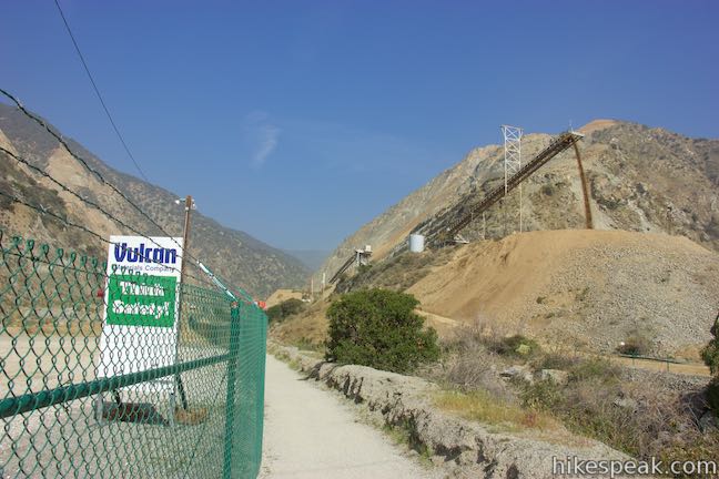
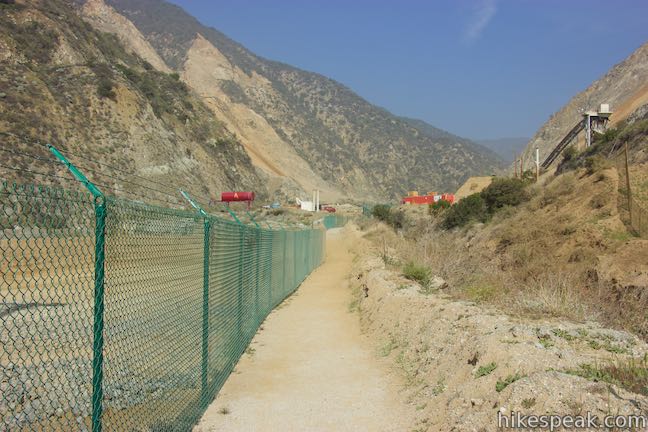
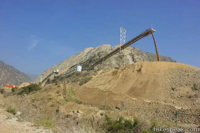
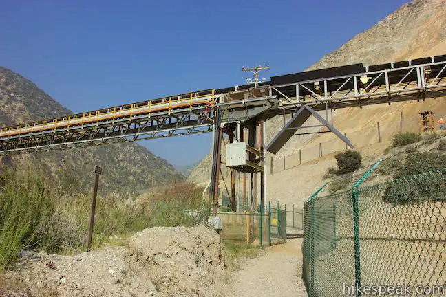
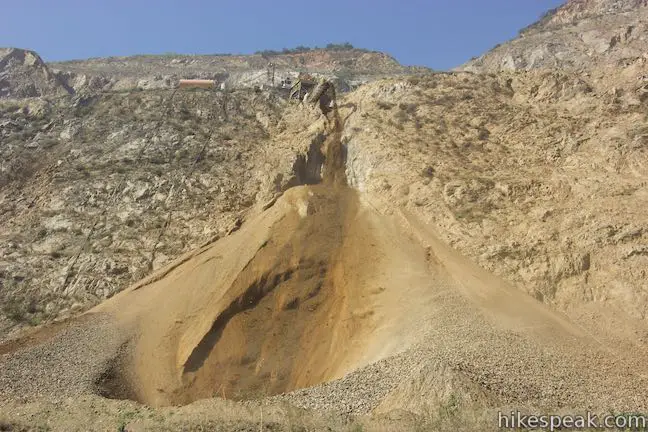
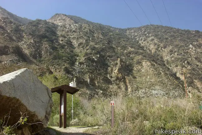
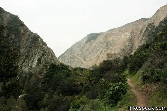
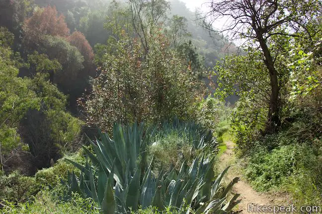
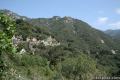
Set out from a parking area near the bottom of the quarry and take the Fish Canyon Access Trail up through the active mining area. The wide dirt trail is bordered by high fences to keep you on course. Get a good look at the machinery chewing up the mountainsides as you go. While this is definitely not the scenery that you would choose for the start of a hike, it is pretty impressive to watch the Azusa Rock Quarry in action.
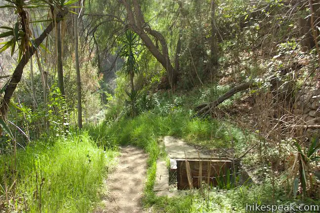
At 0.35 miles from the start, walk under a long conveyor belt with rocks passing overhead. The rocks from this quarry are of a high quality and used for construction. At the half mile point, the trail passes a kiosk, narrows to a singe track, and drops into some brush along Fish Canyon Creek. The quarry is basically behind you now as the trail slips through a restoration area along Fish Creek.
Fish Canyon Falls Trail
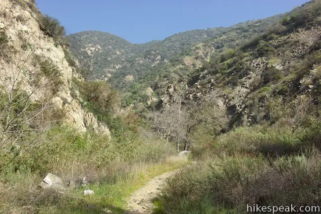
At 0.7 miles from the start, you will reach another trail kiosk at the site of the former trailhead and the boundary of San Gabriel Mountains National Monument (Angeles National Forest). Pass through the fence and cross a metal bridge over Fish Canyon Creek to enter the beautiful part of the canyon and continue onto the real trail.
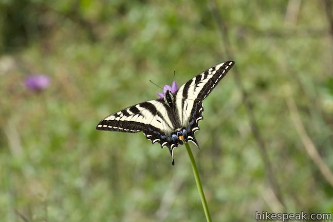
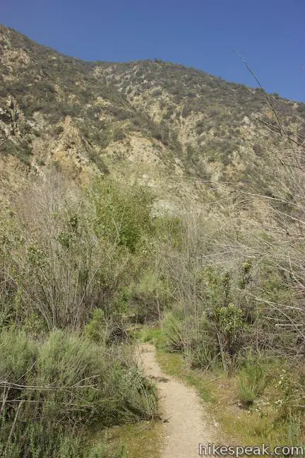
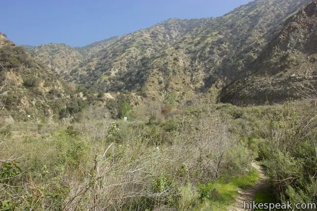
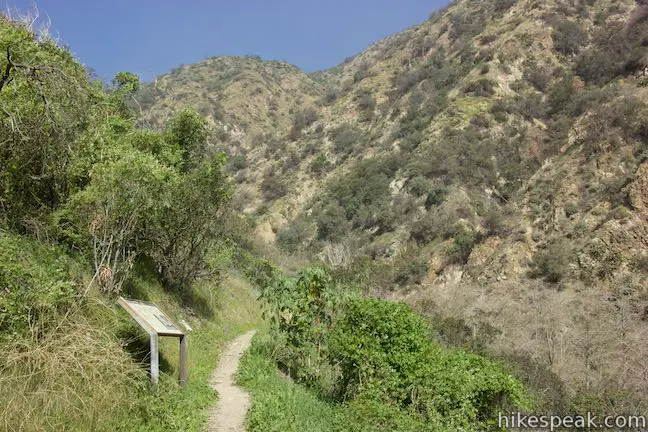
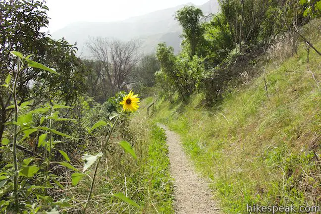
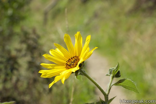
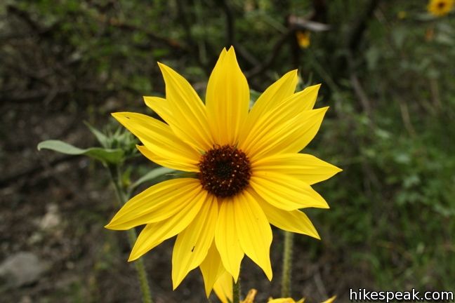
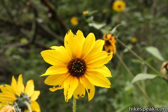
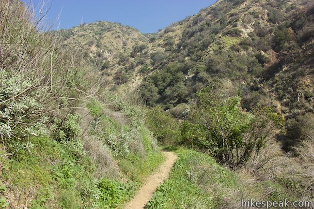
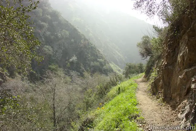
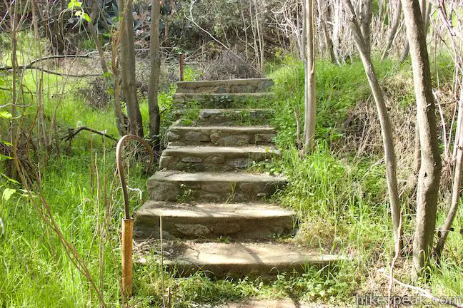
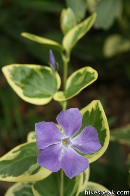
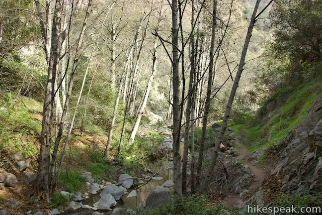
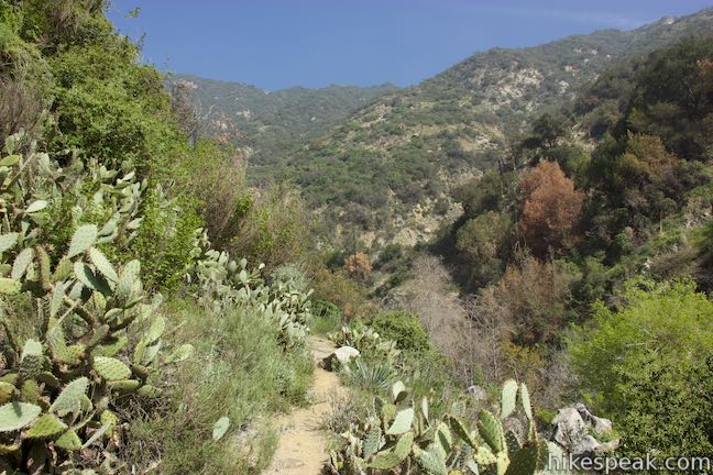
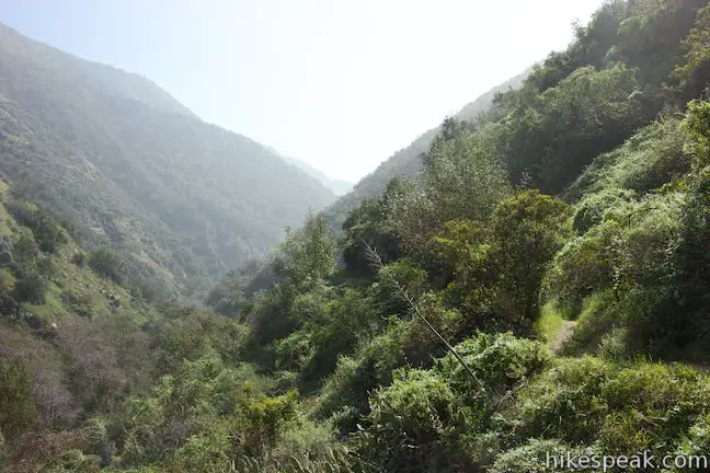
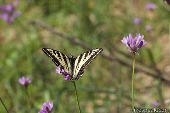
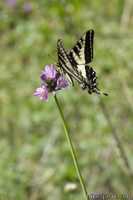
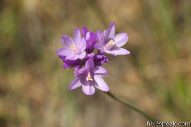
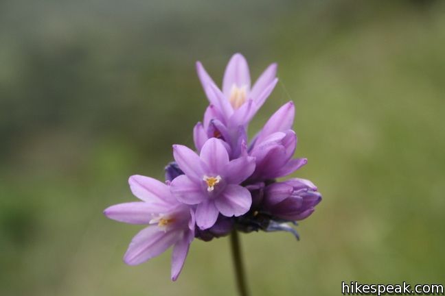
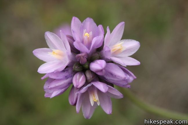
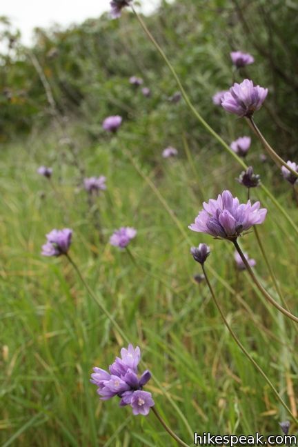
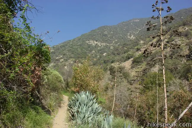
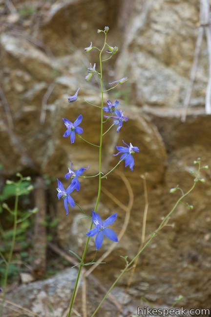
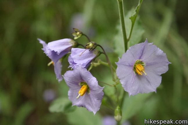
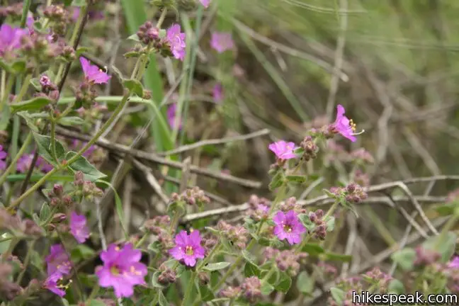
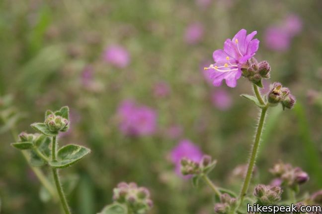
Fish Canyon Falls Trail wraps around a bend and leaves the sound of the quarry behind. Walk right along the creek for a short stretch before the trail climbs to the left up a few short switchbacks to come to the first of several panels along the trail with information about Fish Canyon (a tenth of a mile from Fish Canyon Falls Bridge). As the trail progresses along the side of the canyon, you will pass patches of beaming wildflowers in the springtime, like sunflowers, wishbone bush, blue dicks, and larkspur.
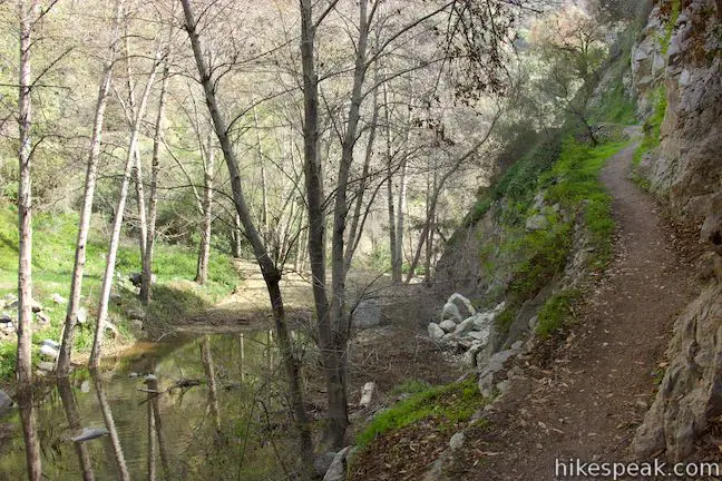
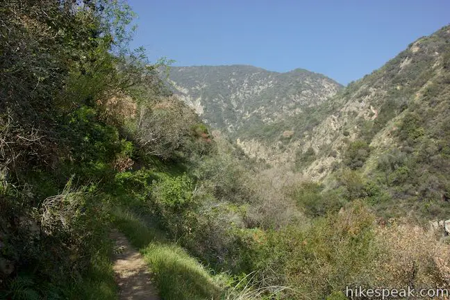
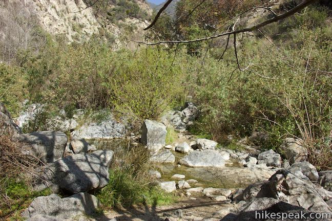
On the right side of the trail, you’ll find steep drops down to Fish Canyon Creek. Hike carefully as the trail makes its way back toward the floor of the canyon. A reflective pool of water has built up in one section of the creek behind a landslide caused by heavy rains in December of 2014.
At 0.3 miles from the start of Fish Canyon Falls Trail (and 1 mile from the start of the hike), pass through the ruins of several cabins that were built along the creek. A panel here explains how Fish Canyon once hosted a lot more than hikers:
At one time there were over 100 cabins in Fish Canyon. Many had permanent occupants, while others were sanctuaries for city dwellers. In October 1958, a devastating fire destroyed many of the cabins. The following winter, floods wiped out many more. By 1971, there were only a few cabins left in Fish Canyon. Remnants of some of the cabins are still visible today.
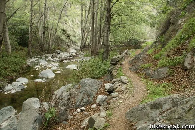
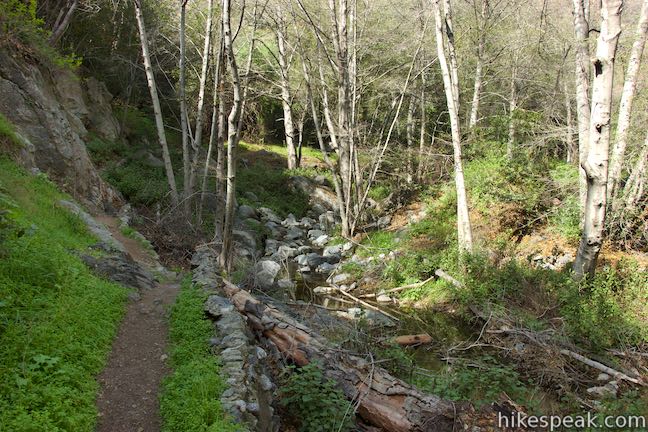
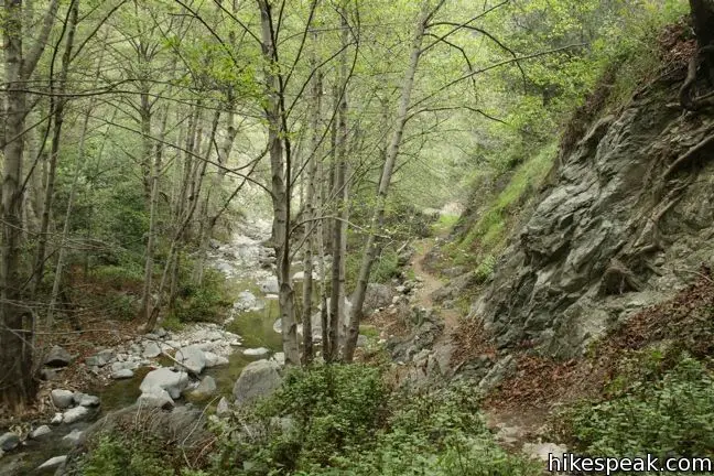
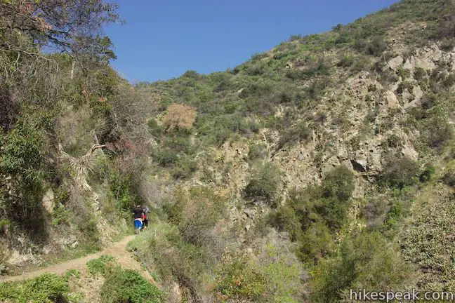
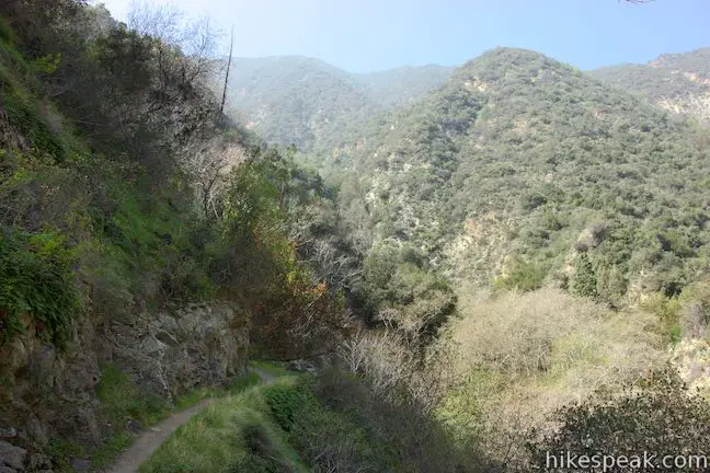
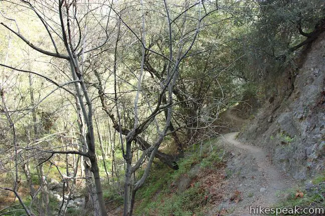
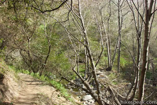
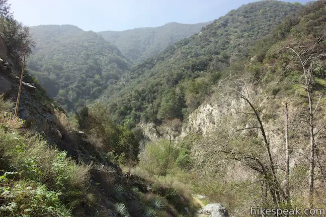
Continue up the trail through beautiful scenery along Fish Canyon Creek. Boulders in the creek create small rapids and pools while sycamores, bays, and alders providing relaxing shade. Enjoy soothing scenes as the trail weaves up the canyon.
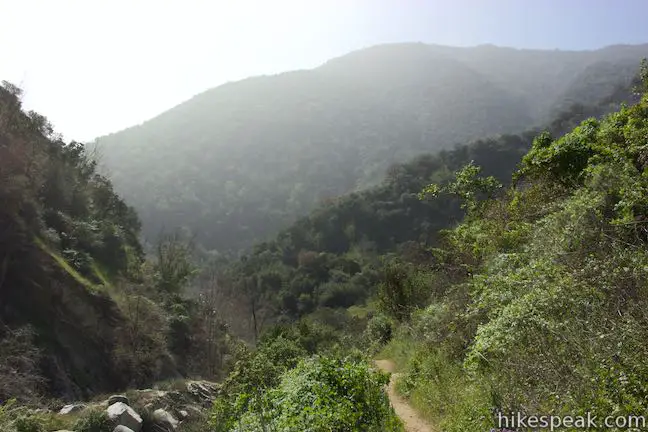
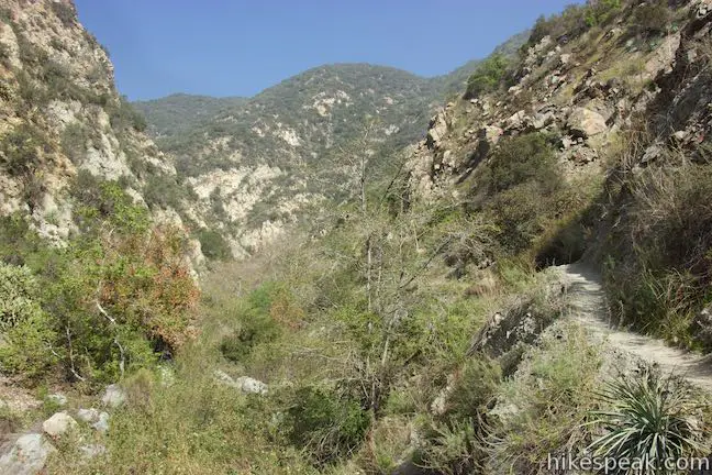
At 0.7 miles from the start of Fish Canyon Falls Trail (and 1.4 miles from the trailhead), a sharp switchback to the left takes the trail higher above the canyon floor. Your legs might get a little tired over this stretch of the trail, but it leads to nice views up and down Fish Canyon.
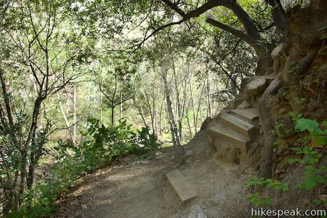
After another half mile, the trail heads downhill and uses a unique flight of wooden steps to pass through a bay laurel and come down closer to Fish Canyon Creek. Enjoy a shaded stroll down by the creek before the final ascent to the waterfall.
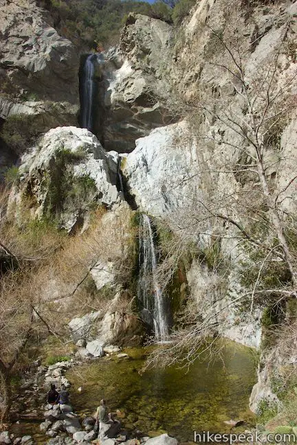
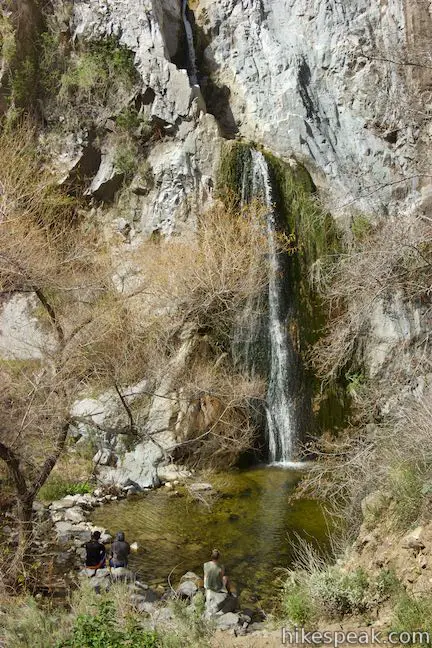
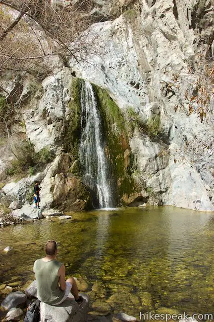
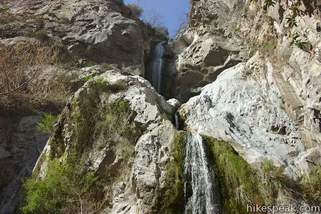
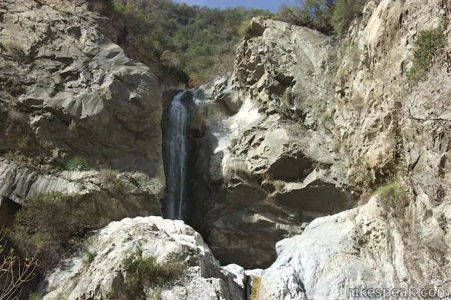
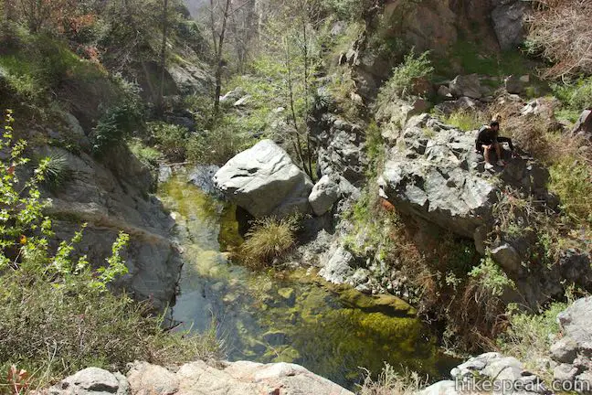
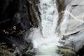
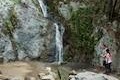
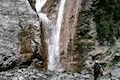
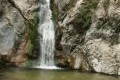
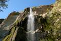
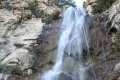
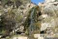
With 0.35 miles to go, the trail crosses Fish Canyon Creek and switches to the east side of the canyon to approach Fish Canyon Falls. The waterfall is quite a sight! Water springs from the lip of the canyon into an upper pool, slides down a short drop, and tumbles down the third and longest tier. At the base of the falls, you’ll find a decent sized pool and plenty of room to stretch out and enjoy a snack.
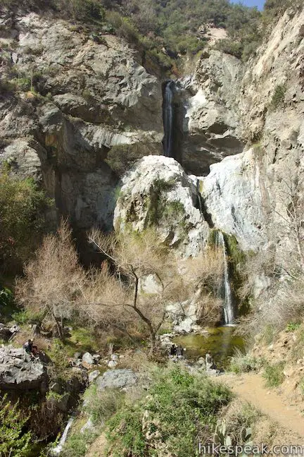
The small elevated pool beneath the upper falls is not accessible to hikers, but could make for an adventurous climb for those with proper gear. Below the larg pool at the base of the third tier, there is actually another short waterfall as the creek takes one last leap before flowing down the canyon. The main three tiers are said to be 80 feet tall, although the total distance from the top of the falls to the base may be closer to 130 feet.
Fish Canyon Falls Trail ends at the waterfall, so return the way you came for a 4.8-mile round trip hike with 650 feet of elevation change.
Fish Canyon Trail remains closed due to the Fish Fire Closure Area. When not affected by the closure, Fish Canyon Falls is accessible seven days a week. Fish Canyon Access Trail is open from 7 a.m. to 7 p.m. from April to September and 7 a.m. to 5 p.m. from October to March. Bikes are not allowed. Dogs are allowed on leashes on Saturdays and Sundays. There is poison oak along the trail, so long pants are recommended. It is particularly important to stay on trail and not trespass while hiking to Fish Canyon Falls. No fee or permit is required to hike to Fish Canyon Falls, so get out and enjoy!
Directions to the Trailhead
- Make your way to the intersection of the 210 and 605 freeways in Azusa (east of Pasadena).
- Exit to Huntington Drive and head east.
- After a few blocks, make a left on Encanto Parkway.
- The quarry is about one mile up the road (which becomes Fish Canyon Road).
- Inside the rock quarry, bear right at a split to reach a large parking area at the trailhead.
Trailhead Location
Trailhead address: 3901 Fish Canyon Road, Azusa, CA 91702
Trailhead coordinates: 34.15676, -117.92368 (34° 09′ 24.33″N 117° 55′ 25.24″W)
View San Gabriel Mountains in a larger map
Or view a regional map of surrounding Los Angeles trails and campgrounds.


 | Azusa Peak (and Glendora Peak) via Garcia Trail This 2 2/3-mile or 4 2/3-mile hike ascends Garcia Trail to "the A" and one or two picturesque summits along Glendora Ridge Motorway. |
 | Smith Mountain This 7-mile hike ascends 1,800 feet to a 5,111 foot summit with panoramic views over the San Gabriel Mountains. |
 | Bridge to Nowhere This adventurous 10-mile round trip hike reaches an abandoned and out-of-place bridge with a unique history. |
 | Sturtevant Falls This 3.3-mile hike visits a 60-foot waterfall and a lush cottage-lined canyon. |
 | Hermit Falls This 2.5-mile heads down canyon away from Sturtevant Falls toward a 30-foot waterfall. The lush canyon and the babbling creek are quite calming. |
 | Santa Anita Canyon Loop This 9.5-mile loop visits two peaceful creeks in sylvan canyons, passing a 60-foot waterfall and plenty of beautiful wilderness. |
 | Mount Baldy Loop This 11.3-mile hike incorporates the Devil's Backbone and the Baldy Bowl - Ski Hut Trail into one see-all loop. |
 | More trails in the San Gabriel Mountains Explore other destinations in the range. |
 | Monrovia Falls This 1.6-mile to 3-mile hike in Monrovia Canyon Park follows an enchanting canyon up to the base of the 30-foot waterfall. |
 | San Antonio Falls This 1.4-mile hike visits a multi-tier waterfall along the trail to Mount Baldy. |
 | Eaton Canyon Falls This 3.5-mile hike goes up Eaton Wash to a narrow stretch of Eaton Canyon containing a pleasant 40-foot waterfall. |
 | Trail Canyon Falls This 4-mile hike ascends a mountain-framed canyon to a 30-foot beauty on the east side of the San Gabriel Mountains. |
 | Escondido Falls This 3.8-mile out and back hike visits a 200-foot waterfall that is split into two tiers. The upper tier is 150 feet tall and stunning after a rainstorm. |
 | Rose Valley Falls in the Los Padres National Forest This 1-mile round trip trail leads to the lower tier of a lovely two-tier 300-foot waterfall. |
 | Tangerine Falls in Los Padres National Forest This 2.5-mile hike visits a beautiful waterfall on the edge of Santa Barbara. |
 | More waterfalls around Los Angeles Explore other waterfalls in the Santa Monica and San Gabriel Mountains. |
- Fish Canyon Falls on en.wikipedia.org (opens in a new tab)
- Fish Canyon Falls on Dan's Hikes (opens in a new tab)
- Fish Canyon Falls on socalhiker.net (opens in a new tab)
- Fish Canyon Falls on californiathroughmylens.com (opens in a new tab)
- Fish Canyon Falls on modernhiker.com (opens in a new tab)
- Fish Canyon Falls on greeneadventures.com (opens in a new tab)
- Fish Canyon Falls on world-of-waterfalls.com (opens in a new tab)
- A San Gabriel Valley Tribute article on Fish Canyon Access Trail (opens in a new tab)
- The Azusa Rock Quarry webpage for the Fish Canyon Access Trail (opens in a new tab)
- The official website of the Angeles National Forest (opens in a new tab)
- The official website for San Gabriel Mountains National Monument (opens in a new tab)
Common Questions about Fish Canyon Falls in the San Gabriel Mountains
- Is the trail open?
- Alert: Fish Canyon Falls Trail is currently marked as Closed. Please check official websites for current status.
- Do I need a permit for this hike?
- Yes. It's free, but access is restricted.
- How much time does this hike take?
- It takes approximately 2 hours 30 minutes to hike Fish Canyon Falls Trail. Individual hiking times vary. Add extra time for breaks and taking in the views.
- How long is this hike?
- The hike to Fish Canyon Falls Trail is a 4.8 mile out and back with 650 feet of elevation change.
- Are dogs allowed on this trail?
- Yes, dogs are allowed on Fish Canyon Falls Trail. The trail is open to hikers, dogs (on weekends).
- Will I see a waterfall on this hike?
- Yes, Fish Canyon Falls Trail features a waterfall.
- Are there ruins on this trail?
- Yes, you can encounter ruins on Fish Canyon Falls Trail.
- Is this a good hike for wildflowers?
- Yes, Fish Canyon Falls Trail is known for its seasonal wildflower displays.
- What mountain range is this trail in?
- Fish Canyon Falls Trail is located in the San Gabriel Mountains.
- Where is the trailhead located?
- The trailhead for Fish Canyon Falls Trail is located in Azusa, CA.
Trailhead Address:
3901 Fish Canyon Road
Azusa, CA 91702
Trailhead Coordinates:
34.15676, -117.92368 - What are the driving directions to the start of the hike?
To get to the trailhead: Make your way to the intersection of the 210 and 605 freeways in Azusa (east of Pasadena). Exit to Huntington Drive and head east. After a few blocks, make a left on Encanto Parkway. The quarry is about one mile up the road (which becomes Fish Canyon Road). Inside the rock quarry, bear right at a split to reach a large parking area at the trailhead.
View custom Google Maps directions from your current location.
- Are there other trails near Fish Canyon Falls Trail?
- Yes, you can find other nearby hikes using the Hikespeak Hike Finder Map.

45 Comments on Fish Canyon Falls in the San Gabriel Mountains
What hikers are saying:
✨ Generated summary of user commentsHikers appreciate this trail for its lush wildflower displays and beautiful waterfalls, though the falls may run dry during the summer and autumn months. Because the path features narrow switchbacks and steep, unstable drops, it is best suited for sure-footed adults rather than small children. Visitors should wear long pants to protect against significant growth of poison oak along the route. Note that there are no restroom facilities at the trailhead, and no parking permits are required for access.
Tjis is a great hike! who’s coming on Saturday?
FISH CANYON FALLS SAN GABRIEL MOUNTAINS
Fish Canyon Falls is one fun trail. Now, is a good time to be up there. It is such a beautiful waterfall today.
Will we be allowed to enter the water?
Yes. There is a pool below the waterfall and the creek below is open. Enjoy the hike!
To Whom It May Concern,
Just wonder how often the shuttle runs, from when to when ?
Thanks !
Agnes
The shuttle will be running tomorrow and drives back and forth uninterrupted throughout the day for hikers.
this is a very dangerous hike you have to be well experienced. i stopped right when i got to a really steep, wide trail after a chain fence.
BE AWARE: The shuttle only runs on SATURDAYS.
Otherwise, you’ll have to hike a rigorous 4.5 miles from the parking lot just before the quarry to the falls. According to the copies of the trail map with directions conveniently available for hikers at the start of the trail, the hike is broken up into four stages.
STAGE ONE: Trailhead parking lot to top of Diamond Head (1.1 miles, 860′ elevation gain, 30-40 mins).
STAGE TWO: Diamond Head to Angeles National Forest boundary (0.8 miles, 520′ elevation gain, 25-35 mins).
STAGE THREE: Angeles National Forest boundary to the main Fish Canyon Trail (1.1 miles, 1,100′ elevation loss, 30-40 mins).
STAGE FOUR: Fish Canyon Trail to Fish Canyon Falls (1.5 miles, 400′ elevation gain, 40-50 mins).
We had to bail out early as we did not expect any of this, but the trail looked like a great hike and fun time.
I’m one of those types who when told something is strenous and possibly dangerous I just have to prove something. I’m an intermediate hiker – really don’t know what would qualify that but I’m just guessing. That hike kicked my %}^*#!! And I got all the way to a dried up waterfall, not even a trinkle and the creek was dry.
But I did it!! Where’s my envy me shirt? Now let’s hope that all that poison oak I brushed will get me.. The trail is not maintained.. Not dangerous if you be careful, but is STEEP – beautiful panoramic views of SGV.
Does anyone know if the trail will be open soon? Or if there is a work around for the whole vulcan thing
it’s open despite going up there on a saturday morning at 7:30am may seem to be closed as there were just 1 other car at the new big empty parking lot (i’ve heard the shuttle and the other path of this hike is closed? not sure). the walk to the actual trail from the ‘new’ parking lot is about 0.5 miles and then the fun starts. as someone pointed, trail isn’t maintained which is what i personally liked about this hike. and there are definitely some steep part of this trail that is not well suited for some, but again i find it refreshing when all my other hikes are more plain and level. the water fall is dried up at this time of year of course, but the best part is the trail itself as there are part of path that makes you want to go to the amazon. for the waterfall itself, i’d suggest go during fall/winter/spring.
Are Wednesdays open for hiking to the falls.? Thanks for any info.—Alice
The trail has been closed. This is the message on the Vulcan website (This company should have no hand in control of the access point). > Fish Canyon Access Trail is temporarily closed due to a recent rock slide on a portion of the Angeles National Forest’s Fish Canyon Falls trail. The Los Angeles County Fire Department and the Angeles National Forest Service have advised that the trail access and the trail remain closed until the trail can be evaluated by Angeles National Forest Service.”
I looked at the ANF website and nothing is listed in their alerts. It is the hiking public that maintains these trails and will clear the obstacle much quicker than the forest service which is pretty much worthless.
We had a beautiful morning hike all the way to the falls today. The walk past the quarry is not too bad, and once you enter the forest area, you are transported to some excellent pristine scenic views. We saw a fair number of other hikers, but not an overwhelming crowd. The falls were robust, and the tiered pools below them magnificent. Highly recommend!
Great Pics of this hike would love to visit it some time but there is one problem- that stupid eyesore rock quarry at the begining of the hike other than that a nice lush wildflower filled area
Do you need any sort of parking day permit for this location or a explore California pass ?
No pass or permit is needed.
great photos! Accurate mention of “steep drops” and narrow switchbacks. Elevation change was a bit challenging for a few new hikers. Beautiful waterfalls.
Recommend mentioning there are NO bathroom facilities for hikers to use at the trailhead or on the trail. Only nearby bathrooms are on Encanto near the Duarte Historical Museum.
Memorial Day weekend hike was great. There is water in the creek and falls and wildflowers everywhere. Wear pants as it seems that this is where the most poison ivy/oak is I’ve seen in the area.
My friend and I hiked during the summertime. The waterfall was dry, but we still had a wonderfully peaceful/relaxing time hanging out in the pool at the base of the waterfall The hike itself was really enjoyable!
We hiked it this afternoon. Unfortunately, the waterfall and the pool below the fall were completely dry. We enjoyed the hike. Just have to come back after some rain next time.
Great hike, but the stretches of trail next to the steep drops are narrow & unstable enough that I would not recommend bringing small children along.
You’ll be rewarded with lovely views of Nature on this trail. Was nice in late-December. Agreed, the trail is narrow in many places with steep drops nearly all along the way. Best for alert, sure-footed hikers. Be careful with your small children. And avoid the poison oak.
can you get in during the week. I work on the weekends most of the time ?
Hikers can access the trail seven days a week. Fish Canyon Access Trail is open from 7 a.m. to 7 p.m. from April to September and 7 a.m. to 5 p.m. from October to March. Hikers can only bring dogs on weekends though.
Hi is fish canyon access trail open this coming weekend? Is there also a shuttle running?
Thank you
There’s a sign posted saying that Fish Canyon Trail is closed until September 7th, 2017
Just a heads up, tried this hike a few weeks ago 3/25/17 and there was a sign posted saying the trail will be closed until September 2017.
Anyone know if it’s been reopened?
As of feb 19, 2018, the sign says fish canyon falls trail closed due to the fish fire.
We spoke to a security guy next to the entrance and he said this hike was closed permanently due to lack of funds to restore the hike after fire/flood damage. Bummed since there were so many positive aspects to look forward to!
This article says trail open – however, went by today and Fish Canyon is CLOSED at the quarry gate. There was another trail before the horse stable that was open. Don’t know if they connect. Sketchy people hanging around (not hikers or nature people) so I left. Can person(s) who wrote article confirm trail status??
The trail is currently closed, because of the Fish Fire Closure Area with no scheduled date for the trail to re-open.
I’m missing this trail, any update on when will the trail be open?
June 2019. Trail closed
Such a bummer. Was looking forward to hiking this one.
Has anyone tried to go since June is it sill closed??
I guess we have to face the fact that this trail will never be open again. Vulcan Materials is secretly mining for gold back there and they don’t want to be bothered on land they don’t own. This has been going on for years now. The Complex Fire happened almost four years ago and “still” the trail hasn’t be rebuilt? I talked to two guards at the locked gate and they told me that not one soul has been working on it. Sad that another public right of way has been stolen away from hikers.
As March 4, trail is still closed.
You can get around the Vulcan plant to enter the fish canyon but it’s a steep ass climb you enter way before the Vulcan plant there is a trailhead that leads around a longer way check it out on Google Earth you can see the trail where it connects
Any way you can drop the lat/long for where the trail connects? I am familiar with the Van Tassel trail head, but don’t see on google maps how to circumnavigate the mine. appreciated!
I second that. Does it trail begin on the east or west side of the Vulcan plant?
It’s September 2022. Is it still closed?