Azusa Peak and Glendora Peak
in the San Gabriel Mountains
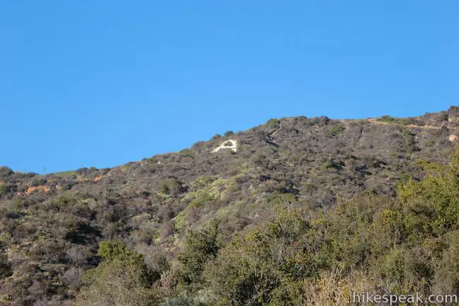
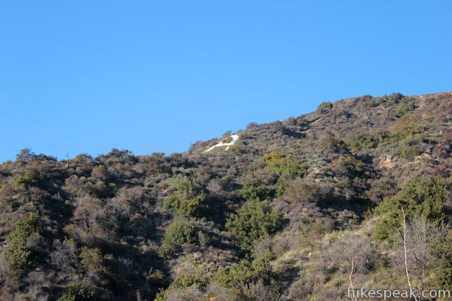
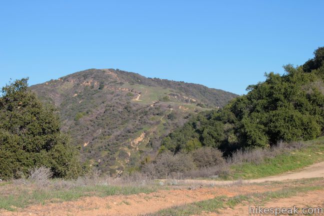
In Griffith Park, Mount Lee has the Hollywood Sign. In the San Gabriel Mountains, Azusa Peak has the A. The big white uppercase A just below the summit is hard to miss from the city below. You can hike to the A and up to the top of Azusa Peak on a 2 2/3-mile out and back hike with 1,275 feet of elevation change. After the steep climb, you have the option to hike to a second peak, Glendora Peak, expanding the trek to 4 2/3 miles round trip with 1,800 feet of elevation change.
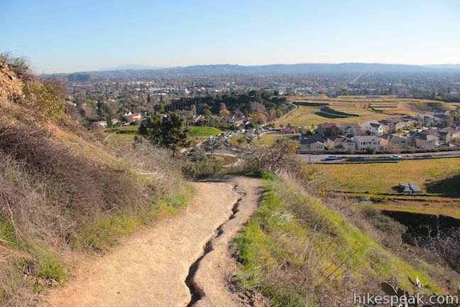
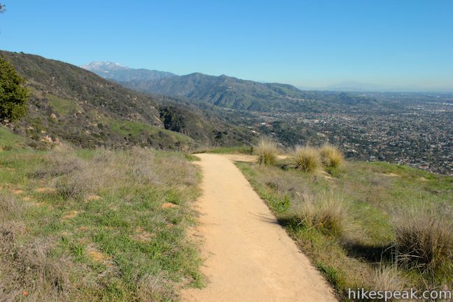
To get to Azusa Peak, you’ll hike up Garcia Trail to an junction with Glendora Ridge Motorway just west of the summit. Start up Garcia Trail alongside a fire station at the base of Azusa Peak. With 1,100 feet of elevation gain to tackle in 1.18 miles, Garcia Trail is steep from the start and the grade rarely lets up.
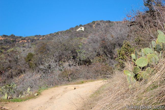
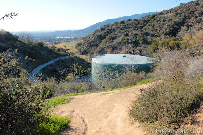
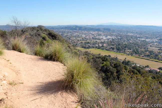
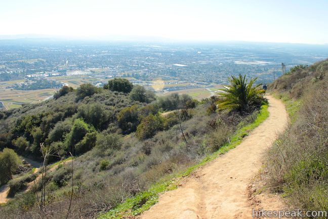
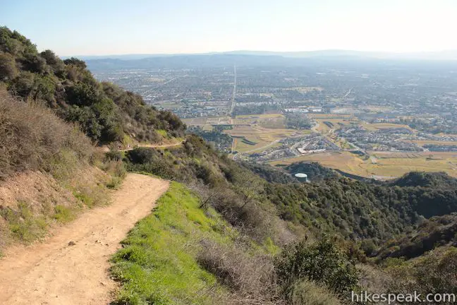
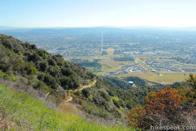
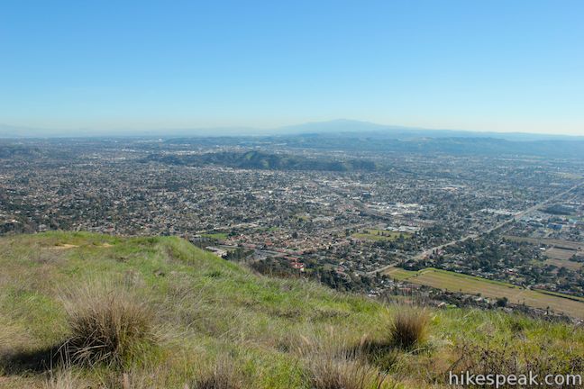
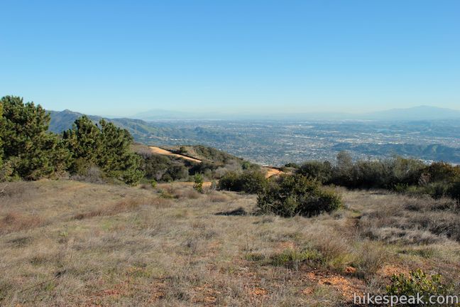
As Garcia Trail passes a holding tank on the left, a quarter mile from the start, get a good view up the mountain toward the A. The trail edges to the east, offering expanding views over Glendora and across the San Gabriel Valley toward the Santa Ana Mountains to the south. A few shade-providing oaks grace the sides of the trail, but you will be mostly exposed to the sun during your conquest of Azusa Peak.
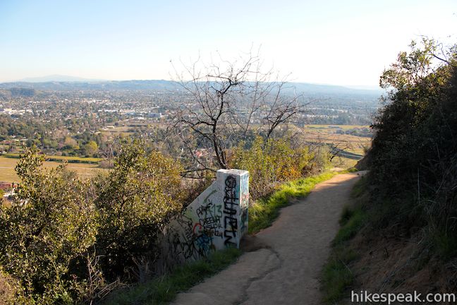
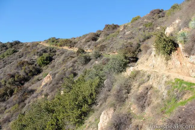
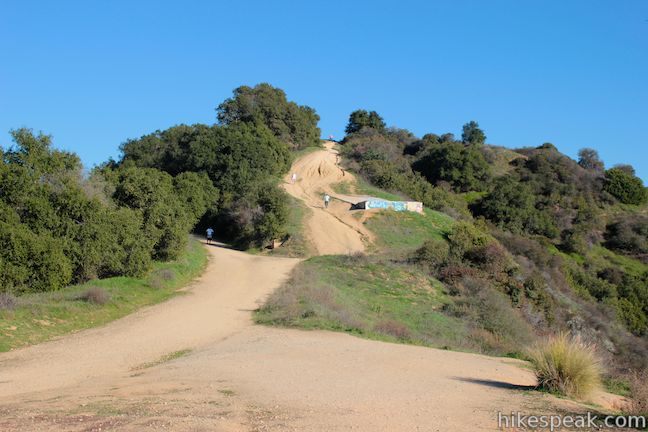
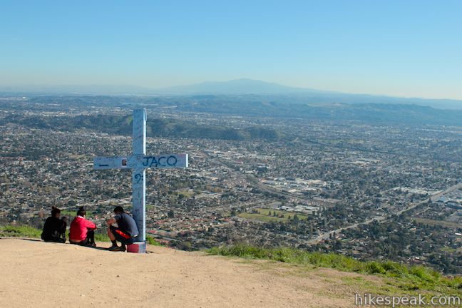
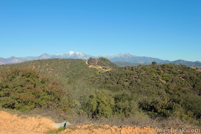
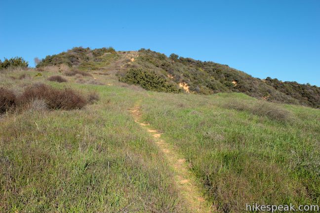
At the 3/4-mile mark, Garcia Trail launches into a string of steady switchbacks that feel a little less steep than the trail below. At the top of these switches, Garcia Trail curves into a draw in the mountainside west of the summit where you will come even with the A. The large white letter lies on the ridge just to the west. Beyond the A is a view west toward downtown Los Angeles.
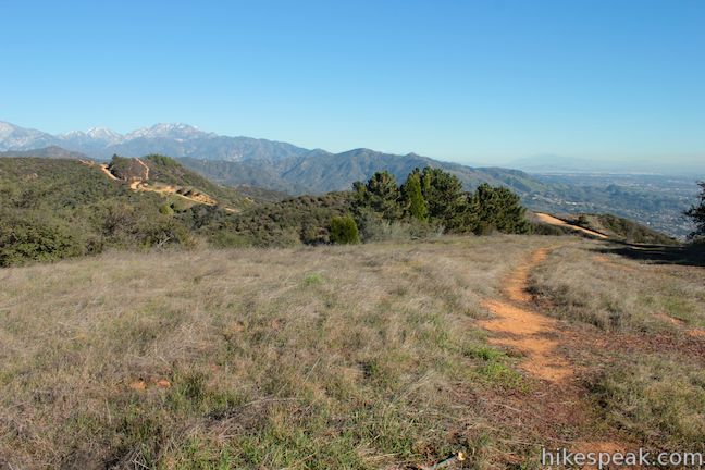
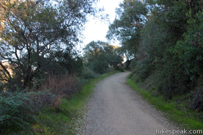
After 1.18 miles of climbing, Garcia Trail comes to an end at a junction with Glendora Ridge Motorway, a vehicle-free dirt road running along the ridge connecting Azusa Peak and Glendora Peak.
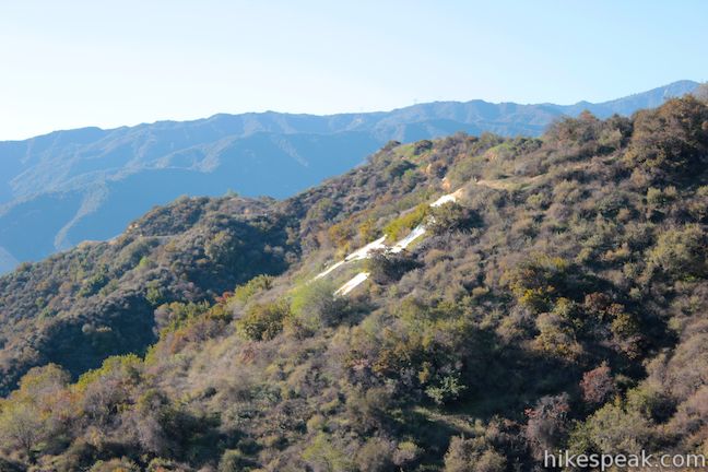
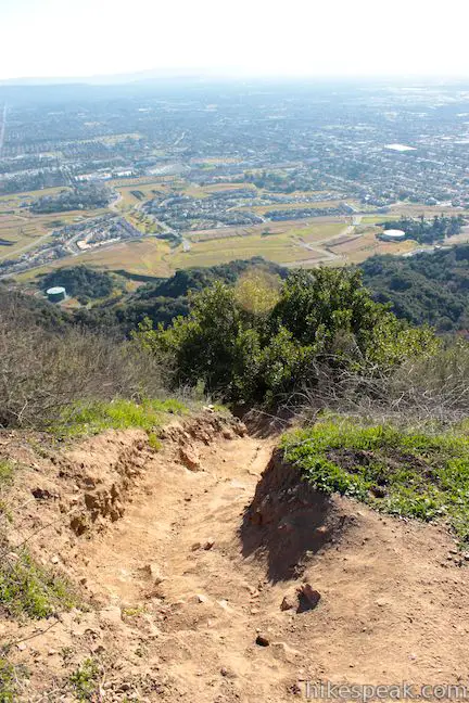
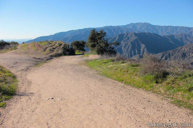
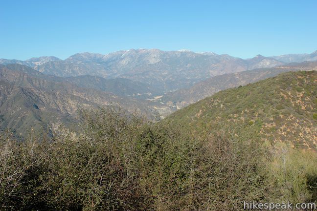
If you step to your left (west) on Glendora Ridge Motorway, you will spot the top of a very steep path going down to the A. Unless you’re feeling particularly adventurous, you’ll probably decide that you got a close enough view of the A from Garcia Trail. From the top of Garcia Trail, you also gain a new view west down the ridge into San Gabriel Canyon and northwest toward higher peaks in the San Gabriel Mountains.
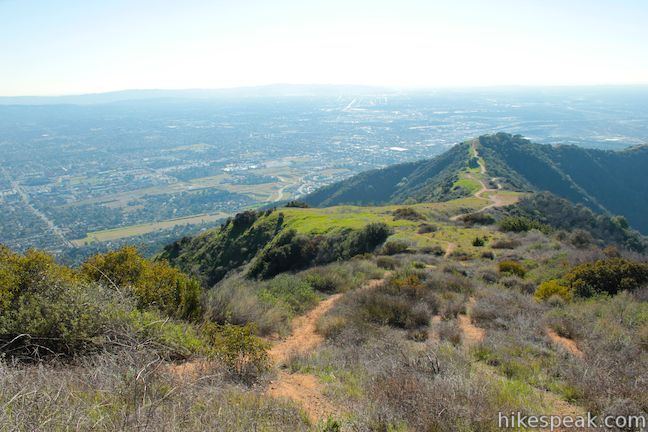
To reach Azusa Peak, turn right at the top of Garcia Trail and head east up Glendora Ridge Motorway. After a few hundred feet, the road will split. Glendora Ridge Motorway continues to the left through a grove of oaks on the north side of the Azusa Peak, while another trail breaks off to the right toward the summit. Turn right and make the short hike to the top of Azusa Peak, 0.15 miles from the top of Garcia Trail.
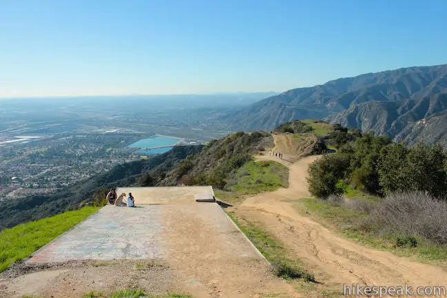
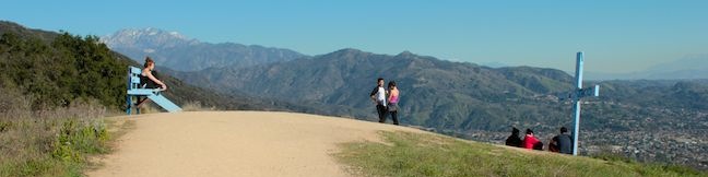
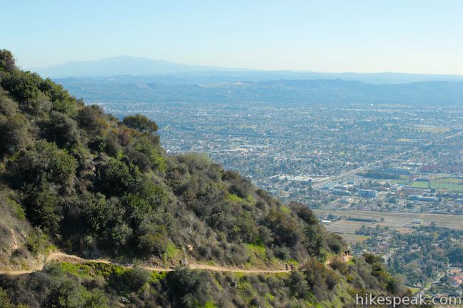
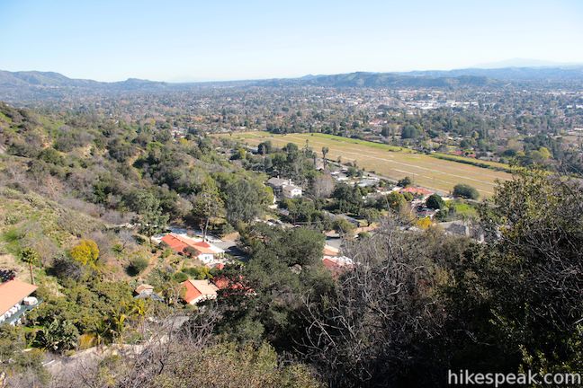
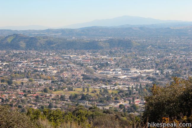
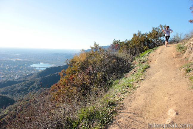
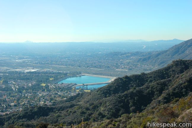
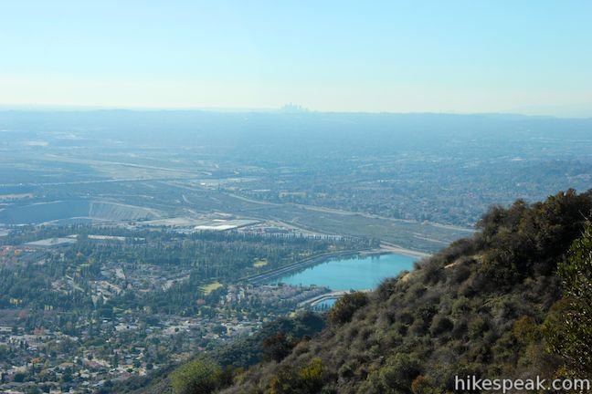
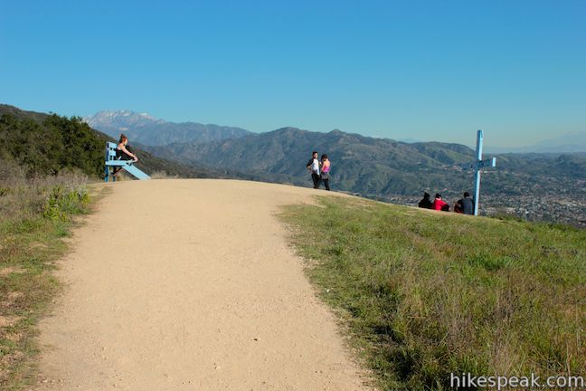
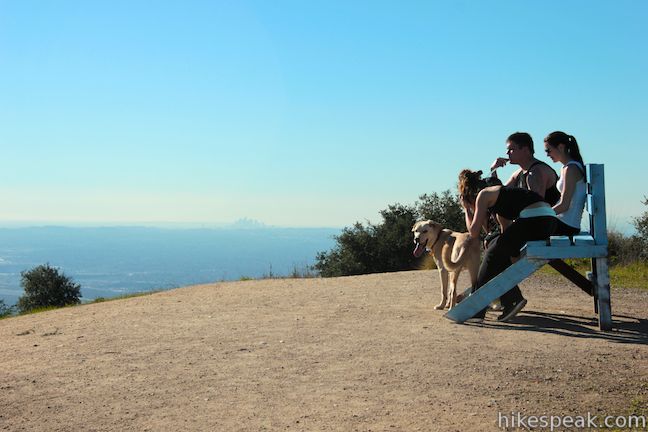
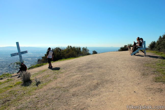
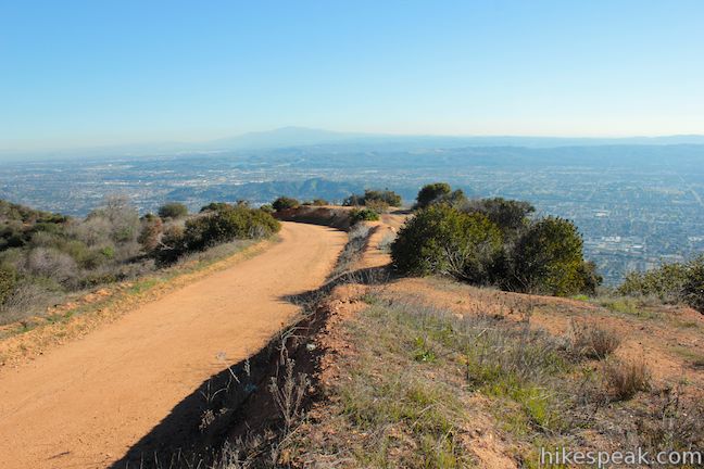
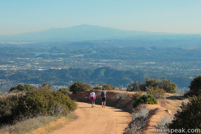
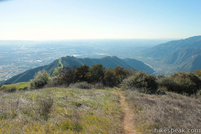
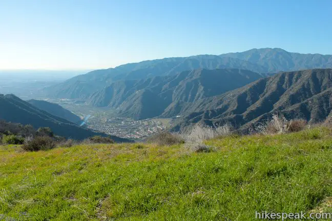
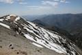
At 2,081 feet, Azusa Peak offers quite a view. You can looks south over the full spread of the San Gabriel Valley. The skyline of downtown Los Angeles rises to the west, and if you look past the skyscrapers, you should be able to spot the form of the Palos Verdes Peninsula and a shimmering streak of the Pacific Ocean (along with the silhouette of Catalina Island on a clear day). The summit of Azusa Peak has a painted cross and a bench where you can relax and gaze. This is a popular hike, and when you get to the top, it’s obvious why!

After taking in the summit view, you may return the way you came, or continue along Glendora Ridge Motorway to Glendora Peak. While you are bound to be tired by the 1.33-mile, 1,275-foot climb, if you choose to continue to Glendora Peak, the hiking will get easier. Another reason to extend this hike is that you will be leaving most of the other hikers behind and find far greater solitude on the trail to Glendora Peak.
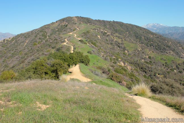
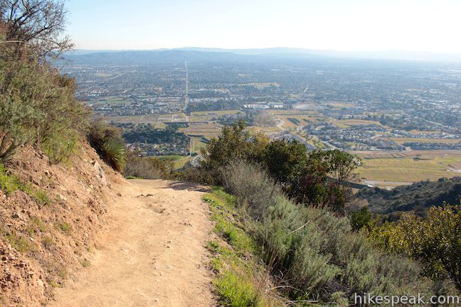
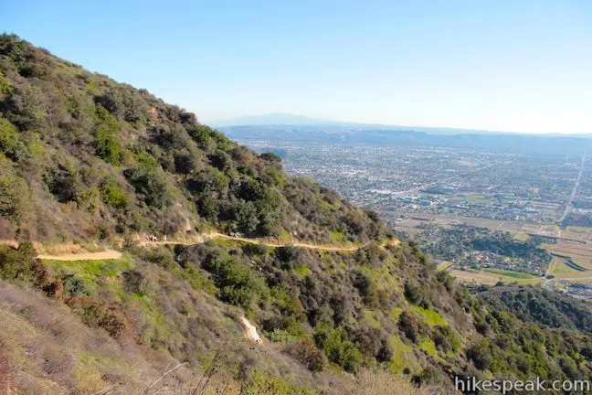
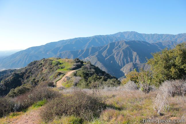
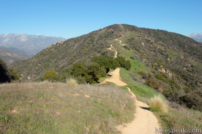
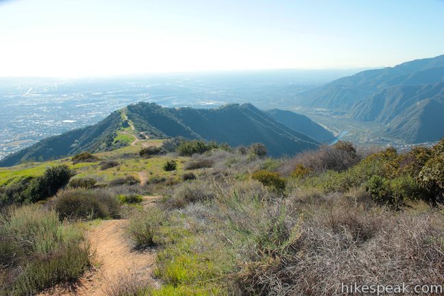
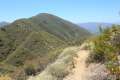
Follow the path down the east side of Azusa Peak, where it rejoins Glendora Ridge Motorway. Hike through oaks and across a saddle that bridges the two peaks. The road turns uphill and begins a steady climb along the north side of the ridgeline, which offers hikers new views into San Gabriel Canyon and across the canyon toward grander mountains to the north.
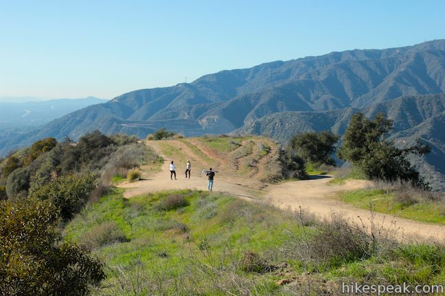
A third of a mile past the saddle, a single-track breaks off to the right that climbs to the top of Glendora Peak. You may take this path, or continue up the road, which is more gradual. After reaching the summit via the road, you can hike down the path and enjoy great views looking out from the mountain toward Azusa Peak.
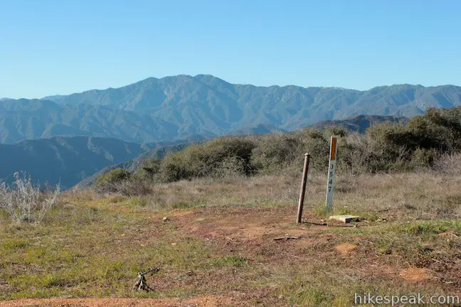
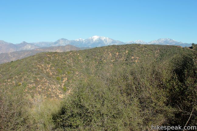
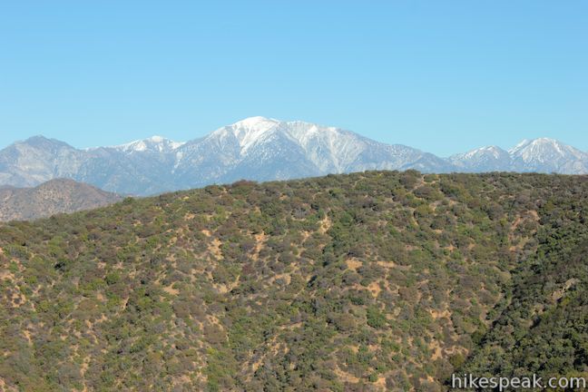
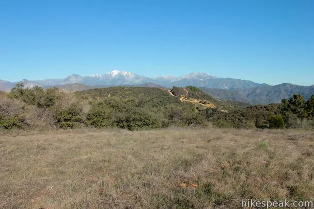
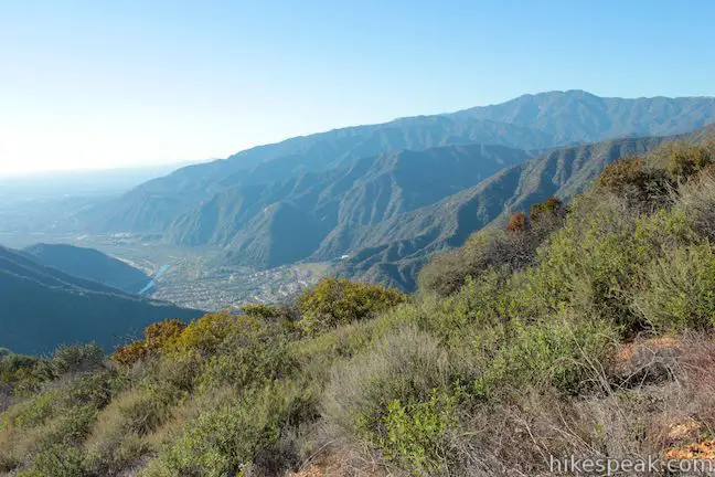
Continuing up Glendora Ridge Motorway, you will wrap around to the east side of Glendora Peak to find a grand view of Mount Baldy and the surrounding peaks to the northeast. About 0.85 miles from the saddle, Glendora Ridge Motorway will cross a firebreak on the east side of Glendora Peak. You should turn right here to reach the summit.

Find the firebreak at a point where Glendora Ridge Motorway starts to bend away from Glendora Peak toward a new string of summits and saddles (eventually reaching Glendora Mountain Road). Leave Glendora Ridge Motorway and double back toward the summit up the firebreak. Only a few feet of elevation change and less than a tenth of a mile of hiking separate Glendora Ridge Motorway from the top of Glendora Peak, which has a pair of survey markers.
The 2,596-foot peak offers even bigger views than Azusa Peak. If you couldn’t make out the ocean and the Palos Verdes Peninsula from Azusa Peak, you have an even better chance from this higher vantage.
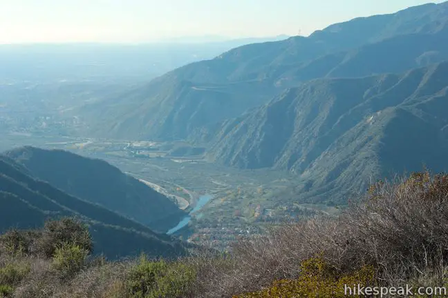
The path down the west side of Glendora Peak will quickly return you to Glendora Ridge Motorway, descending 375 feet in 0.35 miles. As you hike down the single-track, you’ll get great views into San Gabriel Canyon and down the ridge toward Azusa Peak.
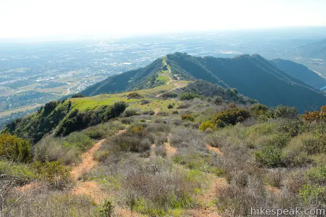
Turn left at the bottom of the path (toward Azusa Peak) and return to the top of Garcia Trail via Glendora Ridge Motorway. The extension to Glendora Peak adds two miles to the hike to Azusa Peak, bringing the distance to 4 2/3 miles with 1,800 feet of elevation gain.
It is a lot easier (and a lot faster) to hike down Garcia Trail than it is to hike up! Dogs and mountain bikes are welcome (although the often-crowded Garcia Trail will be be tough on bikers). No fee or permit is required to hike to Azusa Peak and Glendora Peak, so get out and enjoy!
Directions to the Trailhead
- From the 210 Freeway in Azusa, take exit 40 north on Azusa Avenue (Route 39).
- Drive 1.8 miles north to a split in the road.
- Ignore San Gabriel Canyon (Route 39) as it heads to the left and continue straight for another block on Azusa Ave.
- Turn right on Sierra Madre Avenue.
- Drive 1.1 miles east to the trailhead, just past the second traffic circle.
- Roadside parking is available.
- The trailhead for Garcia Trail is just west of an LA County Fire Station.
Trailhead Location
Trailhead address: Sierra Madre Avenue & Garcia Trail, Azusa, CA 91741
Trailhead coordinates: 34.146861, -117.890387 (34° 08′ 48.69″N 117° 53′ 25.39″W)
View San Gabriel Mountains in a larger map
Or view a regional map of surrounding Los Angeles trails and campgrounds.


 | Fish Canyon Falls This 4.8-mile round trip hike leaves from an active rock quarry and progresses up a beautiful canyon to a mesmerizing multi-tiered waterfall. |
 | Bridge to Nowhere This adventurous 10-mile round trip hike reaches an abandoned and out-of-place bridge with a unique history. |
 | Heaton Flats Trail This hike of 3.6 to 6 miles (or more) starts from the same trailhead as the hike to the Bridge to Nowhere and climbs toward Iron Mountain and panoramic views. |
 | Smith Mountain This 7-mile hike ascends 1,800 feet to a 5,111 foot summit with panoramic views over the San Gabriel Mountains. |
 | Mount Baldy Loop This 11.3-mile hike incorporates the Devil's Backbone and the Baldy Bowl - Ski Hut Trail into one see-all loop. |
 | More trails in the Los Angeles Explore other destinations in the Santa Monica Mountains, San Gabriel Mountains, and elsewhere. |
- Garcia Trail to Azusa Peak in 60 Hikes Within 60 Miles: Los Angeles by Laura Randall (opens in a new tab)
- Garcia Trail to Azusa Peak on Dan's Hiking Pages (opens in a new tab)
- Garcia Trail to Azusa Peak on myown100hikes.blogspot.com (opens in a new tab)
- Azusa Peak and Glendora Peak on dailykos.com (opens in a new tab)
- Azusa Peak and Glendora Peak on eastwesthike.com (opens in a new tab)
- The official website of the Angeles National Forest (opens in a new tab)
Common Questions about Azusa Peak and Glendora Peak in the San Gabriel Mountains
- Is the trail open?
- Yes. You should expect to find that Garcia Trail & Glendora Ridge Trail is open. There are no recent reports of trail closures. If you discover that the trail is closed, please help your fellow hikers by reporting a closure.
- Is this trail free to access?
- Yes, Garcia Trail & Glendora Ridge Trail is free to access. No entrance fee, pass, or permit is required. If you discover that access rules have changed, please provide feedback on your experience.
- How much time does this hike take?
- It takes approximately 3 hours to hike Garcia Trail & Glendora Ridge Trail. Individual hiking times vary. Add extra time for breaks and taking in the views.
- How long is this hike?
- The hike to Garcia Trail & Glendora Ridge Trail is a 4.66 mile out and back with 1800 feet of elevation change.
- Are dogs allowed on this trail?
- Yes, dogs are allowed on Garcia Trail & Glendora Ridge Trail. The trail is open to hikers, dogs, bikes.
- Does this trail go to a summit?
- Yes, Garcia Trail & Glendora Ridge Trail reaches a summit with panoramic views.
- What mountain range is this trail in?
- Garcia Trail & Glendora Ridge Trail is located in the San Gabriel Mountains.
- Where is the trailhead located?
- The trailhead for Garcia Trail & Glendora Ridge Trail is located in Azusa, CA.
Trailhead Address:
Sierra Madre Avenue & Garcia Trail
Azusa, CA 91741
Trailhead Coordinates:
34.146861, -117.890387 - What are the driving directions to the start of the hike?
To get to the trailhead: From the 210 Freeway in Azusa, take exit 40 north on Azusa Avenue (Route 39). Drive 1.8 miles north to a split in the road. Ignore San Gabriel Canyon (Route 39) as it heads to the left and continue straight for another block on Azusa Ave. Turn right on Sierra Madre Avenue. Drive 1.1 miles east to the trailhead, just past the second traffic circle. Roadside parking is available. The trailhead for Garcia Trail is just west of an LA County Fire Station.
View custom Google Maps directions from your current location.
- Are there other trails near Garcia Trail & Glendora Ridge Trail?
- Yes, you can find other nearby hikes using the Hikespeak Hike Finder Map.

19 Comments on Azusa Peak and Glendora Peak in the San Gabriel Mountains
What hikers are saying:
✨ Generated summary of user commentsHikers describe this route as a challenging climb that rewards effort with expansive views of the Los Angeles basin. While the initial stretch is prone to heavy foot traffic, pushing past the cross leads to a quieter experience with better vistas. Mark warns that parking is strictly limited to residents on the Glendora side, so visitors should be cautious of ticketing and towing in the surrounding neighborhoods.
“it was a very challenging hike.” Jump to comment ↓
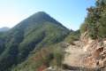
A photo of Glendora Ridge Trail near Glendora Peak in the San Gabriel Mountains, California
Please, please don’t hold up Azusa’s “A” as the San Gabriel mountains’ version of the Hollywood sign. How embarrassing! It’s made of glorified trash bags! Cities like Duarte and Monrovia at least have their city letters up on the mountain made of permanent materials…
And for the record, I know everyone always says Garcia Trail is in Azusa, but the reality is that the trailhead is right on the border and most of the trail is actually in Glendora. More importantly, the peak known as Azusa Peak is actually in Glendora!
Relax Adam were not talking about the 38th parallel! Are you so much against Azusa that you have to make the distinction? Just enjoy the hike and the view!
Actually, yes. I do have something against Azusa. It’s a corrupt city with a history of cronyism that is almost as bad as places like Bell and Vernon. As a hiker, I will never forgive Azusa, AKA “the Canyon City,” for what they’ve done to Fish Canyon, home of the nicest falls in the San Gabriels. In the 50s Duarte, incorporated in order to stop quarrying operations in the community (with the support of the county) was going to shut down the quarrying operations which had cut off the once-famous canyon, pride of the local community. The quarry then got Azusa to annex it and to allow continued quarrying. Every generation, this fight has resurfaced (80s, late 2000s) and every time Azusa officials made back room deals to keep this quarry operating.
Azusa has also always given APU carte blanche to tear down original Route 66 resources. Azusa even aided and abetted APU in tearing down a very early McDonalds and a drive-in movie theater – both times deliberately misleading the public about their intentions.
So yes, Azusa sucks royally!
The tearing down of the foothill drive in was 100% bullcrap…How can we tear down history places like that,,,like it’s nothing,,to put in a Parking lot,,,one that you can drive by and see that they don’t even use that much of it,,,It’s un-F ing believable
I found the Garcia trail much too crowded. I go hiking to get away from the crowds. Once you get above the cross…so much better! Views are better and almost no one on the trail! I will do this hike again, but I will bypass the Garcia Trail portion.
i just bought me “good entry level” mountain bike that has disk brakes and a shock on the fork.
i live in the los angeles area and is there a trail that you would recommend to a beginner mountain biker? thanks!
There are lots of trails open to bikers around LA. For something level/gradual, you could try biking to the M*A*S*H Site in Malibu Creek State Park or go for a ride up Sullivan Canyon. The Verdugo Mountains are also great for biking in, and you could try Beaudry Motorway Loop if you want to tackle more elevation gain.
TRY BONELLIE PARK IN SAN DIMAS.
I live off of Skyline Trail and think it’s a great option for bikes. If you start at the top of Punta Del Este (culdesac on residential street) you can take a dirt fire road in either direction. The trail connects to something like 26 miles of trails but you need to learn a few turns to access the tunnels that go under the roads and freeways. The trail has views of LA, OC and SGV. On many days you can see Catalina.
There are lots of trail heads and Punta Del Este is not one, but it’s probably the easiest starting point for a new biker. Just enter Punta Del Este Drive in Hacienda Heights in Google maps and take it to the top. I recommend going east (left) from Punta Del Este the first time. The views are amazing.
Is Garcia’s Trail will have access to hike Saturday 18 because of fire?
Does anyone know when the Garcia trail will reopen after the fire
Closure alert, of course many avid hikers are aware that since January 16, 2014 the trail head has been closed. A huge fire roared though this area, after a campers fire got out of control just off of Colby trail in Glendora, California.
Now the city of Glendora has started the process of restricting street side parking to residents only, all other’s who park their cars and hike will be issued a ticket and or have their cars towed away.
There are NO parking facilities on the Azusa side of the entrance to the Garcia Trail head.
Thanks for the head’s up. Apparently the residents got annoyed with the popularity of Garcia trail. Of course the trail has been there for over a century, long before most, if not all, of the houses…
I really enjoyed hiking the Garcia Trial. it was a very challenging hike. Is it closed now? can you recommend another challenging Hiking trail nearby?
This might not quite qualify as nearby (Burbank), but Vital Link Trail has a similar feel.
You can also stay up to date on the status of Garcia Trail on Facebook.
Thank you for recommending Vital Link Trail. I’ll be trying it out tomorrow.
Isn’t Garcia’s Trail closed? If it is, you should put something on this page to let hikers know.