Heaton Flats Trail
in the San Gabriel Mountains

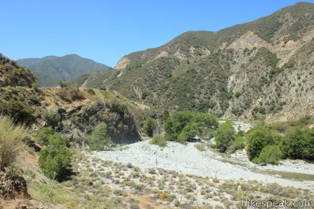
Half a mile from the start of the crowded trail to the Bridge to Nowhere, you’ll find a junction with Heaton Flats Trail, which rises above the canyon carved by the East Fork of the San Gabriel River to offer big views and plenty of solitude.
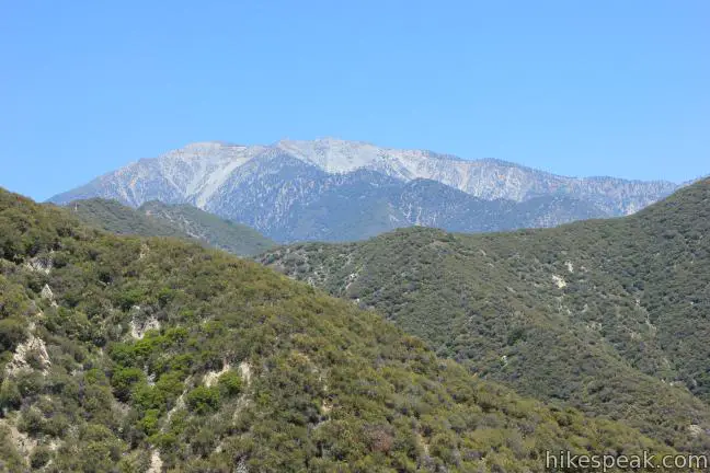
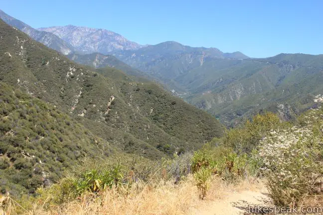
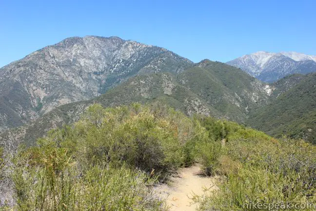
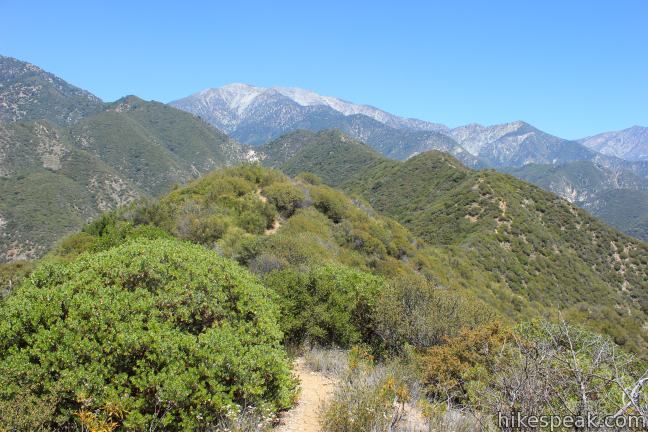
Enjoy panoramic perspectives of some of the most notable peaks in the San Gabriel Mountains (including Mount Baldy, Mount Baden-Powell, and Iron Mountain) along the trail to a 4,000-foot high clearing on the ridge. The trail becomes faint beyond this point, so to avoid doing any bushwhacking, turn around for a 6-miles round trip trek with 2,000 feet of elevation gain.
Those with less time and energy may shorten the hike by venturing up the canyon wall only as far as the first saddle on the ridge for a 3.6-mile round trip hike with 1,000 feet of elevation gain. On the other hand, those with endless amounts of time and energy can continue up the ridge to the summit of Iron Mountain for a 15-mile leg-busting adventure with 6,000 feet of elevation gain.
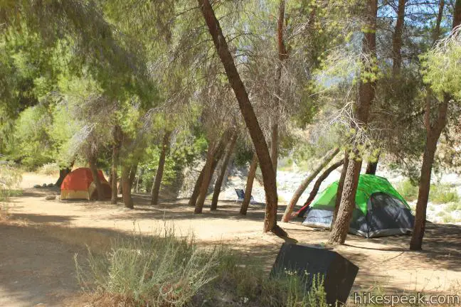
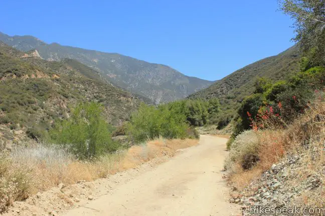
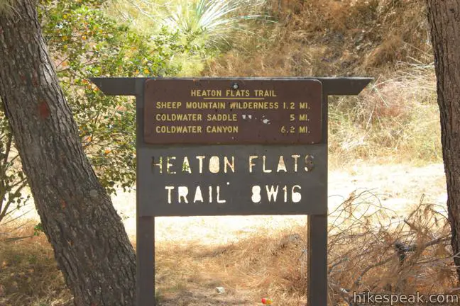
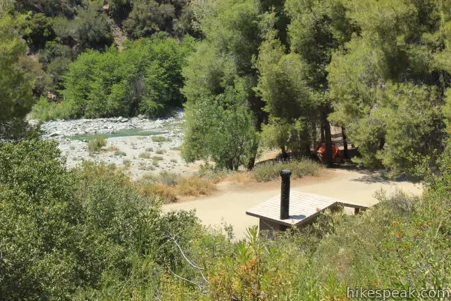
Start as though you were hiking to the Bridge to Nowhere, leaving the large (and usually full) trailhead parking area at the end of Camp Bonita Road. Head north on the wide dirt service road 2N21, which parallels the East Fork of the San Gabriel River. After half a mile of level and slightly downhill hiking, the trail arrives at Heaton Flats Campground. The trail camp is home to the hike’s only marked junction. Turn right up Heaton Flats Trail, leaving East Fork Trail to begin climbing up the ridge.
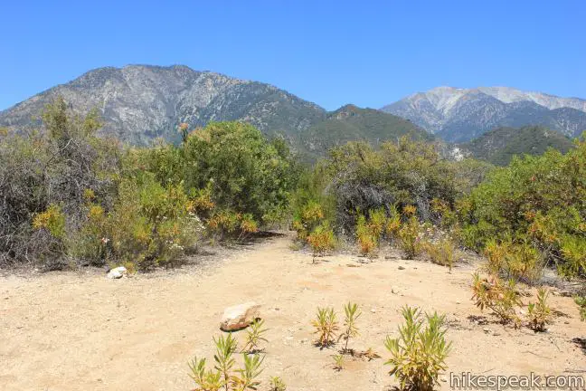
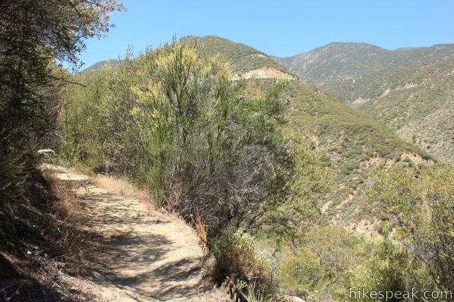
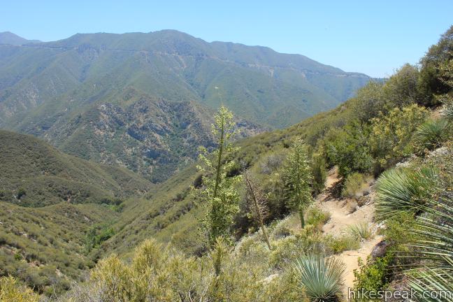
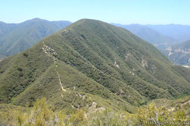
Heaton Flats Trail weaves up the east side of the canyon, passing through chaparral and some of the hike’s only shade. After half a mile of switchbacks, the trail crosses a draw in the canyon wall and continues to climb. Views down the river expand as you reach a saddle on the top of the ridge, 1.3 miles and 1,000 feet above the campground.
Turn left when you arrive at the saddle, avoiding the use trail that heads to the right up a 500-foot rise on the ridge. After a sixth of a mile, you will pass a sign at the boundary of the Sheep Mountain Wilderness (a free wilderness permit is required to proceed).
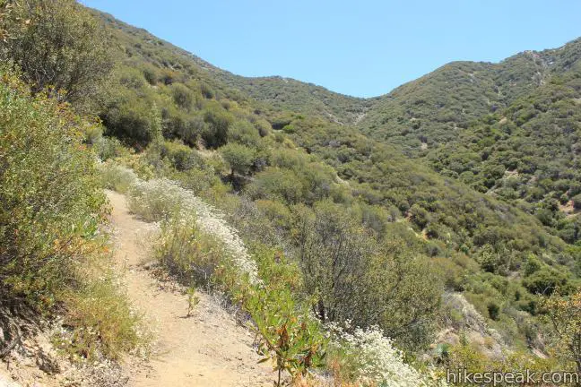
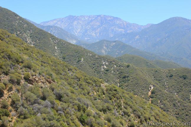
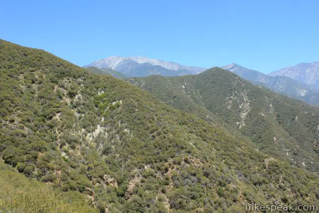
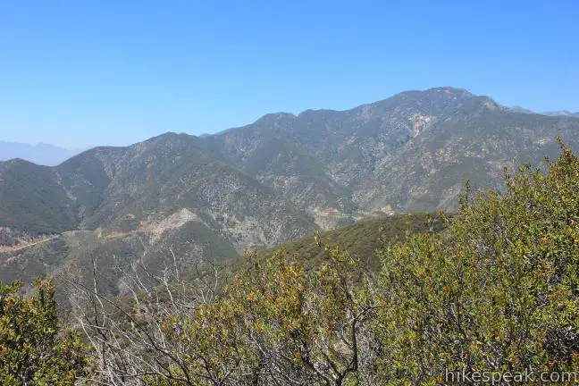
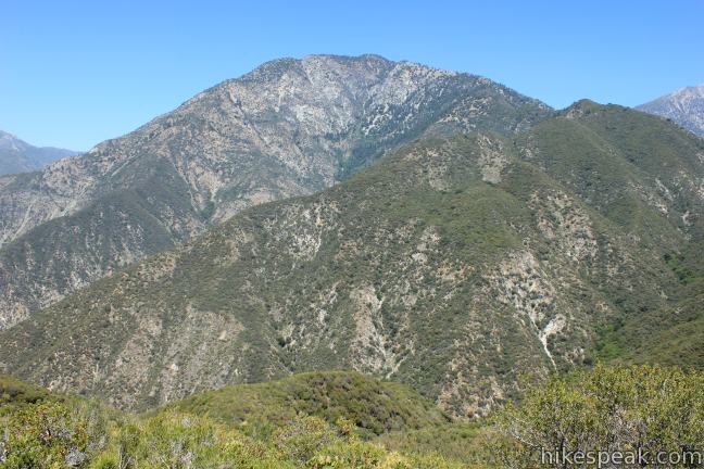
The trail wraps around the east side of the ridge, heading north to quickly deliver the first views of Mount Baldy. The often snow-covered summit is the highest point in the San Gabriel Mountains. Coldwater Canyon and Cattle Canyon are below the ridge to the east. For those who decide to turn around at the saddle for the shorter hike, it is definitely worth carrying on for another quarter mile up the trail for the impressive view of Mount Baldy.
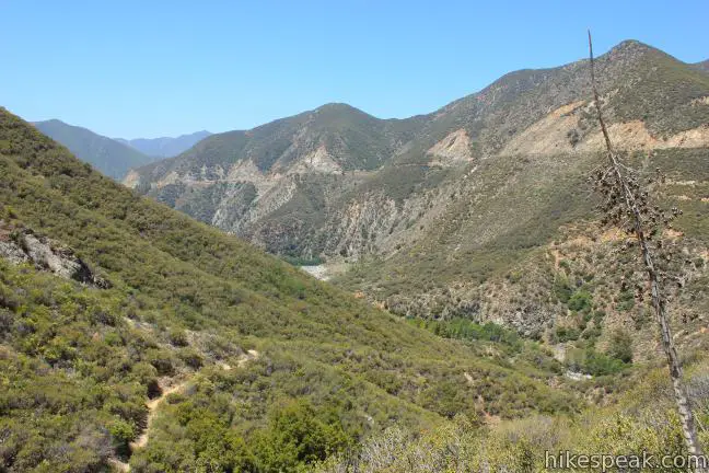
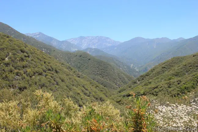
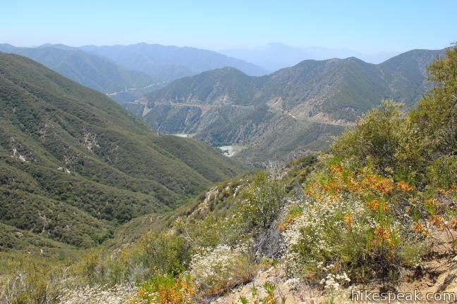
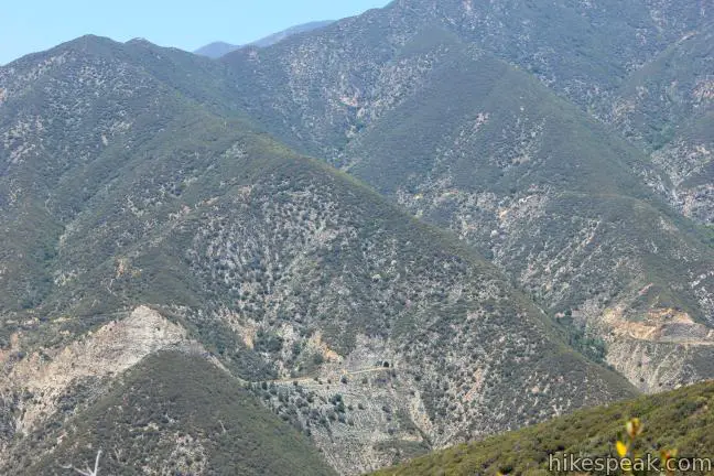
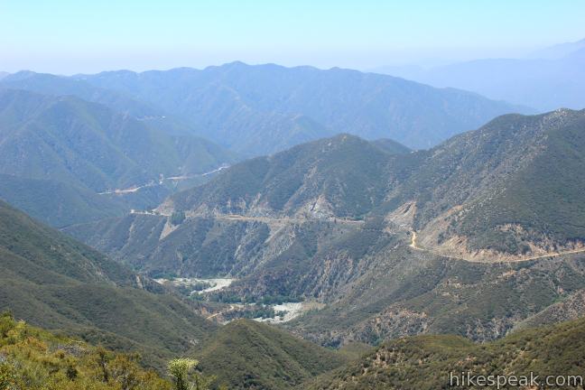
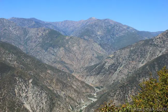
A switchback in Heaton Flats Trail lifts you to views facing southwest down the drainage of the East Fork of the San Gabriel River. The trail sticks to the east side of the ridge, leading to a level area where you can look down the west side of the ridge. On the other side of the canyon, you’ll spot Shoemaker Canyon Road, an ill-plotted dead-end road that passes through a tunnel in the mountain on the opposite side of the East Fork of the San Gabriel River.
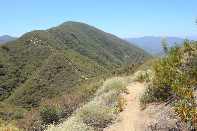
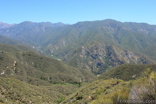
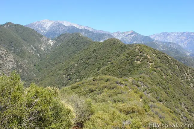
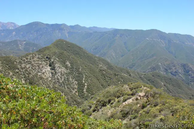
A steep path pushes up the ridge’s spine, while the trail continues along the east side of the ridge, employing a switchback for a more gradual climb. The trail wraps around the west side of the ridge and ascends to a small clearing, 3 miles from the start, and 1.2 miles from the first saddle on the ridge. Located at just over 4,000 feet above sea level, the gap in the brush at this crest on the ridge has room for just a couple backpackers’ tents.
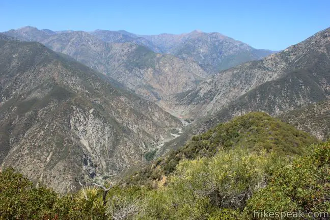
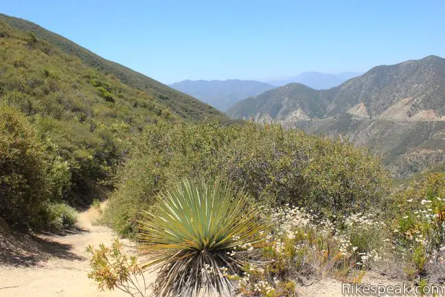
For the first time of the hike, you’ll get an expansive in-you-face view of Iron Mountain, looming to the north across Laurel Gulch, which drops to the East Fork of the San Gabriel River (across from Swan Rock). The faint line of Allison Trail can be seen tracing the skirt of the mountain on the opposite slide of the gulch, leading to another canyon housing Allison Mine, an old gold claim. Looking farther up the canyon carved by the East Fork of the San Gabriel River, you’ll have a good perspective of Mount Baden-Powell.
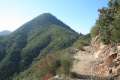
Beyond this rise on the ridge, the trail turns downhill for the first time and becomes faint and overgrown as it travels over rolling bumps in the ridgeline, eventually climbing to Heaton Saddle, an obvious notch 1.3 miles farther up the ridge.
Heaton Saddle is marked by exposed bleached rocks and is the last point along the ridge before the grueling assault on Iron Mountain, considered by writer John Robinson to be the toughest summit hike in the San Gabriel Mountains.
Rather than going through the undulations of the overgrown ridge trail, you may turn around when you reach the ridge crest. After gaining 2,000 feet over the last 2.5 miles, your legs will probably be ready to turn around, so take one last look at Mount Baden-Powell, Iron Mountain, and Mount Baldy before heading back the way you came.
A wilderness permit is required to access Sheep Mountain Wilderness. You may self-register for a permit at the kiosk at the south end of the trailhead, or obtain one at the East Fork Ranger Station located on the road to the trailhead (or at other ranger stations in the Angeles National Forest). A newer permit kiosk should also be available at Heaton Flats Trail Camp. This trail begins within the national forest so an adventure pass (day use pass) may be required to part at the trailhead, which can also be purchased at the ranger station. Dogs are welcome.
Directions to the Trailhead
- From the 210 Freeway in Azusa, take exit 40 north on Route 39.
- Drive 11.6 miles north, passing the East Fork Ranger Station at the base of the San Gabriel Mountains.
- Pass San Gabriel Reservoir and turn right on East Fork Road.
- After 5.2 miles, when the road makes a sharp bend to the right, continue straight ahead on Camp Bonita Prairie Forks Road, sticking with the river for an additional 3/4 of a mile to the trailhead parking area.
Trailhead Location
Trailhead address: Camp Bonita Road, San Gabriel Mountains National Monument, Azusa, CA 91702
Trailhead coordinates: 34.23696, -117.765119 (34° 15′ 05.03″N 117° 44′ 32.26″W)
View Heaton Flats in a larger map
Or view a regional map of surrounding Los Angeles trails and campgrounds.


 | Bridge to Nowhere This adventurous 10-mile round trip hike reaches an abandoned and out-of-place bridge with a unique history. |
 | Smith Mountain This 7-mile hike ascends 1,800 feet to a 5,111 foot summit with panoramic views over the San Gabriel Mountains. |
 | Mount Baden-Powell This 8.25-mile round trip hike ascends 2,834 feet to one of the tallest summits in the San Gabriel Mountains and a monument to Lord Baden-Powell, a BSA icon and the founder of the Scout Movement. |
 | Azusa Peak (and Glendora Peak) via Garcia Trail This 2 2/3-mile or 4 2/3-mile hike ascends Garcia Trail to "the A" and one or two picturesque summits along Glendora Ridge Motorway. |
 | Mount Baldy Loop This 11.3-mile hike incorporates the Devil's Backbone and the Baldy Bowl - Ski Hut Trail into one see-all loop. |
 | More trails in the Los Angeles Explore other destinations in the Santa Monica Mountains, San Gabriel Mountains, and elsewhere. |
 | Coldbrook Campground This 20-site campground in the Angeles National Forest in the San Gabriel Mountains offers first-come first-serve camping year-round. |
- Heaton Flats Trail on Dan's Hiking Pages (opens in a new tab)
- Heaton Flats Trail and South Ridge on summitpost.org (opens in a new tab)
- Heaton Flats Trail on myown100hikes.blogspot.com (opens in a new tab)
- Heaton Flats Trail on myown100hikes.blogspot.com (again) (opens in a new tab)
- The official website of the Sheep Mountain Wilderness (opens in a new tab)
- The official website of the Angeles National Forest (opens in a new tab)
Common Questions about Heaton Flats Trail in the San Gabriel Mountains
- Is the trail open?
- Yes. You should expect to find that Hike to Heaton Flats is open. There are no recent reports of trail closures. If you discover that the trail is closed, please help your fellow hikers by reporting a closure.
- Do I need a permit for this hike?
- Yes. National Forest Adventure Pass.
- How much time does this hike take?
- It takes approximately 3 hours 45 minutes to hike Hike to Heaton Flats. Individual hiking times vary. Add extra time for breaks and taking in the views.
- How long is this hike?
- The hike to Hike to Heaton Flats is a 6 mile out and back with 2000 feet of elevation change.
- Are dogs allowed on this trail?
- Yes, dogs are allowed on Hike to Heaton Flats. The trail is open to hikers, dogs, bikes.
- What mountain range is this trail in?
- Hike to Heaton Flats is located in the San Gabriel Mountains.
- Where is the trailhead located?
- The trailhead for Hike to Heaton Flats is located in Azusa, CA.
Trailhead Address:
Camp Bonita Road
Azusa, CA 91702
Trailhead Coordinates:
34.23696, -117.765119 - What are the driving directions to the start of the hike?
To get to the trailhead: From the 210 Freeway in Azusa, take exit 40 north on Route 39. Drive 11.6 miles north, passing the East Fork Ranger Station at the base of the San Gabriel Mountains. Pass San Gabriel Reservoir and turn right on East Fork Road. After 5.2 miles, when the road makes a sharp bend to the right, continue straight ahead on Camp Bonita Prairie Forks Road, sticking with the river for an additional 3/4 of a mile to the trailhead parking area.
View custom Google Maps directions from your current location.
- Are there other trails near Hike to Heaton Flats?
- Yes, you can find other nearby hikes using the Hikespeak Hike Finder Map.

6 Comments on Heaton Flats Trail in the San Gabriel Mountains
What hikers are saying:
✨ Generated summary of user commentsHikers find this trail to be a strenuous but rewarding workout. Bradley warns that the sun can be intense, making it necessary to monitor temperatures and plan for heat. The path is easy to follow, though some light brush encroaches on the way.
“Awesome trail, and a great workout.” Jump to comment ↓
Loved this hike. We did the 6 mile trail and are ready to go back for the 15-mile excursion. These directions were so helpful!
Just did 10 miles. Wanted to try for the 15 mile trek but the sun convinced me to turn around (it was 92 degrees today). Awesome trail, and a great workout. It was really easy to follow. Some smaller bushes are pushing their way into the trail, but it was easily passed.
What hiking trails do we have in Santa Monica Mountains with over night trail camps and what are the directions for parking overnight at starting trail.
Two that come to mind are Musch Camp in Topanga State Park and La Jolla Valley Walk-in Campground in Point Mugu State Park (likely damaged by the Springs Fire). You can find more information about both on this Los Angeles Camping page.
Nice post Seth. I just hiked the trail with a friend on 12/19/14 and was surprised by how strenuous this portion of the trail was. We had to turn back just short of Heaton Saddle due to time constraints but do plan on returning with more time. Although I’m not planning on doing Iron Mountain like my friends have, I do want to get to the Heaton Saddle. By the way, do you have any pictures taken on Heaton Saddle itself. I realize its just a saddle (like Icehouse Saddle and Saddle Junction) but I’m puzzled by the lack of photos there. Best regards.
Nice post!
Here is a quick video of Heaton Flats Trail to Bonita Peak.
https://www.youtube.com/watch?v=fqRw9w7rtss