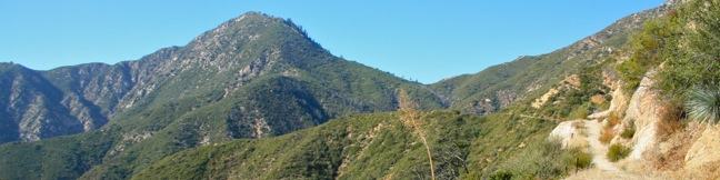
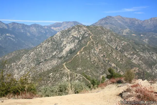
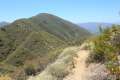
If someone wrote a book about hiking Smith Mountain, it would be called A Tale of Two Trails. It was the most gradual of times, it was the steepest of climbs… This classic hike in the San Gabriel Mountains begins with three miles of single track that easily gain a thousand feet to Smith Saddle. What follows is an 800-foot scramble to the summit in less than half a mile. The two segments of the hike could not be more different, but they do have one thing in common, extraordinary views. The sweeping 360 degree panorama from the 5,111-foot summit of Smith Mountain definitely justifies the effort.
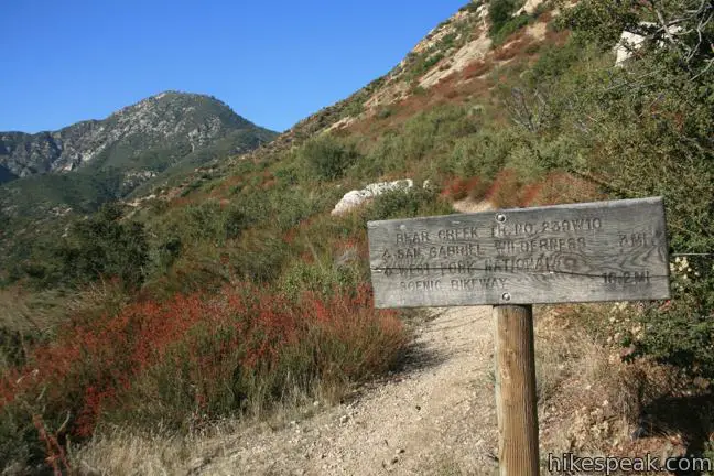
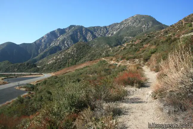
Upper Bear Creek Trail begins from a turnout on Route 39 north of Azusa near Coldbrook Campground. The trail angles south from the trailhead and climbs into a crease in the gaping canyon above the North Fork of the San Gabriel River.
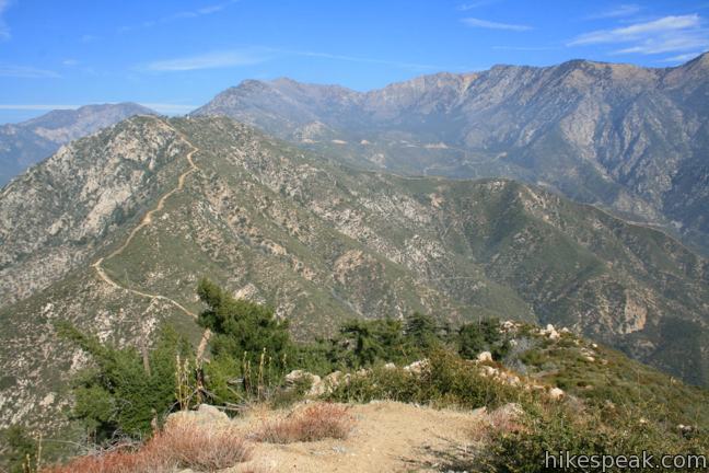
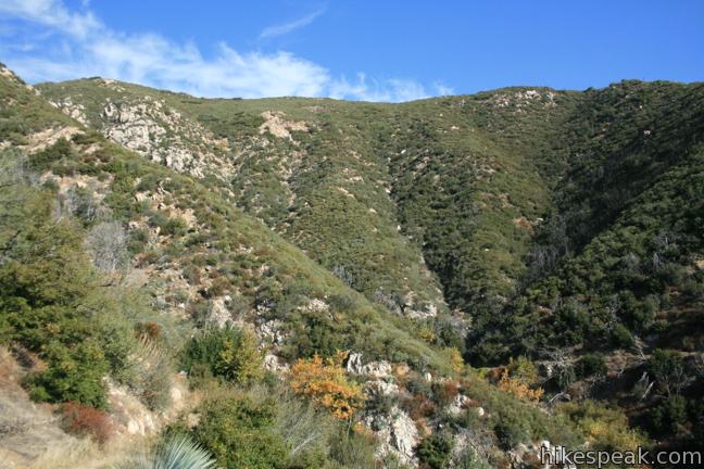
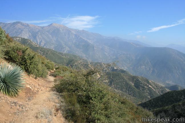
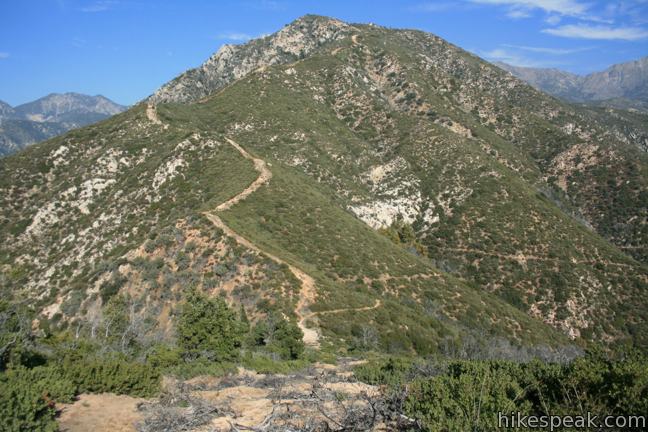
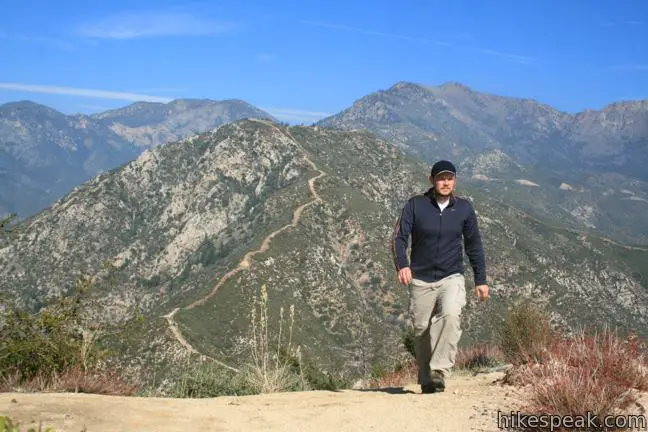
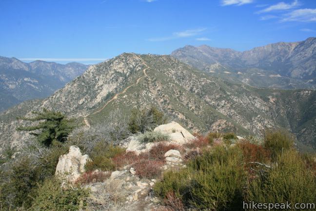
Upper Bear Creek Trail gains a couple hundred feet in its early goings, ascending a few switches around a saddle overlooking Lost Canyon. The great views continue throughout the hike. Smith Mountain towers to the west and would be about a mile away if not for the grand bowl-shaped canyon in between.
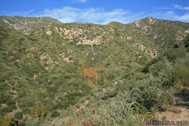
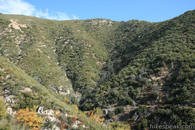
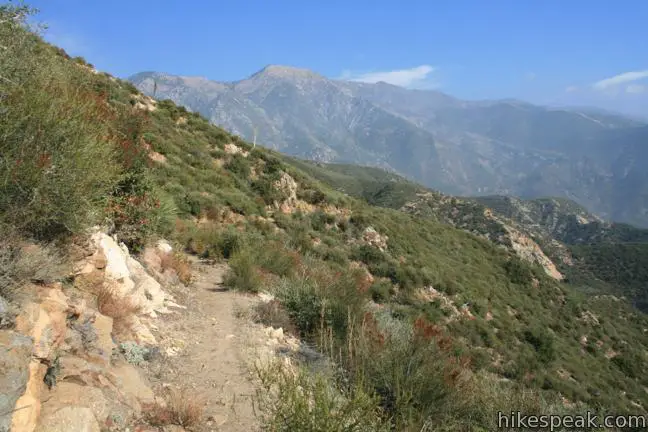
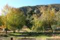
Follow the trail around the edge of Lost Canyon past several creases where seasonal creeks spawn riparian vegetation. Outside of these oasis, the slopes of the canyon are covered in sage, yucca, and brush like young manzanitas. Scared trunks and branches linger along the trail, evidence of oak forests that preceded the 2002 Curve Fire. The fire blazed through the canyon, removing trees and closing the trail for several years. New vegetation has returned with vigor, while providing open views at almost every step of the trail.
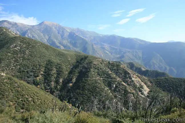
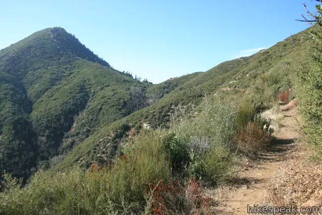
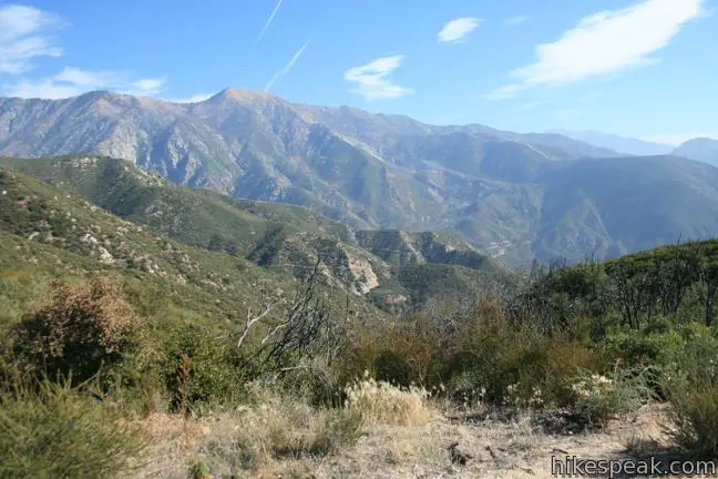
The last two miles of Upper Bear Creek Trail make a grand curve around the fingers of Lost Canyon. The trail becomes incredibly gradual, almost level at times, luring you into a false comfort zone as you approach Smith Saddle. Do not be fooled – a climb is coming!
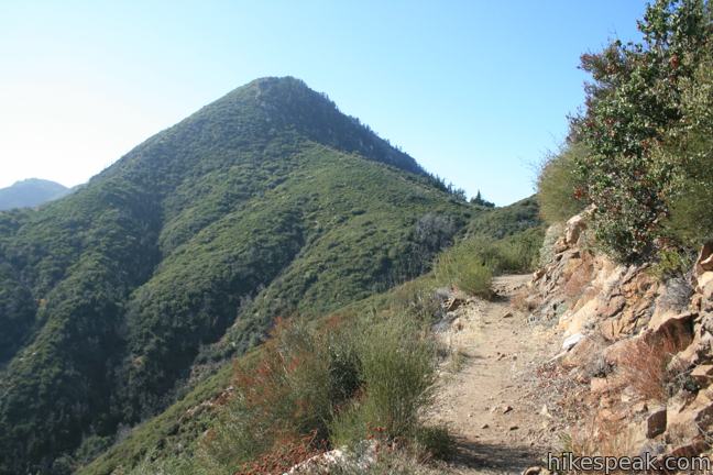
When you reach Smith Saddle at 4,290 feet, stop to admire the new view to the east. The trail actually continues down the east side of the saddle into Bear Creek Canyon in the San Gabriel Wilderness. To reach the top of Smith Mountain, you will leave the trail and turn left up a fire break toward the summit.
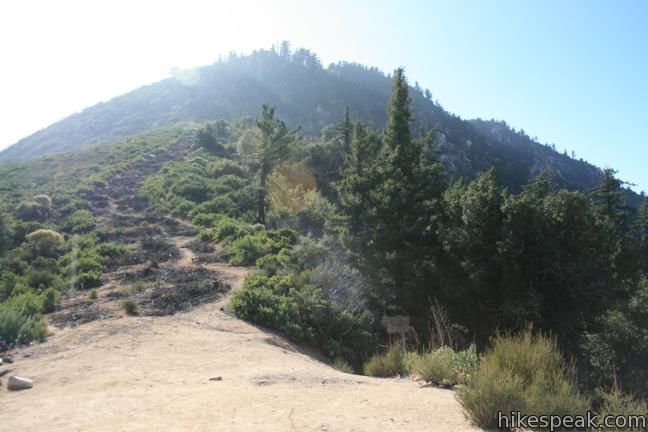
A dirt track zigzags up the line of burnt branches, coming to the top of the fire break after 0.15 miles. Here things become quite steep as you tackle 325 feet over the next 0.15 miles up a rocky slope spotted with oaks and pines. Climb a worn path over and around granite boulders leading up to a false summit. Things taper out as you turn east and ascend the final 150 feet over 0.15 miles. Follow cairns stacked on boulders to reach the small round summit. It is a rapid climb from the saddle, but if you take a couple breaks along the way, you can reach the top without your heart pounding out of your chest.
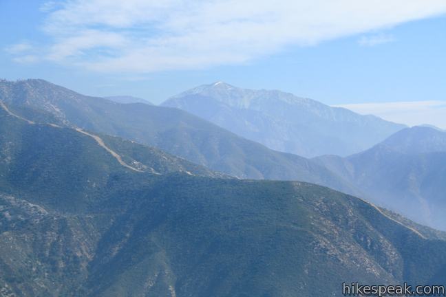
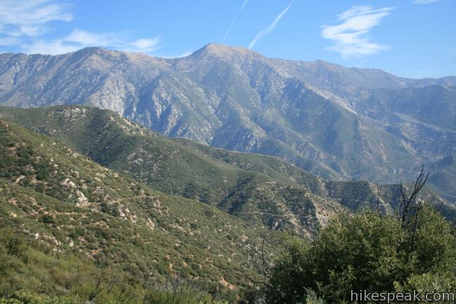
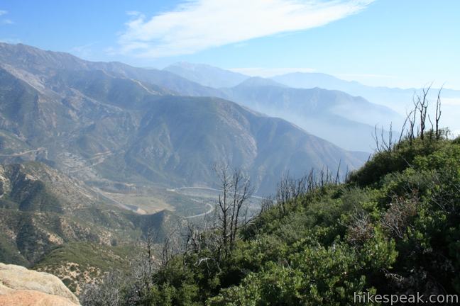
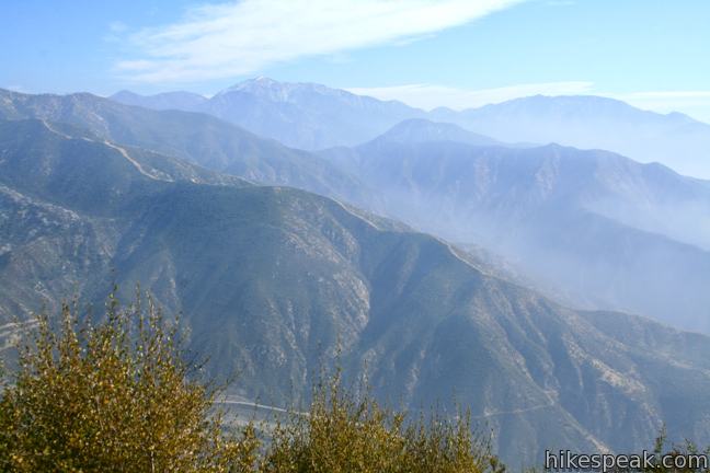
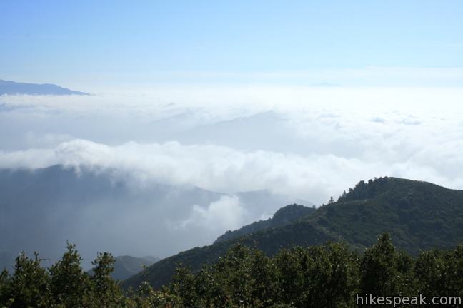
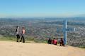
The views from Smith Mountain are breathtaking. To the south, the San Gabriel Mountains taper off toward the San Gabriel Valley. To the west Bear Creek Canyon is cradled by Twin Peaks and Mount Waterman. Mount Islip rises to the north beyond a neighboring summit on the ridge north of Smith Saddle. Mount Hawkins looms to the northeast, and to the east is the most recognizable high peak, Mount Baldy.
A small clearing at the summit surrounds a summit marker and register. The USGS summit marker reads Headlee, the name the peak went by in the 1930s.
Do take in the entire view before returning the way you came. It is downhill all the way! Be sure to watch your step descending to the saddle. The steep slope of dirt and rocks is trickier going down than it is coming up. From the saddle, it is a relatively quick three miles back to the trailhead, completing a 7-mile round trip hike with 1,800 feet of elevation gain. No permit is required to hike Upper Bear Creek Trail to Smith Mountain, but an adventure pass is required to park at the trailhead. This day-use pass may be purchased from the East Fork Ranger Station located on Route 39 at the base of the San Gabriels (and at several other distributors).
Directions to the Trailhead
- From the 210 freeway in Azusa, take exit 40 and drive 18 miles north Route 39 to the trailhead.
- You will pass the East Fork Ranger Station at the base of the San Gabriel Mountains.
- Continue past San Gabriel Reservoir and go straight through an intersection with East Fork Road (the turnoff you would take to reach the Bridge to Nowhere hike).
- From the intersection, it is another 6.3 miles to the paved turnout on the left for the trailhead.
- (If you reach Coldbrook Campground, you drove 1/3 of a mile too far.)
- Upper Bear Creek Trail begins next to the bathroom at the north end of the lot.
Trailhead Location
Trailhead address: San Gabriel Canyon Road (Route 39), San Gabriel Mountains National Monument, Azusa, CA 91702
Trailhead coordinates: 34.28738, -117.84267 (34° 17′ 14.57″N 117° 50′ 33.6″W)
View San Gabriel Mountains in a larger map
Or view a regional map of surrounding Los Angeles trails and campgrounds.


 | Bridge to Nowhere This adventurous 10-mile round trip hike reaches an abandoned and out-of-place bridge with a unique history. |
 | Heaton Flats Trail This hike of 3.6 to 6 miles (or more) starts from the same trailhead as the hike to the Bridge to Nowhere and climbs toward Iron Mountain and panoramic views. |
 | Crystal Lake This 1 1/3-mile round trip hike visits the only naturally occurring lake in the San Gabriel Mountains. |
 | Fish Canyon Falls This 4.8-mile round trip hike leaves from an active rock quarry and progresses up a beautiful canyon to a mesmerizing multi-tiered waterfall. |
 | Azusa Peak (and Glendora Peak) via Garcia Trail This 2 2/3-mile or 4 2/3-mile hike ascends Garcia Trail to "the A" and one or two picturesque summits along Glendora Ridge Motorway. |
 | More trails in the Los Angeles Explore other destinations in the Santa Monica Mountains, San Gabriel Mountains, and elsewhere. |
 | Coldbrook Campground This 20-site campground in the Angeles National Forest in the San Gabriel Mountains offers first-come first-serve camping year-round. |
Common Questions about Smith Mountain via Upper Bear Creek Trail in the San Gabriel Mountains
- Is the trail open?
- Yes. You should expect to find that Upper Bear Creek Trail To Smith Mountain is open. There are no recent reports of trail closures. If you discover that the trail is closed, please help your fellow hikers by reporting a closure.
- Do I need a permit for this hike?
- Yes. National Forest Adventure Pass.
- How much time does this hike take?
- It takes approximately 4 hours to hike Upper Bear Creek Trail To Smith Mountain. Individual hiking times vary. Add extra time for breaks and taking in the views.
- How long is this hike?
- The hike to Upper Bear Creek Trail To Smith Mountain is a 7 mile out and back with 1800 feet of elevation change.
- Are dogs allowed on this trail?
- Yes, dogs are allowed on Upper Bear Creek Trail To Smith Mountain. The trail is open to hikers, dogs, bikes.
- Does this trail go to a summit?
- Yes, Upper Bear Creek Trail To Smith Mountain reaches a summit with panoramic views.
- What mountain range is this trail in?
- Upper Bear Creek Trail To Smith Mountain is located in the San Gabriel Mountains.
- Where is the trailhead located?
- The trailhead for Upper Bear Creek Trail To Smith Mountain is located in Azusa, CA.
Trailhead Address:
San Gabriel Canyon Road
Azusa, CA 91702
Trailhead Coordinates:
34.28738, -117.84267 - What are the driving directions to the start of the hike?
To get to the trailhead: From the 210 freeway in Azusa, take exit 40 and drive 18 miles north Route 39 to the trailhead. You will pass the East Fork Ranger Station at the base of the San Gabriel Mountains. Continue past San Gabriel Reservoir and go straight through an intersection with East Fork Road (the turnoff you would take to reach the Bridge to Nowhere hike). From the intersection, it is another 6.3 miles to the paved turnout on the left for the trailhead. (If you reach Coldbrook Campground, you drove 1/3 of a mile too far.) Upper Bear Creek Trail begins next to the bathroom at the north end of the lot.
View custom Google Maps directions from your current location.
- Are there other trails near Upper Bear Creek Trail To Smith Mountain?
- Yes, you can find other nearby hikes using the Hikespeak Hike Finder Map.

5 Comments on Smith Mountain via Upper Bear Creek Trail in the San Gabriel Mountains
What hikers are saying:
✨ Generated summary of user commentsThis trail offers wide open views and a series of switchbacks that lead to a rewarding summit experience. The final scramble from the saddle is the most exciting portion of the trek, though it requires careful footing and sturdy shoes. The steep climb to the top is a heart-pounding challenge that pays off with great vistas.
“The climb from the saddle is the best part and the highlight of this hike.” Jump to comment ↓
This is a good hike with excellent views, does have many switchbacks though. No creeks or waterfalls to see just wide open views. The very last climb to the summit is tough, very steep and some scrambling over rocks required. It will get your heart pounding but the view at the top is great. Did this hike mid January and the trail was deserted of any other climbers.
Is the distance round-trip or one-way?
Round Trip (Out & Back)
Did this hike today. Couldn’t find the register. Is the rocky peak to the north-northwest Mount Hawkins?
Smith Mountain is a must for every hiker in Socal. The climb from the saddle is the best part and the highlight of this hike. The scramble I would say is a class 2 scramble. Nothing like Strawberry Peak, but make sure you are careful and wear the proper shoes.
Adventure video and the scramble is about half way in the video.
https://www.youtube.com/watch?v=1NEKICzg0EQ&index=7&list=PLm4oOlR7oGXA56GQ3xoTUBh3ESNPFj5nB