Mount Baden-Powell
in the San Gabriel Mountains

Mount Baden-Powell is a special summit in the San Gabriel Mountains. It is one of the range’s tallest peaks at 9,399 feet and holds particular importance to the Boy Scouts of America because it memorializes the lofty accomplishments of Lord Baden-Powell who founded the Scout Movement. The views are lofty too, lording over an expanse of rugged mountains framed the San Gabriel Valley to the south and the Mojave Desert to the north. The hike to the top is a thigh-burning 8.25 miles round trip with lots of switchbacks and 2,834 feet of elevation gain. The effort is rewarded by substantial views including a summit 360.
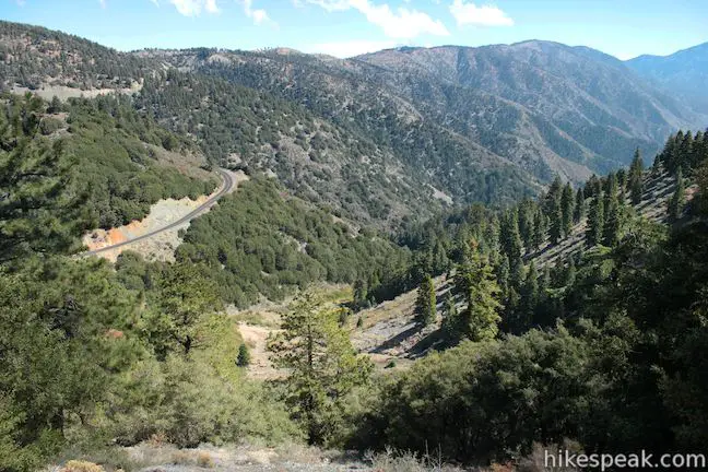
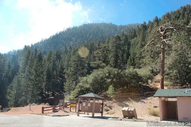
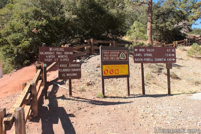
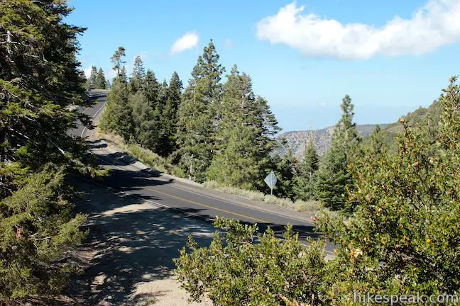
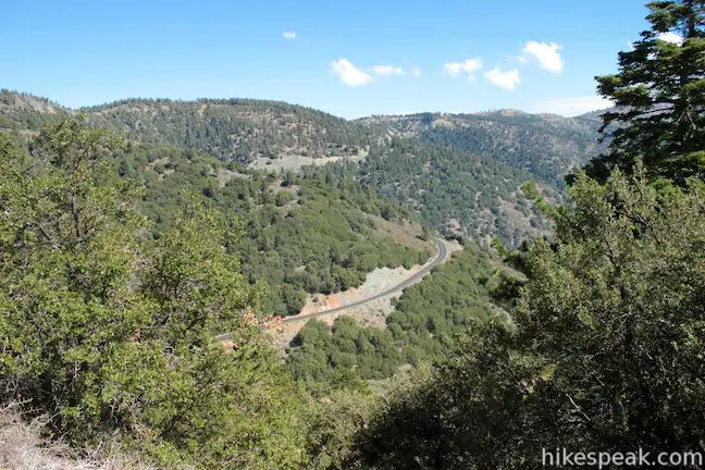
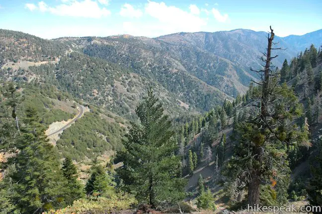
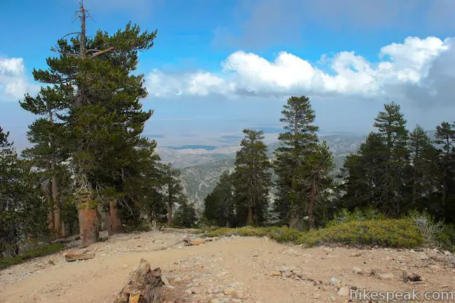
The hike begins 6,565 feet above sea level at Vincent Gulch Divide, located near the northeast end of the San Gabriel Mountains. Vincent Gulch Divide (Or Vincent Gap) is a divide below Mount Baden-Powell that separates the drainage of Big Rock Creek to the north from the drainage of the upper forks of the San Gabriel River to the south. You will find a large turnout along Angeles Crest Highway at Vincent Gulch Divide where the trail sets out southwest up Mount Baden-Powell. The trail up Mount Baden-Powell is a well-maintained section of the Pacific Crest Trail and the Silver Moccasin Trail (Silver Moccasin Trail is a 53-mile route used by boy scouts and other backpackers to cross the San Gabriel Mountains between Chantry Flat and Vincent Gap, topping out on Mount Baden-Powell).
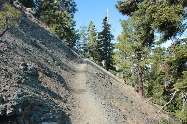
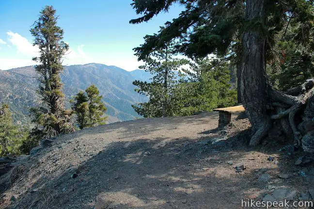
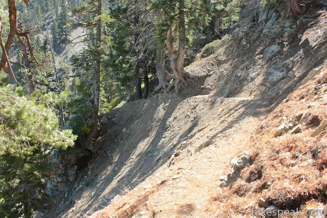
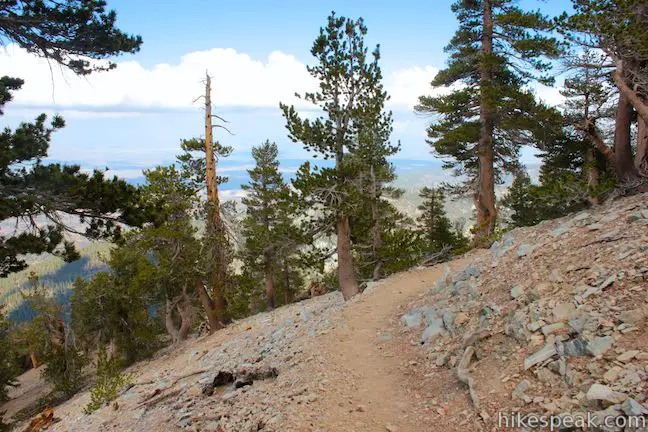
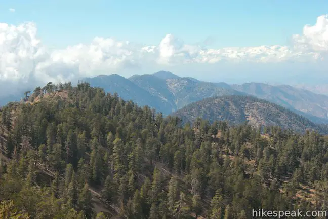
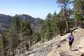
Make your way up the dirt single track, climbing through Jeffrey pines and firs that exude pleasant mountain aromas. The trail maintains a steady grade, never getting too steep as it chips away about 700 feet per mile. If you like switchbacks, you are in luck, because there are about 30 along the way. At the top of the sixth switchback, and 0.95 miles from the start, you will arrive at a bench that presents an early opportunity to pause and enjoy the view. The bench looks east over Mine Gulch below Vincent Gulch Divide.
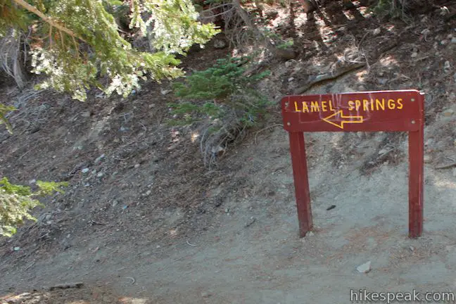
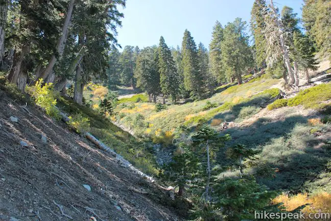
Above the bench, the trail continues to climb with switchbacks alternating between the northern slope of the mountain and a ravine on the eastern face. At 1.8 miles from the start you will arrive at a junction with a spur to Lamel Springs, marked by a large sign. A narrow track heads to the left, extending to a water source in the ravine. Assuming you packed enough water for the trek, simply continue up the main trail to the summit of Mount Baden-Powell. About half a mile above the spring, the trail passes a landing on the side of the mountain that could make a nice backcountry campsite.
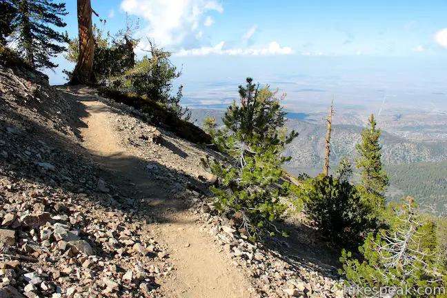
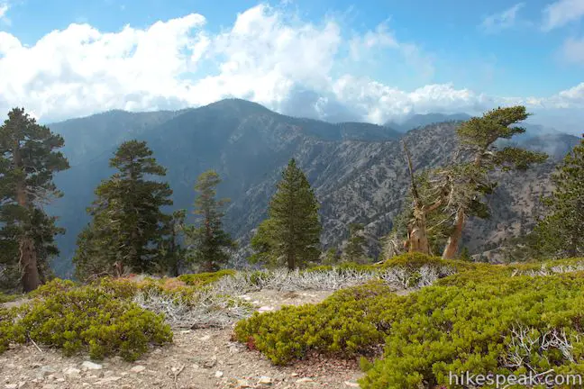
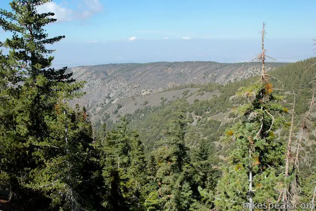
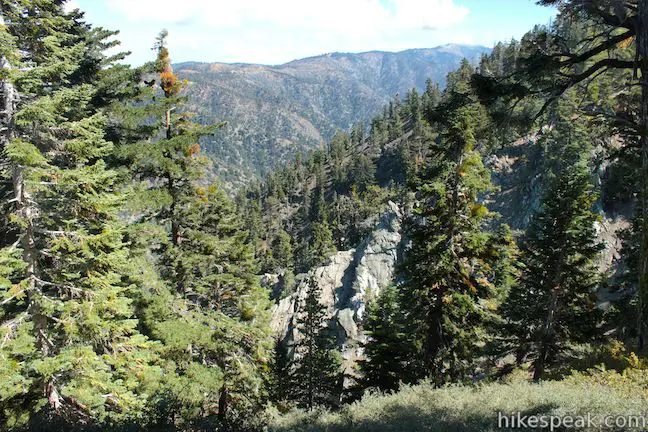
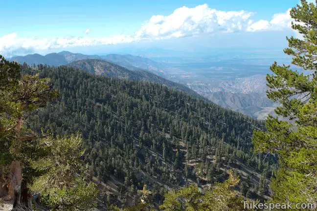
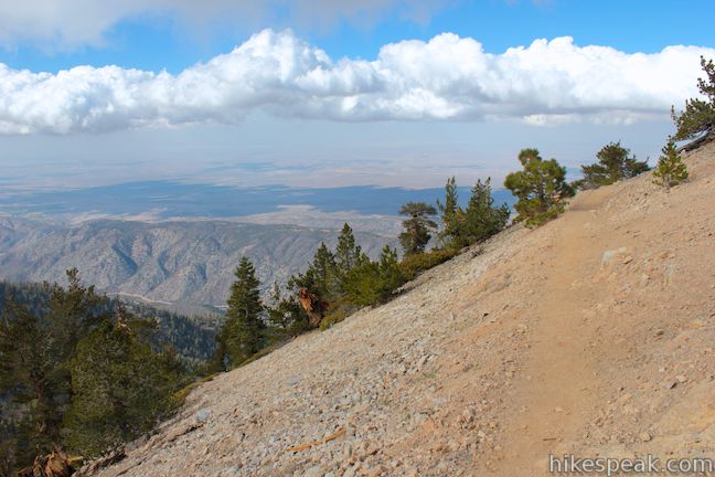
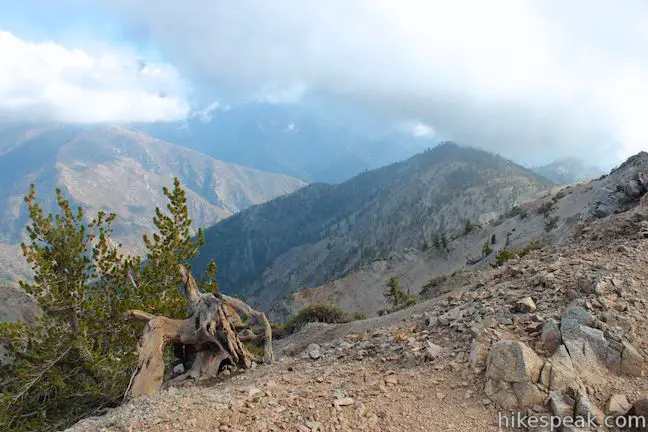
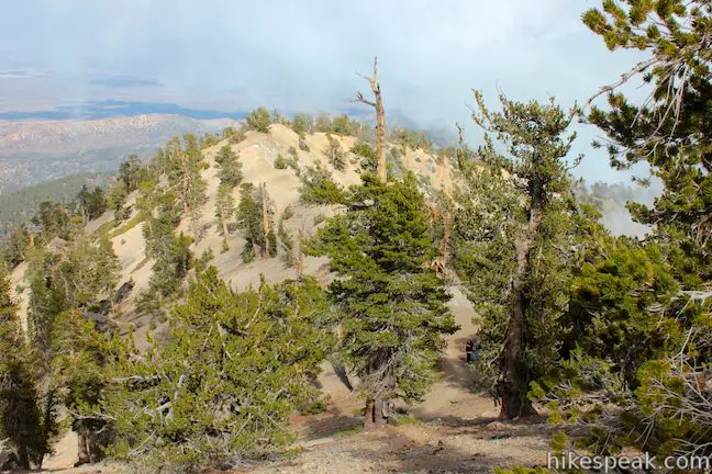
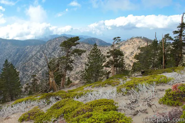
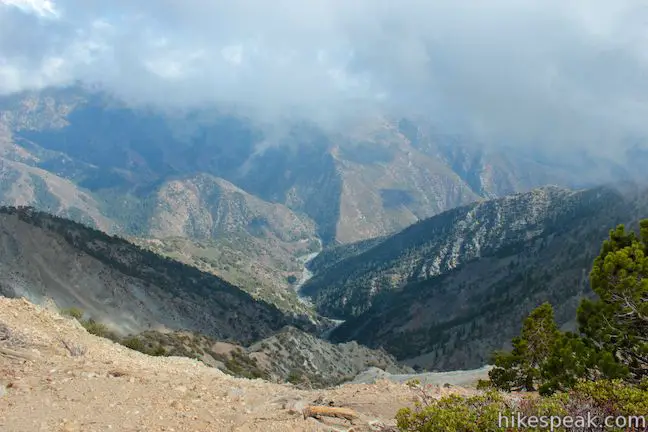
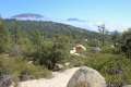
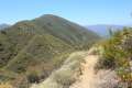
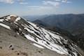
The switchbacks continue, weaving farther around the north side of the mountain. As you climb above 8,000 feet, the lodgepole pines thin and the views expand, allowing you to gaze down the north side of the range toward the Mojave Desert. The switchbacks shorten as you climb a false summit east of the actual peak, taking you to new views northwest over canyons carved by Big Rock Creek.
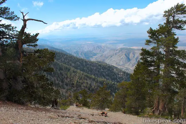
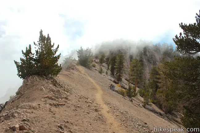
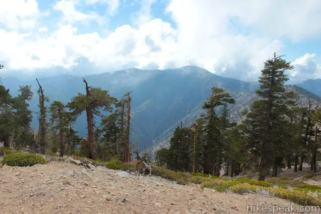
Catch your breath as the trail crosses a narrow ridge just below the actual summit (that is like a short taste of the Devil’s Backbone Trail east of Mount Baldy). Along the ridge, you will reach the Mount Baden-Powell Pacific Crest Trail Junction, 4 miles and 2,625 feet from the start. To the right, the PCT heads downhill to Windy Gap (5.2 miles) and Islip Saddle (7.2 miles). To reach the summit of Mount Baden-Powell, turn left and continue up the ridge to the peak.
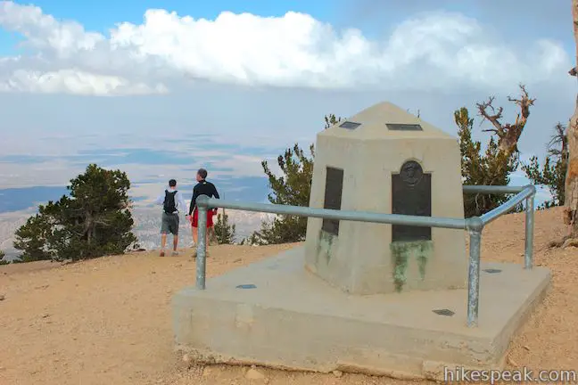
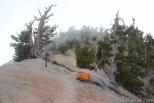
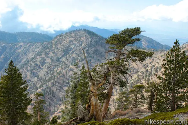
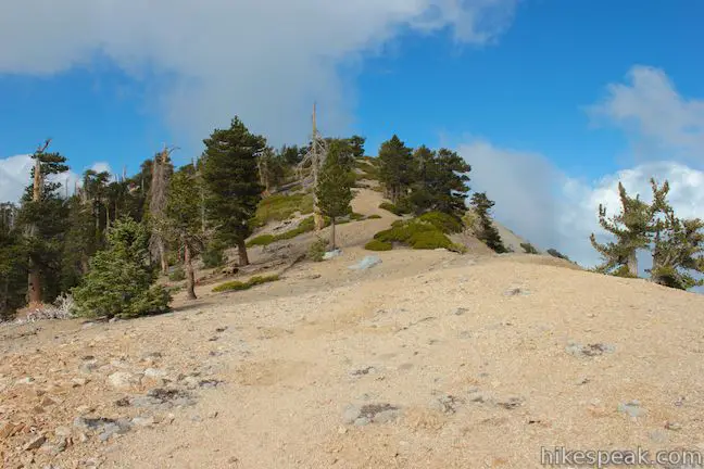
Just past the Mount Baden-Powell Pacific Crest Trail junction you will pass the Wally Waldon Tree, a limber pine clinging to the spine of the ridge that is estimated to be 1,500 years old. The tree honors the scout leader most responsible for the creation of the monument for Lord Baden-Powell on the summit, which you will reach after just a couple more switchbacks.
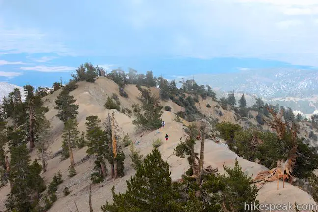
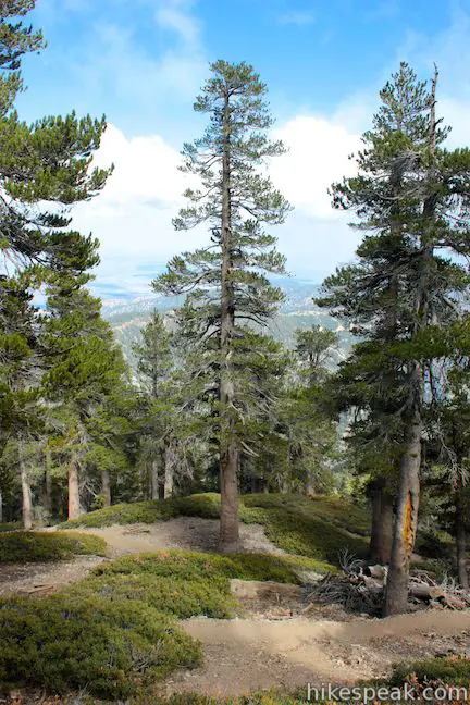
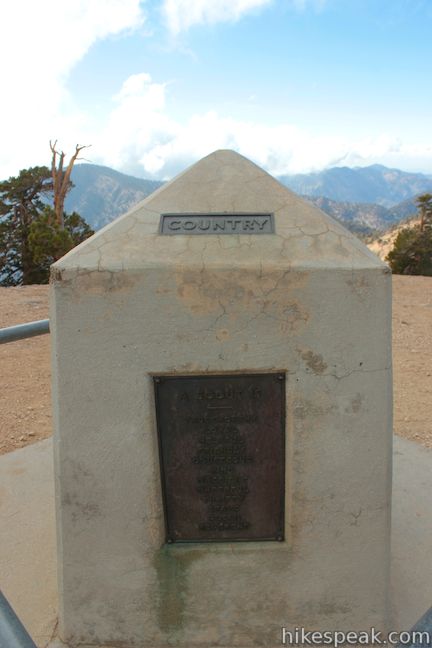
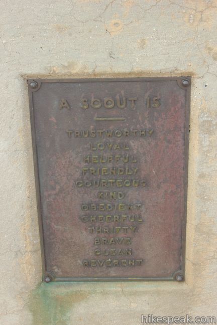
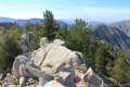
From the junction, it is only 1/8 of a mile to the summit of Mount Baden-Powell. The impressive mmemorial has four sides labeled with compass arrows and the guiding principles of scouting, duty to God, country, others, and self. Each side of the monument bares a plaque of significance to Baden-Powell and the Boy Scouts of America. There is a summit register next to the monument, where you are invited to write a message, having completed the climb to the 8,399-foot summit!
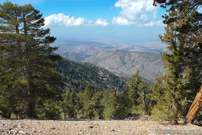
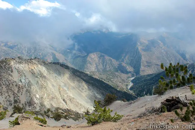
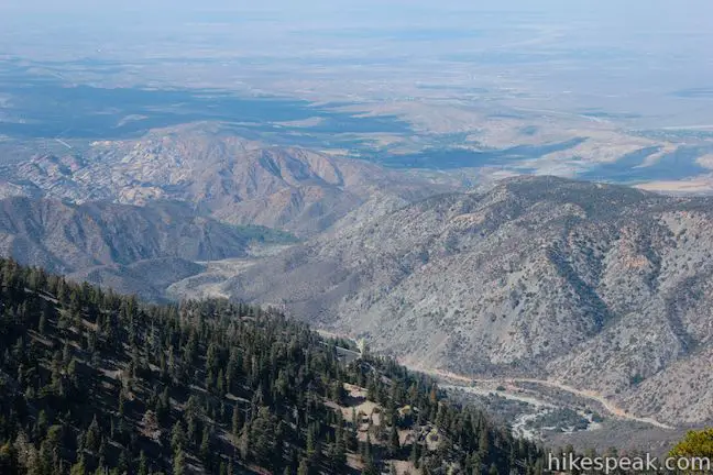
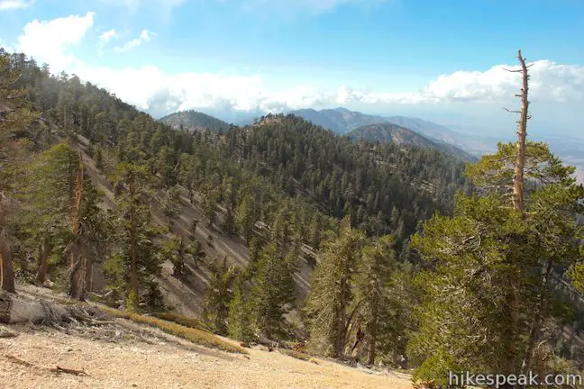
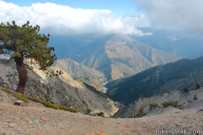
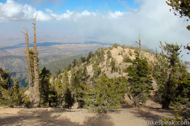
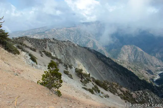
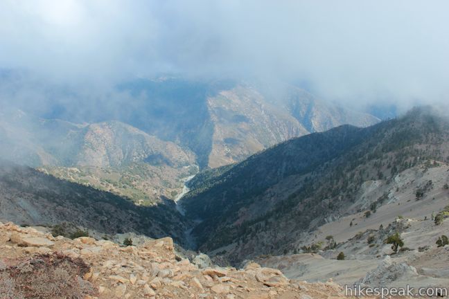
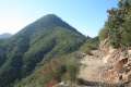
The views from the mountaintop are epic. To the north lies the expansive Mojave Desert. To the west, Hawkins Ridge extends toward Throop Peak. To the south, when not consumed by clouds, you will spot Iron Mountain. The dominating form of Mount Baldy, the tallest mountain in the San Gabriels, rises to the southeast and just north of that round bald summit you’ll see Pine Mountain and Dawson Peak. If you aren’t afraid of heights, look southeast over the deep trench called Mine Gulch and the canyons carved by the upper forks of the San Gabriel River. The views in every direction are mesmerizing.
The summit is roughly pyramid-shaped with three ridges extending east, west, and south. If there are crowds on Mount Baden-Powell, the south ridge is a great place to get away and enjoy a private view. You can hike a quarter mile down this ridge (dropping 125 feet) before the terrain becomes steep. There are fantastic views southeast over the chasm of Mine Gulch toward Mount Baldy. The path down the south ridge offers bonus exploration for those who want to spend a little extra time on the summit.
Linger as long as you like before hiking back the way you came (it’s all downhill), completing the 8.25-mile round trip hike between Vincent Gulch Divide and the summit of Mount Baden-Powell. Do not hike up the mountain in a lightning storm or when the trail is icy or made dangerous by other questionable weather. Dogs are allowed on the trail, but mountain bikes are prohibited. A National Forest Adventure Pass is required for vehicles parked at the trailhead, but no other permit is required to hike to the summit of Mount Baden-Powell, so get out and enjoy!
Directions to the Trailhead
- From the 210 Freeway in La Cañada Flintridge, head northeast on Angeles Crest Highway (CA 2) for 50.3 miles to Vincent Gulch Divide where there is a large turnout on the south side of the road at the start of the trail.
- From the 15 Freeway, take exit 131 for Route 138 west.
- Drive 20 miles and turn left up Angeles Crest Highway (CA 2).
- Go 14 miles and turn left into the trailhead parking area.
Trailhead Location
Trailhead address: Angeles Crest Highway, Azusa, CA 91702
Trailhead coordinates: 34.372947, -117.752282 (34° 22′ 22.60″N 117° 45′ 08.21″W)
You may also view a regional map of surrounding Los Angeles trails and campgrounds.


 | Mount Waterman The 5.5 to 6 miler can be completed as an out and back hike or a loop, traveling through a pine forest to a round summit. |
 | Twin Peaks & Mount Waterman This 11.65-mile hike extends the loop over Mount Waterman by dropping across a saddle and ascending Twin Peaks, a panoramic summit in the center of the San Gabriel Mountains. |
 | Cooper Canyon Falls This 3-mile hike leaves from Buckhorn Campground and visits a short waterfall in an enchanting glen of tall pines. |
 | Winston Ridge and Winston Peak This 4.85-mile partial loop bags a summit and a scenic ridge in the high San Gabriel Mountains. |
 | Mount Hillyer This 6,215-foot summit can be reach from two trailheads for a 3 to 6.25-mile hike gaining between 575 and 1,000 feet. |
 | Bridge to Nowhere This adventurous 10-mile round trip hike reaches an abandoned and out-of-place bridge with a unique history. |
 | Heaton Flats Trail This hike of 3.6 to 6 miles (or more) starts from the same trailhead as the hike to the Bridge to Nowhere and climbs toward Iron Mountain and panoramic views. |
 | Smith Mountain This 7-mile hike ascends 1,800 feet to a 5,111 foot summit with panoramic views over the San Gabriel Mountains. |
 | Mount Baldy Loop This 11.3-mile hike incorporates the Devil's Backbone and the Baldy Bowl - Ski Hut Trail into one see-all loop. |
 | More trails in the Los Angeles Explore other destinations in the Santa Monica Mountains, San Gabriel Mountains, and elsewhere. |
- Mount Baden-Powell on wikipedia.org (opens in a new tab)
- Mount Baden-Powell on summitpost.org (opens in a new tab)
- Mount Baden-Powell on Dan's Hiking Pages (opens in a new tab)
- Mount Baden-Powell on wrightwoodca.com (opens in a new tab)
- Mount Baden-Powell on abhiking.blogspot.com (opens in a new tab)
- Mount Baden-Powell on alltrails.com (opens in a new tab)
- The official website of the Angeles National Forest (opens in a new tab)
Common Questions about Mount Baden-Powell in the San Gabriel Mountains
- Is the trail open?
- Yes. You should expect to find that Mount Baden-Powell Trail is open. There are no recent reports of trail closures. If you discover that the trail is closed, please help your fellow hikers by reporting a closure.
- Do I need a permit for this hike?
- Yes. National Forest Adventure Pass.
- How much time does this hike take?
- It takes approximately 5 hours 15 minutes to hike Mount Baden-Powell Trail. Individual hiking times vary. Add extra time for breaks and taking in the views.
- How long is this hike?
- The hike to Mount Baden-Powell Trail is a 8.25 mile out and back with 2834 feet of elevation change.
- Are dogs allowed on this trail?
- Yes, dogs are allowed on Mount Baden-Powell Trail. The trail is open to hikers, dogs.
- Is Mount Baden-Powell Trail a difficult hike?
- This hike should be considered strenuous. Hikers should be prepared for a workout covering 8.25 miles and 2834 feet of climbing.
- Does this trail go to a summit?
- Yes, Mount Baden-Powell Trail reaches a summit with panoramic views.
- What mountain range is this trail in?
- Mount Baden-Powell Trail is located in the San Gabriel Mountains.
- Where is the trailhead located?
- The trailhead for Mount Baden-Powell Trail is located in Azusa, CA.
Trailhead Address:
Angeles Crest Highway
Azusa, CA 91702
Trailhead Coordinates:
34.372947, -117.752282 - What are the driving directions to the start of the hike?
To get to the trailhead: From the 210 Freeway in La Cañada Flintridge, head northeast on Angeles Crest Highway (CA 2) for 50.3 miles to Vincent Gulch Divide where there is a large turnout on the south side of the road at the start of the trail.
From the 15 Freeway, take exit 131 for Route 138 west. Drive 20 miles and turn left up Angeles Crest Highway (CA 2). Go 14 miles and turn left into the trailhead parking area.
View custom Google Maps directions from your current location.
- Are there other trails near Mount Baden-Powell Trail?
- Yes, you can find other nearby hikes using the Hikespeak Hike Finder Map.

15 Comments on Mount Baden-Powell in the San Gabriel Mountains
What hikers are saying:
✨ Generated summary of user commentsHikers find this trail to be a rewarding experience with plenty of shade and well-placed benches to rest. The summit offers amazing views and ample space for lunch, though it can be cold and windy at the peak. Andrew recommends using Little Jimmy campground as a base camp because it provides running water and bathrooms for those looking for a beginner backpacking trip. Be alert for rattlesnakes while navigating the switchbacks.
Crazy there was no snow up there in December! Nice recap
It’s a great hike. I made it up before the snow hit. We had kind of a late winter this year.
how long does it take to get to the top? is there a campground at the top or is this just a day hike? Thank you. hg
this is a great day hike, there is no campground at the top. the top is a great place to have lunch. on the way up, there are benches to stop and take a break.
about 3 miles from where you park there is a campground called Little Jimmy that has running water and bathrooms. It is a great base camp or a good beginner backpacking trip.
Is there a campsite nearby that can be used as a base? We would be coming from the south.
Angeles Crest Highway (CA 2) is usually closed in the winter, as it is not plowed, west of Grassy Hollow; therefore, you’d have to walk or ride bicycles to get to Vincent Gap trailhead.
Jackson Flat Group Campground is located south-west of the town of Wrightwood, on the Blue Ridge near Grassy Hollow Visitor Center. This is a group campground right along the Pacific Crest Trail (PCT), west of Inspiration Point. This is a walk-in only campground (There is no vehicle access to this campground). The Jackson Flat Group Campground has 5 large group sites, pit toilets, and running water. Inside the campground there are bear-proof food storage containers.
There are other campgrounds in the Wrightwood area just a few minutes drive from Vincent Gap.
Well done.
Having done this hike many times (particularly fun in the winter when the 2 is open) I’ve found that I prefer the Dawson Saddle Trail.
The trail is well maintained, more varied and there’s a much better chance for solitude. It’s about a mile longer RT, and roughly 700 feet less elevation gain, but offers some killer views on the way up.
And if anyone really wants a workout (or solitude) after you reach the summit; just keep walking on the use trail. You lose significant elevation the farther you go but it’s an awesome way to grab two summits in the same day…even if it’s the same one.
As of mid October Highway 2 was closed between Islip Saddle and Vincent Gap. I was told it would not reopen until spring. So, you probably have to plan on going through the town of Wrightwood to get there.
Do we need to wear clampons at this time?
Ive hiked Mount Baden Powell multiple times from the vincent gap and the Dawson saddle area. Vincent gap is about 8 miles rt with 2,800 gain. Dawson saddle side is 9 miles rt with 1,800 gain. I prefer the dawson side as your literally walking in a mountain ridge the 80% of the way, vegetaion is also extremely diverse here as well. For the more adventurous and fit, from the Summit of Baden you can head down south to Ross Peak, 2 miles from baden and about a 2,000 foot drop which you have get gain back.
One of my favorite hikes. Lots of shade. Sometimes cold and windy at the top, lots of areas to eat lunch. Switchbacks are inclined as you reach the top. Mid way the switchbacks have flat areas to catch your breathe. To the top at an average pace with one or two stops will take you two hours, back down about 1.5 hours if you are at a 19 pace. The views are amazing.
Where do I find which trail is open to more brain bikes?
IS MT BADEN POWELL OPEN TO HIKE ON jULY 4, 2020?
I was a member of Explorer Scout Post 509 (Highland Park) in the LA Area District back in the 1960s. One of our duties every year was to hike the trail, clean up the switchbacks, paint the monument railing, and clean up the monument area. It was a great way to spend a Saturday, and contribute to the mountain’s history. Saw a few rattlesnakes too. Thanks for the pictures.