Mount Waterman
in the San Gabriel Mountains
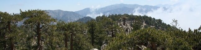
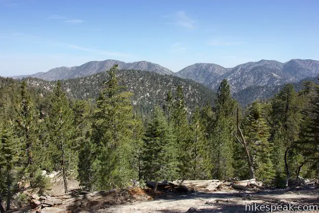
The round summit of Mount Waterman offers boulders to climb and views to enjoy. Mount Waterman Trail provides a pleasant route to the top, passing through a sylvan mixed forest of incense cedars and Jeffrey pines as it ascends 1,265 feet over 2.75 miles. Descend the same way for a 5.5-mile out and back hike or return by a dirt road for a 5.65-mile (or longer) loop. Twin Peaks Trail extends from Mount Waterman Trail to the impressive summit of Twin Peaks East and can be used to and an second summit and another 6 miles of hiking (round trip) to this trek. The trailhead is an hour’s drive up Angeles Crest Highway from Los Angeles and provides a secluded hiking experience.
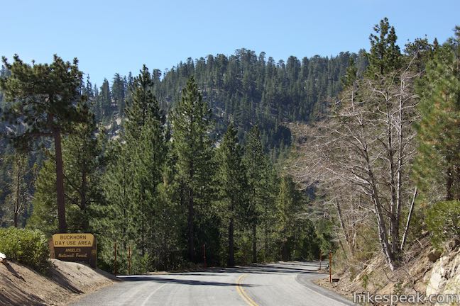
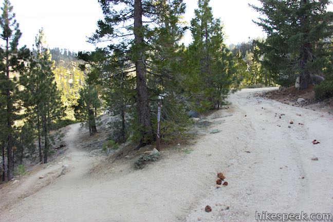
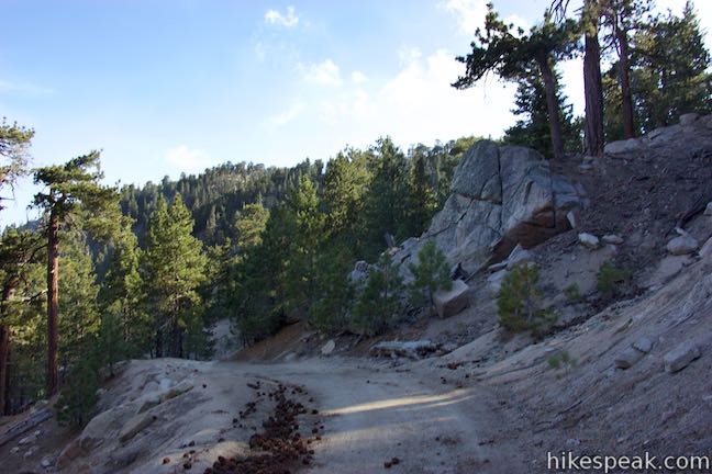
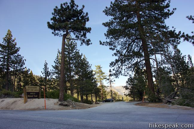
Park at a large turnout along Angeles Crest Highway and walk east down the road. As you approach Buckhorn Day Use Area (a spot for picnics), cross Angeles Highway to a white gate at the start of a dirt road up Mount Waterman (Mount Waterman Road)
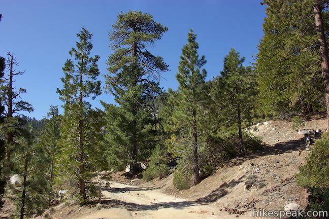
Walk 150 yards up Mount Waterman Road and turn onto Mount Waterman Trail, a dirt single track splitting off to the left. Mount Waterman Road continues up Mount Waterman and can be used at the end of this hike as a return route across the summit.
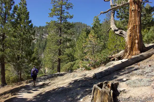
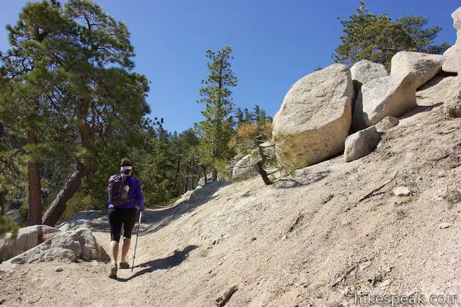
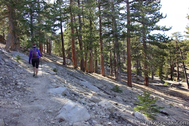
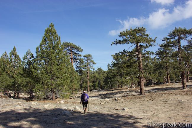
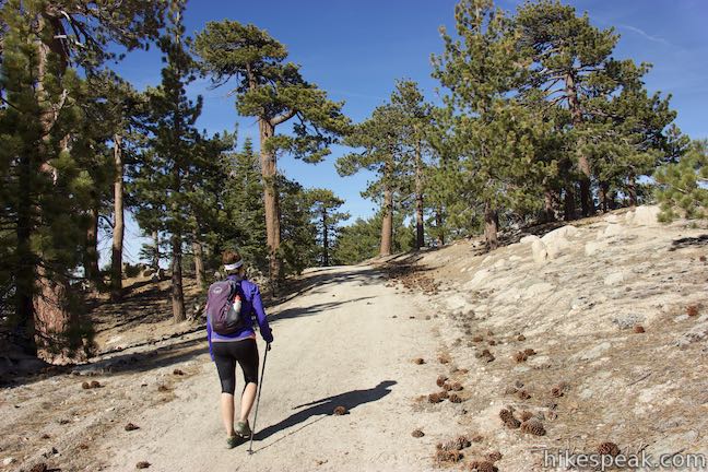
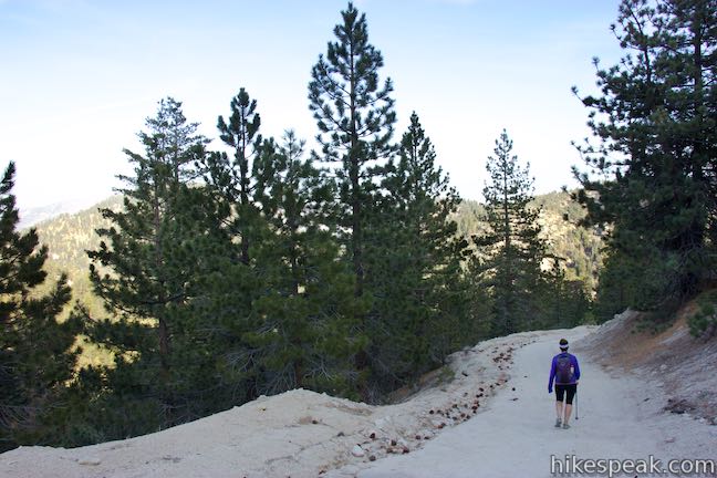
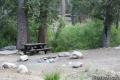
Mount Waterman Trail runs parallel to Angeles Crest Highway at the start, but quickly curves uphill and away from the sounds of passing motorists. The trail is even and hard packed – easy on the feet. And the ascent is gradual – easy on the legs. At a quarter mile from the start, a picnic table is positioned just off the left side of the trail, just before the trail crosses a boulder-covered drainage. As you ascend, look northeast over Buckhorn Campground toward the mountains making up Pleasant View Ridge.
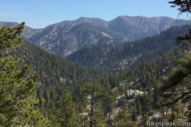
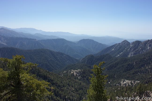
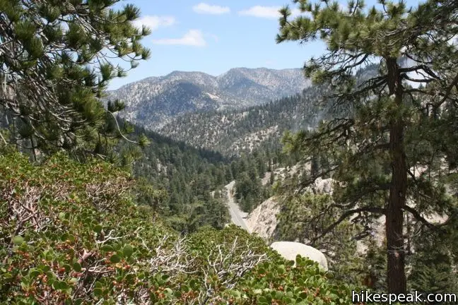
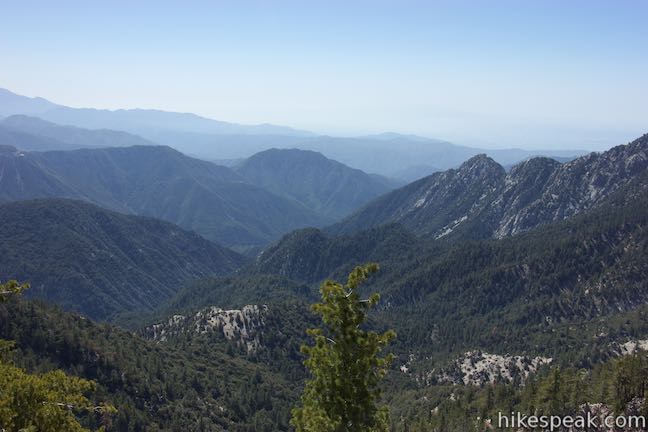
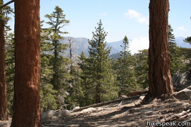
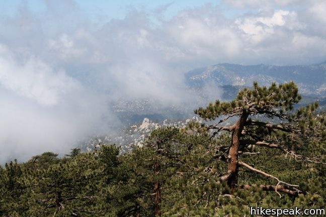
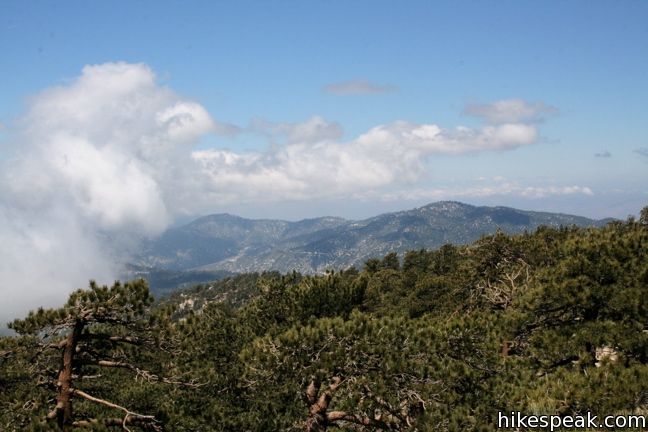
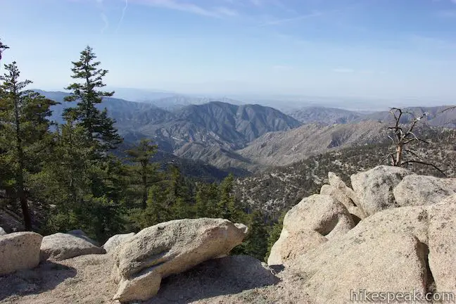
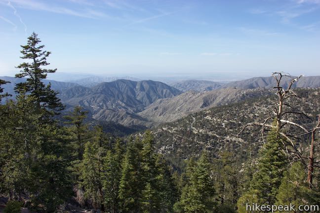
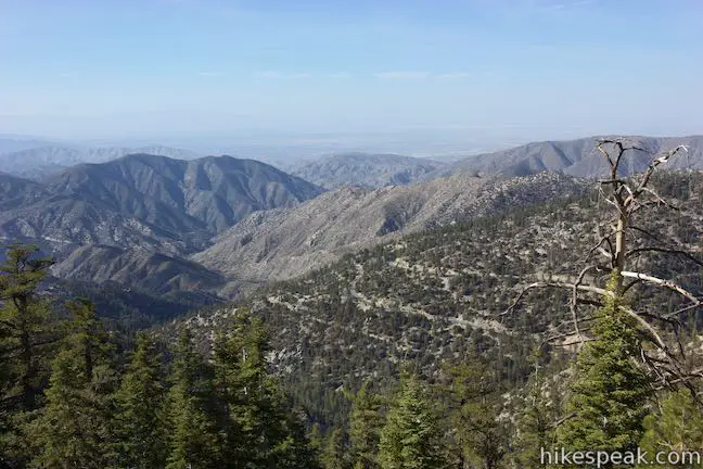
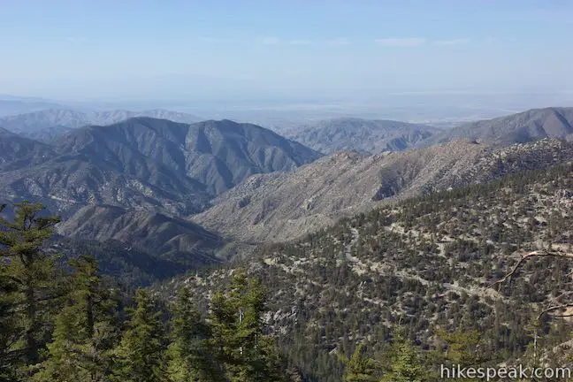
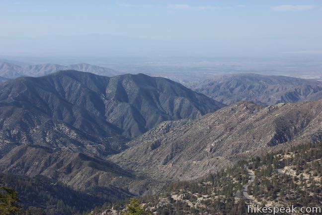
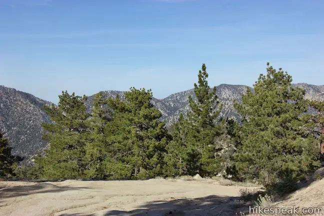
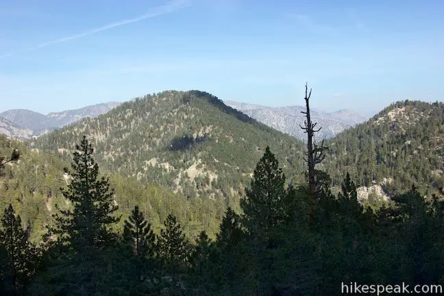
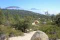
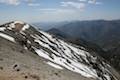
After one mile, the soothing trail reaches a ridge running east from Mount Waterman and curves to the right. New views to the south open up below the trail. The broad expanse of Bear Creek Canyon runs away from you, bordered by rugged ridges and peaks. Beyond the San Gabriel Mountains, you can look across the San Gabriel Valley toward the silhouette of Santiago Peak in the Santa Ana Mountains. This is one of the better views of the hike, so pause to appreciate it.
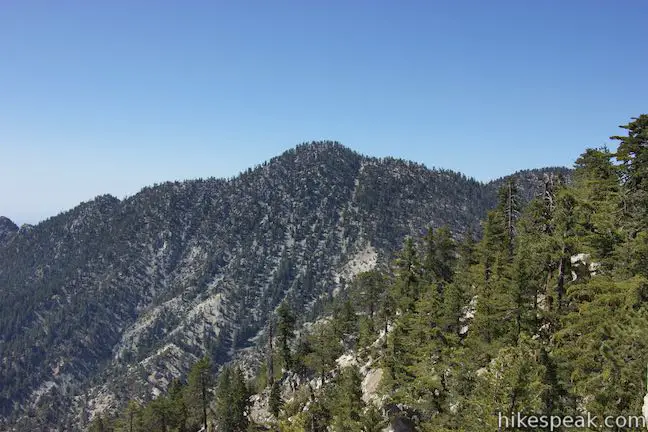
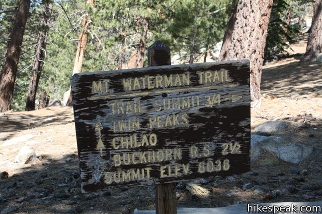
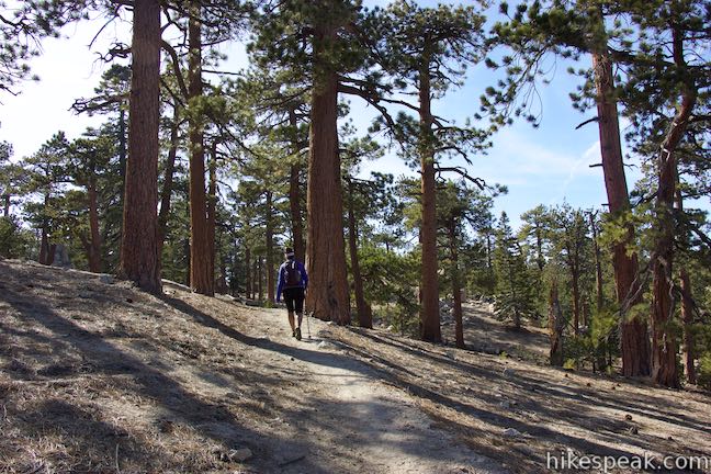
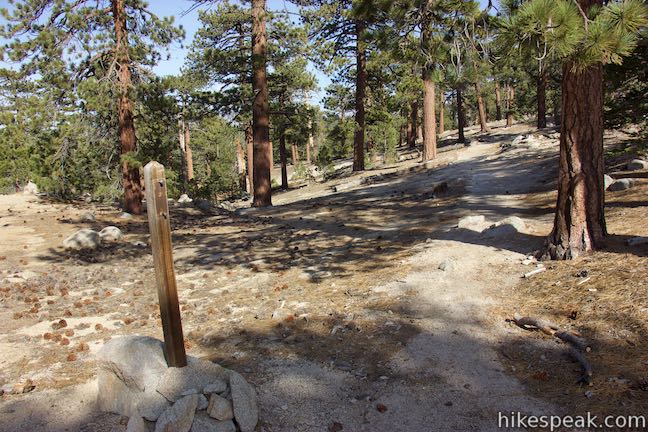
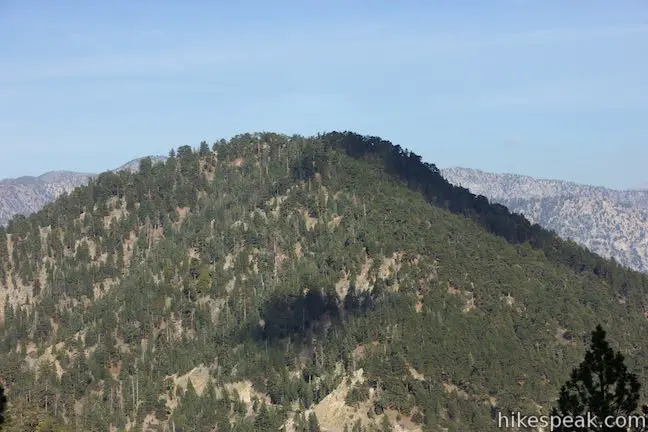
Mount Waterman Trail heads west up the ridgeline and maintains the ascent. After two miles, the trail comes to a marked junction. To the left, a trail descends toward Twin Peaks and the Three Points Trailhead on Angeles Crest Highway. This trail can be used to extend the hike by six miles round trip, with a gradual 1,145-foot descent followed by a steep 1,230-foot ascent to the summit of Twin Peaks East. To reach the top of Mount Waterman, turn right. It is another 0.75 miles to the 8,038-foot summit via the shortest route.
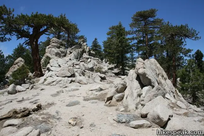
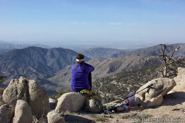
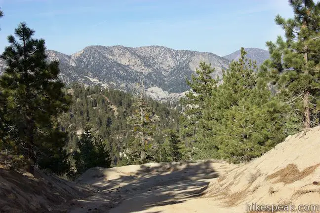
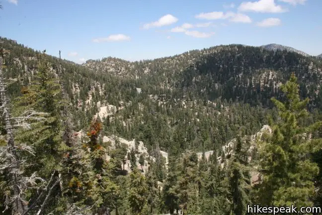
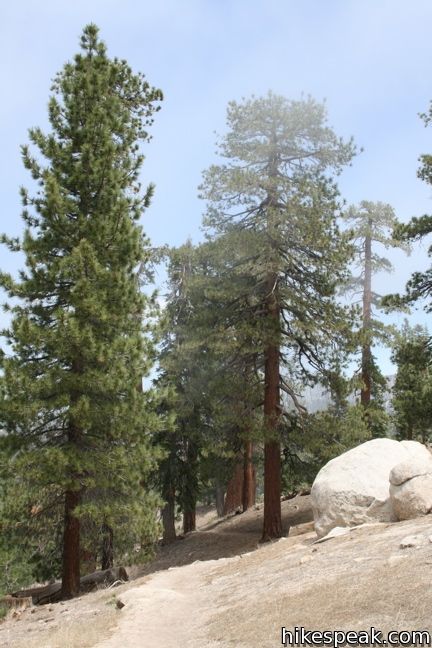
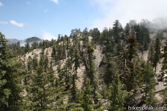
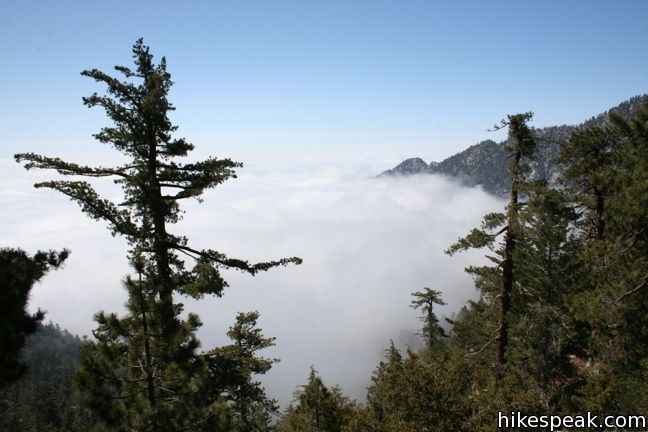
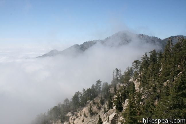
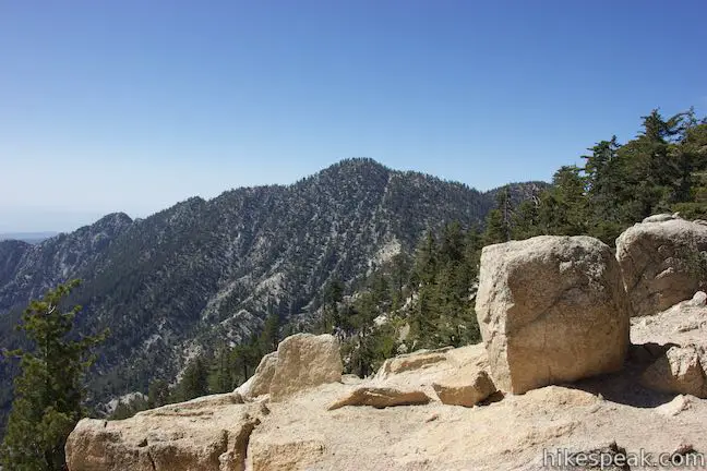
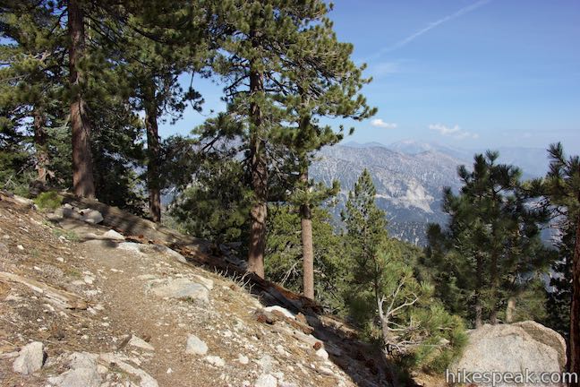
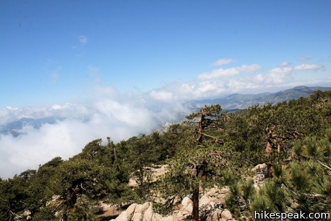
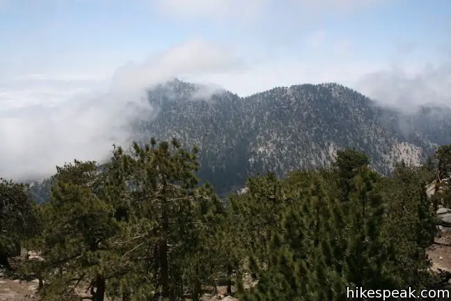
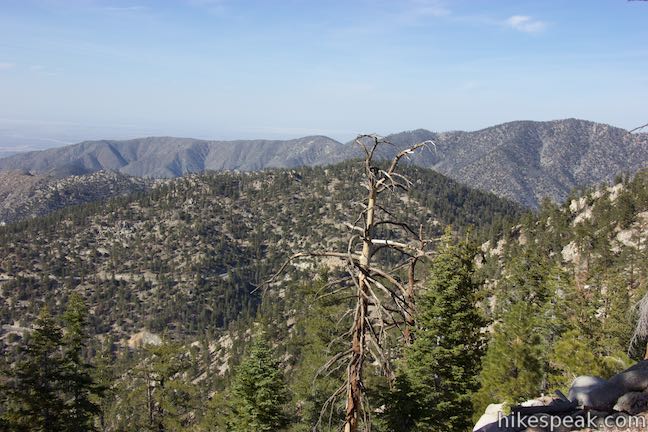
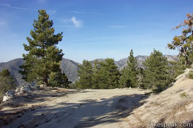
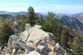
The upper section of Mount Waterman Trail remains gradual, heading north before curving to the west. The trail crosses a crest and offers nice views northeast across Cooper Canyon toward Pallett Mountain and the rest of Pleasant View Ridge. At 0.65 miles from the previous junction, a split in the trail leaves hikers with two options. A steeper path turns up the mountain to the left leading to the highest southern end of Waterman. Take this route to summit the mountain after just 2.75 miles of hiking. The high point of the mountain is not prominent enough to offer completely sweeping views, but a panorama can be pieced together by climbing atop boulder stacks to see over the trees and take in the surroundings.
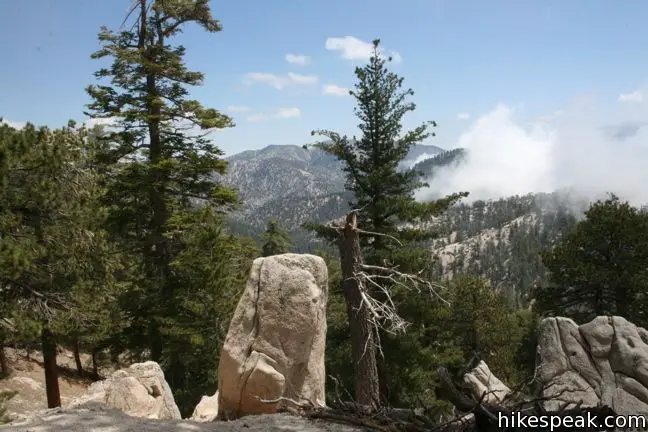
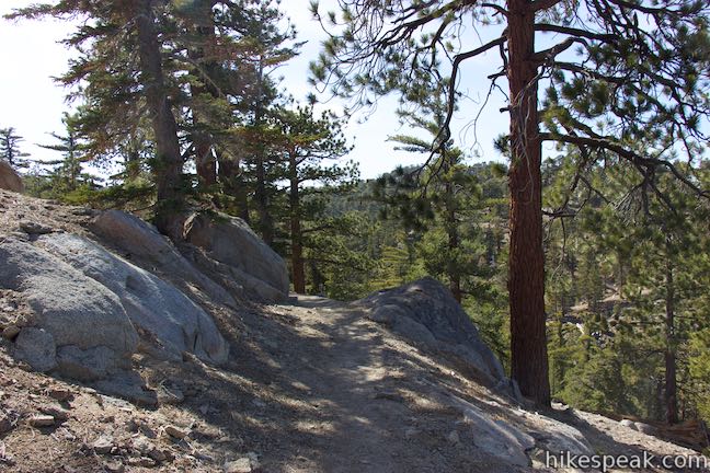
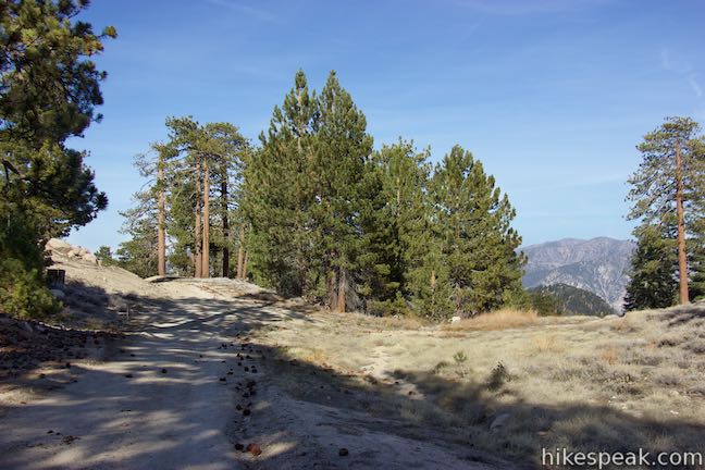
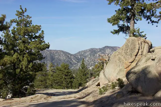
Continuing straight (bearing to the right) at the split, Mount Waterman Trail maintains a gradual course toward the center of the mountaintop. Mount Waterman has a large C-shaped summit with dispersed boulder formations. At 0.95 miles above the Mount Waterman Trail Junction, the single-track trail comes to an end at a T-junction with a dirt road. Bear left to explore the south side of the summit or turn right to hike the loop across the mountain.
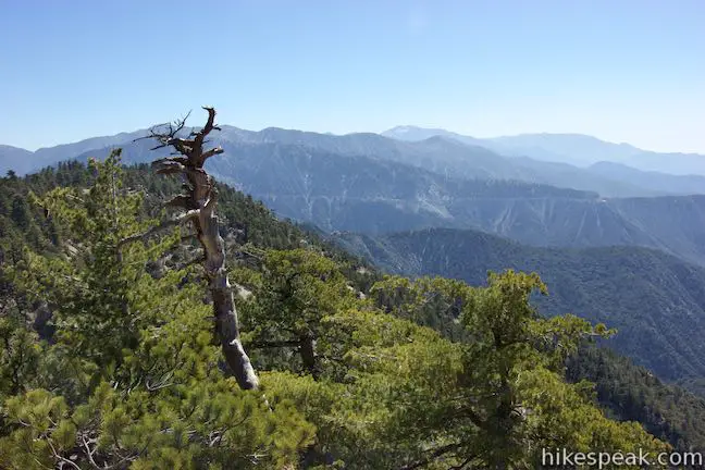
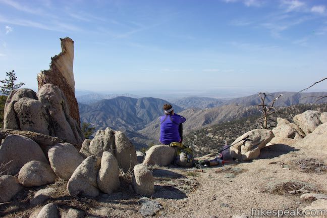
If you are opting for an out-and-back hike on Mount Waterman, climb atop a nearby rock pile to gain views over the canyons to the west. Then head south toward the high point of Mount Waterman, which isn’t much higher than the rest of the broad mountaintop. Take in the southward view of Twin Peaks and the westward view toward Mount Hillyer. From here, return down the steeper path to get back to the V on Mount Waterman Trail. Proceed back down the trail through the marked junction, along the ridge, and down to the trailhead for a hike of around 6 miles round trip.
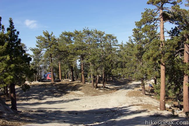
To make a loop of the hike to Mount Waterman, take a dirt road through Mount Waterman Resort on the north side of the mountain. After bearing right at the top of Mount Waterman Trail, 2.95 miles from the start, come to a T-junction in the dirt road after another tenth of a mile. Bear right again to head north along the mountain. Straying off the left side of the trail here, you can find excellent views from the edge of the mountaintop and look north and west over lower ridges toward the drainage of Rock Creek and the desert below.
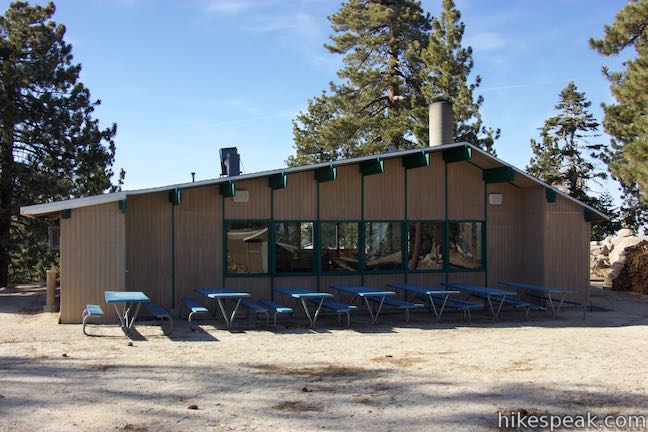
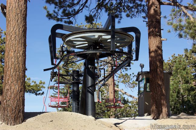
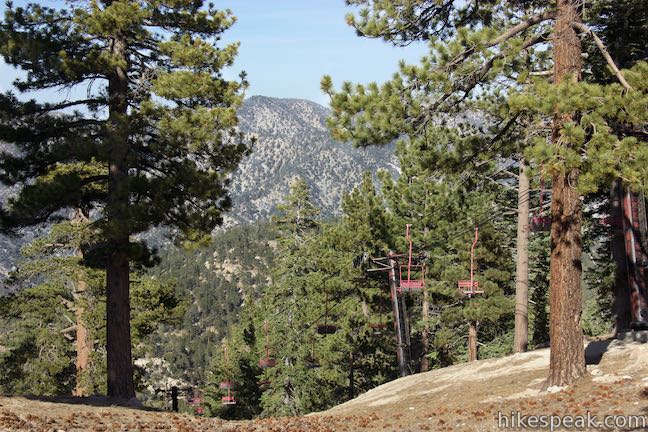
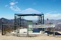
Hike north, passing several less used roads on the right that connect to the top of a chairlift. At 3.35 miles from the start, bear right at a split to stick with the main road down Mount Waterman. Hike past a few disc golf basket and descend toward Mount Waterman Village, where a small lodge is perched at the top of the main chairlift for Mount Waterman Resort, which has a very brief ski season. Bear right to continue down the road. After another 1.15 miles of switchbacks, and 4.85 miles from the start, come to an intersection in the road and turn left. The road to the right is an alternate route down Mount Waterman. Descend for almost another 3/4 of a mile to the junction with the bottom of Mount Waterman Trail, just up from Angeles Crest Highway. Close Mount Waterman Loop and hike down the final stretch of the road to return to pavement. Turn left up Angeles Crest Highway to walk back to the parking area.
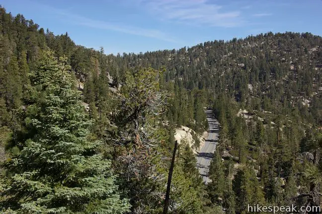
The drive up the Angeles Crest Highway to Mount Waterman takes about an hour and is a pleasant trip for a day when you have time to head deeper into the mountains. Far as it is from LA, Mount Waterman’s visitors may wish to stay overnight at Buckhorn Campground. A shorter trail at the campground heads down to Cooper Canyon Falls, providing another good hike in the area. Dogs and bikes are permitted on the trail on Mount Waterman. A National Forest Adventure Pass map be required to park along Angeles Crest Highway. No permit is required to hike to the summit of Mount Waterman, so get out and enjoy!
Directions to the Trailhead
- From the 210 Freeway in La Cañada Flintridge, head northeast on Angeles Crest Highway (CA 2) for 35 miles.
- Pass Mount Waterman Ski Area and park in the small lot off the north side of the road, just past mile marker 58.
- If you reach the entrance for Buckhorn Campground you have gone too far.
- Walk along the road toward Buckhorn Day Use Area, which is just past the parking area.
- Cross Angeles Crest Highway to the start of Mount Waterman Road, a dirt road on the south side of the highway that is blocked by a white gate.
Trailhead Location
Trailhead address: Angeles Crest Highway, San Gabriel Mountains National Monument, Pearblossom, CA 93553
Trailhead coordinates: 34.3465, -117.9210 (34° 20′ 47.39″N 117° 55′ 15.60″W)
View Mount Waterman Area Trails in a larger map
Or view a regional map of surrounding Los Angeles trails and campgrounds.


 | Cooper Canyon Falls This 3-mile hike leaves from Buckhorn Campground and visits a short waterfall in an enchanting glen of tall pines. |
 | Winston Ridge and Winston Peak This 4.85-mile partial loop bags a summit and a scenic ridge in the high San Gabriel Mountains. |
 | Mount Hillyer This 6,215-foot summit can be reach from two trailheads for a 3 to 6.25-mile hike gaining between 575 and 1,000 feet. |
 | Vetter Mountain This 3.8 or 4.4-mile hike ascends from Charlton Flats Picnic Area to Vetter Mountain, where there are exceptional 360-degree view from the site of an old fire lookout tower. |
 | Mount Baden-Powell This 8.25-mile round trip hike ascends 2,834 feet to one of the tallest summits in the San Gabriel Mountains and a monument to Lord Baden-Powell, a BSA icon and the founder of the Scout Movement. |
 | Mount Baldy Loop This 11.3-mile hike incorporates the Devil's Backbone and the Baldy Bowl - Ski Hut Trail into one see-all loop. |
 | More trails in the San Gabriel Mountains Explore other destinations in the range. |
 | Buckhorn Campground This 38-site campground is an hour drive up the Angeles Crest Highway from LA and a great weekend spot for summer tent camping. |
 | Horse Flats Campground This 25-site campground in the Angeles National Forest in the San Gabriel Mountains offers first-come first-serve equestrian-friendly sites. |
 | Coulter Group Campground This single-site campground accommodates up to 50 people per night, offering fresh mountain air and sweeping views at 5,300 feet. |
Common Questions about Mount Waterman in the San Gabriel Mountains
- Is the trail open?
- Yes. You should expect to find that Mount Waterman Loop is open. There are no recent reports of trail closures. If you discover that the trail is closed, please help your fellow hikers by reporting a closure.
- Do I need a permit for this hike?
- Yes. National Forest Adventure Pass.
- How much time does this hike take?
- It takes approximately 3 hours to hike Mount Waterman Loop. Individual hiking times vary. Add extra time for breaks and taking in the views.
- How long is this hike?
- The hike to Mount Waterman Loop is a 5.5 mile out and back with 1265 feet of elevation change.
- Are dogs allowed on this trail?
- Yes, dogs are allowed on Mount Waterman Loop. The trail is open to hikers, dogs, bikes.
- Does this trail go to a summit?
- Yes, Mount Waterman Loop reaches a summit with panoramic views.
- What mountain range is this trail in?
- Mount Waterman Loop is located in the San Gabriel Mountains.
- Where is the trailhead located?
- The trailhead for Mount Waterman Loop is located in Pearblossom, CA.
Trailhead Address:
Angeles Crest Highway
Pearblossom, CA 93553
Trailhead Coordinates:
34.3465, -117.921 - What are the driving directions to the start of the hike?
To get to the trailhead: From the 210 Freeway in La Cañada Flintridge, head northeast on Angeles Crest Highway (CA 2) for 35 miles. Pass Mount Waterman Ski Area and park in the small lot off the north side of the road, just past mile marker 58. If you reach the entrance for Buckhorn Campground you have gone too far. Walk along the road toward Buckhorn Day Use Area, which is just past the parking area. Cross Angeles Crest Highway to the start of Mount Waterman Road, a dirt road on the south side of the highway that is blocked by a white gate.
View custom Google Maps directions from your current location.
- Are there other trails near Mount Waterman Loop?
- Yes, you can find other nearby hikes using the Hikespeak Hike Finder Map.

21 Comments on Mount Waterman in the San Gabriel Mountains
What hikers are saying:
✨ Generated summary of user commentsHikers find this trail to be a heaven on earth that offers a peaceful escape close to the city. The gradual climb and wide summit make it an ideal choice for those building their mountain legs, especially when snow covers the fire roads. Diane advises everyone to keep the wilderness pure by packing out all waste and tissue in sealed bags. Be aware that mountain bikes occasionally cut through the trails, which can lead to close encounters for those on foot.
“The climb is gradual given the switchbacks, the trail opens to some nice views and the wide, vast summit is great to explore.” Jump to comment ↓
Hiked Mt Waterman and Twin Peaks, 15+ mi, 6,000 elev up/down, left 8:15a back 3:45p return hwy 2. Sore but really great double in 1 day. Little tracks, only 3 people all day, no mammals bummer. Wish the wilderness had more animals…Overall very awesome hike and views. Feb 18 2012.
Oh the animals are there. They don’t always pop out to say hi to humans though. That’s the problem with hiking, is most the animals can smell and hear you from hundreds of yards away. Try finding a hiding rock cropping and post up their for 2-12 hours, and you’ll see something, if you’re in the right places.
Warning: Groupon is selling the mt waterman coupon again. Consider the following condition before you buy, and there is no refund or exchange.
1. check how many days Mt. Waterman open during 2011-2012 or end of 2012 ski season, the answer is ZERO.
2. Groupon or others has fine print say “subject to weather”, they will not responsible if they don’t ever open because the weather condition. if Mt Waterman never open during the season, good luck with the groupon and they will not care.
3. Since Mt. waterman DO NOT make snow, like there web site said “pray, pray, pray”, beside pray, you can’t do anything, ‘cos money is in there pocket.
4. If you don’t have a SUV or larger car, make sure your car fit all the ski equipments before you buy groupon, because mt. waterman don’t have equipment rental, you need to bring your own, buy your own, or rent it from sport chalet or else and drive all the way from your rental place to Mt. Waterman. if you forgot to check Mt. Waterman condition before you rent, good luck, after you rent your stuff, bring it to Mt. Waterman, and they said they don’t have enough snow and not open, then all you can do is bring it back to the place you rent, return the equipment and lost 1 day equipment rental fee, then pray.
5. if you go to school or work like me, busy during week day and maybe some weekend, you should prepare some vacation off, because weather don’t come in every weekend, if they open during weekday, you better take a day off to go, otherwise coupon site said, mt. waterman did open, and you can go during those days. you need to be very flexible on your schedule if you ever buy those coupon, because mt. waterman pray for snow storm, and snow storm not necessary come in holiday or weekend.
6. Road condition is not so easy to drive like the way to Mt. high or bear mt., bring snow chain all the time in case it snow after you ski.
7. LA has several very cold storm in the last few weeks, it’s less than 50F or in low 50F during day time, everyone else like mt. high, snow valley, big bear are opened, but Mt. waterman can’t open because they don’t have enough snow, pray, pray and pray.
Think of these condition before you buy a contract from the coupon site, i am so disappoint because i bought groupon in late fall in 2011, i was never able to use it because they never open, and groupon has been very helpfull to suggest to give it away to someone else and won’t do anything else. i was so excited when i bought it, but after one season, i already give up my hope on my $$$, and bought a ticket to mt. high and big bear during winter break. Good luck everyone.
yes, but Mt Waterman, is honoring all tickets, vouchers, passes purchased from last year to be valid for this 2012/2013 winter season, because they did not open. Hopefully Mother Nature comes through this year so Mt. Waterman can open.
was the waterman,buckhorn area, north, damaged in the fire a few years ago? if so, is it recovering well?
No. There was no fire damage in those areas.
We are coming down from SF to the LA area to do this wonderful hike next month. What is an “Adventure Pass” and how/where do we obtain one ? Thank you.
Hi. An adventure pass is/was needed to visit the national forests in SoCal. Recently, the areas where the adventure pass are required have been reduced. Since it is undeveloped, it is likely that an Adventure Pass is no longer required to park at this trailhead. When you drive up Angeles Crest Highway, you will pass a ranger station where you can stop and check to see if a pass is still needed and purchase one for $5 for the day or $30 for the year. Have a good hike! More info on the Adventure Pass.
This is very helpful. Thank you very much ! We are really looking forward to this hike, and several others near Malibu. This is a very helpful website. Keep the info coming ! Have a great day.
The trail map for this hike (Mt. Waterman) is actually the map for Winston Ridge/Peak. Do you have a map for Mt. Waterman?
The trail map for Mount Waterman and Twin Peaks has been added. Enjoy the hike!
I am assuming the gps map located at the bottom of this article is incorrectly linked? I see Waterman Mountain on the South Side of the 2 freeway. Prior research of this trail supports that conclusion. Am I correct?
Hi, the GPS map has been updated to show the trails to Mount Waterman and Twin Peaks. More photos coming soon.
any restrooms in the area?
There’s a vault toilet at the Buckhorn Picnic Area.
Nature calls sometimes when we are near a toilet. ALWAYS carry kleenex and a ziploc in your pocket. Find a hidden place off trail behind a bush or tree. Dig a hole with a rock or stick. Do your thing, bury it as deep as you can. (6″?) and ALWAYS pack out your kleenex or tp in the ziploc bag, throw away at home. NEVER bury tp or kleenex. It gets uncovered with wind, etc, and ruins the landscape. It’s so easy to PACK IT OUT, please do it. Keep our wilderness pure.
Been hiking up here since 1978!…Its heaven on earth…being so close to the city…great to get away only a 1 hours drive from L.A.! The only thing I do not like is the mountain bikes being allowed to cut thru the trails…I have had several close encounters…lets keep this beautiful wilderness to hikers only…if you want to be in the wilderness…hike into it!
I think this is one of the better hikes in the ANF for those who are beginning to get their higher elevation hiking legs.
The climb is gradual given the switchbacks, the trail opens to some nice views and the wide, vast summit is great to explore without much fear of losing your way back to the trail.
And for those who dig snow hiking, particularly during a storm, if the 2 is open it’s an awesome place to spend a day and/or night. The fact that you can turn it in to a loop is a nice option. For me, I don’t mind fire road hiking in the snow because I can just zone out and enjoy the ride down the mountain.
Does the trail open tomorrow? Where can I purchase the parking pass?
[…] Mt. Waterman […]
Hiked Mount Waterman today with my dog. There’s still quite a bit of fire damage but otherwise, the conditions were near perfect – high 60s, clear skies and a slight breeze. Titus appreciated the patches of snow on the ground. Whenever he’d feel hot, he’d just roll around in the snow, cool down and be ready and eager for the next leg up the mountain. All in all, a great day!