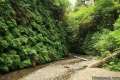
Woodland Trail
in Richardson Grove Redwoods State Park
Normally when you hike a trail, you don’t spend your time speculating what motivated the trail builders to put the path where the did. Perhaps the CCC was eager for work when it designed Woodland Trail in Richardson Grove State Park.
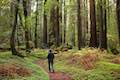
The east side of this 1.25-mile lollipop loop is sensible, passing through pockets of redwoods at the base of a hill. On the other hand, the west side makes you ask what’s my motivation as you ascend 325 feet up the side of a mountain to an arbitrary apogee, just so you can immediately hike down the other side.
No one says you have to hike the whole thing, so feel free to avoid what seems like wasted effort and cut out the climb, reducing the loop to a 1-mile out and back with less than 50 feet of elevation gain.
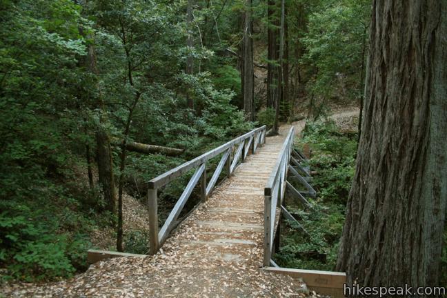
Find Woodland Trail from the Ranger Station just inside the entrance station, or from the north end of Huckleberry Campground. If you park at the ranger station, backtrack a short distance up the road past the entrance to a trail marker on the left side of the road. This single track heads northwest, skirting along the exterior of Huckleberry Campground before crossing a wooden bridge to the start of the loop.
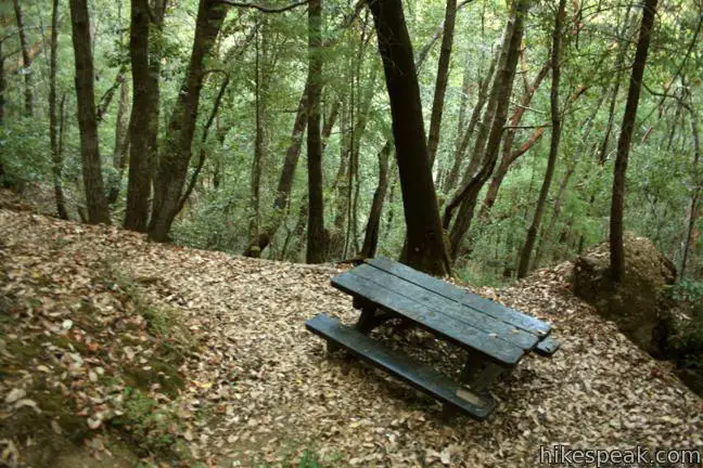
To the left, the trail ascends 300 feet over a quarter-mile to a picnic table at Hikers Rest. It is a quick aggressive climb, with no rewarding view at the top. Past the picnic table, the trail immediately drops back off the wooded mountainside, reaching the level part of the loop after 1/3 of a mile.
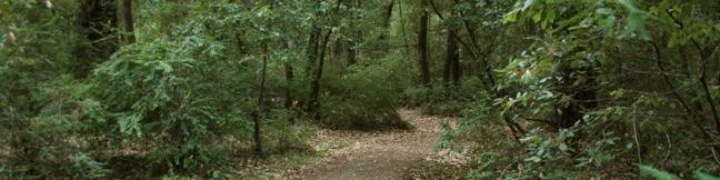
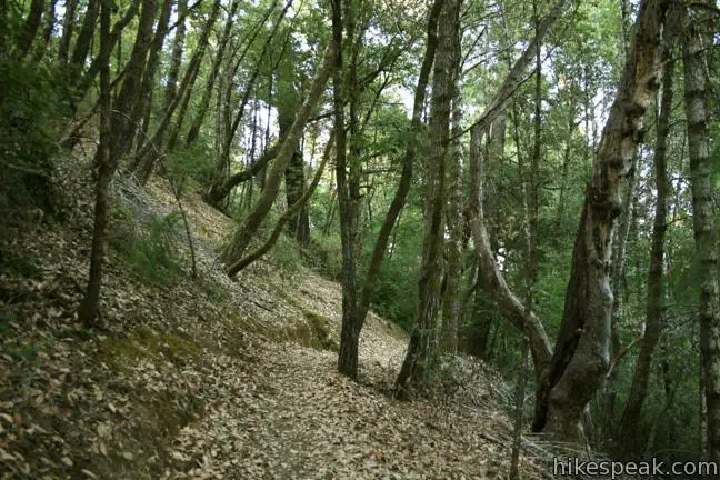
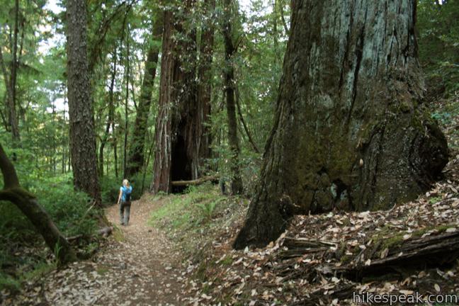
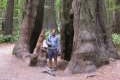
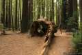
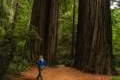
To skip all the uphill, or save it for last, turn right at the start of the loop, taking a gradual course through an oak forest mixed with redwoods. Several signs provide names for the groves along the trail. Calling them groves may be a bit of an exaggeration, as only a handful of redwoods make up each grouping.
No redwoods seem to grown on the arduous side of the loop, which is why you can pull a 180 as soon as the grade starts to increase. Save yourself the trouble and give the easy-to-reach redwoods a second look. That’s what you came here for anyway, right?
No permit is required to hike Woodland Trail, but at $8 day use fee is required to enter Richardson Grove Redwoods State Park. Dogs are not allowed on hiking trails within the park.
For a longer hike in the park with even fewer redwoods, check out Durst Creek Trail – Tan Oak Springs Trail – Lookout Point Loop, or take a short stroll through the grove near the park visitor where you will find the highest concentration of redwoods in Richardson Grove Redwoods State Park.
Directions to the Trailhead
- From Highway 101, 15 miles north of Leggett, and approximately 30 miles south of Humboldt Redwoods State Park, turn west into the main entrance for Richardson Grove Redwoods State Park.
- The road curls immediately to the south to the park entrance station.
- Proceed straight ahead to the ranger station outside Huckleberry Campground and park.
- Backtrack up the road(using the path to the right of the entrance station if you prefer) to reach the trailhead at the bend in the road.
Trailhead Location
Trailhead address: 1600 Highway 101, Richardson Grove Redwoods State Park, Garberville, CA 95542
Trailhead coordinates: 40.021954, -123.794194 (40° 01′ 19.03″N 123° 47′ 39.09″W)
You may also view a regional map of surrounding Northern California trails and campgrounds.


 | Durphy Creek Trail - Tan Oak Springs Trail - Lookout Point Loop This 3.75-mile loop climbs 1,000 feet to a forest ridge before descending to Lookout Point, where you can enjoy an unimpressive view to the south. |
 | Founders Grove Nature Trail This 0.5 mile loop explores an ancient grove honoring the founders of the Save-the-Redwoods League in Humboldt Redwoods State Park. |
 | Grieg-French-Bell Trail This half-mile loop in Humboldt Redwoods State Park explores redwood groves dedicated to Grieg, French, and Bell, crossing ground covered in redwood sorrel to visit the Girdled Tree, which had its bark stripped away and sent to San Francisco. |
 | Drury-Chaney Loop Trail This 2.4-mile lollipop loop provides an easy and enchanting hike through redwood trees at the north end of Humboldt Redwoods State Park. |
 | Gould Grove Trail This half mile loop explores an old growth redwood forest across from the visitor center in Humboldt Redwoods State Park. |
 | Fern Canyon Trail This one-mile hike explores an incredibly ferny canyon in Prairie Creek Redwoods State Park. |
 | Yurok Loop and Hidden Beach This 2.25-mile hike explores a rugged and beautiful area of California's north coast, combining Yurok Loop Trail and the Hidden Beach Section of Coastal Trail to visit beaches, forests, and ocean vistas. |
 | Stout Memorial Grove This 0.55-mile hike explores an old growth grove of coastal redwoods in Jedediah Smith Redwoods State Park. |
 | More hikes in Northern California Explore other trails in Northern California, including hikes in coastal parks and around Mount Shasta. |
Common Questions about Woodland Trail in Richardson Grove Redwoods State Park
- Is the trail open?
- Yes. You should expect to find that Woodland Trail is open. There are no recent reports of trail closures. If you discover that the trail is closed, please help your fellow hikers by reporting a closure.
- Do I need a permit for this hike?
- Yes. State Park Entrance Fee.
- How much time does this hike take?
- It takes approximately 45 minutes to hike Woodland Trail. Individual hiking times vary. Add extra time for breaks and taking in the views.
- How long is this hike?
- The hike to Woodland Trail is a 1.25 mile lollipop loop with 325 feet of elevation change.
- Are dogs allowed on this trail?
- No, dogs are likely not allowed on Woodland Trail. The trail is primarily open to hikers.
- Is Woodland Trail good for kids?
- Yes, this hike is likely suitable for children. It is relatively short (1.25 miles) with manageable elevation gain.
- Are there redwood trees on this hike?
- Yes, Woodland Trail passes through a grove of redwood trees.
- Where is the trailhead located?
- The trailhead for Woodland Trail is located in Garberville, CA.
Trailhead Address:
1600 Highway 101
Garberville, CA 95542
Trailhead Coordinates:
40.021954, -123.794194 - What are the driving directions to the start of the hike?
To get to the trailhead: From Highway 101, 15 miles north of Leggett, and approximately 30 miles south of Humboldt Redwoods State Park, turn west into the main entrance for Richardson Grove Redwoods State Park. The road curls immediately to the south to the park entrance station. Proceed straight ahead to the ranger station outside Huckleberry Campground and park. Backtrack up the road(using the path to the right of the entrance station if you prefer) to reach the trailhead at the bend in the road.
View custom Google Maps directions from your current location.
- Are there other trails near Woodland Trail?
- Yes, you can find other nearby hikes using the Hikespeak Hike Finder Map.

Go the extra miles...
Submit a rating of this hike to go with your comment. Contribute to the average trail rating.