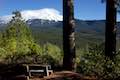
Vista Point
in Castle Crags State Park
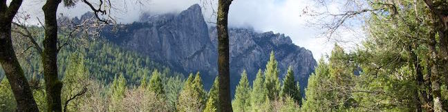
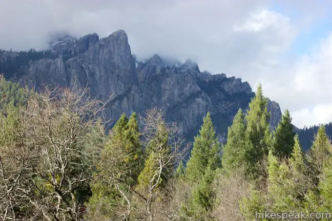
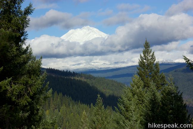
A popular destination for visitors to Castle Crags State Park is the scenic overlook at the end of Vista Point Trail. This easy half-mile round trip hike leads to a triptych of views. On your left, you’ll spot the Gray Rocks rising above evergreen ridges. On your right, there is a clear view of Mount Shasta. In the center, rise the Castle Crags, a fortress of daunting granite peaks. It’s a three-course meal of views, reached by a quick and effortless walk.
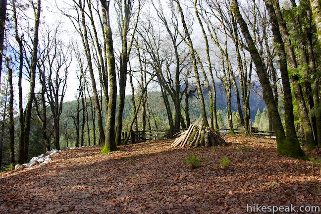
Start from the parking area at the end of Vista Point Road, where a well marked trail sets out for Vista Point. The quarter-mile long trail takes a horseshoe-shaped course up to a landing on Kettlebelly Ridge. The trail starts out heading southeast, but swings around to face northwest toward the Castle Crags. At 0.15 miles, as the trail is making a curve to the right, you will pass the top of another trail on the left that descends toward the campground. Continue up the trail, which levels out and arrives at the scenic overlook.
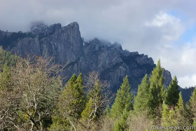
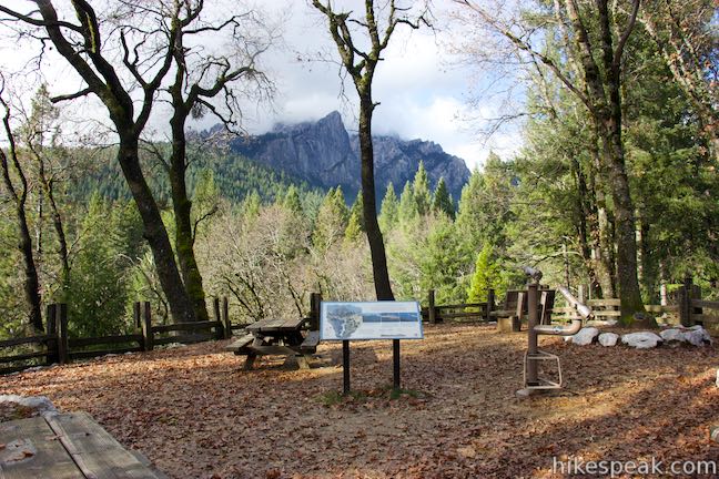
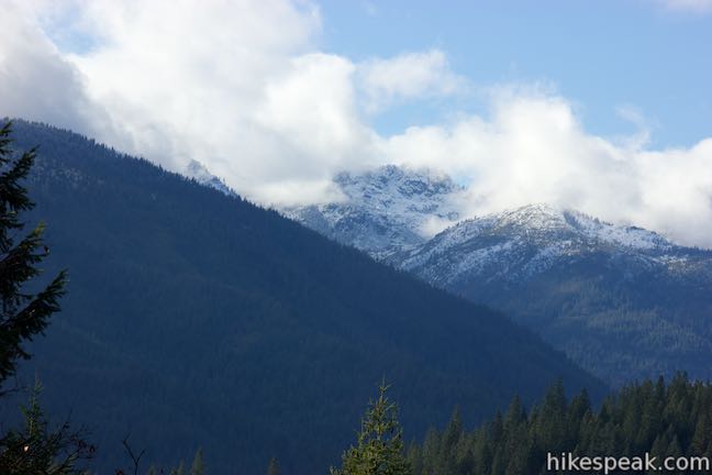
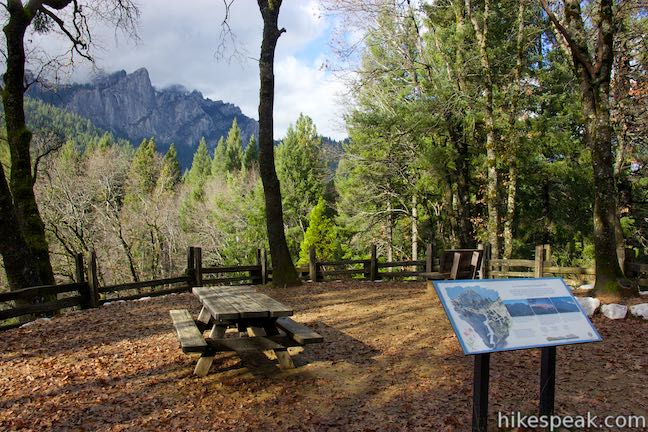
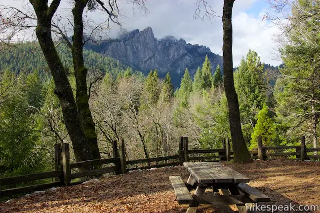
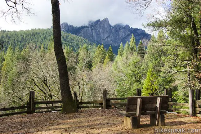
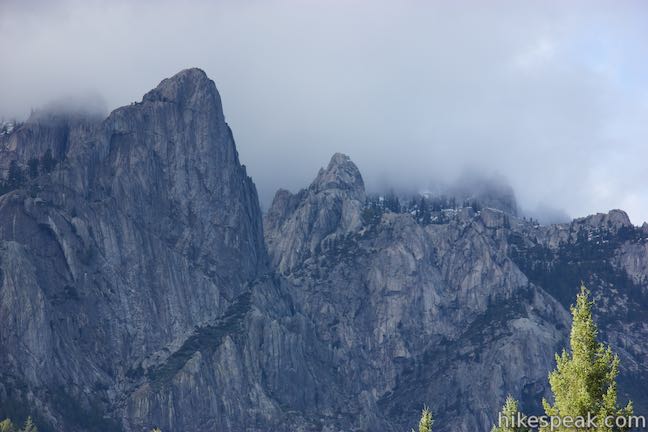
Reaching the overlook, you will first be struck by the head-on view of the Castle Crags. The mountains rise 3,000 feet above the overlook and are made up of jagged rugged peaks. A sign about the area’s geography explains that:
The spectacular Castle Crags are made of granite that cooled slowly deep within the earth. Over time, this granitic pluton was uplifted and the rock above it worn away. Once the granite was exposed to the elements, water and ice have taken over as the main sculpting forces, breaking fractures in the rock, creating the castle-like features.
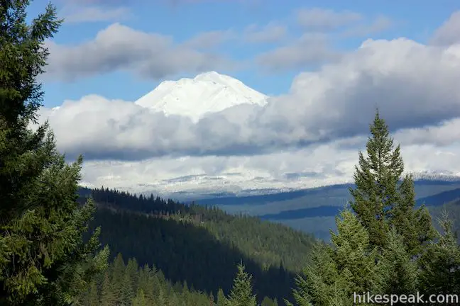
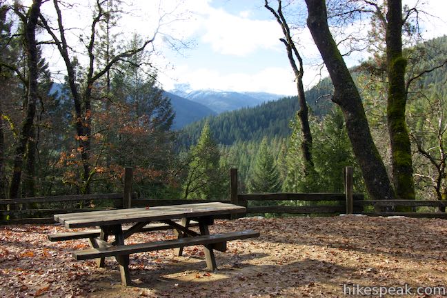
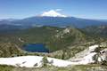
Find a large opening in the trees to your right and it will line you up perfectly for a clear views north toward Mount Shasta. This massive volcano is over 14,000 feet tall and completely covered in snow during the winter months. In geological terms, Mount Shasta is relatively young compared to the area’s other mountains, having begun forming just 530,000 years ago.
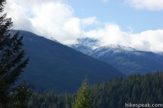
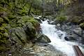
There is also a gap in the trees to the left, providing a window up a canyon carved by Castle Creek. Across the canyon there are evergree ridges topped by rocky peaks known as the Gray Rocks, which look different from the Castle Crags and are actually made up of greenstone.
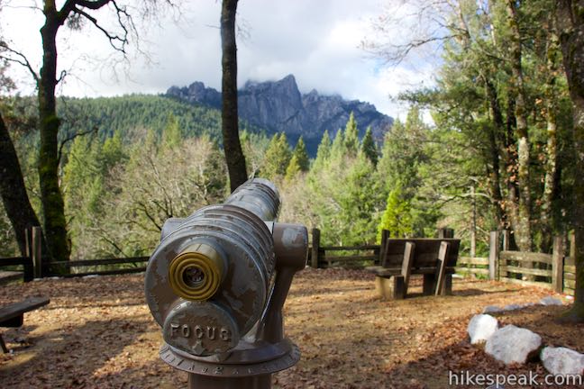
There are picnic tables and a viewing scope at the vista point, allowing you to really enjoy the surroundings. Vista Point Trail is wheelchair-friendly and gains 50 feet in a quarter mile, with a typical grade of 4% and a typical width of 4 feet. Dogs and bikes are not allowed on trails in Castle Crags State Park. There is an entrance fee for Castle Crags State Park ($10 as of 2015).
Directions to the Trailhead
- Take Interstate 5 to exit 724 in Castella (located 14 miles south of Mount Shasta City and 44 miles north of Redding).
- At the bottom of the offramp, turn northwest onto Castle Creek Road.
- Drive 0.3 miles and turn right into the park entrance.
- Inside the park, bear right and drive almost two miles up Vista Point Road to the parking area at the road's end where the trail begins.
- This road goes through the campground in Castle Crags State Park before heading up Kettlebelly Ridge.
- You will pass the start of the longer Crags Trail just before reaching the parking area for Vista Point Trail.
Trailhead Location
Trailhead address: 20022 Castle Creek Road, Castella, CA 96017
Trailhead coordinates: 41.1595, -122.30575 (41° 09′ 34.20″N 122° 18′ 20.70″W)
You may also view a regional map of surrounding Northern California trails and campgrounds.


 | Crags Trail to Castle Dome This 5.6-mile round trip hike in Castle Crags State Park ascends 2,150-feet through a garden of granite crags to the base of Castle Dome. This hike can be extended to 6 miles round trip by taking a worthy side trail to Indian Springs. |
 | Root Creek Trail This 2.2-mile round trip hike in Castle Crags State Park takes a level and easy course to a tumbling creek in a mossy forest. |
 | Bailey Cove Trail This easy 3.1-mile loop circles a hill-covered peninsula on the McCloud Arm of Shasta Lake, providing both lake views and shade. |
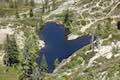 | Heart Lake and Little Castle Lake This 2 to 3-mile hike visits lakes in a beautiful area of Shasta-Trinity National Forest, including the charming-contoured waters of Heart Lake. |
 | Castle Peak and Heart Lake This approximately 3.2-mile hike ventures off trail above Heart Lake to a summit with extraordinary views of the Castle Crags and Mount Shasta. |
 | Lake Siskiyou Trail (South Shore Loop) This short and easy lakefront loop offers great views across Lake Siskiyou toward Mount Shasta and the surrounding evergreen wilderness. |
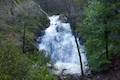 | Faery Falls and Ney Springs This short hike travels along a creek up to an impressive 50-foot waterfall, passing the ruins of an old resort along the way. |
 | Spring Hill This 2.9-mile hike hits a short summit near Mount Shasta with excellent views of Mount Shasta, Black Butte, and the surroundings. |
 | More hikes in Northern California Explore more trails in Northern California, including redwood grove and oceanfront parks along the North Coast. |
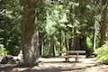
 | Castle Crags State Park Campground There are 76 developed campsites within this state park that are nestled within a pine forest with access to nearby trails. |
 | Castle Lake Campground This six-site campground in Castle Lake is shaded by conifers in Shasta-Trinity National Forest. |
 | Antlers Campground This well-shaded 59-site campground in Shasta-Trinity National Forest has level sites on a bluff next to Shasta Lake. |
Common Questions about Vista Point in Castle Crags State Park
- Is the trail open?
- Yes. You should expect to find that Vista Point Trail is open. There are no recent reports of trail closures. If you discover that the trail is closed, please help your fellow hikers by reporting a closure.
- Do I need a permit for this hike?
- Yes. State Park Entrance Fee.
- How much time does this hike take?
- It takes approximately 15 minutes to hike Vista Point Trail. Individual hiking times vary. Add extra time for breaks and taking in the views.
- How long is this hike?
- The hike to Vista Point Trail is a 0.5 mile out and back with 50 feet of elevation change.
- Are dogs allowed on this trail?
- No, dogs are likely not allowed on Vista Point Trail. The trail is primarily open to hikers.
- Is Vista Point Trail good for kids?
- Yes, this hike is likely suitable for children. It is relatively short (0.5 miles) with manageable elevation gain.
- Is this trail wheelchair accessible?
- Yes, Vista Point Trail is designated as wheelchair-friendly.
- Where is the trailhead located?
- The trailhead for Vista Point Trail is located in Castella, CA.
Trailhead Address:
20022 Castle Creek Road
Castella, CA 96017
Trailhead Coordinates:
41.1595, -122.30575 - What are the driving directions to the start of the hike?
To get to the trailhead: Take Interstate 5 to exit 724 in Castella (located 14 miles south of Mount Shasta City and 44 miles north of Redding). At the bottom of the offramp, turn northwest onto Castle Creek Road. Drive 0.3 miles and turn right into the park entrance. Inside the park, bear right and drive almost two miles up Vista Point Road to the parking area at the road's end where the trail begins. This road goes through the campground in Castle Crags State Park before heading up Kettlebelly Ridge. You will pass the start of the longer Crags Trail just before reaching the parking area for Vista Point Trail.
View custom Google Maps directions from your current location.
- Are there other trails near Vista Point Trail?
- Yes, you can find other nearby hikes using the Hikespeak Hike Finder Map.

Nice post! I love Castle Crags and I feel they are very undervalued since they are next to so much awesome stuff!