
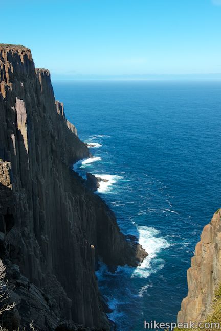
With some of the tallest sea cliffs in Australia, Cape Raoul is a daunting promontory jutting south from the Tasman Peninsula. While it is listed as one of Tasmania’s 60 Great Short Walks, this hike is longer and harder than other tracks on that list at 12 to 14 kilometers (7.45 to 8.7 miles) round trip. The out and back bushwalk follows a track through wild vegetation in Tasman National Park, first ascending 200 meters (655 feet) and then descending 240 meters (790 feet) to reach Cape Raoul. The track is narrow and the hiking is tough at times, but there are stunning cliff-top views along the way to justify the effort, leading to postcard views of the 200-meter tall cliffs of dolerite columns at Cape Raoul.
The walk begins from a car park at the end of Stormlea Road at the southwest corner of the Tasman Peninsula (in the southeast corner of the island of Tasmania). A sign at the start of the track offers this description:
This walk takes you through heath, woodland, and rainforest vegetation to stunning coastal seascapes that feature rock platforms, towering cliffs, offshore islands and swirling seas. The track has a natural bush surface and some rough uphill sections. The cape is subject to strong winds and hazardous cliff edges – please supervise children.
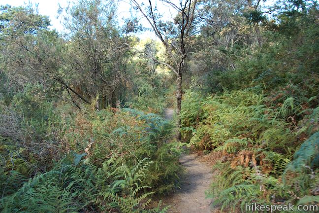
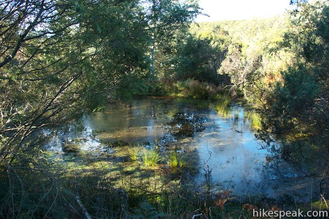
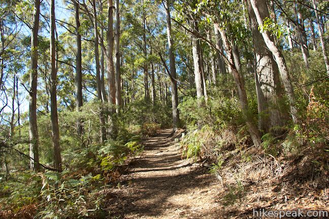
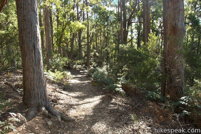
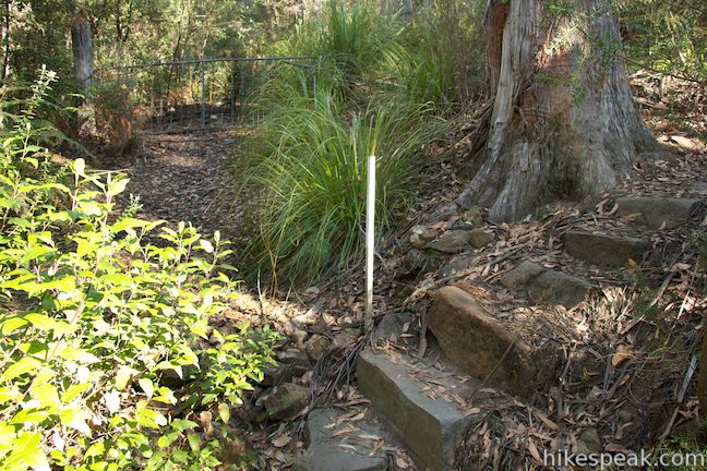
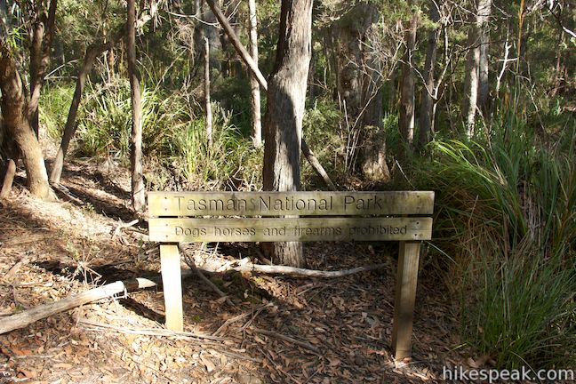
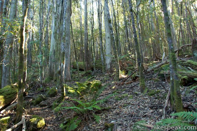
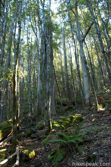
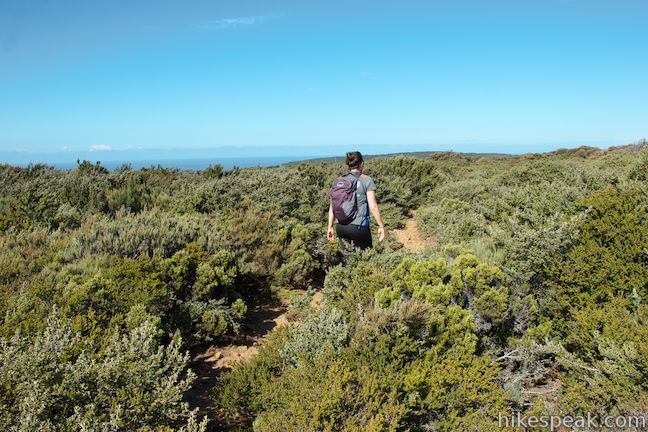
The trail is wide as you get underway, heading uphill along the edge of a forest bordering a pasture. The trail gets narrow quickly, passing through scratchy chest high-brush (long pants and long shirts recommended). Pass a small pond on the left and continue through the rough brush and ferns. As you enter a forest of tall eucalyptus trees, the track will widen temporarily. At the top of this section that looks like an old road, you will come to a flight of stone steps on the right just before a metal gate. Turn right up these steps on a single track venturing deeper into the forest. A short distance farther, and 0.8 kilometers from the start, you will pass a sign at the boundary of Tasman National Park.
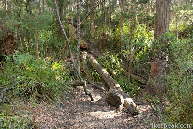
The trail continues through dense forest where a downed tree can be used as a log bridge to cross a gully. The forest (and trail) will thin as you turn uphill and come to the track’s only marked junction, 1.5 kilometers from the start. A trail to the right goes to Shipstern Bluff, which has a popular surf break. Stay to the left to continue toward Cape Raoul.
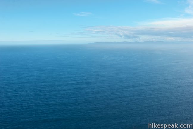
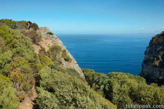
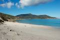
As you continue up the track, you may start to wonder if you’ll ever see the ocean on this coastal hike. After another half a kilometer (2 kilometers from the start), the trail suddenly reaches the edge of some very tall cliffs where you finally get an ocean view, and it’s a knock out!
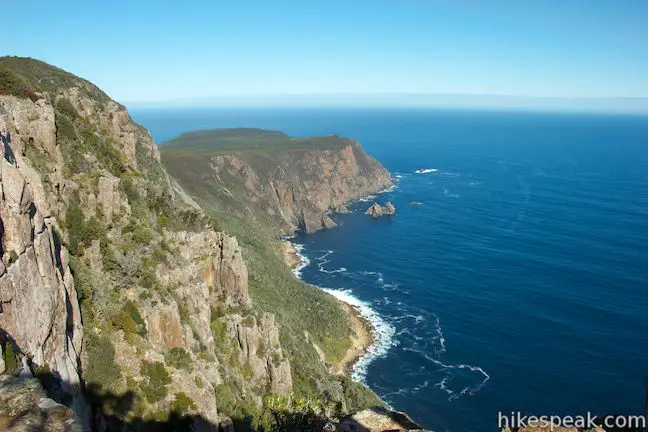
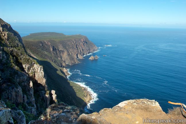
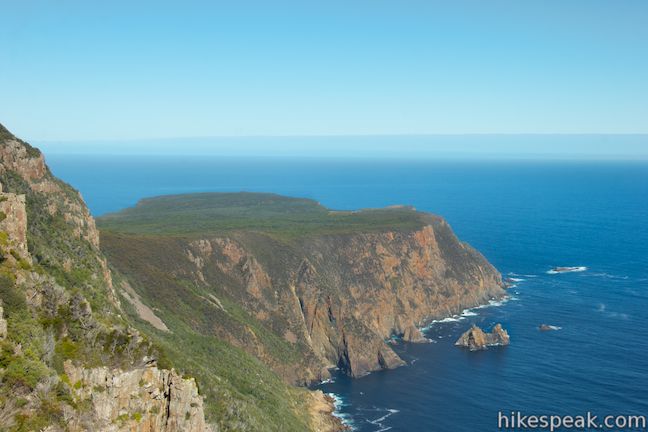
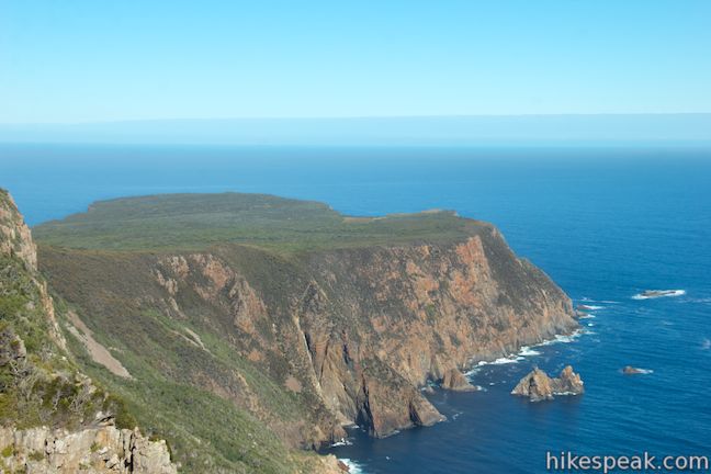
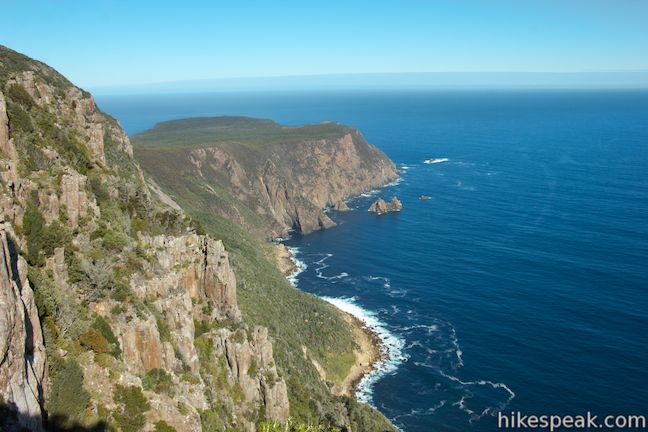
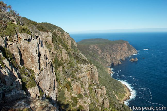
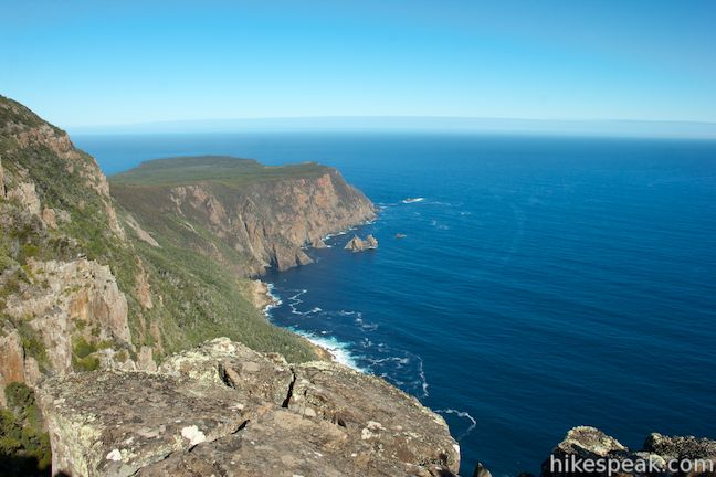
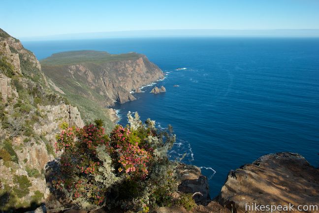
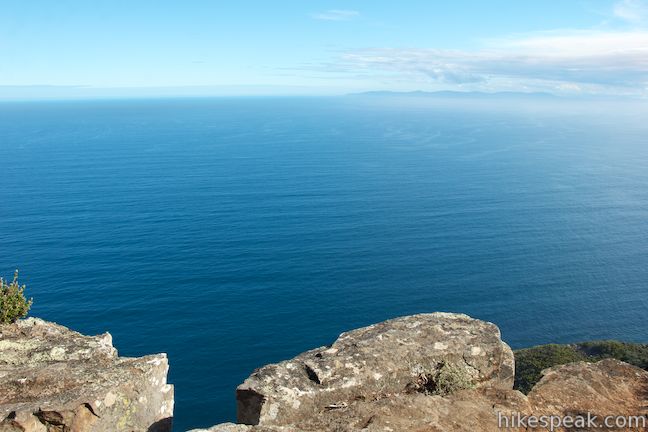
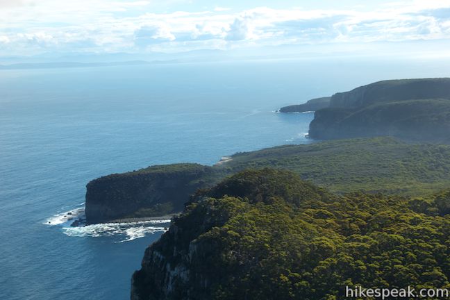
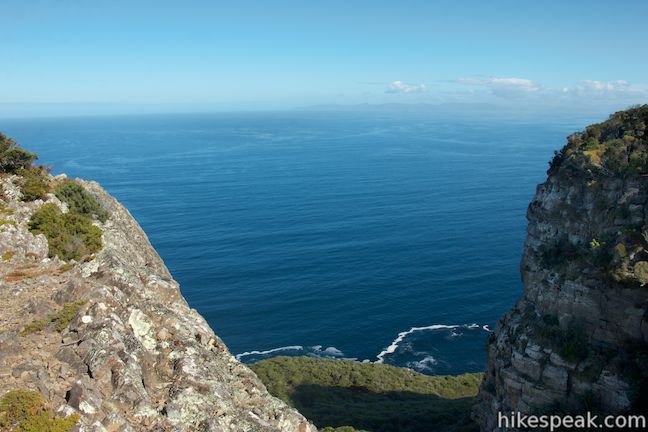
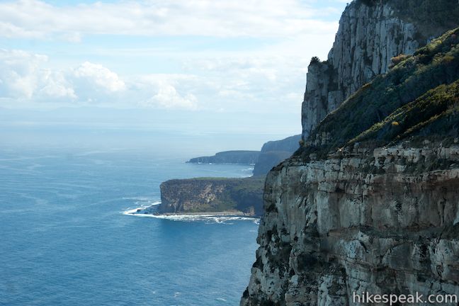
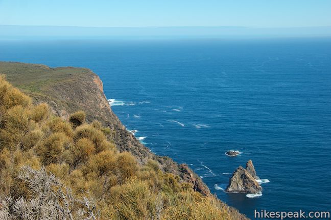
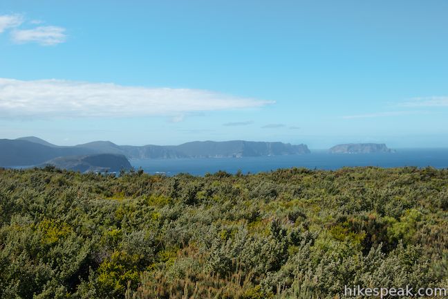
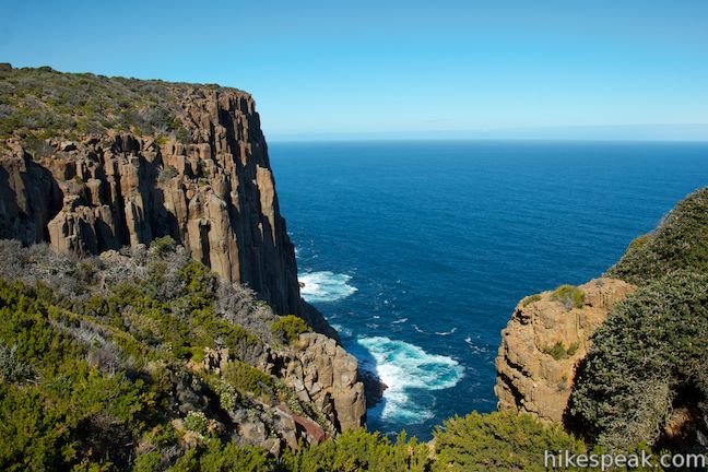
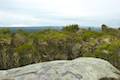
The cliffs are just inland from the coast, rising 400 meters above Raoul Bay. The bold rock face is surrounded by pristine coastal beauty. Take in the view south down the cliffs toward Cape Raoul, which sits on a lower plateau with green vegetation on top supported by sheer orange cliffs.
From this vantage, there is a view south toward Cape Raoul and east across the blue waters of Storm Bay toward Bruny Island, but the coastline to the north is not in view. To look up the coast in this direction, you’ll need to find a path to the right, going along the cliffs to an outcropping with clear views to the northwest. From here, you can look down on the cove at Shipstern Bluff and out over more wild Tasmanian coastline.
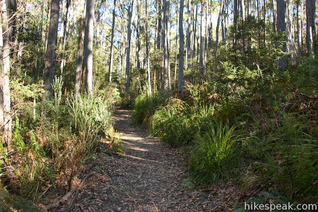
Retrace your steps back to the overlook and follow the track south along the edge of the cliff. There are no railings along this hike, so watch your step. The track backs away from the rock face and returns to the forest, ascending gradually through trees and grasses. You will cross the high point of the hike, 2.5 kilometers from the start, and turn downhill, leaving the top of the high cliffs for the lower plateau on Cape Raoul.
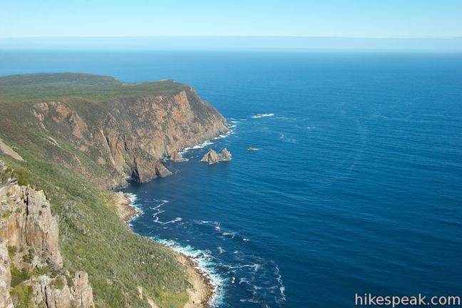
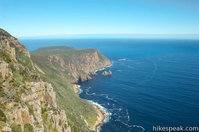
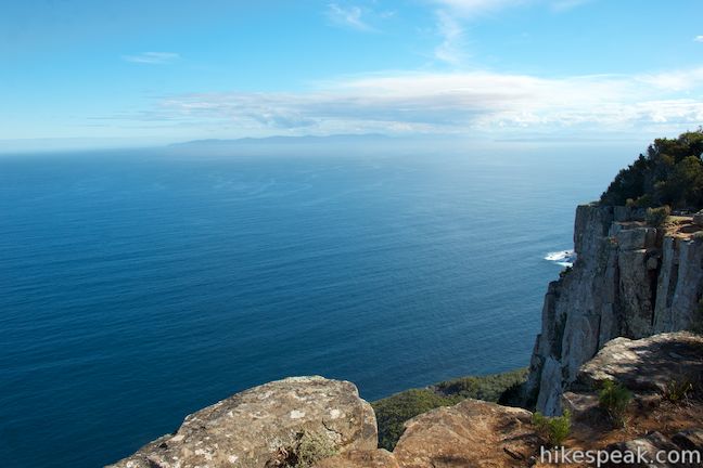
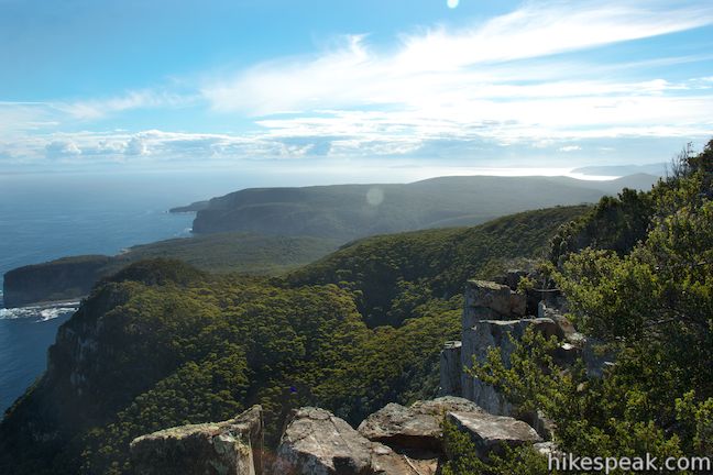
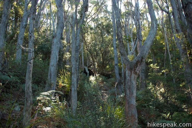
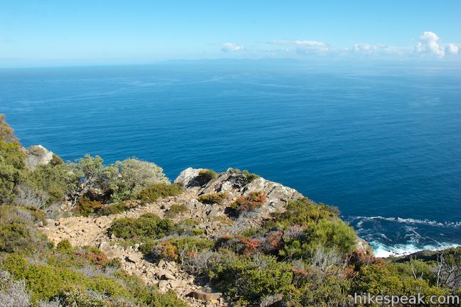
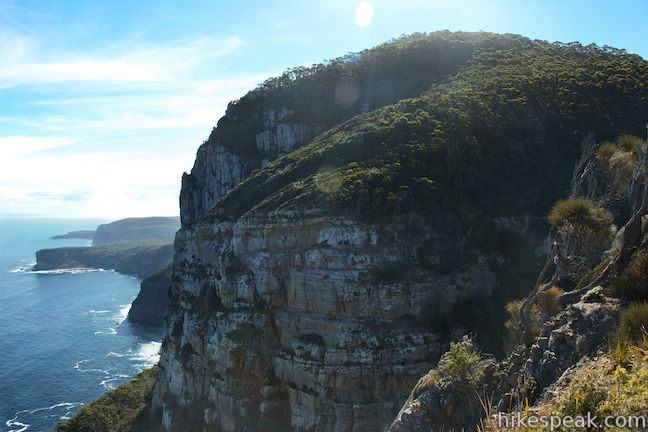
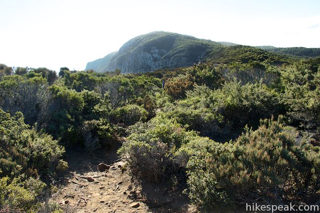
The trail weaves its way down a steep hillside covered in mossy rocks and trees. At the bottom of the slope, you will squeeze through some shorter trees and suddenly find yourself out in the open again. The track escapes the forest next to a gully that drops 300 meters down to the coast. It’s a big wild world, and you’re just walking through it. Take the track around the far side of the gully out to the cliff’s edge for the next great coastal overlook.
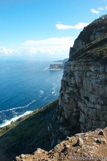
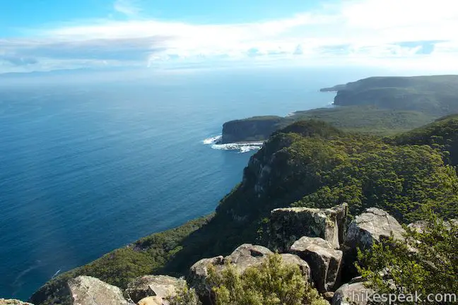
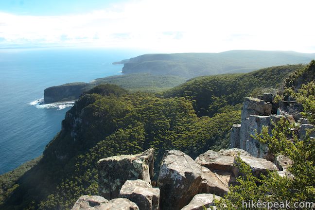
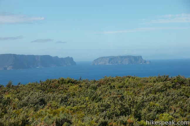
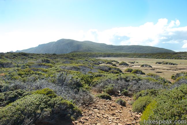
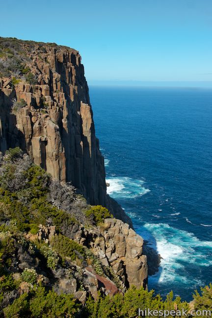
From this lower cliff-top viewpoint, you can look northwest along the face of the cliffs you were just standing on at the previous viewpoint. Shipstern Bluff is visible on the coast farther to the northwest across Raoul Bay. Take a look back up the hillside inland from the cliffs (Mount Raoul), where the track you came down is completely hidden by a dense canopy. This is a beautiful spot to catch your breath, 3.5 kilometers from the start.
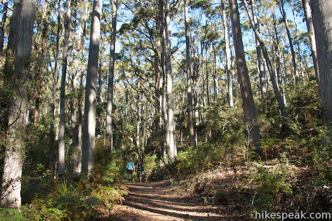
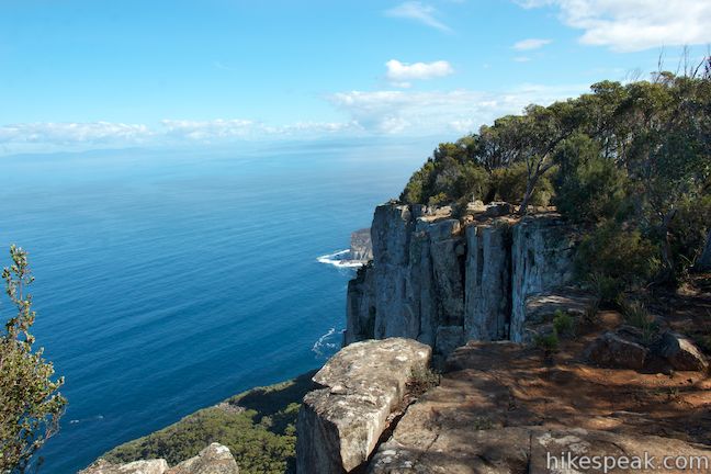
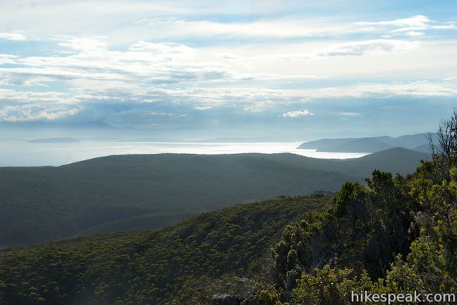
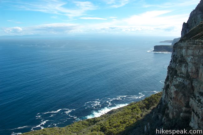
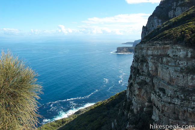
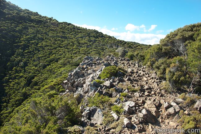
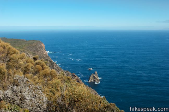
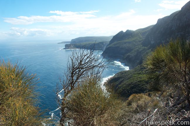
Continuing south, the track hugs the top of the cliffs, at times weaving through a forest of short trees and brush. There are sporadic views up and down the dramatic coastline to spur you on. The trail progresses gradually downhill toward the end of the cape. Keep an eye out to your left where you’ll discover views east over more of the beautiful coastline at the south end of the Tasman Peninsula, including Tasman Island which lies just off the end of a promontory to the east.
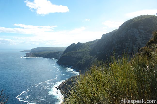
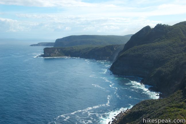
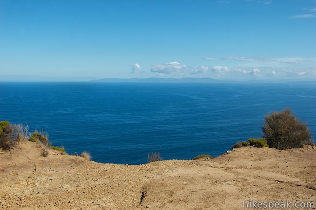
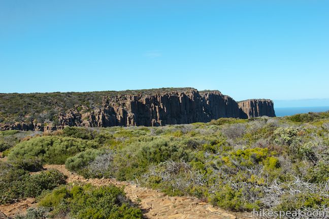
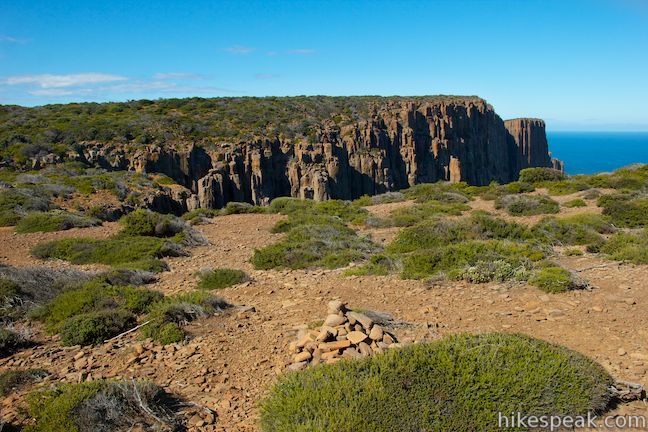
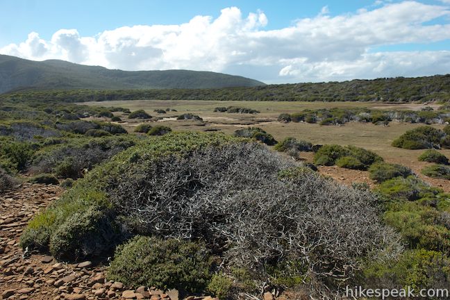
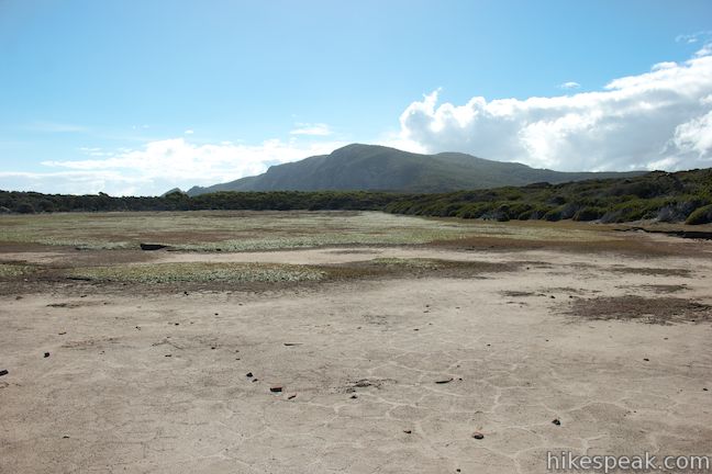
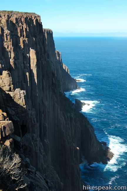
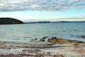
As you pass a clearing on the right, on the edge of the cliffs, the trail will curve to the left through low brush. There are a few false tracks breaking off from the actual route and the trail gets narrow and hard to follow in this area. Do your best to stay on track and you will spot cairns (piles of rocks) along the correct trail to Cape Raoul. The track makes its way along the edge of a grassy depression just behind the cape. This is a seasonal tarn that can fill with a shallow pool of water. At the bottom of the depression, you will find a clear view of the imposing cliffs that make Cape Raoul so impressive.
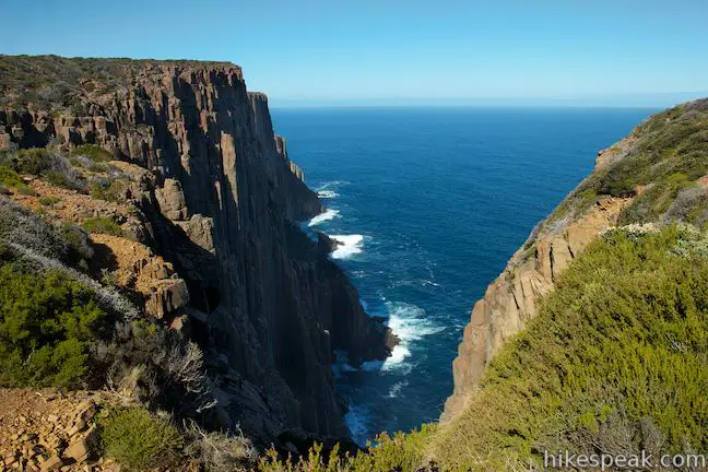
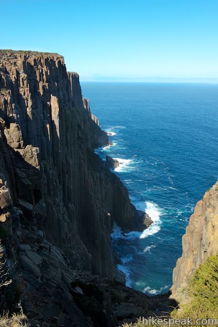
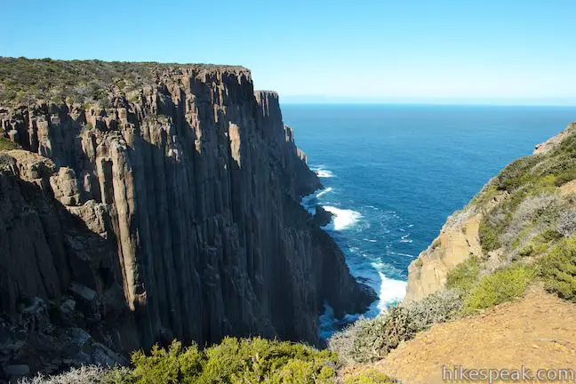
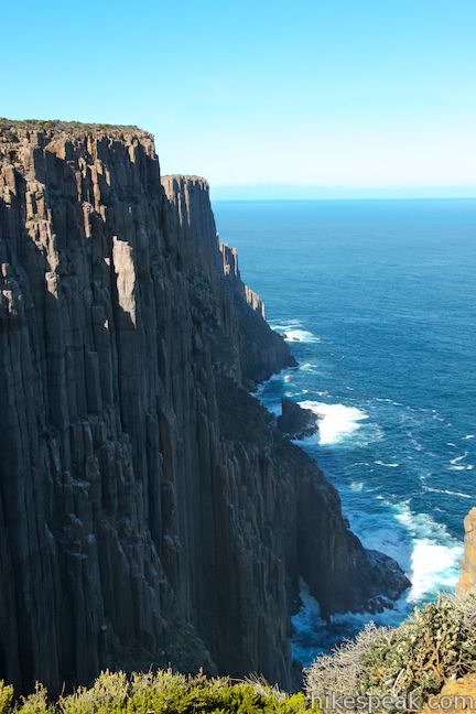
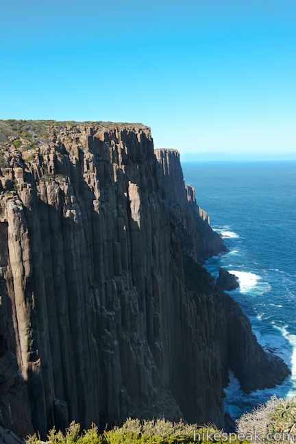
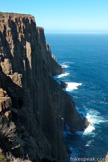
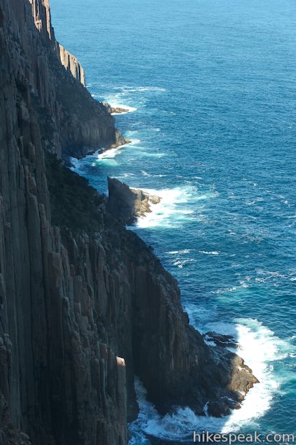
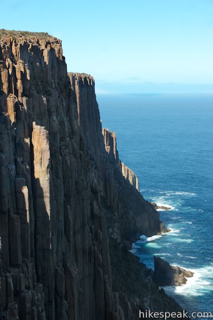
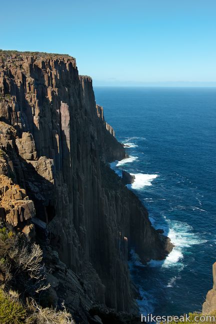
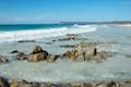
This is the view you walked six kilometers for, so take it in! Walk along the edge of the depression and find the best perspective of the cliffs to the south. This superb vantage looks down the kilometer-long 200-meter tall sea cliffs that make Cape Raoul such an icon. The cliffs are made up of dolerite columns, a volcanic rock that creates long, imposing pillars. These incredible cliffs drop all the way down to the ocean where white waves are repelled off the dark rock.
The already-difficult-to-follow track appeared to end here on a trip in April of 2014. Each path into the brush on the far side of the depression that would have lead farther down the cape appeared to dwindle and dead end. If you want to continue out to the end of Cape Raoul, you will need to push through this scratchy brush. Aerial photos reveal that the trail comes back together beyond the brush and continues another kilometer to the very end of the point where it splits to two overlooks.
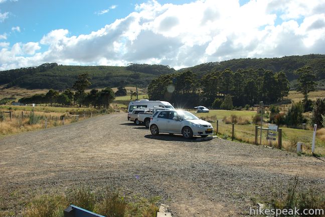
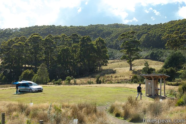
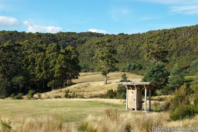
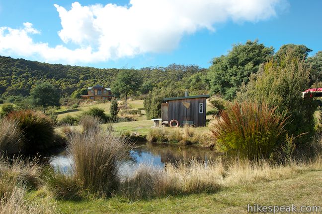
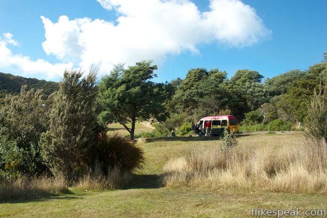
The hike to Cape Raoul is 12 kilometers round trip if you turn around at the viewpoint by the depression and 14 kilometers round trip if you press on to the very end of Cape Raoul. On the return trip, there is actually more elevation gain, an ascent of 225 meters to the high point, followed by a 200 meter descent over the final 2 kilometers. Alongside of the car park there is a privately run campground with several grassy campsites. The campground has a primitive toilet that can be used before starting the walk (donations accepted) as there are no toilets along the track. Pets and bikes are not permitted on Cape Raoul Track. A National Parks Pass is required to visit Tasman National Park. A single day pass will cost $40 or you may purchase an 8-week pass good for all of Tasmania’s National Parks for $80 (all prices in Australian Dollars as of 2021).
Directions to the Trailhead
- Take Tasman Highway (A3), 25 kilometers east of Hobart to the town of Sorell.
- You will come to an intersection in the center of town where A3 makes a 90-degree turn.
- Take the road leaving A3 at this intersection, which is Coles Street/Arthur Highway (A9).
- This will be a right turn if you are coming from Hobart.
- Drive 69 miles to Port Arthur and continue on to Nubeena Road (B37).
- Take this road for 8 kilometers and turn left on Stormlea Road (following a sign for Stormlea).
- Drive 9.5 kilometers to the car park at road's end where the track begins.
Trailhead Location
Trailhead address: Stormlea Road, Stormlea, TAS 7184, Australia
Trailhead coordinates: -43.195255, 147.777145 (43° 11′ 42.91″S 147° 46′ 37.72″E)
View Tasman Peninsula in a larger map
Or view a regional map of surrounding Australian trails, campgrounds, and lodging.

 | Coal Mines Historic Site This 0.8-kilometer loop through the Convict Precinct explores the ruins of an old prison and coal mine that relied on convict laborers. |
 | Tasmans Arch & Devils Kitchen This 0.9-mile walk visits two impressive features on the coast of the Tasman Peninsula, a natural bridge and a chasm carved by the sea. |
 | Blowhole & Fossil Bay Lookout This short walk in Tasman National Park reaches a coastal vista point and a wave-carved tunnel through a rocky point that has the potential to spray up like a whale spout. |
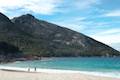 | Wineglass Bay and Hazards Beach Circuit This approximately 12-kilometer loop takes a rewarding route through Freycinet National Park, visiting pristine light sand beaches at Hazards Beach and the renowned Wineglass Bay. |
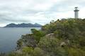 | Cape Tourville This 0.6-kilometer circuit provides big views along the east coast of Freycinet Peninsula, circling 100-meter tall bluffs to reach the Cape Tourville Lighthouse. |
 | Friendly Beaches This hike explores a long, pristine beach on the east coast of Tasmania north of the Freycinet Peninsula. |
 | Apsley Waterhole & Lookout Track This 1.4-kilometer loop travels through a eucalyptus forest to a popular swimming hole on the Apsley River in Douglas-Apsley National Park. |
 | Cataract Gorge This 3.4-kilometer loop combines Zig-Zag Track, Cataract Walk, and Bridge Walk to explore Cataract Gorge Reserve, an impressive natural area just outside the center of Launceston. |
 | Liffey Falls This 2.2-kilometer walk passes the Upper Cascades on the Liffey River to reach the base of lovely Liffey Falls, one of Tasmania's finest waterfalls. |
 | Mount William This 3.6-kilometer out and back hike tops a short summit that is the high point of Mount William National Park with panoramic views over the coastline at the northeast corner of Tasmania. |
 | Octopus Tree and Circle Track This 1.1-kilometer loop in Hobart's Wellington Park reaches a unique eucalyptus tree with tentacles for roots that wrap around a boulder. |
 | Pinnacles Boardwalk & Summit Trig The 0.3-kilometer round trip walk on Pinnacles Boardwalk can easily be extended to a 0.75-kilometer walk on the top of Mount Wellington, checking out another short boardwalk and the trig station at the summit. |
 | Russell Falls & Horseshoe Falls This hike in Mount Field National Park visits one of Tasmania's most famous and beautiful waterfalls and can be extended from 1.8 to 2.65 kilometers by venturing to the top of Russell Falls and nearby Horseshoe Falls. |
 | Saint Columba Falls This 1.2-kilometer round trip hike descends into a rainforest to the base of a powerful 90-meter tall waterfall. |
 | More trails in Australia Explore other destinations in Victoria and Tasmania, Australia. |
 | Lime Bay State Reserve Campground This shaded campground is bordered by sandy beaches in a cove on a remote thumb of the Tasman Peninsula. |
 | Mayfield Beach Conservation Area Campground This beachfront campground is located on Great Oyster Bay on the east coast of Tasmania. |
- Cape Raoul on tastrails.com (opens in a new tab)
- Cape Raoul (in 2013) on tasbushblog.blogspot.com (opens in a new tab)
- Cape Raoul (in 2009) on tasbushblog.blogspot.com (opens in a new tab)
- The Tasmania Parks and Wildlife page for Cape Raoul (opens in a new tab)
- The Tasmania Parks and Wildlife visiting guide for Tasman National Park (from 2016) (opens in a new tab)
- The Tasmania Parks and Wildlife page for Tasman National Park (opens in a new tab)
Common Questions about Cape Raoul in Tasman National Park
- Is the trail open?
- Yes. You should expect to find that Cape Raoul Track is open. There are no recent reports of trail closures. If you discover that the trail is closed, please help your fellow hikers by reporting a closure.
- Do I need a permit for this hike?
- Yes. National Park Entrance Fee.
- How much time does this hike take?
- It takes approximately 4 hours 15 minutes to hike Cape Raoul Track. Individual hiking times vary. Add extra time for breaks and taking in the views.
- How long is this hike?
- The hike to Cape Raoul Track is a 14 km / 8.7 mile out and back return with 240 meters / 790 feet of elevation change.
- Are dogs allowed on this trail?
- No, dogs are likely not allowed on Cape Raoul Track. The trail is primarily open to hikers.
- Is Cape Raoul Track a difficult hike?
- This hike should be considered strenuous. Hikers should be prepared for a workout covering 8.7 miles and 790 feet of climbing.
- Are there ocean views on this hike?
- Yes, Cape Raoul Track offers views of the ocean.
- Where is the trailhead located?
- The trailhead for Cape Raoul Track is located in Stormlea, Tasmania.
Trailhead Address:
Stormlea Road
Stormlea, Tasmania 7184
Trailhead Coordinates:
-43.195255, 147.777145 - What are the driving directions to the start of the hike?
To get to the trailhead: Take Tasman Highway (A3), 25 kilometers east of Hobart to the town of Sorell. You will come to an intersection in the center of town where A3 makes a 90-degree turn. Take the road leaving A3 at this intersection, which is Coles Street/Arthur Highway (A9). This will be a right turn if you are coming from Hobart. Drive 69 miles to Port Arthur and continue on to Nubeena Road (B37). Take this road for 8 kilometers and turn left on Stormlea Road (following a sign for Stormlea). Drive 9.5 kilometers to the car park at road's end where the track begins.
View custom Google Maps directions from your current location.
- Are there other trails near Cape Raoul Track?
- Yes, you can find other nearby hikes using the Hikespeak Hike Finder Map.

5 Comments on Cape Raoul in Tasman National Park
What hikers are saying:
✨ Generated summary of user commentsHikers find the journey to Cape Raoul magnificent, especially when viewing the towering sea cliffs that define the landscape. Kim reports that the path leading to the final lookouts is well maintained and clear for those making the trek. While the terrain involves significant climbs and drops that require steady effort, the dramatic coastal scenery makes every step worthwhile.
“the towering sea cliffs really sold the experience” Jump to comment ↓
If a toilit is a composting one ie you dont put drinking water with your poo does that mean its primative??? In my books a typical water flushing toilet is far more primative…
What a fantastic read — thank you for sharing this detailed guide on the hike to Cape Raoul in Tasman National Park! I especially appreciated the description of the terrain (that 200-meter climb then 240-meter drop is no joke!), and the vivid photos of the towering sea cliffs really sold the experience.
I was there last year, We hiked Cape Raoul as part of the Three Capes Track. Cape Raoul is truly magnificent.
Thanks for wonderful post & Fantastic photos.
This looks amazing and your photographs are fantastic. When we can all travel again, Australia is somewhere I would love to visit, and Tasmania is the area I would choose. If I eventually make it there, Cape Raoul looks like an excellent place to visit.
Just been there (October 2025) & the path to the final 2 lookouts is now cleer and well maintained