
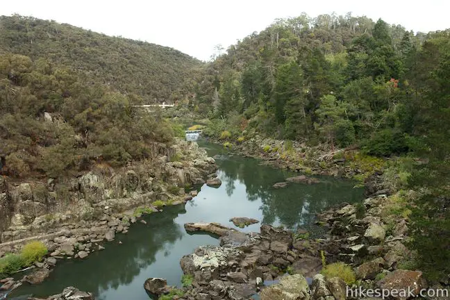
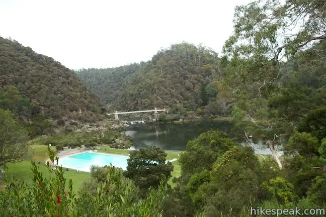
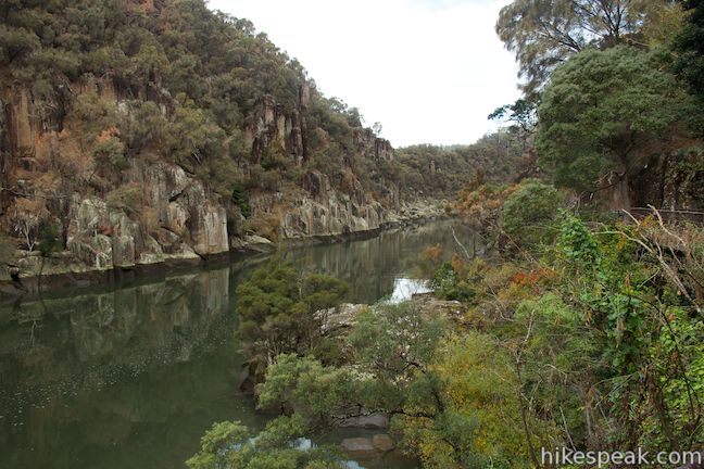
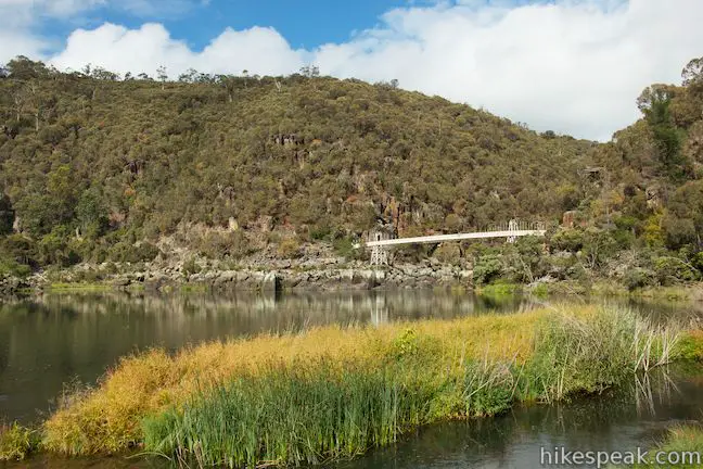
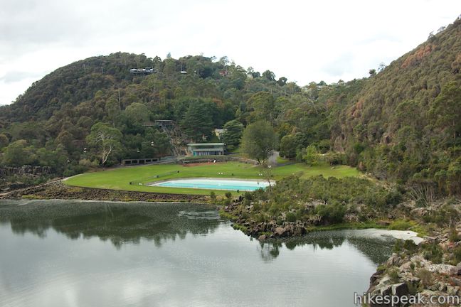
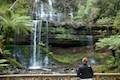
Tasmania is a wild and rugged island with natural beauty around every turn. In fact, you don’t even need to leave the major cities to see natural wonders. Hobart has Mount Wellington and Launceston has Cataract Gorge. Find Cataract Gorge Reserve just outside the city center, where the South Esk River courses down a deep, rugged trench. Trails run along both sides of the river to give hikers a variety of excellent views. Combine Zig-Zag Track (which crosses the bluffs on the south side of the gorge) and Cataract Walk (which goes along the north side of the river) with Bridge Walk (which crosses a long suspension bridge) for a 3.4-kilometer (2.1-mile) loop with 80 meters of elevation gain. The circuit travels along the gorge and around First Basin, where there are other amenities for visitors, like a swimming pool, cafe, and chairlift.
Several hikes are possible within Cataract Gorge Reserve. The 3.4-kilometer loop described here gives you a great overview of the 192-hectar (475-acre) reserve.
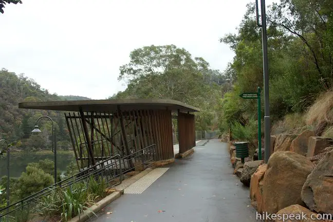
If you have a vehicle, the easiest place to start this loop is First Basin Car Park, a large parking area at the end of Basin Road. If you are walking to Cataract Gorge from the Launceston city center it will be easier to begin from the northeast end of the loop, where Zig-Zag Track descends to Kings Bridge by the start of Cataract Walk (more on this location later).
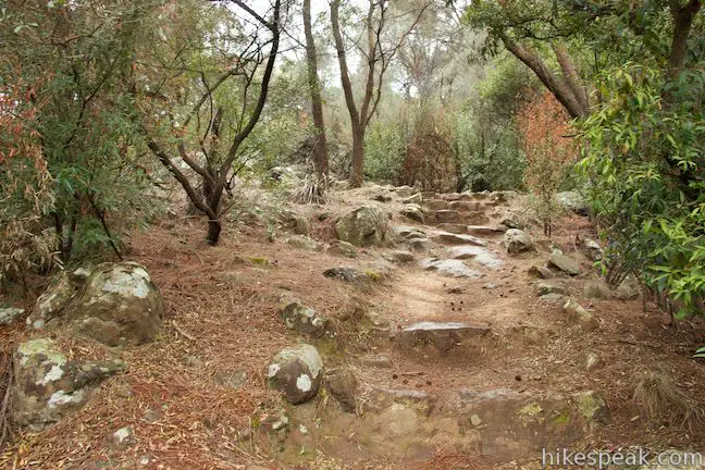
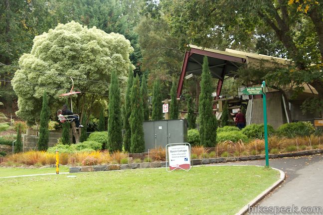
From the end of the main parking area, take the high road to the right, a paved road called Inclinator Track that leads to Zig-Zag Track. If you take the road to the left, you will go downhill to First Basin and end up hiking this circuit in reverse. Inclinator Track stays up along the ridge above First Basin, providing an overview of this wide area between narrow stretches of Cataract Gorge. You will pass both the charlift, which gives visitors a ride across the gorge, and the inclinator, which offers wheelchair-friendly travel down to the lawn at First Basin, two conveyances that are not needed for this route. After less then 150 meters on Inclinator Track, the pavement ends, so continue onto a dirt trail. While over half of this loop is paved, you get to walk on dirt for the next 1.1 kilometers. This first stretch of dirt quickly leads to a T-junction with Zig-Zag Track. To the left, Zig-Zag Track descends to the lawn at First Basin. Turn right to take Zig-Zag Track up and along the bluff on the southeast side of Cataract Gorge.
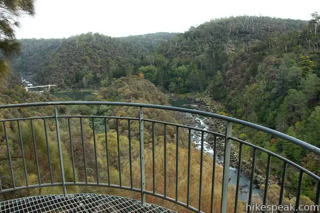
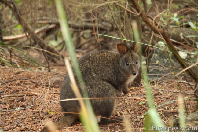
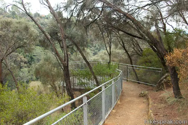
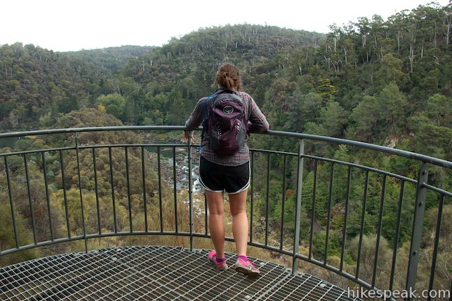
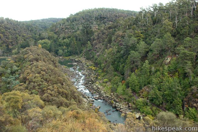
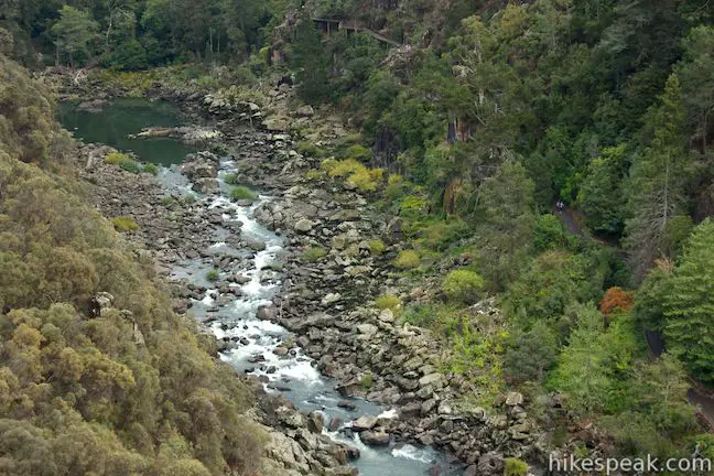
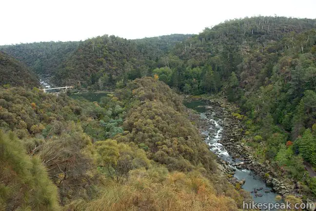
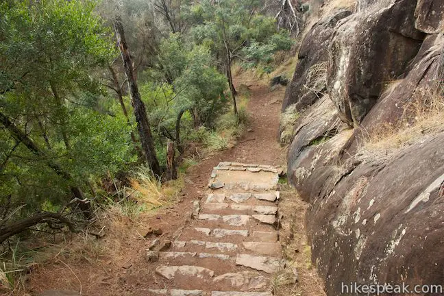
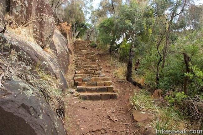
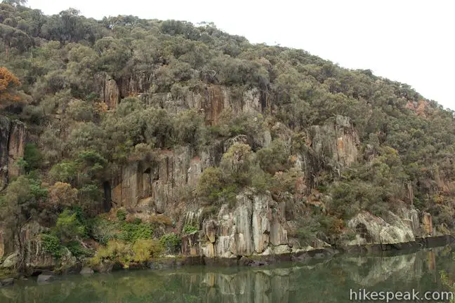
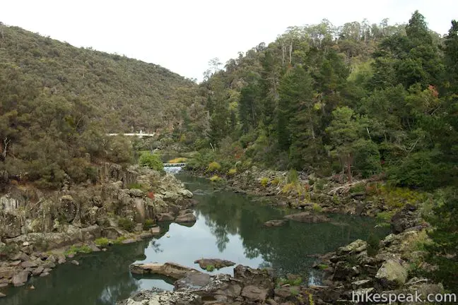
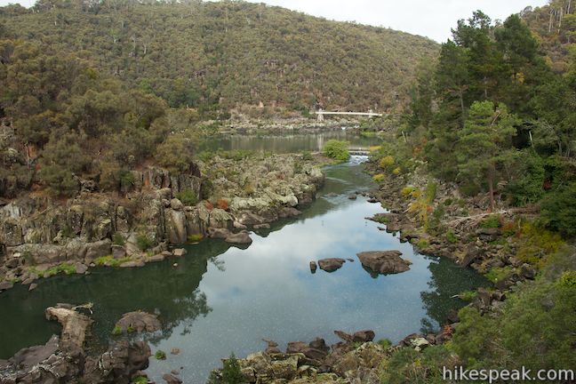
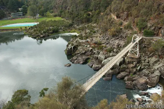
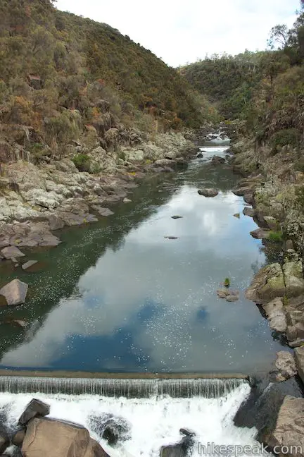
A few stone steps in the trail help you ascend through a forest where you might spot wallabies poking around the brush. As you near the top of the climb, come to a junction with a short spur dropping to the left to a metal viewing platform. Take this 50-meter long side trail down to the vista point for a fantastic overview of Cataract Gorge. About 60 meters below, a rapid-filled section of the South Esk River flows between the steep bluffs that frame the gorge. On the far side of the river below, you’ll spot the paved trail of Cataract Walk, the next leg of this loop. Look up the river toward First Basin, where the cabins of the chairlift can be seen floating across the gorge. At the top of First Basin, you’ll see the lovely, long span of Alexandra Suspension Bridge.
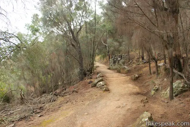
Return to Zig-Zag Track and proceed up the ridge. Come to another junction as you reach the crest. A spur to the right goes for 100 meters to a cul-de-sac at the end of Argyle Street where there is parking for a just a few cars (a potential alternate starting point) as well as a path that continues downhill toward Launceston. Avoid this side trail and stick with Zig-Zag Track, which stays along the edge of Cataract Gorge and now goes downhill (after 0.75 kilometers of hiking).
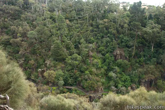
With the high point of the loop behind you, venture down stone steps built into the bluff that frames Cataract Gorge. After another quarter of a kilometer, you’ll reach a second established vista point, where you can step out onto a metal platform for expanded views up and down the gorge. Take in the views, looking out across the gorge and down the river toward Launceston.
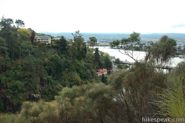
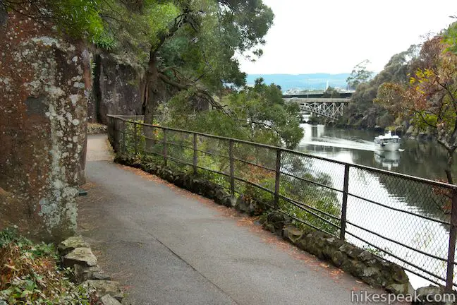
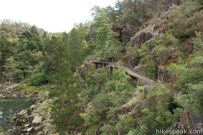
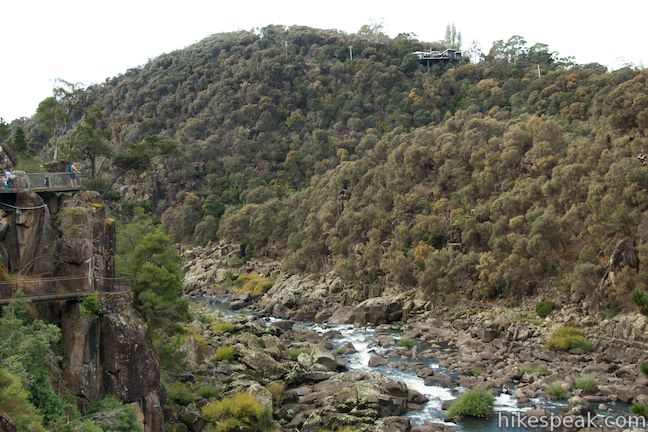
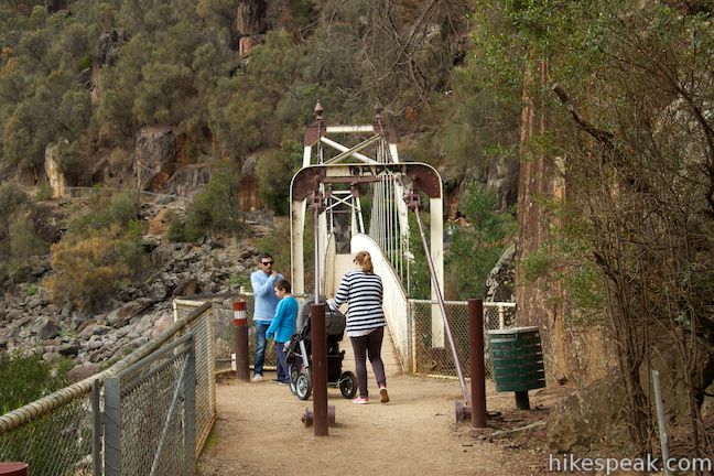
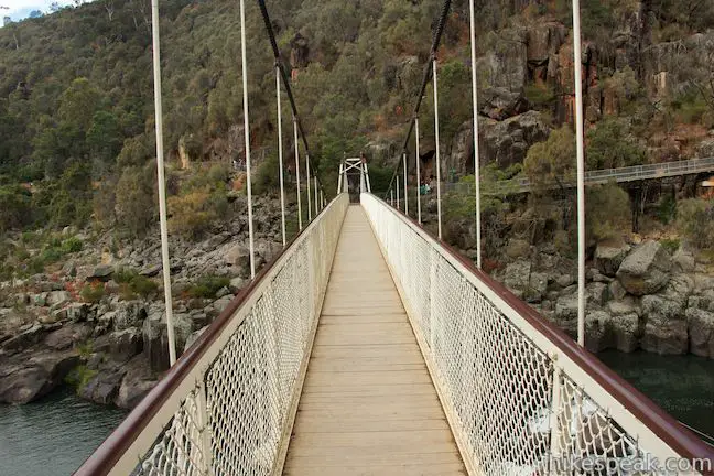
You won’t actually face too many zig-zags or switchbacks as you descend to the bottom of Cataract Gorge. Zig-Zag Track comes to an end (after 1.25 kilometers of hiking) alongside Kings Bridge on Bridge Road. Turn left and take the sidewalk across the bridge, getting a good look up the end of the river flowing down Cataract Gorge. This is the lowest point on the loop as well as the closest point to Launceston’s Central Business District, making it a good place to begin the loop if you are walking to Cataract Gorge Reserve from Launceston.
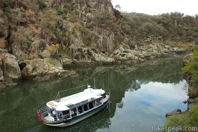
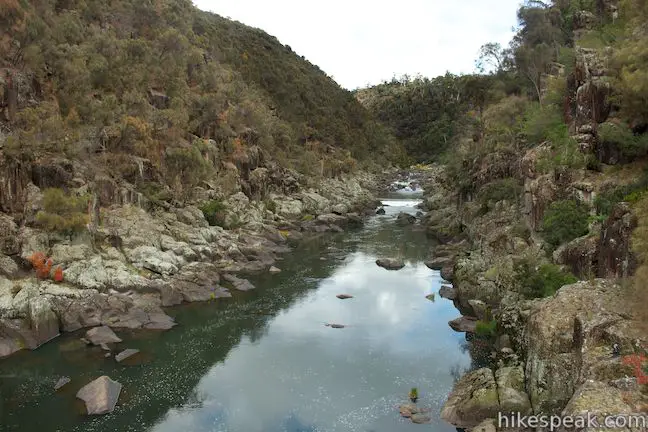
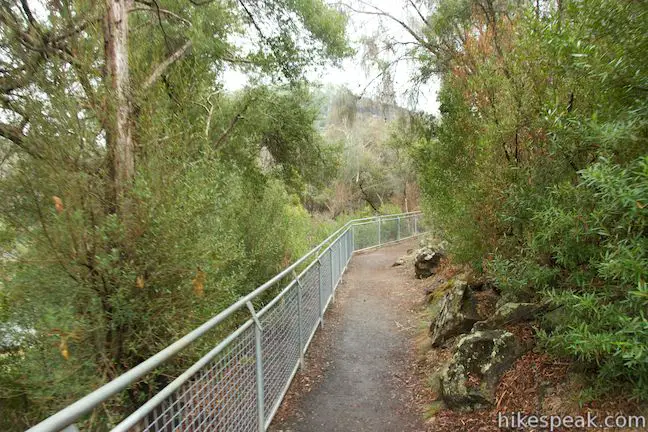
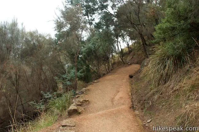
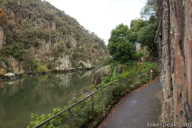
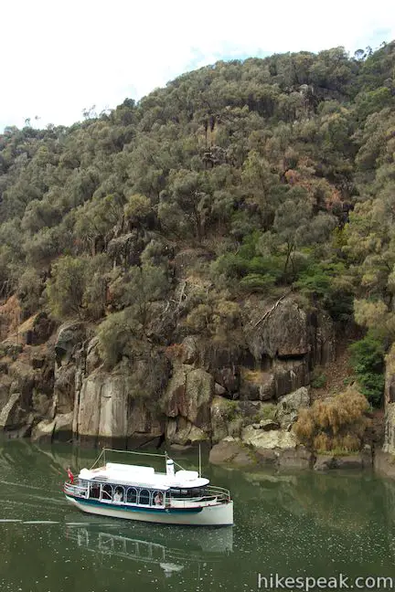
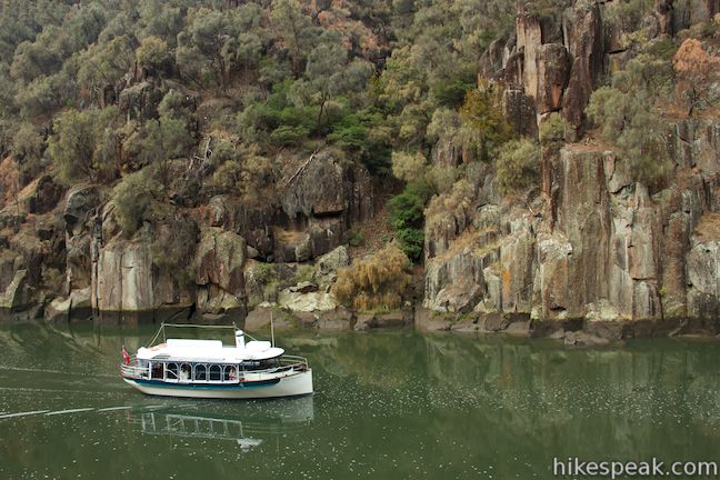
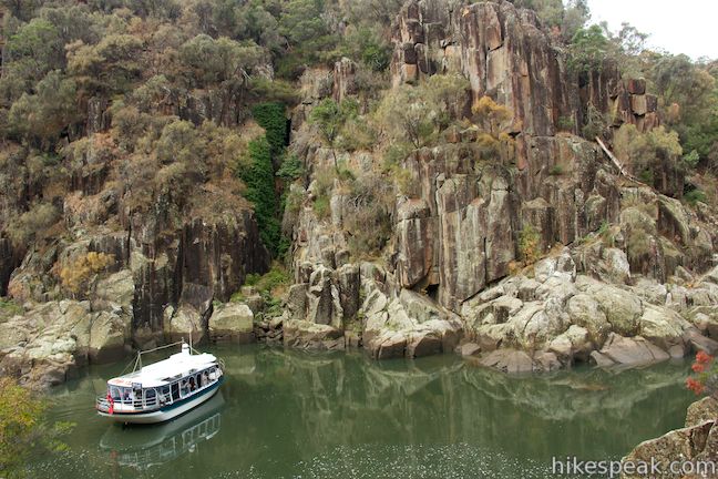
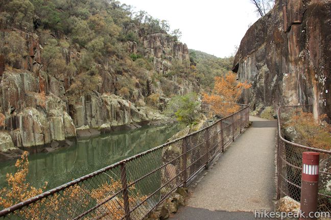
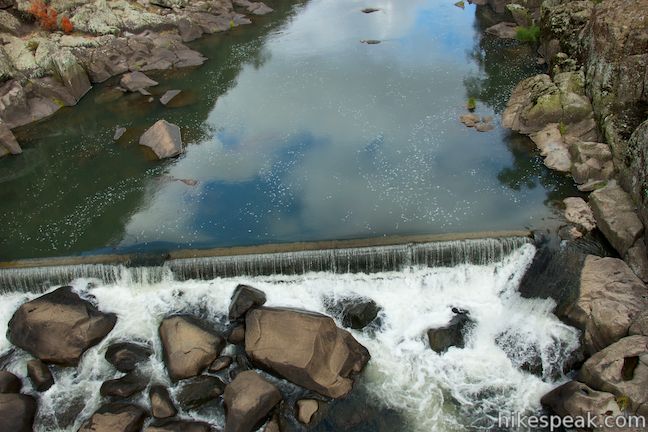
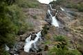
Walk to the other side of the old, ornate bridge and turn left up Cataract Walk, a paved trail that runs along the opposite side of the river. There won’t be any serious elevation to tackle on this trail, which stays down closer to the water and offers intimate river views. Stroll up the trail between the flat water of the South Esk River and the steep rock walls that form this side of Cataract Gorge. The river is navigable along this lower stretch below the rapids and you may see cruise boats taking passengers up into the gorge.
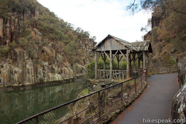
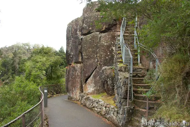
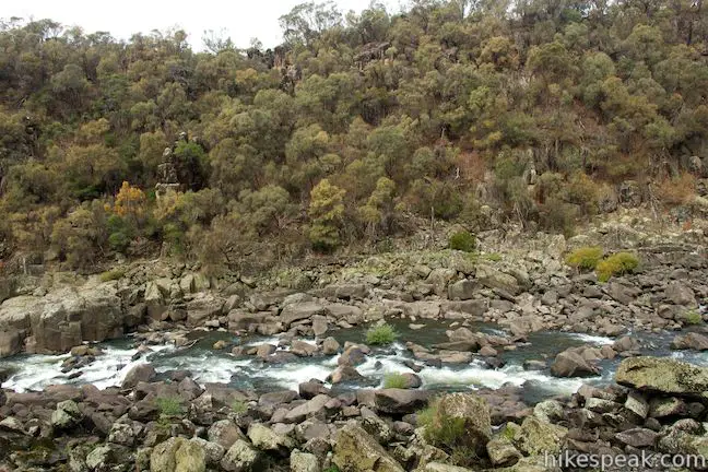
There are many good lookout points along Cataract Walk. A weathered wooden pavilion, 0.35 kilometers up the trail, makes a nice place to stop and admire the river. After a larger overlook on the left, and 0.75 easy kilometers on Cataract Walk, come to a flight of steep steps on the right that go up to an overlook. Climb this short but taxing staircase at near-ladder steepness to a small lookout that is perched on a rock outcropping like a crow’s nest. From this vantage, you can look up a string of rapids in the South Esk River toward First Basin.
Another tenth of a kilometer up Cataract Walk, there will be a viewpoint on the left with another view up Cataract Gorge toward First Basin (that does not require going up any steps). From there it is just another tenth of a kilometer to the end of Cataract Walk.
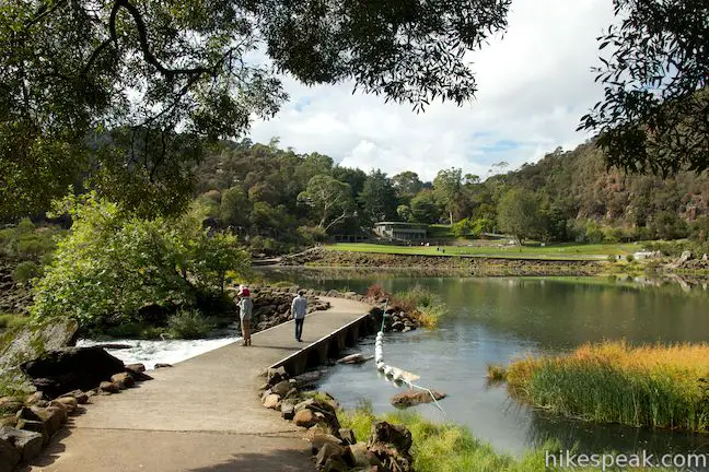
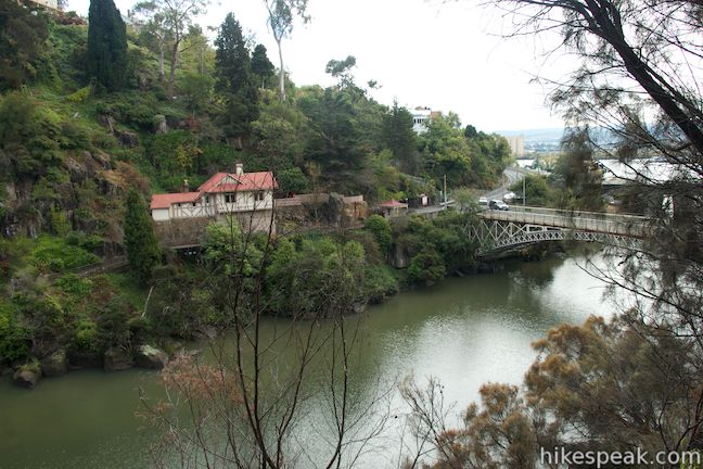
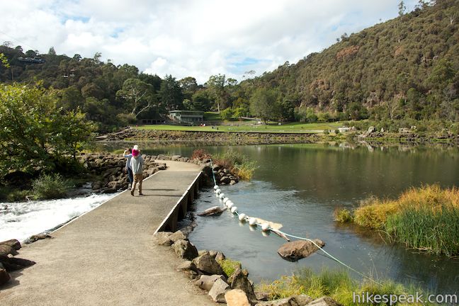
Cataract Walk leads to a small web of trails around Gorge Restaurant, which is part of the Cliff Grounds, a Victorian resort built across the river from the lawn and pool at First Basin. When you come to the four-way junction at the end of Cataract Walk, you have the option to continue straight, following a sign for the band rotunda and restaurant, but it is probably easier to turn left and stay closer to the river (just don’t turn right). Turning left, you will quickly come to another intersection. You can go straight or turn left again. Turning left will put you onto Baeckea Walk, a dirt trail that descends toward the river and continues upstream to a junction with Basin Walk. If you’d like to cut this loop short, you could turn left here and cross a causeway below the pool in the river at First Basin to reach the lawn below the car park. Going this way skips Alexandra Suspension Bridge, so you probably want to turn right so that you can get the bridge experience. (If you want a nice view of First Basin, you can get one by walking a short distance to the left on Basin Walk before doubling back to continue toward the bridge.)
After you turn right up Basin Walk, quickly reach another junction, this time with the other trail past Gorge Restaurant. Turn left to head toward the bridge. Pass a picnic area and keep straight at the next junction. Before reaching Alexandra Suspension Bridge, come to a spur trail that ascends to the right toward Alexandra Lookout. This side option begins with a flight of stone steps climbing above Bridge Walk to an unmarked T-junction. Turn left and walk out to a final flight of stairs up to an overlook above the suspension bridge. This vantage offers a good view over First Basin as well as new views looking farther up the gorge above Alexandra Suspension Bridge, where the walls are steep and the river is full of rapids.
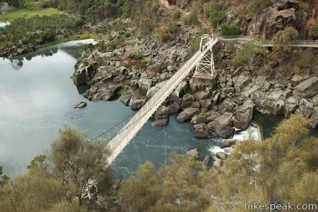
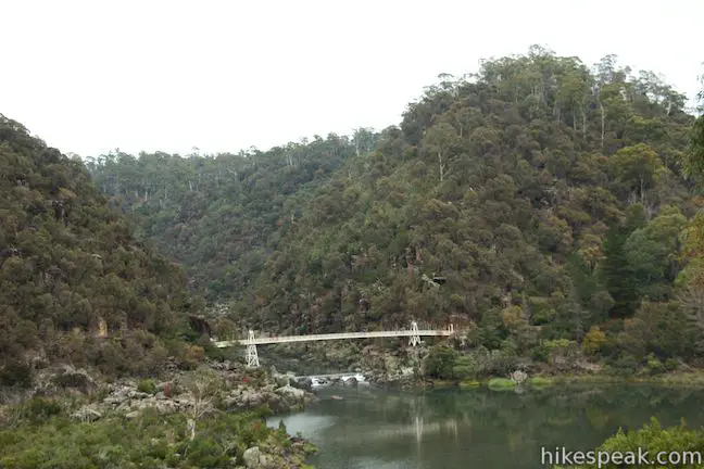
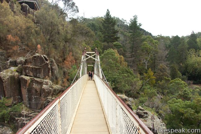
Walk back down to Bridge Walk and turn right to continue toward the suspension bridge. You’ll soon arrive at the impressive cream-colored span. Enjoy a bouncy walk across the long bridge. Look down on rapids in the river below, and enjoy perspectives up the river toward more of Cataract Gorge and down over First Basin.
On the far side of the bridge, reach a junction with a trail continuing up the gorge to Duck Reach (which a sign lists as a 90-minute return). This hike is listed as one of Tasmania’s 60 Great Short Walks and offers impressive views of the gorge.
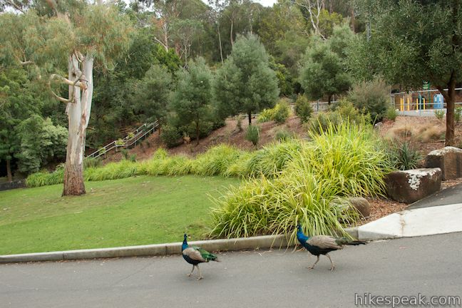
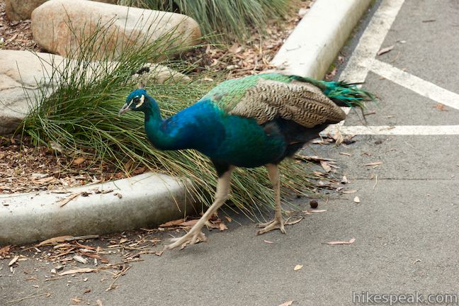
If you’re not hiking to Duck Reach, turn left to stay on Bridge Walk and close out the loop. Go over a rise and descend to a junction behind the lawn and pool. Stay to the right through the last junction to hike back up to the car park where the loop started. On this last short ascent, you will pass the cafe and chairlift and might see a couple peacocks flashing their colorful plumage around the parking lot.
No permit is required to hike in Cataract Gorge Reserve, but a fee is charged to leave a vehicle at First Basin Car Park. Use the pay and display kiosk before setting out. Dogs and bikes are not allowed. The Cataract Gorge is an impressive area to visit with peaceful spots and dramatic natural features on the doorstep of one of Tasmania’s principle cities.
Directions to the Trailhead
- From the Launceston CBD, take Highway One south to Frederick Street and drive west a couple blocks.
- Pass Bourke Street and continue onto Hillside Crescent.
- After 450 meters, turn right onto Brougham Street.
- Drive 3 blocks and turn right onto Basin Road.
- Go 750 meters to the First Basin Car Park at the end of the road.
Trailhead Location
Trailhead address: Basin Road, West Launceston, TAS 7250, Australia
Trailhead coordinates: -41.445923, 147.122482 (41° 26′ 45.32″S 147° 07′ 20.93″E)
You may also view a regional map of surrounding Australian trails, campgrounds, and lodging.


 | Liffey Falls This 2.2-kilometer walk passes the Upper Cascades on the Liffey River to reach the base of lovely Liffey Falls, one of Tasmania's finest waterfalls. |
 | Russell Falls & Horseshoe Falls This hike in Mount Field National Park visits one of Tasmania's most famous and beautiful waterfalls and can be extended from 1.8 to 2.65 kilometers by venturing to the top of Russell Falls and nearby Horseshoe Falls. |
 | Pinnacles Boardwalk & Summit Trig The 0.3-kilometer round trip walk on Pinnacles Boardwalk can easily be extended to a 0.75-kilometer walk on the top of Mount Wellington, checking out another short boardwalk and the trig station at the summit. |
 | Octopus Tree and Circle Track This 1.1-kilometer loop in Hobart's Wellington Park reaches a unique eucalyptus tree with tentacles for roots that wrap around a boulder. |
 | Saint Columba Falls This 1.2-kilometer round trip hike descends into a rainforest to the base of a powerful 90-meter tall waterfall. |
 | Apsley Waterhole & Lookout Track This 1.4-kilometer loop travels through a eucalyptus forest to a popular swimming hole on the Apsley River in Douglas-Apsley National Park. |
 | Mount William This 3.6-kilometer out and back hike tops a short summit that is the high point of Mount William National Park with panoramic views over the coastline at the northeast corner of Tasmania. |
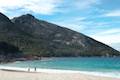
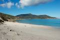
 | Friendly Beaches This hike explores a long, pristine beach on the east coast of Tasmania north of the Freycinet Peninsula. |
 | Cape Tourville This 0.6-kilometer circuit provides big views along the east coast of Freycinet Peninsula, circling 100-meter tall bluffs to reach the Cape Tourville Lighthouse. |
 | Wineglass Bay and Hazards Beach Circuit This approximately 12-kilometer loop takes a rewarding route through Freycinet National Park, visiting pristine light sand beaches at Hazards Beach and the renowned Wineglass Bay. |
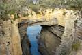 | Tasmans Arch & Devils Kitchen This 0.9-mile walk visits two impressive features on the coast of the Tasman Peninsula, a natural bridge and a chasm carved by the sea. |
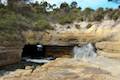 | Blowhole & Fossil Bay Lookout This short walk in Tasman National Park reaches a coastal vista point and a wave-carved tunnel through a rocky point that has the potential to spray up like a whale spout. |
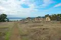 | Coal Mines Historic Site This 0.8-kilometer loop through the Convict Precinct explores the ruins of an old prison and coal mine that relied on convict laborers. |
 | Cape Raoul This 12 to 14-kilometer hike explores the pristine coastline at the southwest end of the Tasman Peninsula, reaching a cape with daunting 200-meter tall cliffs dropping to swirling seas. |
 | More trails in Australia Explore other destinations in Victoria and Tasmania, Australia. |
 | Big4 Launceston Holiday Park This holiday park in Launceston offers tent sites, campervan sites, and cabins on a hillside near the city center. |
Common Questions about Zig-Zag Track, Cataract Walk, and Bridge Walk Loop in Cataract Gorge Reserve
- Is the trail open?
- Yes. You should expect to find that Zig-Zag Track, Cataract Walk, and Bridge Walk Loop is open. There are no recent reports of trail closures. If you discover that the trail is closed, please help your fellow hikers by reporting a closure.
- Do I need a permit for this hike?
- Yes. Parking fee.
- How much time does this hike take?
- It takes approximately 1 hour to hike Zig-Zag Track, Cataract Walk, and Bridge Walk Loop. Individual hiking times vary. Add extra time for breaks and taking in the views.
- How long is this hike?
- The hike to Zig-Zag Track, Cataract Walk, and Bridge Walk Loop is a 3.4 km / 2.1 mile circuit loop with 80 meters / 260 feet of elevation change.
- Are dogs allowed on this trail?
- No, dogs are likely not allowed on Zig-Zag Track, Cataract Walk, and Bridge Walk Loop. The trail is primarily open to hikers.
- Where is the trailhead located?
- The trailhead for Zig-Zag Track, Cataract Walk, and Bridge Walk Loop is located in Launceston, Tasmania.
Trailhead Address:
Basin Road
Launceston, Tasmania 7250
Trailhead Coordinates:
-41.445923, 147.122482 - What are the driving directions to the start of the hike?
To get to the trailhead: From the Launceston CBD, take Highway One south to Frederick Street and drive west a couple blocks. Pass Bourke Street and continue onto Hillside Crescent. After 450 meters, turn right onto Brougham Street. Drive 3 blocks and turn right onto Basin Road. Go 750 meters to the First Basin Car Park at the end of the road.
View custom Google Maps directions from your current location.
- Are there other trails near Zig-Zag Track, Cataract Walk, and Bridge Walk Loop?
- Yes, you can find other nearby hikes using the Hikespeak Hike Finder Map.

I am planning a trip to Tasmania and will have some free time in Launceston. Our hotel is located on Earl St and we would like to walk to the Cataract Gorge. The map and directions I have seen has us walking down York St to E. Tamer Highway to Frederick St/Hillside Cres to Brougham St and finally to Basin Rd. In looking at the map, a more direct route would be straight down York St/Upper York St to Basin Rd. Is there any reason we could not take that route? Thank you.
[…] The cataract gorge walk […]