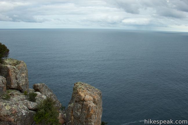
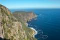
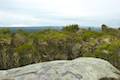
Freycinet National Park preserves a picturesque peninsula on Tasmania’s east coast. The park’s beaches are the pride of Tasmania, and if you’ve got slightly loftier ambitions, and you can get a great overview of the peninsula from Cape Tourville. An easy 600-meter long trail loops around this promontory on the peninsula’s east coast, crossing 100-meter tall granite bluffs to reach the Cape Tourville Lighthouse, a naval beacon on the point. Cape Tourville is listed as one of Tasmania’s 60 Great Short Walks and certainly offers a lot of views for just a little bit of effort.
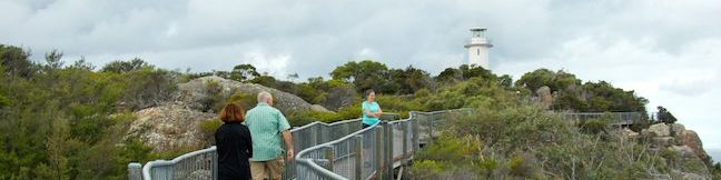
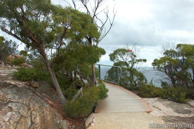
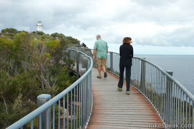
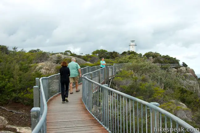
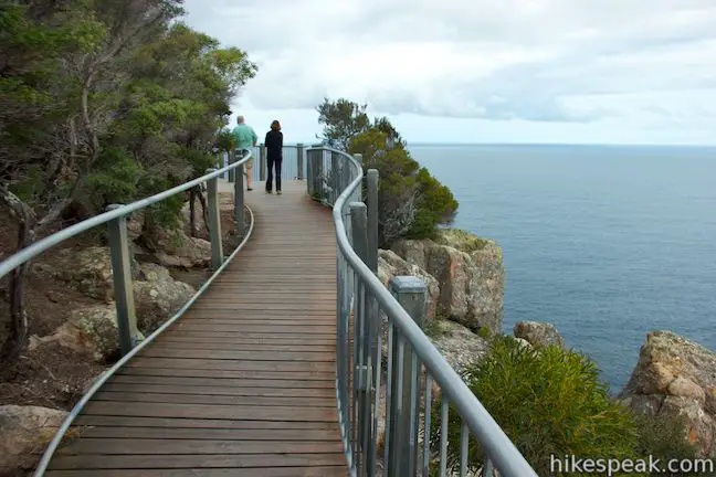
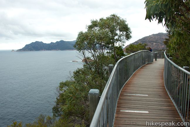
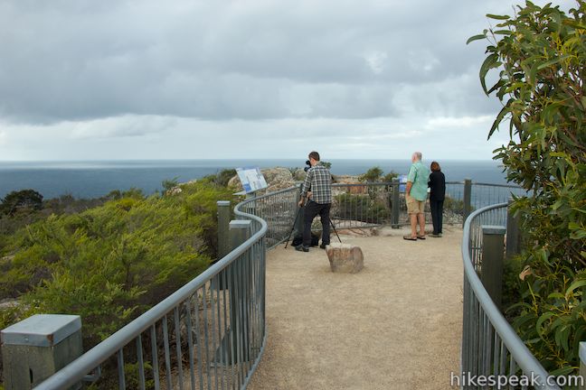
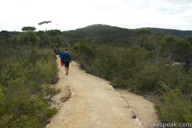
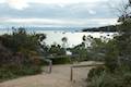
Start from the car park at the end of Cape Tourville Road and take a dirt trail a couple meters to a junction at the start of the loop. An arrow will direct you to turn right to hike the circuit in a counter-clockwise (anti-clockwise) direction. The dirt trail continues uphill through brush until it reaches the coast, where the trail becomes a wooden boardwalk that runs along the top of the sheer cliffs at the end of Cape Tourville.
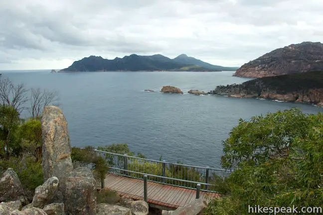
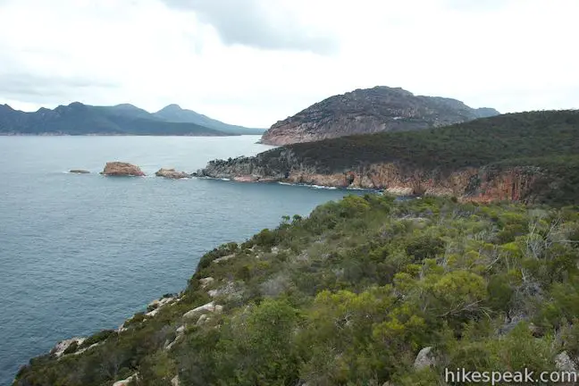
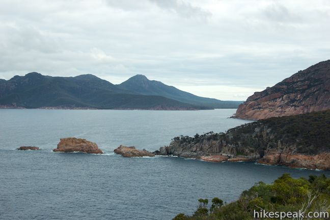
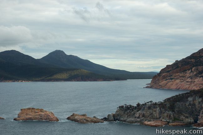
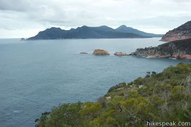
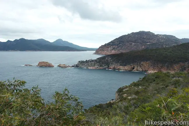
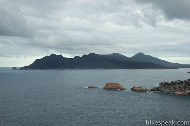
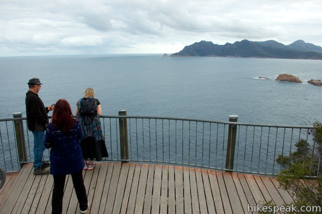
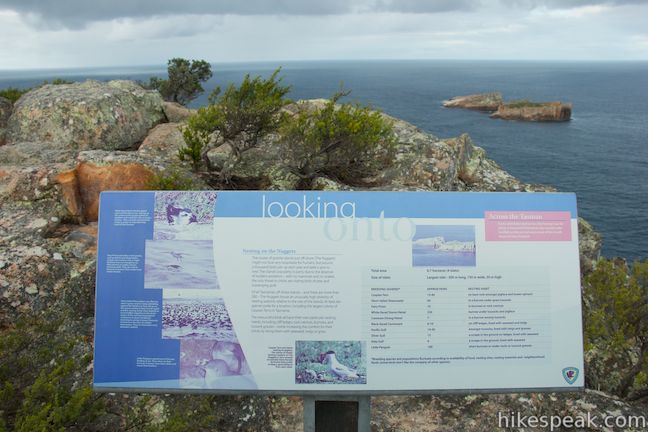
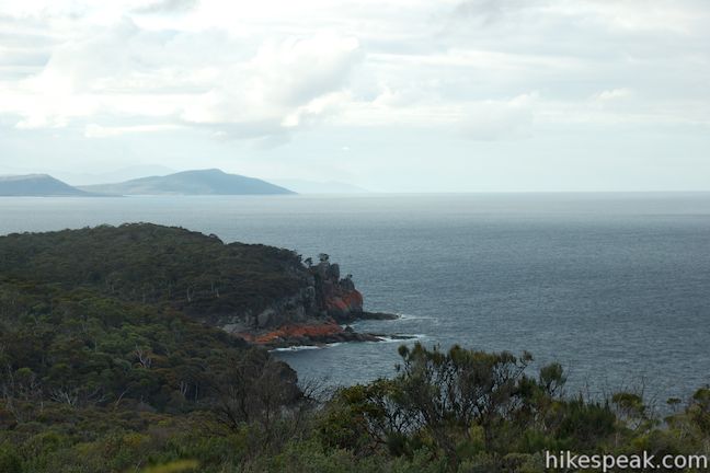
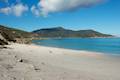
Before reaching the lighthouse, you will come to an overlook on the right that looks south down the Freycinet Peninsula. One of the loop’s info panels sits atop the safety railing, marking the landmarks in the view to the south. Carp Bay and Sleepy Bay lie just south of Cape Tourville, divided by a granite point. The unmistakable form of Wineglass Bay, cups the coastline beyond that. Mount Graham (579 meters) and Mount Freycinet (620 meters) rise up behind Wineglass Bay and are part of the Hazard Mountains that crown the Freycinet Peninsula. Beyond Wineglass Bay, the coast runs southeast to Cape Forestier where you’ll spot Lemon Rock, a small island just off the point that does not sour the view.
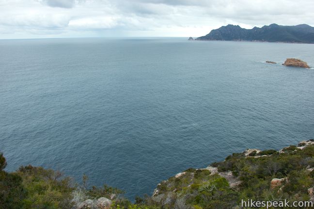
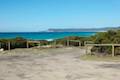
Farther to the east lies a vast expanse of the Tasman Sea. These are migration waters for humpback whales and southern right whales, so keep an eye out for wildlife. If you time your visit right, you can spot these big whales, as well as dolphins and seals in the waters below Cape Tourville.
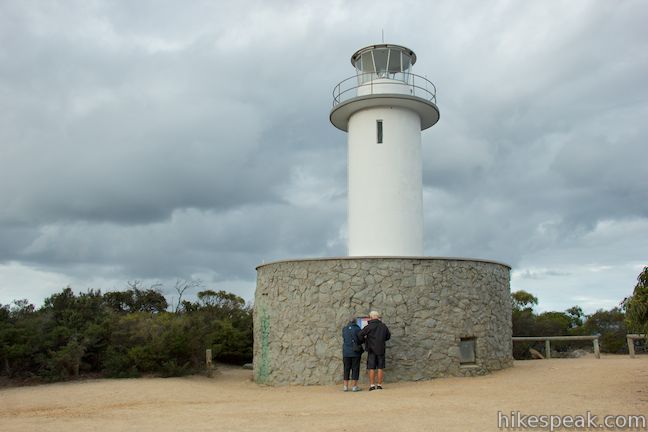
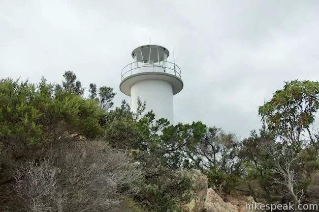
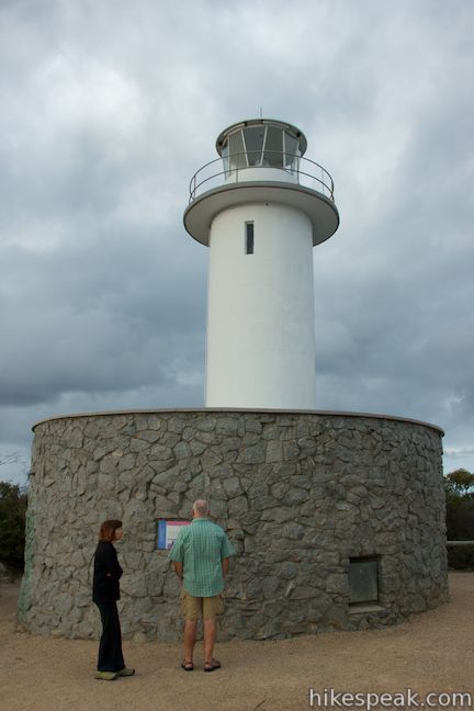
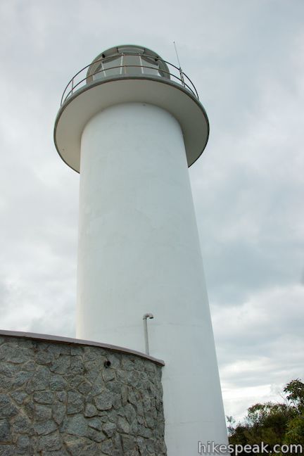
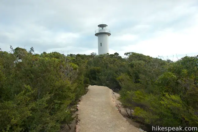
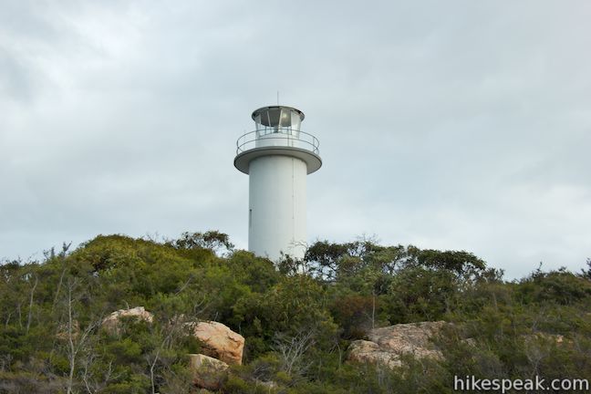
Continue up the boardwalk as it curls to the left toward the end of the cape where you will come to a junction with a dirt trail that ascends to the left. This is the path to Cape Tourville Lighthouse. Take a short walk up this spur to reach the base of the 11-meter tall lighthouse made up of a white tower with a stone building attached to the base. The unmanned light station was built in 1971 and sits at the crest of Cape Tourville at an elevation 126 meters, allowing it to cast a beacon a great distance up and down the east coast of Tasmania.
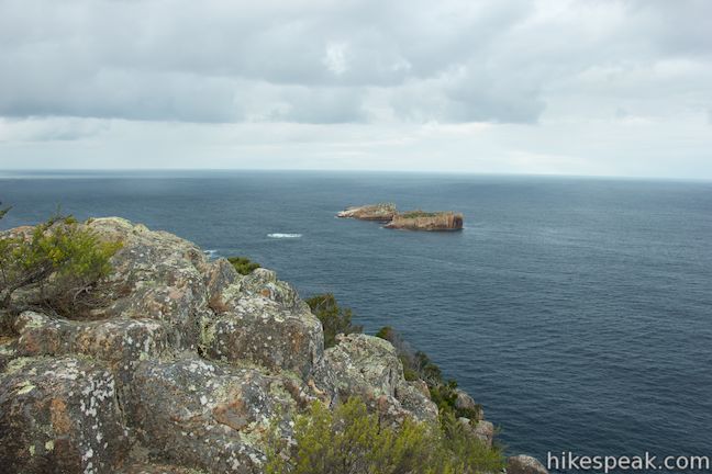
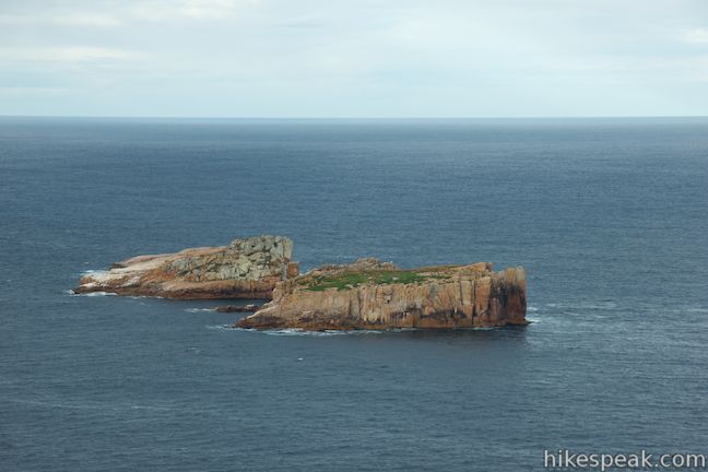
Walk back down from the lighthouse and continue with the loop. As you proceed around the cape, you’ll find more views looking east over a small cluster of rock islands sitting just off Cape Tourville called The Nuggets. Rounding the cape even farther, you’ll discover views looking up the coast over more rocky headlands toward the Friendly Beaches north of the Freycinet Peninsula.
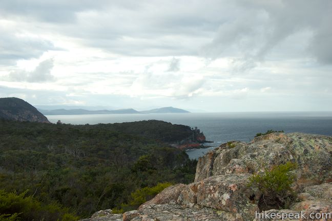
A short spur to an overlook on the right delivers the best views north, along with a final look south down the peninsula. After this final overlook, the dirt trail moves away from the coast and back toward the car park, completing the short, scenic loop.
Dogs and bikes are not allowed on this wheelchair-friendly walking track. A national park entrance fee is required to visit Freycinet National Park. A single day pass will cost $40 or you may purchase an 8-week pass good for all of Tasmania’s National Parks for $80 (all prices in Australian Dollars as of 2021).
Directions to the Trailhead
- Take Tasman Highway (A3) 11.3 kilometers south of Bicheno to Coles Bay Road (C302) and take this road southeast toward Coles Bay.
- After 26 kilometers, pass through the town and continue straight into Freycinet National Park.
- Pass the visitor center after another kilometer and proceed 1.5 kilometers to Cape Tourville Road.
- Turn left and drive 5.5 kilometers to the car park at the road end.
Trailhead Location
Trailhead address: Cape Tourville Road, Freycinet National Park, Coles Bay, TAS 7215, Australia
Trailhead coordinates: -42.122311, 148.34135 (42° 07′ 20.31″S 148° 20′ 28.86″E)
You may also view a regional map of surrounding Australian trails, campgrounds, and lodging.


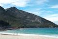 | Wineglass Bay and Hazards Beach Circuit This approximately 12-kilometer loop (shorter if you skip two overlooks and longer if you do extra beach strolling) takes a rewarding route through Freycinet National Park, visiting pristine light sand beaches at Hazards Beach and the renowned Wineglass Bay. |
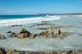 | Friendly Beaches This hike explores a long, pristine beach on the east coast of Tasmania north of the Freycinet Peninsula. |
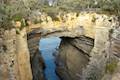 | Tasmans Arch & Devils Kitchen This 0.9-mile walk visits two impressive features on the coast of the Tasman Peninsula, a natural bridge and a chasm carved by the sea. |
 | Blowhole & Fossil Bay Lookout This short walk in Tasman National Park reaches a coastal vista point and a wave-carved tunnel through a rocky point that has the potential to spray up like a whale spout. |
 | Coal Mines Historic Site This 0.8-kilometer loop through the Convict Precinct explores the ruins of an old prison and coal mine that relied on convict laborers. |
 | Cape Raoul This 12 to 14-kilometer hike explores the pristine coastline at the southwest end of the Tasman Peninsula, reaching a cape with daunting 200-meter tall cliffs dropping to swirling seas. |
 | Apsley Waterhole & Lookout Track This 1.4-kilometer loop travels through a eucalyptus forest to a popular swimming hole on the Apsley River in Douglas-Apsley National Park. |
 | Cataract Gorge This 3.4-kilometer loop combines Zig-Zag Track, Cataract Walk, and Bridge Walk to explore Cataract Gorge Reserve, an impressive natural area just outside the center of Launceston. |
 | Liffey Falls This 2.2-kilometer walk passes the Upper Cascades on the Liffey River to reach the base of lovely Liffey Falls, one of Tasmania's finest waterfalls. |
 | Mount William This 3.6-kilometer out and back hike tops a short summit that is the high point of Mount William National Park with panoramic views over the coastline at the northeast corner of Tasmania. |
 | Octopus Tree and Circle Track This 1.1-kilometer loop in Hobart's Wellington Park reaches a unique eucalyptus tree with tentacles for roots that wrap around a boulder. |
 | Pinnacles Boardwalk & Summit Trig The 0.3-kilometer round trip walk on Pinnacles Boardwalk can easily be extended to a 0.75-kilometer walk on the top of Mount Wellington, checking out another short boardwalk and the trig station at the summit. |
 | Russell Falls & Horseshoe Falls This hike in Mount Field National Park visits one of Tasmania's most famous and beautiful waterfalls and can be extended from 1.8 to 2.65 kilometers by venturing to the top of Russell Falls and nearby Horseshoe Falls. |
 | Saint Columba Falls This 1.2-kilometer round trip hike descends into a rainforest to the base of a powerful 90-meter tall waterfall. |
 | More trails in Australia Explore other destinations in Victoria and Tasmania, Australia. |
 | Richardsons Beach Campground This bay side campground near Coles Bay offers powered and non-powered campsites in Freycinet National Park. |
 | Friendly Beaches Campground This primitive campground offers oceanfront camping surrounded by beautiful beaches in Freycinet National Park. |
 | Big 4 Iluka on Freycinet Holiday Park This holiday park in the coastal town of Coles Bay at the top of Freycinet Peninsula offers tent sites, campervan sites, and cabins, as well as quick access to nearby Freycinet National Park. |
 | Mayfield Beach Conservation Area Campground This beachfront campground is located on Great Oyster Bay on the east coast of Tasmania. |
- Cape Tourville on lighthouses.org.au (opens in a new tab)
- The Tasmania Parks and Wildlife page for Cape Tourville (opens in a new tab)
- Cape Tourville on wanderexplorediscover.com (opens in a new tab)
- The Tasmania Parks and Wildlife page for the 60 Great Short Walks (opens in a new tab)
- The Tasmania Parks and Wildlife page for Freycinet National Park (opens in a new tab)
Common Questions about Cape Tourville in Freycinet National Park
- Is the trail open?
- Yes. You should expect to find that Cape Tourville Track is open. There are no recent reports of trail closures. If you discover that the trail is closed, please help your fellow hikers by reporting a closure.
- Do I need a permit for this hike?
- Yes. National Park Entrance Fee.
- How much time does this hike take?
- It takes approximately 15 minutes to hike Cape Tourville Track. Individual hiking times vary. Add extra time for breaks and taking in the views.
- How long is this hike?
- The hike to Cape Tourville Track is a 0.65 km / 0.4 mile circuit loop with 30 meters / 100 feet of elevation change.
- Are dogs allowed on this trail?
- No, dogs are likely not allowed on Cape Tourville Track. The trail is primarily open to hikers.
- Is Cape Tourville Track good for kids?
- Yes, this hike is likely suitable for children. It is relatively short (0.4 miles) with manageable elevation gain.
- Are there ocean views on this hike?
- Yes, Cape Tourville Track offers views of the ocean.
- Is there a lighthouse on this hike?
- Yes, you will see a lighthouse on Cape Tourville Track.
- Where is the trailhead located?
- The trailhead for Cape Tourville Track is located in Freycinet National Park, Tasmania.
Trailhead Address:
Cape Tourville Road
Freycinet National Park, Tasmania 7215
Trailhead Coordinates:
-42.122311, 148.34135 - What are the driving directions to the start of the hike?
To get to the trailhead: Take Tasman Highway (A3) 11.3 kilometers south of Bicheno to Coles Bay Road (C302) and take this road southeast toward Coles Bay. After 26 kilometers, pass through the town and continue straight into Freycinet National Park. Pass the visitor center after another kilometer and proceed 1.5 kilometers to Cape Tourville Road. Turn left and drive 5.5 kilometers to the car park at the road end.
View custom Google Maps directions from your current location.
- Are there other trails near Cape Tourville Track?
- Yes, you can find other nearby hikes using the Hikespeak Hike Finder Map.

Go the extra miles...
Submit a rating of this hike to go with your comment. Contribute to the average trail rating.