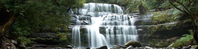
Tumbling through an enchanting Tasmania rainforest, Liffey Falls is considered one of the island state’s prettiest waterfalls. A 2.2-kilometer (1.4-mile) round trip walking track to the falls descends 70 meters in elevation past three enticing cascades in the Liffey River before reaching the photogenic falls. The trail is located in Liffey Falls State Reserve near the center of Tasmania in the Great Western Tiers, mountains southwest of the city of Launceston.
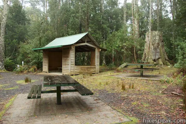
Two routes take hikers to Liffey Falls from car parks above and below the waterfall on the Liffey River. The route described here starts from Upper Liffey Car Park and travels downstream past three cascades to reach the waterfall. Liffey Falls Picnic Area can also be found at the Upper Liffey Car Park, as well as a short walk to an enormous eucalyptus tree that makes a nice add-on after a walk to the falls.
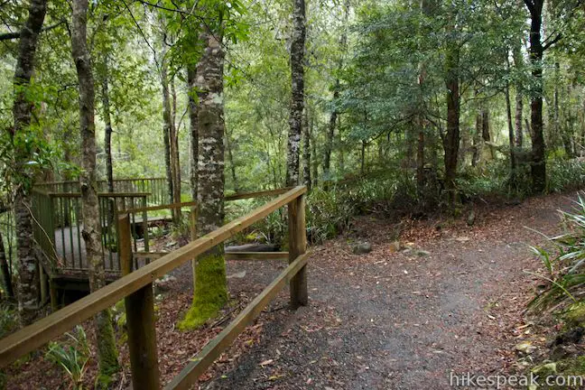
Alongside a shelter in the picnic area, you will find a panel with information about the park and a map of the trail. As shown, the route passes overlooks at cascade 1, cascade 2, and cascade 3 before reaching Liffey Falls. Spot the sign for Liffey Falls, one of Tasmania’s 60 Great Easy Walks, at the trailhead and start hiking. Immediately, the trail will pass a silvery metal sculpture called Stratose, made up of three angled posts that, as a panel explains, “depict the geological strata through which the swirling waters have cut a path.”
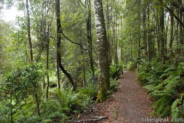
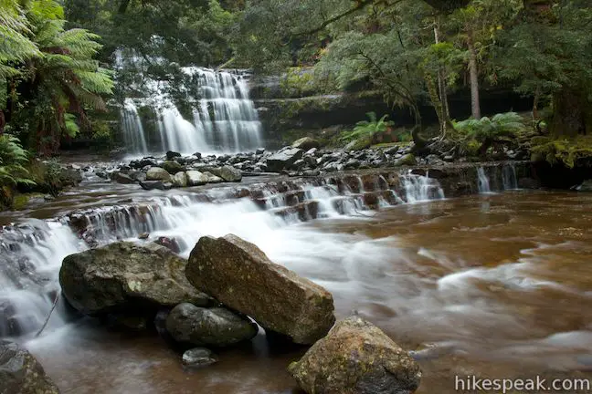
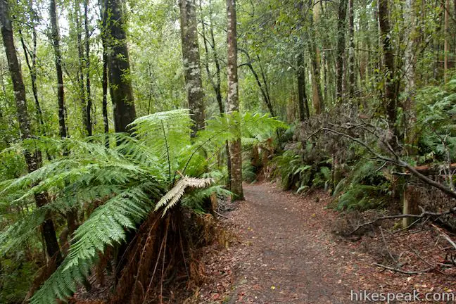
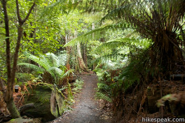
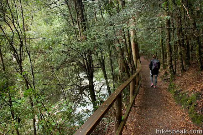
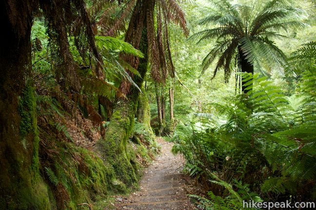
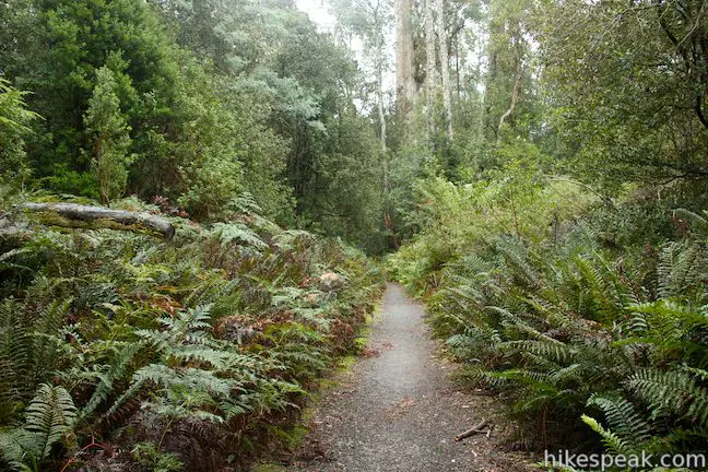
The dirt track passes between tall eucalyptus trees to enter a dense rainforest. Tall tree ferns arch over the trail as it descends through a switchback toward the Liffey River. From here, the trail sticks to the right bank of the river. At half a kilometer from the start, you will reach the first split in the trail. The most direct trail to Liffey Falls is to the right, bypassing the overlook at the first cascade. The trail to the left ventures about twenty meters out to the cascade viewpoint before reuniting with the other side of the trail.

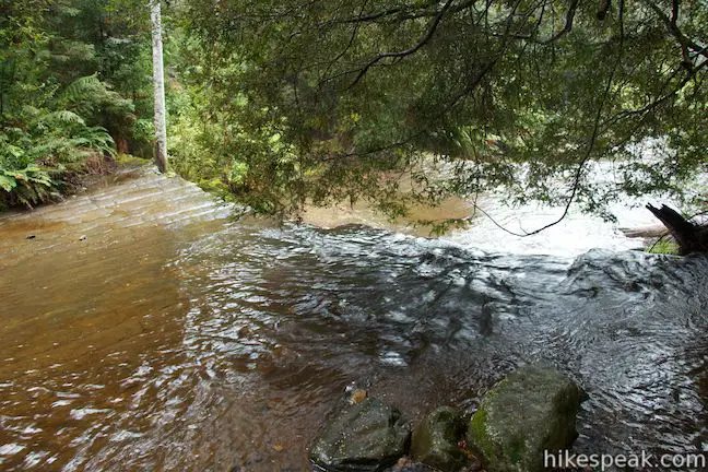
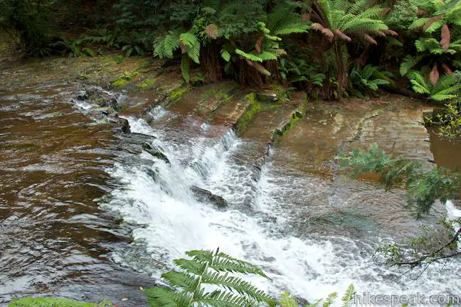
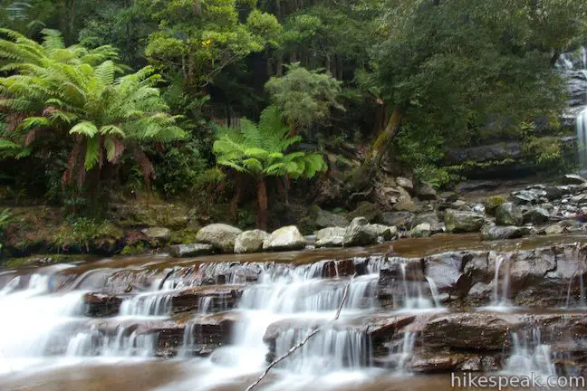
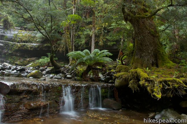
Walk down the trail to the left to an overlook just above the first cascade. Here the wide, relatively calm river drops off a shelf of orange sandstone. Ferns and verdant brush line the banks of the rainforest-wrapped river. While they are known as cascades one, two, and three (collectively the Upper Cascades), these three small waterfalls have names of their own, Alexandra Falls, Hopetoun Falls, and Albert Falls (or Spout Falls).
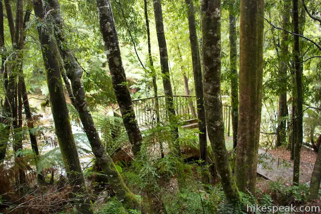
The side trail to the first overlook turns back and connects to the other trail. Continue down the unified trail to a wooden platform at an overlook by the second cascade. Look down on a new liquid staircase in the river and gaze back upstream toward the first cascade.
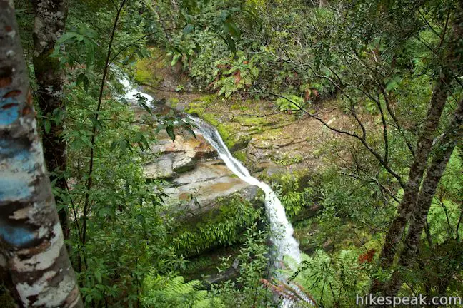
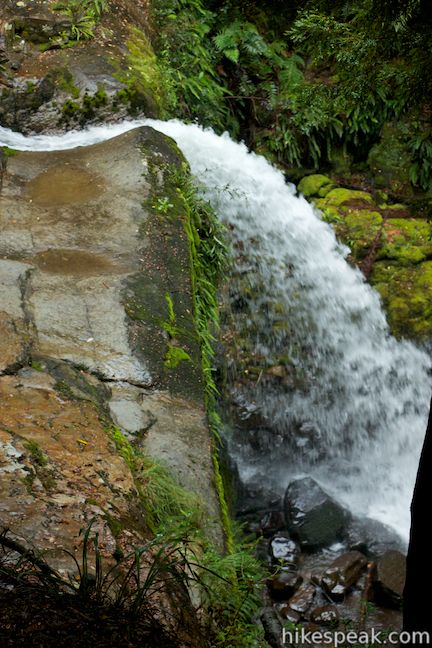
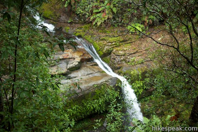
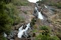
Follow the trail through more dense forest toward the third cascade. You can actually spot this gusher through the trees before you reach the final overlook. Unlike the previous cascades, and Liffey Falls below, this is not a wide fanned-out drop. Instead the water is concentrated into a pipe of white water that leaps off a ledge like an oversized waterspout. A fork in the trail goes out and back to the overlook above the third cascade. Cross a wooden walkway with a railing that you can lean over and look down on the cascade. The trees somewhat obscure the view of the river, wrapping the short waterfall in a wreath of green.
As you continue past the overlook and back to the main trail, you’ll spot another drop in the river below. This taste of things to come should motivate you to press on to the end of the trail at the base of Liffey Falls. As you reunite with the main trail, you’ll see a sign showing the distance to the falls as 20 minutes. Don’t turn back now. The most impressive waterfall lies just down the trail.
Follow the trail down the bank above the river to an important junction. The trail to the right, Liffey River Trail, proceeds another 40 minutes down to the lower trailhead. Turn left to reach the waterfall, following a sign that puts Liffey Falls at 5 minutes away.
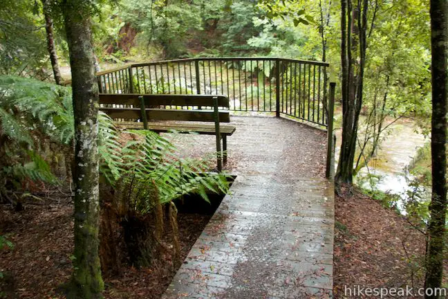
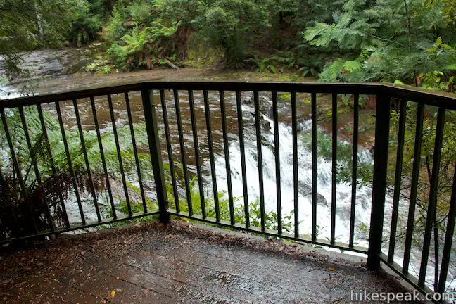
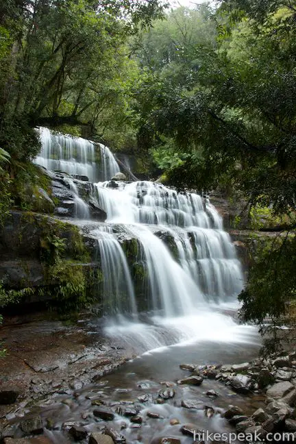
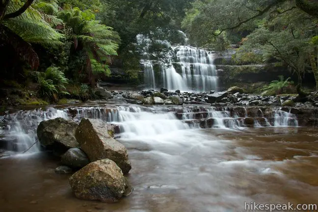
The trail descends with purpose past a few signs painted with children’s drawings and descriptions of the area’s plants. The cute signs may have you looking at the plants around you with a fresh perspective. Walk down past a bench to reach the side of the river. The trail ends at a viewing area with a metal railing. Take in Liffey Falls from here, which appears to your right, spanning across the Liffey River.
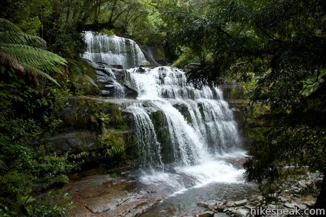
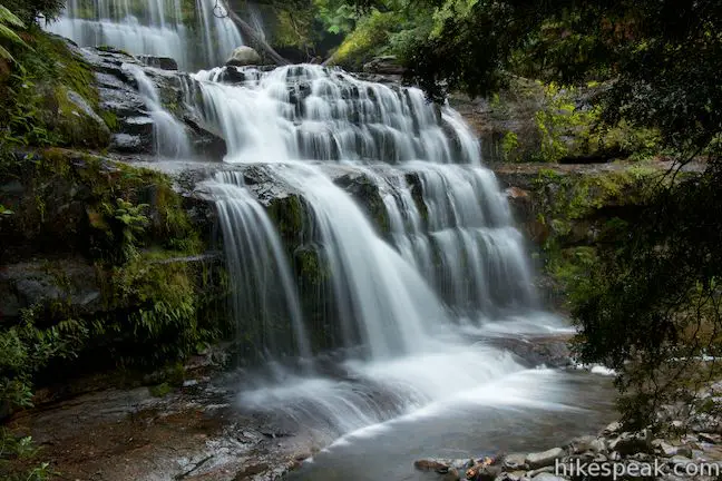
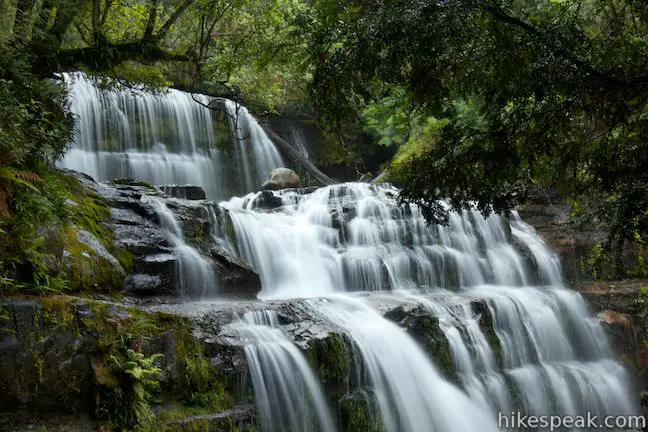
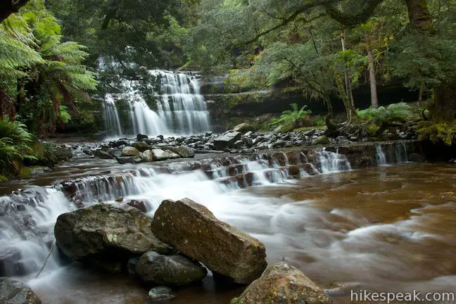
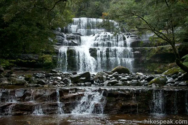
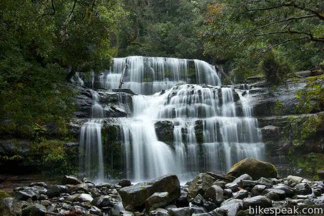
Lovely Liffey Falls fans out across a staircase of dark rocks. At the top of the falls, there is an initial drop that expands to a broader middle falls, where the water crashes and jumps across a landing and down a final, even broader plunge. It is a beautiful spot, and if you brought your camera, the waterfall will look mystical with a long exposure.
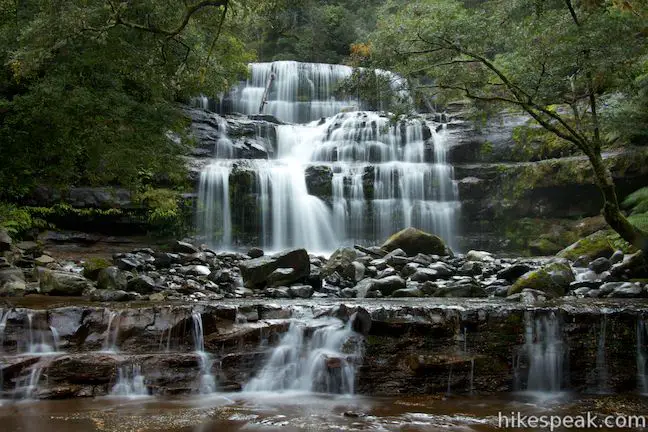
If you backtrack a few meters from the end of the trail, there will be a spot to step out from beneath the trees onto the bank of the river. If you’re feeling adventurous, walk out amongst the rocks in the shallow river for great head-on views of Liffey Falls. There is a stone overhang on the right side of the river shrouded by the rainforest. Downstream, there are a few more small drops in the river, but the water seems to get calm below the falls.
The hike down to Liffey Falls is 1.15 kilometers long. If you walk back via the more direct route it will be a 1.05-kilometer long return. Hike back uphill, regaining the 70 meters of elevation to get back to the car park.
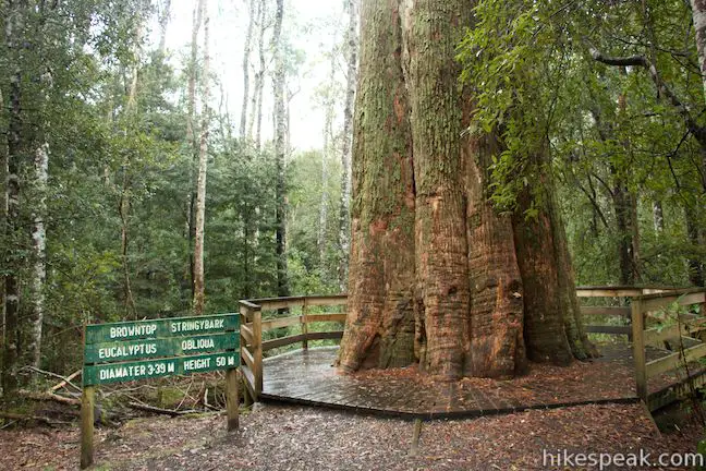
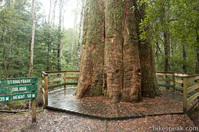
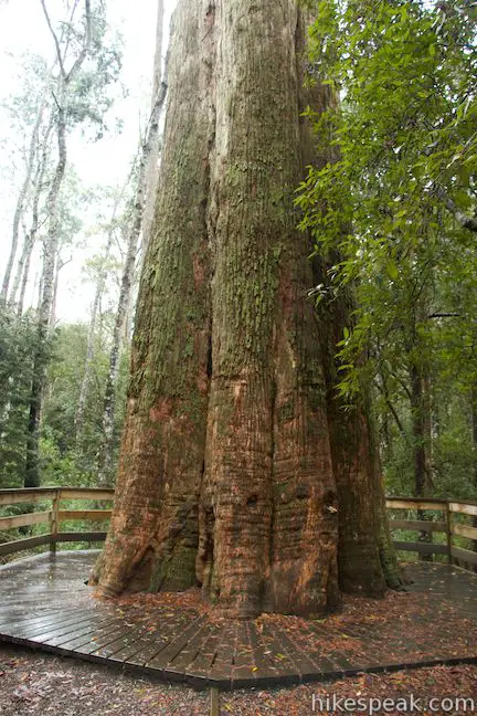
To extend your walk and check out the reserve’s “Big Tree,” walk across the car park to the toilets at the higher side of the picnic area. To the right of the bathroom you’ll find the Liffey River Trail and a sign for the Big Tree, which is a one minute walk away. Stroll up the trail to a grand eucalyptus tree (the Big Tree) with a wooden viewing platform built around the base. Walk around the broad 3.39-meter diameter trunk and look up toward its highest branches, 50 meters off the ground. The big tree is a eucalyptus obliqua or a browntop stringybark. When you’ve completed your tour of the tree, simply walk back to the car park.
Dogs and bikes are not permitted on these trails. No fee or permit is required to visit Liffey Falls State Reserve or hike to Liffey Falls, so get out and enjoy!
Directions to the Trailhead
- From South Launceston, drive west on Highway 1 for 42 kilometers.
- Take the Meander Valley Road (A5) exit and drive south on Meander Valley Road for 1.3 kilometers to a roundabout.
- Take the second exit (like turning right) to proceed on Meander Valley Road (A5).
- In another 2.2 kilometers, pass through the town of Deloraine and turn left to stay on A5 (don't cross the Meander River), following signs for Meander and Liffey Falls.
- In another 7 kilometers, make another left to stay on A5, leaving Meander Road for Highland Lakes Road.
- Drive 16 kilometers and turn right onto Riversdale Road (C513).
- Proceed another 6 kilometers down this windy dirt road to the picnic area and trailheads at the road end.
Trailhead Location
Trailhead address: Riversdale Road, Liffey, TAS 7301, Australia
Trailhead coordinates: -41.700153, 146.759189 (41° 42′ 00.55″S 146° 45′ 33.08″E)
You may also view a regional map of surrounding Australian trails, campgrounds, and lodging.


The Big Tree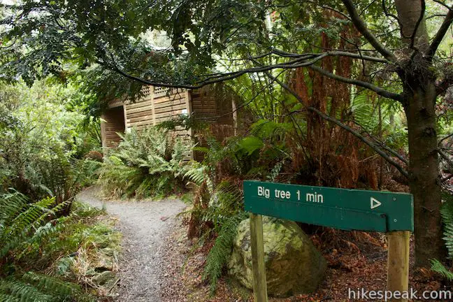

 | Cataract Gorge This 3.4-kilometer loop combines Zig-Zag Track, Cataract Walk, and Bridge Walk to explore Cataract Gorge Reserve, an impressive natural area just outside the center of Launceston. |
 | Russell Falls & Horseshoe Falls This hike in Mount Field National Park visits one of Tasmania's most famous and beautiful waterfalls and can be extended from 1.8 to 2.65 kilometers by venturing to the top of Russell Falls and nearby Horseshoe Falls. |
 | Pinnacles Boardwalk & Summit Trig The 0.3-kilometer round trip walk on Pinnacles Boardwalk can easily be extended to a 0.75-kilometer walk on the top of Mount Wellington, checking out another short boardwalk and the trig station at the summit. |
 | Octopus Tree and Circle Track This 1.1-kilometer loop in Hobart's Wellington Park reaches a unique eucalyptus tree with tentacles for roots that wrap around a boulder. |
 | Friendly Beaches This hike explores a long, pristine beach on the east coast of Tasmania north of the Freycinet Peninsula. |
 | Cape Tourville This 0.6-kilometer circuit provides big views along the east coast of Freycinet Peninsula, circling 100-meter tall bluffs to reach the Cape Tourville Lighthouse. |
 | Wineglass Bay and Hazards Beach Circuit This approximately 12-kilometer loop takes a rewarding route through Freycinet National Park, visiting pristine light sand beaches at Hazards Beach and the renowned Wineglass Bay. |
 | Tasmans Arch & Devils Kitchen This 0.9-mile walk visits two impressive features on the coast of the Tasman Peninsula, a natural bridge and a chasm carved by the sea. |
 | Blowhole & Fossil Bay Lookout This short walk in Tasman National Park reaches a coastal vista point and a wave-carved tunnel through a rocky point that has the potential to spray up like a whale spout. |
 | Coal Mines Historic Site This 0.8-kilometer loop through the Convict Precinct explores the ruins of an old prison and coal mine that relied on convict laborers. |
 | Cape Raoul This 12 to 14-kilometer hike explores the pristine coastline at the southwest end of the Tasman Peninsula, reaching a cape with daunting 200-meter tall cliffs dropping to swirling seas. |
 | Apsley Waterhole & Lookout Track This 1.4-kilometer loop travels through a eucalyptus forest to a popular swimming hole on the Apsley River in Douglas-Apsley National Park. |
 | Saint Columba Falls This 1.2-kilometer round trip hike descends into a rainforest to the base of a powerful 90-meter tall waterfall. |
 | Mount William This 3.6-kilometer out and back hike tops a short summit that is the high point of Mount William National Park with panoramic views over the coastline at the northeast corner of Tasmania. |
 | More trails in Australia Explore other destinations in Victoria and Tasmania, Australia. |
- Liffey Falls on australia.com (opens in a new tab)
- Liffey Falls on wikipedia.org (opens in a new tab)
- Liffey Falls on world-of-waterfalls.com (opens in a new tab)
- Liffey Falls on theoutdoortype.livejournal.com (opens in a new tab)
- Liffey Falls on molecreek.info (opens in a new tab)
- Liffey Falls on roamingdownunder.com (opens in a new tab)
- The Tasmania Parks and Wildlife page for the 60 Great Short Walks (opens in a new tab)
- The Tasmania Parks and Wildlife page for Liffey Falls Nature Walk (opens in a new tab)
- The Tasmania Parks and Wildlife page for Liffey Falls State Reserve (opens in a new tab)
Common Questions about Liffey Falls in Liffey Falls State Reserve
- Is the trail open?
- Yes. You should expect to find that Liffey Falls Track is open. There are no recent reports of trail closures. If you discover that the trail is closed, please help your fellow hikers by reporting a closure.
- Is this trail free to access?
- Yes, Liffey Falls Track is free to access. No entrance fee, pass, or permit is required. If you discover that access rules have changed, please provide feedback on your experience.
- How much time does this hike take?
- It takes approximately 45 minutes to hike Liffey Falls Track. Individual hiking times vary. Add extra time for breaks and taking in the views.
- How long is this hike?
- The hike to Liffey Falls Track is a 2.2 km / 1.4 mile out and back return with 70 meters / 230 feet of elevation change.
- Are dogs allowed on this trail?
- No, dogs are likely not allowed on Liffey Falls Track. The trail is primarily open to hikers.
- Is Liffey Falls Track good for kids?
- Yes, this hike is likely suitable for children. It is relatively short (1.4 miles) with manageable elevation gain.
- Will I see a waterfall on this hike?
- Yes, Liffey Falls Track features a waterfall.
- Where is the trailhead located?
- The trailhead for Liffey Falls Track is located in Liffey, Tasmania.
Trailhead Address:
Riversdale Road
Liffey, Tasmania 7301
Trailhead Coordinates:
-41.700153, 146.759189 - What are the driving directions to the start of the hike?
To get to the trailhead: From South Launceston, drive west on Highway 1 for 42 kilometers. Take the Meander Valley Road (A5) exit and drive south on Meander Valley Road for 1.3 kilometers to a roundabout. Take the second exit (like turning right) to proceed on Meander Valley Road (A5). In another 2.2 kilometers, pass through the town of Deloraine and turn left to stay on A5 (don't cross the Meander River), following signs for Meander and Liffey Falls. In another 7 kilometers, make another left to stay on A5, leaving Meander Road for Highland Lakes Road. Drive 16 kilometers and turn right onto Riversdale Road (C513). Proceed another 6 kilometers down this windy dirt road to the picnic area and trailheads at the road end.
View custom Google Maps directions from your current location.
- Are there other trails near Liffey Falls Track?
- Yes, you can find other nearby hikes using the Hikespeak Hike Finder Map.

Go the extra miles...
Submit a rating of this hike to go with your comment. Contribute to the average trail rating.