
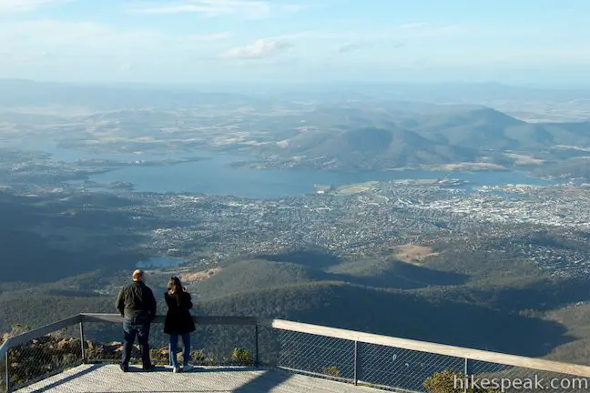
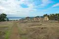
If you’re traveling to Tasmania by plane, you’ll probably be flying in an out of Hobart, the capital of Tasmania. Hobart is a great city to explore, and every itinerary should include a visit to Mount Wellington, the 1,271-meter (4,170-foot) tall mountain that rises above the city to the wast. As daunting as this mountain might look, you can actually drive all the way to the top, easily reaching an incredible perspective over Hobart and what feels like a top-down view of Tasmania. A 150-meter long boardwalk at the top delivers the best views over Hobart and the River Derwent. While you’re up there, you can also make your way to the top of a jumble of boulders at the summit and explore another short boardwalk for more views to the northwest. All in, this easy summit walk of around 0.75 kilometers (0.45 miles) gives you a sensationally scenic experience on the top of Mount Wellington.
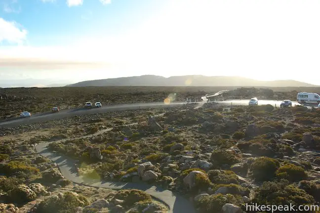
This walk begins just below the summit of Mount Wellington, so the grand views don’t require any tough elevation gain. In fact, you’ll get quite a view over Hobart as you make the winding drive up the side of Mount Wellington on Pinnacles Road.
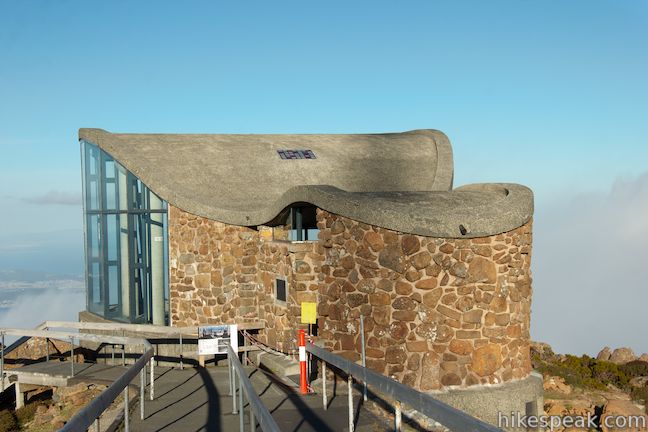
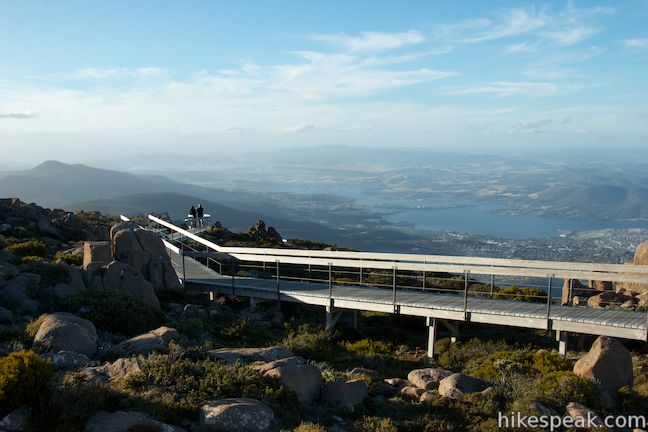
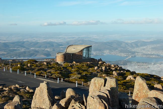
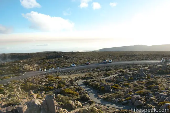
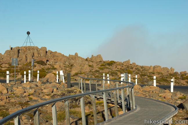
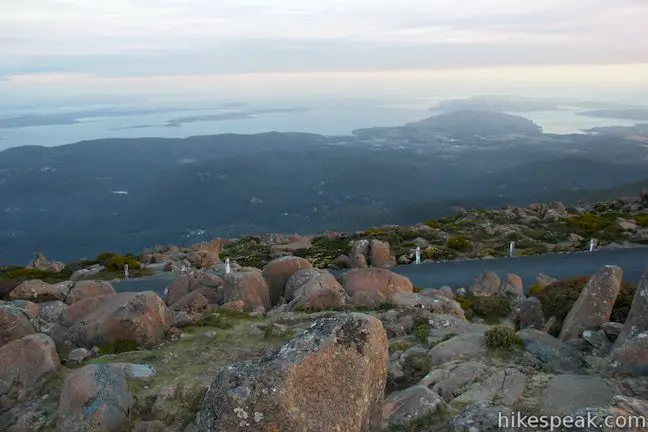
At the end of the road, drive around a clockwise loop that circles the summit and find parking on the far side. Walk back to the point where the loop began and cross the road to Pinnacles Boardwalk, which ventures out to the Pinnacles Observation Shelter and two exceptional vista points.

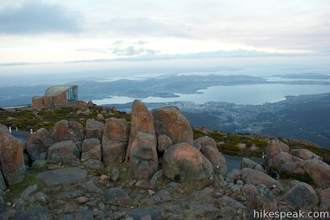
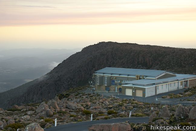
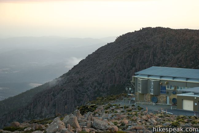
Begin down the boardwalk toward the Observation Shelter, which has a large glass front overlooking Hobart. On a windy day, you can step inside this building and gain protection from the elements while enjoy awesome views.
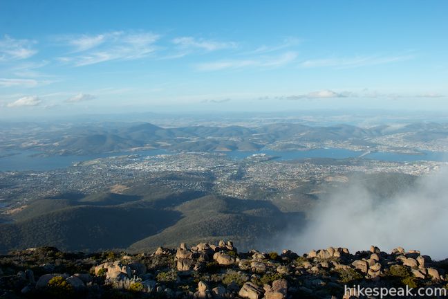
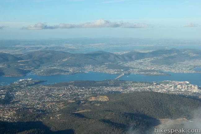
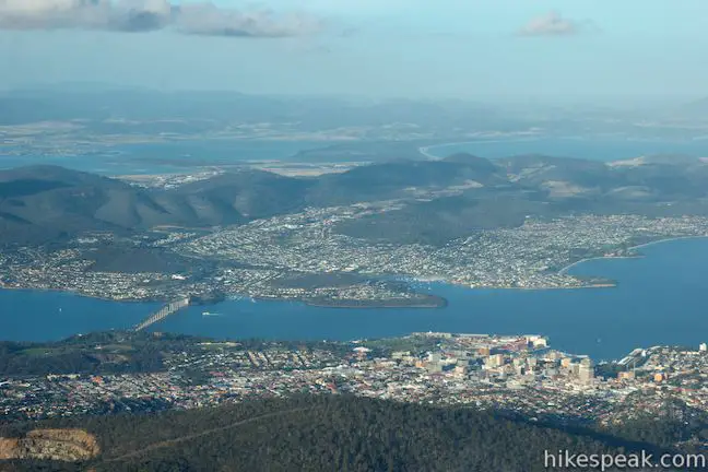
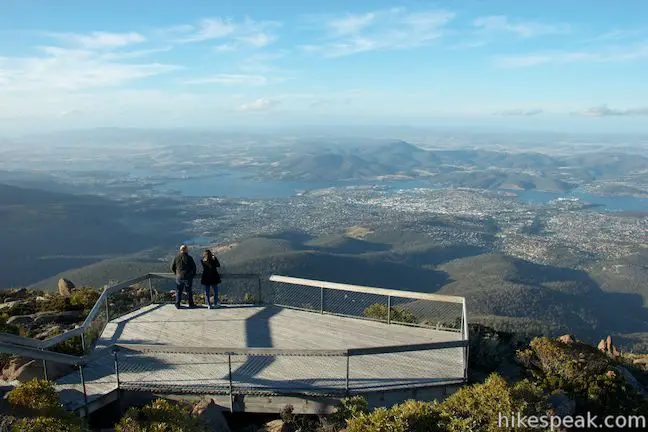
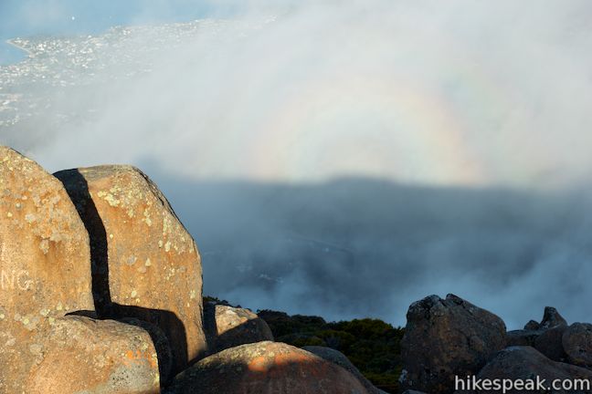
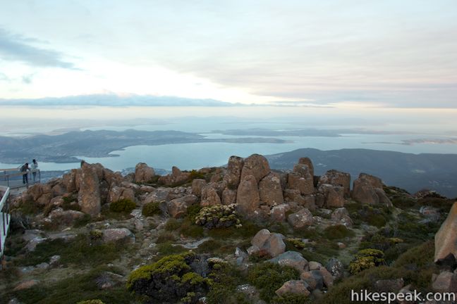
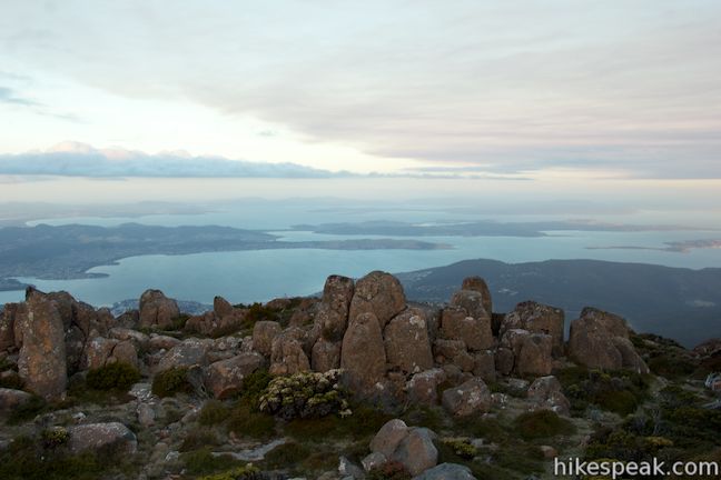
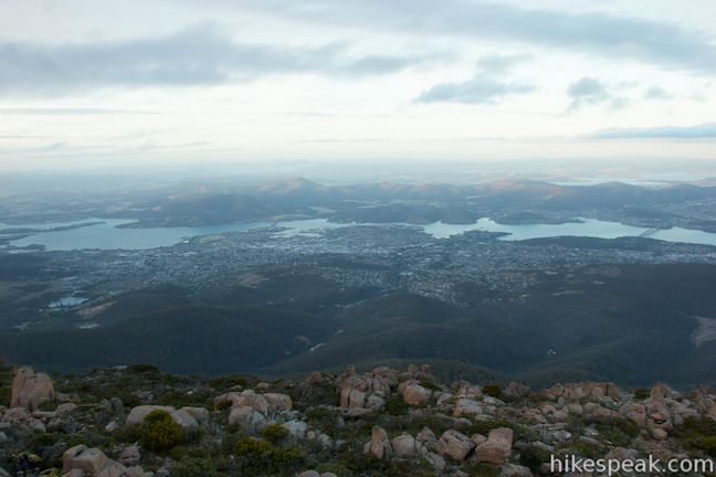
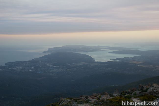
If the weather is fine, keep walking out on the boardwalk. Walk down a flight of stairs and come to a viewing platform on the right. Step down to the overlook and take it all in! On a clear day, you’ll be able to look east over Hobart and south down the River Derwent toward the peninsulas and bays along the southern edge of Tasmania.
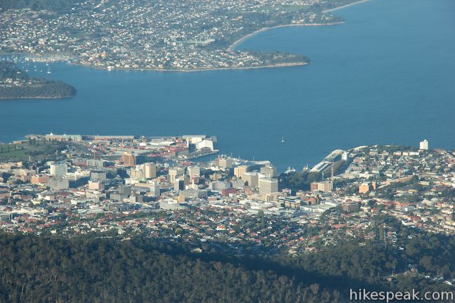
The boardwalk continues to the left, heading north toward a second vista point. As you walk down the boardwalk, there are continuous over Hobart. You can clearly pick out the city’s central business district and the famed harbor that launched some of the earliest expeditions to Antarctica. As the boardwalk comes to an end, the panorama expands to the north, looking farther up the River Derwent and over mountains in the chain north of Mount Wellington.

In 1985, Mark Twain had this to say of the great mountain:
Mount Wellington, massive and noble like his brother Etna, literally heaves in sight, sternly guarded on either hand by Mounts Nelson and Rumney.
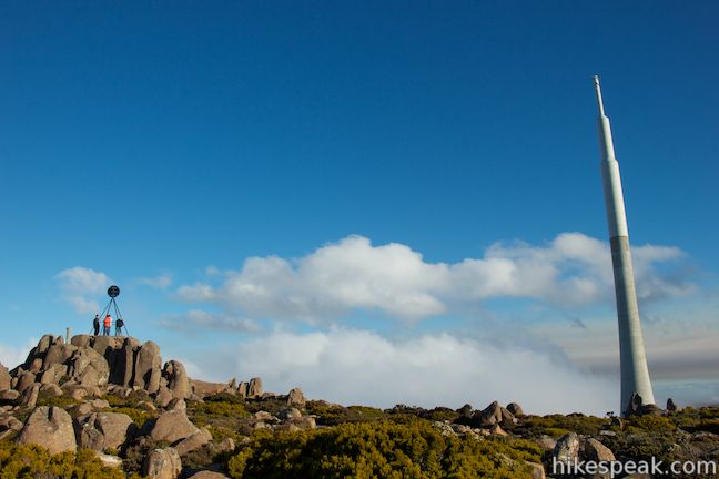
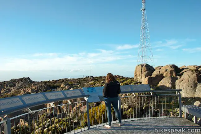
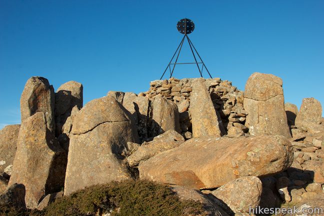
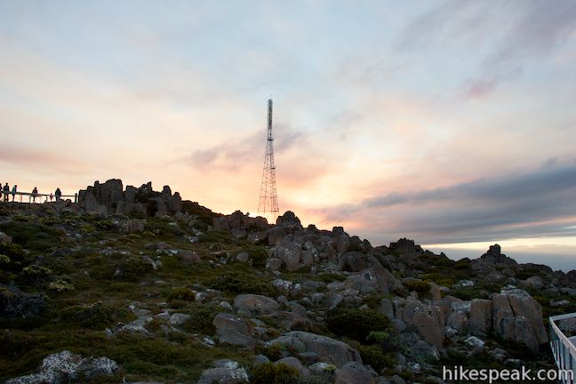
Once you’ve taken in the exceptional views from Pinnacles Boardwalk (0.3-kilometer round trip), make your way back up to the road. Across the road, there is a mass of boulders at the true summit of Mount Wellington with a tripod-shaped trig station on the top. Trig stations are common throughout Australia and New Zealand for geodetic measuring and are similar to USGS survey markers in the United States.
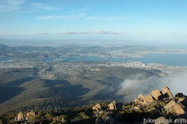
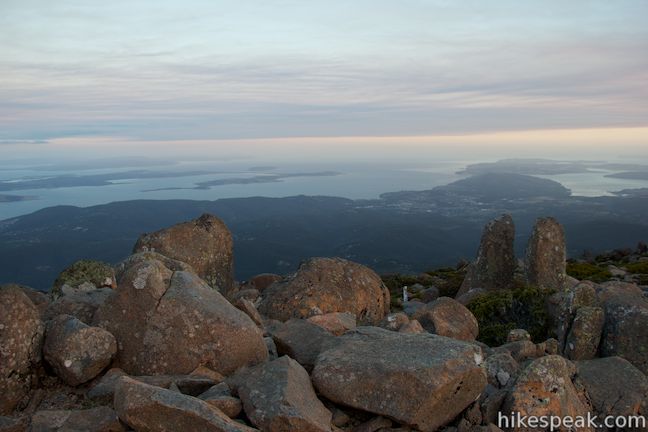
A couple of blacktopped paths approach the summit from the parking area. Take these paths or forge your own route across the rocks. To reach the trig, you’ll need to make a short scramble up the boulders. Hoist yourself up to the trig and enjoy 360-degree views at the top.
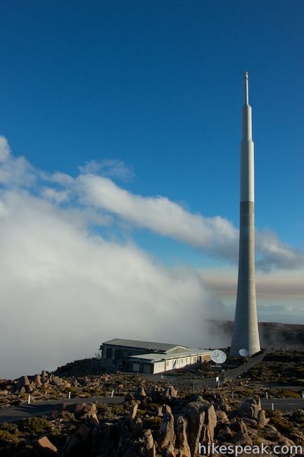
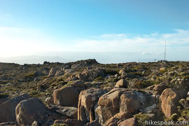
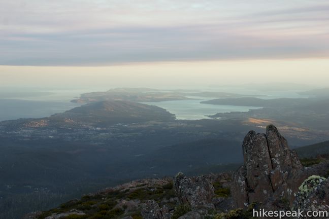
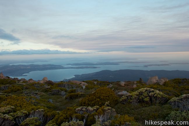
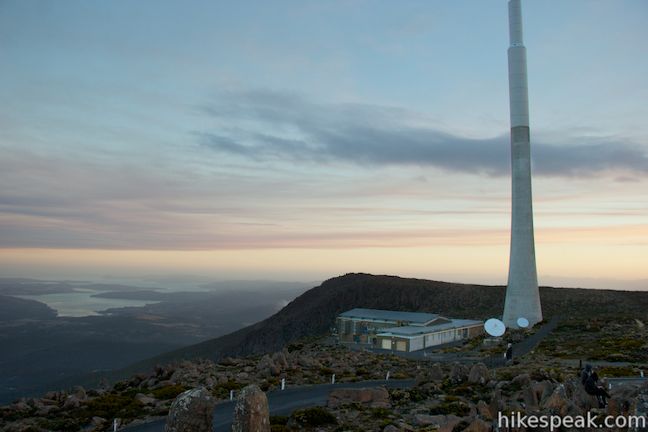
Compared to the boardwalk, you can see even farther south from the summit, looking beyond the River Derwent toward the southern end of Tasmania. Impressive rock columns on Mount Wellington known as the Organ Pipes are visible to the southwest where you’ll also see a building alongside a communications tower that rises over Mount Wellington like a tall white pole. There is also another less prominent radio tower to the north, backed by more mountain views.
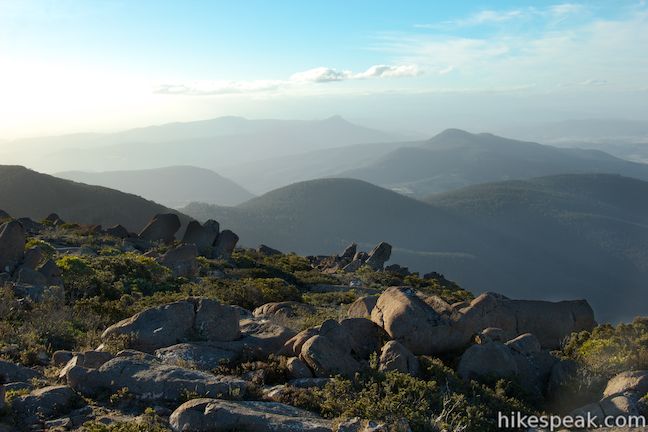
Another short boardwalk leaves from the west side of the loop at the end of Pinnacles Road. Take this 50-meter-long boardwalk to a vista point that looks out over the barren rocky terrain at the top of Mount Wellington toward the mountains to the north and west. While Mount Wellington falls away sharply on the east face toward Hobart, the mountainside is far more tapered as it stretches away to the northwest.
Longer hikes in Wellington Park are possible too, but if you want all the views without the effort, Pinnacles Boardwalk and the other trails at the summit of Mount Wellington will not disappoint. For another short hike in Wellington Park, check out Octopus Tree and Circle Track. Dogs and bikes are prohibited on the boardwalks. No fee or permit is required to visit the summit of Mount Wellington in Wellington Park, so get out and enjoy!
Directions to the Trailhead
- From the central business district of Hobart, where Highway 1 and A3 merge, continue south on Davey Street (A6).
- After 2 kilometers, stay to the right to continue straight through an intersection with Sothern Outlet (A6) and proceed up Davey Street (B54).
- After another 900 meters, Davey Street becomes Huon Road and curves to the right.
- Drive another 6.3 kilometers up Heon Road and make a very sharp right turn up Pillinger Drive (C616) toward Mount Wellington.
- Pillinger Drive turns into Pinnacles Road.
- From the intersection, it is 11.5 kilometers up to end of the road at the top of Mount Wellington.
- You will pass the trailhead for Octopus Tree at Shoobridge Bend, nine kilometers below the summit.
Trailhead Location
Trailhead address: Pinnacle Road, Wellington Park, TAS 7054, Australia
Trailhead coordinates: -42.89542, 147.237723 (42° 53′ 43.51″S 147° 14′ 15.80″E)
You may also view a regional map of surrounding Australian trails, campgrounds, and lodging.


 | Octopus Tree and Circle Track This 1.1-kilometer loop in Hobart's Wellington Park reaches a unique eucalyptus tree with tentacles for roots that wrap around a boulder. |
 | Tasmans Arch & Devils Kitchen This 0.9-mile walk visits two impressive features on the coast of the Tasman Peninsula, a natural bridge and a chasm carved by the sea. |
 | Blowhole & Fossil Bay Lookout This short walk in Tasman National Park reaches a coastal vista point and a wave-carved tunnel through a rocky point that has the potential to spray up like a whale spout. |
 | Coal Mines Historic Site This 0.8-kilometer loop through the Convict Precinct explores the ruins of an old prison and coal mine that relied on convict laborers. |
 | Cape Raoul This 12 to 14-kilometer hike explores the pristine coastline at the southwest end of the Tasman Peninsula, reaching a cape with daunting 200-meter tall cliffs dropping to swirling seas. |
 | Russell Falls & Horseshoe Falls This hike in Mount Field National Park visits one of Tasmania's most famous and beautiful waterfalls and can be extended from 1.8 to 2.65 kilometers by venturing to the top of Russell Falls and nearby Horseshoe Falls. |
 | Liffey Falls This 2.2-kilometer walk passes the Upper Cascades on the Liffey River to reach the base of lovely Liffey Falls, one of Tasmania's finest waterfalls. |
 | Cataract Gorge This 3.4-kilometer loop combines Zig-Zag Track, Cataract Walk, and Bridge Walk to explore Cataract Gorge Reserve, an impressive natural area just outside the center of Launceston. |
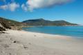
 | Friendly Beaches This hike explores a long, pristine beach on the east coast of Tasmania north of the Freycinet Peninsula. |
 | Cape Tourville This 0.6-kilometer circuit provides big views along the east coast of Freycinet Peninsula, circling 100-meter tall bluffs to reach the Cape Tourville Lighthouse. |
 | Wineglass Bay and Hazards Beach Circuit This approximately 12-kilometer loop takes a rewarding route through Freycinet National Park, visiting pristine light sand beaches at Hazards Beach and the renowned Wineglass Bay. |
 | Apsley Waterhole & Lookout Track This 1.4-kilometer loop travels through a eucalyptus forest to a popular swimming hole on the Apsley River in Douglas-Apsley National Park. |
 | Saint Columba Falls This 1.2-kilometer round trip hike descends into a rainforest to the base of a powerful 90-meter tall waterfall. |
 | Mount William This 3.6-kilometer out and back hike tops a short summit that is the high point of Mount William National Park with panoramic views over the coastline at the northeast corner of Tasmania. |
 | More trails in Australia Explore other destinations in Victoria and Tasmania, Australia. |
Common Questions about Pinnacles Boardwalk and Summit Trig on Mount Wellington in Wellington Park
- Is the trail open?
- Yes. You should expect to find that Pinnacles Boardwalk is open. There are no recent reports of trail closures. If you discover that the trail is closed, please help your fellow hikers by reporting a closure.
- Is this trail free to access?
- Yes, Pinnacles Boardwalk is free to access. No entrance fee, pass, or permit is required. If you discover that access rules have changed, please provide feedback on your experience.
- How much time does this hike take?
- It takes approximately 15 minutes to hike Pinnacles Boardwalk. Individual hiking times vary. Add extra time for breaks and taking in the views.
- How long is this hike?
- The hike to Pinnacles Boardwalk is a 0.75 km / 0.45 mile out and back return with 20 meters / 65 feet of elevation change.
- Are dogs allowed on this trail?
- No, dogs are likely not allowed on Pinnacles Boardwalk. The trail is primarily open to hikers.
- Is Pinnacles Boardwalk good for kids?
- Yes, this hike is likely suitable for children. It is relatively short (0.45 miles) with manageable elevation gain.
- Does this trail go to a summit?
- Yes, Pinnacles Boardwalk reaches a summit with panoramic views.
- Where is the trailhead located?
- The trailhead for Pinnacles Boardwalk is located in Wellington Park, Tasmania.
Trailhead Address:
Pinnacle Road
Wellington Park, Tasmania 7054
Trailhead Coordinates:
-42.89542, 147.237723 - What are the driving directions to the start of the hike?
To get to the trailhead: From the central business district of Hobart, where Highway 1 and A3 merge, continue south on Davey Street (A6). After 2 kilometers, stay to the right to continue straight through an intersection with Sothern Outlet (A6) and proceed up Davey Street (B54). After another 900 meters, Davey Street becomes Huon Road and curves to the right. Drive another 6.3 kilometers up Heon Road and make a very sharp right turn up Pillinger Drive (C616) toward Mount Wellington. Pillinger Drive turns into Pinnacles Road. From the intersection, it is 11.5 kilometers up to end of the road at the top of Mount Wellington. You will pass the trailhead for Octopus Tree at Shoobridge Bend, nine kilometers below the summit.
View custom Google Maps directions from your current location.
- Are there other trails near Pinnacles Boardwalk?
- Yes, you can find other nearby hikes using the Hikespeak Hike Finder Map.

Australia looks absolutely amazing to hike!