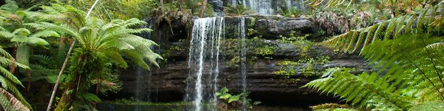
Russell Falls is likely the most-visited attraction in Mount Field National Park, and one of Tasmania’s best-known waterfalls. There is a viewing area at the base of the approximately 50-meter tall (165-foot tall) waterfall that can be reached on a 1.8-kilometer (1.1-mile) round trip hike with 30 meters of elevation gain. Trails travel through an old and well-established rainforest to deliver an intimate look at the broad and beautiful waterfall. For a longer hike, take an additional trail to the top of Russell Falls and upstream to a smaller waterfall, Horseshoe Falls, on a 2.65-kilometer (1.65-miles) hike with 80 meters (265 feet) of elevation gain.
Mount Field National Park was created in 1916 as one of Tasmania’s first national parks in order to protect Russell Falls and the surrounding forests. Perhaps it’s because Russell Falls is such a star attraction that the park has set things up so that you walk through the visitor center (with it’s café and gift shop) to reach the trail to the falls. The main trail to Russell Falls is paved and wheelchair friendly, while another route that loops back through the rainforest is not paved, allowing for greater rainforest immersion on the second half of Russell Falls Loop.
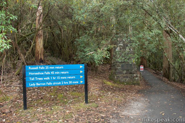
Hike out the back of the visitor center and around a pavilion up to a sign for Russell Falls, One of Tasmania’s 60 Great Short Walks. Proceed up the trail to the edge of the rainforest where a larger sign lists the hiking times to Russell Falls (25-minute return), Horseshoe Falls (45-minute return), Tall Tree Walk (75-minute return), and Lady Baron Falls (2 hour 30-minute circuit).
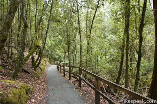
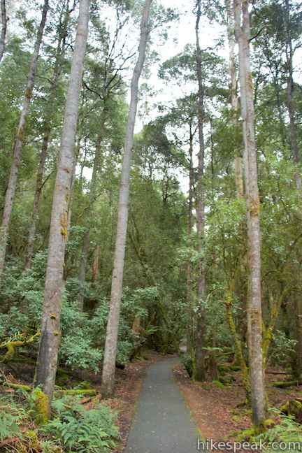
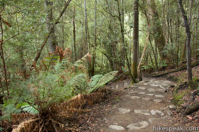
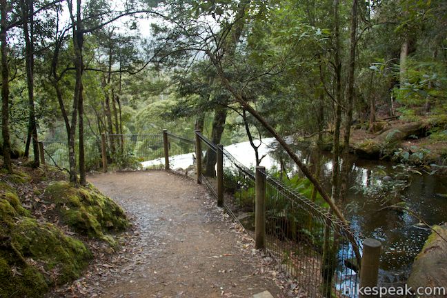
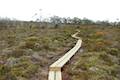
The paved track enters the rainforest and turns downhill toward the bank of a gentle stream. From here, the trail turns slightly uphill, following the water toward Russell Falls. When you reach the stream there will be a junction with a dirt trail parting across a bridge to the right. This is the start of Russell Falls Loop. Stay to the left for the main paved route to Russell Falls.
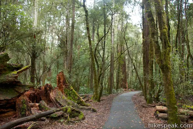
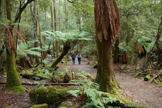
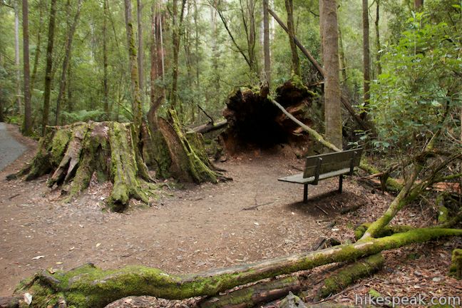
Hike between tall swamp gum (eucalyptus trees) that are joined by myrtle and tree ferns to create a cool rainforest environment. Moss lines the tree trunks, stumps, and fallen logs along the trail in this soggy rainforest. Half a kilometer from the start there will be a bench on the right next to an upturned tree with a dark root base that’s big enough for you to step inside.
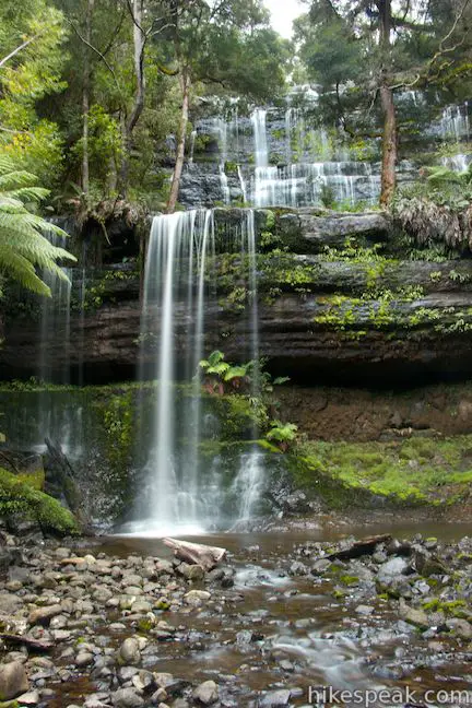
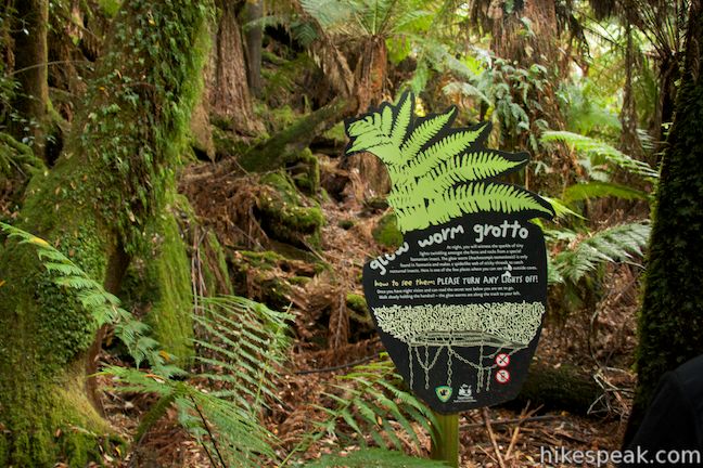
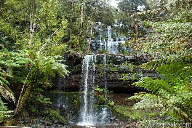
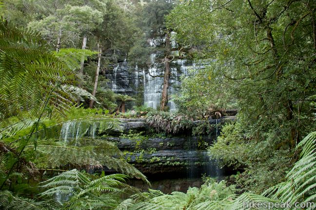
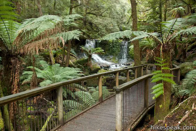
Not far past the bench, and just before you reach the falls, the trail will pass a glow worm grotto on the left where glow worms can be spotted at night (courtesy of their luminous scat). The paved track ends as you step out from below the tree ferns onto a wooden platform with a big open views of Russell Falls.

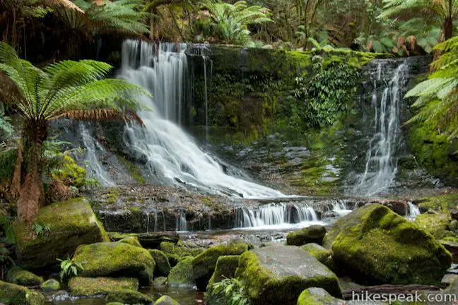
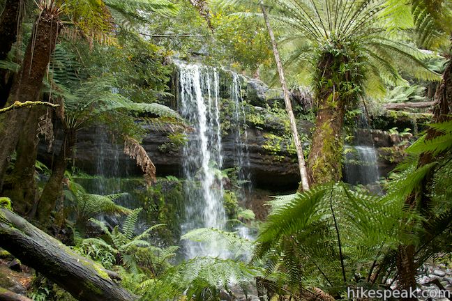
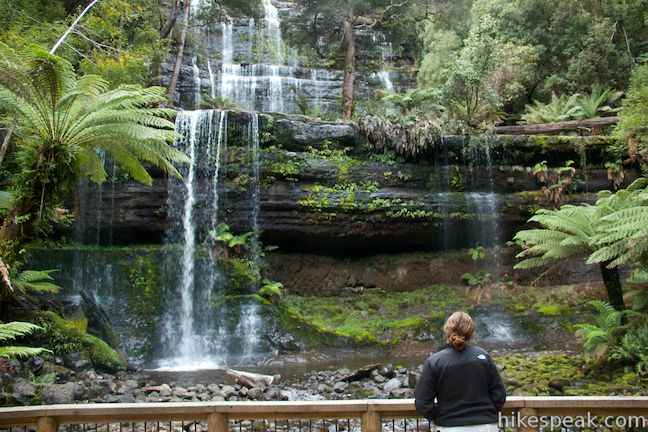
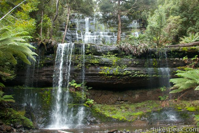
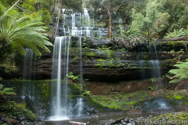
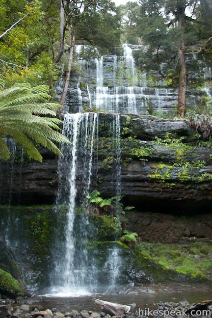
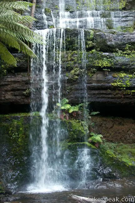
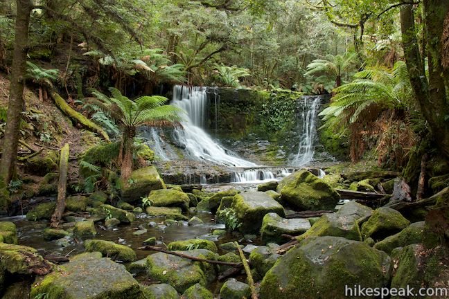
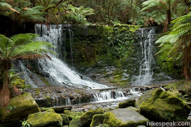
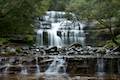
The falls are about fifty meters tall and fairly wide as well, with cords of water stumbling down an open rock face. Toward the top of the waterfall there are steps in the sheer rock that broaden the falls as it comes down. At the bottom of the falls, the long main drop courses down the left side of a dark moss and fern-covered ledge. A few fingers of water form their own falls to the right, spilling off the rock in faint ribbons. A dense collection of rainforest trees line the waterfall on both side, but there are no trees between the viewing area and the bottom of the falls, affording a close clear look at Russell falls. Stand inside the large opening below the waterfall and take in the liquid view!
The wheelchair-friendly trail ends here, but if you’re able to go on, you can continue with Russell Falls Loop and extend things by hiking up to the top of Russell Falls and farther upstream to Horseshoe Falls.
There is a junction just past the wooden viewing area. To the right, the loop track returns toward the visitor center, while another trail goes to the left and immediately comes to another junction. At this next junction, you may turn left up a track that ascends to another view of Russell Falls. This higher lookout point is obscured by trees and has diminished views compared to the main platform below. Take the trail straight ahead at the second junction to hike up to Horseshoe Falls and the top of Russell Falls.
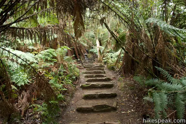
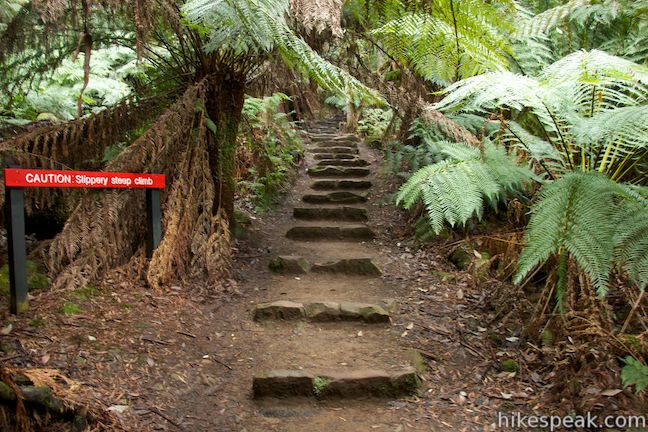
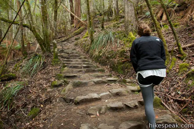
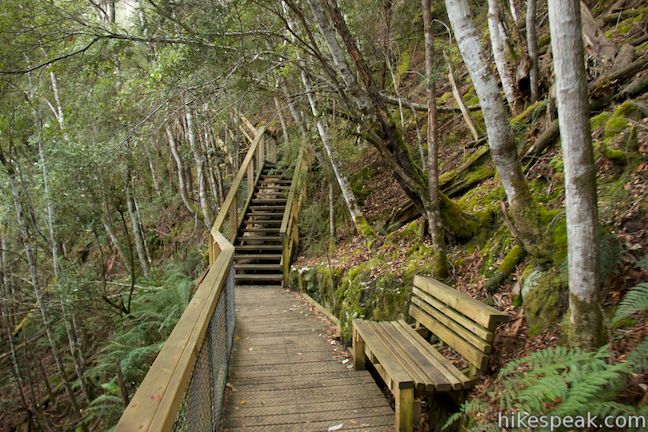
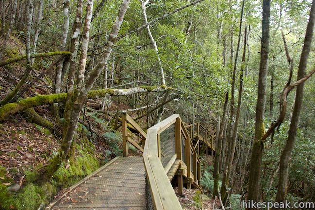
The trail to the top of the falls is steep, with lots of steps. First you will ascend stone steps that make a cool addition to the lush myrtle rainforest. After a few tight switchbacks (and benches for those whose legs get tired), there are wooden steps on a walkway that is raised off the hillside.
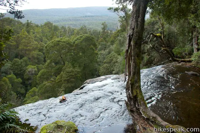
Head up through the forest and return to solid ground as you reach the brink of Russell Falls, ascending some 50 meters from the base of the falls in 1/3 of a kilometer. A railing along the trail allows you to walk right past the edge of the falls. From this perch you can look out across the top of the canopy toward the surrounding hills. Unfortunately, it’s hard to actually look down the waterfall. The water simply disappears over the edge.
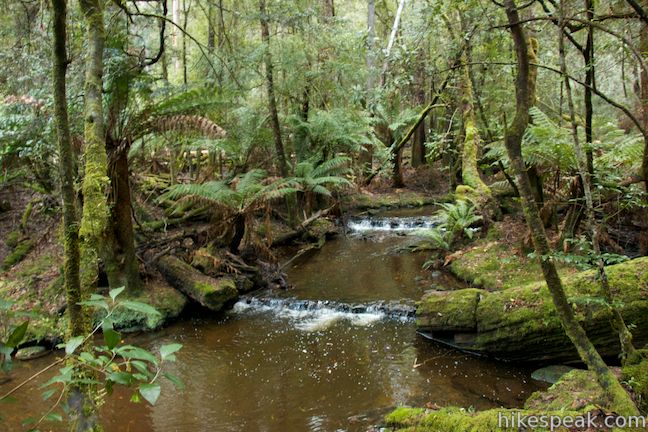
Continue up the trail along a stream that is surprisingly calm, given the wild ride that the water has in store. Just up the right side of the stream, you will come to a junction. The trail to the Tall Trees Walk and Lady Baron Falls breaks off to the left, providing an even longer hike in Mount Field National Park. Stay to the right to hike a short distance farther to Horseshoe Falls, which is practically in view.
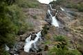
The boardwalk trail ends at an lookout just downstream from Horseshoe Falls. This short cascade can’t compete with Russell Falls for magnitude, but is pleasant never the less. Horseshoe Falls is about 5 meters tall, a crescent shaped drop over a dark mossy rock in a shaded forest.
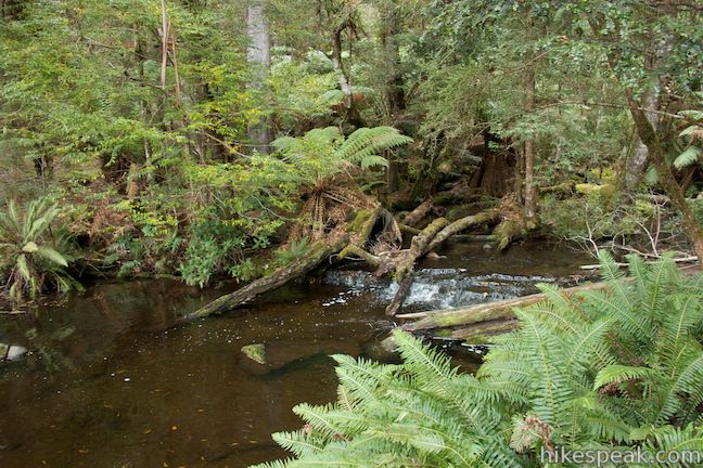
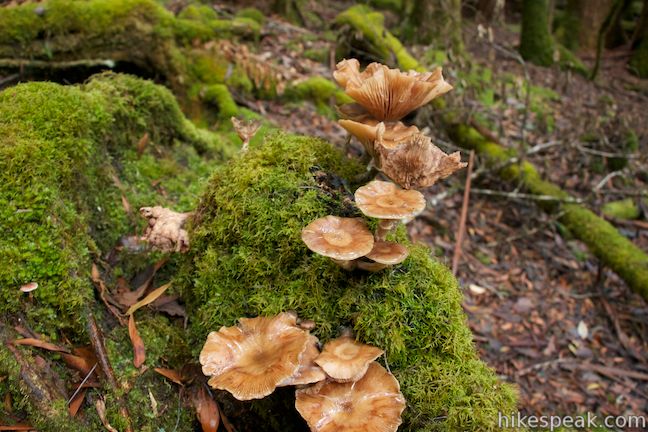
Hike back past the top of Russell Falls and down the steps to the junction nearest the viewing area at the base of Russell Falls. It’s now time to continue with the loop, so make a left turn (which was originally on your right). The second half of Russell Falls Loop is a dirt trail that takes a gently rolling course across the forest floor between tall old trees. Take a look at some of the stumps and logs along the trail and you’ll find a carpet of green moss, mushrooms, and bright orange fungi. The trail runs alongside the stream of water that trickles along below Russell Falls. After a nice walk through the forest, you will reach the bridge back to the paved trail. Turn left, closing the loop, and walk back to the trailhead at the visitor center.
Directions to the Trailhead
- From Hobart, take Highway 1 north to Granton and head west on Lyell Highway (A10).
- After 33 kilometers, turn left onto Gordon River Road (B61).
- Take this road for 23 kilometers and turn right onto Lake Dobson Road.
- After less than 500 meters, turn right into the parking area by the Mount Field National Park Visitor Center where the trail to Russell Falls begins.
Trailhead Location
Trailhead address: 66 Lake Dobson Road, Mount Field National Park, Mount Field, TAS 7140, Australia
Trailhead coordinates: -42.682073, 146.716127 (42° 40′ 55.46″S 146° 42′ 58.05″E)
You may also view a regional map of surrounding Australian trails, campgrounds, and lodging.


 | Moorland Mosaic This 2/3 of a kilometer round trip walk in Mount Field National Park crosses an alpine meadow covered with an interesting mix of plants called the Moorland Mosaic. |
 | Pinnacles Boardwalk & Summit Trig The 0.3-kilometer round trip walk on Pinnacles Boardwalk can easily be extended to a 0.75-kilometer walk on the top of Mount Wellington, checking out another short boardwalk and the trig station at the summit. |
 | Octopus Tree and Circle Track This 1.1-kilometer loop in Hobart's Wellington Park reaches a unique eucalyptus tree with tentacles for roots that wrap around a boulder. |
 | Liffey Falls This 2.2-kilometer walk passes the Upper Cascades on the Liffey River to reach the base of lovely Liffey Falls, one of Tasmania's finest waterfalls. |
 | Cataract Gorge This 3.4-kilometer loop combines Zig-Zag Track, Cataract Walk, and Bridge Walk to explore Cataract Gorge Reserve, an impressive natural area just outside the center of Launceston. |
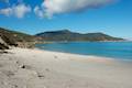
 | Friendly Beaches This hike explores a long, pristine beach on the east coast of Tasmania north of the Freycinet Peninsula. |
 | Cape Tourville This 0.6-kilometer circuit provides big views along the east coast of Freycinet Peninsula, circling 100-meter tall bluffs to reach the Cape Tourville Lighthouse. |
 | Wineglass Bay and Hazards Beach Circuit This approximately 12-kilometer loop takes a rewarding route through Freycinet National Park, visiting pristine light sand beaches at Hazards Beach and the renowned Wineglass Bay. |
 | Tasmans Arch & Devils Kitchen This 0.9-mile walk visits two impressive features on the coast of the Tasman Peninsula, a natural bridge and a chasm carved by the sea. |
 | Blowhole & Fossil Bay Lookout This short walk in Tasman National Park reaches a coastal vista point and a wave-carved tunnel through a rocky point that has the potential to spray up like a whale spout. |
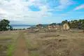 | Coal Mines Historic Site This 0.8-kilometer loop through the Convict Precinct explores the ruins of an old prison and coal mine that relied on convict laborers. |
 | Cape Raoul This 12 to 14-kilometer hike explores the pristine coastline at the southwest end of the Tasman Peninsula, reaching a cape with daunting 200-meter tall cliffs dropping to swirling seas. |
 | Apsley Waterhole & Lookout Track This 1.4-kilometer loop travels through a eucalyptus forest to a popular swimming hole on the Apsley River in Douglas-Apsley National Park. |
 | Saint Columba Falls This 1.2-kilometer round trip hike descends into a rainforest to the base of a powerful 90-meter tall waterfall. |
 | Mount William This 3.6-kilometer out and back hike tops a short summit that is the high point of Mount William National Park with panoramic views over the coastline at the northeast corner of Tasmania. |
 | More trails in Australia Explore other destinations in Victoria and Tasmania, Australia. |
- Russell Falls and Horseshoe Falls on tastrails.com (opens in a new tab)
- Russell Falls and Horseshoe Falls on world-of-waterfalls.com (opens in a new tab)
- Russell Falls on tasmania.com (opens in a new tab)
- Russell Falls on wikipedia.org (opens in a new tab)
- The Tasmania Parks and Wildlife page for the 60 Great Short Walks (opens in a new tab)
- The Tasmania Parks and Wildlife page for Russell Falls (opens in a new tab)
- The Tasmania Parks and Wildlife page for Mount Field National Park (opens in a new tab)
Common Questions about Russell Falls and Horseshoe Falls in Mount Field National Park
- Is the trail open?
- Yes. You should expect to find that Russell Falls and Horseshoe Falls is open. There are no recent reports of trail closures. If you discover that the trail is closed, please help your fellow hikers by reporting a closure.
- Do I need a permit for this hike?
- Yes. National Park Entrance Fee.
- How much time does this hike take?
- It takes approximately 45 minutes to hike Russell Falls and Horseshoe Falls. Individual hiking times vary. Add extra time for breaks and taking in the views.
- How long is this hike?
- The hike to Russell Falls and Horseshoe Falls is a 2.65 km / 1.65 mile loop with 80 meters / 265 feet of elevation change.
- Are dogs allowed on this trail?
- No, dogs are likely not allowed on Russell Falls and Horseshoe Falls. The trail is primarily open to hikers.
- Is Russell Falls and Horseshoe Falls good for kids?
- Yes, this hike is likely suitable for children. It is relatively short (1.65 miles) with manageable elevation gain.
- Will I see a waterfall on this hike?
- Yes, Russell Falls and Horseshoe Falls features a waterfall.
- Where is the trailhead located?
- The trailhead for Russell Falls and Horseshoe Falls is located in Mount Field, Tasmania.
Trailhead Address:
66 Lake Dobson Road
Mount Field, Tasmania 7140
Trailhead Coordinates:
-42.682073, 146.716127 - What are the driving directions to the start of the hike?
To get to the trailhead: From Hobart, take Highway 1 north to Granton and head west on Lyell Highway (A10). After 33 kilometers, turn left onto Gordon River Road (B61). Take this road for 23 kilometers and turn right onto Lake Dobson Road. After less than 500 meters, turn right into the parking area by the Mount Field National Park Visitor Center where the trail to Russell Falls begins.
View custom Google Maps directions from your current location.
- Are there other trails near Russell Falls and Horseshoe Falls?
- Yes, you can find other nearby hikes using the Hikespeak Hike Finder Map.

Go the extra miles...
Submit a rating of this hike to go with your comment. Contribute to the average trail rating.