Wineglass Bay is one of the top-rate beaches in Australia, and a premier destination for hikers in Freycinet National Park. A great way to see Wineglass Bay and the beautiful beach on the opposite side of the peninsula is to hike Wineglass Bay and Hazards Beach Circuit. This loop loop is 11.5 kilometers (7.15 miles) long, or a bit farther if you walk out along the beach at Wineglass Bay and take a pair of side trails to scenic overlooks. Expect to hike at least 12 kilometers on this rewarding trek around the Freycinet Peninsula.
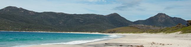
Taking the loop in a counterclockwise (anti-clockwise) direction, you will follow Hazards Beach Track down the west coast of the peninsula with views over Coles Bay and Great Oyster Bay on the way to Hazards Beach. Walk down this lovely stretch of sand and cross the peninsula on Isthmus Track to Wineglass Bay, where a crescent-shaped light-sand beach is sheltered by rocky points. From above, the bay resembles the profile of a wine glass, and you can admire the bay’s curves from the perch at Wineglass Bay Lookout, a viewpoint off the track back to the car park.
This hike circles Mount Mayson, one of the Hazards Mountains on Freycinet Peninsula, resulting in 213 meters (700 feet) of elevation between the beaches and the highest point of the loop at Wineglass Bay Lookout. Hike Wineglass Bay and Hazards Beach Circuit to get a bit of exercise and explore a beautiful peninsula on Tasmania’s east coast.
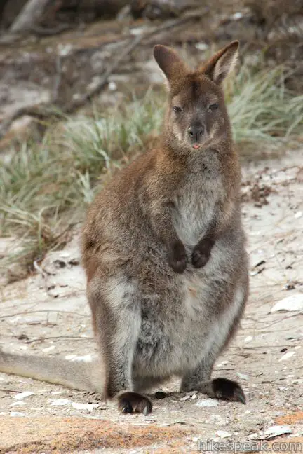
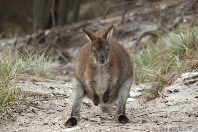
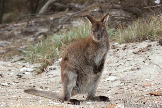
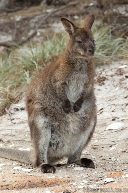
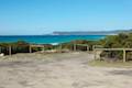
Start from the car park at the end of Coles Bay Road in Freycinet National Park, south of Coles Bay Township. There are toilets and water spigots at the car park. Make sure you have plenty of water before setting out, and use the bathroom provided here, because this hike that can take several hours and there are no toilets out on the trails. You will likely see wallabies in the parking lot and throughout the hike, begging for food and attention from humans. Do not be one of those visitors that feeds or pets the wallabies. Help keep the wallabies wild and keep your distance from these cute animals (you may see tourists taking selfies with the wallabies, but don’t be one of them).
A kiosk for hikers registering for overnight treks is positioned alongside information panels at the start of the trail. Look over the map, sign in with your hiking plans, and head out up the trail.
This is a loop hike, so you could travel in either direction. Wineglass Bay is considered one of the Australia’s prettiest beaches, so why not save it for the second half of the hike and head to Hazards Beach first? To do this, stay to the right through a couple early junctions, following signs for Hazards Beach. You will pass the loop’s return route on the left, with signs for Mount Amos and Wineglass Bay. After 1/3 of a kilometer, turn right to stay on Hazards Beach Track, passing a trail on the left that ascends to Coles Bay Lookout (seen later).
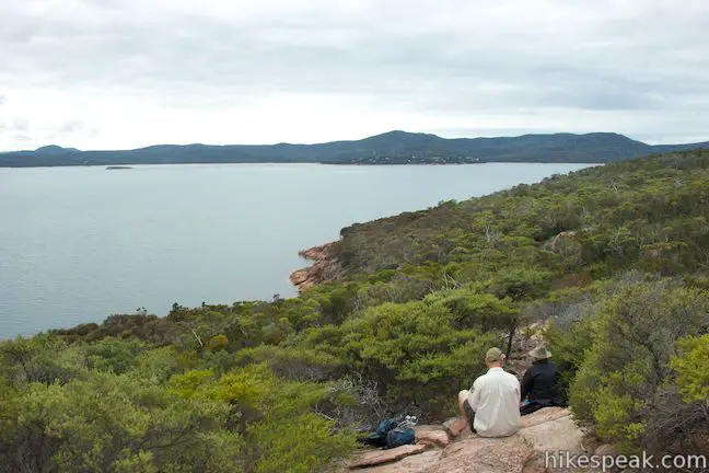
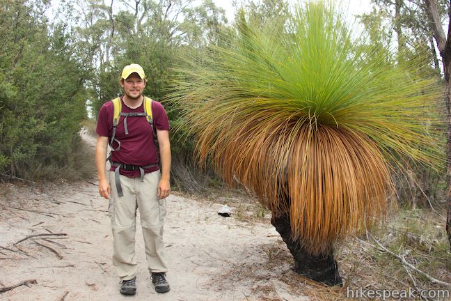
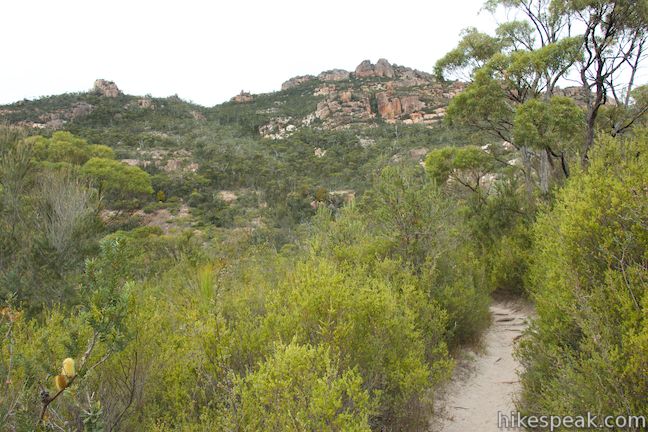
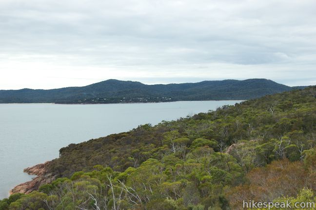
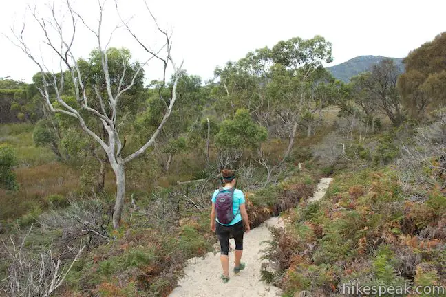
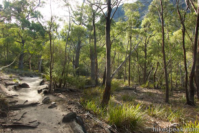
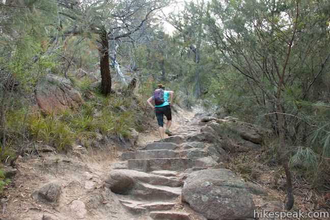
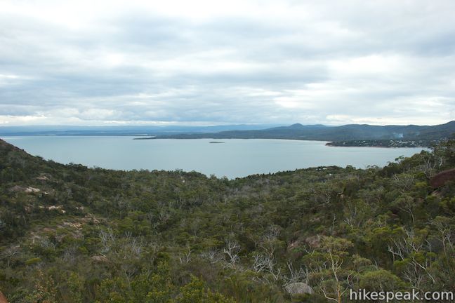
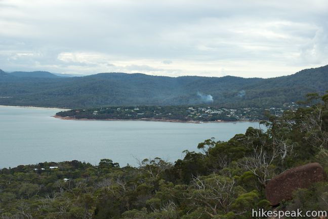
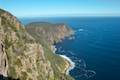
From here, there are no more junctions on the way to Hazards Beach, but over 5 kilometers of hiking. The trail will pass a grass tree and a sign explaining how these plants, which appear to have been inspired by Dr. Seuss, were once a lot more common. As the trail progresses, you will ascend stone steps to a rocky ledge with panoramic coastal views. Have a seat on the bedrock and enjoy this perspective north toward the town of Coles Bay and west across the waters of Great Oyster Bay.
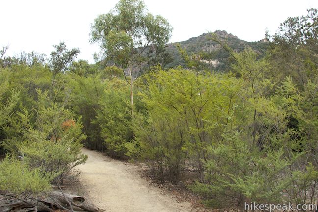
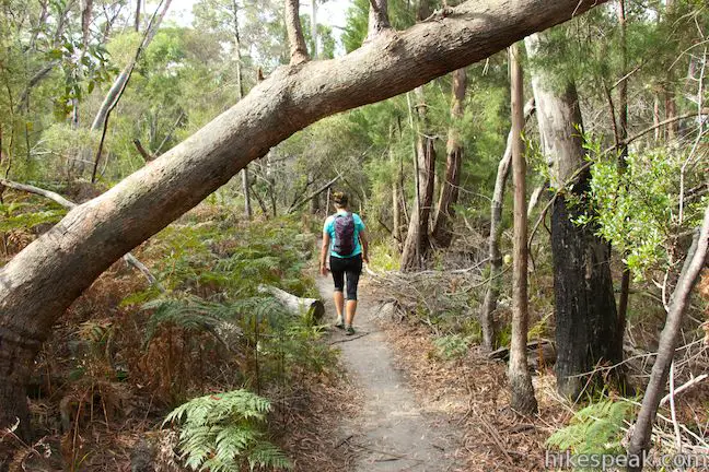
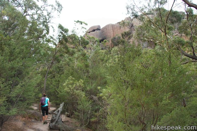
From the unofficial viewpoint, it is another 3.3 kilometers to Hazards Beach. The trail continues through brush over undulating terrain, and while the trail is never far from the coast, the bay views are usually obscured.
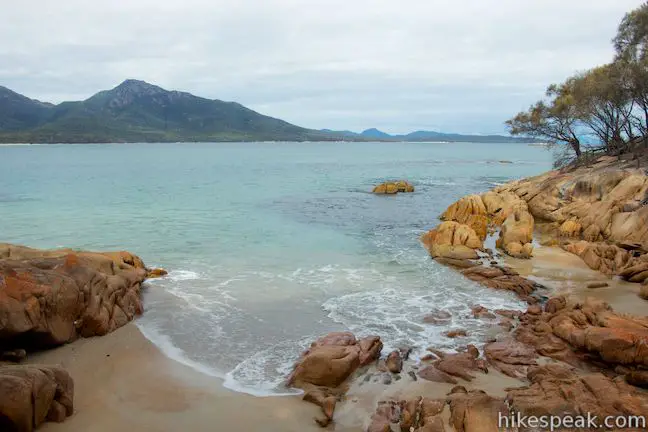
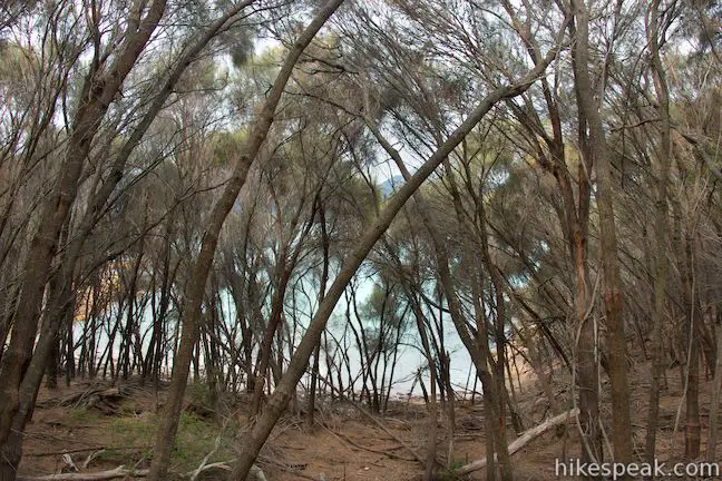
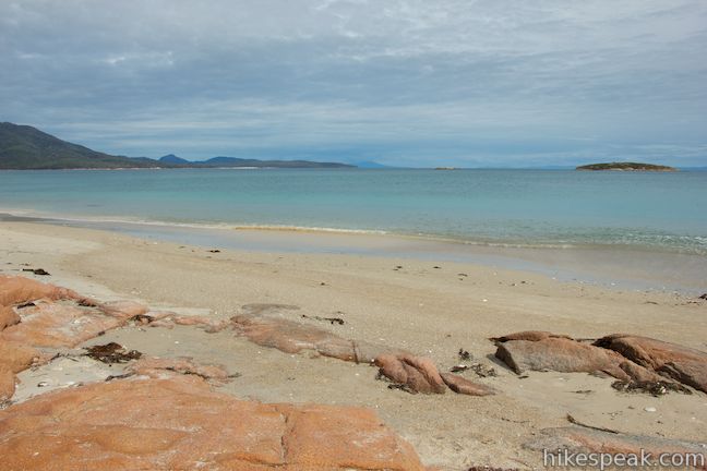
With about 0.6 kilometers to go, spot a small cove on the coast through a grove of thin trees. This isn’t Hazards Beach, so continue down the trail. You will walk alongside another small cove, 1/3 of a kilometer before Hazards Beach, where inviting blue water lies beyond an orange sand beach between orange boulders. This is a nice little cove, but there is a much larger beach just ahead.
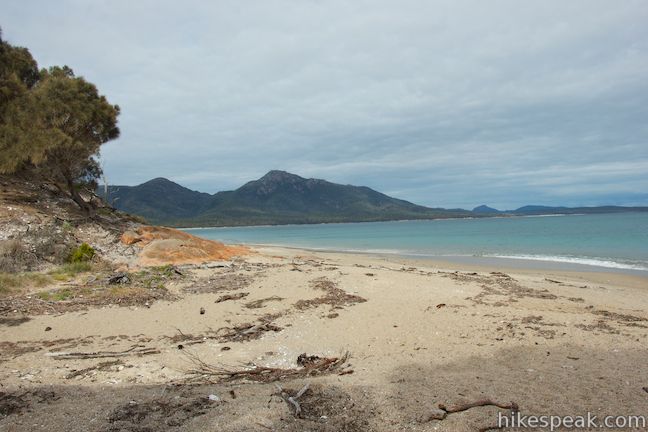
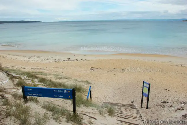
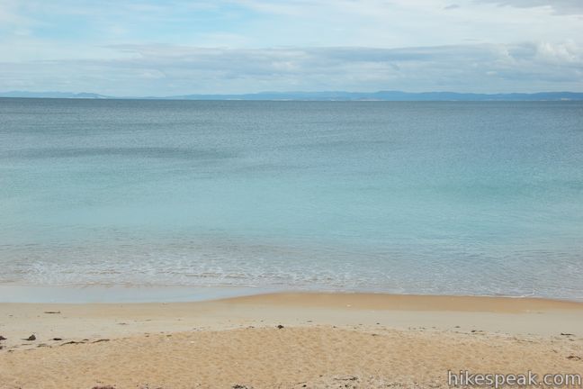
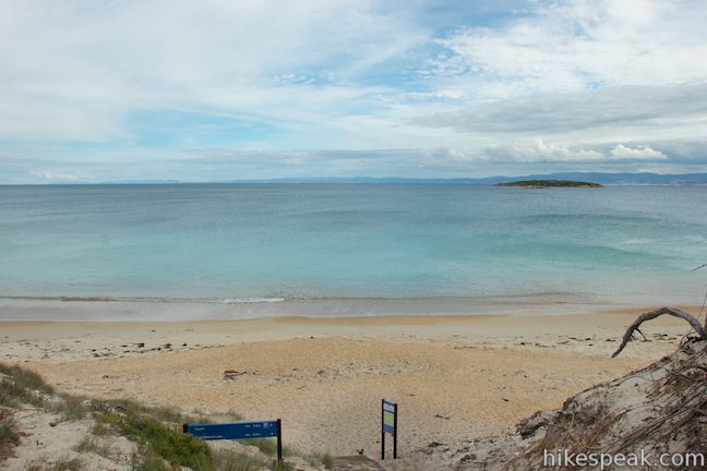
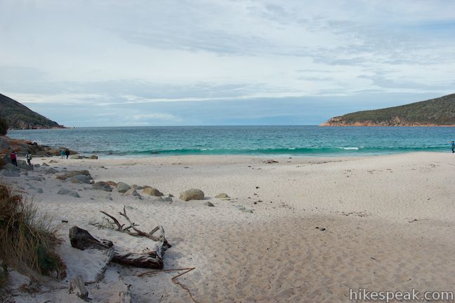
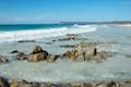
After 5.7 kilometers, Hazards Beach Track reaches the north end of Hazards Beach. This is a long, lovely beach stretching a couple kilometers down the west coast of Freycinet Peninsula. Looking out from the beach, you’ll spot an island not far from shore backed by Great Oyster Bay. This is a good place along the loop to have a picnic.
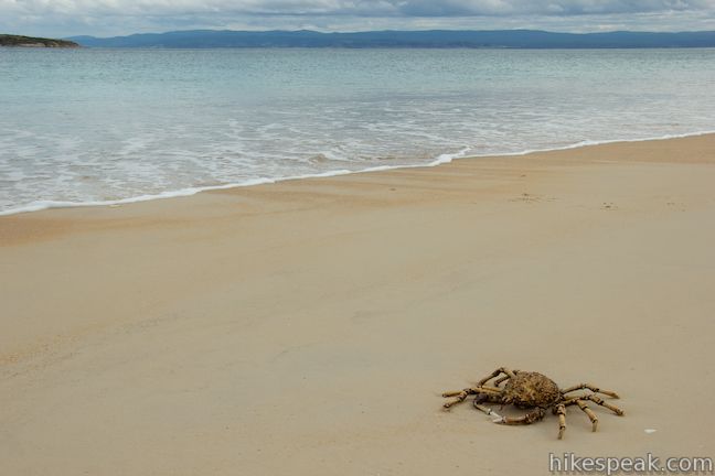
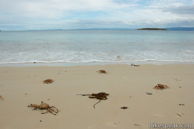
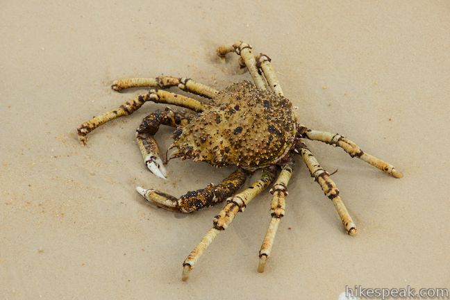
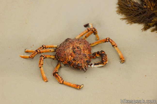
Walk south down the beach and keep an eye on the sand below your feet, where you may spot crabs washed up on the beach. As you look down the coast, there are excellent views of the Hazards Mountains at the south end of the peninsula.

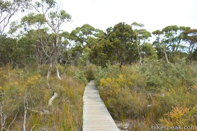
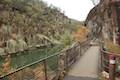
After 0.7 kilometers strolling down the beach, you will comes to a junction with Isthmus Track, which goes across a low land bridge at a narrow point on Freycinet Peninsula. Those on overnight treks can continue walking down Hazards Beach to Peninsular Track and venture farther down the Freycinet Peninsula. For the Wineglass Bay and Hazards Beach Circuit, turn left on Isthmus Track. Walk up a flight of steps over a sand dune to a boardwalk that crosses through a marshy area on the peninsula. A couple pools of water called Hazards Lagoon lie just south of the trail.
The ocean waves get louder as you come to the end of the easy 2-kilometer long hike across the peninsula. Isthmus Track ends at a junction just behind Wineglass Bay. Take the path to the right to walk out onto the beach at Wineglass Bay. The trail to the left, Wineglass Bay Track, heads back to the car park.
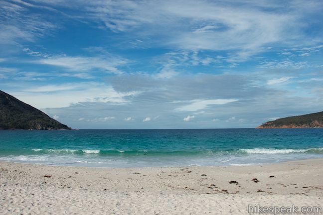
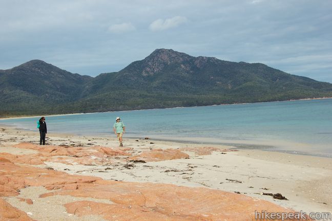
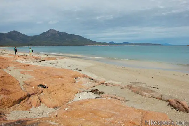
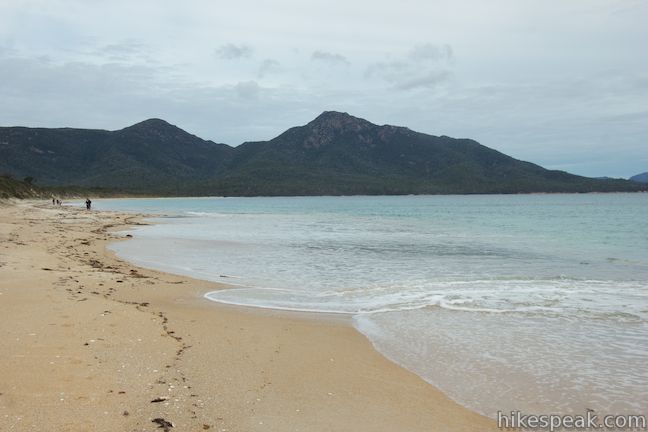
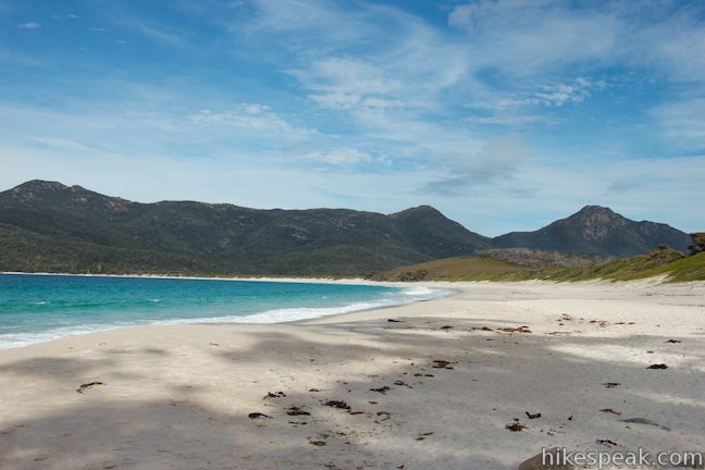
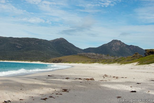
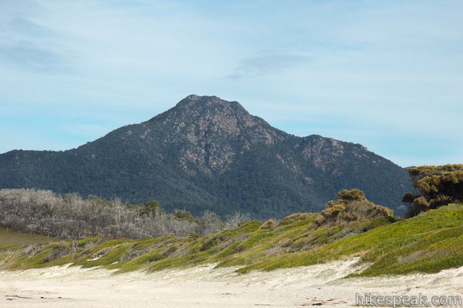
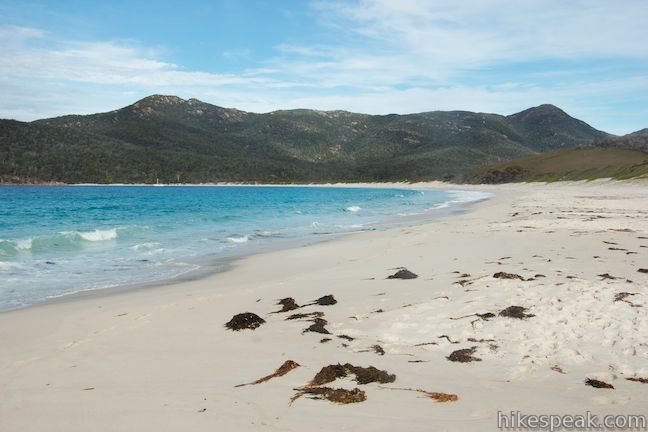
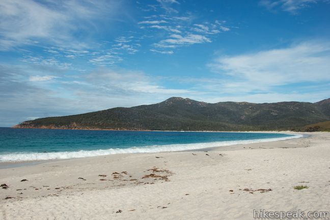
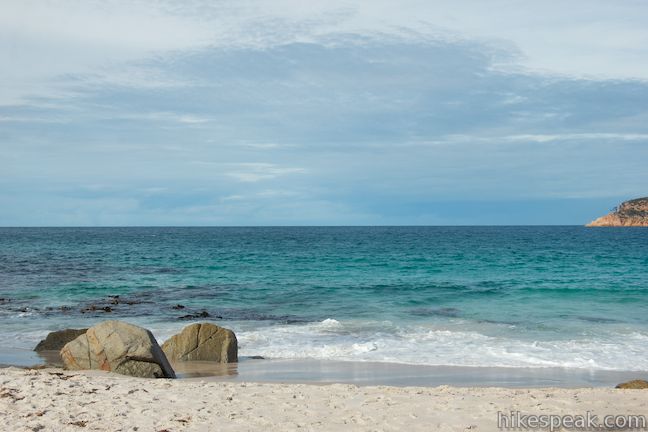
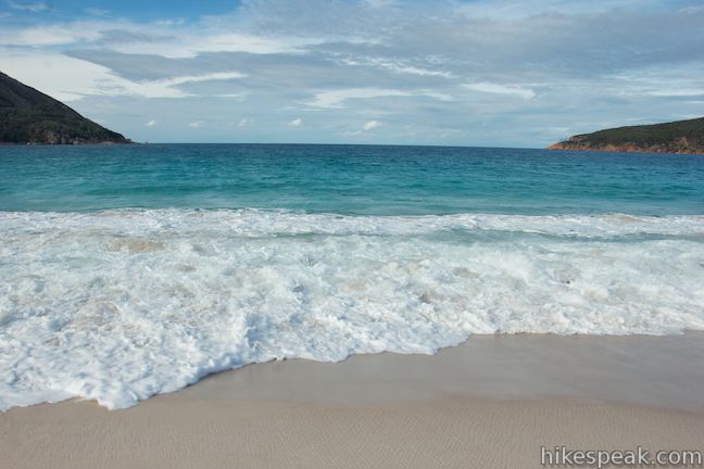
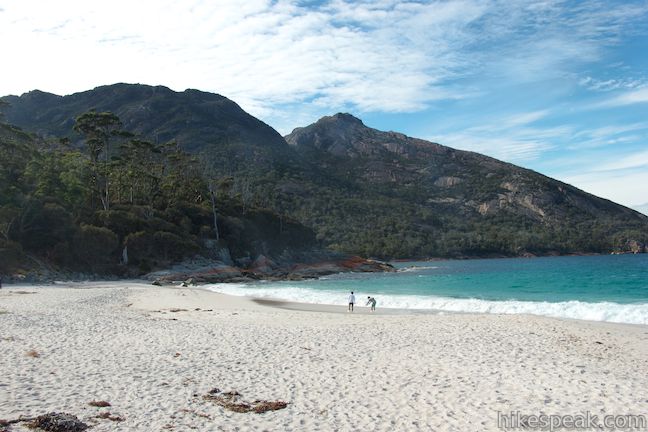
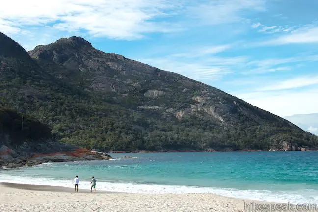
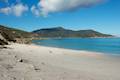
Walk out to Wineglass Bay, which has a beautiful crescent-shaped arc of pale sand framed by granite points. The fine sand drops steeply toward beautiful turquoise water where forceful waves wash up on shore. To the left, at the north end of the beach, there are boulders that make nice seats. In the other direction, you can walk a long way down the beach toward the south end of Wineglass Bay. Mount Graham (579 meters) and Mount Freycinet (620 meters) rise up above the beach to the south.

When you’re done drinking up the beauty of Wineglass Bay, head back to the junction and hike north up Wineglass Bay Track.
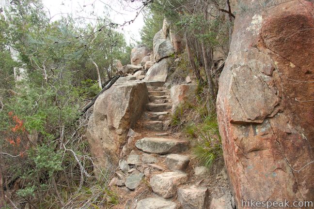
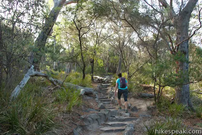
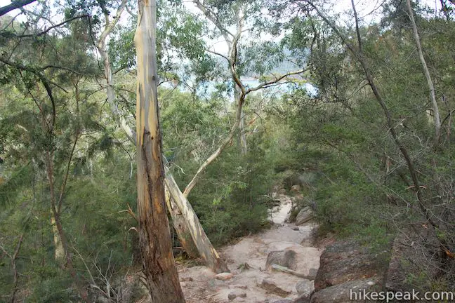
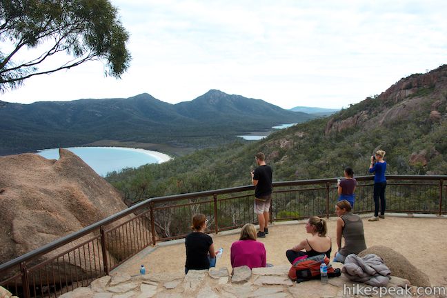
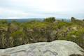
The trail leaves the coast and ascends stone steps to a saddle between Mounts Mayson and Amos. There are a lot of stone steps over this stretch of the track, which gets steeper toward the top as you ascend to the high point of the circuit. Boulders rise up around the trail as you reach the mountain pass and come to a junction. Bear right to take the short sidetrack up to Wineglass Bay Lookout.
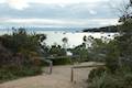
After climbing a few more flights of stone steps, you will reach a panoramic overview of Wineglass Bay. The bay’s signature shape is easy to recognize from this vantage. The cup-shaped bay is backed by Cape Forestier and bordered by rocky peaks in the Hazards Mountains. Behind the sandy beach, you’ll spot Hazards Lagoon breaking up the vegetation along the isthmus. There is a stone seating area at the lookout for those who would like to relax and enjoy the views down Freycinet Peninsula.

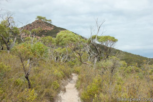
Walk back down to Wineglass Bay Track, turn right, cross the saddle, and continue down the other side of the mountains toward Coles Bay.
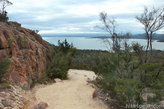
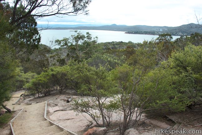
Quickly come to Boulderfield Junction where a sign will direct you to stay to the right to return to the car park. Boulderfield Track descends to the left to Hazards Beach Track. While there is no need to hike all the way down to Hazards Beach Track, it is worth taking this side trail for 100 meters out to Coles Bay Lookout, where you’ll find a panoramic perspective north over Coles Bay.
Take in a sweeping view over Coles Bay and the waters to the east and then walk back to Wineglass Bay Track. Turn left to hike the final kilometer down Wineglass Bay Track. The trail descends mountain slopes through boulders and brush with more views over Coles Bay. When you come to the bottom of the trail, turn right and walk a few hundred feet back to the start, completing this impressive circuit.

For those who think that hiking 12 kilometers (7.45 miles) is a bit too long, you could hike 3 1/3 kilometers (2 miles) round trip to Wineglass Bay Lookout or hike 6.8 kilometers (4.2 miles) round trip on an out and back hike to the beach at Wineglass Bay. If you were to hike to Hazards Beach and back, that would be an 11.4-kilometer return hike, and at that distance you might as well complete the entire loop. Wineglass Bay and Hazards Beach Circuit is a satisfying multi-attraction hike in beautiful Freycinet National Park.
A National Parks Pass is required to visit the park. A single day pass will cost $40 or you may purchase an 8-week pass good for all of Tasmania’s National Parks for $80 (all prices in Australian Dollars as of 2021). Dogs and bikes are prohibited, but no permit is required to hike Wineglass Bay and Hazards Beach Circuit, so get out and enjoy!
Directions to the Trailhead
- Take Tasman Highway (A3) 11.3 kilometers south of Bicheno to Coles Bay Road (C302) and take this road southeast toward Coles Bay.
- After 26 kilometers, pass through the town and continue straight into Freycinet National Park.
- Pass the visitor center after another kilometer and proceed 3 kilometers to the car park at road's end where the hike begins.
Trailhead Location
Trailhead address: Coles Bay Road, Freycinet National Park, TAS 7215, Australia
Trailhead coordinates: -42.14581, 148.289189 (42° 08′ 44.91″S 148° 17′ 21.08″E)
View Freycinet National Park in a larger map
Or view a regional map of surrounding Australian trails, campgrounds, and lodging.


 | Cape Tourville This 0.6-kilometer circuit provides big views along the east coast of Freycinet Peninsula, circling 100-meter tall bluffs to reach the Cape Tourville Lighthouse. |
 | Friendly Beaches This hike explores a long, pristine beach on the east coast of Tasmania north of the Freycinet Peninsula. |
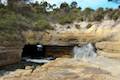
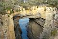 | Tasmans Arch & Devils Kitchen This 0.9-mile walk visits two impressive features on the coast of the Tasman Peninsula, a natural bridge and a chasm carved by the sea. |
 | Blowhole & Fossil Bay Lookout This short walk in Tasman National Park reaches a coastal vista point and a wave-carved tunnel through a rocky point that has the potential to spray up like a whale spout. |
 | Coal Mines Historic Site This 0.8-kilometer loop through the Convict Precinct explores the ruins of an old prison and coal mine that relied on convict laborers. |
 | Cape Raoul This 12 to 14-kilometer hike explores the pristine coastline at the southwest end of the Tasman Peninsula, reaching a cape with daunting 200-meter tall cliffs dropping to swirling seas. |
 | Apsley Waterhole & Lookout Track This 1.4-kilometer loop travels through a eucalyptus forest to a popular swimming hole on the Apsley River in Douglas-Apsley National Park. |
 | Cataract Gorge This 3.4-kilometer loop combines Zig-Zag Track, Cataract Walk, and Bridge Walk to explore Cataract Gorge Reserve, an impressive natural area just outside the center of Launceston. |
 | Liffey Falls This 2.2-kilometer walk passes the Upper Cascades on the Liffey River to reach the base of lovely Liffey Falls, one of Tasmania's finest waterfalls. |
 | Mount William This 3.6-kilometer out and back hike tops a short summit that is the high point of Mount William National Park with panoramic views over the coastline at the northeast corner of Tasmania. |
 | Octopus Tree and Circle Track This 1.1-kilometer loop in Hobart's Wellington Park reaches a unique eucalyptus tree with tentacles for roots that wrap around a boulder. |
 | Pinnacles Boardwalk & Summit Trig The 0.3-kilometer round trip walk on Pinnacles Boardwalk can easily be extended to a 0.75-kilometer walk on the top of Mount Wellington, checking out another short boardwalk and the trig station at the summit. |
 | Russell Falls & Horseshoe Falls This hike in Mount Field National Park visits one of Tasmania's most famous and beautiful waterfalls and can be extended from 1.8 to 2.65 kilometers by venturing to the top of Russell Falls and nearby Horseshoe Falls. |
 | Saint Columba Falls This 1.2-kilometer round trip hike descends into a rainforest to the base of a powerful 90-meter tall waterfall. |
 | More trails in Australia Explore other destinations in Victoria and Tasmania, Australia. |
 | Richardsons Beach Campground This bay side campground near Coles Bay offers powered and non-powered campsites in Freycinet National Park. |
 | Friendly Beaches Campground This primitive campground offers oceanfront camping surrounded by beautiful beaches in Freycinet National Park. |
 | Big 4 Iluka on Freycinet Holiday Park This holiday park in the coastal town of Coles Bay at the top of Freycinet Peninsula offers tent sites, campervan sites, and cabins, as well as quick access to nearby Freycinet National Park. |
 | Mayfield Beach Conservation Area Campground This beachfront campground is located on Great Oyster Bay on the east coast of Tasmania. |
- Wineglass Bay and Hazards Beach Circuit on tastrails.com (opens in a new tab)
- Freycinet Peninsula Circuit handout and map from Tasmania Parks and Wildlife (opens in a new tab)
- The Tasmania Parks and Wildlife page for Wineglass Bay and Hazards Beach Circuit (opens in a new tab)
- The Tasmania Parks and Wildlife page for Freycinet National Park (opens in a new tab)
Common Questions about Wineglass Bay and Hazards Beach Circuit in Freycinet National Park
- Is the trail open?
- Yes. You should expect to find that Wineglass Bay and Hazards Beach Circuit is open. There are no recent reports of trail closures. If you discover that the trail is closed, please help your fellow hikers by reporting a closure.
- Do I need a permit for this hike?
- Yes. National Park Entrance Fee.
- How much time does this hike take?
- It takes approximately 3 hours 30 minutes to hike Wineglass Bay and Hazards Beach Circuit. Individual hiking times vary. Add extra time for breaks and taking in the views.
- How long is this hike?
- The hike to Wineglass Bay and Hazards Beach Circuit is a 12 km / 7.45 mile circuit loop with 213 meters / 700 feet of elevation change.
- Are dogs allowed on this trail?
- No, dogs are likely not allowed on Wineglass Bay and Hazards Beach Circuit. The trail is primarily open to hikers.
- Are there ocean views on this hike?
- Yes, Wineglass Bay and Hazards Beach Circuit offers views of the ocean.
- Where is the trailhead located?
- The trailhead for Wineglass Bay and Hazards Beach Circuit is located in Freycinet National Park, Tasmania.
Trailhead Address:
Coles Bay Road
Freycinet National Park, Tasmania 7215
Trailhead Coordinates:
-42.14581, 148.289189 - What are the driving directions to the start of the hike?
To get to the trailhead: Take Tasman Highway (A3) 11.3 kilometers south of Bicheno to Coles Bay Road (C302) and take this road southeast toward Coles Bay. After 26 kilometers, pass through the town and continue straight into Freycinet National Park. Pass the visitor center after another kilometer and proceed 3 kilometers to the car park at road's end where the hike begins.
View custom Google Maps directions from your current location.
- Are there other trails near Wineglass Bay and Hazards Beach Circuit?
- Yes, you can find other nearby hikes using the Hikespeak Hike Finder Map.

How hard is the wine glass bay track? My husband & I are in our 60’s & aren’t that fit but do like to walk. How long does it take?
Can you swim at this beach?
Super trail and challenging for stupid people like me. Did it clock-wise in Feb. 1996 and actually only intended to go to the top of Mayson and Amos to have a look at Wineglass. Spotted a trail and followed it past Wineglass to the isthmus and across to Hazards Beach. Had a refreshing dip and walked north along the beach where there was a small sign and an almost invisible path. As I was staying at the lodge I figured it would be just as easy to continue up the coast as going back the same way and that I couldn’t get lost as long as I kept the sea on my left. Big mistake. Remember it was before cell phones, GPS and so on, no map, no water and the trail was not well marked. About an hour later found myself in area with massive boulders and deep cracks – and losing light and gaining mosquitos. Could luckily hear the sea so soldiered on – seemingly forever. Had not seen a soul for hours so was quite relieved to see the lights at Coles Bay. Sore legs the next day but a memory that is vividly with me almost 25 years later.