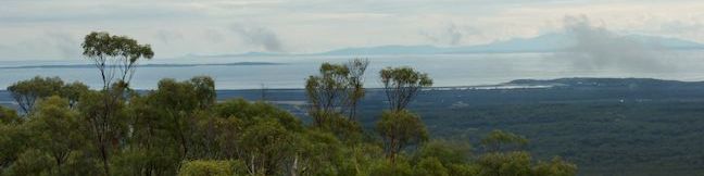
Rising to just 216 meters (708 feet) above sea level, Mount William is far from the tallest mountain in Tasmania. Despite its modest stature, Mount William is the highest point in Mount William National Park and offers far reaching 360-degree views over the northeast corner of Tasmania. The summit is close to the coast, with an ocean view that includes Flinders Island and the Bass Straight. A straightforward 3.6-kilometer (2.25-mile) round trip track ascends 140 meters (460 feet) to the summit. Most of the hike is gradual and easy going, leading to a short steep ascent to the summit.
The trail begins from the end of a side road off Mount William, the scenic road that loops through Mount William National Park and offers great viewing of kangaroos and wallabies at dawn and dusk.
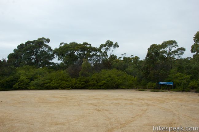
At the large dirt lot at the road end, you’ll spot a sign next to the trail that reads “Mount William Summit 45 mins.” While other guides (including official park material) list this as a 1.5 to 2 hour hike, rest assured that this 3.6-kilometer round trip walk should only take 45 minutes to 1 hour to complete.
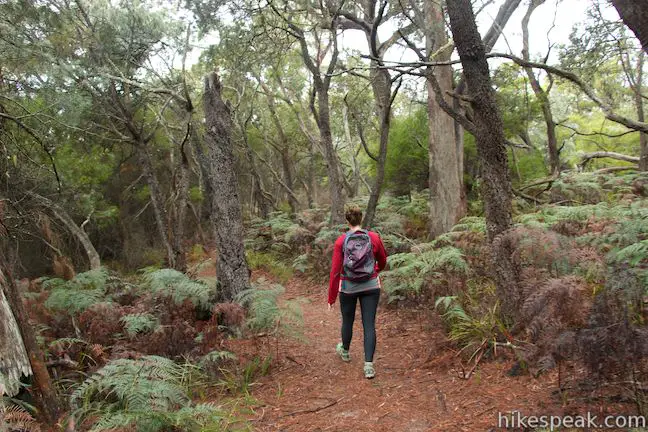
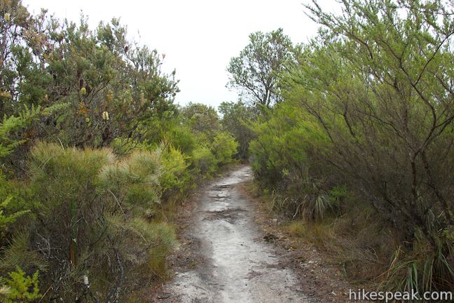
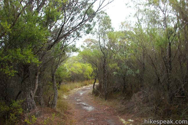
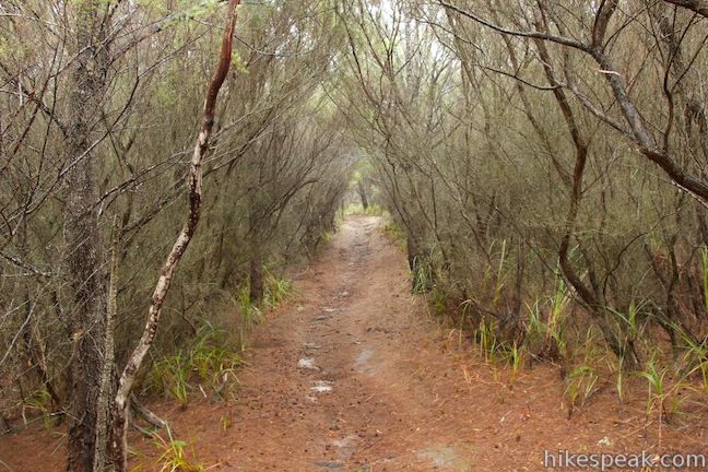
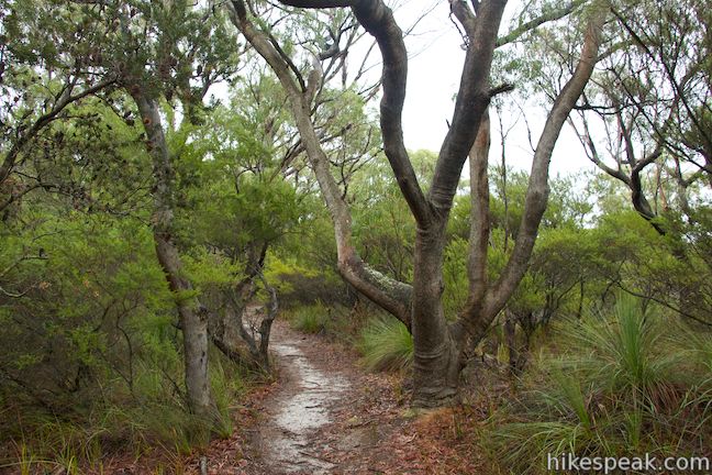
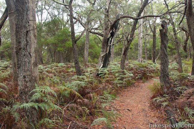
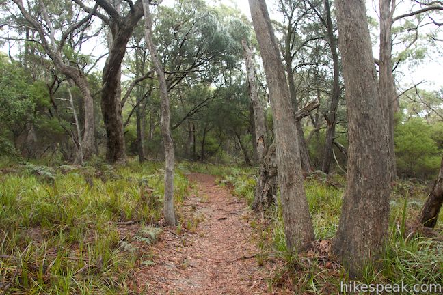
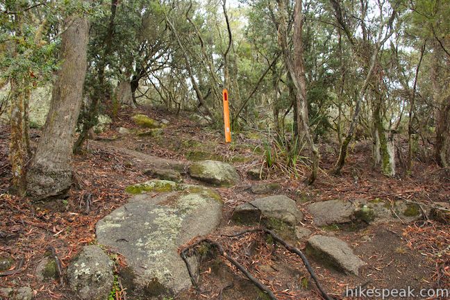
Set out up the track to Mount William, which takes a fairly straight line toward the unpronounced summit. At the start, this trail is wide enough for two people to walk side by side, but narrows to a single track toward the summit. Tall brush borders the trail at the start, and there is an impressive collection of moss, lichens, and mushrooms on the ground along the trail.
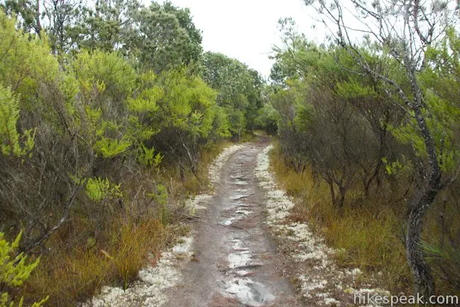
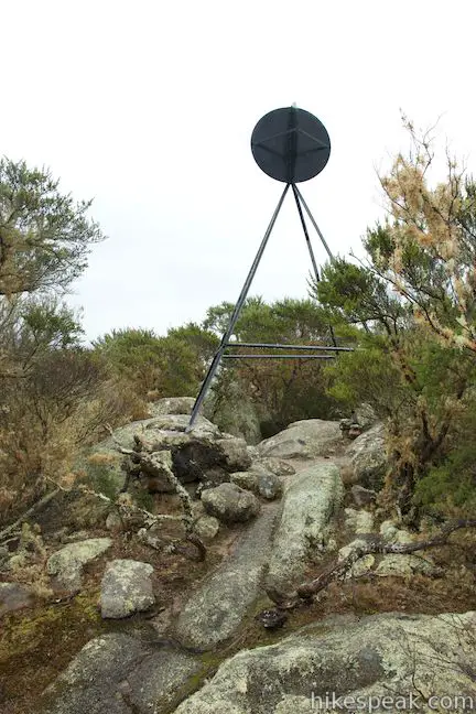
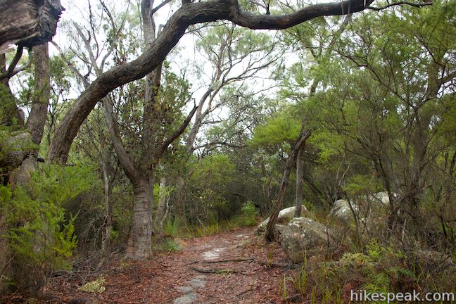
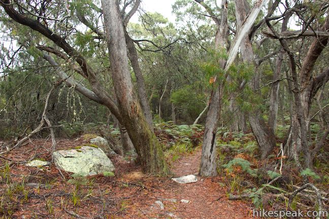
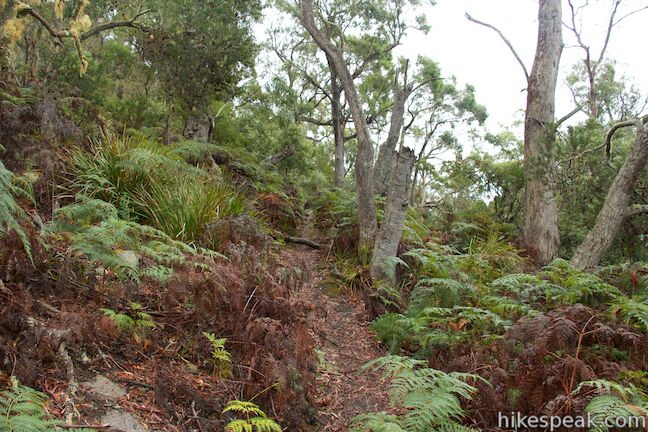
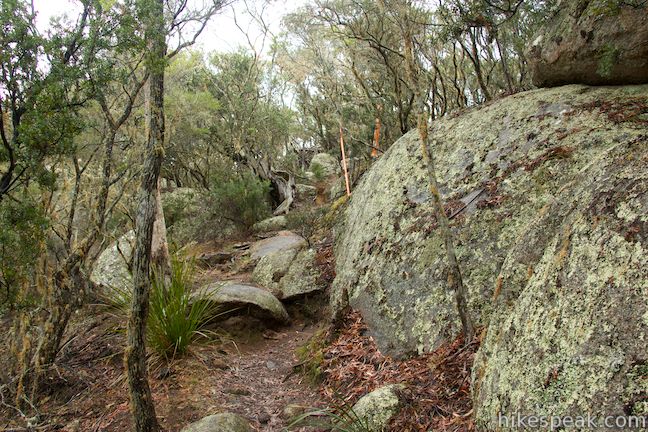
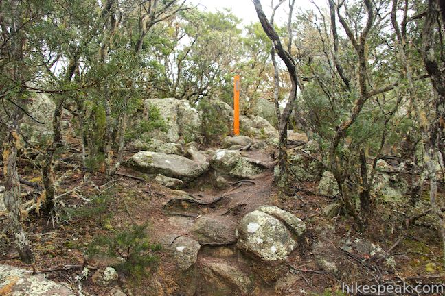
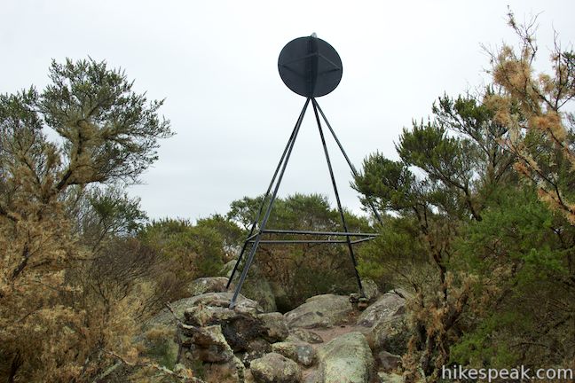
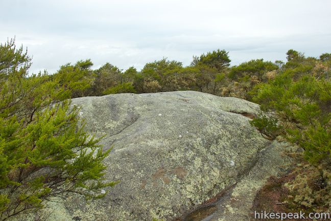
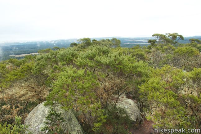
The trail enters a forest of swamp gums (eucalyptus trees) and she-oaks that shade the trail as it gets a bit steeper. The track curves to the right as you approach a rocky crown rising out of the trees, the summit of Mount William. Follow orange markers as the trail tackles a few boulders on the side of the mountain and ascends to the summit. There is a trig station at the top. Just past that the trail ends at a large boulder with panoramic coastal views.
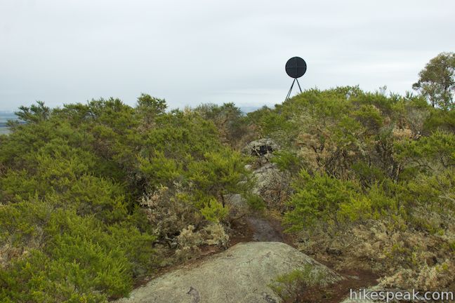
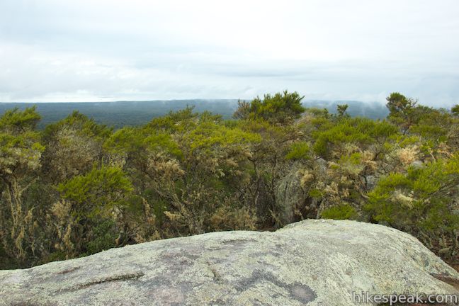
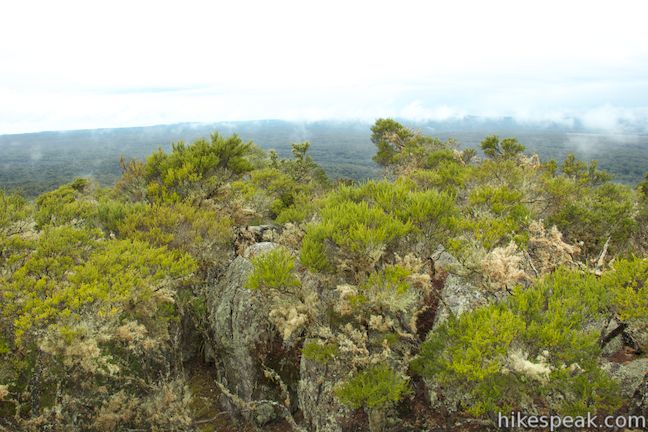
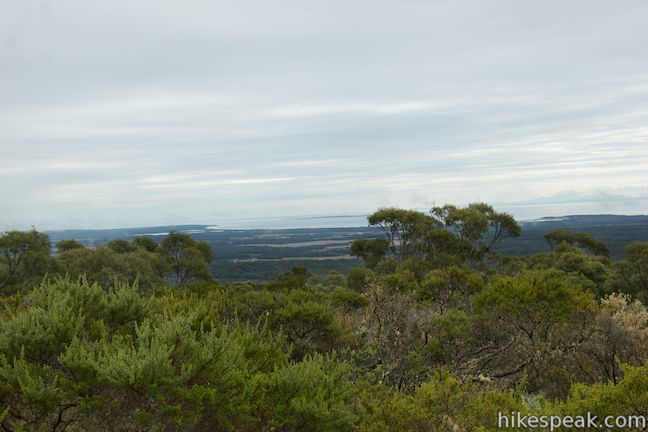
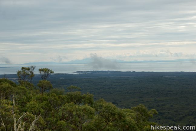
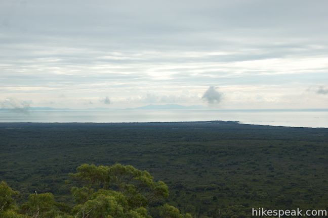
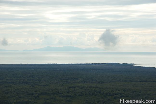
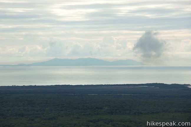
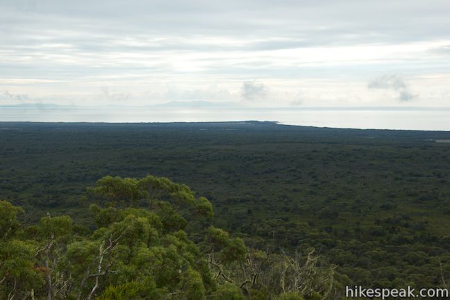
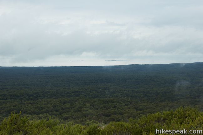
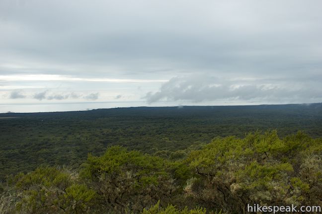
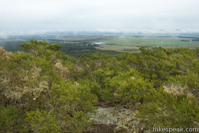
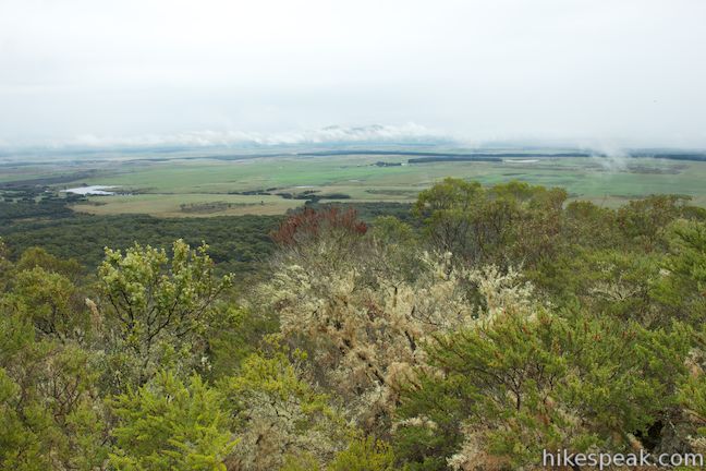
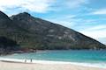
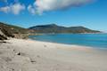
Stand on the large boulder at the summit and get your head above the treetops for sweeping 360-degree views. Half of the view looks inland over farmland, while the other half looks east and north over the coastline at the northeast corner of the Island of Tasmania. Gazing north, your eyes will be drawn to the form of Flinders Island and Cape Barren Island on the edge of the Bass Straight.
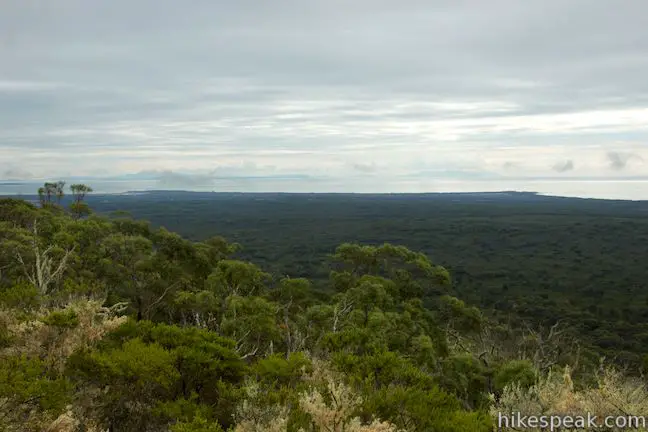
While Mount William might not tower over its surroundings, it is more prominent than it initially appears and really does offer a big panoramic view (especially if the weather is clearer than shown here). When you’re done taking in the views, simply return the way you came. There are no junction along the trail, so it shouldn’t be hard to stay on track.
A national park entrance fee is required to visit Mount William National Park. A single day pass will cost $40 or you may purchase an 8-week pass good for all of Tasmania’s National Parks for $80 (all prices in Australian Dollars as of 2021). Dogs and bikes are not permitted. There is a bathroom at the trailhead. Camping is available at nearby Stumpys Bay.
Directions to the Trailhead
- Take Tasman Highway (A3), 42 kilometers east of Scottsdale and 56 kilometers northwest of St.
- Helens to Gladstone Road (B82) and turn north following signs for Mount William National Park.
- Drive 25 kilometers to the small town of Gladstone and turn right on Carr Street/Cape Portland Road again following signs for the park (if you miss the intersection, you will quickly come to the end of the road).
- Drive two kilometers as the road becomes dirt and continue on to Browns Ridge Road/Musselroe Bay Road.
- Drive another 15.25 kilometers, going through a few twists and turn before entering the national park where you will turn right on to Mount William.
- Take this scenic dirt road for 4 kilometers and turn right on a dirt road to Mount William.
- After 1.5 kilometers, the road ends at the trailhead car park for Mount William Track.
Trailhead Location
Trailhead address: Mount William Road, Mount William National Park, Mt William, TAS 7264, Australia
Trailhead coordinates: -40.90896, 148.207197 (40° 54′ 32.25″S 148° 12′ 25.90″E)
You may also view a regional map of surrounding Australian trails, campgrounds, and lodging.

 | Saint Columba Falls This 1.2-kilometer round trip hike descends into a rainforest to the base of a powerful 90-meter tall waterfall. |
 | Apsley Waterhole & Lookout Track This 1.4-kilometer loop travels through a eucalyptus forest to a popular swimming hole on the Apsley River in Douglas-Apsley National Park. |
 | Friendly Beaches This hike explores a long, pristine beach on the east coast of Tasmania north of the Freycinet Peninsula. |
 | Cape Tourville This 0.6-kilometer circuit provides big views along the east coast of Freycinet Peninsula, circling 100-meter tall bluffs to reach the Cape Tourville Lighthouse. |
 | Wineglass Bay and Hazards Beach Circuit This approximately 12-kilometer loop takes a rewarding route through Freycinet National Park, visiting pristine light sand beaches at Hazards Beach and the renowned Wineglass Bay. |
 | Cataract Gorge This 3.4-kilometer loop combines Zig-Zag Track, Cataract Walk, and Bridge Walk to explore Cataract Gorge Reserve, an impressive natural area just outside the center of Launceston. |
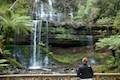
 | Liffey Falls This 2.2-kilometer walk passes the Upper Cascades on the Liffey River to reach the base of lovely Liffey Falls, one of Tasmania's finest waterfalls. |
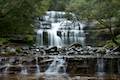
 | Russell Falls & Horseshoe Falls This hike in Mount Field National Park visits one of Tasmania's most famous and beautiful waterfalls and can be extended from 1.8 to 2.65 kilometers by venturing to the top of Russell Falls and nearby Horseshoe Falls. |
 | Pinnacles Boardwalk & Summit Trig The 0.3-kilometer round trip walk on Pinnacles Boardwalk can easily be extended to a 0.75-kilometer walk on the top of Mount Wellington, checking out another short boardwalk and the trig station at the summit. |
 | Octopus Tree and Circle Track This 1.1-kilometer loop in Hobart's Wellington Park reaches a unique eucalyptus tree with tentacles for roots that wrap around a boulder. |
 | Tasmans Arch & Devils Kitchen This 0.9-mile walk visits two impressive features on the coast of the Tasman Peninsula, a natural bridge and a chasm carved by the sea. |
 | Blowhole & Fossil Bay Lookout This short walk in Tasman National Park reaches a coastal vista point and a wave-carved tunnel through a rocky point that has the potential to spray up like a whale spout. |
 | Coal Mines Historic Site This 0.8-kilometer loop through the Convict Precinct explores the ruins of an old prison and coal mine that relied on convict laborers. |
 | Cape Raoul This 12 to 14-kilometer hike explores the pristine coastline at the southwest end of the Tasman Peninsula, reaching a cape with daunting 200-meter tall cliffs dropping to swirling seas. |
 | More trails in Australia Explore other destinations in Victoria and Tasmania, Australia. |
 | Stumpys Bay Campground This campground is split into four areas along Stumps Bay with numerous campsite for visitors to Mount William National Park. |
 | Forester Kangaroo Drive This 11.25-kilometer scenic dirt road in Mount William National Park offers great wildlife viewing of the area's Forest kangaroos or Bennetts wallabies. |
Common Questions about Mount William in Mount William National Park
- Is the trail open?
- Yes. You should expect to find that Mount William Track is open. There are no recent reports of trail closures. If you discover that the trail is closed, please help your fellow hikers by reporting a closure.
- Do I need a permit for this hike?
- Yes. National Park Entrance Fee.
- How much time does this hike take?
- It takes approximately 1 hour 15 minutes to hike Mount William Track. Individual hiking times vary. Add extra time for breaks and taking in the views.
- How long is this hike?
- The hike to Mount William Track is a 3.6 km / 2.25 mile out and back return with 140 meters / 460 feet of elevation change.
- Are dogs allowed on this trail?
- No, dogs are likely not allowed on Mount William Track. The trail is primarily open to hikers.
- Are there ocean views on this hike?
- Yes, Mount William Track offers views of the ocean.
- Does this trail go to a summit?
- Yes, Mount William Track reaches a summit with panoramic views.
- Where is the trailhead located?
- The trailhead for Mount William Track is located in Mt William, Tasmania.
Trailhead Address:
Mount William Road
Mt William, Tasmania 7264
Trailhead Coordinates:
-40.90896, 148.207197 - What are the driving directions to the start of the hike?
To get to the trailhead: Take Tasman Highway (A3), 42 kilometers east of Scottsdale and 56 kilometers northwest of St. Helens to Gladstone Road (B82) and turn north following signs for Mount William National Park. Drive 25 kilometers to the small town of Gladstone and turn right on Carr Street/Cape Portland Road again following signs for the park (if you miss the intersection, you will quickly come to the end of the road). Drive two kilometers as the road becomes dirt and continue on to Browns Ridge Road/Musselroe Bay Road. Drive another 15.25 kilometers, going through a few twists and turn before entering the national park where you will turn right on to Mount William. Take this scenic dirt road for 4 kilometers and turn right on a dirt road to Mount William. After 1.5 kilometers, the road ends at the trailhead car park for Mount William Track.
View custom Google Maps directions from your current location.
- Are there other trails near Mount William Track?
- Yes, you can find other nearby hikes using the Hikespeak Hike Finder Map.

Go the extra miles...
Submit a rating of this hike to go with your comment. Contribute to the average trail rating.